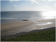
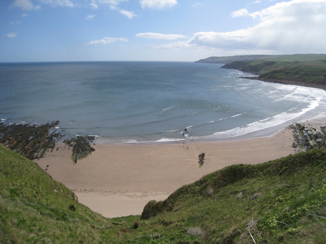
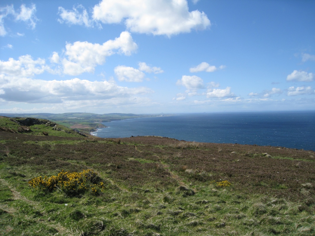
 Thortonloch Beach
 With the early summer sun lighting up the inside of the tent from about 4.00am, we did well sleeping on and off through to six o’ clock. We had not wasted any time going to bed after setting up tent and sleeping equipment. Spared the wearisome bother of a hot shower by dint of poverty there was nothing else to do but sleep.
The breakfast plan had been to cook some porridge and eat the sandwiches we had saved from yesterday but as they say 'the plans of mice and men aye gan agly'. When I crawled out of the tent there was a sandwich wrapper blowing about the green. When I picked it up, I was surprised to find it was the same make and filling of one of the packets I had bought yesterday. On the way back to the tent I noticed a very fat and smug magpie sitting on the fence trying ever so hard to look inconspicuous. Sure enough, when Joanna checked her rucksack it was her sandwiches that had disappeared. I swear to you, the bird was laughing! Ah well, porridge it is.
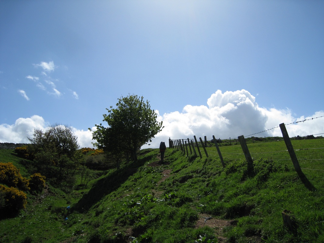
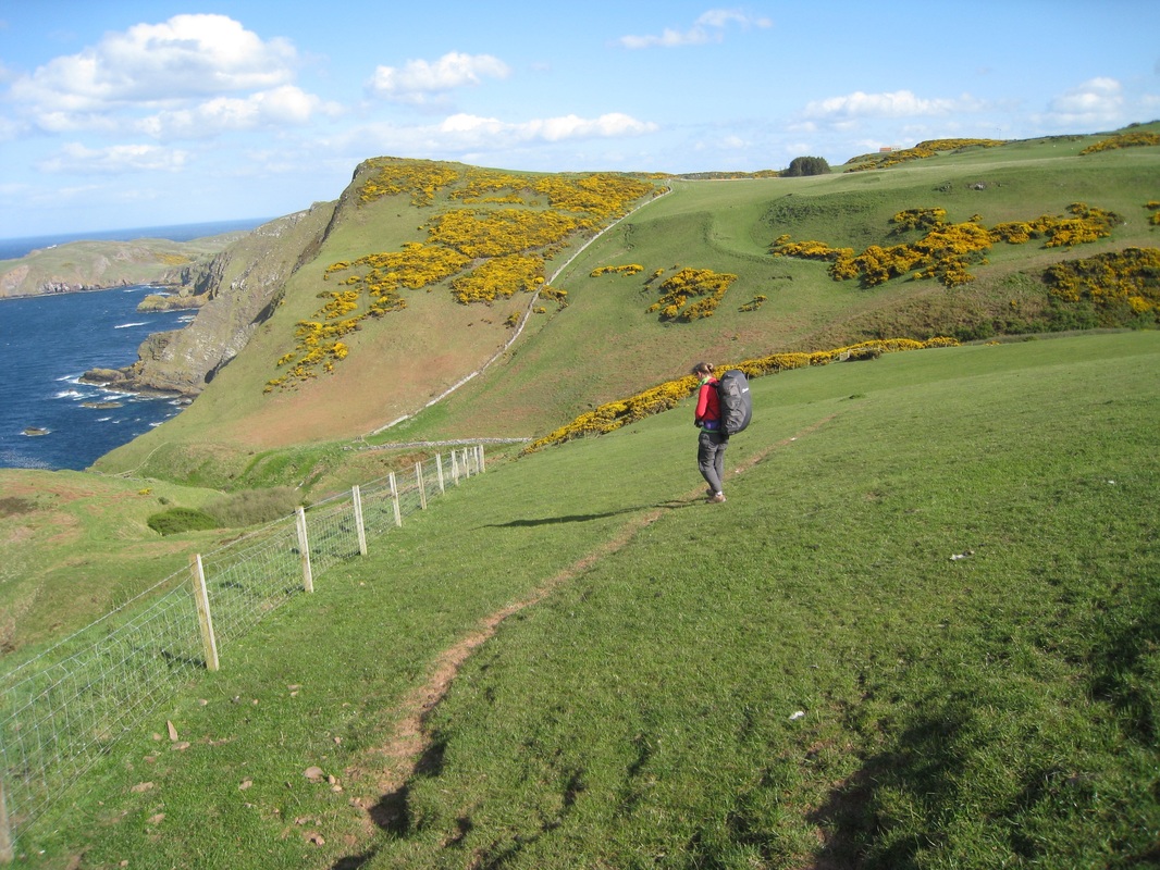
 Thortonloch Camp Site
 Despite rising at 6.00am it was nearer eight before we set off what with making breakfast, cleaning up and breaking camp. While breakfast had been ‘adequate’, we worried about when we might eat again as we had next to no money (tell a lie had four pounds) and no knowledge of when we might get some before St Abbs. Leaving the campsite, we had a short walk along the beach before rising up a steep bank covered in wild flowers. Steep banking, or steep hills, was to be the major feature of the day as we made an overall elevation gain of about 4,000 feet going up and down and back up the cliffs heading for St Abbs.
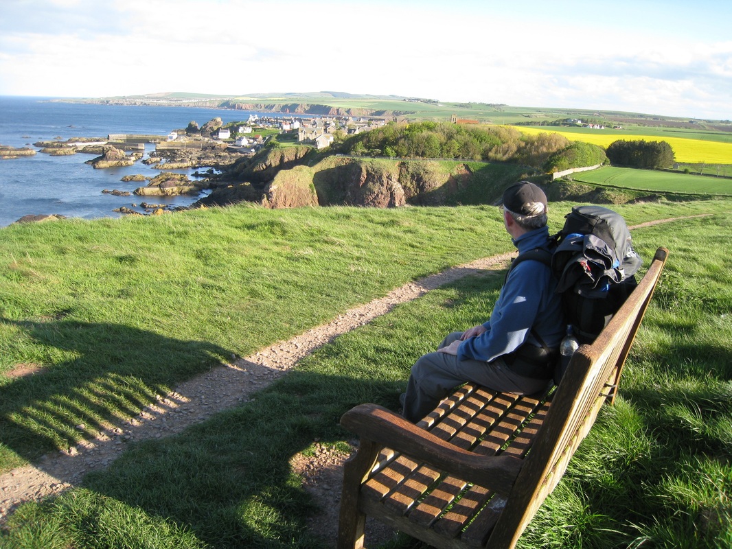
 Early Morning Light
 In the early morning light there were few clouds in the sky, albeit there was a cold morning chill. The play of the light on the sand was interesting. We were back to following the John Muir Way as it moved along Thortonloch Beach heading towards Billsdean Creek where there are natural sea arches and, just beyond is the wonderfully named ‘Standalane Otter Hole’ beach. Our trail went away from the beach at this points to go upwards in to an area called ‘The Linn’ where there was an abundance of wild garlic in full flower and the aroma from them was almost over-whelming. There is a crossing here over the Billsdean Burn where we glimpsed a very pretty waterfall through the trees.
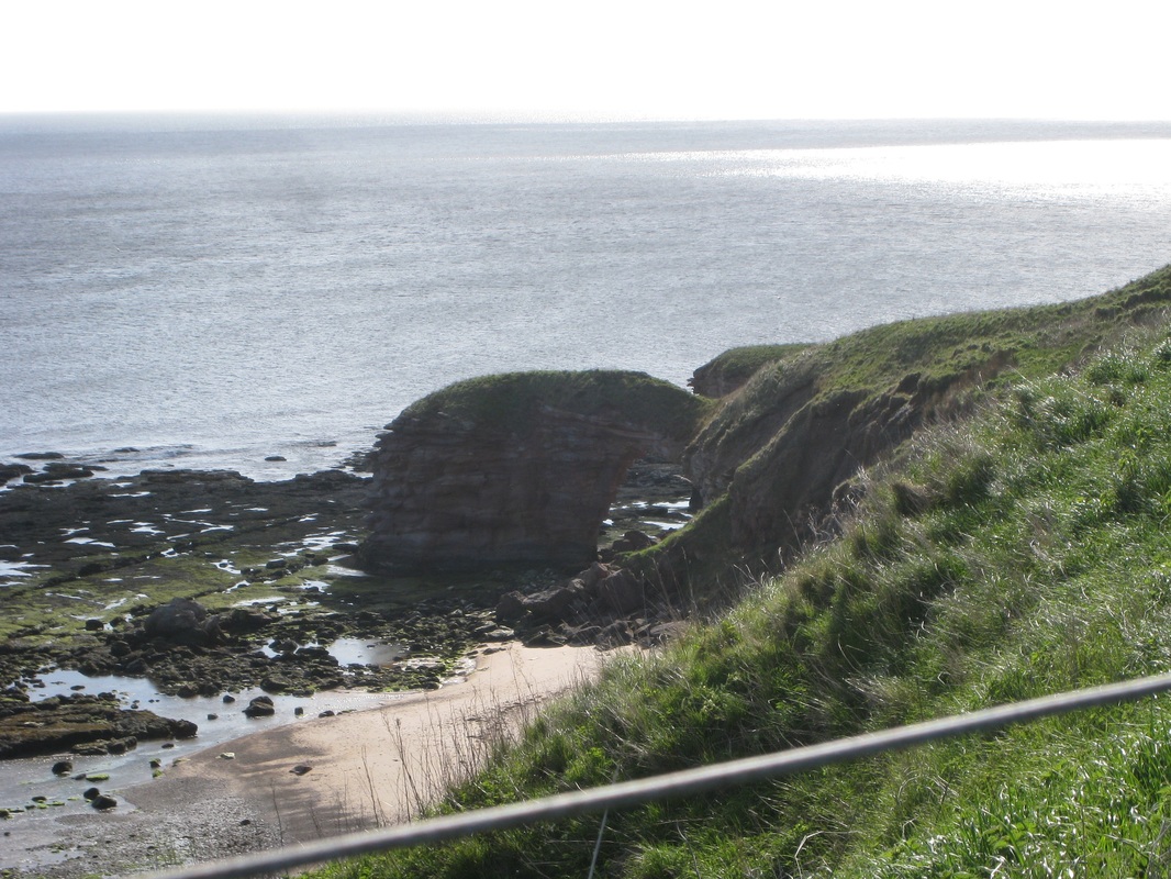


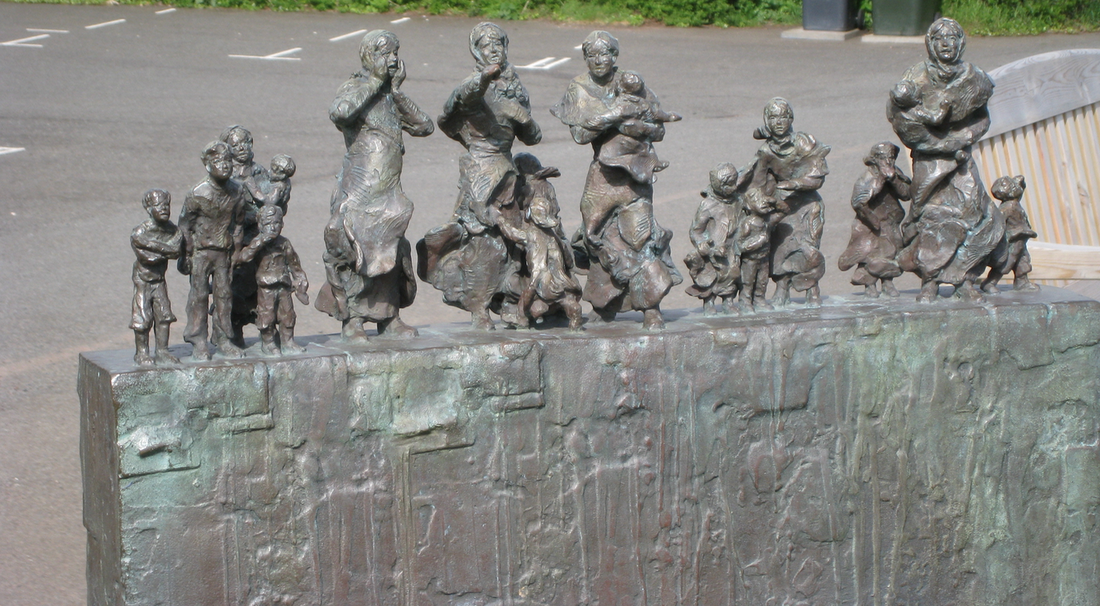
Back down on the beach and we walked the short distance to Dunglass where we had to leave the beach again to walk up the road to the small village of Cove. At the top of the hill on the way down in to Cove village there is a memorial by Jill Watson commemorating the 1881 fishing disaster that struck the East Coast fishing communities. While nearby Eyemouth lost 129 men and a third of their boats, Cove lost proportionately more with three of its four boats and 11 men out of a fishing complement of 21 lost. The memorial depicts women and children looking forlornly to sea, searching for their husbands, fathers, brothers and other relatives and friends. It is one of many memorials that we have passed on our coastal journey to people who gave their lives that others might improve theirs including fishermen, the men of the life boat service, miners and shipbuilders and sailors generally.
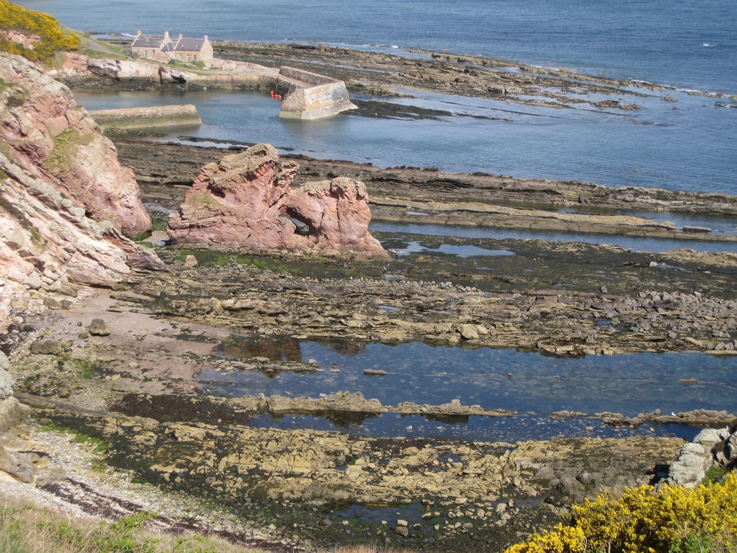
Climbing back up and out of Cove there were good views south of what are some of the highest cliffs on the East Coast of the United Kingdom and which give an inkling of the day’s challenges. In the distance to the north, Torness Power Station still stands tall against the roiling clouds. Looking back, the very pretty Cove Harbour sits like a wee jewel beneath the red sandstone cliffs. The harbour was bought privately in 1990 by Benjamin Tindall to save it from development and it does have a certain timeless quality to it. It is popular as a location for still photographers (fashion shoots, etc.,) and filmmakers. An architect by trade, some of Tindall's work and influence can be seen in the holiday accommodation 'the blue cabin by the sea' here.


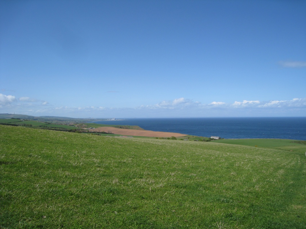
 Pease Bay & Beach
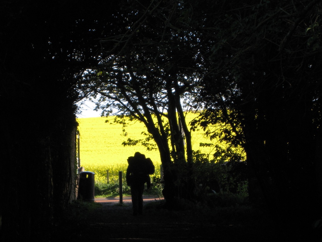
 It is a short walk along the cliffs from Cove to Pease Bay where there is a beautiful beach that is becoming popular with surfers. The John Muir Way diverted from our path here to go and link up with the Southern Upland Way. We had been warned about a huge caravan park that was on site that reportedly spoilt the enjoyment of the beach for outsiders. Before we arrived, we had already made up our minds that it was the most horrible caravan park in Scotland and, when we first viewed from the cliff top, saw nothing to change our minds. It was only when we went in to the park and find out that they had a shop that sold bacon rolls and gave cash back that we reviewed our position on this loveliest of holiday locations. Self-interest is a great thing!
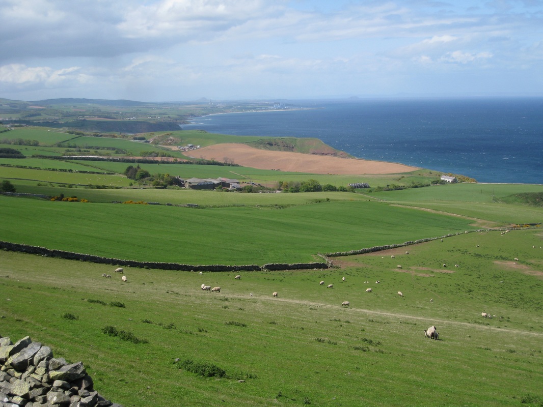
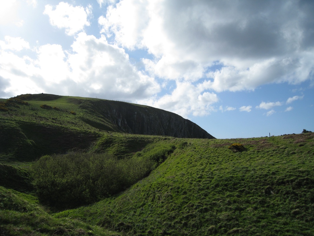
Rising up very steeply from Pease Bay there is a small B road that takes you back up on to the cliffs above Greenheugh Point, from where we were able to access a grass path along the cliff edge to the point. However, we were forced back in land by a gully before resuming along the cliff. Just after Greenheugh Point, are the remains of St Helen’s Church that contains one complete hogback stone and the remains of another. Hogbacks are carved stones from the 10th Century that were generally used a grave markers and they are thought to be of Scandinavian origin. Almost immediately below St Helen's is Siccar Point which is famous in the history of geology as one of the sites where in 1788 James Hutton and friends observed the geological feature known as 'Hutton's Unconformity' which Hutton regarded as conclusive proof of his theory about the nature of geological development.
We continued along the top of the cliffs until we could go no further and were forced to go even further uphill to make progress. The views from up here to north and south, just below an area called "Haud Yauds', were pretty spectacular. With only a thin trail of white cloud out on the horizon, the sea and sky were an endless 'nocturne in blue'. After crossing a number of fields we reached a small track by a mast and quarry in an area called Harly Darlies. The names in this area were just wonderful and it was fun to play with them in your mouth as you tried to pronounce them in different kinds of Scots dialect. From the Darlies, we followed the track until we reached Dowlaw Farm and Deans, where we stopped for lunch.
 North from Dowlaw
 I decided to undertake a wee bit of foot care here as I had been having problems with a compeed plaster that I had put on the day before. The plaster had been put on a sensitive area on the pad under my right big toe as a preventative measure. There had been no blister when it went on. As one does when removing plasters, I shut my eyes to hide from the pain (what? I'm a man!) and gave it a hard yank hoping to remove it fairly painlessly in one movement. Unfortunately, a blister had developed since the plaster went on and, not only did I remove the skin from the blister but also a fair old wallop of the healthy skin round about it on the pad of my toe. The poor wee white hare that had come down to see what all the commotion was about got the fright of his life and disappeared at a fast rate of knots back over the brae. Me, I just felt like greetin and was gie near to it before the day was done. It was a fair old mess.
There is no confusion in such circumstances. There are no choices. You just have to tidy it up the best you can and carry on walking home. The fact that we still had a fair number of miles to go, most of it up and down very steep hills didn’t matter a sparrow’s fart, I had to walk home. At this point, those of you who know me and experienced my response to set back will appreciate that by the end of the day Joanna deserved a medal for staying the course and not burying me in some bottomless bog on a border hillside.
From Dowlaw Farm we had dropped back down toward the cliffs only to have to come back up again when we hit the Dowlaw Dean (or ravine) forcing us back inland where we followed sheep paths across the line of the cliffs. The OS maps show various settlements and homesteads for this area but there is actually very little to see. On the cliff top, between Oatlee Hill and Pettico Wick, there are four Admiralty Distance Poles that were used to test the performance of ships before the invention of GPS systems and we walked along this route. Known as the 'measured mile' they are relatively rare in Scotland.

 Reedbed, Mire Loch
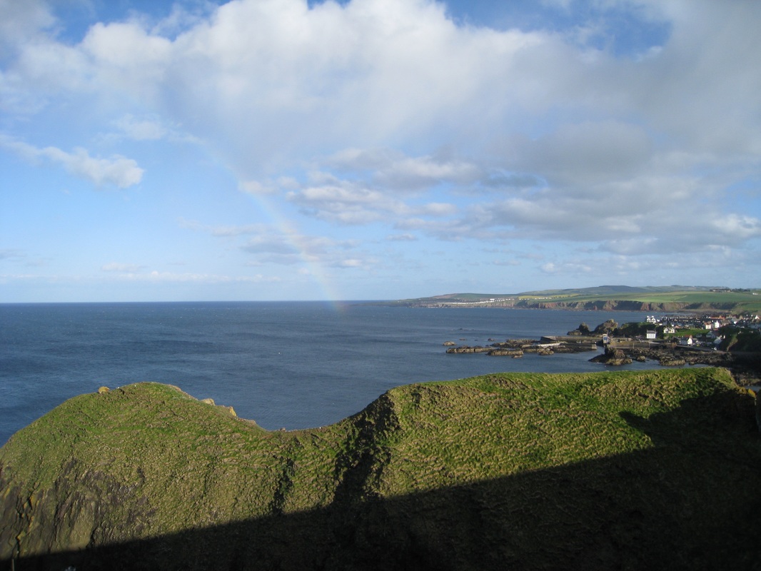
 At the end of the measured mile we started the descent down from the cliff tops. Given the state of my foot we had to decide not to walk out on to and around the headland. Instead we headed for the path that goes along the side of the Mire Loch to exit at Horsecastle Bay and the rock formations known as The Wuddy, which are a popular place for people to go diving. Following the coastline round and over Bell Hill into Starney Bay we enjoyed beautiful and glorious views over St Abbs.


The walk along the last section of cliffs going into St Abbs was reinvigorating. Even a grumpy old sod like me could appreciate it. The next section (St Abbs to Eyemouth) I knew was equally as spectacular but from the sloshing in my right boot I knew that I would not be able to complete the final four miles and had to tell Joanna I needed to stop for the day. We had just walked on to the road going in to St Abbs when the bus to Eyemouth passed us on the way out. It was one of those days!

We had not expected to have to catch the bus and had not looked in to the timetable so had no idea when the next one would be. As it was getting late we decided to telephone our landlady for the night and advise her we might be late. Without any hesitation she offered the services of her husband to come out and pick us up and sure enough, within twenty minutes we were booking in for the night. When we were settled and I was able to get my boots off it was obvious from the state of my state of my foot that I would not be walking on the next day either and our three day trip came to a premature end.
 RSS Feed
