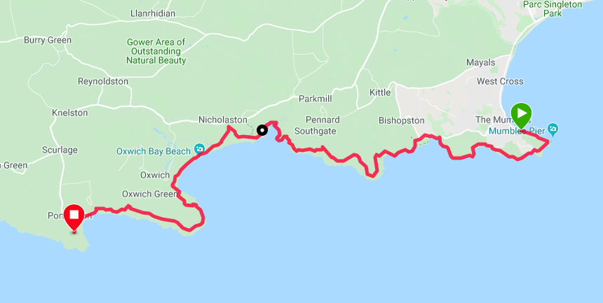
Route Map
Despite the fact we had a long day in front of us we tarried in the hotel this morning taking an age to leave the breakfast table. It is a conundrum that when we are camping and have all the gear to take down and pack up that we seem to be on the road consistently earlier than we do when we are slumming it in hotels and B&B.
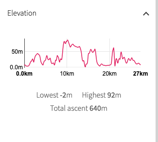 Walk Profile
 The route today sticks rigidly to the coast, unless there are diversions that we are unaware of. As well as being a fairly long walk, estimated at sixteen miles, it is a pretty active route with rolling countryside from start to finish. A saving grace is that the tide is with us for part of the route meaning that later we might avoid some of the hills by walking on the beach. The hard work of the day is towards the middle of the walk at and on the approaches to Pwlldu Head, where the highest point of the day is just over ninety metres (three hundred feet). Leaving behind the built-up areas of Cardiff, Port Talbot and Swansea, as we 'turn the corner', this is the start of the lovely 'wild' section of the Gower Peninsula with lots of sandy beaches, beautiful bays and coves, lovely headlands and cliffs.
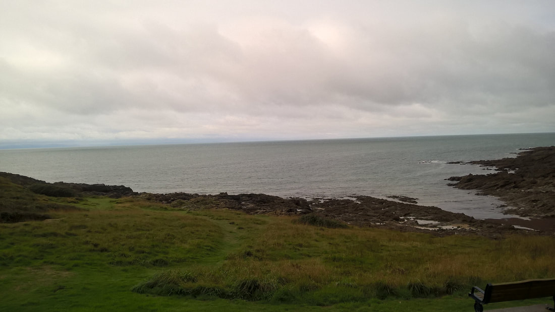
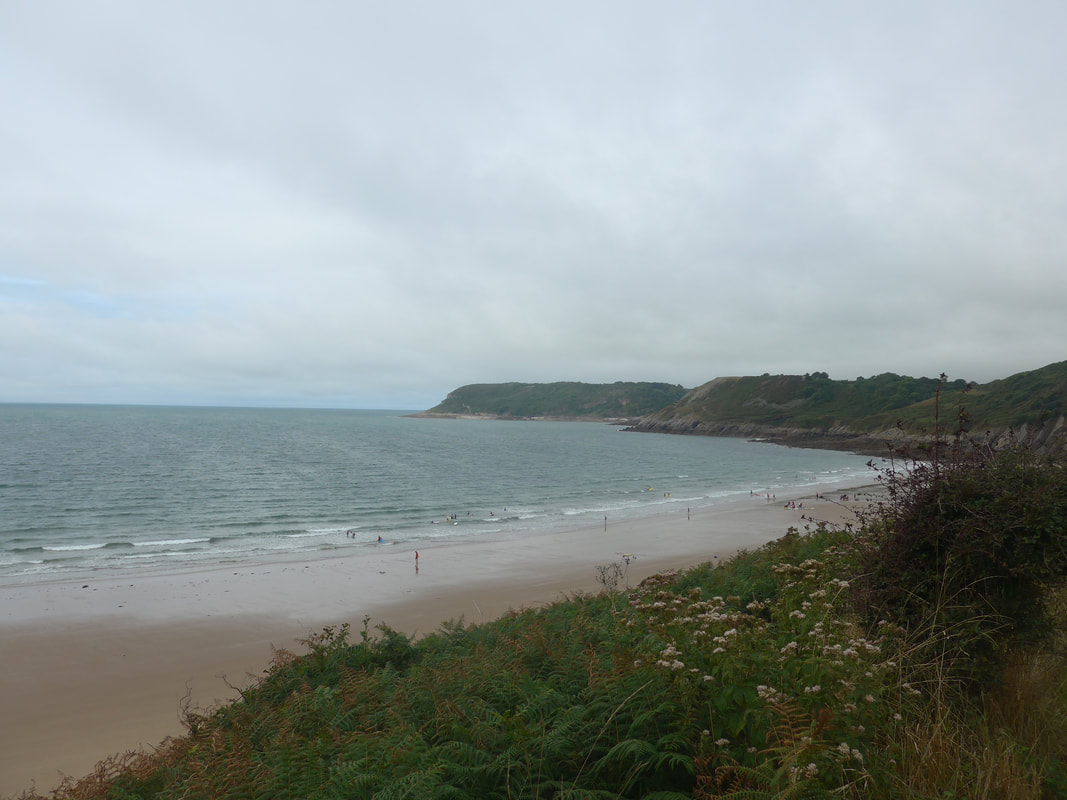
 Bracelet Bay to the east
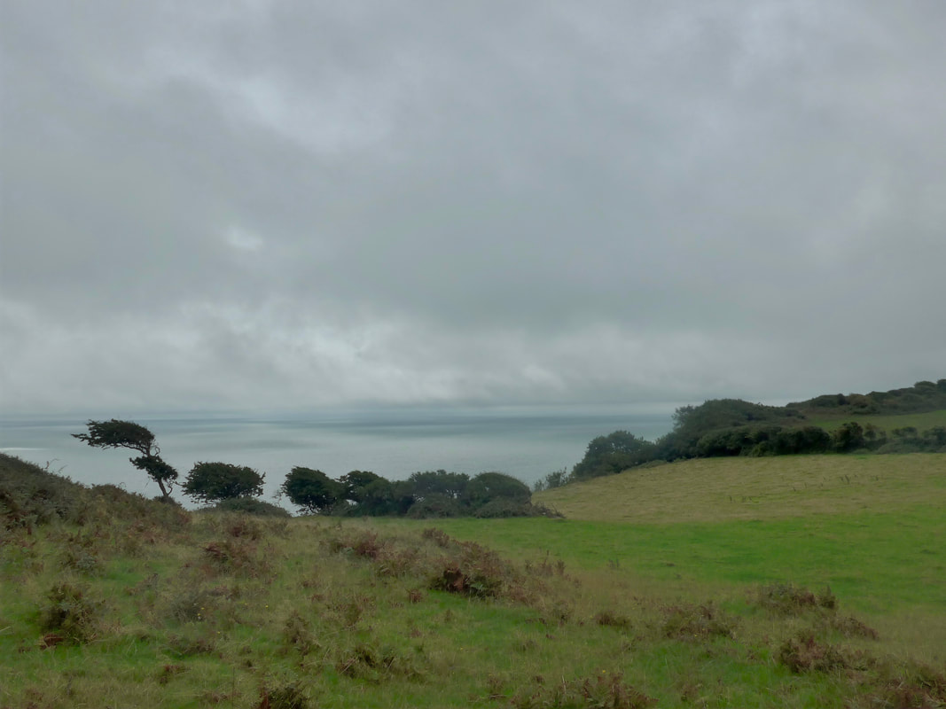
 The weather was not promising as we set off with angry, dark grey clouds dominating the skyline to the east. Looking westward the sky held more light that we hoped would improve as we walked.
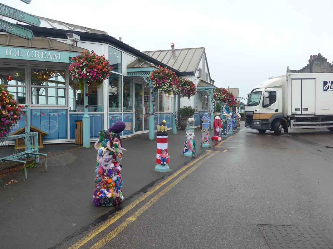
Leaving the Mumbles, we passed along the seafront, a reminder that the Mumbles is a seaside resort with a promenade that has the usual ice cream parlours, etc. While we were quite taken with the decorated bollards, we were more excited about what lay to the front of us and, after having walked through built up areas pretty much since we reached Ogmore-by-Sea, at last we had the open road in front of us. We headed along the promenade in the direction of Mumbles Head where we turned right to cross over the back of Bracelet and Limeslade Bays.
Leaving the Mumbles, we passed along the seafront, a reminder that the Mumbles is a seaside resort with a promenade that has the usual ice cream parlours, etc. While we were quite taken with the decorated bollards, we were more excited about what lay to the front of us and, after having walked through built up areas pretty much since we reached Ogmore-by-Sea, at last we had the open road in front of us. We headed along the promenade in the direction of Mumbles Head where we turned right to cross over the back of Bracelet and Limeslade Bays.
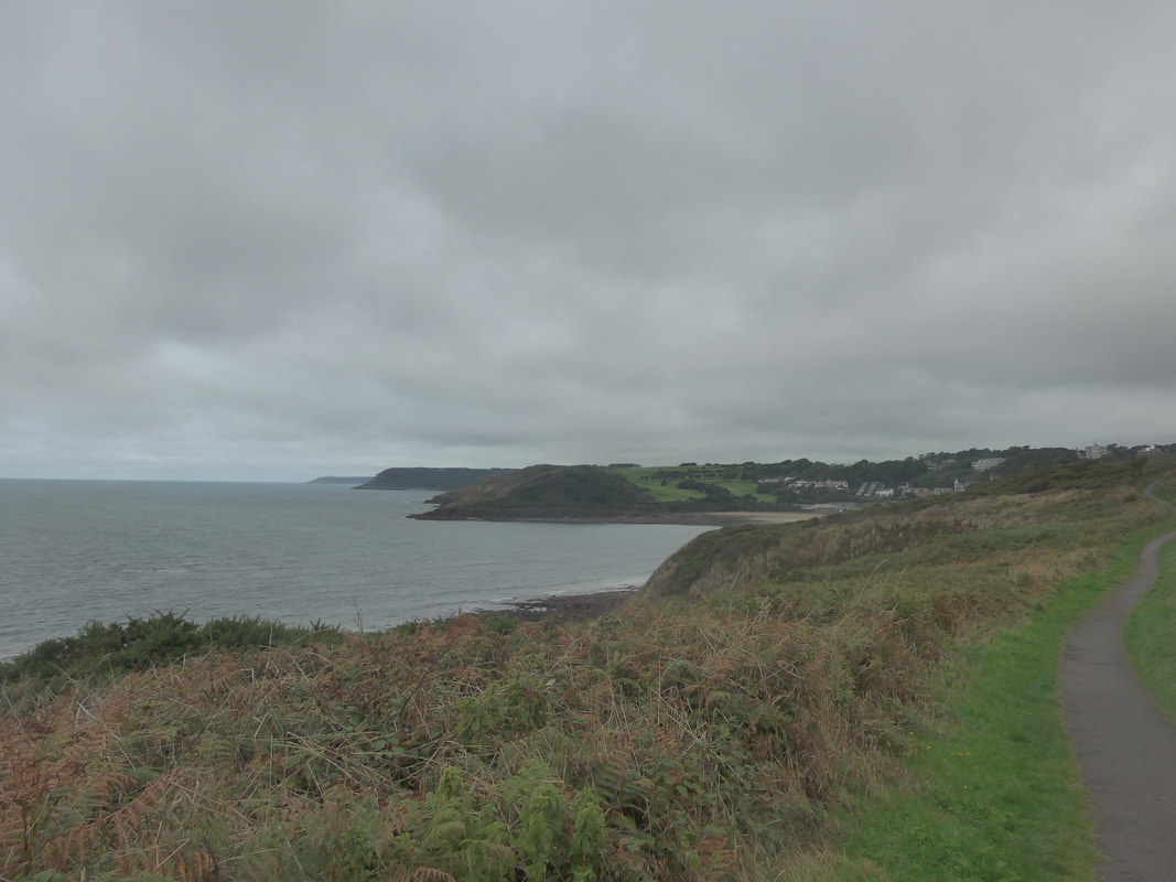
 Approaching Langland Bay
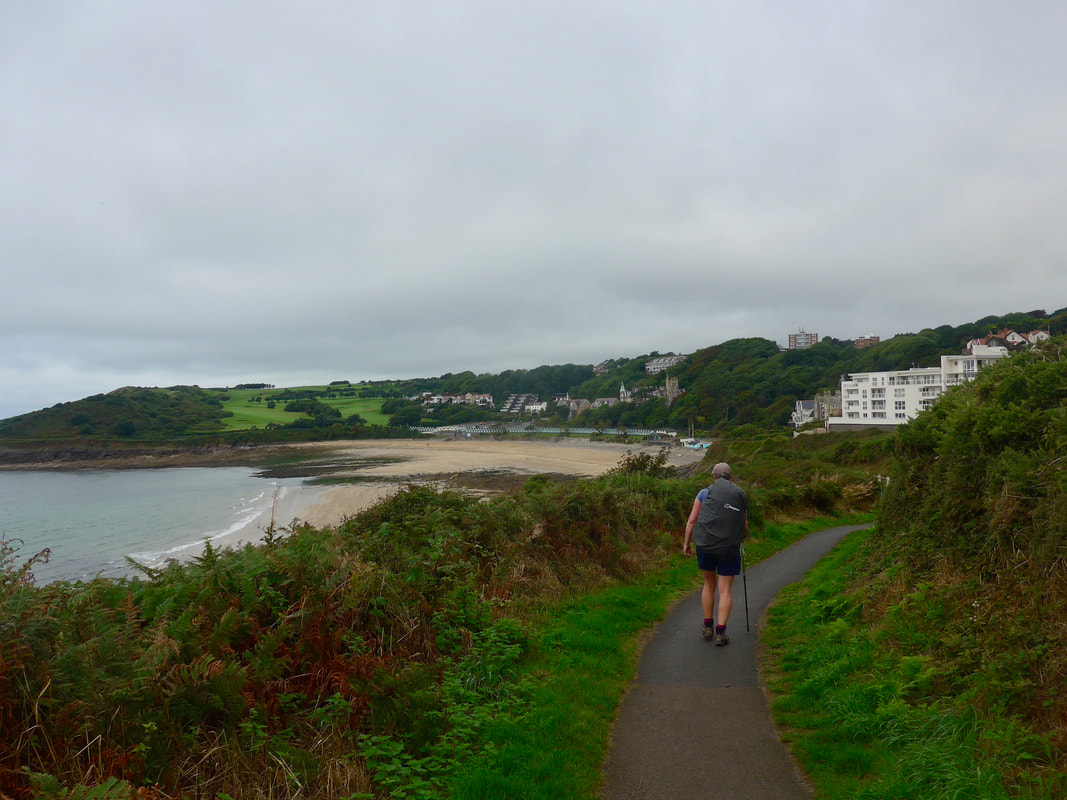
 There are one or two little settlements at the beginning of this section of the walk, Langland and Caswell, and to facilitate travel between them there are formal footpaths across the hillside that make this early walking easy and straightforward. From the footpath there are good views over the beaches where, even on an overcast day such as this, there were a few hardy souls enjoying the sand and sea. From Langland Bay, on the southern horizon where a little bit of light had started to break through the clouds we could just make out the coast of England with places like Ilfracombe, Combe Martin and Lynton huddled down in the gloom.
Continuing round the hillside to Caswell Bay we had our first really clear view of Pwlldu Head jutting out in to the sea at the end of Pwlldu Bay. On Caswell beach a number of sea-based activities were underway with lots of people clothed in cold water suits. Leaving Caswell Bay to begin the long climb up to the headland, you lose the posh footpath and move on to a rougher grassy path.
Continuing round the hillside to Caswell Bay we had our first really clear view of Pwlldu Head jutting out in to the sea at the end of Pwlldu Bay. On Caswell beach a number of sea-based activities were underway with lots of people clothed in cold water suits. Leaving Caswell Bay to begin the long climb up to the headland, you lose the posh footpath and move on to a rougher grassy path.
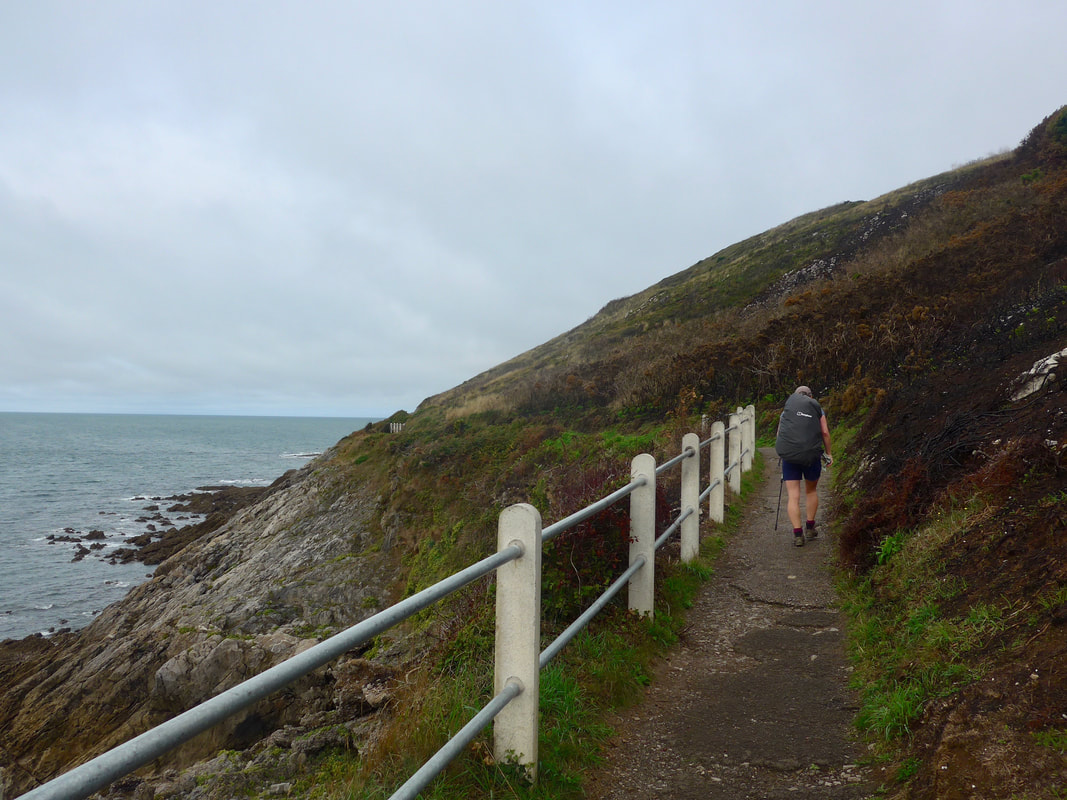
 On Redley Cliff
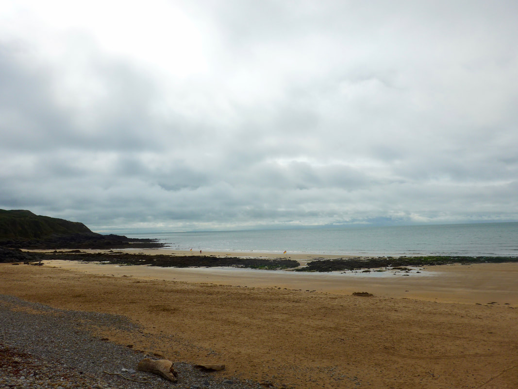
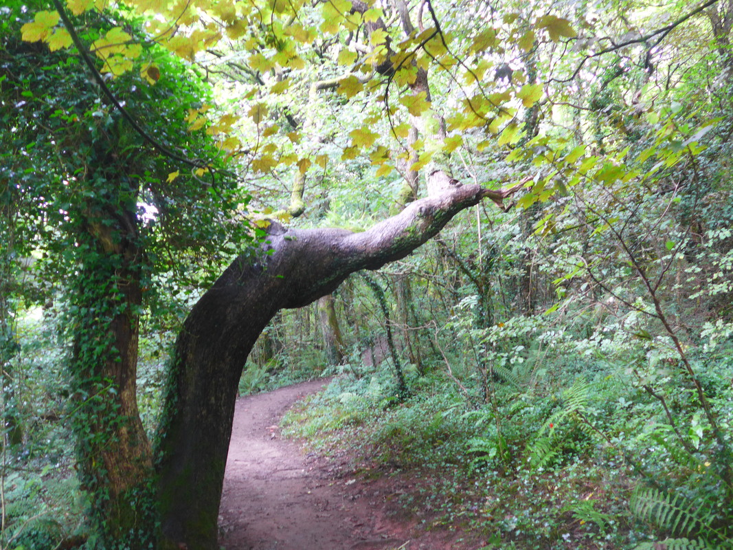
 There is an uphill path coming out of Caswell Bay and going through a wooded area the path moves on to Redley Cliff heading for Brandy Cove. Walking on the top of the cliff with the land rising even further on your right, you are about fifty feet above sea level with fine views fore and aft. It is a pleasant meandering walk with only slight rises to the ground before it starts to descend again on the approaches to Brandy Cove, with a set of steps set in to the hillside to make the descent a little easier.
Brandy Cove is an interesting, isolated stony beach with a sandy section visible and accessible only at low tide. It lies at the bottom of the Hareslade Valley, the valley slowly rising from from the beachhead up to the village of the same name. The cove is well known locally with a history of smuggling (tobacco & alcohol) and folk tales of the supernatural attached to it. The remains of a female murder victim were found in a lead / silver mining cave in the cove in modern times.
Brandy Cove is an interesting, isolated stony beach with a sandy section visible and accessible only at low tide. It lies at the bottom of the Hareslade Valley, the valley slowly rising from from the beachhead up to the village of the same name. The cove is well known locally with a history of smuggling (tobacco & alcohol) and folk tales of the supernatural attached to it. The remains of a female murder victim were found in a lead / silver mining cave in the cove in modern times.
 Approaches to Brandy Cove
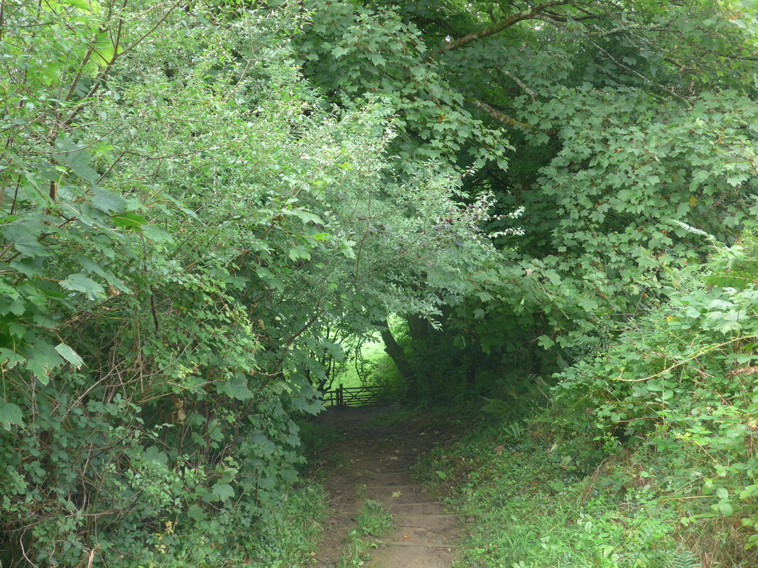
 There are a number of caves round the coast of the peninsula that were occupied by Neolithic people some twenty-five thousand years ago. By the time of the Iron Age the inhabitants had progressed to more substantial dwellings such as hill forts, of which there is one on the top of the Redley Cliff. Archeological evidence has also been found that links the area with silver mining during the Roman occupation. In the surrounding landform can be seen the remains of a Pleistocene raised beach, evidence that the sea level in the area has been at least thirty feet higher that it is today. Varying sea levels have over many millions of years, created and shaped the Gower as we see it today with its many bays and inlets. The main geology of the area is a mixture of Limestone and Old Red Sandstone (ORS), the softer ORS slowly worn away, while the harder limestone has shown more stubborn resistance in holding back the sea, creating the many headlands and tidal islands in the area.
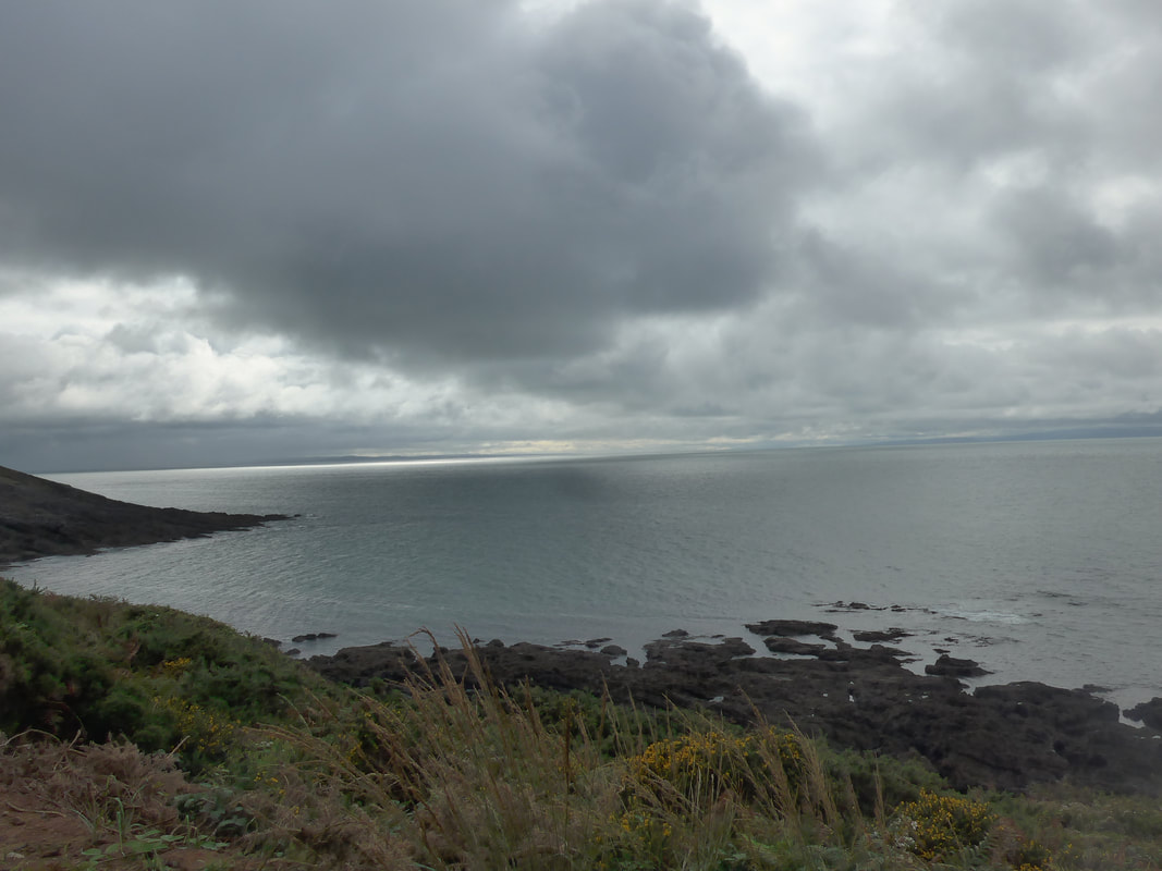
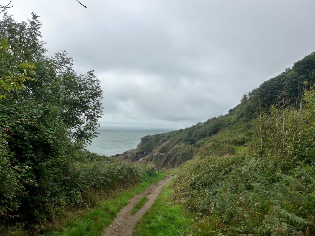
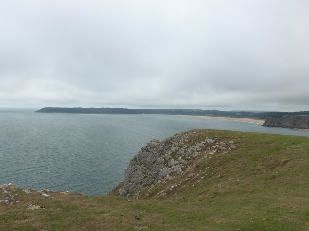
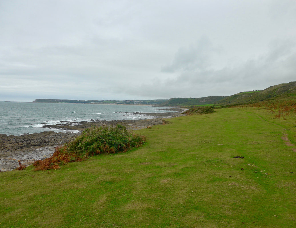
 Pwlldu Bay
 Continuing along the mid-cliff, we enjoyed good sea views across Pwulldu Bay. You could see from the angle the trees at the top of the cliff were growing that it is an area where high winds are the norm. Walking on the mid-cliff like this is my favourite location. With land and sea stretching endlessly out in front of you there is an exciting sense of adventure that makes it a real joy and delight.
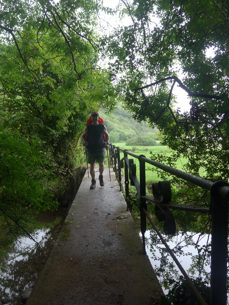
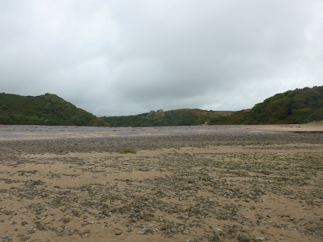
It was not long before we reached the next beach (generally stony with sand only at low tide) at Pwlldu Bay, where walked along the back of the beach to access a small bridge across the river that bisects the sand and rocks on the beach. On up the wooded hill , it is a steady climb up on to Pwlldu Head. Just to the west of the summit is the location of another Iron Age Fort, known as High Pennard Fort, which archaeological finds have indicated was occupied about 1-2C AD.
It was not long before we reached the next beach (generally stony with sand only at low tide) at Pwlldu Bay, where walked along the back of the beach to access a small bridge across the river that bisects the sand and rocks on the beach. On up the wooded hill , it is a steady climb up on to Pwlldu Head. Just to the west of the summit is the location of another Iron Age Fort, known as High Pennard Fort, which archaeological finds have indicated was occupied about 1-2C AD.
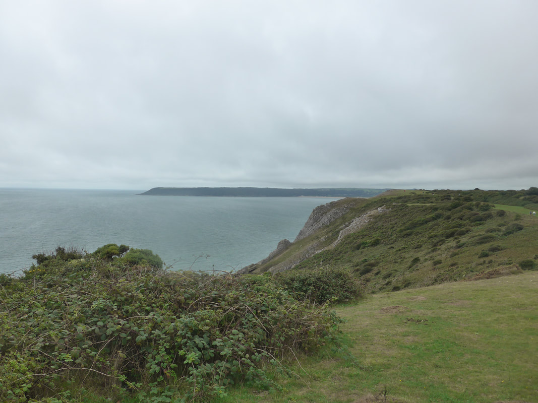
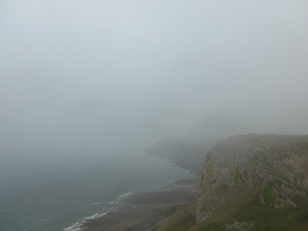
 Strong Winds!
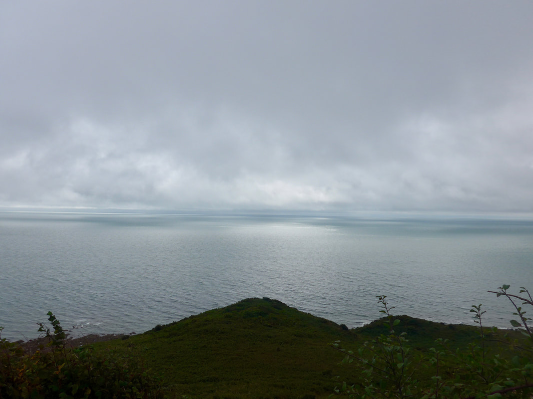
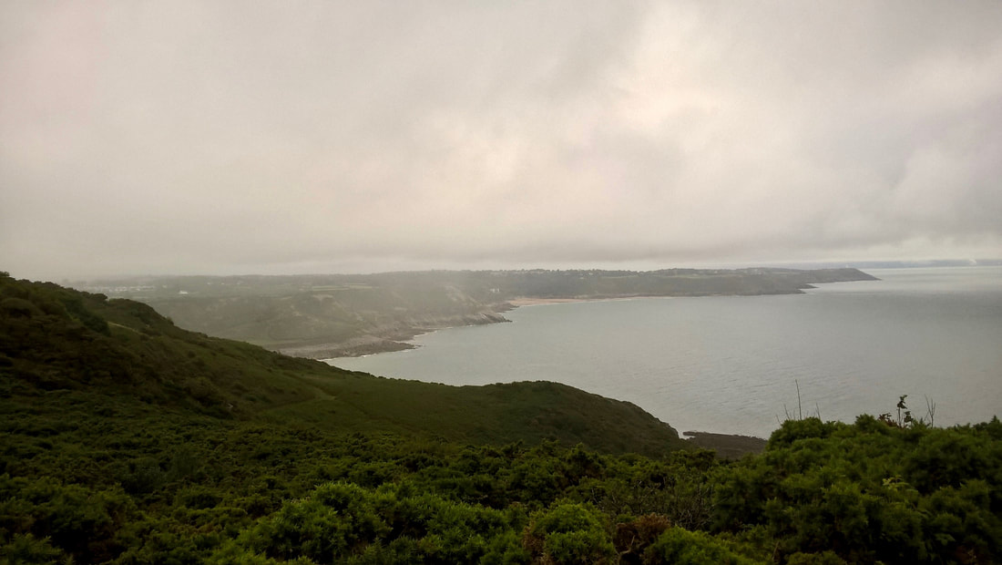
 By now the weather was doing funny things. Despite being warm and close, there was a mist rolling in from the sea to lie lightly across the land like a mohair christening robe. The light effects out to sea were lovely, with shades of grey and silver interchanging and mingling as the sun penetrated the low cloud. As suddenly as it appeared, the mist disappeared and we were left with lovely views across Oxwich Bay to Oxwich Point and beach.
Below the cliffs on this section there are a number of caves, including the large Minchin Hole, known colloqially as the bone caves, lived in during the Upper Palaeolithic period (50,000 and 10,000 years ago) and in which the remains of numerous animals have been found including straight-tusked elephant, bison, rhinoceros, cave bear, reindeer, wolf and hyena. In addition to the animal remains, evidence of human occupation has also been found in the cave from the Roman period and the Middle Ages. Nearby, is another cave known as Bacon Hole which was also inhabited during the same periods. A series of red bands in this cave was initially thought to have been evidence for very early cave art but further research concluded that it was a natural expression of red oxides in the rock.
Below the cliffs on this section there are a number of caves, including the large Minchin Hole, known colloqially as the bone caves, lived in during the Upper Palaeolithic period (50,000 and 10,000 years ago) and in which the remains of numerous animals have been found including straight-tusked elephant, bison, rhinoceros, cave bear, reindeer, wolf and hyena. In addition to the animal remains, evidence of human occupation has also been found in the cave from the Roman period and the Middle Ages. Nearby, is another cave known as Bacon Hole which was also inhabited during the same periods. A series of red bands in this cave was initially thought to have been evidence for very early cave art but further research concluded that it was a natural expression of red oxides in the rock.
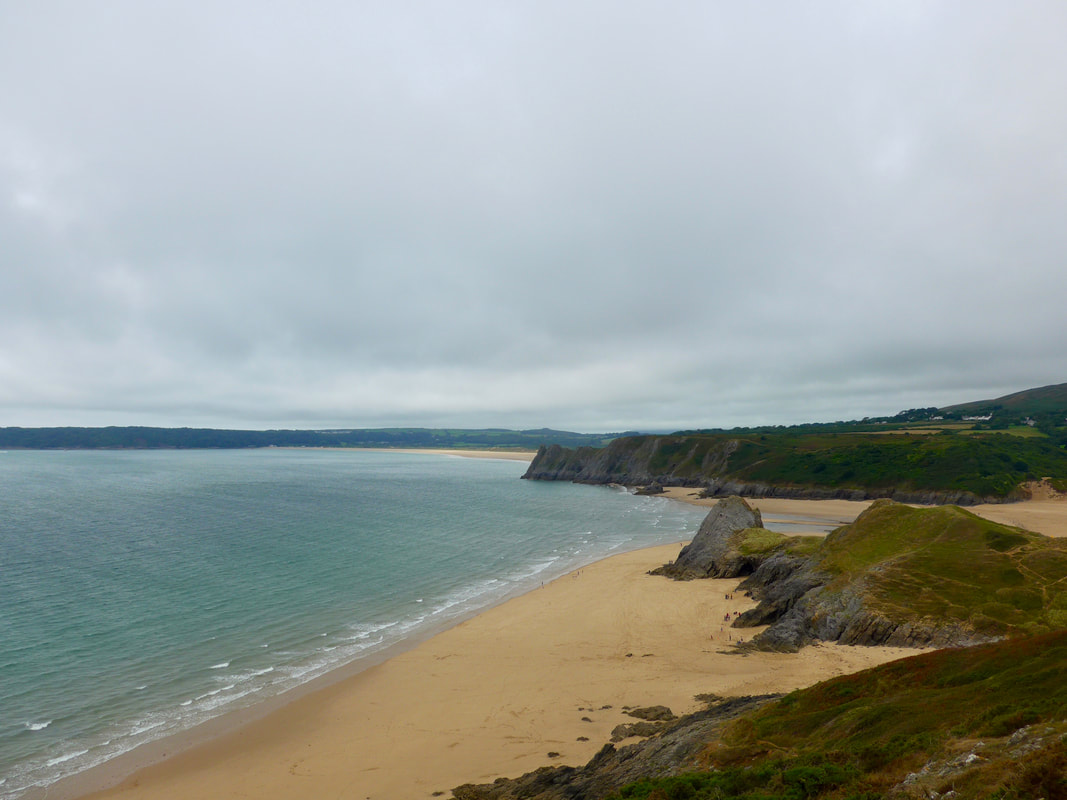 Threecliffs Bay
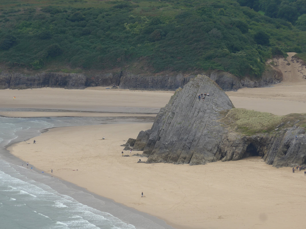
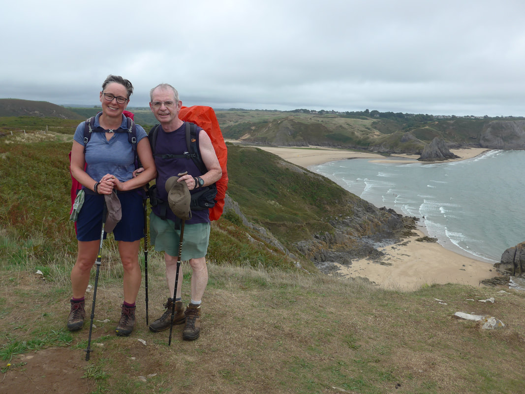
 As you walk the cliff top here it is Oxwich Bay that initially catches the eye. However, tucked in below Pennard Cliff is the small but impressive Threecliff Bay with its interesting rock features. At low tide it is part of one continuous beach with Oxwich, but they are separated at high tide. As we approached the small bay, we could see a number of climbers on one of the tall and sharply angles peaks that rise up from the sands. A tidal river, the Pennard Pill, splits the beach at high tide. Before we reached Threecliffs, however, the road took us to the edges of the town of Southgate where we stopped at the Mennard Stores / Threecliffs Cafe for lunch.
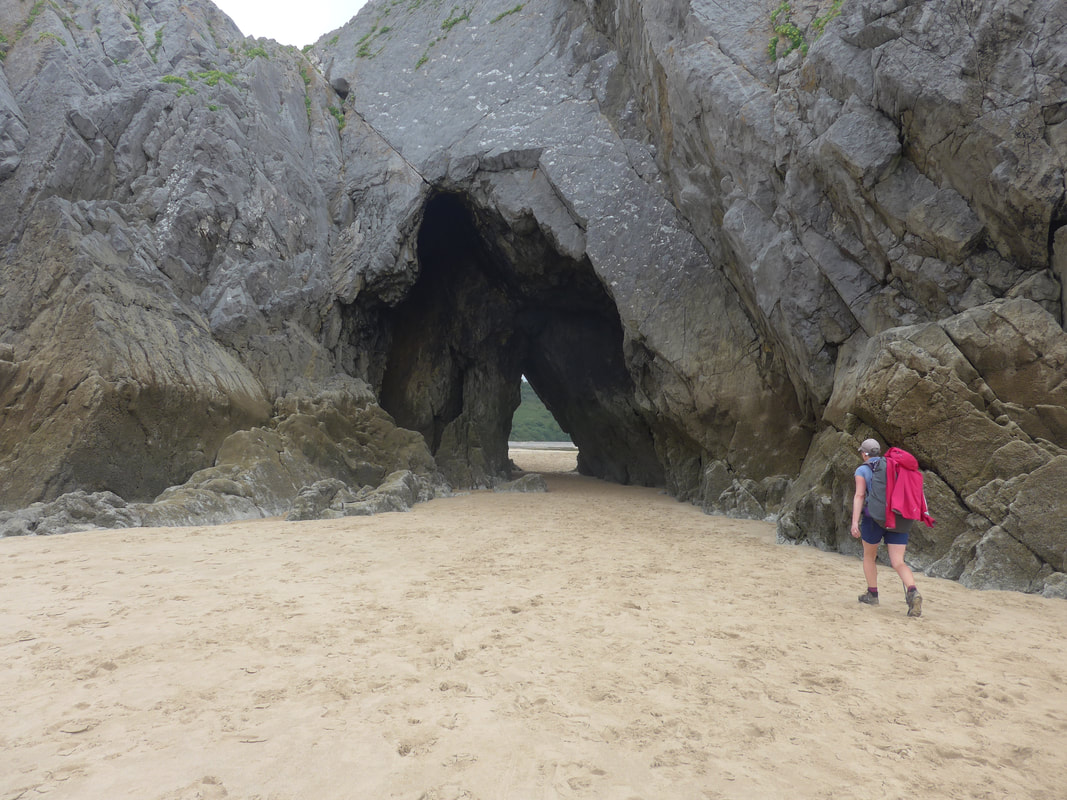
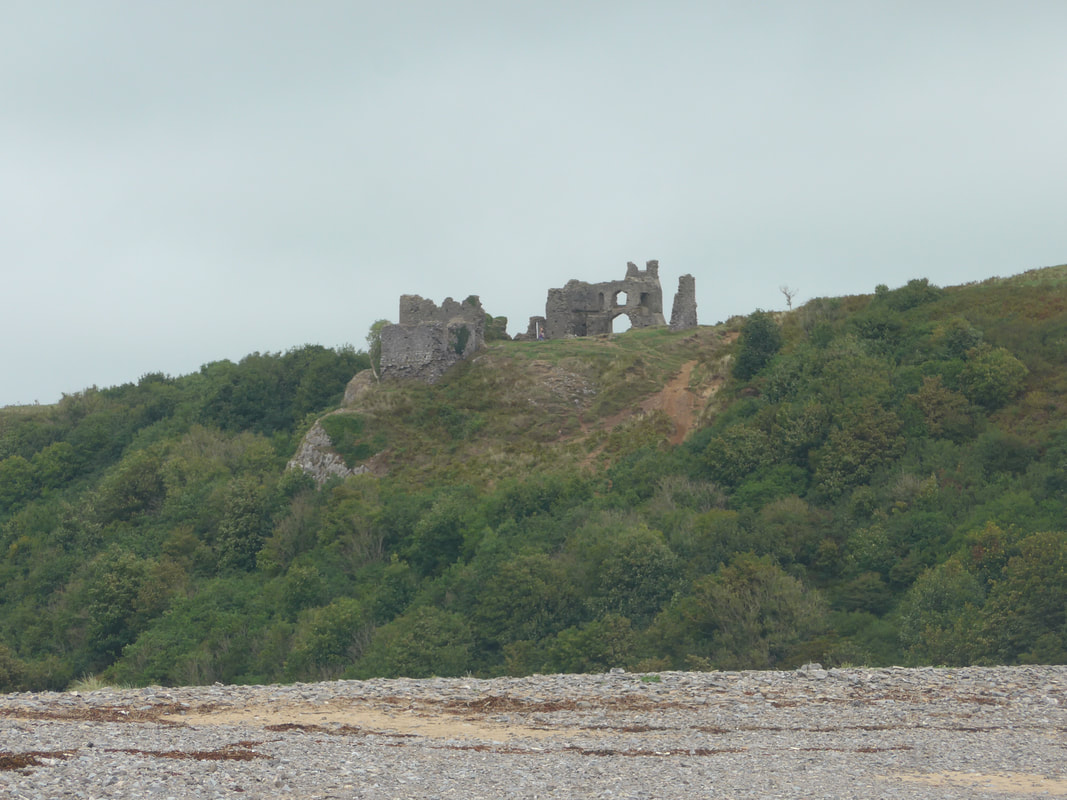
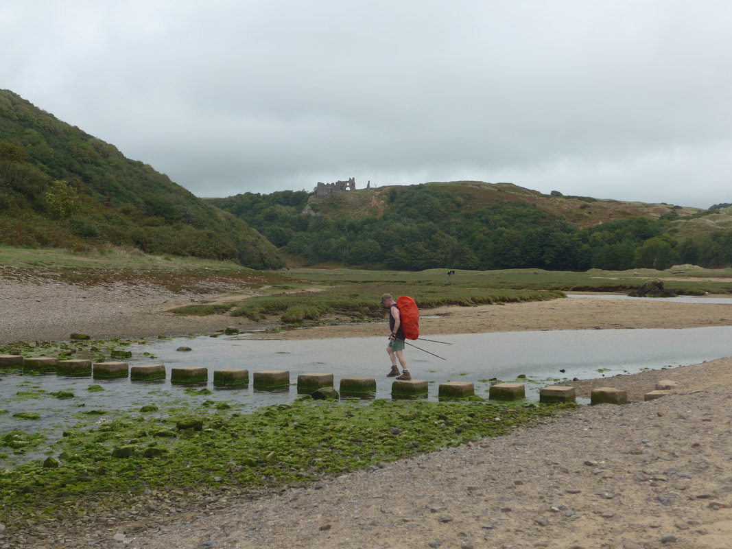
After lunch we continued along the clifftop before dropping down on to Threecliffs beach where we went through a cave archway on the sands to access a set of stepping stones that assist you in crossing the Pill. As you cross the beach, on top of the twenty-foot limestone cliffs the 12C Pennard Castle shows starkly against the skyline. It is thought that the castle was built by Henry de Beaumont, first earl of Warwick. The castle was abandoned in the 14C when it began to disappear below wind-blown sand. Nearby are the remains of St Mary's Church which served the small community that was established here, before all fell victim to the sands.
After lunch we continued along the clifftop before dropping down on to Threecliffs beach where we went through a cave archway on the sands to access a set of stepping stones that assist you in crossing the Pill. As you cross the beach, on top of the twenty-foot limestone cliffs the 12C Pennard Castle shows starkly against the skyline. It is thought that the castle was built by Henry de Beaumont, first earl of Warwick. The castle was abandoned in the 14C when it began to disappear below wind-blown sand. Nearby are the remains of St Mary's Church which served the small community that was established here, before all fell victim to the sands.
 High seas?
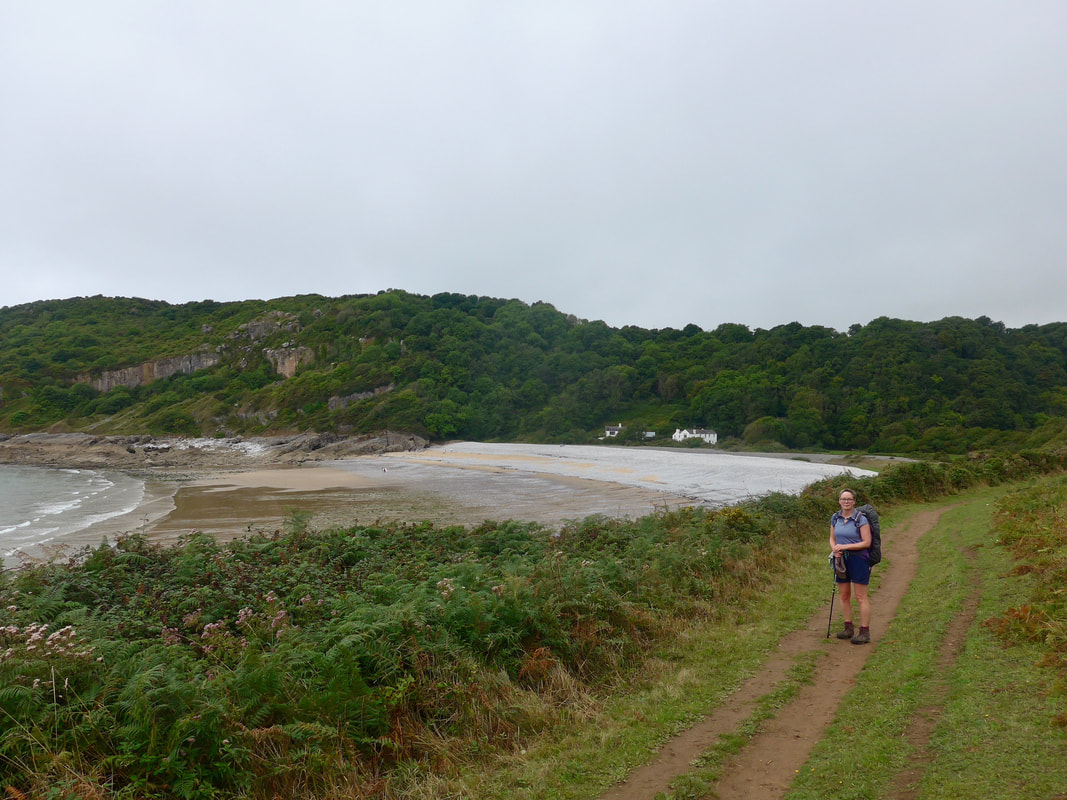
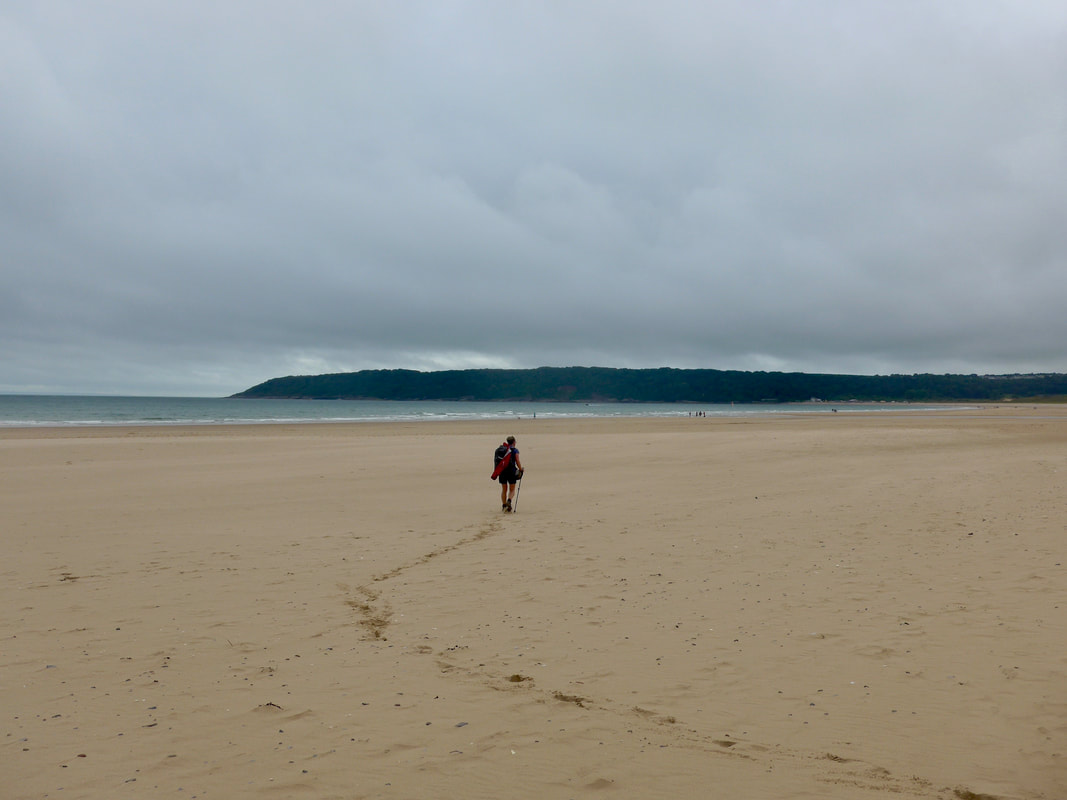
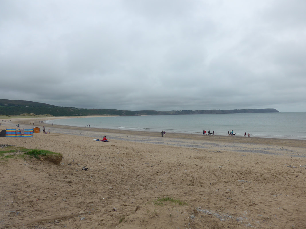
 Rising up from Threecliffs there is a short walk across the hillside to the extensive sands of Nicolaston and Oxwich Burrows. One of the most popular beaches in Wales it is generally pretty busy, as it was the day we passed through. Dropping on to to Nicolaston we could see the consequences of the high tides where the sand and earth was being slowly removed from beneath the trees at the beach head. The two beaches are split by a body of water and you need to go to the back of the sands to access a small bridge. Once across the river we set off across the firm sands, heading for the Oxwich headland which we could see in front of us. It is a long beach and despite the firmness of the sand, it took its toll on us and before the end we began to weary.

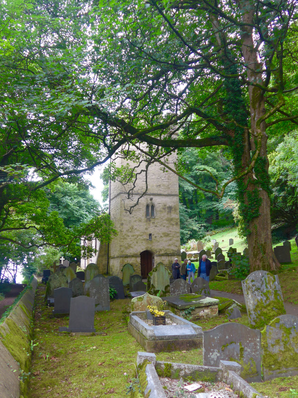
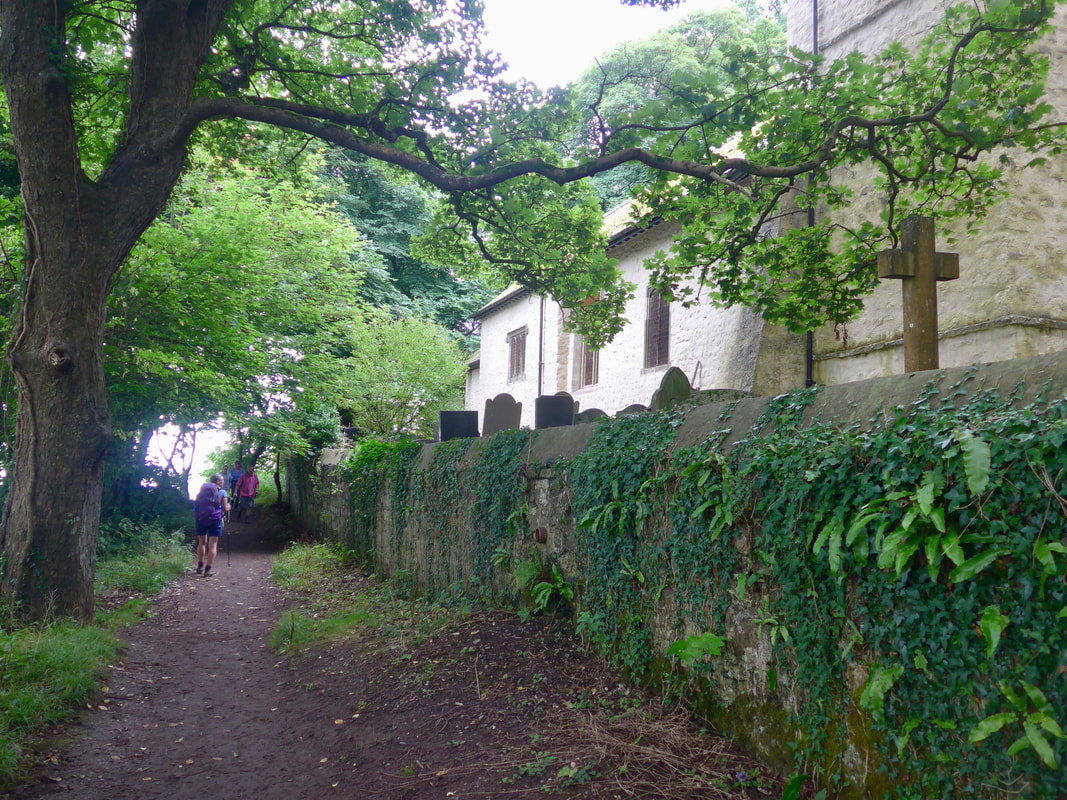
The Oxwich Nation Nature Reserve is located towards the western end of Oxwich Burrows Despite its relatively small size, the reserve has a surpringingly diverse range of habitats in its boundary ranging from sand dunes, to lakes and woodlands. On the hill above the reserve are the remains of what is known as Oxwich Castle (15C), although it is not really a castle but a fortified manor house. At the end of the beach, as you leave the village on a small road to access the open countrside again through a nice woodland walk with very old broad-leaved trees, you pass the lovely little churchyard of St. Illtyd. Built in the 13C, with a 14C tower, it is thought there has been a church on the site since the 6C. Celtic Saint, St Illtyd was active in the 6C and founded a divinity school in Llantwit Major, in the Vale of Glamorgan which had amongst its exclusivea alumni, St David, patron saint of Wales.
 Heading for Home
 The uphill path exits from the woodland walk just at Oxwich Point from where there are good views back as far as the Mumbles headland at Swansea. Up and round the headland there are a number of small ascents and descents that on their own would not be a trouble. After a very long day, however, we found this section hard, with what seemed like a very long and flat section approaching Port Enyon Bay going on for ever. Carrying backpacks of about thirty-five pounds, by this stage they felt like thirty five kilos. It was one of those sections where you think it ends at the next corner, only to find out there is another straight length and another corner, seemingly 'ad infinitum'. When you are walking in this frame of mind you start to lose an appreciation your surroundings and just want the walk to be done!
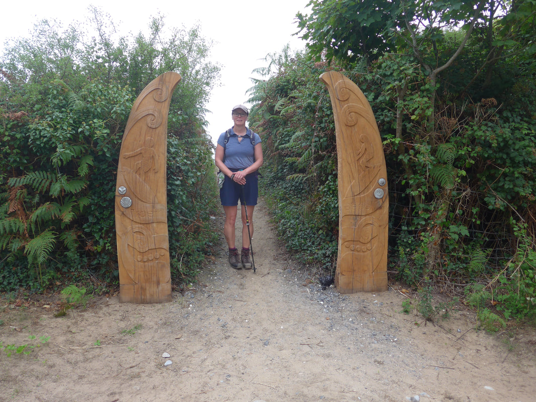 End of a long day
 As is usual the end appears suddenly in front of you and, after fixating on it for so long it seems so sudden, unexpected and underwhelming. We were staying in a local hostel and were so glad to see the unusual entry posts appear at the top of the beach. It had been a long and hard day and we were very grateful to lay down the rucksacks, luxuriate in a hot shower and then enjoy the cooked meal we had the sense to order before we left home.
 RSS Feed
