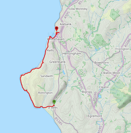
This walk was the start of a three-week adventure. The plan was to utilise the very good railway links in the area and, using different bases, walk clockwise or anti-clockwise as the circumstances dictated. For this first section we were based in St Bees. To simplify today's walk we split it into two, walking from St Bees to Whitehaven, taking a train from there back to Seascale and walking back to our starting point at St Bees. When considering the mileage for this walk, please remember that it includes walks to and from our hotel to the coastal path.
 Route Map 1 | 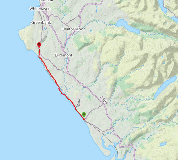 Route Map 2 |
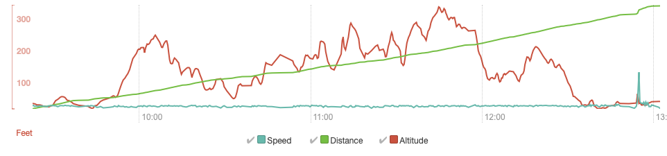
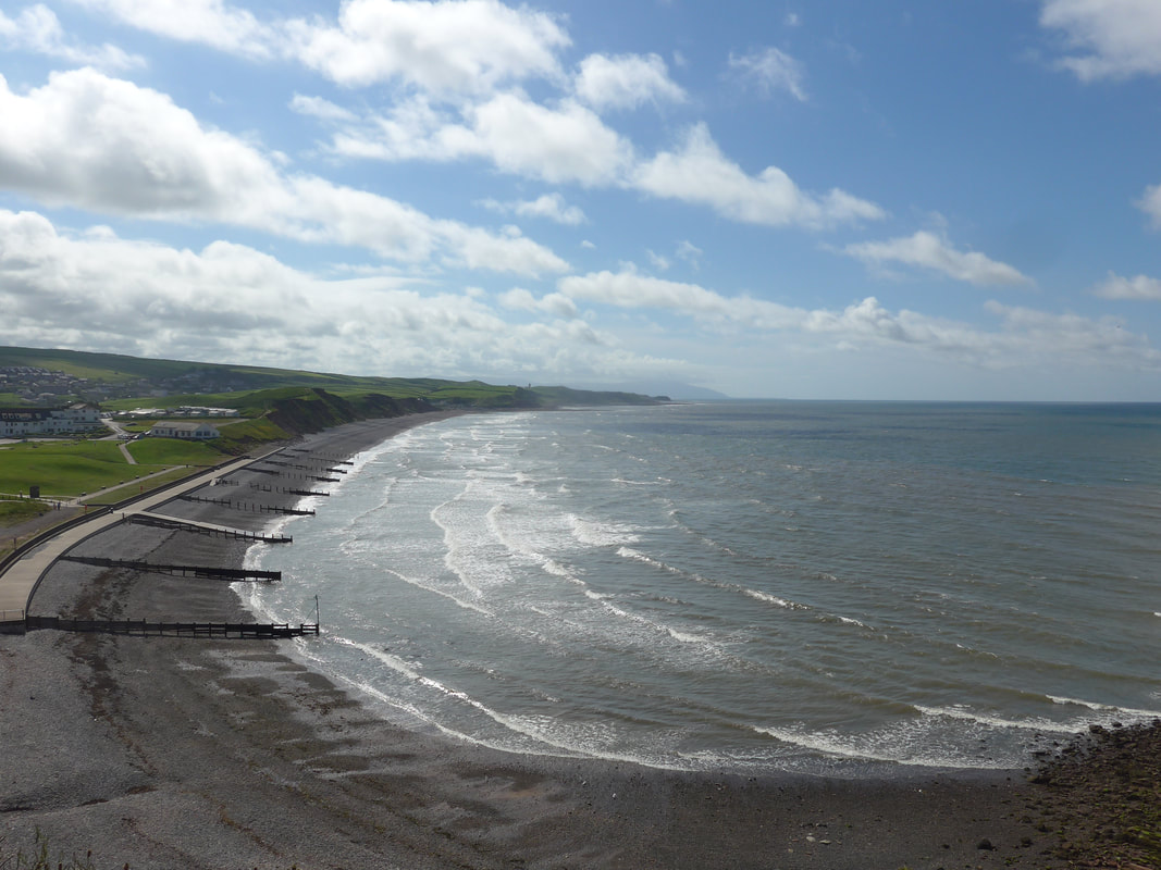
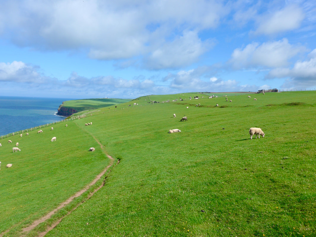
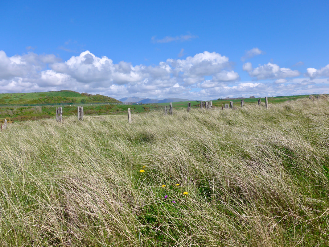
The plan is to try and keep to the coast as much as possible. The first walk on St Bees Head is the one with the most altitude, rising to nearly four hundred feet on the cliffs just after North Head. There is a descent to about one hundred and twenty feet at Kells, before another rise to over two hundred feet on the cliff just before Whitehaven, finishing with a descent to the harbour area in the town. The second walk of the day starts of at fairly low levels before starting to rise at Braystones to a height of over one hundred and fifty feet, dropping down at the head of St Bees Golf Club and back up to one hundred feet on the approaches to the village. The weather was good with sun forecast for most of the day.
 Route 1 - Altitude | 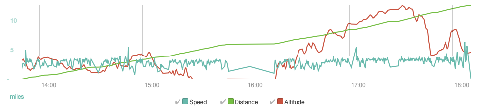 Route 2 - Altitude |
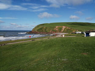
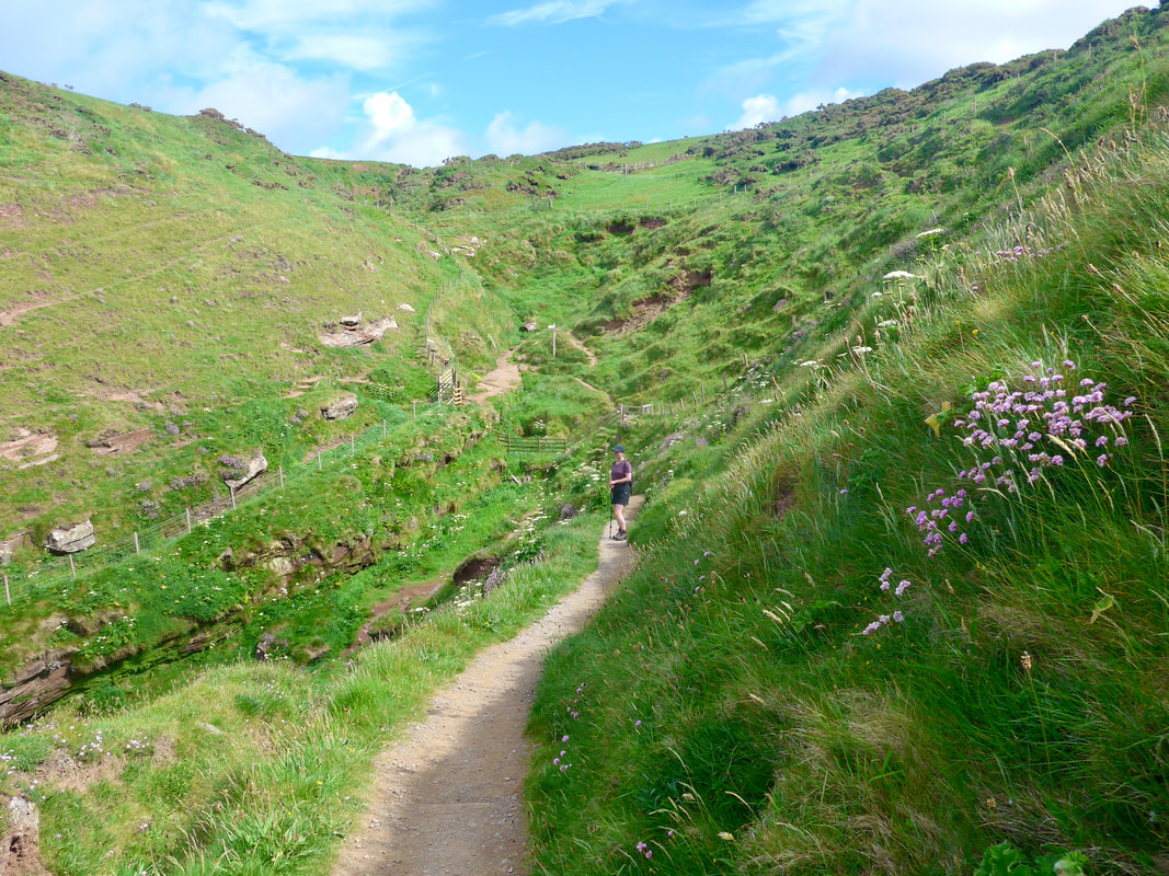
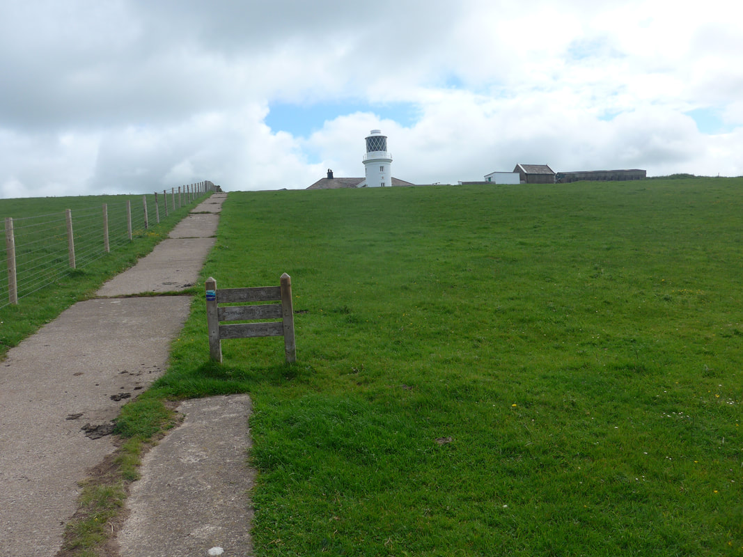
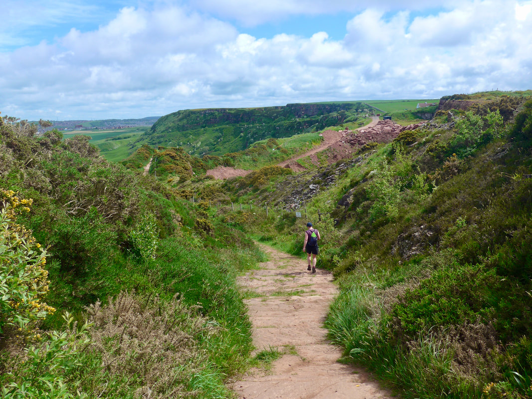
From our hotel in St Bees we had a walk of just over a kilometre to to reach the beach and link up with the England Coast Path. Shortly after leaving the village we passed the location of St Bees Priory, The route is also part of Alfred Wainwright's 190-mile Coast to Coast walk, taking in St Bees Head before cutting inland half-way along Saltom Bay.
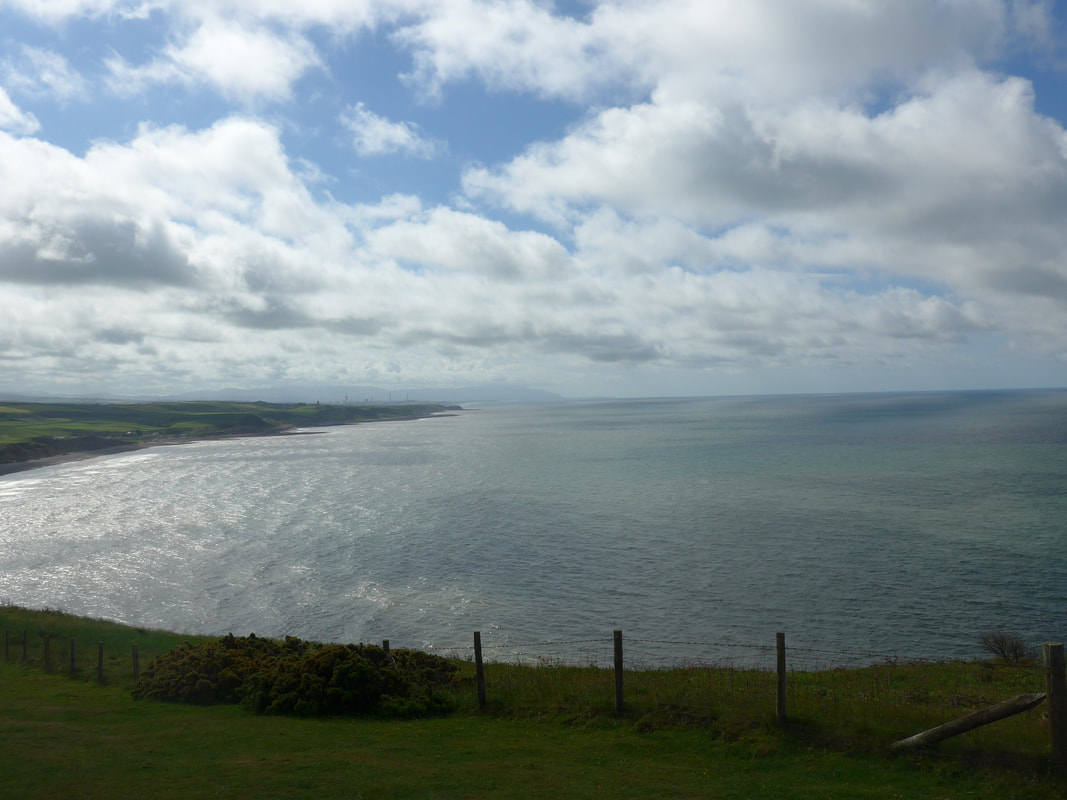
There are toilets on the beach front, handy before you set off on the walk. It is a nice, tidy beach front here with good views on to South Head which gives you an idea of the walking in front of you. But don't be fooled in to thinking that what you see is the only, or the highest climb of the day. The initial route heads along the seafront heading for the Lifeboat Station where there is a small footbridge over the Rottington Beck before heading up the hill.
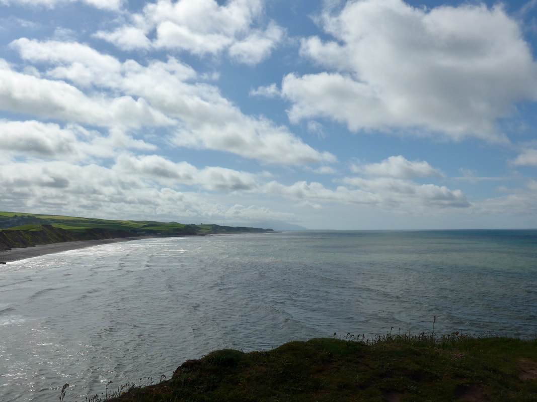
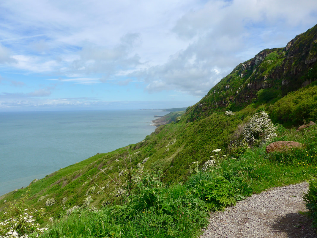
As you rise up the hill the surrounding countryside gradually comes in to view. Looking South over the groynes on the beach you can see right back to the Black Coombe, approximately marking the mouth of the Duddon Estuary. Looking inward to the east are the Cumbrian Mountains and, on a good day looking out to sea you can see the Point of Ayre at the tip of the Isle of Man. This first run of sandstone cliffs heads from South Head via St Bees Head to North Head, before turning slightly north on to Saltom Bay.
There are toilets on the beach front, handy before you set off on the walk. It is a nice, tidy beach front here with good views on to South Head which gives you an idea of the walking in front of you. But don't be fooled in to thinking that what you see is the only, or the highest climb of the day. The initial route heads along the seafront heading for the Lifeboat Station where there is a small footbridge over the Rottington Beck before heading up the hill.
As you rise up the hill the surrounding countryside gradually comes in to view. Looking South over the groynes on the beach you can see right back to the Black Coombe, approximately marking the mouth of the Duddon Estuary. Looking inward to the east are the Cumbrian Mountains and, on a good day looking out to sea you can see the Point of Ayre at the tip of the Isle of Man. This first run of sandstone cliffs heads from South Head via St Bees Head to North Head, before turning slightly north on to Saltom Bay.
Views from / of South Head
 Rock Fall
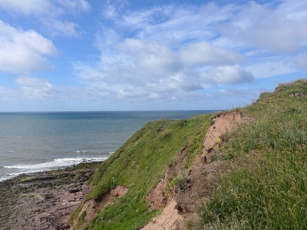
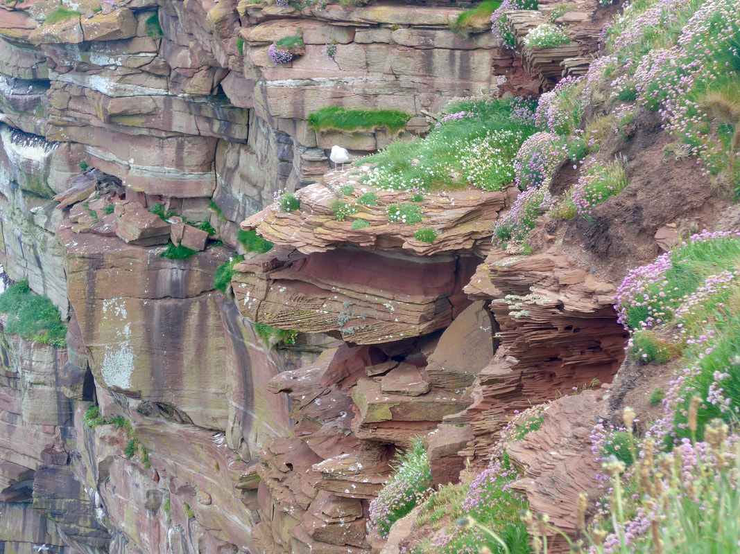
 As you climb St Bees Head there are places where you can see how sensitive the surface of the local red sandstone (St Bees New Red Sandstone) is to erosion, with large sections of the cliffs cleared of vegetation where the surface soil has run off. The local geology is very visible in the cliff face. The underlying rock on St Bees Head is thought to be over two hundred and fifty million years old. It is difficult to imagine it now, but the local area was once part of a huge desert, peppered with seasonal rivers, which deposited the sand for the bedrock.
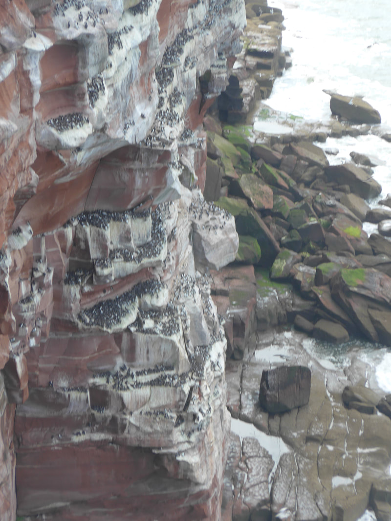
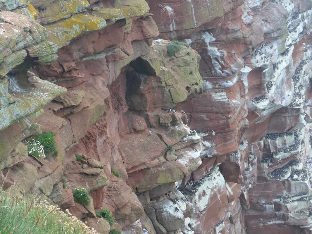
As well as the soil run-off that you get on the cliff face, the effects of rain, wind, ice and saltwater, work on the natural faults found in the underlying bedrock with the consequence that huge slabs of rock detach from the cliff face and fall to the shore. Later on the walk you can see where large colonies of seabirds have colonised the ledges that are left on the cliff face after such a rockfall occurs. The area is an RSPB bird reserve.
St Bees village is located at the end of the geological feature known as St Bees Valley. Originally created during one of the glacial periods, at the mouth of the valley where the golf course has been created, the landscape is dotted with 'moraines'. These are like small hillocks, created when the glaciers deposited unconsolidated debris. They are now an important feature of the golf course. The moraine cliffs to the south are fundamentally different in their construction to the sandstone rock to the north of the village and so deteriorate at a different rate. The cliffs to the north will recede following rock falls, those to the south more by erosion.
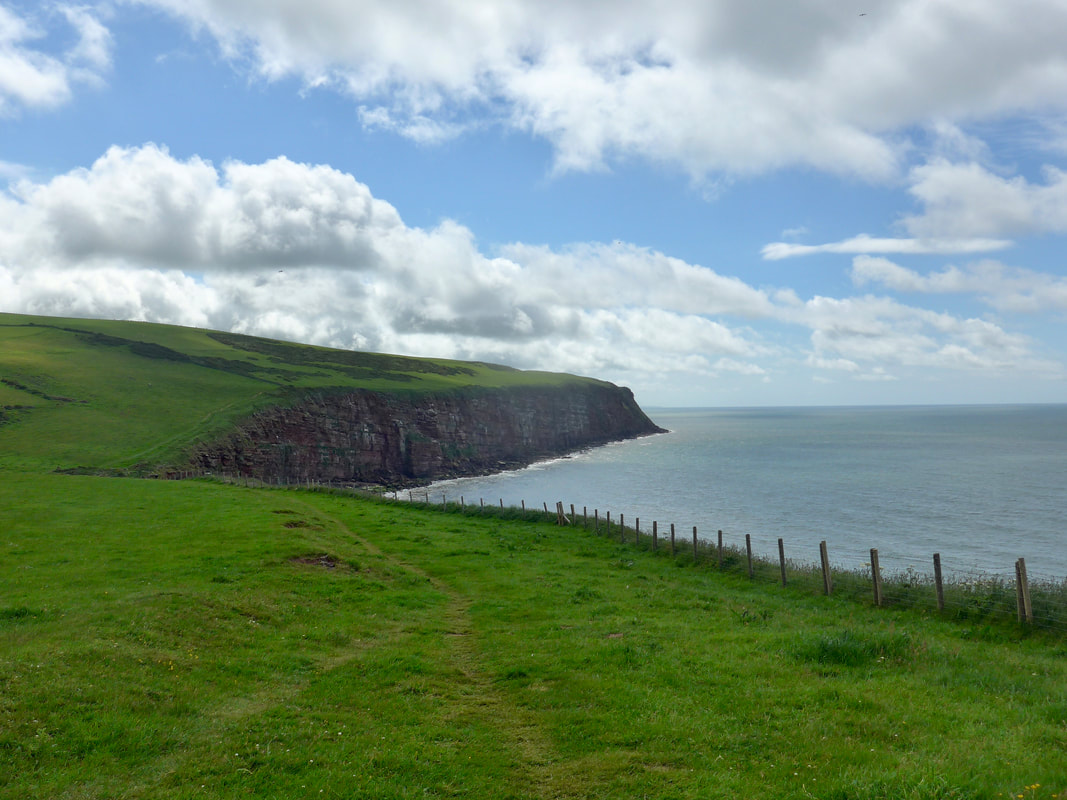
 View of South Head
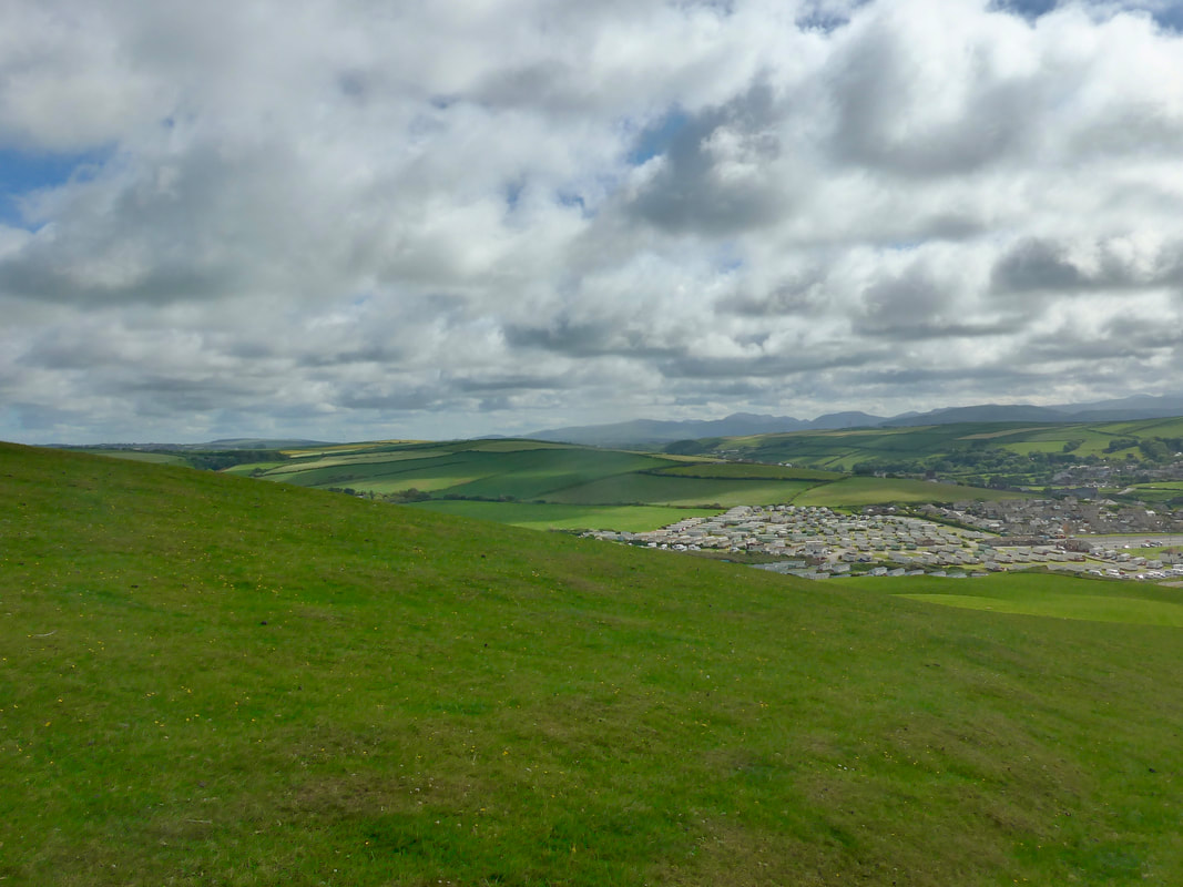
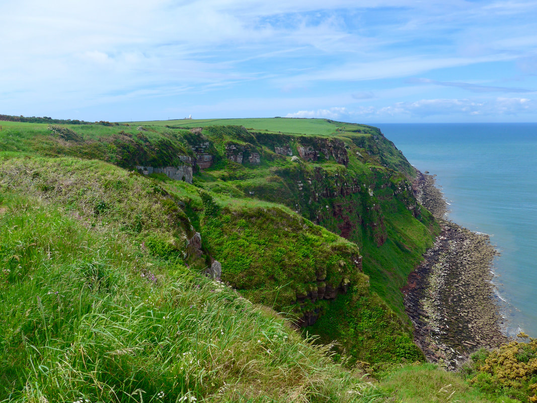
 Heading from South Head the clifftop is mainly farming land with a mixture of sheep, cattle and arable land. Looking landwards it is a very pastoral landscape, but always with the majestic looking Cumbrian Mountains in the background.
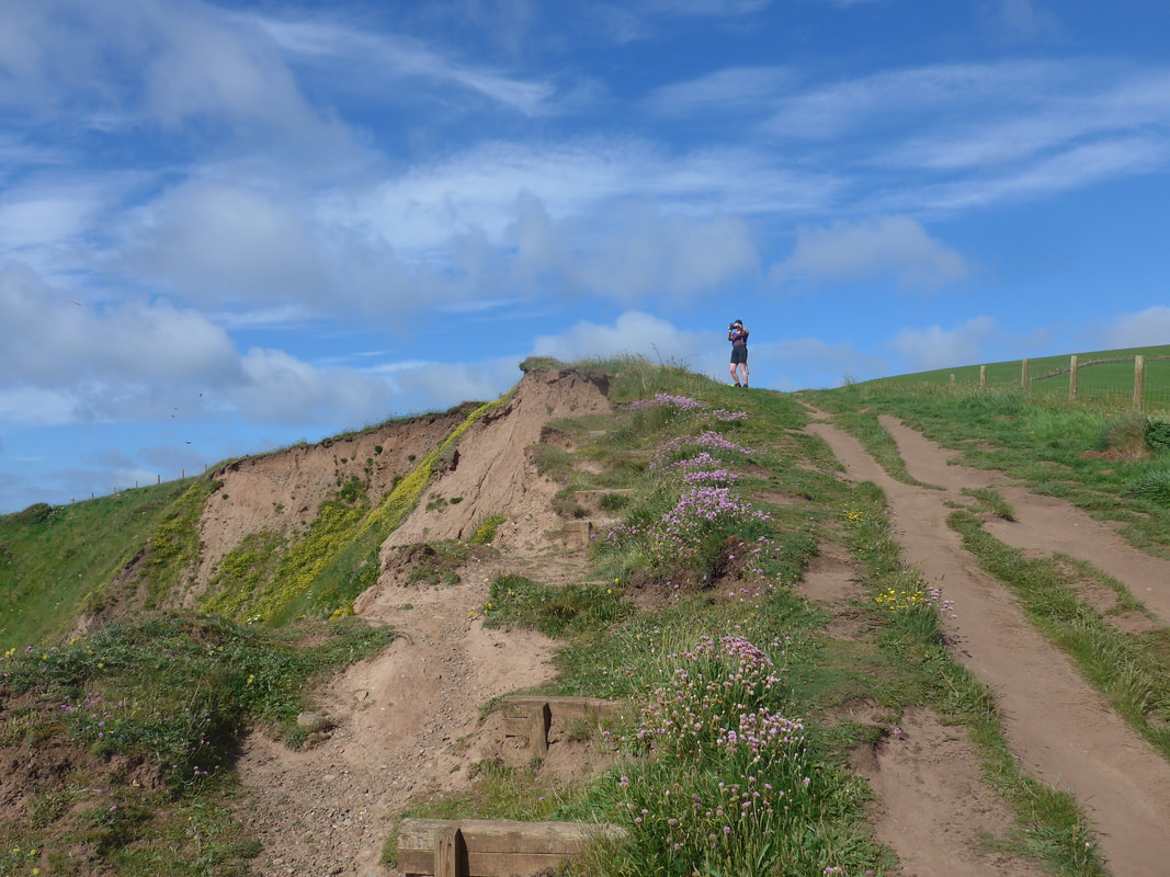
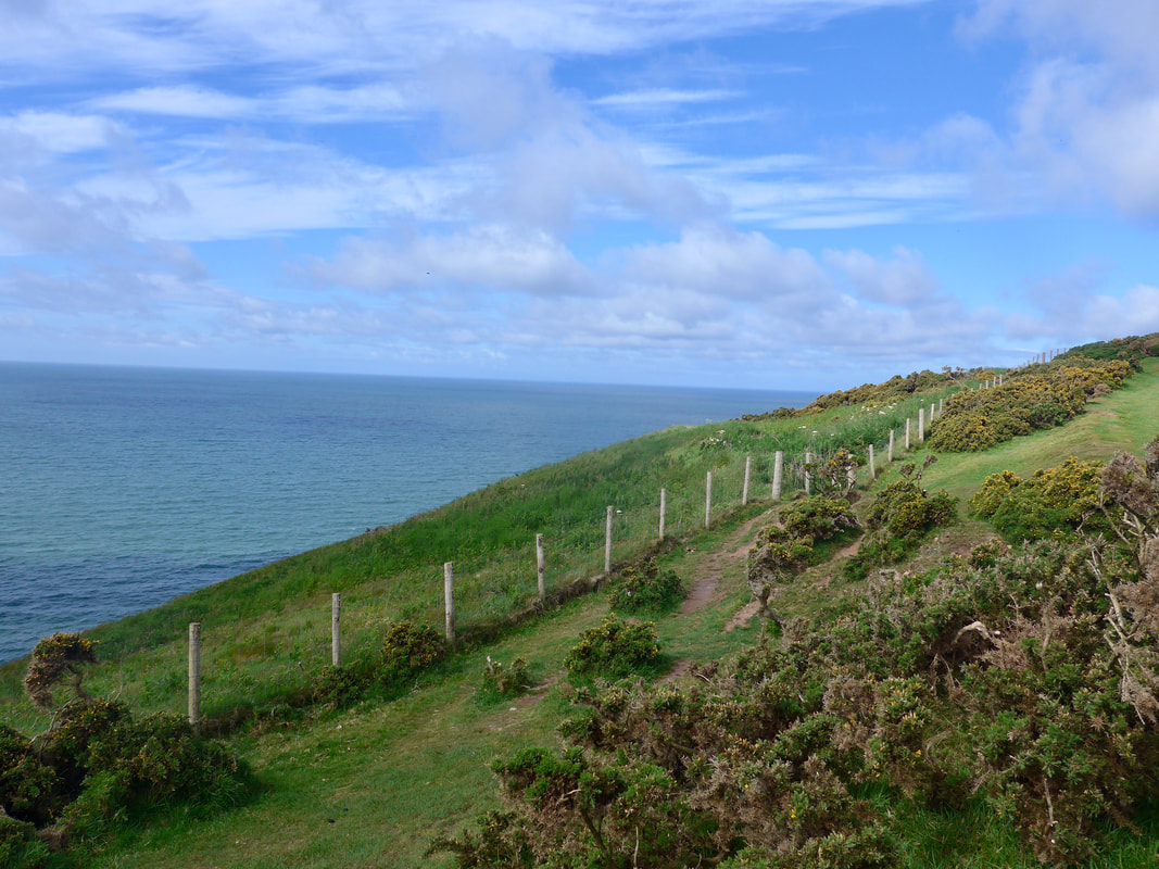
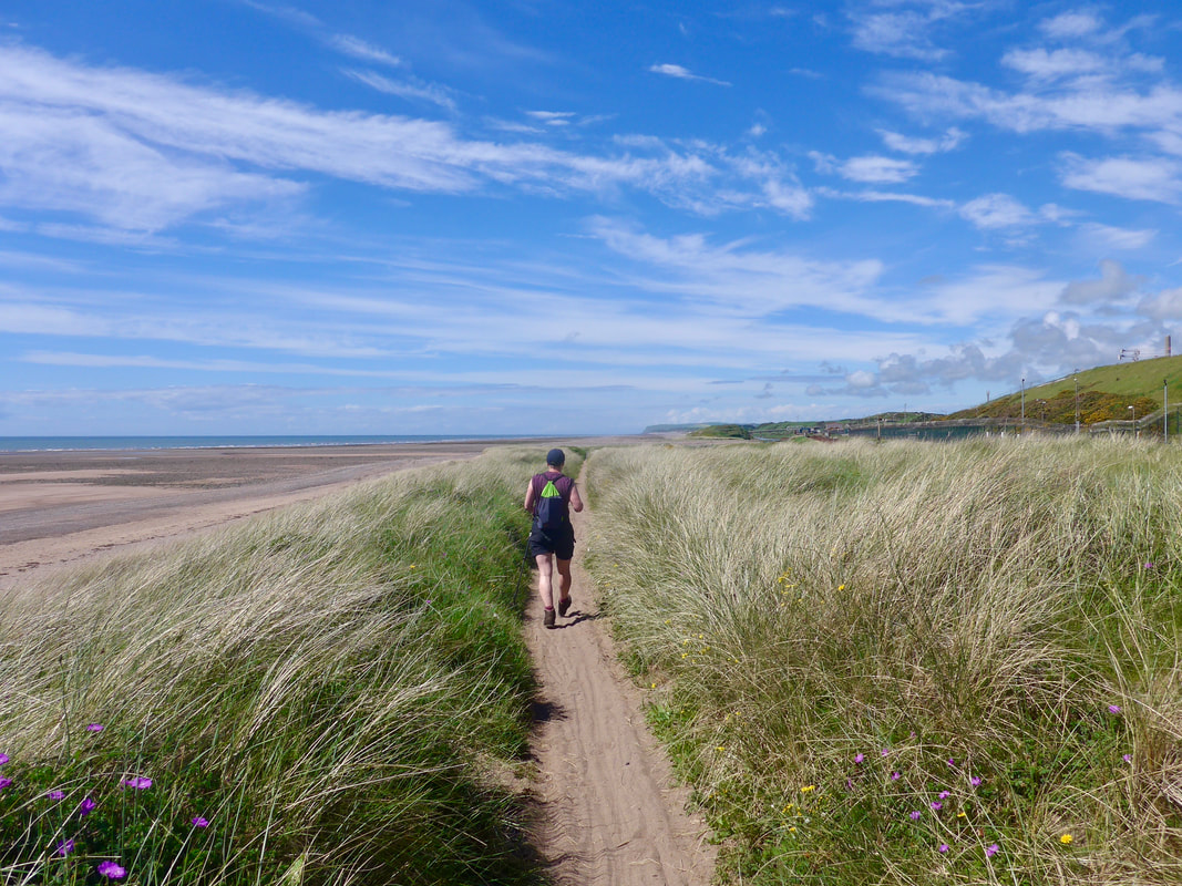
The walking is good and there are sections that are reminiscent of other long distance footpaths I have walked including the South West Coast Path and the Pembroke and Ceredigion Coast Paths. In the main the countryside is very open, with only occasional sections where of gorse and fern interfere with the walking. Walking close to the fence you can see that the footpath has had to be moved to the 'other side of the fence' as a consequence of erosion. Once you have lost sight of the houses of St Bees there is a solitude to the walk that I thoroughly enjoyed.
The walking is good and there are sections that are reminiscent of other long distance footpaths I have walked including the South West Coast Path and the Pembroke and Ceredigion Coast Paths. In the main the countryside is very open, with only occasional sections where of gorse and fern interfere with the walking. Walking close to the fence you can see that the footpath has had to be moved to the 'other side of the fence' as a consequence of erosion. Once you have lost sight of the houses of St Bees there is a solitude to the walk that I thoroughly enjoyed.
South Head to St Bees Head
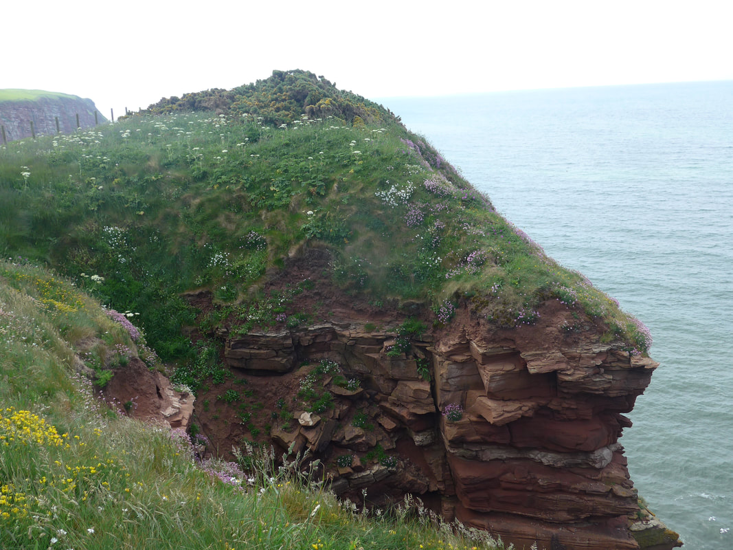
 Gully at Fleswick Bay
 Coming off of South Head, in the distance, the St Bees Lighthouse can be seen clearly on its perch at North Head. In the photograph above, you can also see where the land dips down to Fleswick Bay. There is a set of steps connecting the north and south heads that needs to be negotiated.
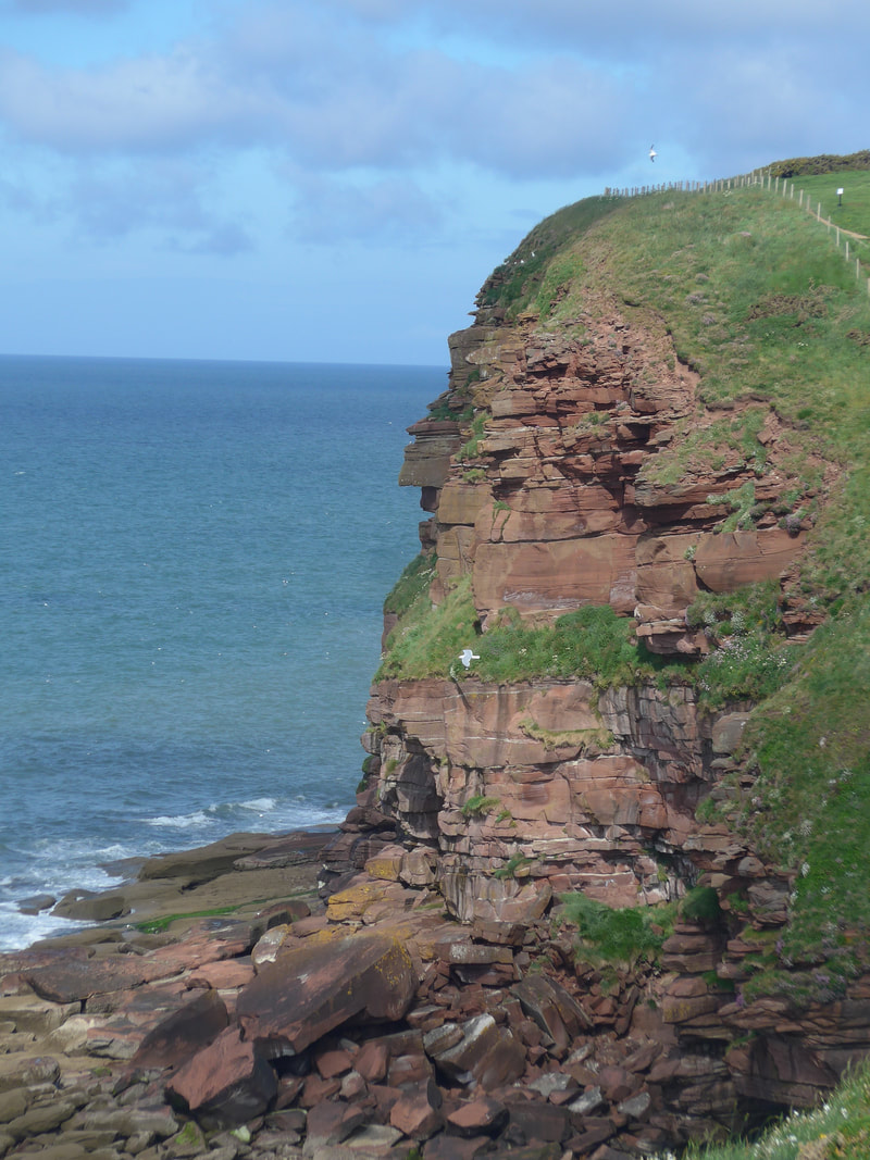
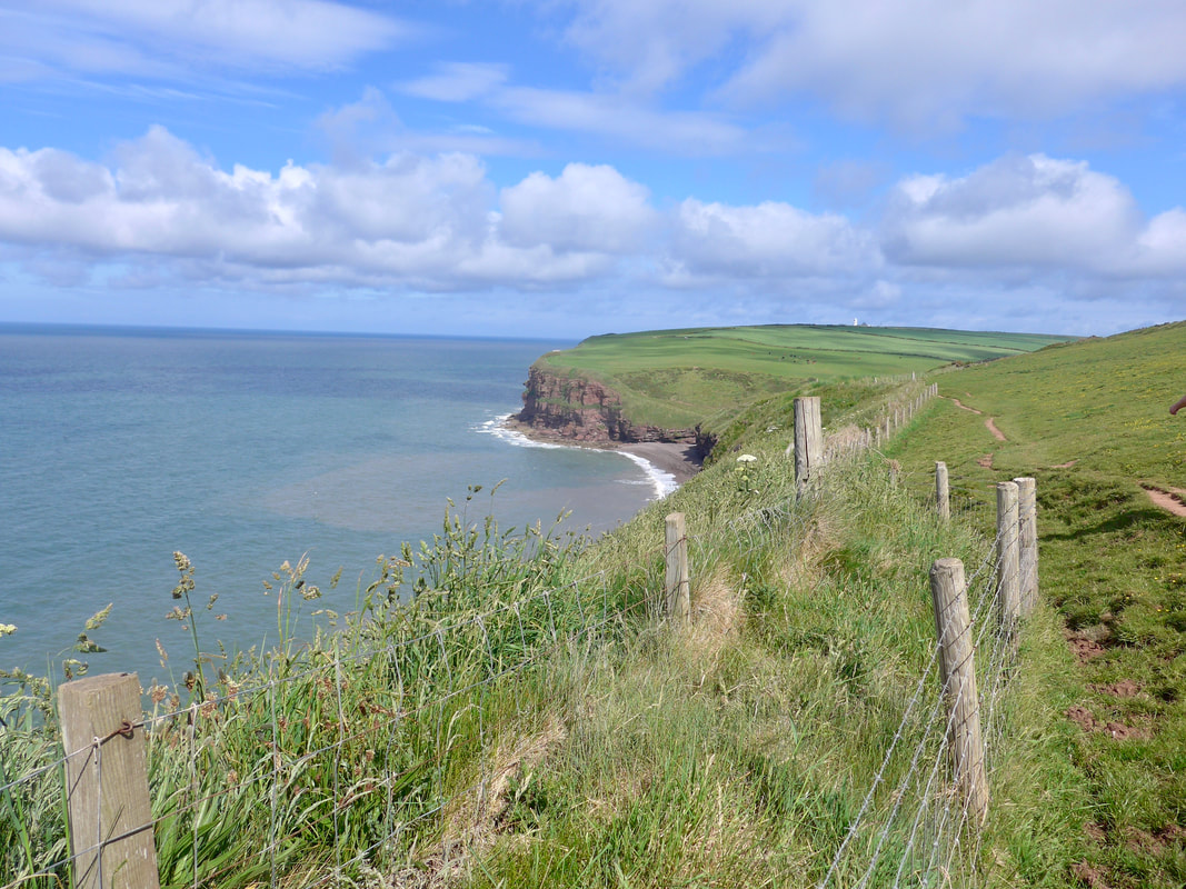
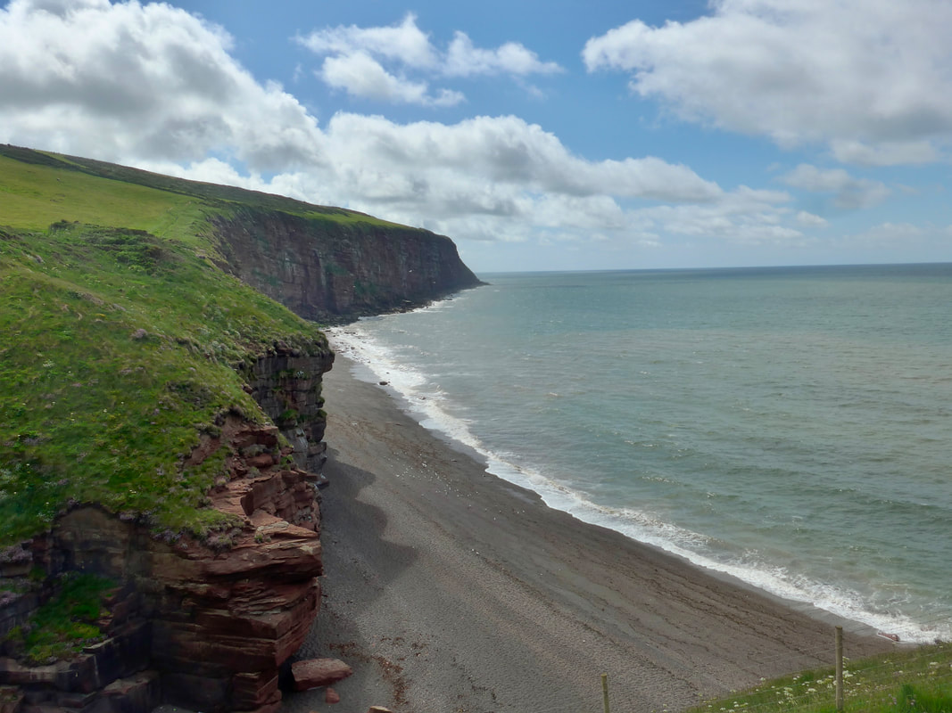
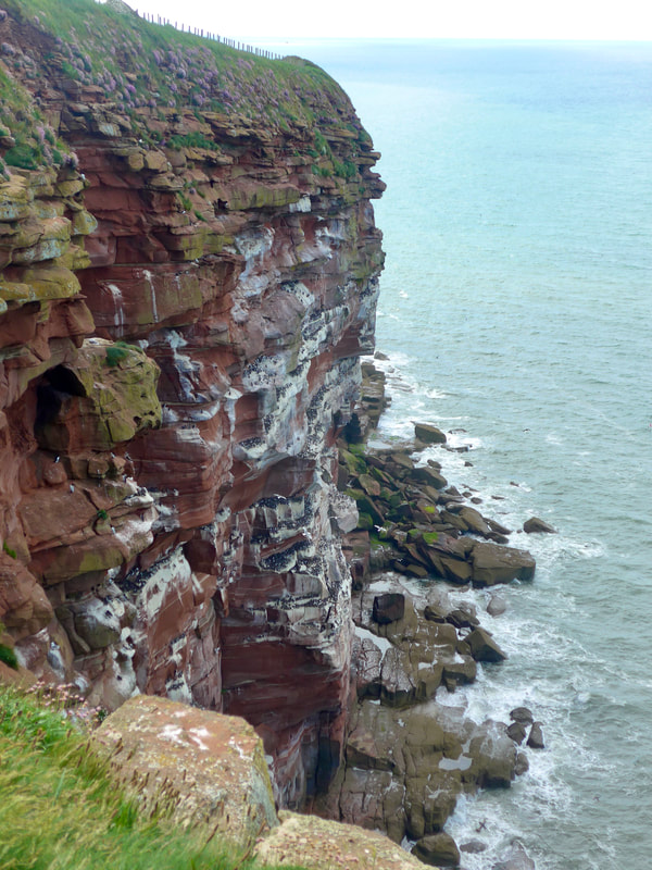
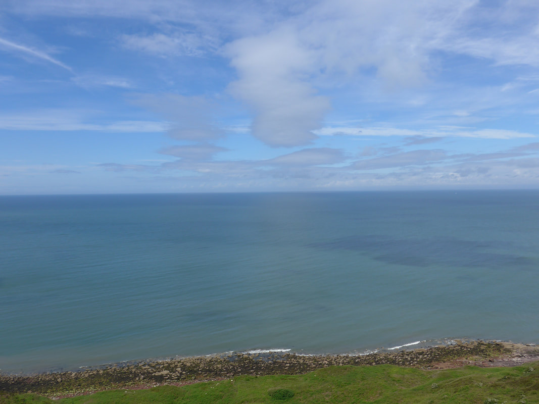
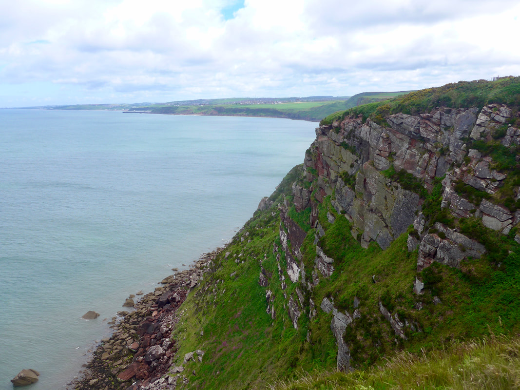
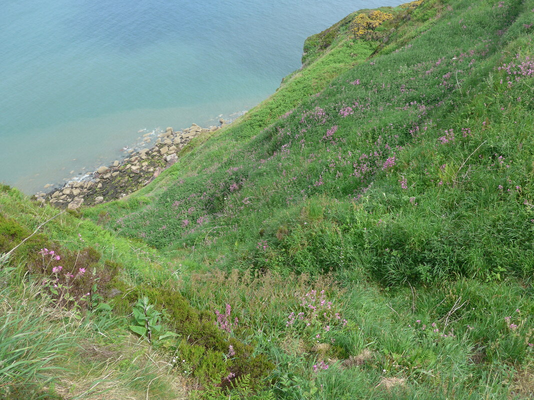
There are good views of the geology of the cliffs on St Bees Head and some of the prospects were stunning, the cliffs bedecked by wild flowers, dazzling in their colour and situation. Looking down to the shore here, with the right tidal conditions, you can see the impressive red sandstone platforms.
There is a viewpoint at St Bees Head, on the north side of the bay, from which you also have grand views of the bird gantries. At different places along the cliff you can be lucky enough to see Razorbills, Guillemot (two kinds), Fulmar, Kittiwake and Cormorant. Flying just off or above the cliff are Ravens, Jackdaw and Peregrine Falcon.
St Bees Head & Fleswick Bay

 St Bees Lighthouse
 From St Bees Head to the lighthouse on North Head it is a relatively short walk. There has been a lighthouse on the St Bees headland since 1718. It has gone through at least two complete re-builds, the most recent in 1865. In 1987 the lighthouse was converted to electricity and in the same year the fog horn was de-commissioned. It is still owned by Trinity House and is operated remotely from their facility at Harwich.The path brings you in just below the lighthouse but there is access up to it.
From the lighthouse the path continues along the clifftop, the landscape and the walking similar to what has gone before. Along this stretch of the cliff there are a number of disused and part-time quarries, including Birkhams Quarry, above Saltom Bay, which was used on an 'as required' basis, with one or two rock faces available for continued abstraction. There are plans to allow the quarry to revert to natural wild land with some rock faces left 'open' to allow for further geological study. Information boards on site explain the workings of the quarry.
Along this route there was also a gypsum and alabaster quarry / mine (Barrowmouth), albeit much over-grown now. Gypsum is a basic ingredient in the plastering industry, as well as used for medical and surgical purposes, pottery, brewing and in paper industries. Alabaster is used for sculptures and in domestic ornamental and decorative activities. It can be processed in to plaster of Paris. It is not known when the quarry opened but the first reference to gypsum and alabaster work in this area was in 1794. Work ceased at the mine in the early 1880's, re-started in 1888, only to be finally closed in 1908 following flooding, roof collapse and contamination.
North Head & Saltom Bay
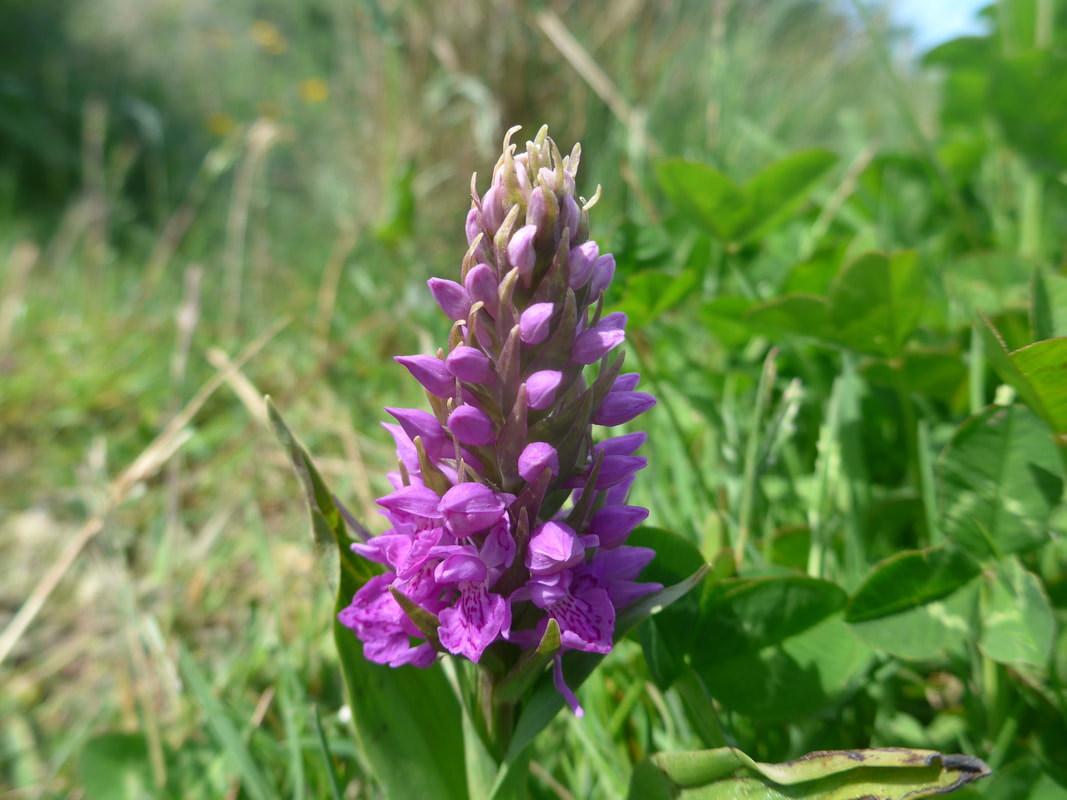
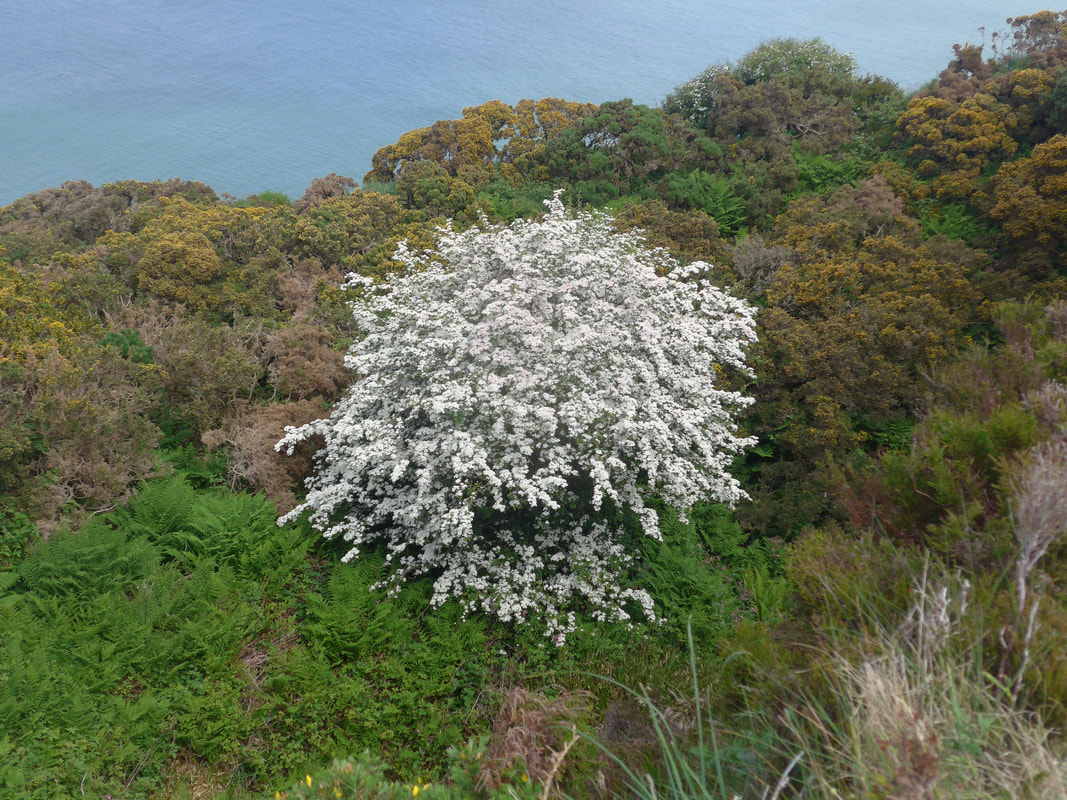
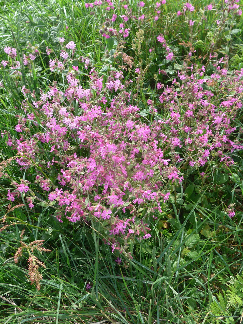
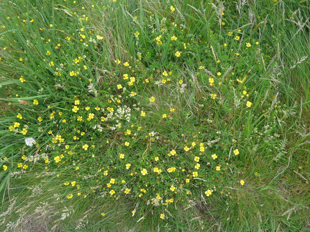
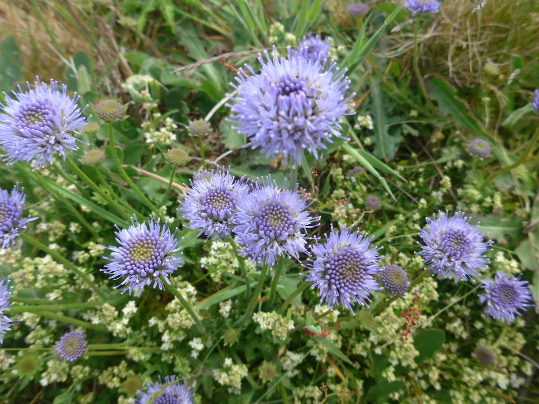
The stars of the show on this section must be the wild flowers and flowering Blackthorn that were to be found in abundance all along the path and on the cliffs.
Floral Abundance
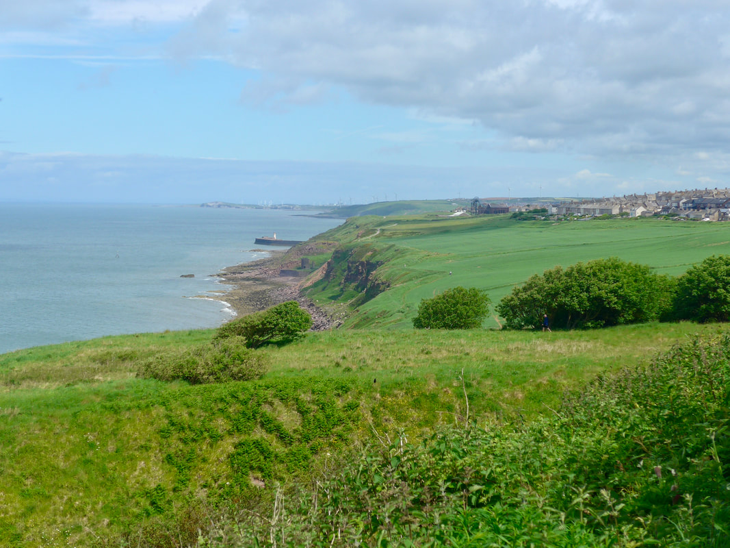 To Whitehaven & Harrington
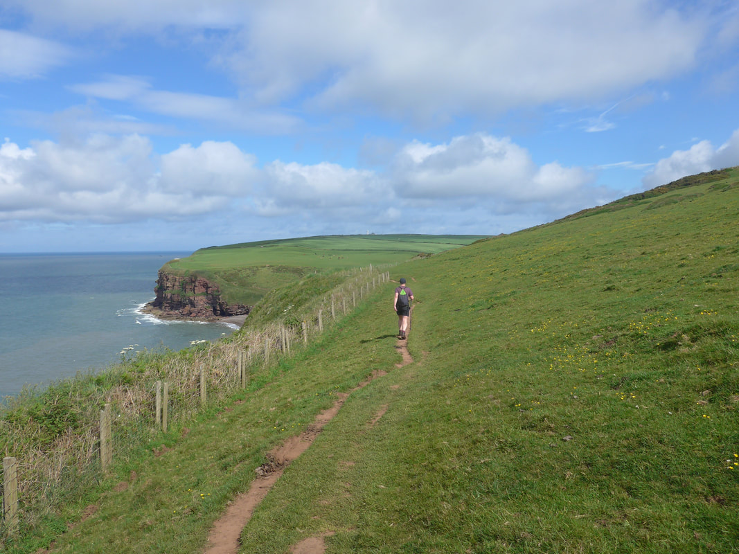
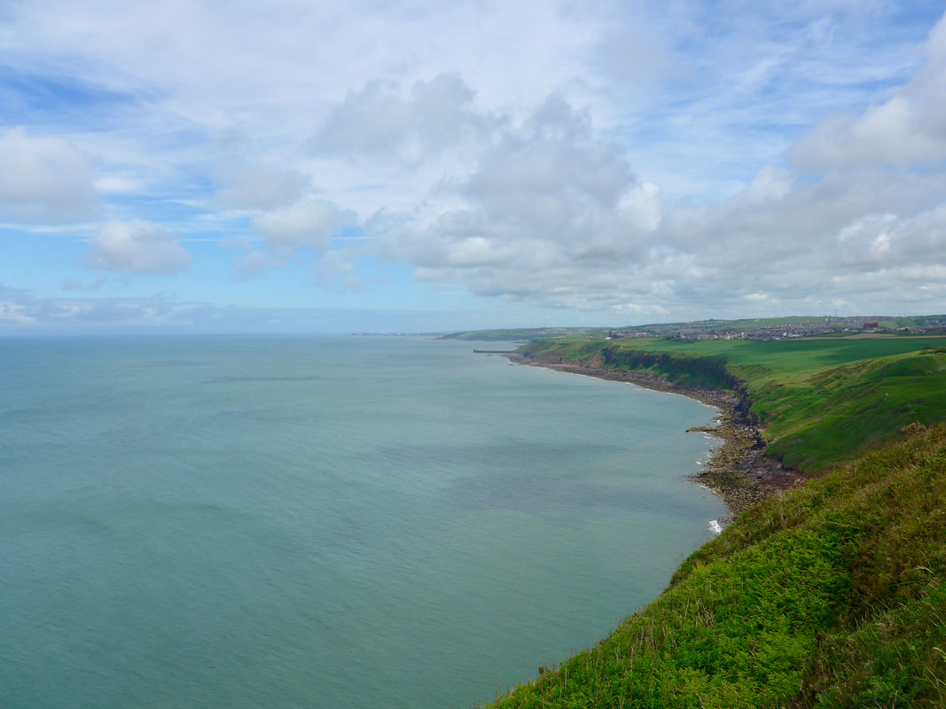
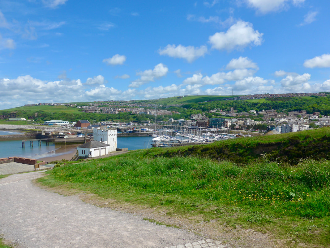
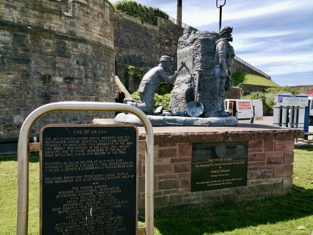
 Moving along the clifftop above Saltom Bay there are lovely views along the coast with the light beacons at Whitehaven old harbour peeking round the headland. In the distance the windmills just before the town of Harrington split the skyline, marching up the hill, outcasts from the Day of the Triffids. On the hilltop on the entry to Whitehaven a mine pit wheel reminds you of the long mining history of the area, with substantial amounts of coal extracted over the years.
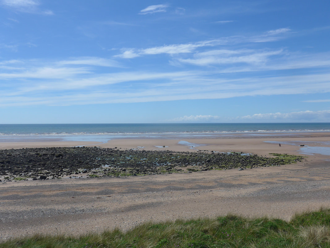
As you approach the final turn on the cliff there is a further geological feature to notice to the left front of the cliffs. The low platform that you can see is actually debris deposited here over many years from the mining activity in the area. With global warming and rising sea levels the likelihood is that this will gradually be eroded and the line of the shore will retreat once again to the line of the natural cliff. The line of the England Coast Path starts to drop down the hillside just below Greenbank, passing below the houses of the Kells district and taking you in to the area known as the Beacon. From here it is a short drop down into the marina and harbour area and, for us, a short walk to the railway station for the train to Seascale.
As you approach the final turn on the cliff there is a further geological feature to notice to the left front of the cliffs. The low platform that you can see is actually debris deposited here over many years from the mining activity in the area. With global warming and rising sea levels the likelihood is that this will gradually be eroded and the line of the shore will retreat once again to the line of the natural cliff. The line of the England Coast Path starts to drop down the hillside just below Greenbank, passing below the houses of the Kells district and taking you in to the area known as the Beacon. From here it is a short drop down into the marina and harbour area and, for us, a short walk to the railway station for the train to Seascale.
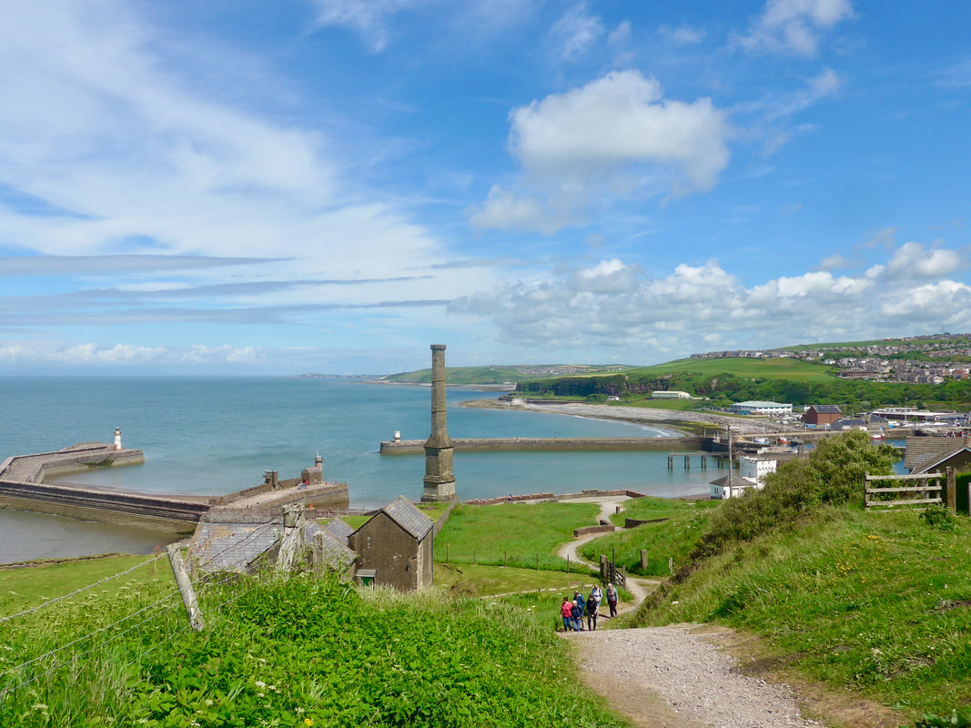
Whitehaven
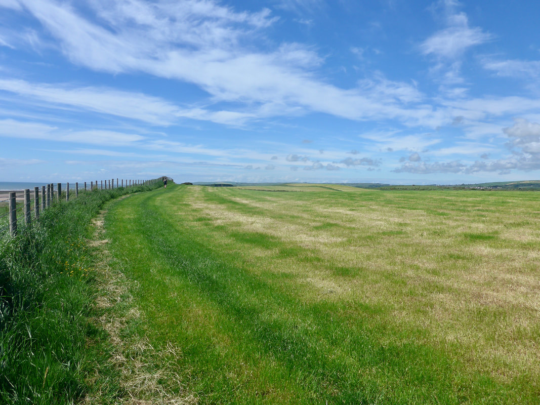
 Seascale & Beach
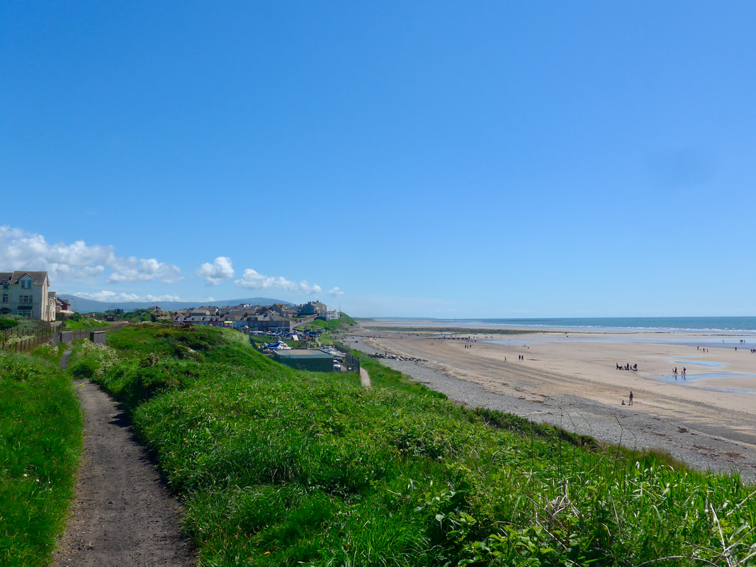
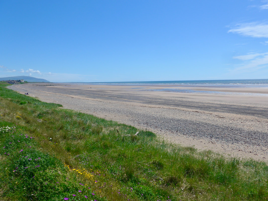
 The walk on St Bees Head was longer than we anticipated and we were grateful for the break provided by the train journey. From Seascale station we dropped right down on to our route, heading out along the back of the beach.
The last time we had seen Seascale it was pouring with rain, bleak and deserted. Today it was bright and sunny and there were lots of people in the village and on the beach. Still slightly weary from our earlier exertions, we were happy to take the footpath at the back of the beach, as opposed to walking on the sands.
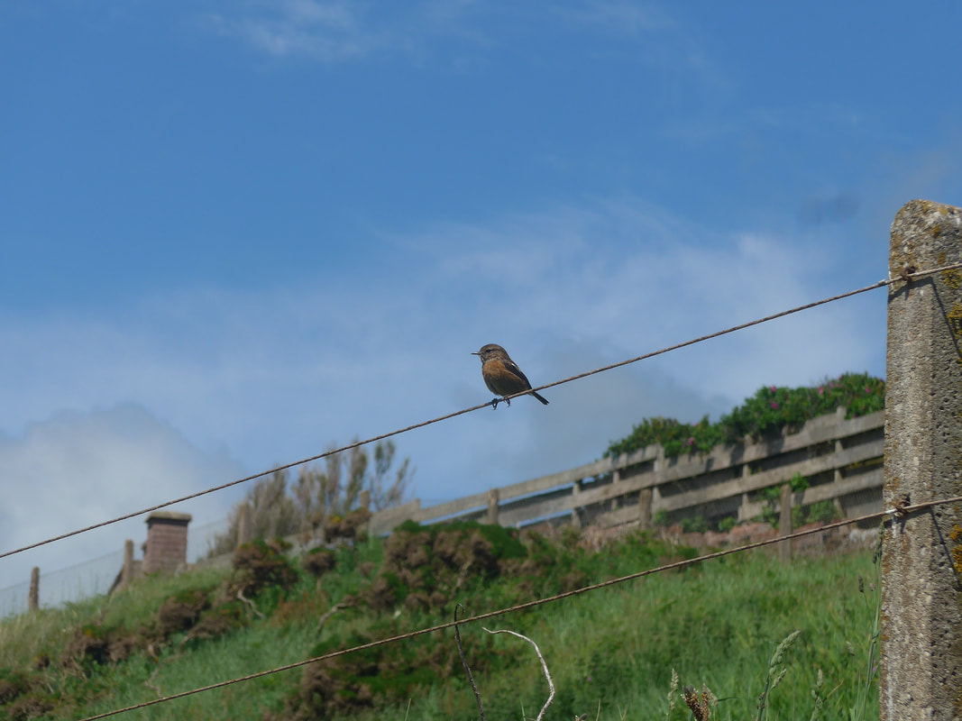
It was a pleasant way to start walk, enjoying the wild flowers and the birdlife on the verges and the open views up and down the beach and across the Irish Sea. There was the occasional break in the landscape on the landward side and we would see the peaks of the Cumbrian Mountains peeking through. Looking back to Seascale we could see all the way back to the headland at the Duddon Estuary.
The last time we had seen Seascale it was pouring with rain, bleak and deserted. Today it was bright and sunny and there were lots of people in the village and on the beach. Still slightly weary from our earlier exertions, we were happy to take the footpath at the back of the beach, as opposed to walking on the sands.
It was a pleasant way to start walk, enjoying the wild flowers and the birdlife on the verges and the open views up and down the beach and across the Irish Sea. There was the occasional break in the landscape on the landward side and we would see the peaks of the Cumbrian Mountains peeking through. Looking back to Seascale we could see all the way back to the headland at the Duddon Estuary.
Leaving Seascale

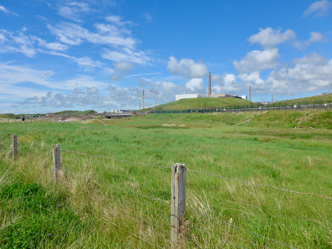
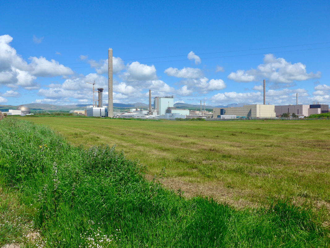 Sellafield
 The first inkling you have of the Sellafield nuclear plant is little glimpses of towers and chimney stacks over the top of the dunes and the appearance of a menacing black fence that runs along the dunes.
Sellafield is the largest nuclear site in Europe, specialising in a number of specific nuclear activities including nuclear waste storage, reprocessing of fuel rods and decommissioning of nuclear plant from other sites, as well as Sellafield.
The site was originally (1950's) involved in the production of weapons-grade uranium, before going on to become (1956) the first major nuclear provider of electricity to the national grid (Calder Hall). Calder Hall started providing electricity on 27 August 1956 and was closed on 31 March 2003. In 1962, a second generation of reactors was introduced (advanced gas cooled) and subsequently closed down in 1981. Plans for Activities continue on the site which has also been identified by the UK government as a suitable location for a future nuclear reactor. In 2009, a consortium proposed the construction of another nuclear reactor on land close to Sellafield but the plans were abandoned in 2018.
The Sellafield and Calder works are on the banks of the River Calder, which splits the site. The river discharges in to the sea, crossing the beach in the process, just before the Sellafield railway station. As well as the RiverCalder, the River Ehen runs along the front of the nuclear site, joining up with the Calder just as its crosses the beach. At the confluence of the two rivers you are forced off the beach to take an inland path that follows the line of the railway.
The new alignment of the England Coast Path now passes by the front of the Sellafield railway station and carries on to the railway bridge which crosses the River Ehen and which has been adapted for use by pedestrians. Once across the bridge we moved down on to the open expanse of the beach. With the tide coming in the room for walking on the beach was becoming very limited and we followed the landward path. From there we had really nice views back and from on the beach and out to the Cumbrian Mountains.
The new alignment of the England Coast Path now passes by the front of the Sellafield railway station and carries on to the railway bridge which crosses the River Ehen and which has been adapted for use by pedestrians. Once across the bridge we moved down on to the open expanse of the beach. With the tide coming in the room for walking on the beach was becoming very limited and we followed the landward path. From there we had really nice views back and from on the beach and out to the Cumbrian Mountains.
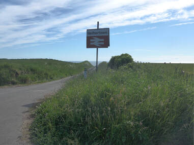
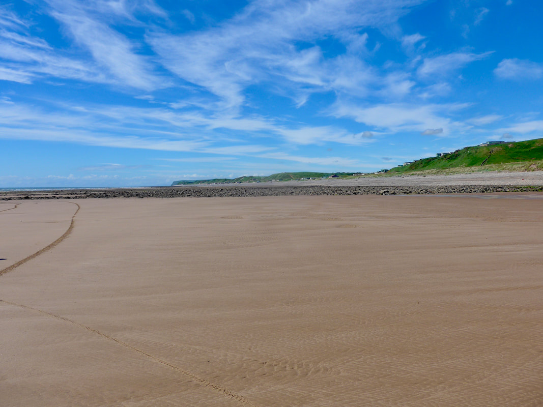
Approaching Nethertown the tide was on the rise and the sand virtually disappears here, replaced by a shingle beach. Just before the village the route moves off the beach to the other side of the railway for a distance before a small path takes you back down to the shore.
Too engrossed in our conversation we missed the path and continued along a road, only noticing our mistake when we passed the road end for the railway station. Rather than add to the miles by going back down we continued on the road until we found a public footpath that took us back down to the shore. From the road we had continued to have nice views to the mountains, but to be honest it a real drag walking on the road. At the head of the golf course we continued to follow the line of the railway which took us in to the town on the side where our hotel was located and we finished the day tired and hungry but dry.
Too engrossed in our conversation we missed the path and continued along a road, only noticing our mistake when we passed the road end for the railway station. Rather than add to the miles by going back down we continued on the road until we found a public footpath that took us back down to the shore. From the road we had continued to have nice views to the mountains, but to be honest it a real drag walking on the road. At the head of the golf course we continued to follow the line of the railway which took us in to the town on the side where our hotel was located and we finished the day tired and hungry but dry.
The first part of the walk on St Bees headland was glorious and I would have no hesitation in recommending it as worth making the effort for. The second part was spoiled by our poor decision making regarding the route and in hindsight, we should have tried to return to the coast at Nethertown sooner than we did. Tiredness played a part and choosing to walk seventeen miles on the first day of an adventure was another mistake that detracted from what would otherwise have been a lovely adventure.
 RSS Feed
