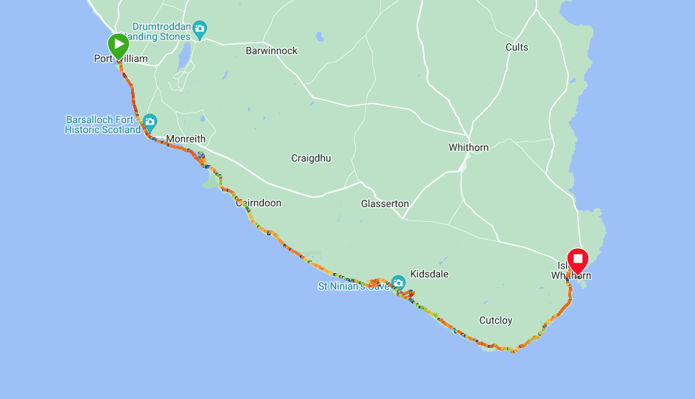
Route Map
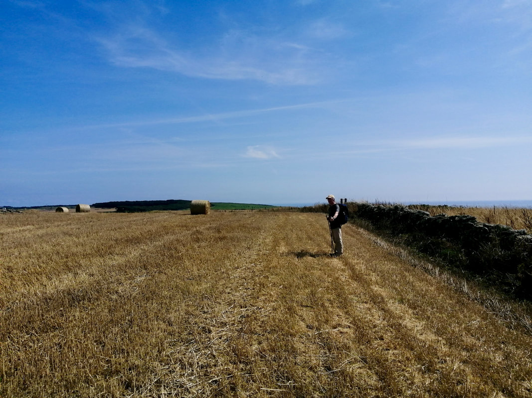
To enable us to complete our walking in Dumfries and Galloway on this trip we are making use of local buses. It means a mixture of clock wise and anti-clockwise walking. Today we're up and away fairly early as we sought to catch the early bus to Port William to walk back to our hotel in Isle of Whithorn.
There is no formal footpath that covers the whole route, so it is a case of making some of it up as you go along. Because of the rock formations and headlands on the coastal section, tide plays a big part in how much of the route you can keep to the shore. There are sections of the route where paths are indicated and it is our hope that we can make them all join up, which would assist us in keeping as close to the coast as possible.
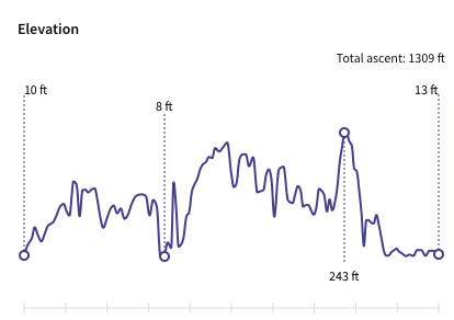
Knowing the elevation for the walk was complicated by the fact we were unsure of where we could and could not walk, the planning included options, most of which indicated a hilly day. Accordingly, we are walking light, carrying only one rucksack between us with provisions and waterproofs. The weather outlook was fair and we looked forward to a good day on the coast.
There is no formal footpath that covers the whole route, so it is a case of making some of it up as you go along. Because of the rock formations and headlands on the coastal section, tide plays a big part in how much of the route you can keep to the shore. There are sections of the route where paths are indicated and it is our hope that we can make them all join up, which would assist us in keeping as close to the coast as possible.
Knowing the elevation for the walk was complicated by the fact we were unsure of where we could and could not walk, the planning included options, most of which indicated a hilly day. Accordingly, we are walking light, carrying only one rucksack between us with provisions and waterproofs. The weather outlook was fair and we looked forward to a good day on the coast.
Expected Elevation
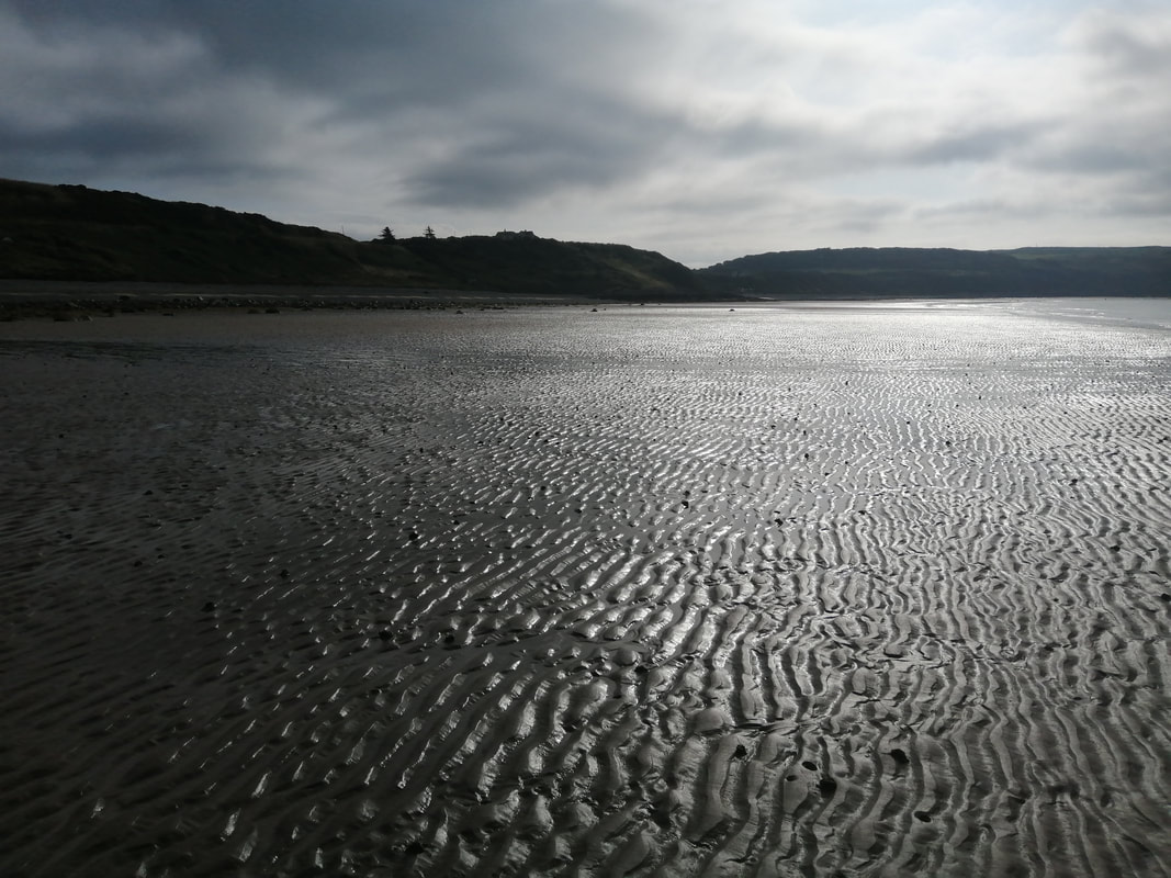
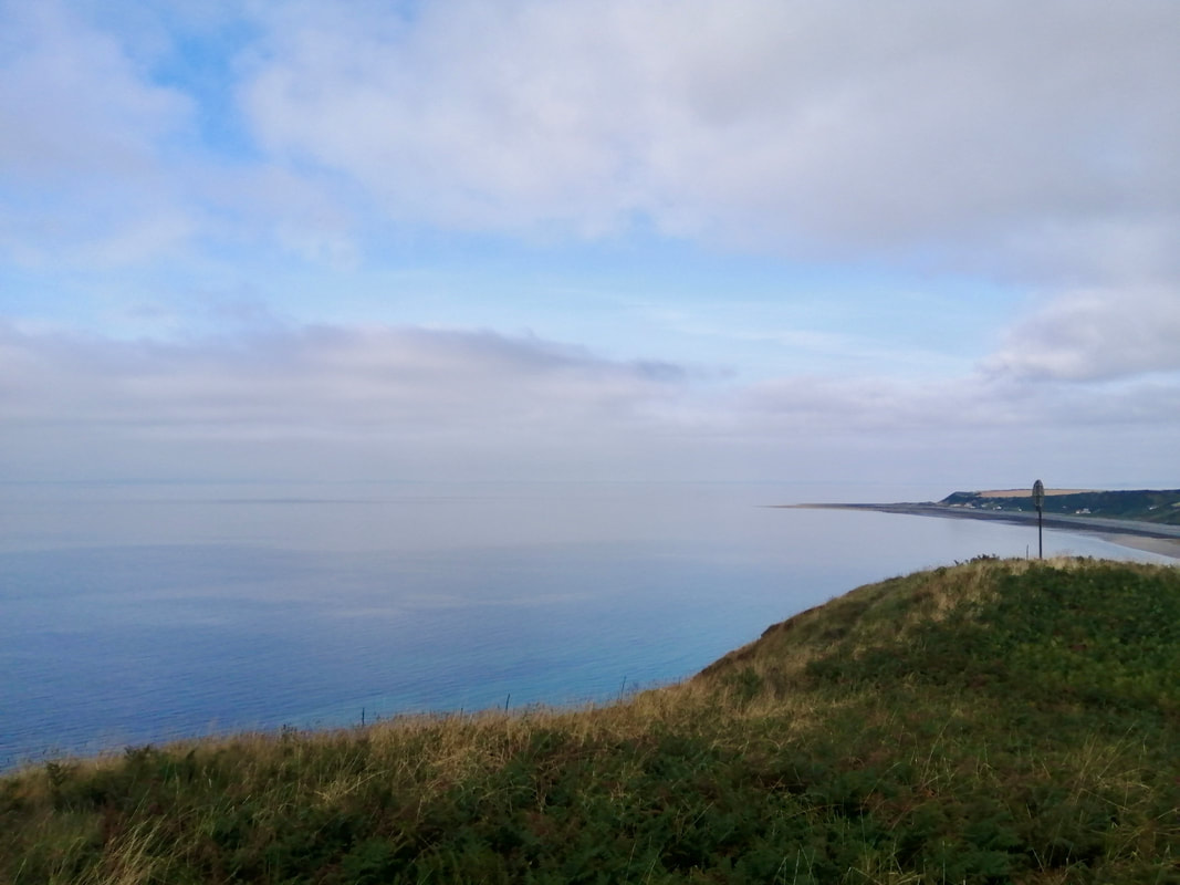
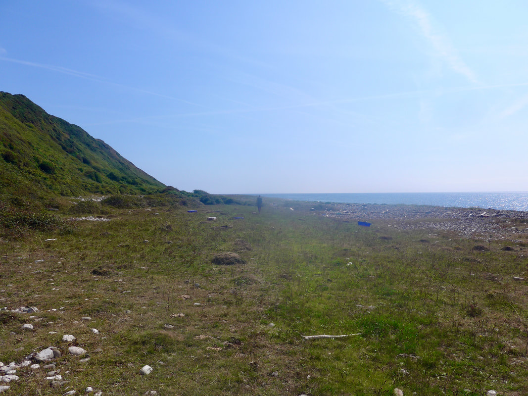
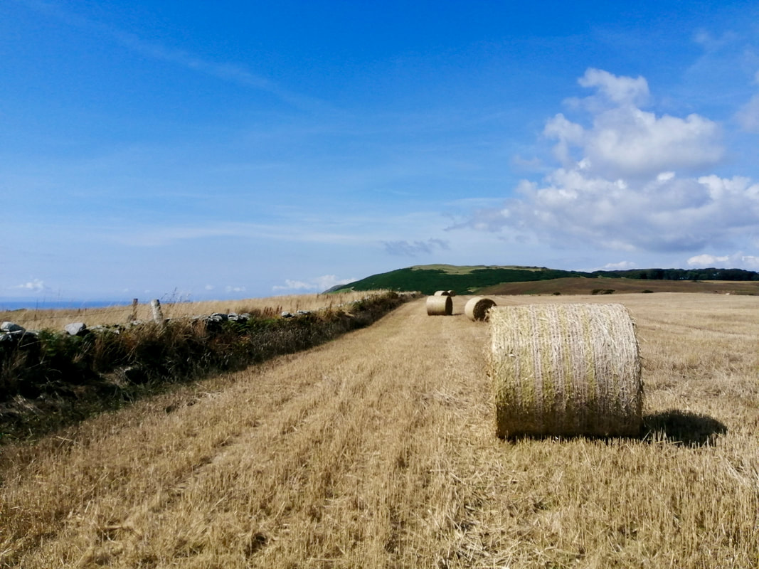
 Port William Shore
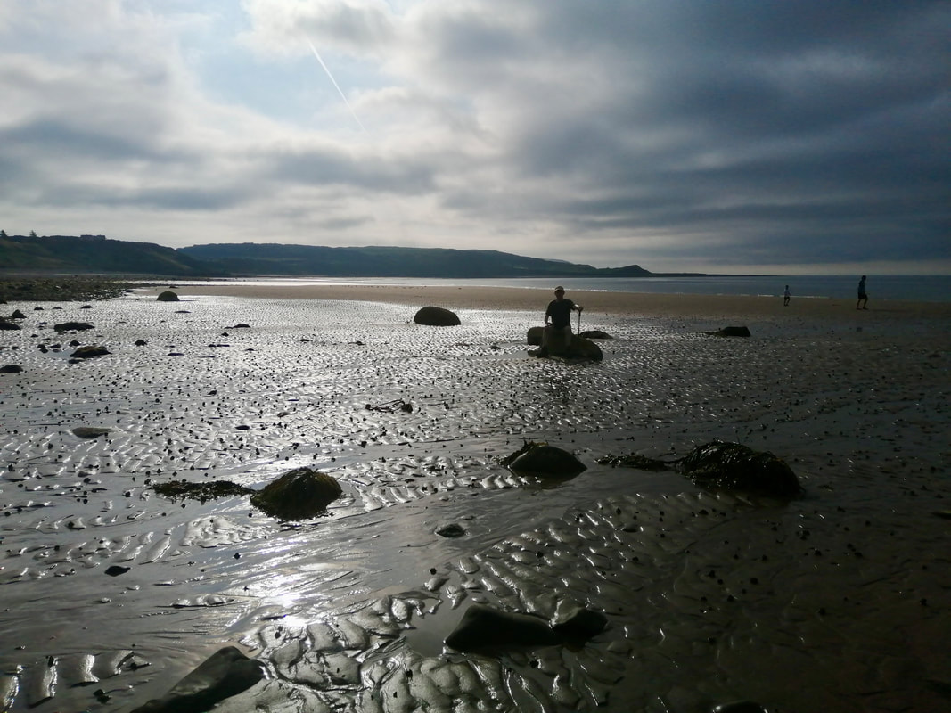
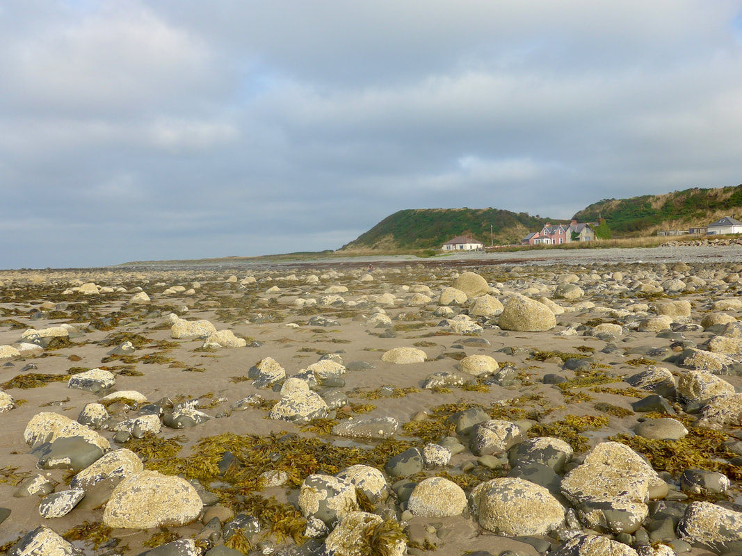
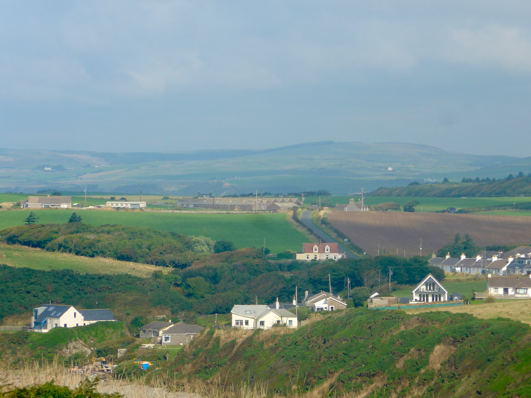
 The bus dropped us off in Port William where we bought provisions for a packed lunch. We had been too early leaving the hotel for breakfast so we had that too sitting in the square before setting off. The original settlement of Port William, known as Killantrae, is thought to have been established as long ago as the end of the 4th C AD. It was established in its current existence as a new village by Sir William Maxwell of Monreith House. The village was notorious for smuggling in the 17th and 18th centuries.
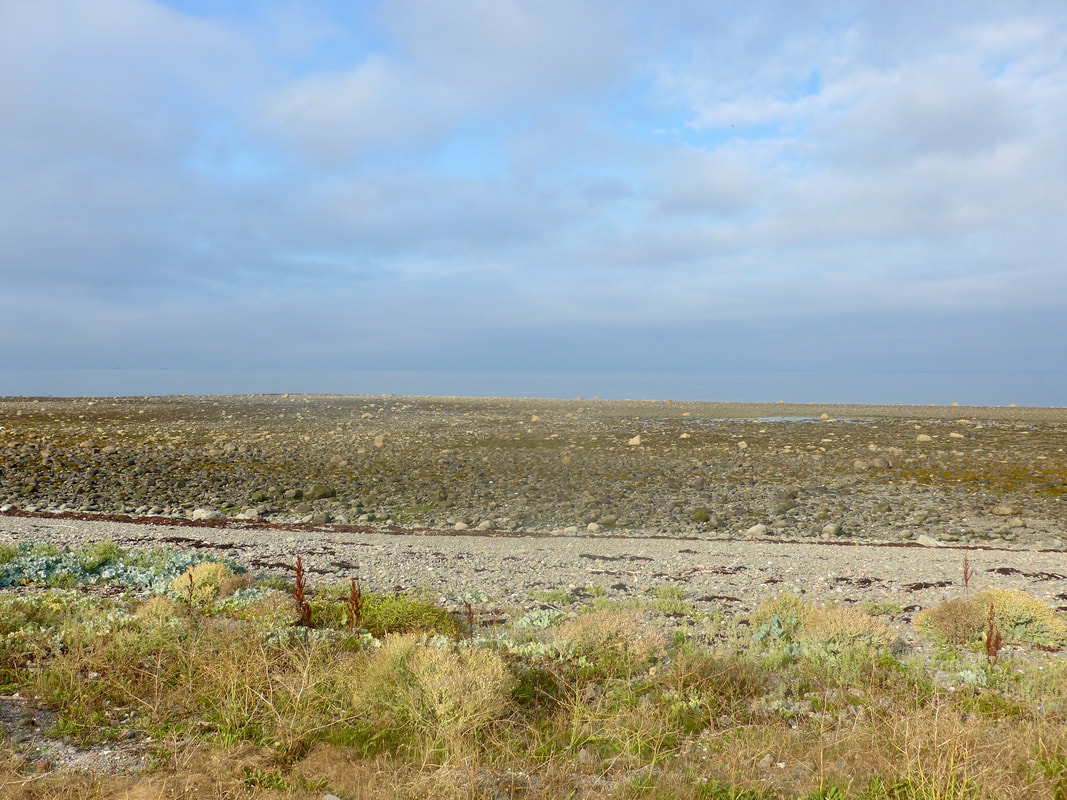
The early part of the walk offers a choice of walking along the road or walking on the very stony beach. We tried walking the shore coming out of Port William but it was too uncomfortable trying to find a route through the stones and large boulders. Later on we had no option but to walk on the rock and shingle beach and it was cruel on the feet. Just above the rocky shoreline there is a thin line of smaller pebbles where various plants have taken root, including sea kale and sea cabbage, dotted with various wild flowers.
The early part of the walk offers a choice of walking along the road or walking on the very stony beach. We tried walking the shore coming out of Port William but it was too uncomfortable trying to find a route through the stones and large boulders. Later on we had no option but to walk on the rock and shingle beach and it was cruel on the feet. Just above the rocky shoreline there is a thin line of smaller pebbles where various plants have taken root, including sea kale and sea cabbage, dotted with various wild flowers.
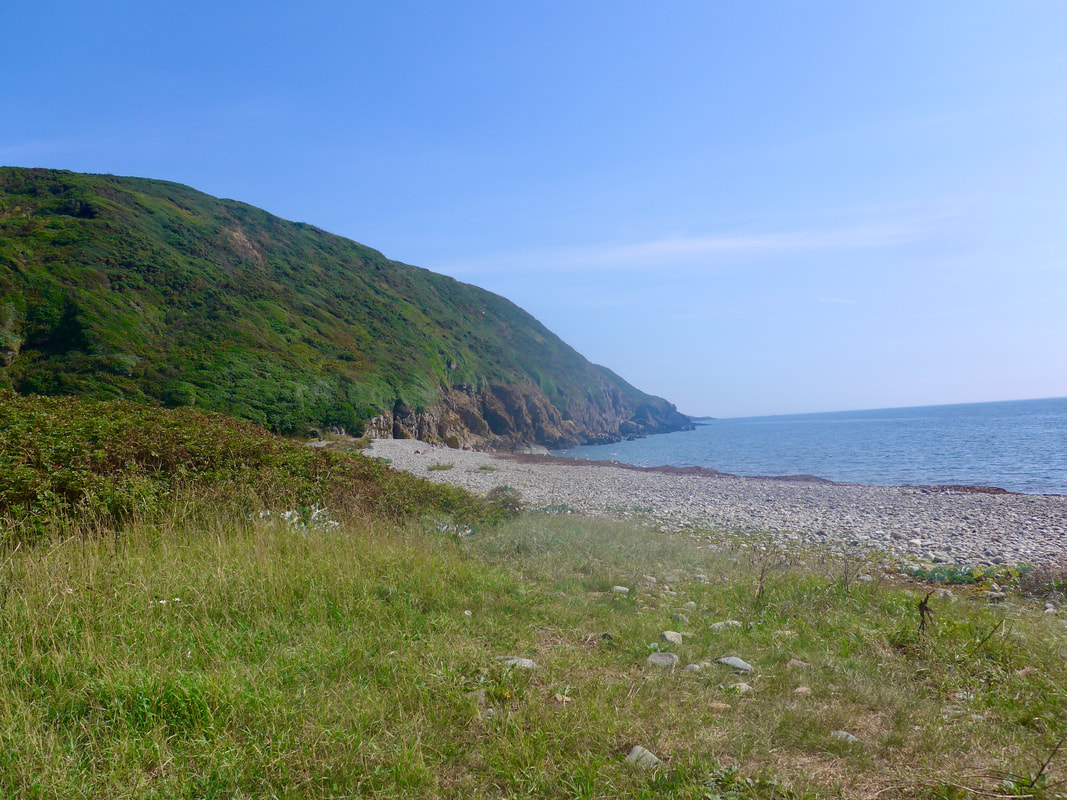
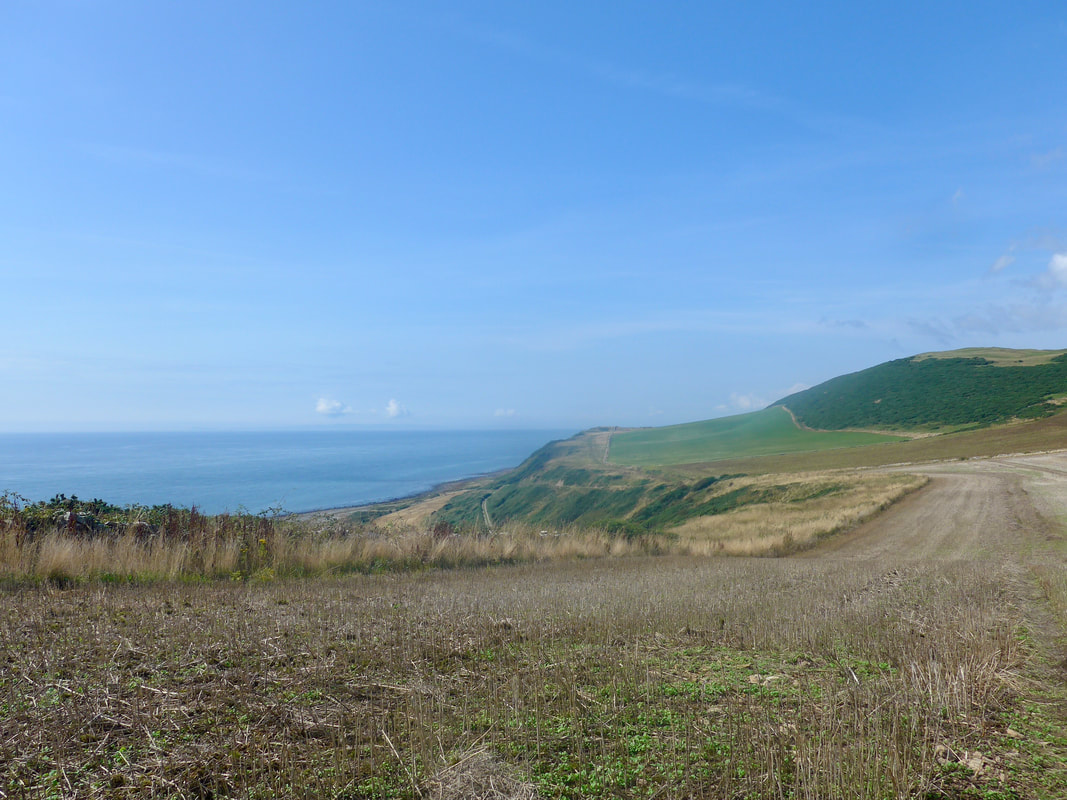
 To Point of Lag & Burrow Head
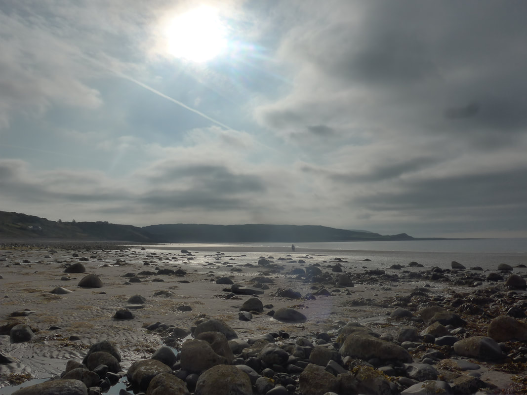
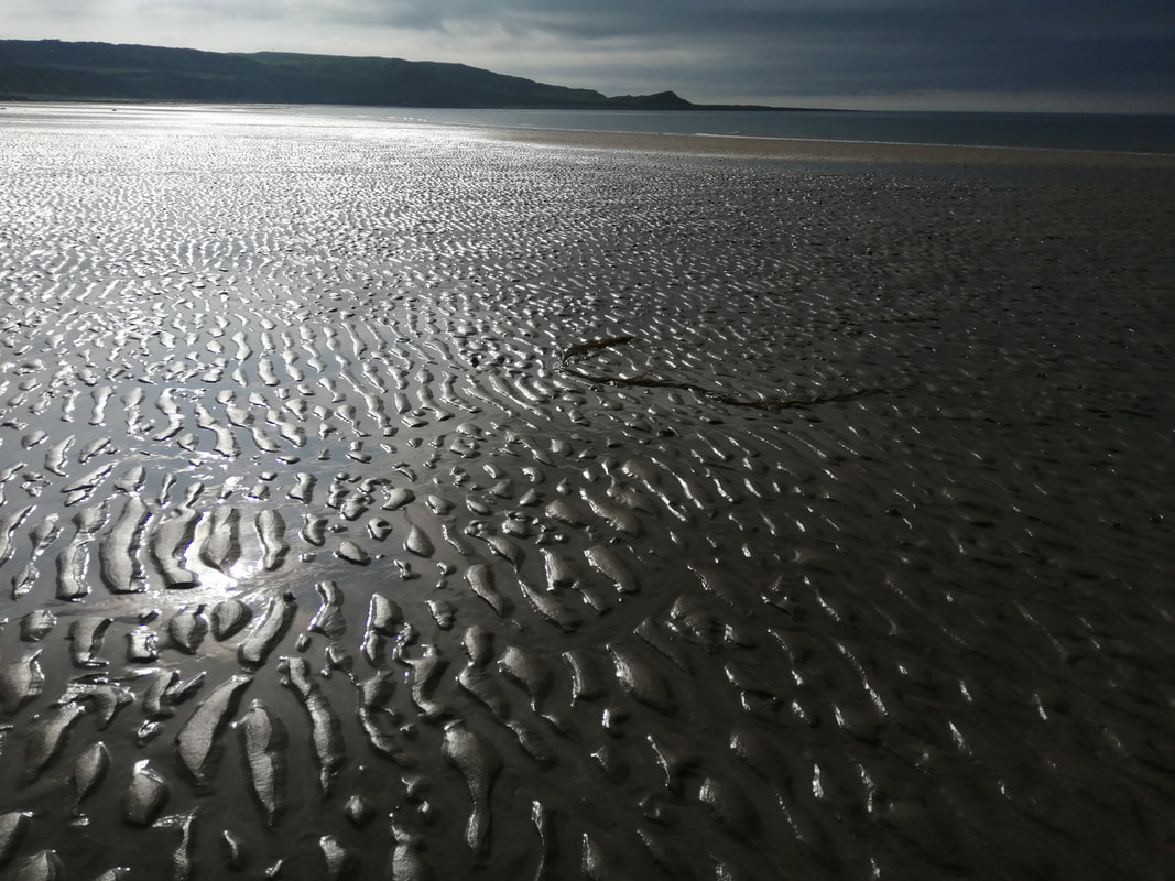
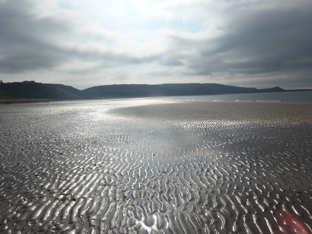
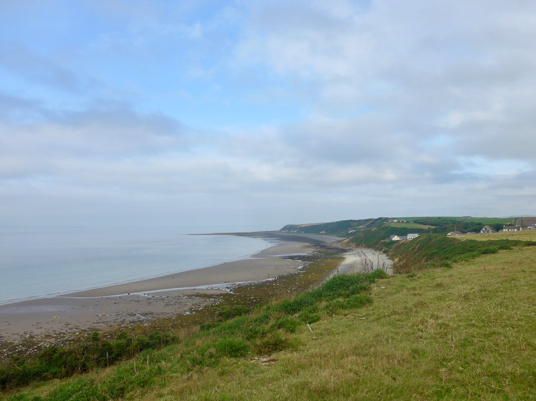
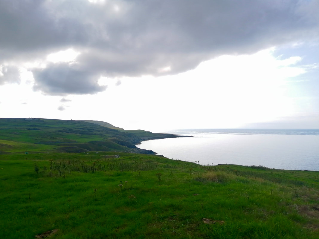
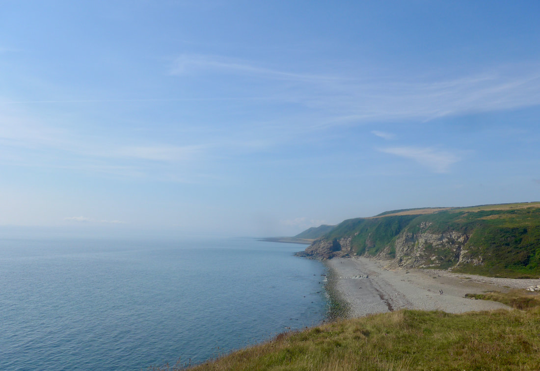
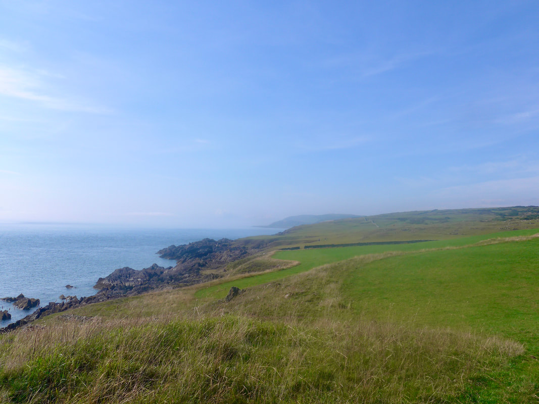
 The tide was low which exposed much of the shore, with the water some distance away. If you watched carefully, in between the rocks and boulders, various bird species could be seen harvesting the sea's bounty, including small, Ring-necked Plovers, Sandpipers and Oyster Catchers. The road section, should you choose it, is about 1.5 miles and ends at Barsalloch Point where, on the hilltop, there are the remains of an Iron Age Fort. Here you can take the grassy path that takes you down to Monreith Bay with its sandy beach. As you walk this next section the Fells of Carleton, Point of Lag and, Burrow Head in the distance, dominate the skyline.
Port William to Barsalloch Point
 Monreith Bay
 Barsalloch Point is the location of a 2,000-year old hill fort, occupied by an enigmatic, local tribe known as the 'Novantae'. It is thought to have been a fortified farmstead. The only historical record of the tribe is in Ptolemy's 'Geography', written in AD 150.
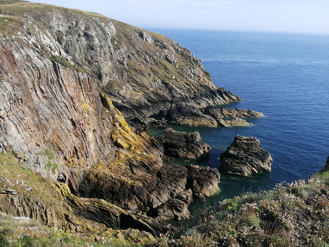
Along this stretch of coast there is ample evidence that it is an ancient landscape. Features such as the upright, greywacke rock formations of the Silurian Period (commencing 443.8 million years ago (MYA) and lasting until the Devonian Period, 419 MYA), to the many and more recent standing stones and cup and ring marks that dot the landscape, highlight it as an area where there has long been activity.
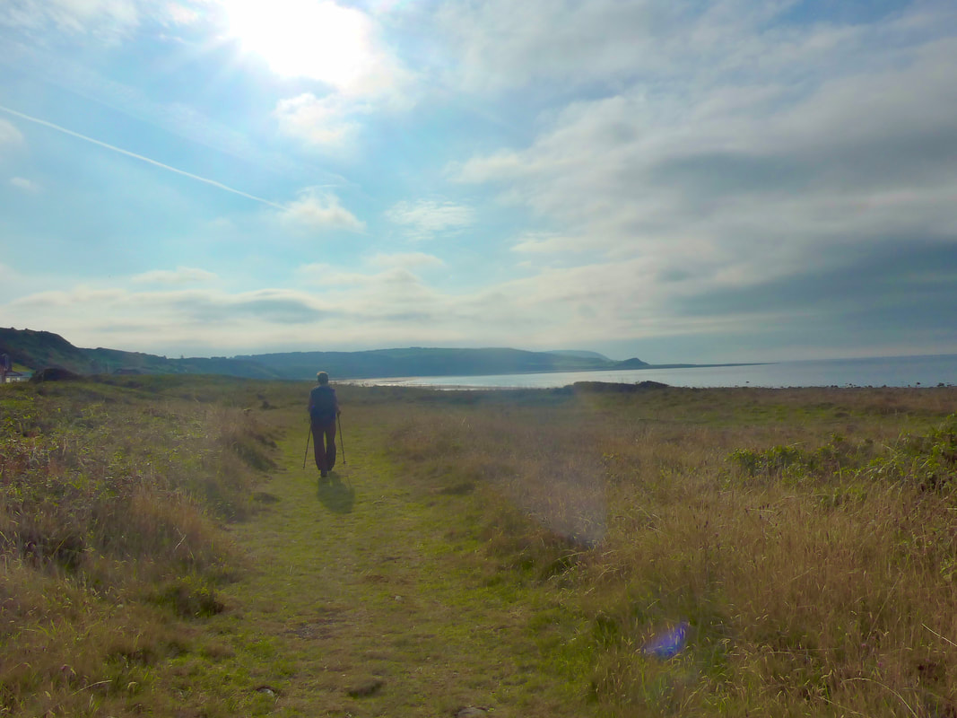
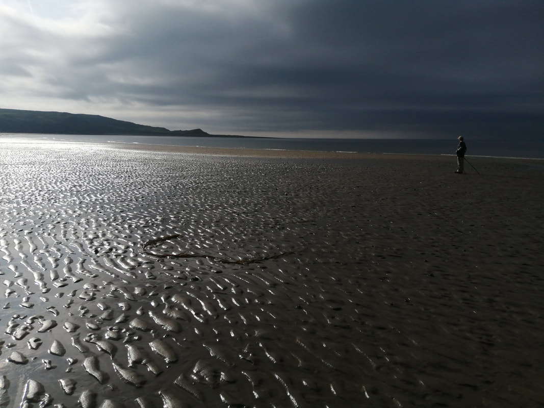
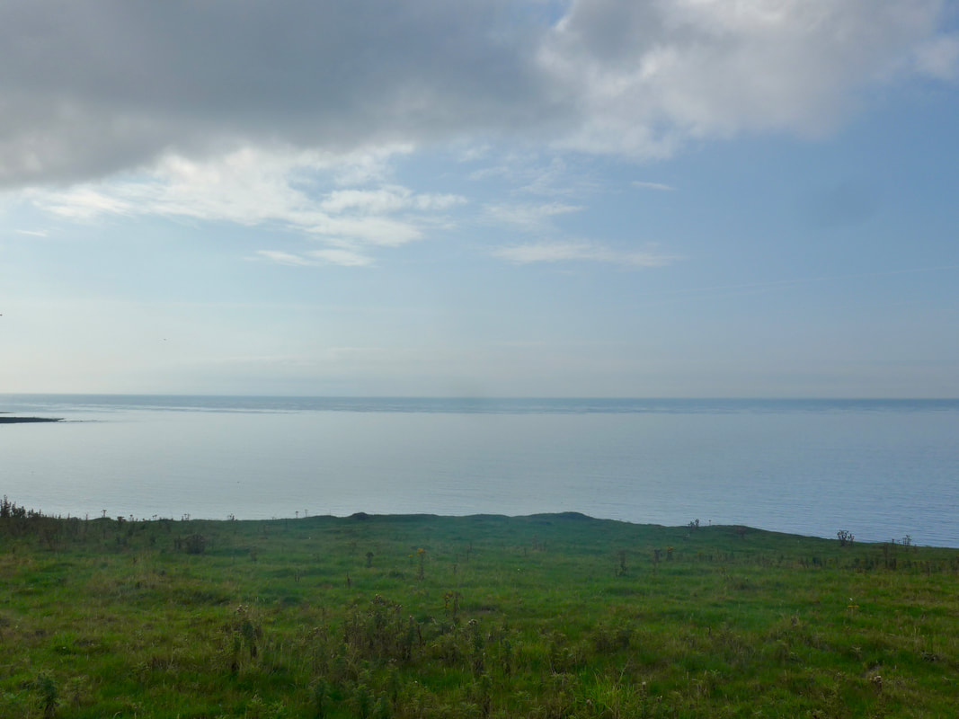
The views along the coastline were excellent, light shimmering on the salt water lying atop the sand in the early morning light. In the sky above us there was a clear dividing line between welcome blue sky, warm with early morning sunshine and, a huge dark cloud that threw an ominous shadow across the lower stretches of the beach. On one side of the line you were walking in light and warmth, on the other there was a cold chill and an almost night-time darkness. Despite the cloud, on the upper shoreline there was a pleasant warmth to the morning that promised well for the remainder of the day.
Along this stretch of coast there is ample evidence that it is an ancient landscape. Features such as the upright, greywacke rock formations of the Silurian Period (commencing 443.8 million years ago (MYA) and lasting until the Devonian Period, 419 MYA), to the many and more recent standing stones and cup and ring marks that dot the landscape, highlight it as an area where there has long been activity.
The views along the coastline were excellent, light shimmering on the salt water lying atop the sand in the early morning light. In the sky above us there was a clear dividing line between welcome blue sky, warm with early morning sunshine and, a huge dark cloud that threw an ominous shadow across the lower stretches of the beach. On one side of the line you were walking in light and warmth, on the other there was a cold chill and an almost night-time darkness. Despite the cloud, on the upper shoreline there was a pleasant warmth to the morning that promised well for the remainder of the day.
Shades
 At St Medana's Well
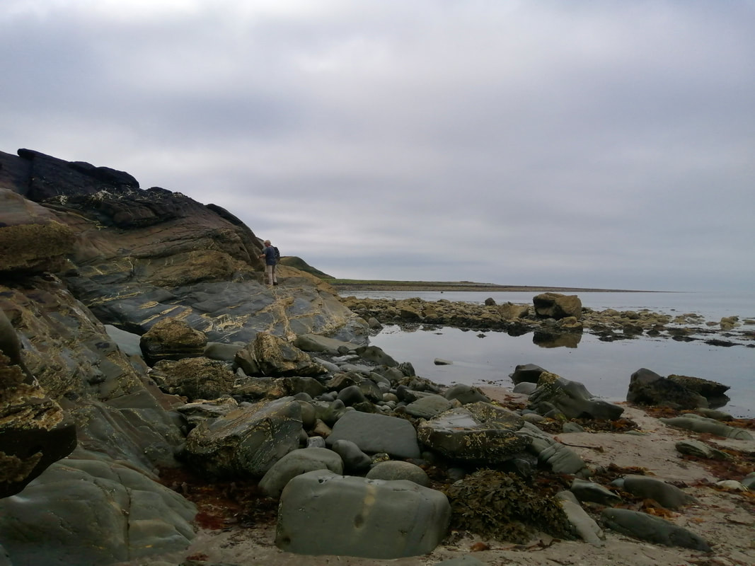
 As we walked the beach at Monreith Bay, we started off below the high water line. As we walked the incoming tide and the heavy cloud gradually pushed us higher to the top of the sand. Here, where there are more rock extrusions, there were a number of interesting caves along the line of the rocks. Seeing the folds and contortions in the rock, one could only marvel at the tremendous forces that must have been at work here forming the earth's crust.
When we reached the small headland by St Medana's Well, we found that the waters were already well up on the rock face. Just beyond the line of the rock, the sea was about two feet deep and continued on in to a small bay in the rocks. While the face of the rock could be climbed, we didn't fancy the abrupt, steep descent in to water on the other side and opted to turn back to find a way on to the cliff and to go up and over to the next bay. We didn't have to go back far, finding a way up in the vicinity of Clark's Burn to access a path on the cliff that took us up to the top of Craigengour, which is where the Sir Gavin Maxwell memorial is located.
When we reached the small headland by St Medana's Well, we found that the waters were already well up on the rock face. Just beyond the line of the rock, the sea was about two feet deep and continued on in to a small bay in the rocks. While the face of the rock could be climbed, we didn't fancy the abrupt, steep descent in to water on the other side and opted to turn back to find a way on to the cliff and to go up and over to the next bay. We didn't have to go back far, finding a way up in the vicinity of Clark's Burn to access a path on the cliff that took us up to the top of Craigengour, which is where the Sir Gavin Maxwell memorial is located.
 Back to Barsalloch Point
 St Medana's well is named after an Irish aristocrat who is said to have plucked out her eyes to deter an unwelcome suitor. The saints in heaven are reputed to have taken pity on her and created the holy well which had the power to restore her vision.
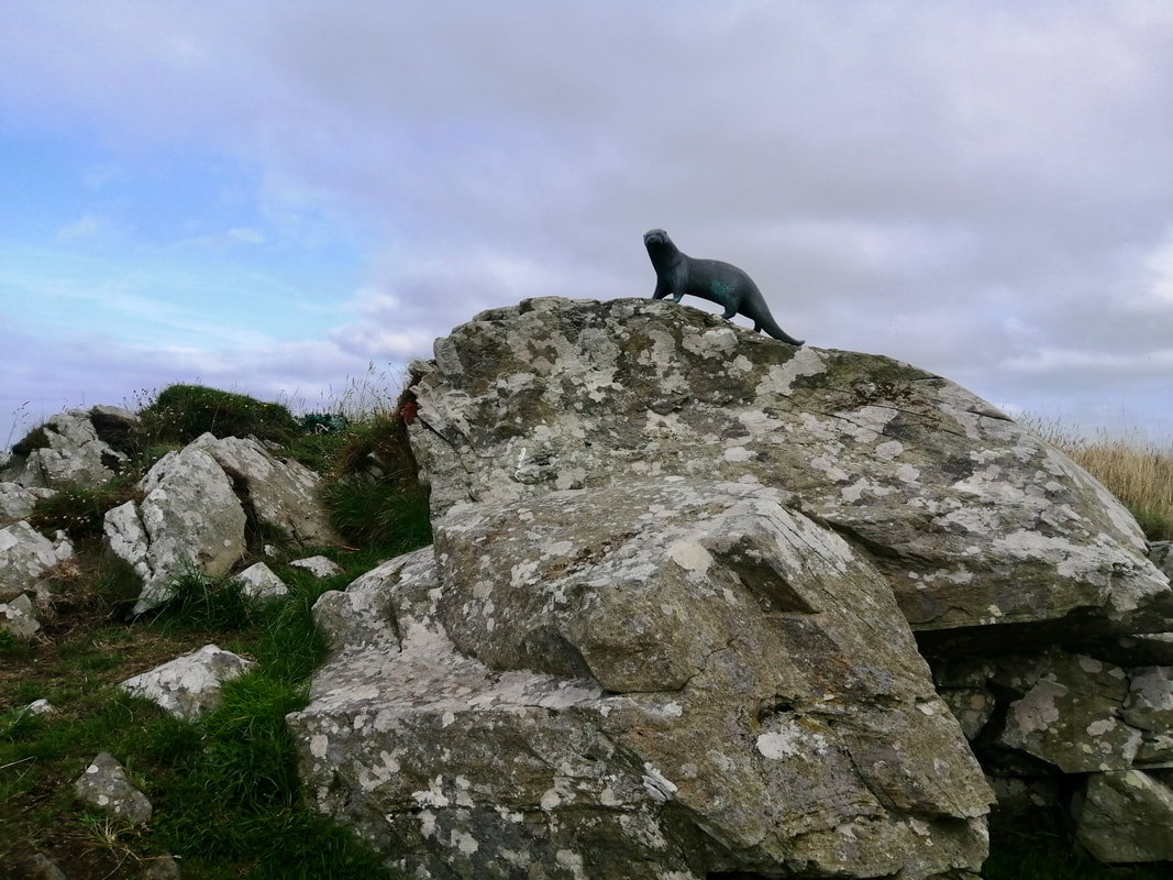
On the top of the hillside, overlooking the Point Of Lag, which is now part of the Medan Golf Course, there is a bronze sculpture of an otter in memory of Sir Gavin Maxwell (Ring of Bright Water 1960), the famous British naturalist. Sir Gavin was born in a small village close to Port William and the family estate and grounds, Monreith House, are nearby. From a well-to-do family, he particularly made a name for himself with his book about the otters he raised in Scotland.
We decided to stop by the memorial for a bit of tiffin and a cup of coffee. Despite the cloud, it was very warm day and we enjoyed sitting in the light breeze, overlooking the sea and the rugged coastline.
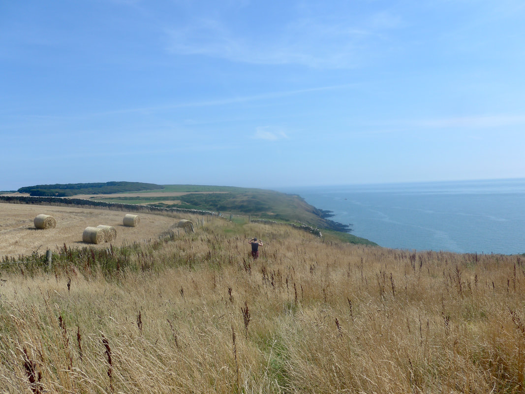
Point of Lag

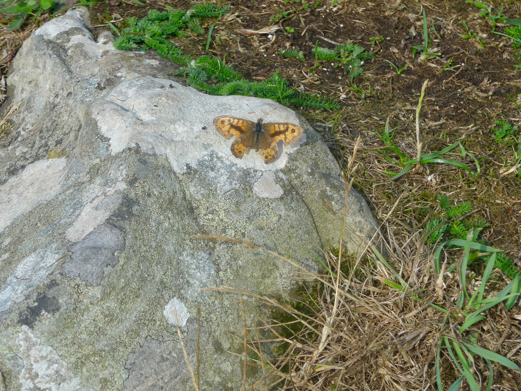 Wall Butterfly
 Moving on our picnic location, we spotted a Wall Butterfly sunning itself on a flat rock. It looked fairly battered and had obviously been in the wars, missing bits of the lower end of the upper and lower wings.
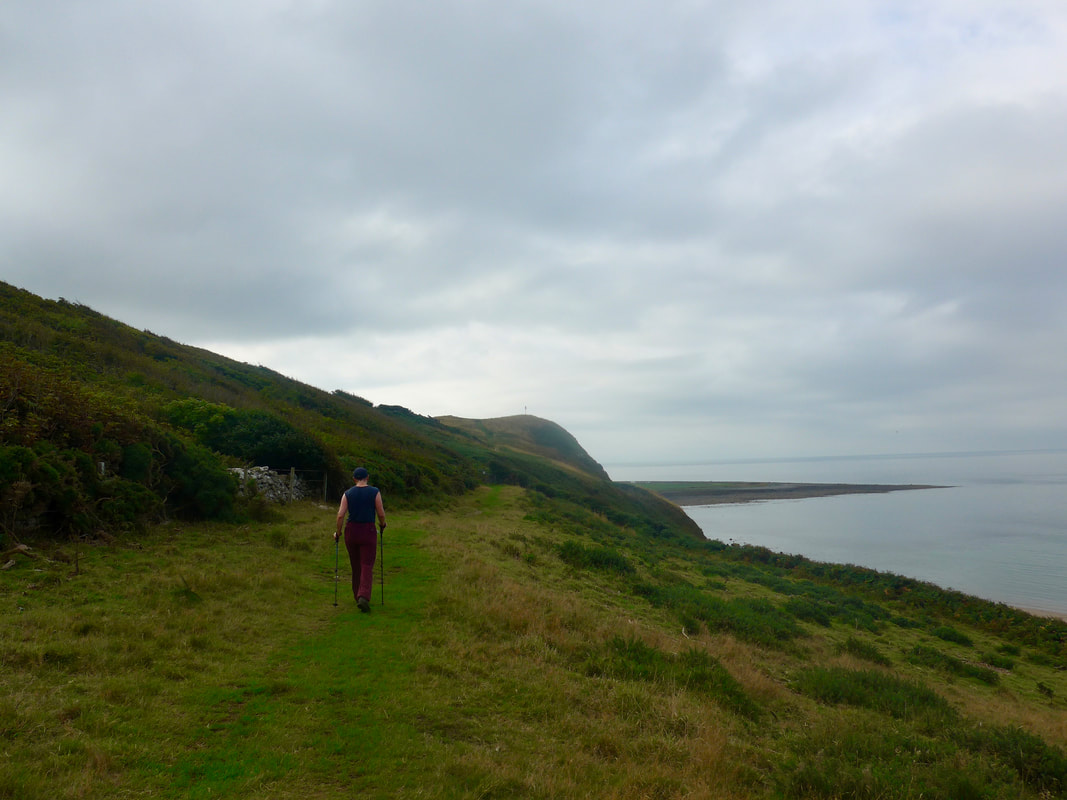
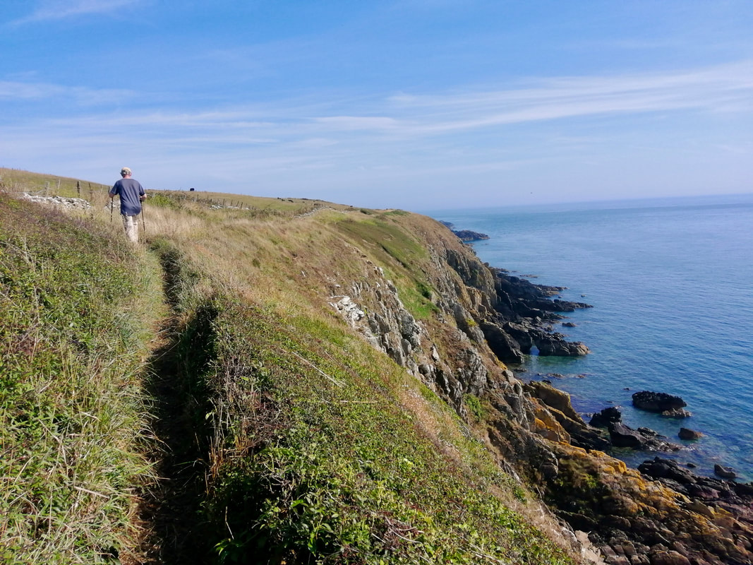
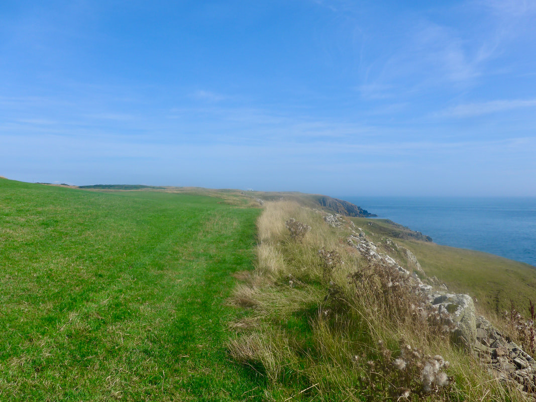
Skirting the edge of the St Medana golf course, we continued along the top of the low cliffs, the rocky foreshore and the high tide preventing us from taking to the beach. On the clifftop some of the path was over-grown with grass, nettles, thistles, brambles and blaeberry and we were both stung and scratched in numerous places.
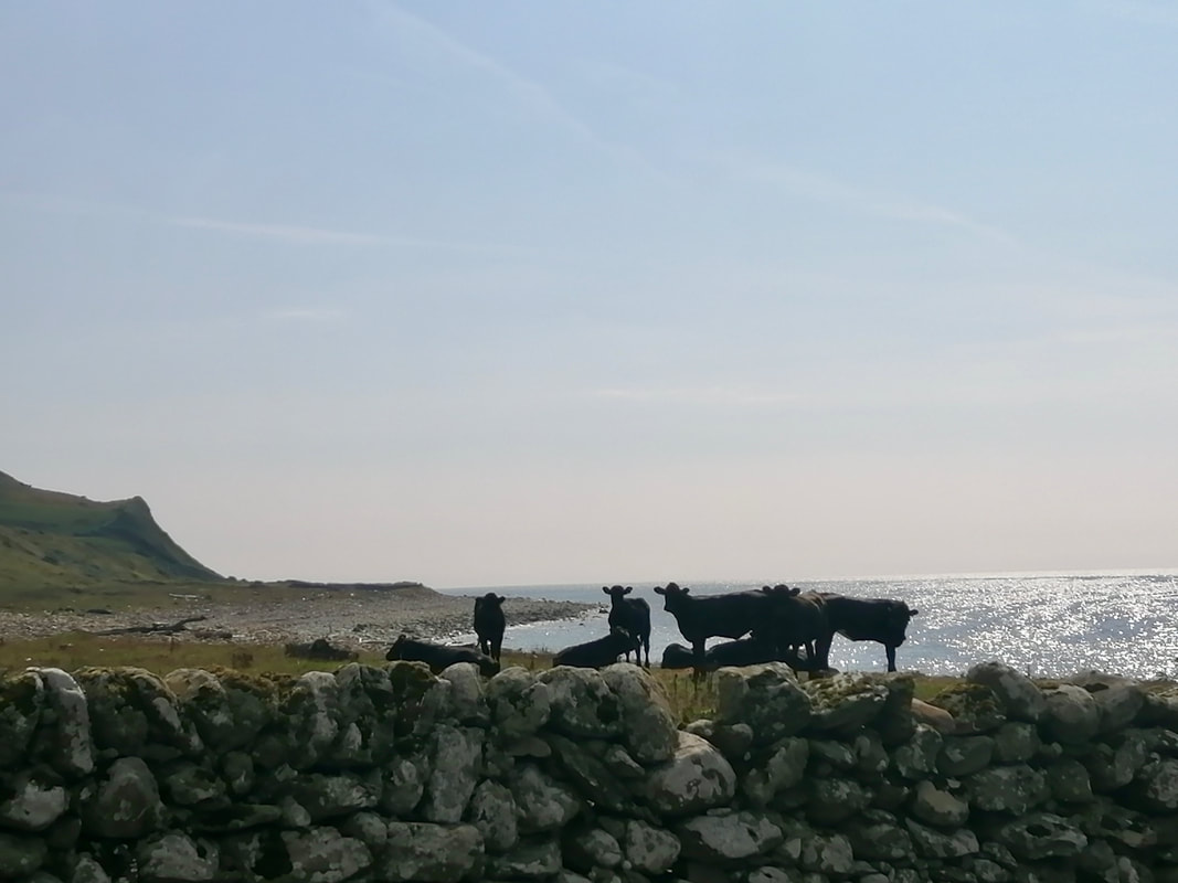
Despite the heavy cloud that was still around over the water and behind us, on the cliff we walked in bright sun and very warm conditions. Although we were carrying four litres of water, we were going through it at an alarming rate. It was lovely walking on the cliff with nice views inland, along the coast and some quite dramatic views down on to the rocky shore. I couldn't help but think of fellow coastal walker Dr Ruth Livingstone and her dislike for herds of cattle as we came across numerous herds of dairy cows and villainous herds of young heifers, thankfully usually behind a dry-stane dyke.
Skirting the edge of the St Medana golf course, we continued along the top of the low cliffs, the rocky foreshore and the high tide preventing us from taking to the beach. On the clifftop some of the path was over-grown with grass, nettles, thistles, brambles and blaeberry and we were both stung and scratched in numerous places.
Despite the heavy cloud that was still around over the water and behind us, on the cliff we walked in bright sun and very warm conditions. Although we were carrying four litres of water, we were going through it at an alarming rate. It was lovely walking on the cliff with nice views inland, along the coast and some quite dramatic views down on to the rocky shore. I couldn't help but think of fellow coastal walker Dr Ruth Livingstone and her dislike for herds of cattle as we came across numerous herds of dairy cows and villainous herds of young heifers, thankfully usually behind a dry-stane dyke.
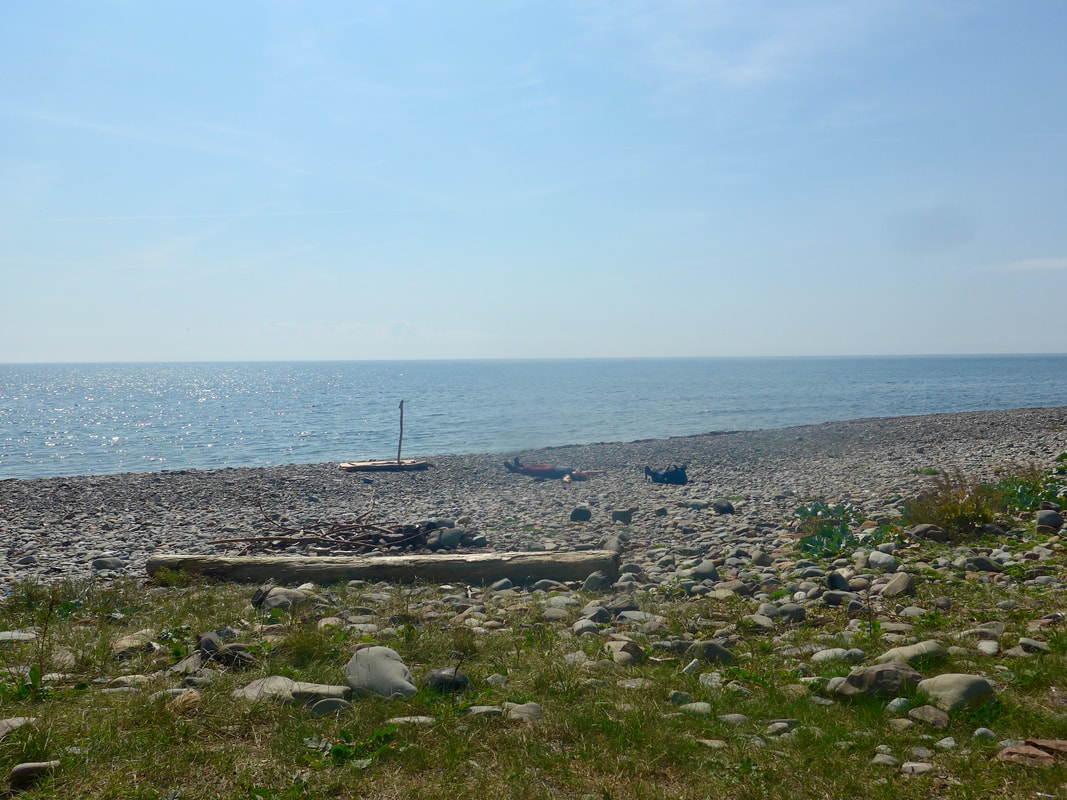
Cairndoon to Port of Counan
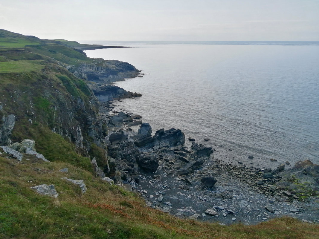
 Below Fell of Carleton
 Just after Carndoon we were able to drop down on to the shore and walked along a thin strip of green grass that runs along below the Fell of Carleton. The walking was slightly uncomfortable, the grass growing over rocks and boulders that made the footings difficult. It was possible to walk the shore as far as the Port of Counan where the sea was again up against the headland and forced us back up on to the cliff top again. Before going on, we stopped on the beach for half an hour, just enjoying the view out over the sea.
There is much to contemplate here at the small bay and throughout the walk. All around in the landscape examples of impermanence can be seen. I was struck again by the notion that the route I walk today, the coast I see, is not necessarily what my children will see should they ever follow my example. Fading evidence of a Roman presence on the clifftop, the rise and fall of the British Tribe structure, civilisations and Empires, erosion of cliff itself, all faded away. As our coastal journey starts, so also does it end.
As you walk on days like this, days when you feel the presence of Time, you appreciate that in long-distance walking there is the physical journey and their is also the spiritual one. The person who starts out to walk the coast will not be the same one who finishes it. The challenges of the route and the insights gained on the walk will change us. Likewise for couples. By the end of the journey our relationships will be different, one way or the other. Early on in our journey my wife and I realised that while you can fall out sharing a two-man tent, you cannot stay that way for long. Something moves, there are new levels of give and take and there is ever-present change taking place. Impermanence!
Port of Counan to Port Castle Bay
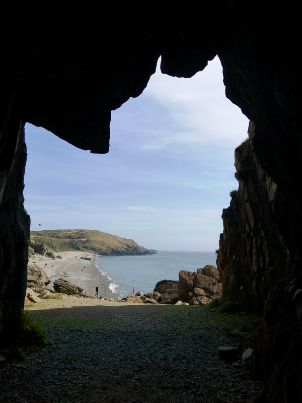 View from St Ninian's Cave
 From the beach at Port of Counan we were able to take a steep, zig-zag path up on to the top of the cliff at the bottom of the Hill of Glasserton. We could have chosen to stay on the road to take a long road route round to Port Castle Bay. Instead, as we breasted the hill, we cut off across some open farmland before we had to go in to and find a route through the Glen Tree Plantation.
The forest was a sticky section, the rucksack often becoming stuck on the low lying branches of the trees. With no path to follow we just stuck to instinct. On the other side of the plantation the valley was too steep to drop down on to the trackway that leads to St Ninian's cave and we were forced even further up the hill. Eventually, we found a local, earth path that took us down through the trees and on to the track that leads from Kidsdale to Port Castle Bay and then across the beach to St Ninian's Cave. After visiting the cave we had another short break on the beach, brewing up a cup of coffee and enjoying just sitting in the sun.
The forest was a sticky section, the rucksack often becoming stuck on the low lying branches of the trees. With no path to follow we just stuck to instinct. On the other side of the plantation the valley was too steep to drop down on to the trackway that leads to St Ninian's cave and we were forced even further up the hill. Eventually, we found a local, earth path that took us down through the trees and on to the track that leads from Kidsdale to Port Castle Bay and then across the beach to St Ninian's Cave. After visiting the cave we had another short break on the beach, brewing up a cup of coffee and enjoying just sitting in the sun.
 St Ninian's Cave & Point of Cardoon
 St Ninian's Cave is thought to have been used by Saint Ninian as a place of retreat. His church is to be found in the nearby village of the Isle of Whithorn. The area around the cave has been subject to rock falls and on the day we visited there were barriers up in various places. The cave itself was still accessible but a bit of care required to negotiate the access.
There are a number of crosses carved on the walls of the cave and a number of Christian carved stones were found there. These can now be viewed in the Whithorn Priory & Museum. The priory was built in the 12th C for the Premonstratensian monks, also known as the Norbertines or White Canons. They were founded in Germany in 1120, by Norbert of Xanten.
There are a number of crosses carved on the walls of the cave and a number of Christian carved stones were found there. These can now be viewed in the Whithorn Priory & Museum. The priory was built in the 12th C for the Premonstratensian monks, also known as the Norbertines or White Canons. They were founded in Germany in 1120, by Norbert of Xanten.
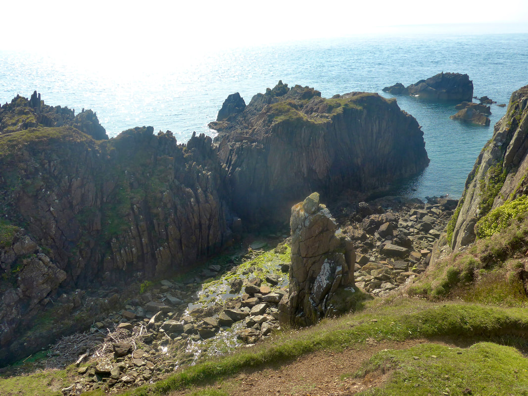
 Carghidown
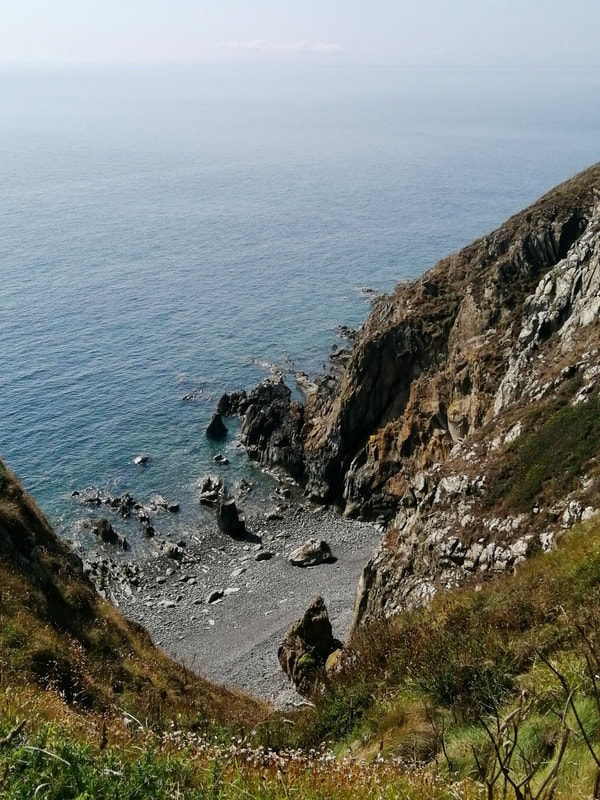
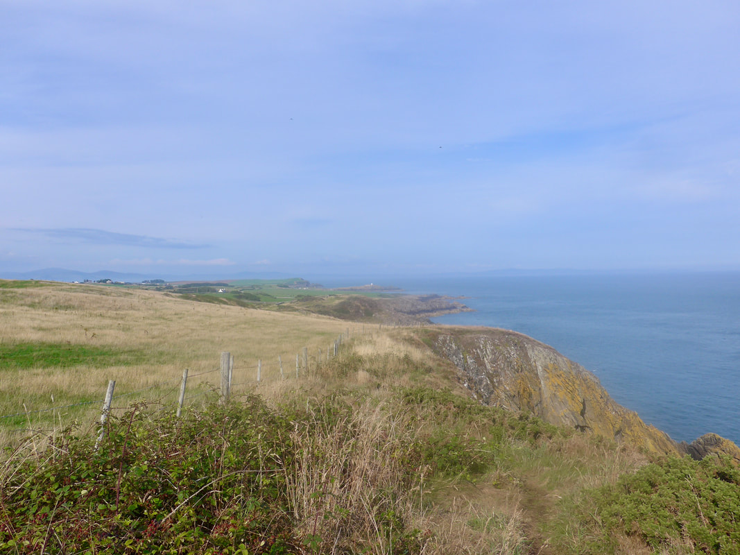
 After our break we continued across the beach to a path up on to the cliffs at Carghidown. There were dramatic views from up here back to the cave and the Point of Cardoon. Not too long after you take to the cliff there is a lovely little natural arch (Devil's Arch) down on the shore.
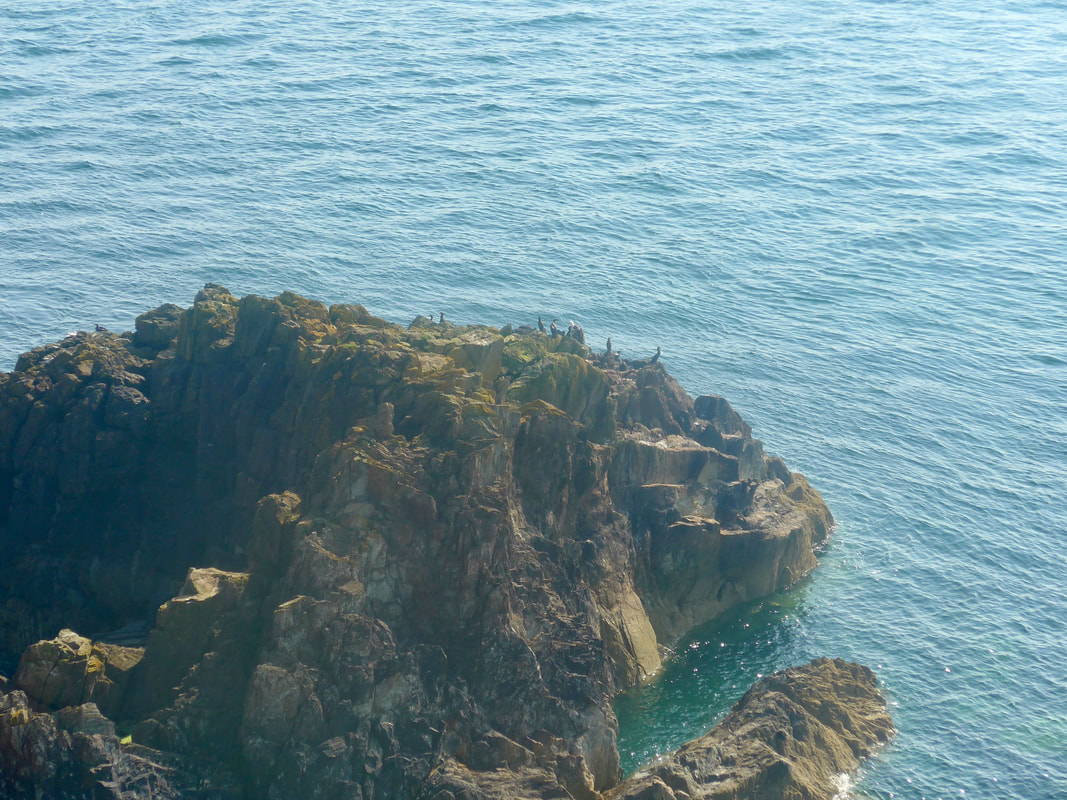
Down on the shore there were dramatic stands of rocks and some lovely, little secluded bays. Many of the jagged rocks were populated by various seabirds, including Herring Gulls, Shags and Cormorants. The view to the front was somewhat truncated by the rise and fall of the landform and the turning of the corner at Burrow Head, leading back to the Isle of Whithorn.
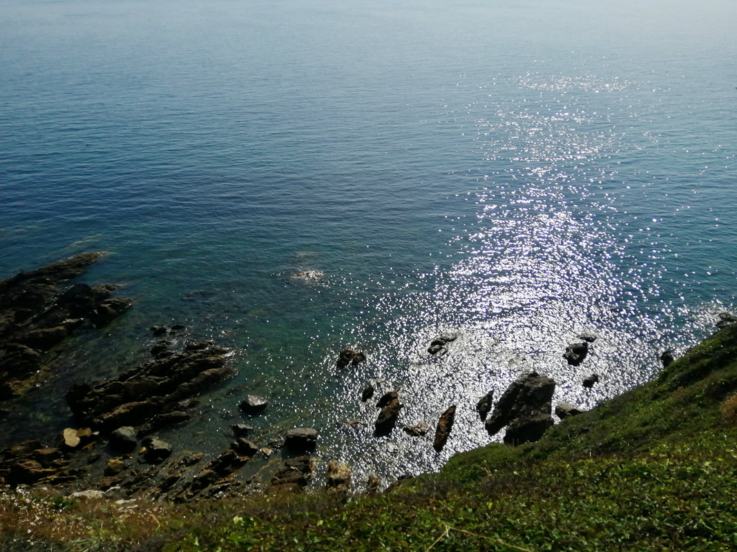
We had almost completely finished our water on the last brew-up so took the opportunity to replenish our water supply when we passed the Burrow Head Holiday Farm. Some of the walking on the clifftop felt a tad restricted on a narrow path that wove its way through gorse and bramble. Fairly close to the cliff edge, at times, it felt quite adventurous. To our left, a moss-encrusted dry-stone dyke lined the path, wild roses and their bright, red berries lying lazily on the top stones. With the sun well across the sky, there were lovely light features at play on the top of the water. Any threat of rain had disappeared and the afternoon sun was hot and energy-draining.
Down on the shore there were dramatic stands of rocks and some lovely, little secluded bays. Many of the jagged rocks were populated by various seabirds, including Herring Gulls, Shags and Cormorants. The view to the front was somewhat truncated by the rise and fall of the landform and the turning of the corner at Burrow Head, leading back to the Isle of Whithorn.
We had almost completely finished our water on the last brew-up so took the opportunity to replenish our water supply when we passed the Burrow Head Holiday Farm. Some of the walking on the clifftop felt a tad restricted on a narrow path that wove its way through gorse and bramble. Fairly close to the cliff edge, at times, it felt quite adventurous. To our left, a moss-encrusted dry-stone dyke lined the path, wild roses and their bright, red berries lying lazily on the top stones. With the sun well across the sky, there were lovely light features at play on the top of the water. Any threat of rain had disappeared and the afternoon sun was hot and energy-draining.
Port Castle Bay to Burrow Head

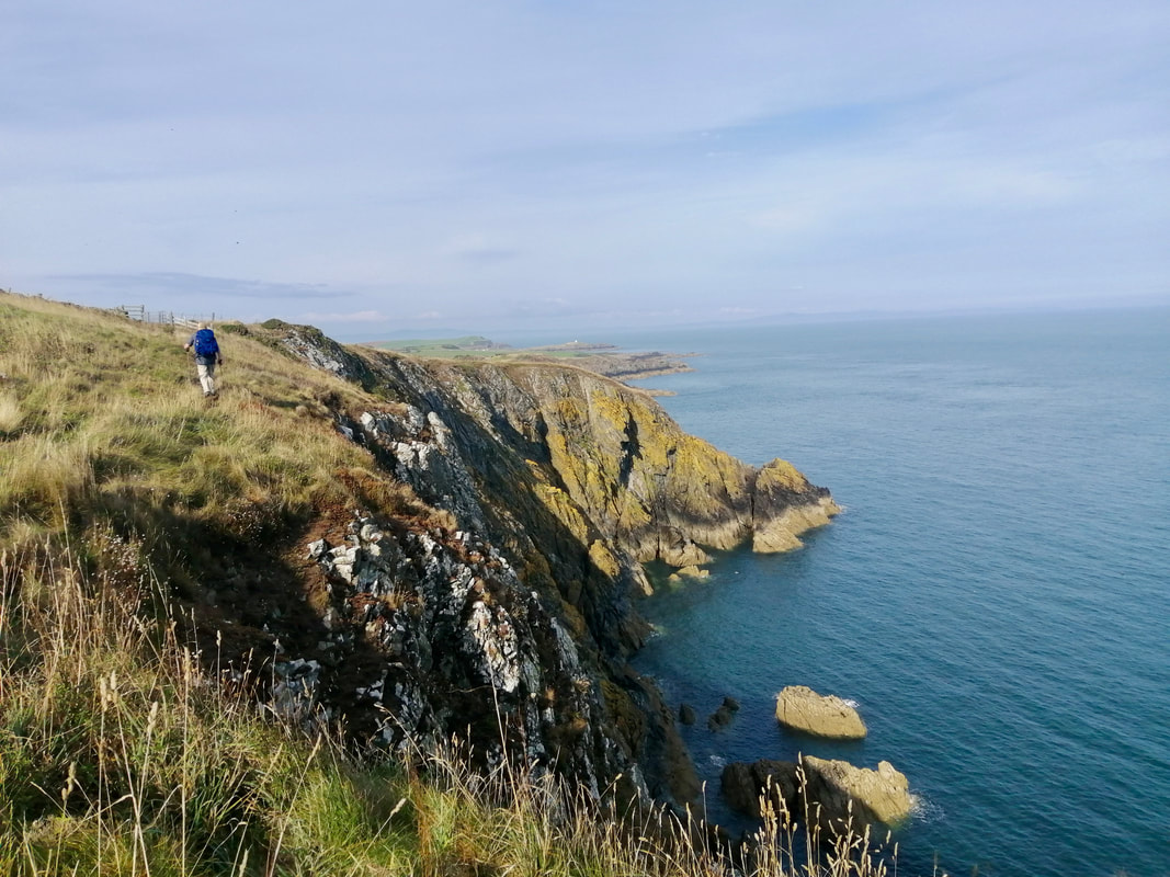
 Greywacke Rock, Burrow H Head
 At Burrow Head the route turns north east on the last leg to Isle of Whithorn. The headland itself is the second-most southern point of the Scottish mainland after the Mull of Galloway. There are a number of features to see on the headland including the remains of ancient forts and natural land features such as Jamie's Hole, a blowhole cave system that connects directly to the sea.
The rock formations are quite dramatic here, almost slate-like in its form, fractured along the vertical plane. All along the point of Burrow Head there were fishermen trying their luck. The views are delightful, peaceful and tranquil. As you turn the corner on the Head the village of Isle of Whithorn lies directly in front of you.
The rock formations are quite dramatic here, almost slate-like in its form, fractured along the vertical plane. All along the point of Burrow Head there were fishermen trying their luck. The views are delightful, peaceful and tranquil. As you turn the corner on the Head the village of Isle of Whithorn lies directly in front of you.
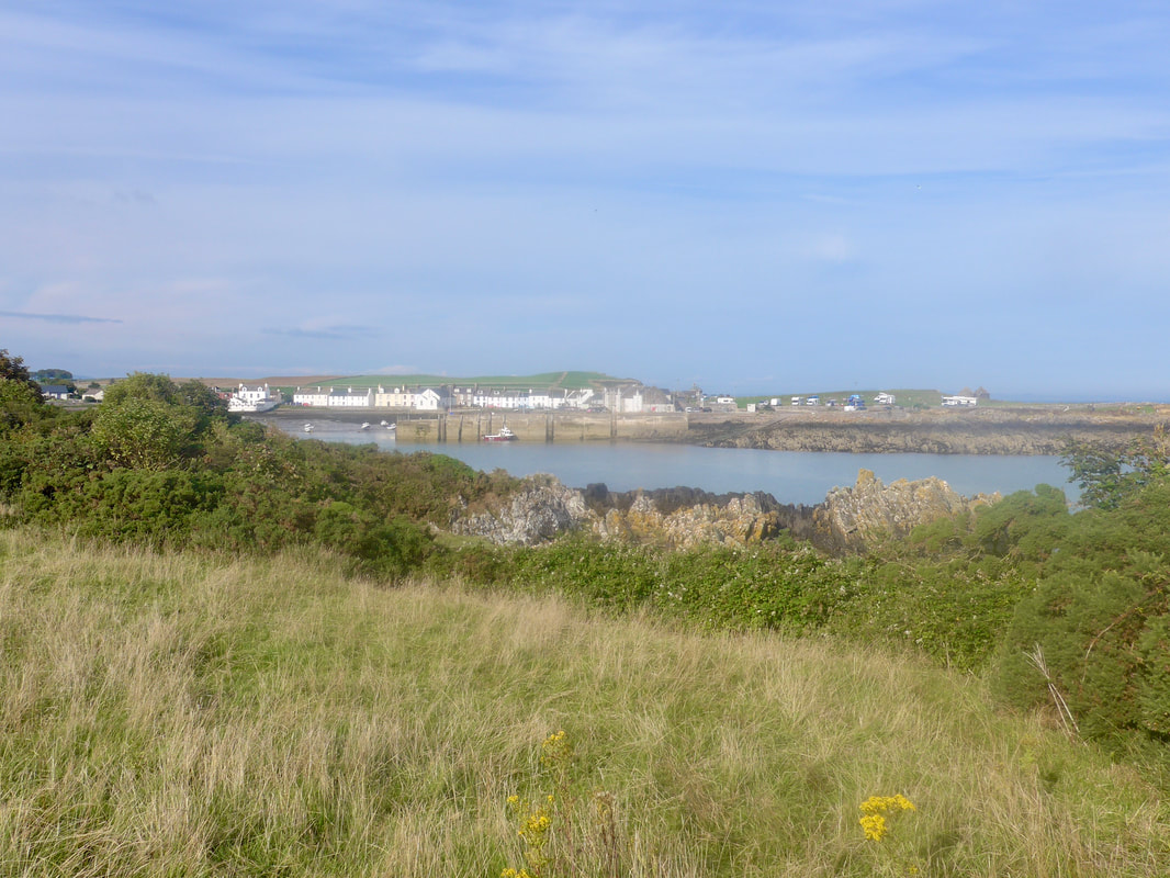
From St Ninian's Cave to the village is just over four miles. On a hot day it is a tiring but delightful last section. By the time we reached the village we felt every one of the day's sixteen miles and were, despite carrying a full load of water, probably a little de-hydrated. Guess where the first stop was?
Burrow Head to Isle of Whithorn
 RSS Feed
