Route Map
Day Eight - Day off spent in Hope Cove
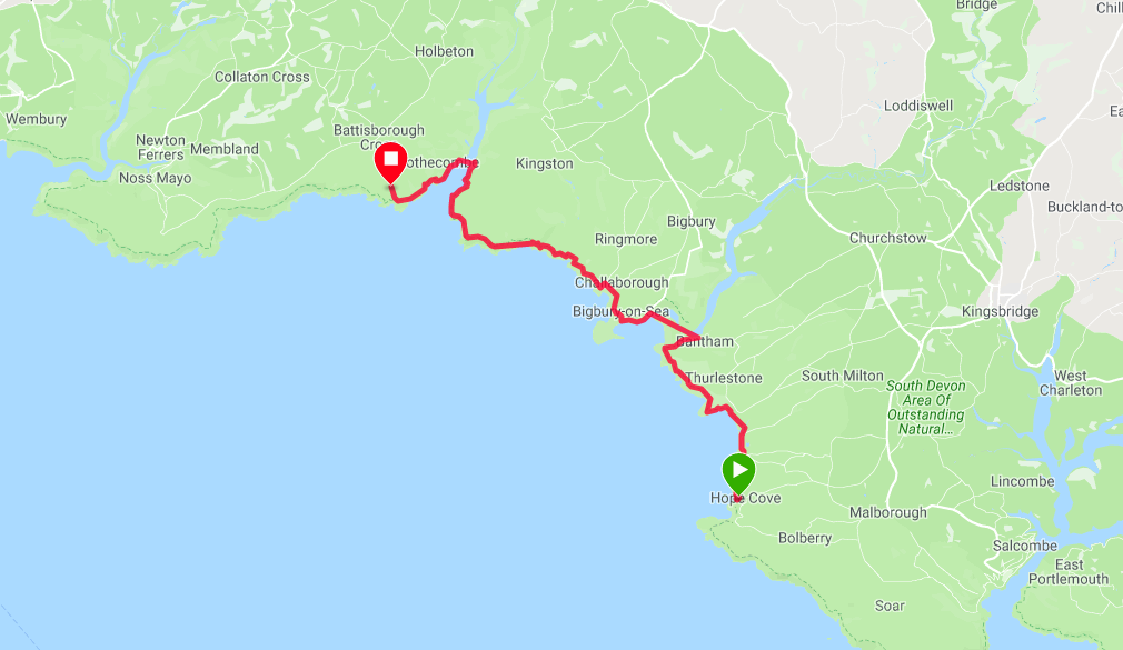
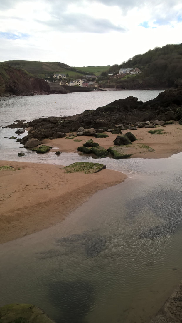
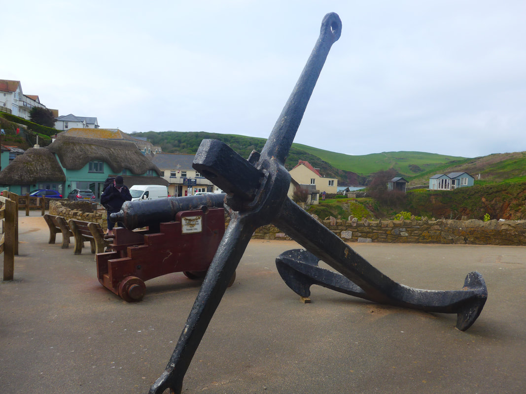
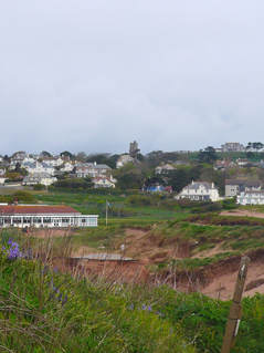
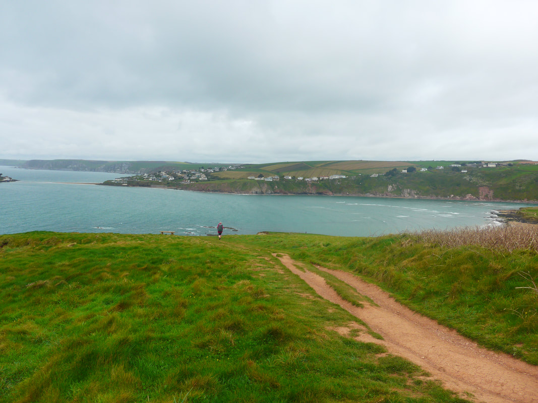
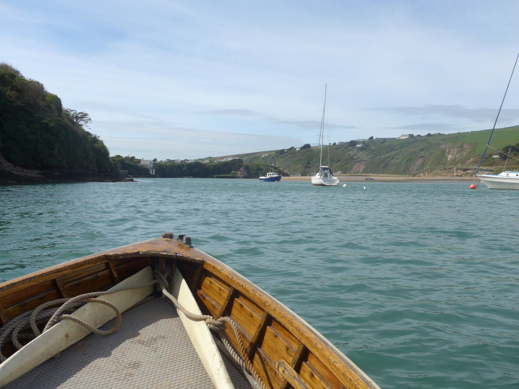
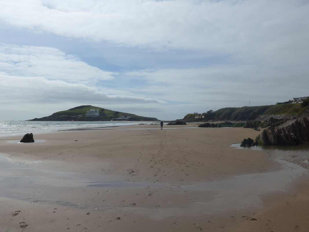
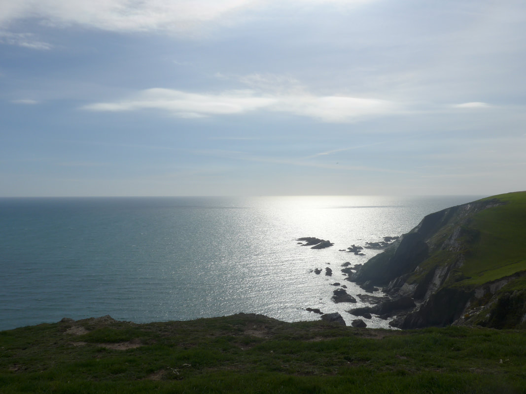
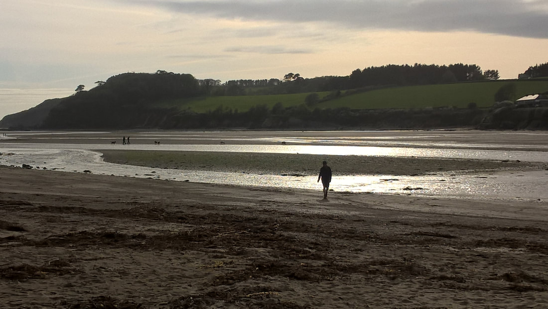
 Inner Hope
 With the first week of our almost nine-week adventure in the bag, we enjoyed a nice Sunday off in Hope Cove. Against the odds, our hotel room had a bath, albeit a 'dinky' one, and, I think for the first time in my life, I had three baths in the one day in an effort to relax tired and aching muscles.
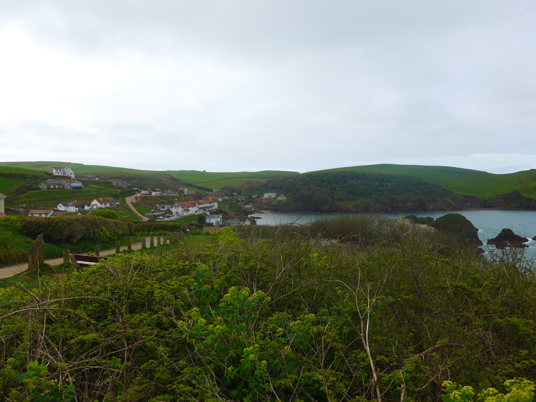
The hotel staff could not do enough for us from an overload of tea and biscuits in the room, all our laundry done for us free of charge and the most wonderful Sunday roast, with the largest Yorkshire pudding I have ever eaten. The two breakfasts and dinners we had here were top notch as well. I enjoyed walking round the harbour and beach area with Joanna Elizabeth on our day off, enjoying the land-level views across Bigbury Bay, but reneged and returned to the hotel while JE went off to explore some of the high places in the village. It was a nice, peaceful and restful day.
The hotel staff could not do enough for us from an overload of tea and biscuits in the room, all our laundry done for us free of charge and the most wonderful Sunday roast, with the largest Yorkshire pudding I have ever eaten. The two breakfasts and dinners we had here were top notch as well. I enjoyed walking round the harbour and beach area with Joanna Elizabeth on our day off, enjoying the land-level views across Bigbury Bay, but reneged and returned to the hotel while JE went off to explore some of the high places in the village. It was a nice, peaceful and restful day.
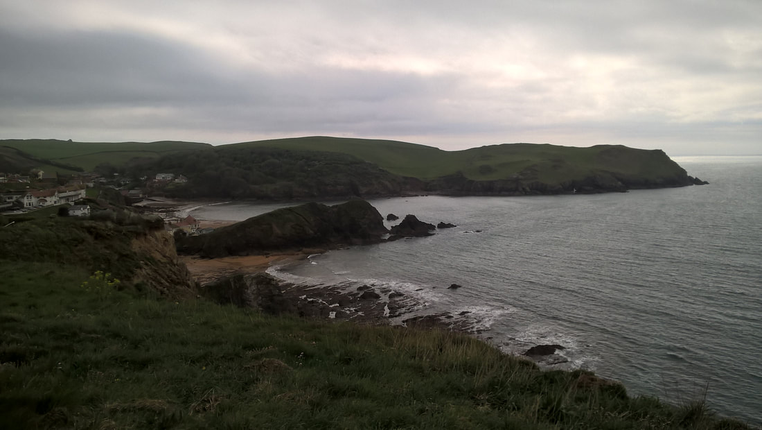
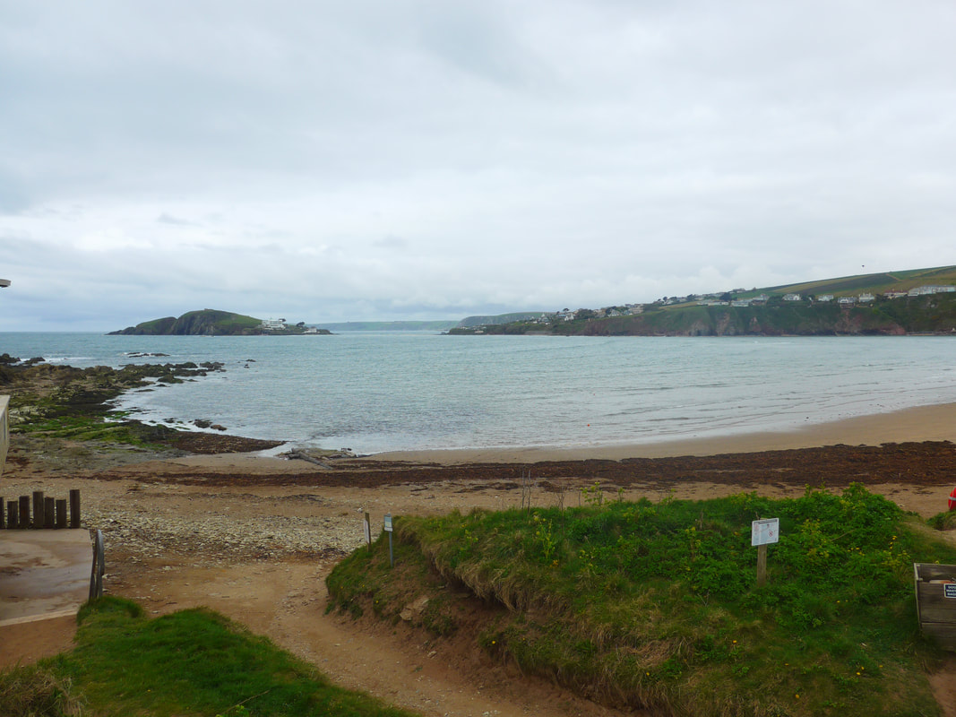
Hope Cove

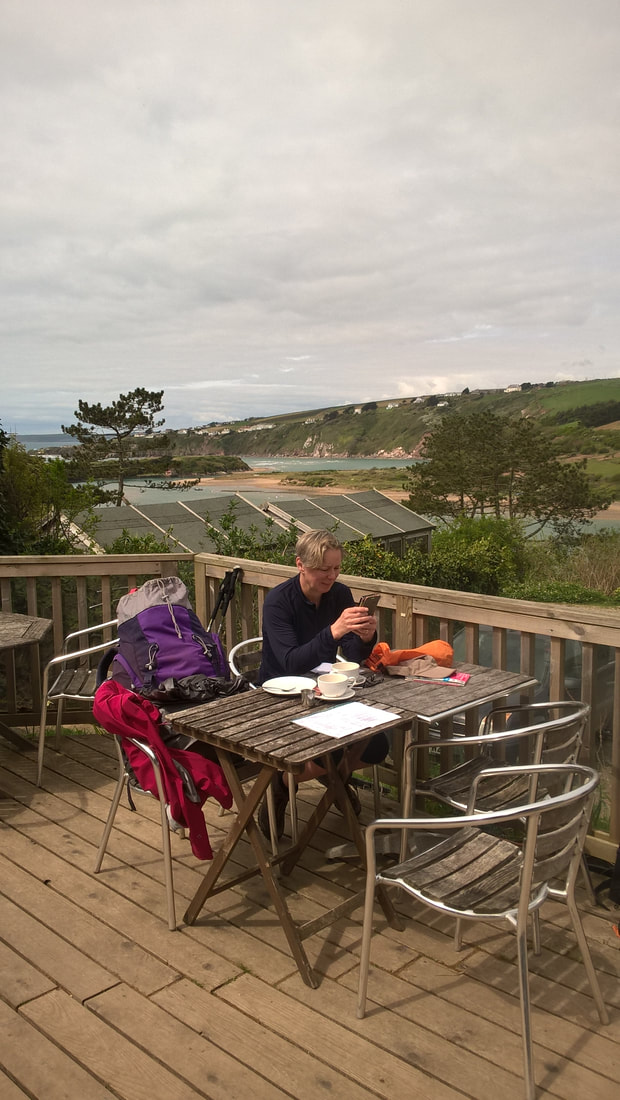
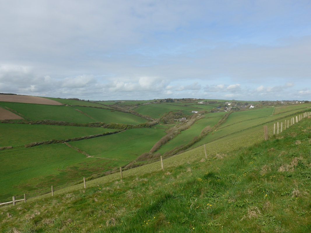
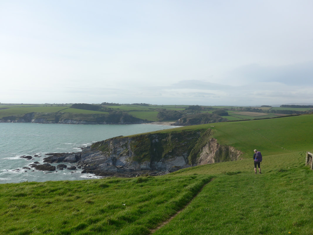
 Walk Profile
 We spent part of our Sunday reviewing the options we had for the next few days; options that we had planned before we left home. Once you are on the ground things have a habit of taking a different complexion. This next section had the potential to be tricky because we could be crossing two rivers (River Avon & the River Erme), each of which had contrary needs as far as the tide was concerned. The first wanted high water for the ferry, but for the next crossing we needed low water so that we could manually ford the river. The difference in time between one and the other would determine whether or not we could cross both rivers on the same day or, whether we would need to take the long walks round the rivers.
The plan over the next three days had been to have two short walks (in case we need to take the long routes round the rivers) and then one long haul to reach Plymouth. However, knowing that things can change on the ground we had built in flexibility and we left Hope Cove armed with various options regarding the river crossings and what we could do if things did not go according to plan. While we did not relish having to walk all the way round the riverine estuaries, we might have no choice if the tides are against us.
The plan over the next three days had been to have two short walks (in case we need to take the long routes round the rivers) and then one long haul to reach Plymouth. However, knowing that things can change on the ground we had built in flexibility and we left Hope Cove armed with various options regarding the river crossings and what we could do if things did not go according to plan. While we did not relish having to walk all the way round the riverine estuaries, we might have no choice if the tides are against us.

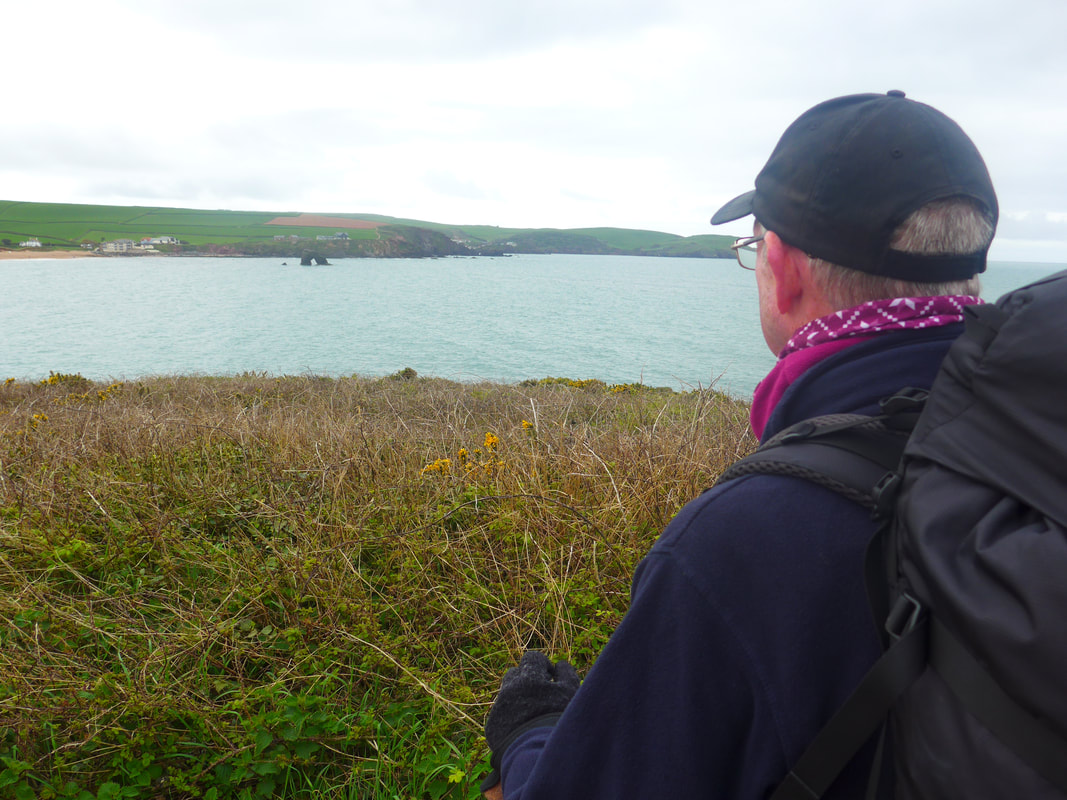
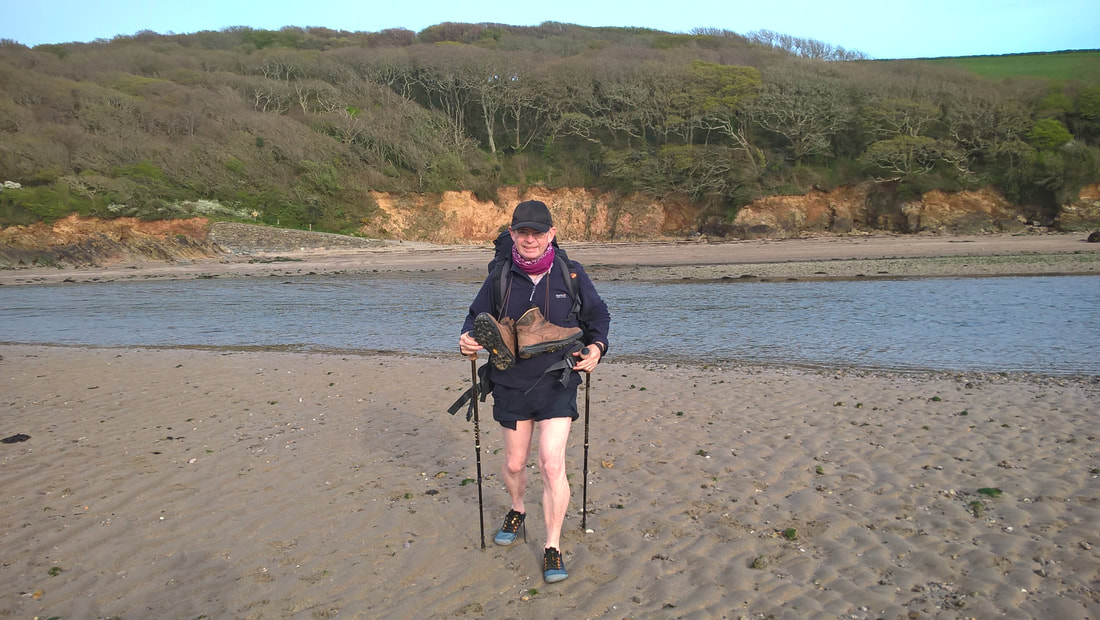
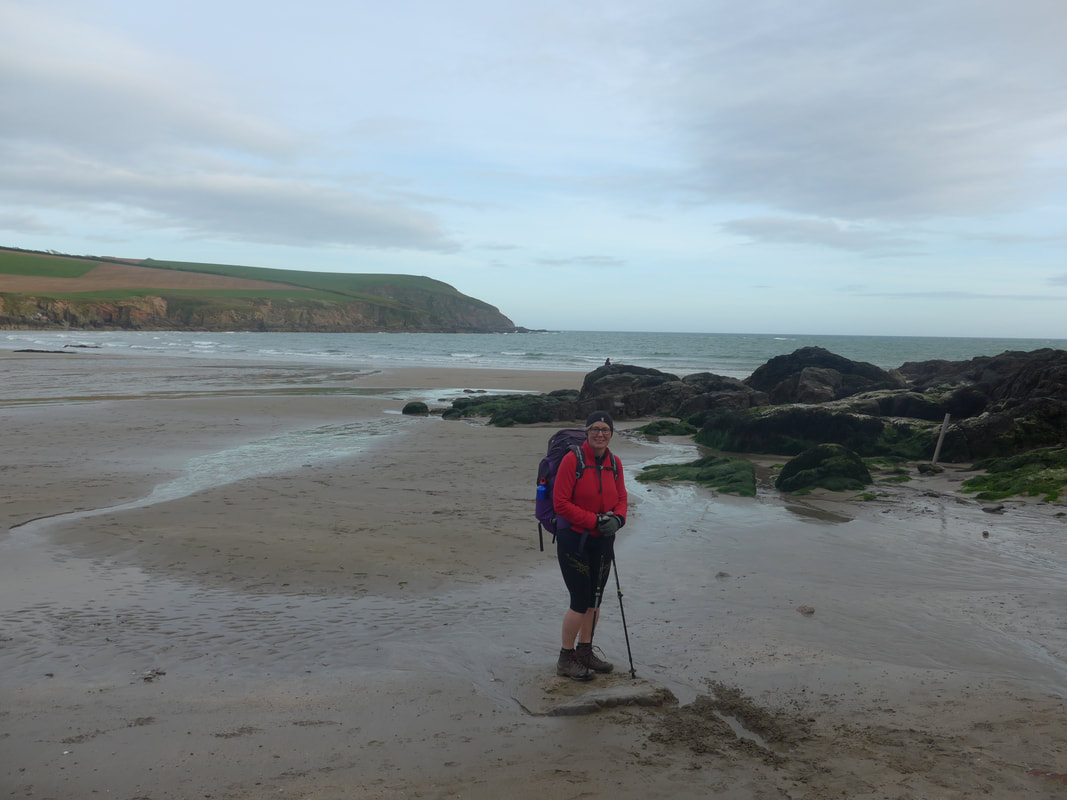
It was cold, breezy and overcast when we eventually managed to get away from our hotel and contrary to the heat of yesterday, we needed to don coats, hats and gloves today and they never came off. From Outer Hope, we made our way back down to the shore at Inner Hope where we made last minute food purchases before taking up the coastal path where we left off yesterday.
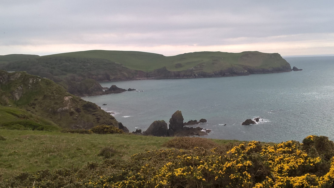
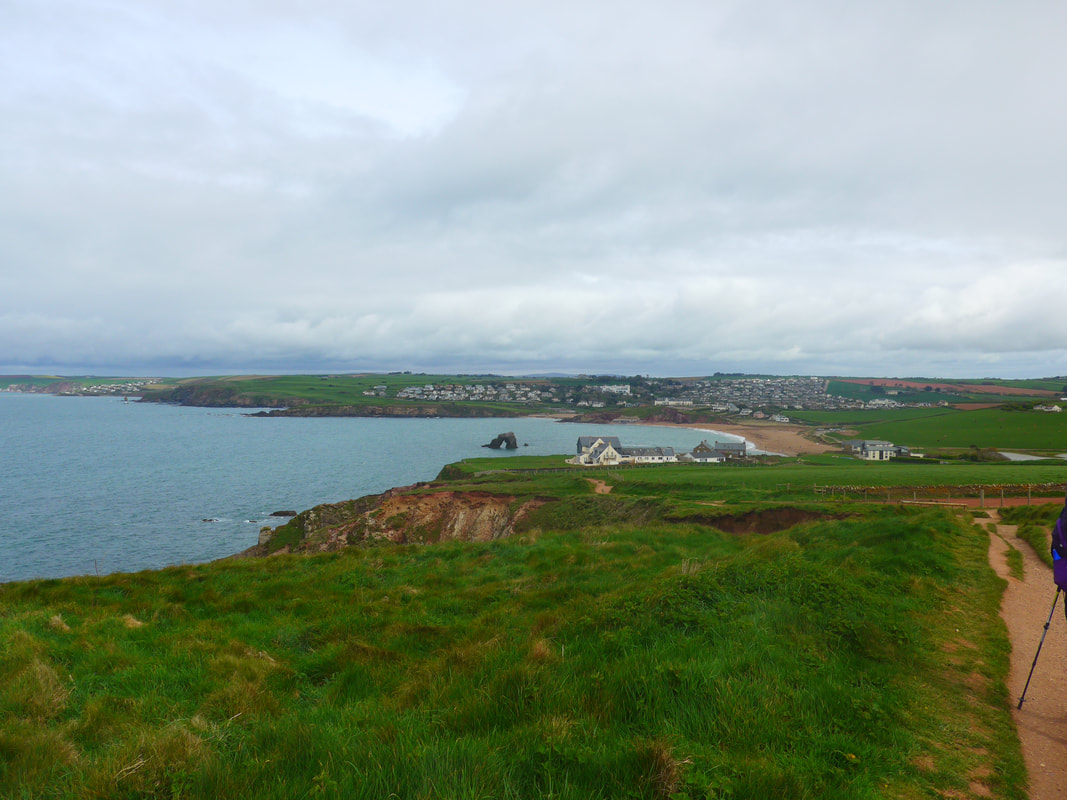
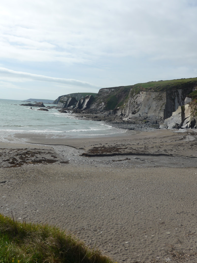
There is a slight rise as you leave Hope Cove going up and over Woolman and Beacon Points and passing by the rock formation known as The Priest. As you beard the hill, the village of Thurlestone lies snug in the lee of the other side of the bay and you have great views of the lovely sea arch from which the village is thought to have taken its name; 'thirl stone', a thirl being a hole. The arch dominates the bay, with the bright red sandstone cliffs behind. Later as you come closer to the cliffs and particularly beside the golf course which abuts the beach, you appreciate just how deeply red the rock is in places. On the hilltop, the cold breeze from the sea was cutting and, in the overhead skies, we felt there was the promise of rain. Back down at sea level, approaching the village, we crossed a lovely little sandy beach that was completely empty of people, a reflection perhaps of the day's temperature.
There is a slight rise as you leave Hope Cove going up and over Woolman and Beacon Points and passing by the rock formation known as The Priest. As you beard the hill, the village of Thurlestone lies snug in the lee of the other side of the bay and you have great views of the lovely sea arch from which the village is thought to have taken its name; 'thirl stone', a thirl being a hole. The arch dominates the bay, with the bright red sandstone cliffs behind. Later as you come closer to the cliffs and particularly beside the golf course which abuts the beach, you appreciate just how deeply red the rock is in places. On the hilltop, the cold breeze from the sea was cutting and, in the overhead skies, we felt there was the promise of rain. Back down at sea level, approaching the village, we crossed a lovely little sandy beach that was completely empty of people, a reflection perhaps of the day's temperature.
Over the town itself, the high tower of All Saints church peers down over the residents like a minister from his pulpit. The first stone church was built on this site in 1230AD, with various additional building works being added over hundreds of years to the basic frame. It is thought the stone church was built on the site of an old wattle and daub church that dated from about 900AD.
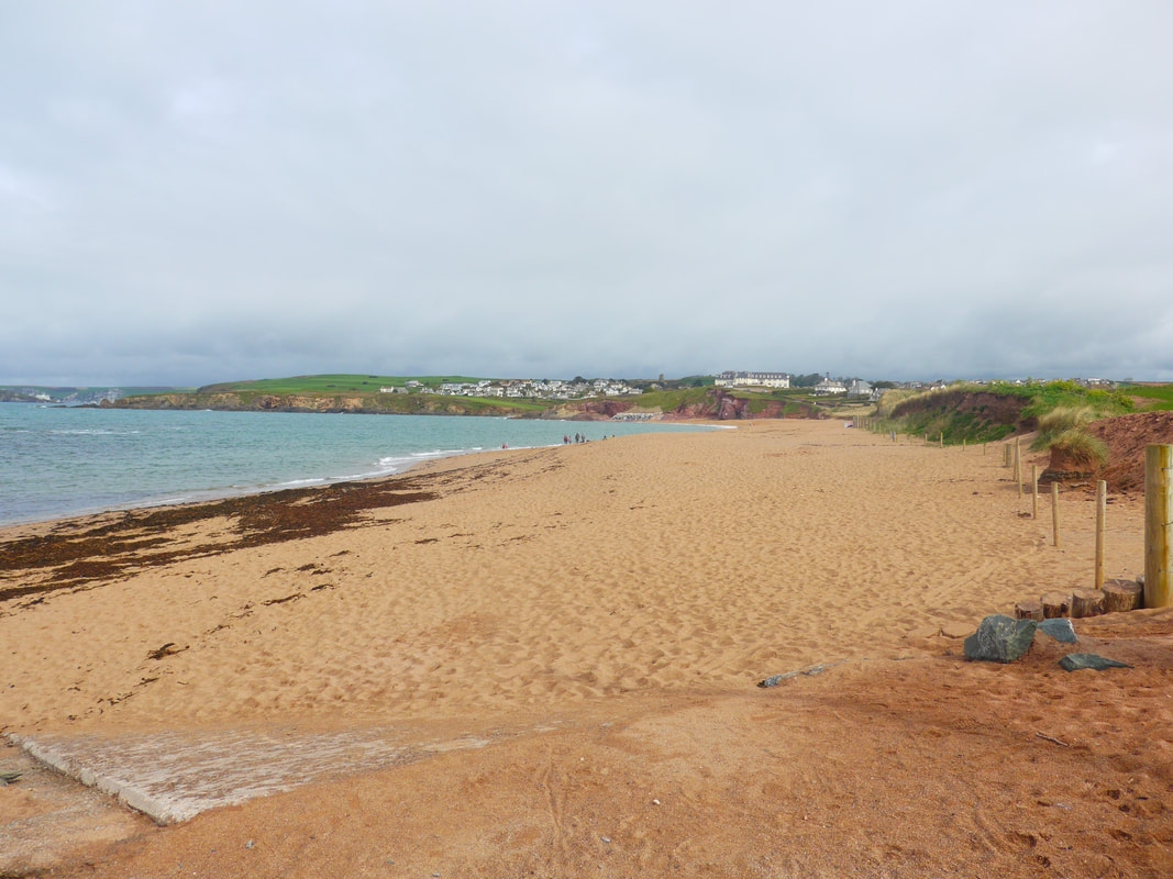
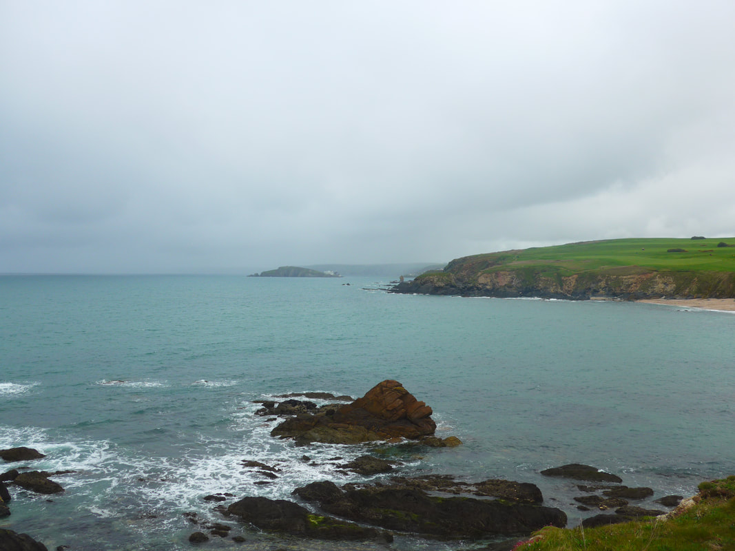
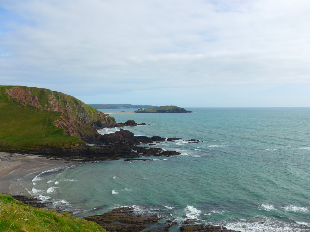
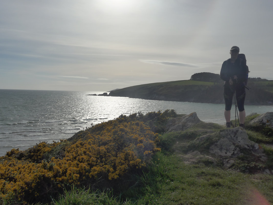
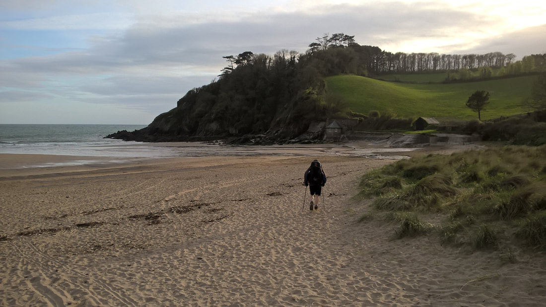
Leaving Thurlstone, you are still walking on Bigbury Bay and the views are wonderful with nice vistas back to Hope Cove and a 'needle's eye view' through 'The Thurlstone' to Bolt Tail beyond. The contrast between the blue-green waters of the bay and the red soil and green grasslands on the tops of the cliff caught the eye. There was a wonderful stillness and quiet to the day, despite the thrum of the breeze in the ear.
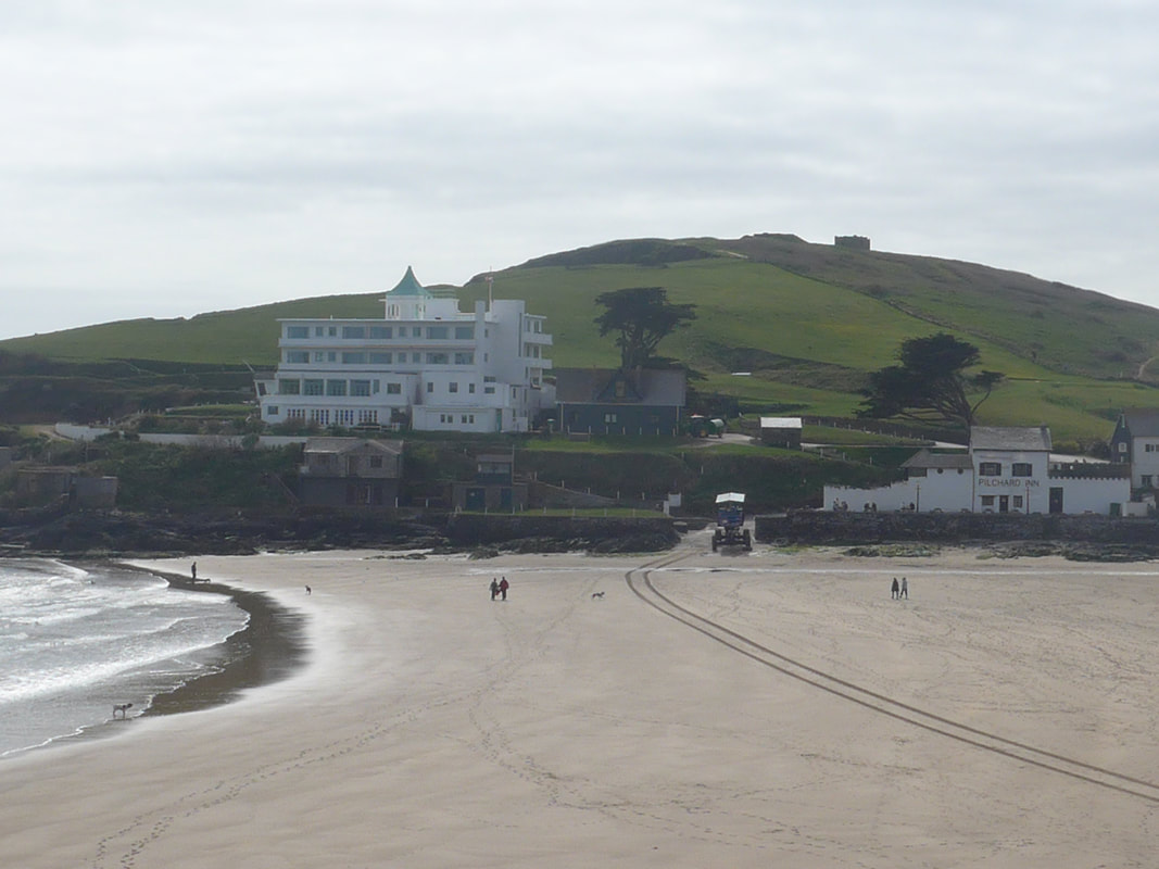
On the other side of the bay looking west, we could see Burgh Island standing just off the mainland, with the outline of the white Burgh Island Hotel stark against the grey skies and the dark background of the cliffs below Ringmore. Later in the day we had closer views across the mouth of the River Avon to the small town of Bigbury-on-Sea, which is on the mainland directly opposite Burgh Island. After the sixty-metre climb to above Butter Cove, the route drops back down to almost sea level for the walk in to the village of Bantham, where the ferry is located. On the way we passed lovely little turreted, boat-house shaped dwellings. It in Bantham that the wheels came off the planning bogey, but for once it worked to our advantage. We had presumed the ferry ran all day, but arriving at noon, we were advised it was only running twice a day, from 10 - 11.00am and, 3 - 4.00pm.
On the other side of the bay looking west, we could see Burgh Island standing just off the mainland, with the outline of the white Burgh Island Hotel stark against the grey skies and the dark background of the cliffs below Ringmore. Later in the day we had closer views across the mouth of the River Avon to the small town of Bigbury-on-Sea, which is on the mainland directly opposite Burgh Island. After the sixty-metre climb to above Butter Cove, the route drops back down to almost sea level for the walk in to the village of Bantham, where the ferry is located. On the way we passed lovely little turreted, boat-house shaped dwellings. It in Bantham that the wheels came off the planning bogey, but for once it worked to our advantage. We had presumed the ferry ran all day, but arriving at noon, we were advised it was only running twice a day, from 10 - 11.00am and, 3 - 4.00pm.
Forced to take it easy with three hours to spare, we relaxed on a cafe terrace over-looking the river, watching the waves and eating and drinking too, too much. The cafe was part of the community shop, so we stacked up on some additional goodies while we were there, including fresh pasta for the night's dinner.
While we sat there, we also rejigged our plans after realising that with a late ferry crossing and with today's tide times, if we did a Royal Marine 'yomp' up to the River Erme, we might be able to make a fording of the river just as the tide turned (low tide roughly 6.30pm) in the early evening and still have enough light to walk round the bay to Battisborough. Instead of two short and one long day, we would do one of about 10 - 12 miles and one of about fifteen, which would then put us a day ahead of schedule and which we could use as an extra day off in Plymouth.
We had intended trying to camp on the other side of the river at Mount Folly, but with heavy rain forecast for tonight that would be no great loss. We spent some time perusing the map and figuring out options. Eventually. we contacted the field study centre where we had booked to stay tomorrow and were lucky enough to be able to change that booking to tonight. We then contacted our youth hostel in Plymouth and were able to extend our booking there, staying in the same room, to two days. Problem solved! Only the miles left to be walked.

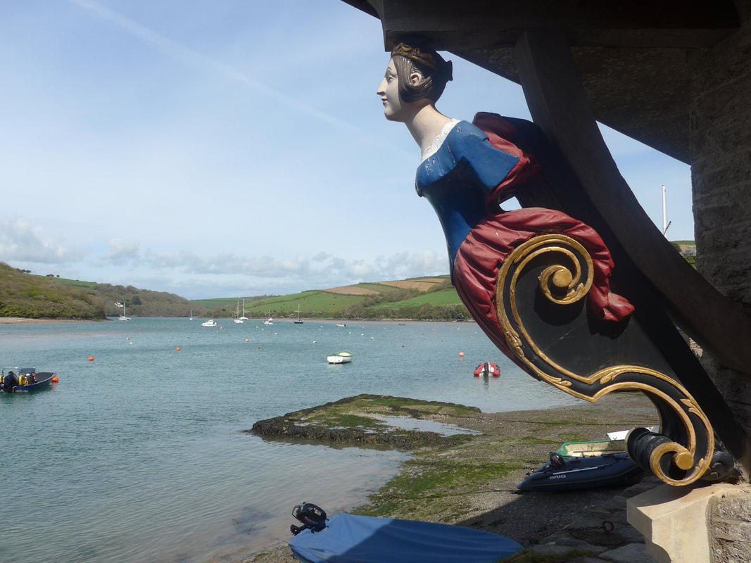
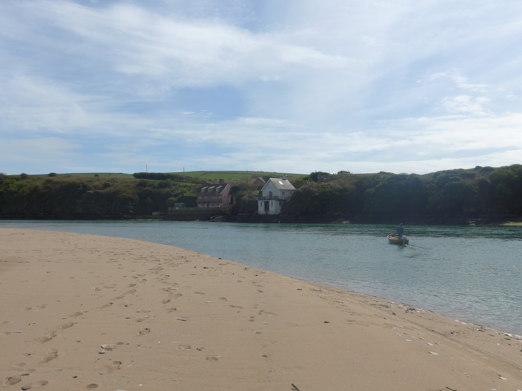
While it was pleasant sitting in the sun, waiting for the ferry, it was also frustrating as we wanted as much time as possible to complete the walk from the Avon to the River Erme to give us the light and water low enough as possible to ford the river. When we did eventually move to the ferry building we were pleasantly surprised to find it was a long-length, fully thatched cottage, with two lovely carved wooden figureheads at each of the front two corners of the building. With the thatched cottage, the location of the ferry so close to the river mouth and great views up the course of the river, it was absolutely charming.
When the ferryman arrived he made his way to a small rubber dingy which to me looked as if it would be lucky to take two people. I looked at me and Joanna, looked at the boatman, looked at the two rucksacks and thought 'not a chance in hell I am getting in that boat'! I was relieved to realise he used the dingy to go and get the proper boat, which was at least twice as large, maybe a bit bigger, more a rowing boat with a lawn mower engine, than an actual ferry. Certainly, it was the smallest ferry we had used on our walk so far. In the event, it did the job, albeit we were a little surprised to be left on a bare patch of sand on the other side, but tried to look nonchalant, as if we did this kind of trip every day and knew exactly what we were doing.
When the ferryman arrived he made his way to a small rubber dingy which to me looked as if it would be lucky to take two people. I looked at me and Joanna, looked at the boatman, looked at the two rucksacks and thought 'not a chance in hell I am getting in that boat'! I was relieved to realise he used the dingy to go and get the proper boat, which was at least twice as large, maybe a bit bigger, more a rowing boat with a lawn mower engine, than an actual ferry. Certainly, it was the smallest ferry we had used on our walk so far. In the event, it did the job, albeit we were a little surprised to be left on a bare patch of sand on the other side, but tried to look nonchalant, as if we did this kind of trip every day and knew exactly what we were doing.
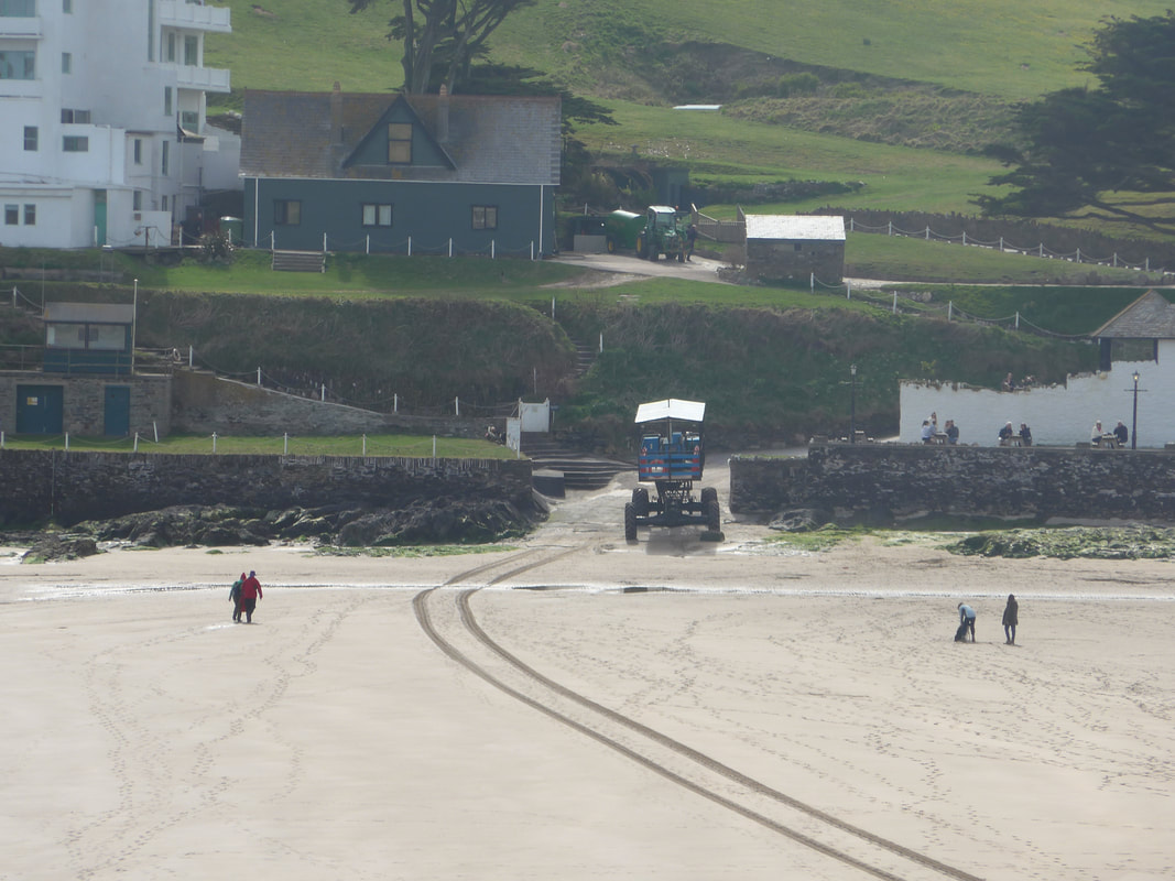
From the beach below Mounty Folly the SWCP takes one of two routes, both of which take you up the hill to Mount Folly Farm and then round to Bigbury-on-Sea following the road. Marsh (the Ferryman) tipped us to stick to the beach and to walk the whole way round as far as Burgh Island, avoiding the climb and the walk on the busy road above the village. It really was a delightful little walk. The quality of the light over the waters was lovely and we enjoyed beautiful views out of the river mouth towards the sea. The route took us right round to below Bigbury, passing by the island where we could clearly see the art deco front of the hotel and the curious high bodied vehicle that they use to transport visitors when the tide is in. To the right of the hotel we could also see the Pilchard Inn. The hotel looked as if it would not be out of place in an Agatha Christie murder mystery.
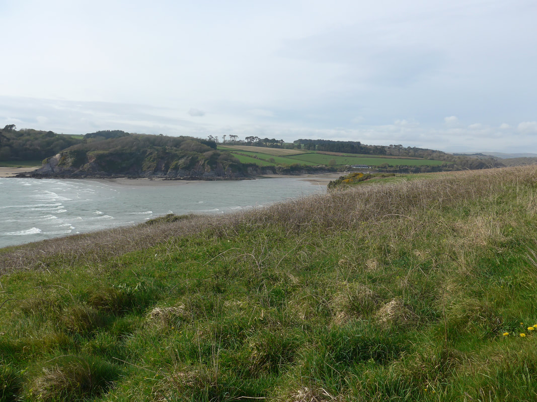
River Avon

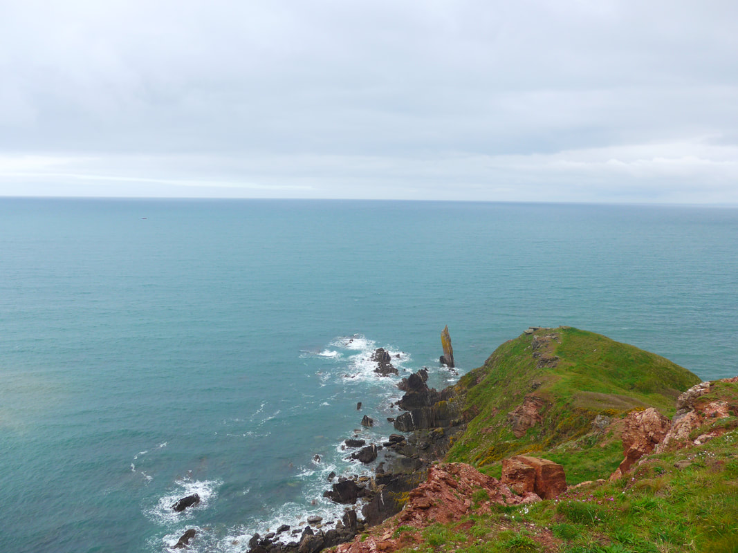
 Cliff below Ringmore
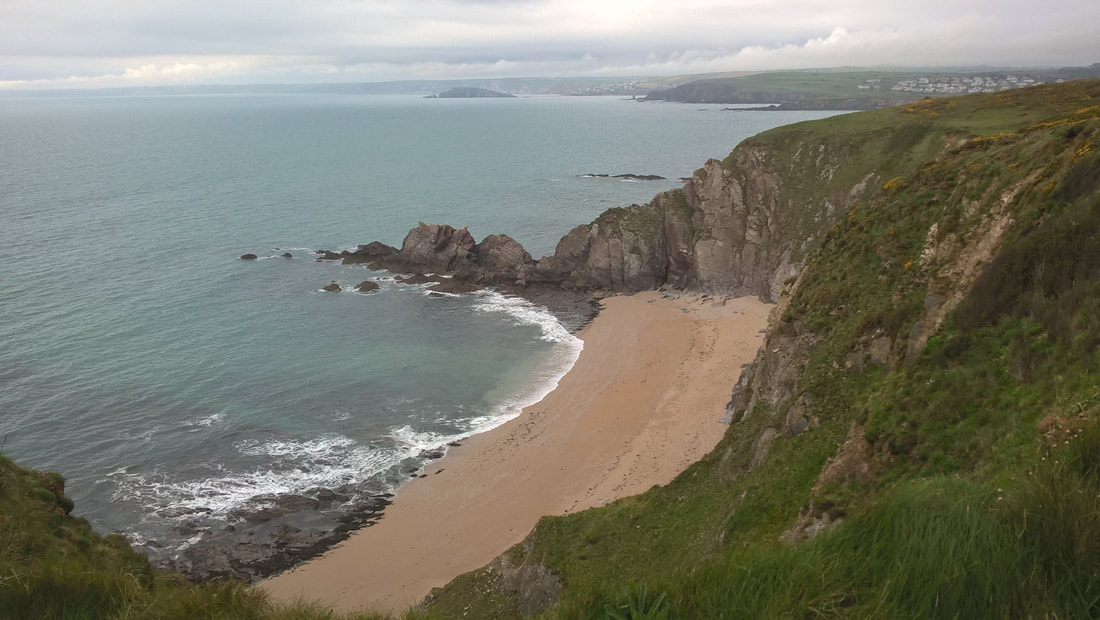
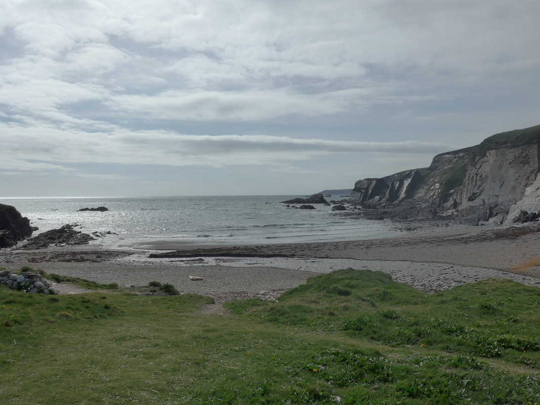
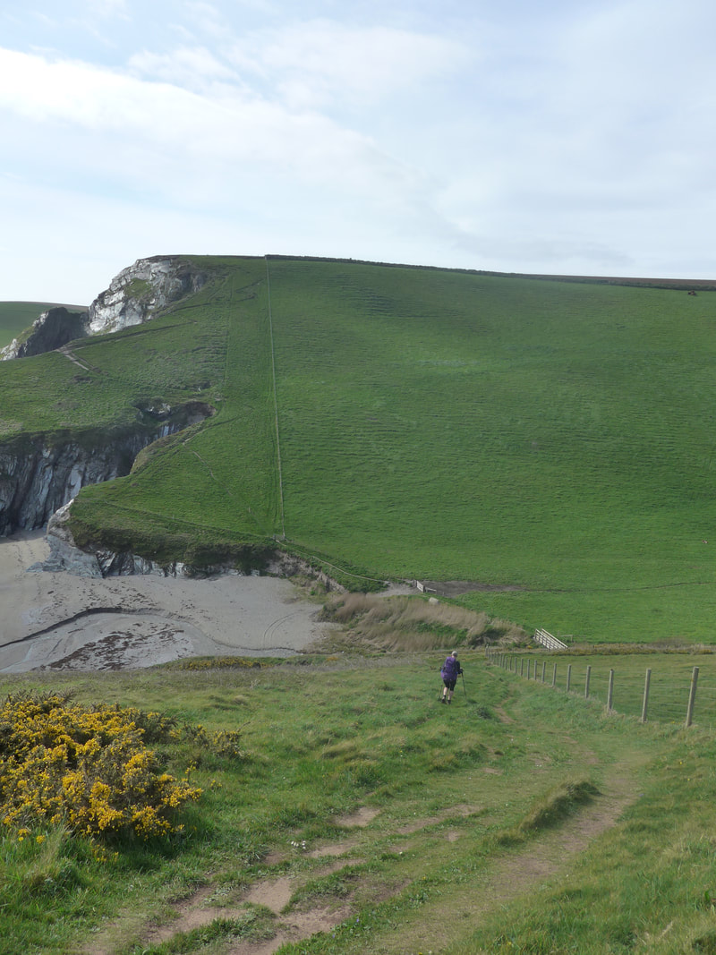
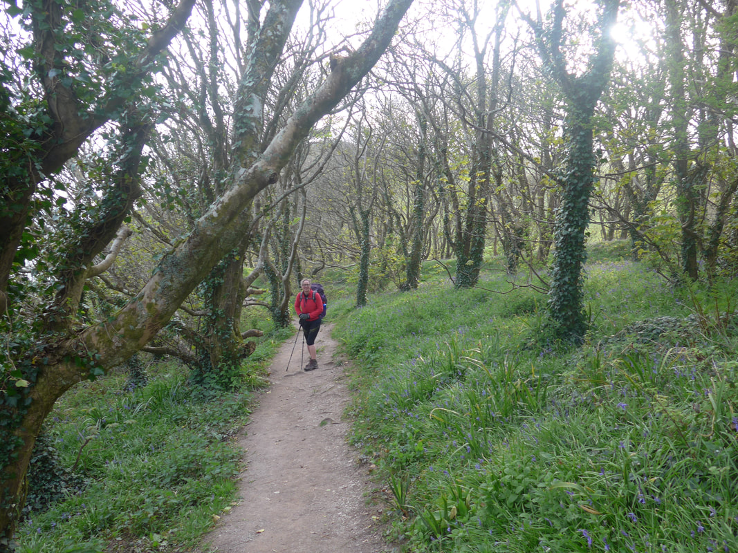
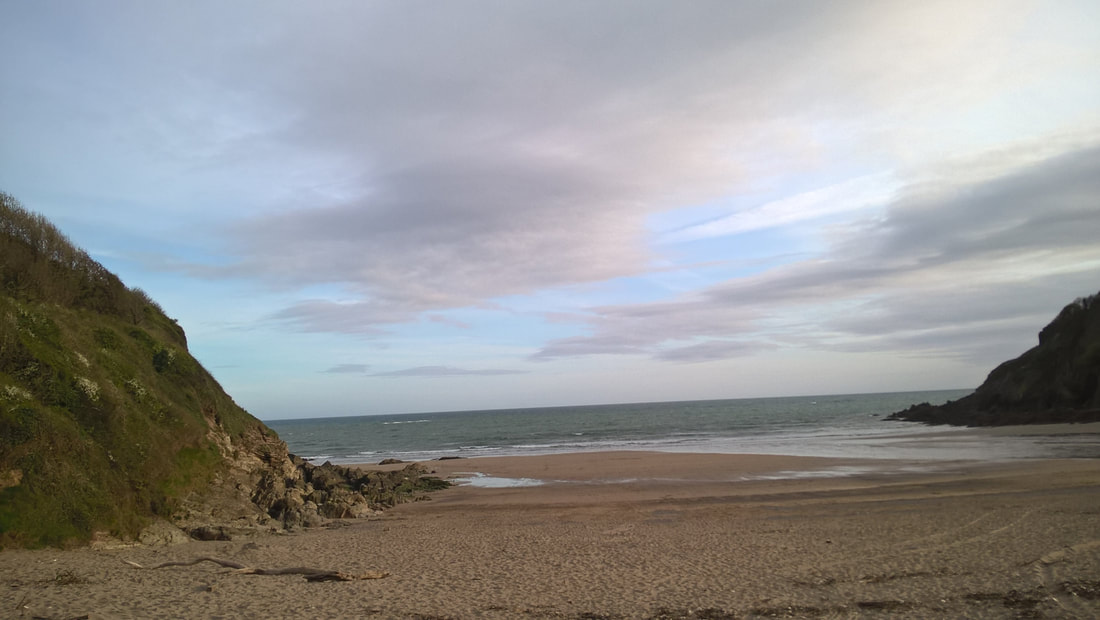
 From the Beach at Bigbury there is a steady rise as you go past Challacombe Caravan Park to go above Toby's Point, then a drop down to the lovely Ayrmer Cove. While we would have liked to linger in some of the area you pass through on this walk, with less than three hours to reach the River Erme, we could not take the chance. Once we had the height, we could see our walk over the next few hours laid out in front of us, undulating and snaking along the cliff top. The verdant green of the grassland was an impressive colour and the view inland was what you would expect of typical Devonian countryside. There are a number of nice coves and bays here, a number of them in the care of the National Trust and it would be interesting to base yourself here for a couple of days and just explore.


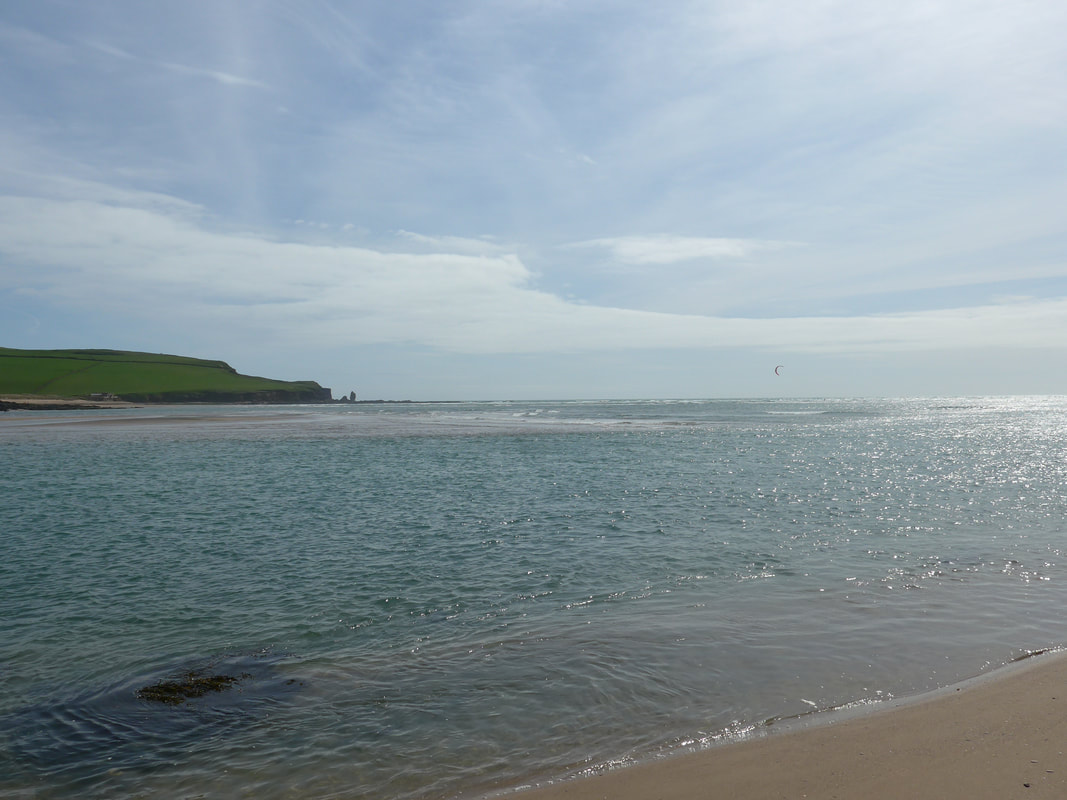
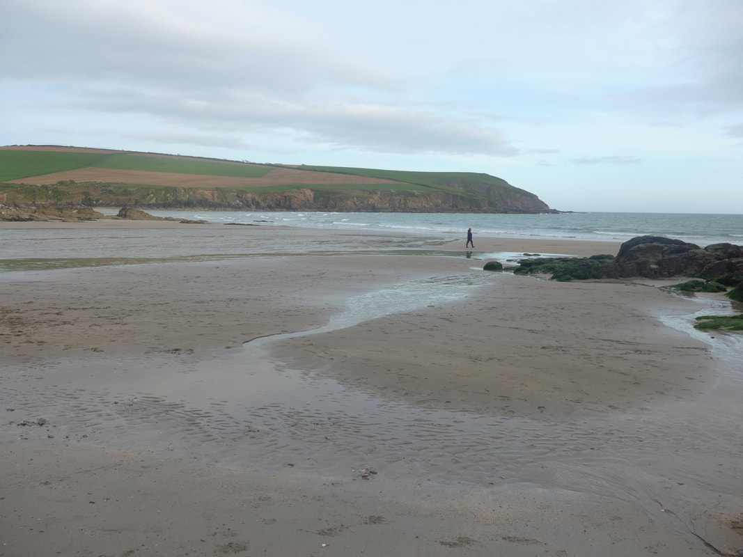
 Mouth of the River Erme
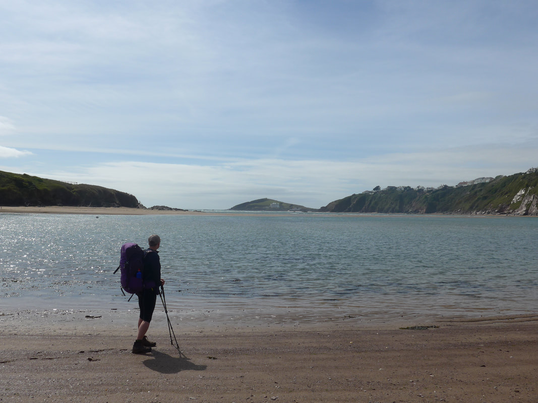
 Towards the end of this stretch it was starting to feel like a hard day. The cold had crept back in and the rain was on and off as we crossed the open countryside. There is a nicely placed bench at the top of the Beacon and I just didn't have the heart to pass it by. While Joanna charged on, worried about the time for crossing the river, I just gave up and sat in quiet contemplation for ten minutes. From my vantage point I could see over the hills to the mouth of the Erme and knew we could not be too far away but when you are tired, you are tired. Still, as I sat there the wind was cutting me in two and it was only doggedness that made me persevere. However, despite the tiredness, the quickness of my recovery held the promise that we were becoming used to the miles and the slopes as the journey moved on. Dropping down from the Beacon and moving on, we were soon approaching the last headland on this side before turning in to the river. On the opposite bank, a couple of bays round, we thought we could see the white of Battisborough House, our destination for the day and that lifted our morale.
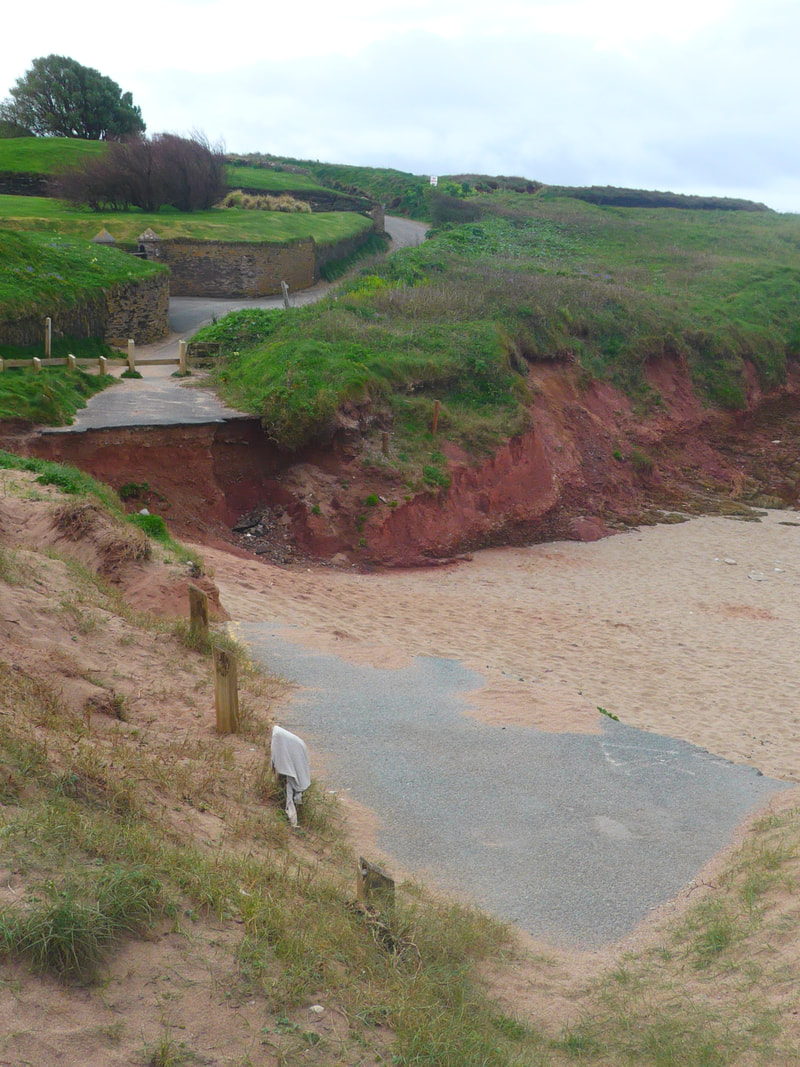
We were briefly walking on the beach, before turning along a woodland path. On the map it looks no distance at all to the ford point on the river. On the ground, after a long day and a 'yomp', it seems a lot longer. Each corner we turned and each rise we breached, we expected to find a sign post heralding the crossing. Eventually, we spoke to two ladies out exercising their dogs, who just pointed to the side of us where there was a sign just a few yards down a wee path. They advised us that with the moving sands on the river, the crossing point can move regularly so to take care and check the depth when crossing. We could easily have missed the sign, as head down and charging on we are sometimes not the most attentive.
As we moved to the ford we stopped to remove boots and socks. We could see the tide was on the turn but it did not look too deep and as we took the plunge, me first and then Joanna Elizabeth, we were relieved to find that at its deepest, it only came to our knees. Despite the shallowness, on the second, deeper part of the river there was a bit of a current and you could feel it tugging at your legs as you walked. The botton of the river beds is rocks and stones and it was occasionally a little bit difficult to keep your balance. I was glad I had worn a pair of Merrells to cushion my feet and using one walking pole was really handy. The water was absolutely freezing and our legs and feet (and hands, curiously) did not recover until much later when we were settled in to our accommodation.
As we moved to the ford we stopped to remove boots and socks. We could see the tide was on the turn but it did not look too deep and as we took the plunge, me first and then Joanna Elizabeth, we were relieved to find that at its deepest, it only came to our knees. Despite the shallowness, on the second, deeper part of the river there was a bit of a current and you could feel it tugging at your legs as you walked. The botton of the river beds is rocks and stones and it was occasionally a little bit difficult to keep your balance. I was glad I had worn a pair of Merrells to cushion my feet and using one walking pole was really handy. The water was absolutely freezing and our legs and feet (and hands, curiously) did not recover until much later when we were settled in to our accommodation.
After our crossing we had about another half hour walk round the headland at Owen's Point, down on to Meadowfoot Beach and past another of the turreted beach houses. On Owen's Point we went through a nice, aged forest section where in the fields off to our right the new spring lambs were bonking about the field in an expression of joy that transmitted itself to us. Battisborough Field Study Centre is located at the top of a combe running up from the coast and it took about ten to fifteen minutes to complete the walk up. It fair gladdened the heart to see it rise up out of the gloaming and we eventually finished our day at 7.10pm.
It was a long and hard day, but with some terrific walking, a sprinkling of adventure and a wee bit tension thrown in to make sure it was exciting. The field study centre rent out a newly fitted, twin-bedded room that has kitchen and toilet / shower facilties and is very comfortable. There was even a washing machine. We found it on Airbnb and its is worth considering if you want to cross the two rivers in one day. Before too long, showered and cleaned up and fed with a meal of fresh pasta and green pesto, ciabbati bread and a nice salad, we were able to lie back and relax and cogitate on the highlights of the day.
 RSS Feed
