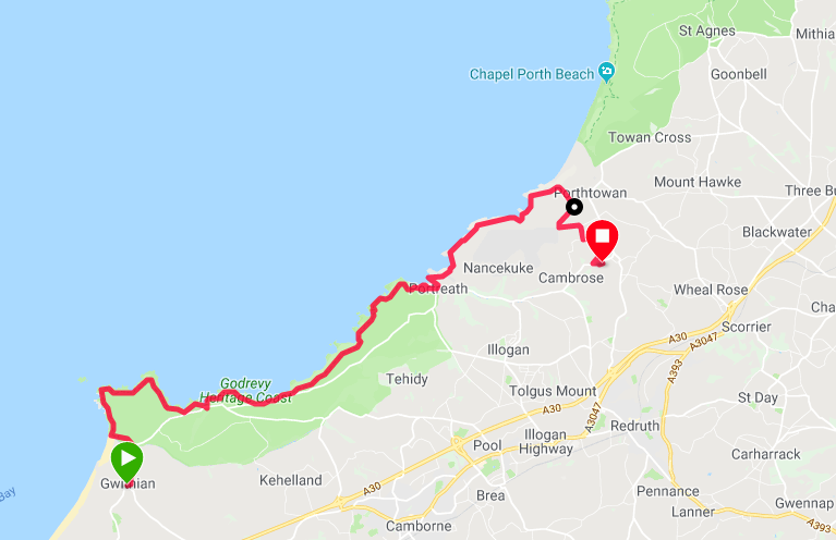
Route Map
We camped up last night at the village of Gwithian where we were very comfortable in the Gwithian Farm Campsite. After a nice meal at the local pub we returned to bed down for the night, walking back to the tent in light rain that stayed on for most of the night. When we woke this morning it was cold and misty and we had a bit of a time drying and packing up the tent. As we started off on the day's walk it was in full regalia of coat, hat and gloves, albeit the waterproofs stayed in the bag for the time being.
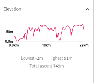 Walk Profile
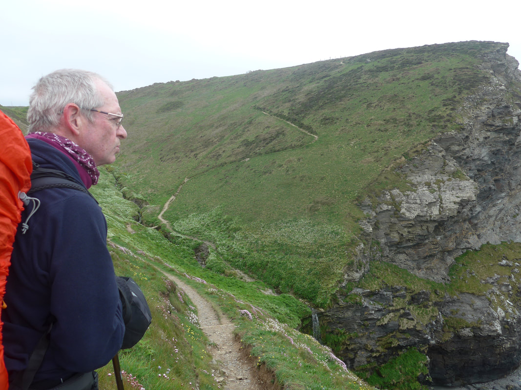
 The route for today starts off fairly easy as we retrace our footsteps of yesterday to return to the coastal path from the village. Very quickly, however, we start a series of rises to take us over Godrevey Point and from then on it is a rollercoaster day as we progress along the coastal cliffs. For most of the day we will stay on the coast, only going inland at the village of Portreath where we need go round the harbour. The day finishes with a climb up on to the Nancekuke Common where we will need to go round the old airfield and then walk a couple of miles inland to our campsite at Laity Moor. The weather forecast is not brilliant but does not contain heavy rain, which is good, albeit cold, windy and overcast is the best it gets.
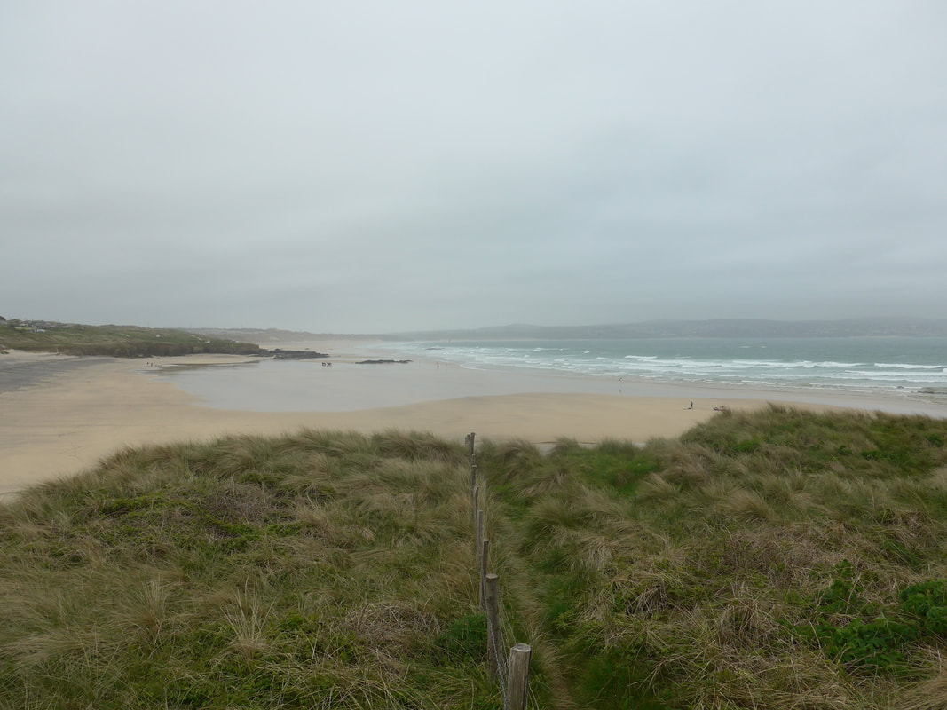 St Gothian Sands across St Ives Bay
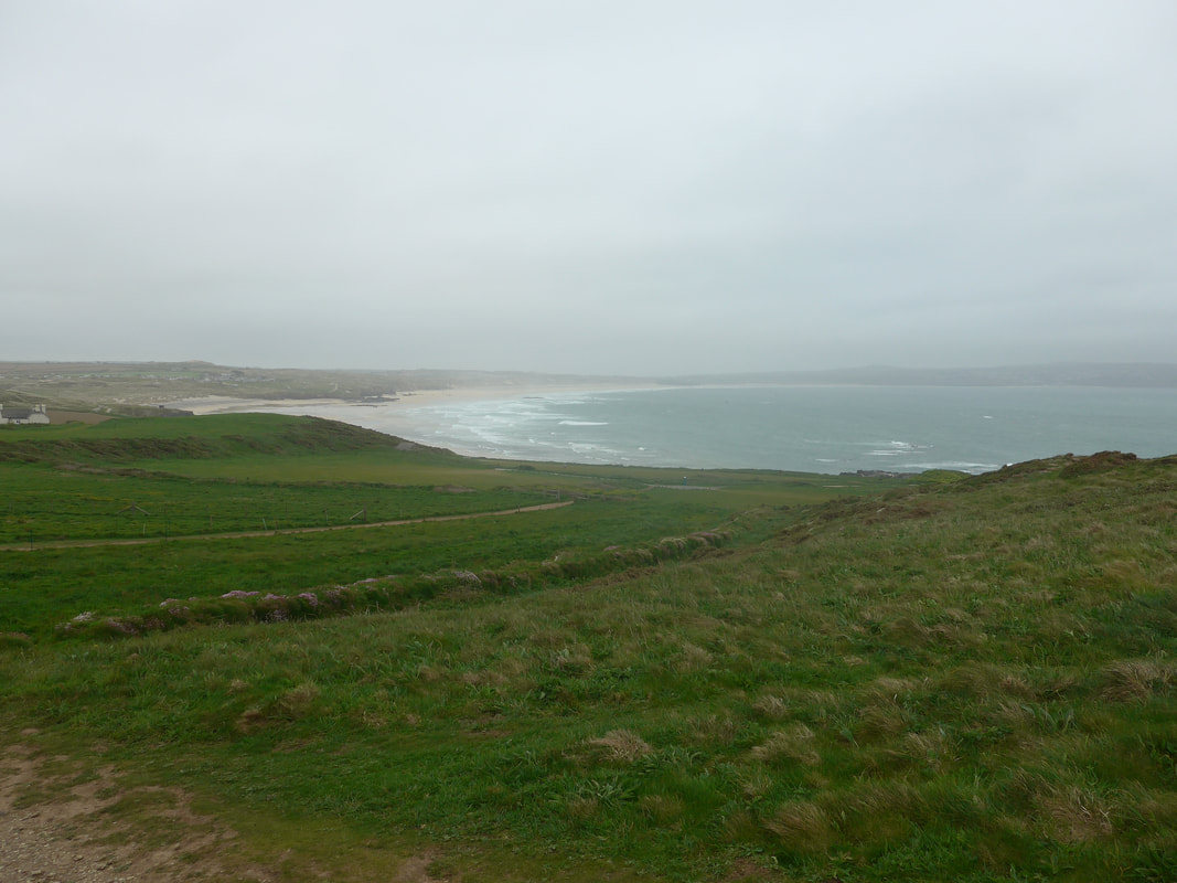
 It was still cold and misty as we hit the beach at St Gothian Sands and on first view we thought the beach was empty. However, as we looked over the sands we could see one hardy family group at the top of the beach, kids playing happily in the sand, one young man already on the waves wind surfing and another preparing his rig on the beach. Brave men! There was a light mist over the sea but we could still see over to the impressive coastline around St Ive's Bay and over to the town of St Ives itself. As we moved away from the sandy beach and on to the rockier shoreline the fierceness of the seas became more obvious. At the end of the beachline the land rises to above Godrevy Point and the walk up was delightful with the hillside full of the small, pink blooms of Sea Pink (Armeria maritima), also commonly known as Sea Thrift.
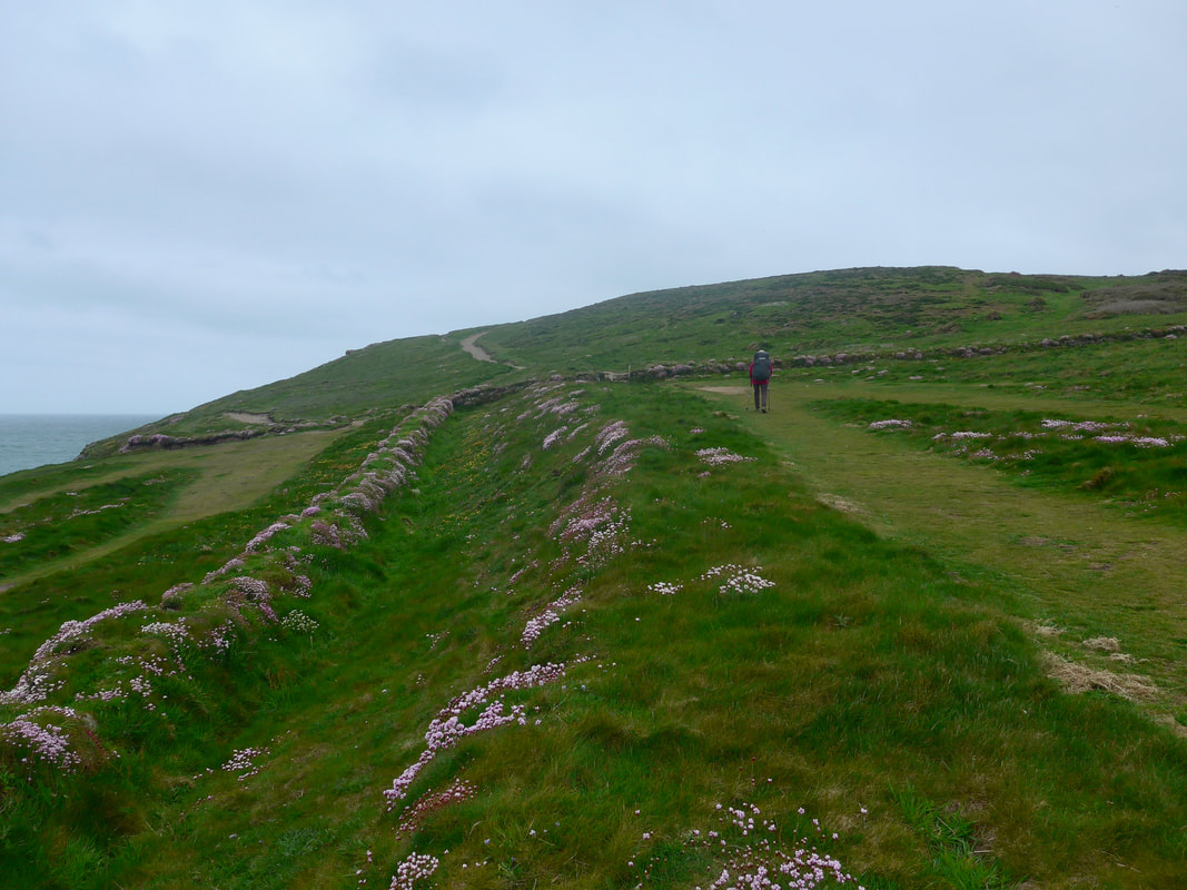
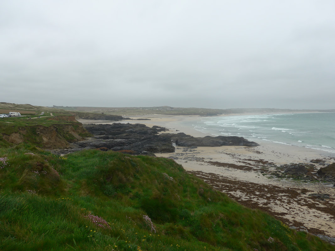 Across St Peter's Point to Gothian Sands
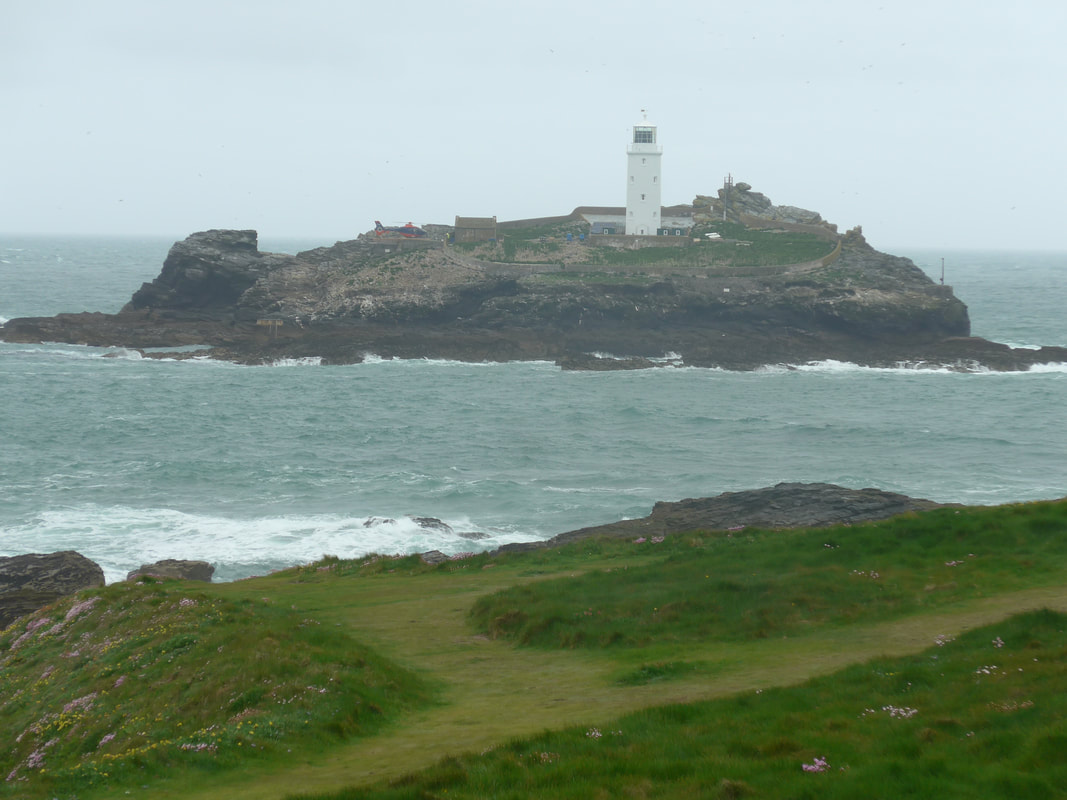
 As we approached the hilltop we stopped to watch a helicopter delivering supplies to the Godrevy Lighthouse, which features in Virginaia Woolfe's book 'To the Lighthouse'. The force of the wind over the island could be ascertained from the manouvering required to land the craft. It was thrilling for us to watch as the wind tried to turn the helicopter each time the pilot approached and it took a couple of attempts before it was successfully landed. Against the backdrop of a slightly stormy sea, the island and the lighthouse, it was a fine sight.
The white octagonal tower of the twenty-six metre high lighthouse was built in 1859. It was originally manned by a team of three men, with two required to be on station at all times. The normal rota was two months on and and one month off. Following changes in 1934, the keepers were withdrawn and the light function was automated. The light system was modernised again in 1995 with the installation of a solar powered lamp and finally in 2012 the light was moved to a ore modern steel structure on one of the other rocks. All functions are now monitored and controlled from Trinity House in Harwich, Essex.
The white octagonal tower of the twenty-six metre high lighthouse was built in 1859. It was originally manned by a team of three men, with two required to be on station at all times. The normal rota was two months on and and one month off. Following changes in 1934, the keepers were withdrawn and the light function was automated. The light system was modernised again in 1995 with the installation of a solar powered lamp and finally in 2012 the light was moved to a ore modern steel structure on one of the other rocks. All functions are now monitored and controlled from Trinity House in Harwich, Essex.
 Whispers
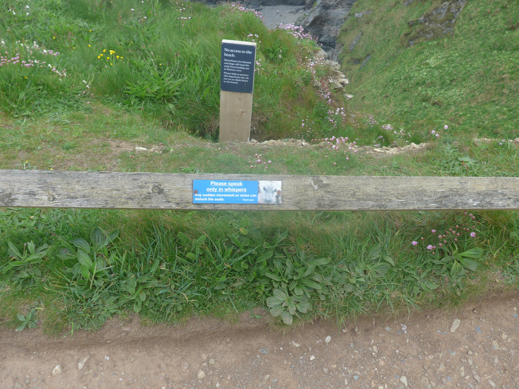
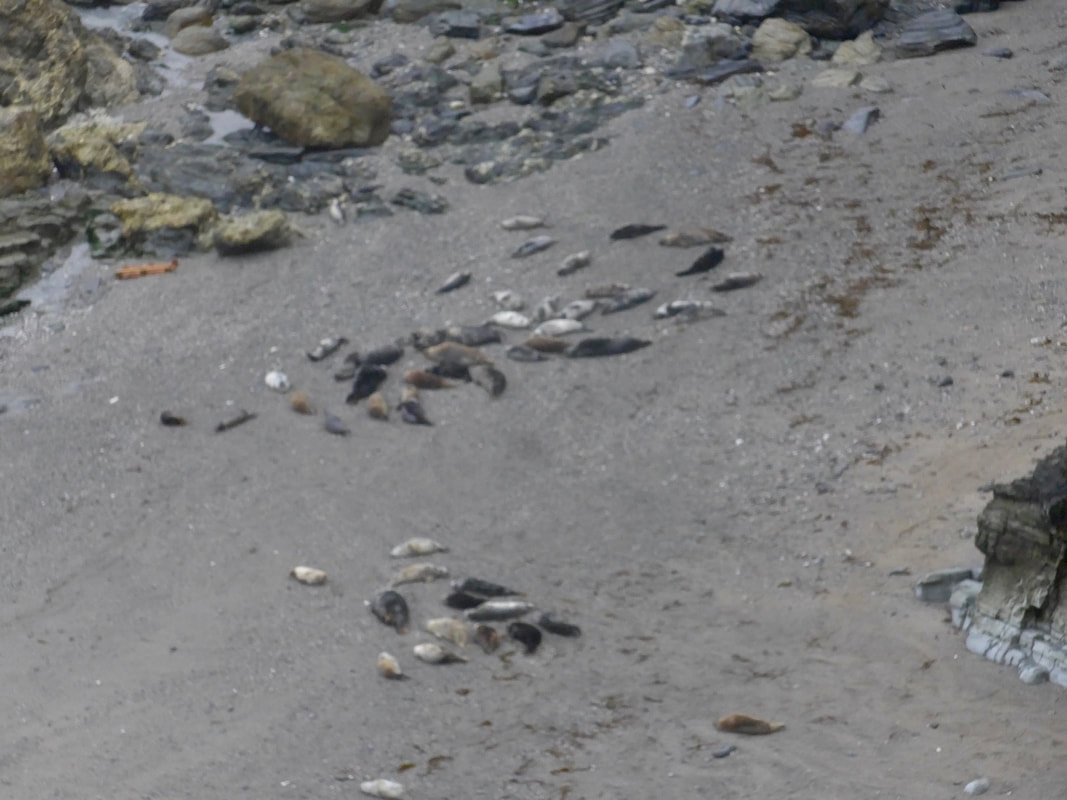
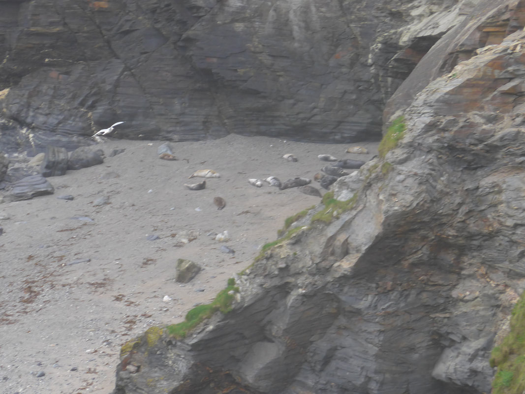
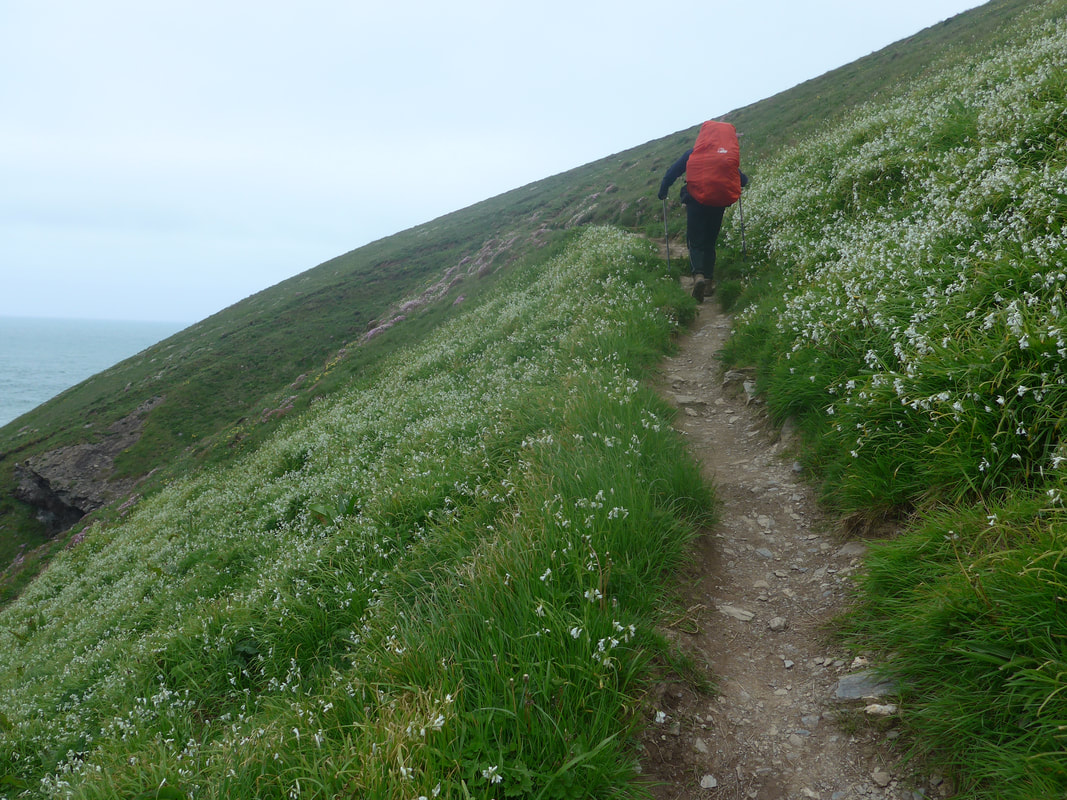
 From Godrevy Point we walked across the short stretch of moorland that connects to Navax Point and the area of heathland known as The Knavocks. On this stretch you pass by Mutton Cove, which has a resident seal population, usually visible at low tide. For once we were lucky to be passing with the waters out and were had good views of about fifty seals sleeping peacefully on the shore. We were tickled by the signpost at the side of the path whoch asks you to only 'speak in whispers'. Righ enough, as we watched another person walking up kicked a stone and that was enough for the seals to be up and heading for the sea. It is curious because in other areas, oarticularly in Kent, we have passed by with the seals almost at arms length and it has not bothered them. Cornish seals are obviously of a nervous disposition.
Mutton Cove Seal Colony
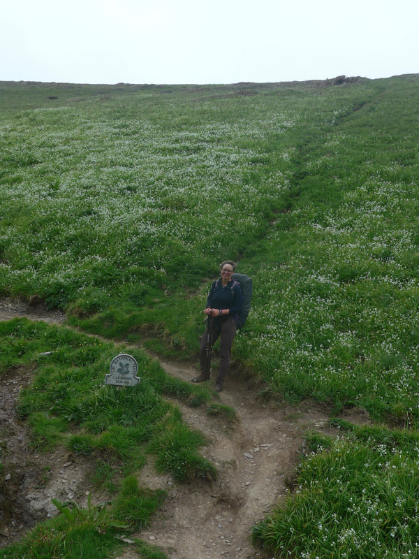
 From The Knavocks
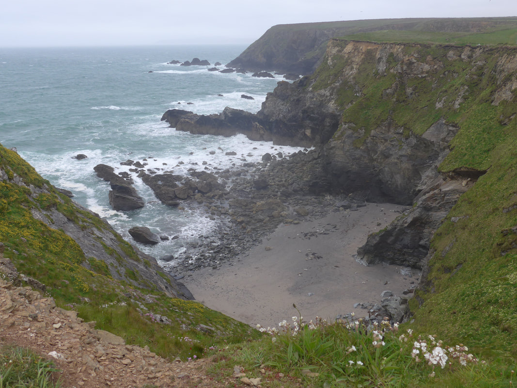
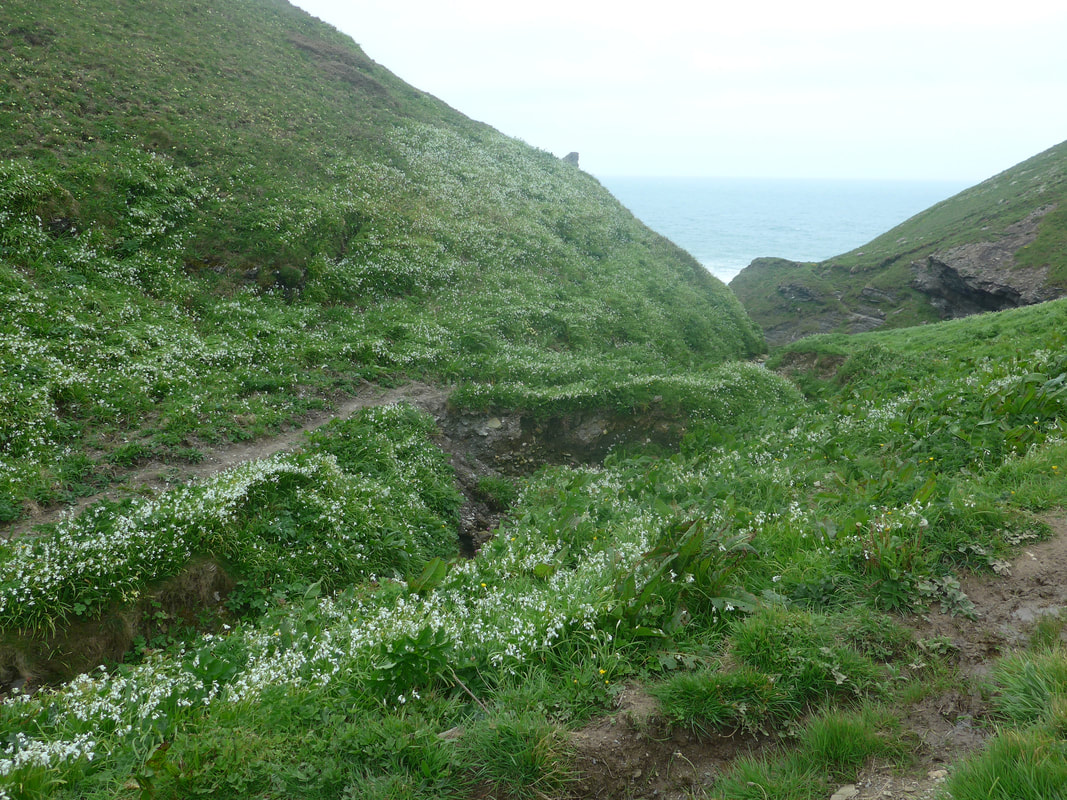
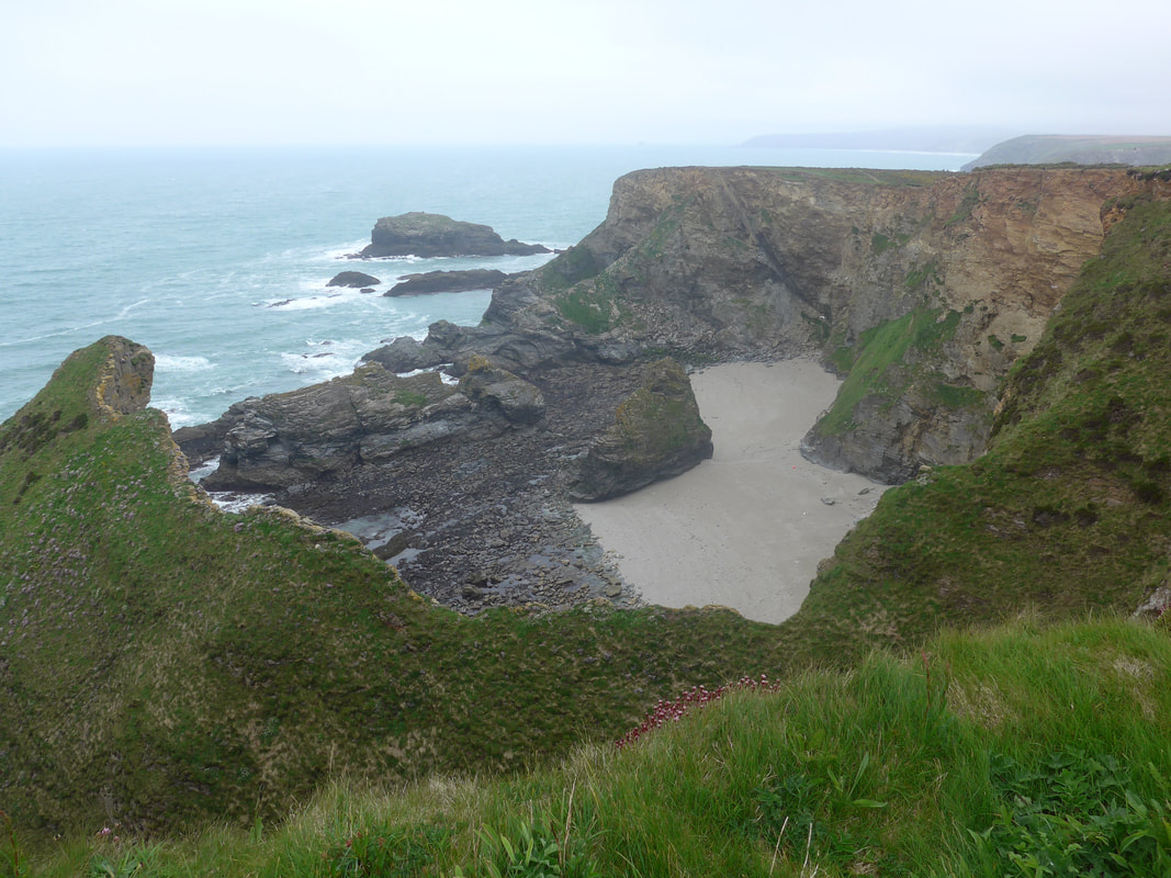
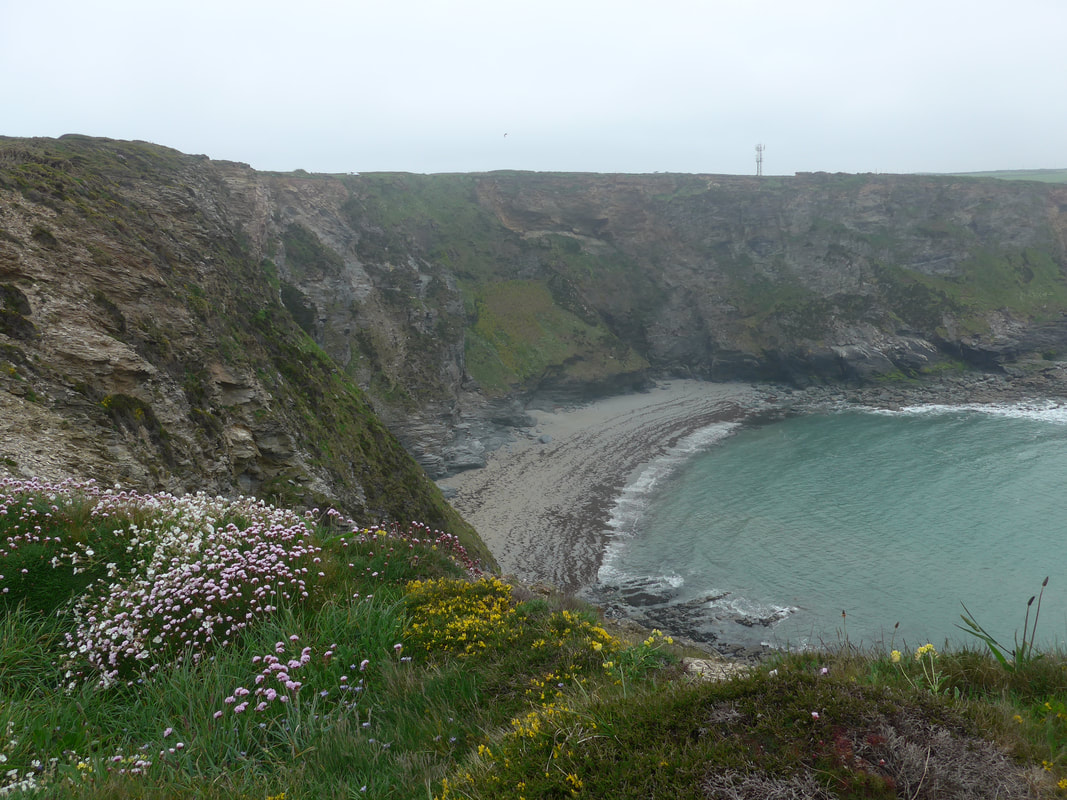
 The From Mutton Cove we moved down slightly to Kynance Cove and then climbed up to the high ground to move on to and across The Knavocks. On this stretch of coastline there are numerous small bays and coves below the cliffs, wild flowers in abundance and as we walked we could hear the call of the Stonechat drift across the heathland. We stopped for a bit at the rock feature know as Hell's Mouth just to take in the grandeur of the land and seascape. This is a wonderful rock feature, the base of the cliff laced with caves, making it easier to understand how sections of the cliff can be undermined, making rockfalls and landslips more likely. In 2011 a jogger reported to the local council that a large crack had appeared on the path. The local council diverted the path and instigated an assessment of the situation over the following couple of days. Subsequently, on 23 September 2011, this dramatic rockfall was caught on camera by two engineers from the council. The whole event took about twenty seconds. Moving a little closer to the edge, we could see lying below the cliff immediately to our right, a pile of rubble from what we think must be a more recent recent cliff fall (think it was more recent than 2011) reminding us again of the dangers of coastal walking.
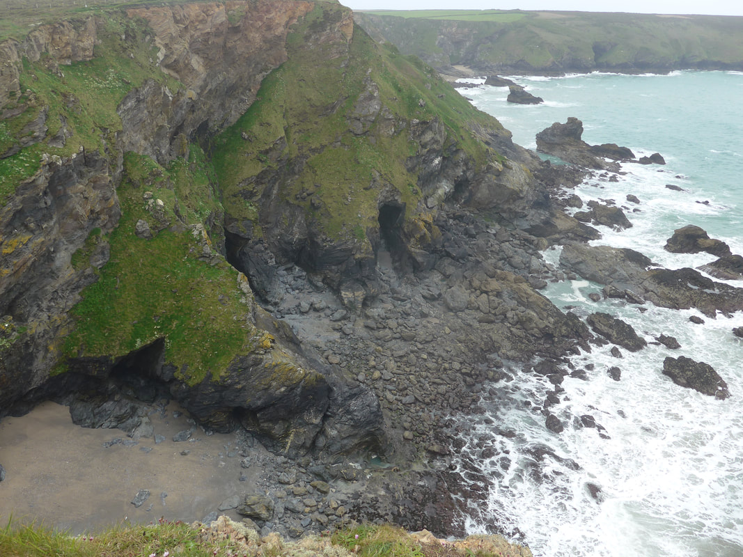
At Hell's Mouth the trail almost reaches the side of the B3301 on the opposite side of which is the Hell's Mouth cafe. Never ones to pass up an opportunity we stopped and enjoyed a nice, late breakfast. After breakfast and back on the trail, we regained height going up to Hudder Down and on to the long Reskajeage Downs that run up to the Carvannel Gully, on the other side of which you begin the approach to the village of Portreath. The approaches to and from the gully were stunning on the day we walked through. To enter the gully there is a long set of stairs and to exit a steep climb up a rubble path.
With just the right level of wildness to the sea, the breakers were cracking white over the rocks, while the hill on the far side of the gully was awash with white from the wild garlic, which also heavily perfumed the air. On exiting from the gully on the slightly higher levels Sea Pink was both running down to the cliff edge and reaching upwards to the sky as it raced up the hill. At the bottom of the gully on the shore of Porth-cadjack Cove huge, round rock features studded the shore, just in front and to the west of Samphire Island. With the tide out there was a small area of dark sand and shingle at the top of the beach and a rockier foreshore but I understand it all disappears at high tide.
With just the right level of wildness to the sea, the breakers were cracking white over the rocks, while the hill on the far side of the gully was awash with white from the wild garlic, which also heavily perfumed the air. On exiting from the gully on the slightly higher levels Sea Pink was both running down to the cliff edge and reaching upwards to the sky as it raced up the hill. At the bottom of the gully on the shore of Porth-cadjack Cove huge, round rock features studded the shore, just in front and to the west of Samphire Island. With the tide out there was a small area of dark sand and shingle at the top of the beach and a rockier foreshore but I understand it all disappears at high tide.
Carvannel Gully
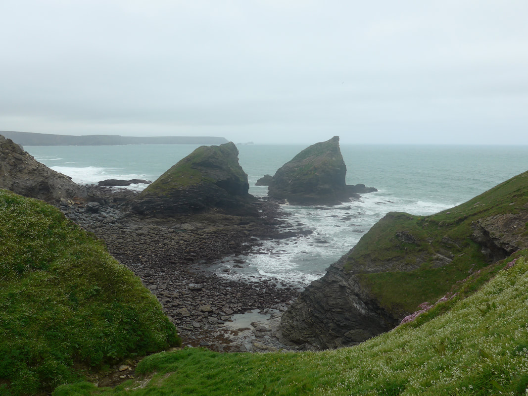
 Gull Rock
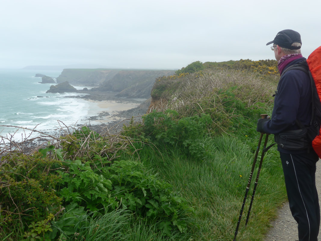
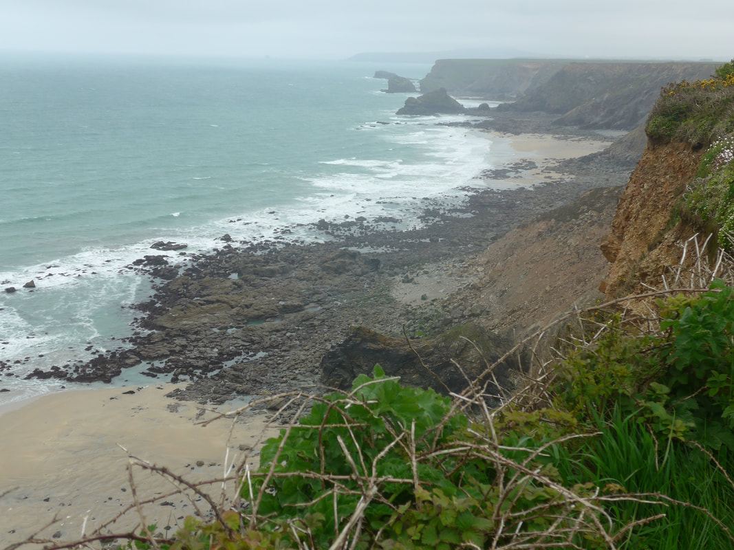
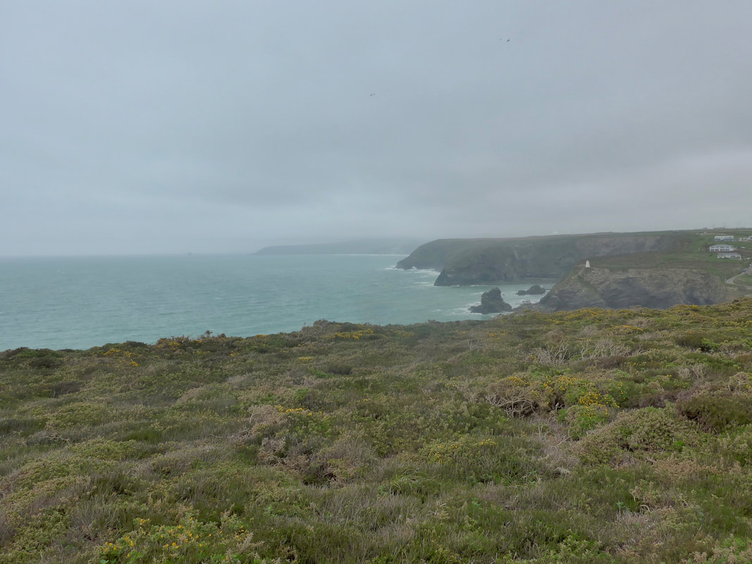
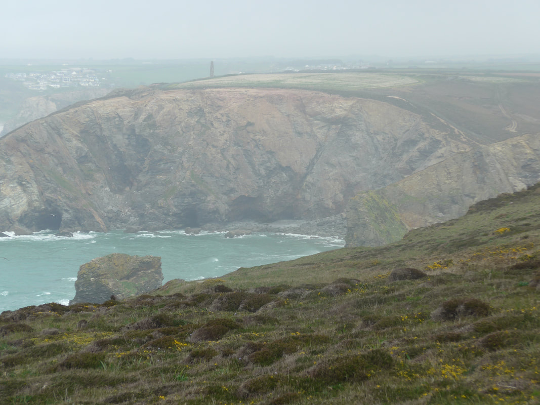
 Regaining the high ground after the gully, we had great views across Western Cove and out to Gull Rock. Looking back Porth-cadjack Cove had opened out and we could see all the rock features, beaches, coves and bays that lie along the shoreline, including Samphire Island. With a slight sea mist moving inland and the heavier seas churning the waters, the sea had a very light and unsual white-washed green tone to it that I found very attractive. High up on the hill one of the larger birds of prey was going round in big, lazy circles, effortlessly riding the thermals. Just in from Gull Rock there was a lovely little protected cove that at low tide would offer you a nice, private area for sunbathing. There is an officially registered naturist beach on this stretch of coastline somewhere, possibly at Greenbank Cove, I believe but this little cove also has its attractions, as long as you were alert to the presence of walkers.
 To Horse Rock & Portreath Pepperpot
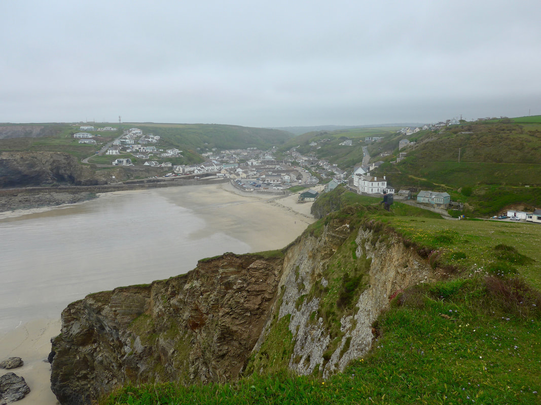
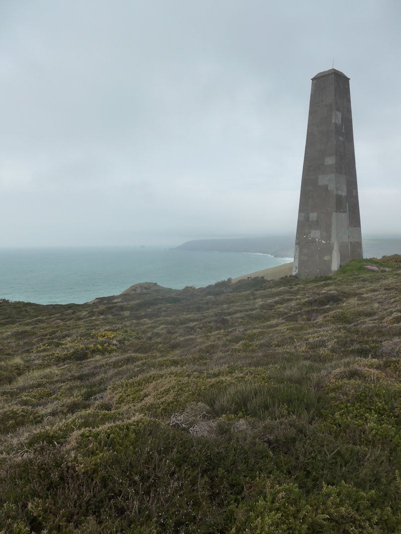
 Continuing along the heathlands of Carvannel Downs, approaching Western Hill, we enjoyed nice views across the mouth of Portreath Beach, with Horse Rock off the headland and the little, white Portreath Pepperpot light on the headlands itself. Through a break in the hills, we could see the white houses of Portreath on the other side of the harbour marching up the hill. The main village was sitting just back off the beach at the bottom of a small gully that runs down from Laity. We decided to stop for lunch in Portreath which we bought from a little sandwch shop just behind the beach. We set ourselves up on a picnic bench just above the sand and happily sat just watching the waves. While it was slightly chilly by the bench with a cold wind coming in off the sea, it was such a delight to be sitting without the boots on that we lingered, and lingered, and then lingered some more.

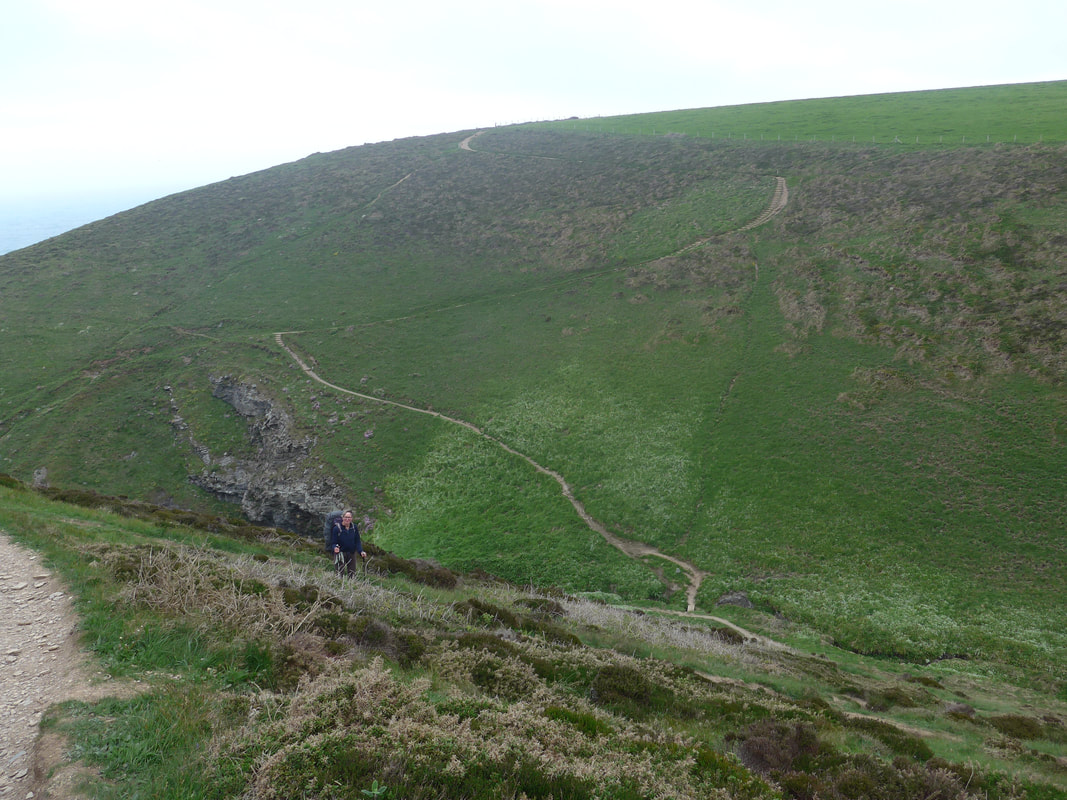
Eventually, we were able to drag ourselves back on to the trail to take the steep road out of Portreath heading, we thought to go above Horse Rock. However, when we turned the corner at the top of the road there were diversions signs in place and we had to continue on up the road for about another half a mile before we found the path to take us back to the coast. We re-joined just above Gooden Heane Cove to beging our walk up to and across Nancekuke Common. Coming late in the day, this section included the hardest and steepest climbs of the day as we made height to get on to the common. The landscape here is scarred in places by its industrial past, the remains of old mine workings dotting the landscape.
 Climb to Above Sheep Rock
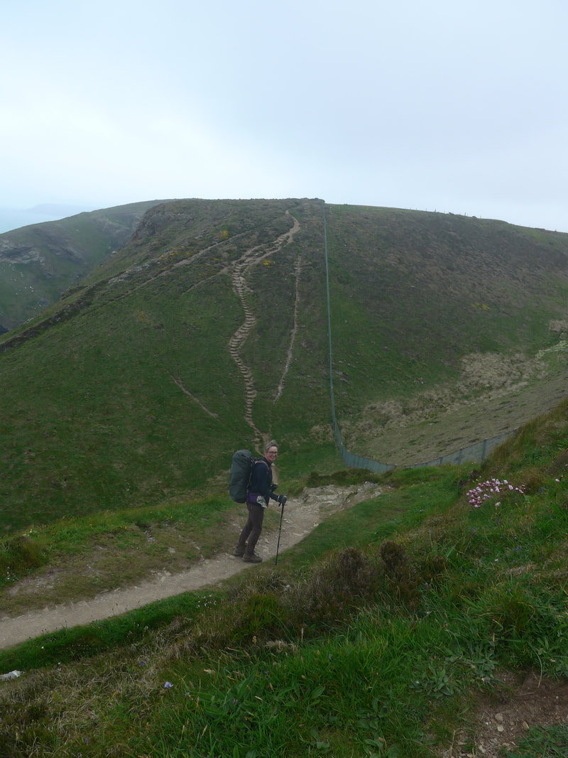
 For much of the walk here you are walking along the fence of what was RAF Portreath, which is completely ringed by modern fencing. As you walk along the miles of it you cannot but wonder what the cost must have been? You can see the fence running up and over the hill on the photograph to the left.
Over the years, the airfield has had various uses including as an RAF Fighter Command Station and a refuelling stop for the American Airforce. Most controversially, it was used to experiment with the production of chemical weapons in the 1950's, with quantities of Sarin Gas being produced and stored there. Production of chemicals is thought to have been stopped in 1956, but it was not until 1976 that the base was decontaminated and handed back to the RAF for whom tt still functions as a remote radio station. The base is closed to the public but interestingly, as you walk round the perimeter of the base, as we did, you can see that there is farming activity on the base, with crops of some kind being grown commercially. I don't know about you, but it widnae be me!
 Across Sally's Bottom & Wheal Tye Chimney
 From Gooden Heane Point there are two steep climbs and one steep descent to be managed. The first climb, which takes you to just above Sheep Rock, has a fair number of wooden steps to assist, but oft times, because of the inconsistent nature of the depth of the steps, you are better to take the earth path at the side. Personally, I persevere using my poles to negotiate the steps until I am too tired to lift the legs, then I use the path. From the top there is a drop down to just above Gullyn Rock and Sally's Bottom beach from where you have a good view of the next steep climb up the hill across the cove. On top of that hill you can see the outline of what I think is the Wheal Tye mine chimney. As you come closer to it, on the seaward side, the huge, long flue for the chimney runs down the hill.
 Wheal Tye Chimney
 Shortly after passing the Wheal Tye chimney, we cut inland to head for our campsite at Elm Farm, Laity Moor. It was a walk of a couple of miles that we could have avoided by going to another campsite but we had read good things about the place and wanted to see for ourselves. We contintinue to follow the fence round the base to the front gate, where we contiued to zizg-zag round the country lanes. We arrived just before the camp shop and cafe closed, still in good time to enjoy coffee and cake. The owners were very friendly and kept the place open for us while we enjoyed our refreshments and then showed us the bicycle hire shop.
The pitches were just across the road and down a short hill and were nice and flat and dry. We picked a spot close to the trees where we would have protection from the wind and once we were set up, set off to use the showers. The shower buildings were like little wooden chalets and, while it was slightly disconcerting to notice the gaps in the wood panelling, the fact that we had the place pretty much to ourselves meant it was not a problem. A nice wee touch was the solar fairy lights that were wrapped around the toilets.
After showering, we returned to the tent and made tea and then were happy to sit back and listen to the songbirds in the trees and hedges sing us a nightime lullaby.
 RSS Feed
