 Eden Estuary
 18-10-2014
Lying in bed in the early hours of the morning before a walk, listening to the tattoo beat of the rain drumming on the roof of the house does not engender enthusiasm for outdoor activities. The temptation is to pull up the duvet and rollover for another wee nap. Had we done so we would have missed out on some really nice, slightly challenging coastal walking, full of social and geological history.
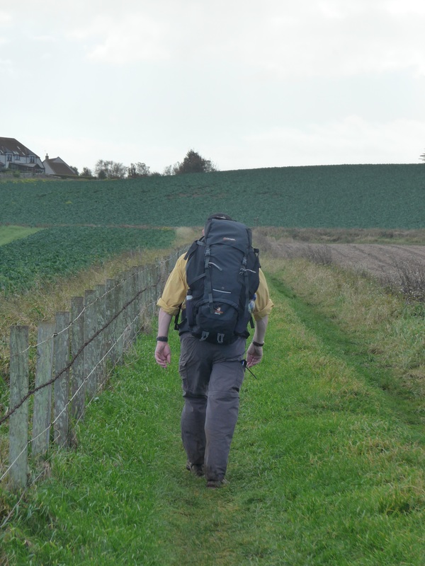
As in the previous walk, transport arrangements for today were slightly complex. After an early start (06.00) Joanna dropped me off at ‘The Clock’ at Guardbridge for my five-mile walk in to St Andrews while Joanna drove off to park the car in distant Crail and then take the number 95 bus back to St Andrews to meet up with me at the golf museum.
Lying in bed in the early hours of the morning before a walk, listening to the tattoo beat of the rain drumming on the roof of the house does not engender enthusiasm for outdoor activities. The temptation is to pull up the duvet and rollover for another wee nap. Had we done so we would have missed out on some really nice, slightly challenging coastal walking, full of social and geological history.
As in the previous walk, transport arrangements for today were slightly complex. After an early start (06.00) Joanna dropped me off at ‘The Clock’ at Guardbridge for my five-mile walk in to St Andrews while Joanna drove off to park the car in distant Crail and then take the number 95 bus back to St Andrews to meet up with me at the golf museum.
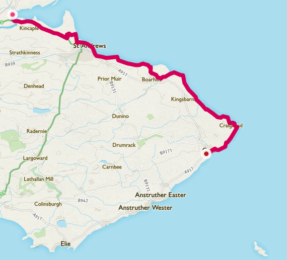
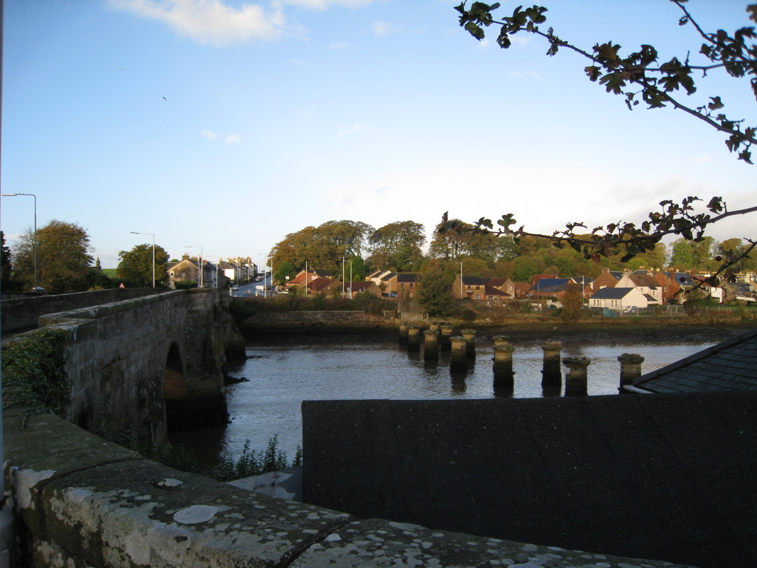 Bridges
 The walk from Guardbridge to St Andrews is, for the most part, uneventful, following long, straight stretches of the A91 road. An interesting feature as you leave Guardbridge is the 3-bridge crossing over the River Eden (albeit the rail bridge is nowt now but the circular, paired piers from an iron girder bridge).
As you approach the bridges from the St Andrew's side of the village the remains of the rail bridge (1852) is on the right; the Gair Bridge (15th century) is in the middle with the newer road bridge (1939) on the left. The rail bridge was victim to the 1960’s Beeching cuts and was subsequently dismantled. The Gair Bridge, by far the most interesting of the three was built in the mid- 15th century under the direction of Archbishop James Beaton (1473- 1539) of St Andrews. Signage at the bridge notes that the crossing was an important stopping point for pilgrims on their way to St Andrew’s town. Much of the labour to build the bridge was said to have been provided free as the church offered what were called ‘indulgencies’ to workers, which were thought to limit the amount of time spent in purgatory. Whatever you do, don't let Iain Duncan Smith (Secretary of State for Work & Pensions) know about this or it will, in all liklihood, appear in the next Tory manifesto.
If you are interested in other images of the bridges, including one of the railway bridge in all its glory and, one of a Tornado aircraft from nearby Leuchars Airfield over the bridges, see here.
For walking the Fife coast we purchased the official Fife Coastal Path book and map. While they both adequately show the route of the path and the book has lots of interesting contextual information about some of the features along the walk, we were happier also having the Ordnance Survey (OS) Explorer (1: 25,000 scale) map (No 371). The official map and book shows you only the official route and we found that this limits your capacity to deviate from it. With the OS map, which is much more detailed, you can see all the other roads, lanes and tracks that cut across and run parallel to the official route and it indicates additional interesting geological and historical features.
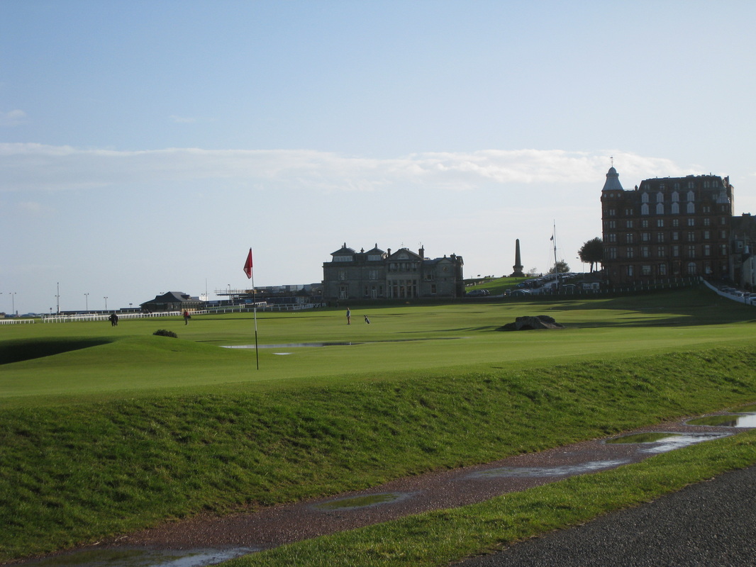 Old Course
 If you are a golfer, the walk in to the town passing St Andrew's golf course offers the opportunity to pay homage to some of the shrines of the sport. As you move forward from the edge of the town well known and famous features appear including signs paying respect to golfing heroes; the Old Course hotel; Swilkin Bridge; up ahead the 18th tee of the Old Course; passing by the caddie’s hut where the gowfer’s helper (or the drunkard’s labourer as I have heard them called) gather to tout for business. I particularly liked the large buildings on the course with grass roofs. But if you are not a golfer there is plenty more to interest you in this historic town.
 West Sands
 Having eventually found a way across the various golf courses, ducking and diving from golf balls hit less than straight, I enjoyed the long walk across the West Sands where there was a retreating tide. While I was tempted to give my impression of Eric Liddle’s famous run in ‘Chariot’s of Fire’ decorum won the day and I avoided the embarassment of being 'the auld geezer running'.
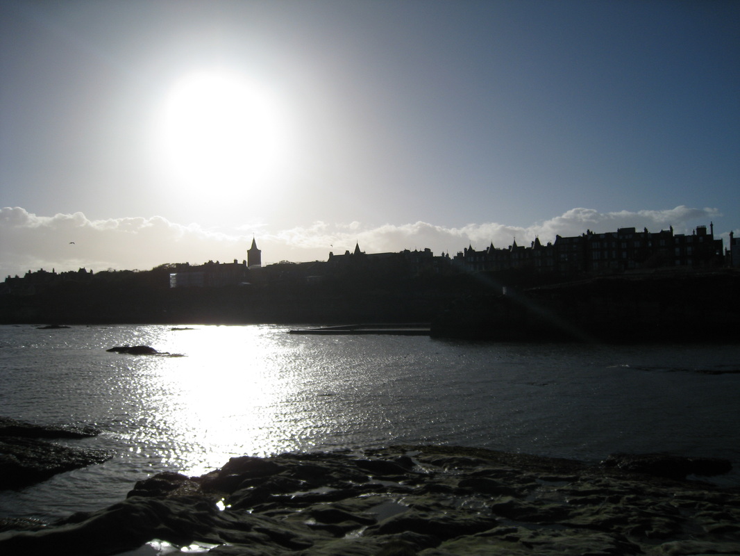 St Andrews
 The Old Town was in the shade with the sun at its’ back and the church towers in relief were pretty and dramatic. Below the aquarium I met up with Joanna and we made our way up to the Scores, heading towards the East Sands and in the distance, Kinkell Braes.
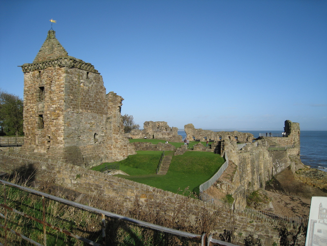 Castle
 Passing through the Scores and beyond it is easy to imagine the historical St Andrews of medieval times. In quick succession you pass the ruins of St Mary’s on the Rocks; the castle and later the remains of the cathedral with the magnificent St Rule’s tower.
For me the ruins of St Mary's, visible at Kirkhill just before the castle, while not so dramatic as the castle or cathedral, are the more enigmatic and mysterious. The ruins are part of that dark period of medieval history relating to the formation of Scotland as a nation and known as well for their status as the major Culdee (Celi De) church in Scotland. There is an excitement in their history that shouts about the birth of a nation, of Picts, Celts, Viking and Danes and murder and mayhem. My favourite Scottish king, Constantine II retired to the monastery here after ruling for an amazing forty three years. This is the time of Columba and the Irish mission, of the death knell of the old religion and acceptance of the way of Rome.
If you are interested in the history of this time, Alfred P Smyth’s (1984) book ‘Warlords & Holy Men: Scotland AD80 -1000' has not been bettered in my opinion as a very detailed introduction to a complex and troubled time. Difficult reading at times but only because it is so packed with factual information.
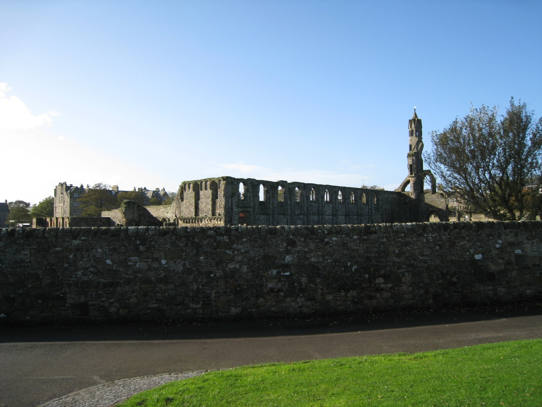 Cathedral
 Dropping down from the cathedral and through the wee dinky harbour we left the confines and history of the town to move even further back in time to an area filled with geological history and features. Here, looking at the history of Scotland through the lens of geology, the violence and drama of natural forces dwarves anything produced by Kenneth Mac Alpin and his murderous progeny.
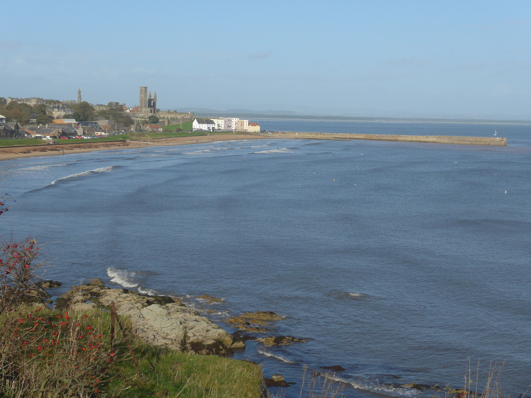
Passing East Sands beach where we could see people surfing, we soon started to climb up the heights of the Kinkell Braes. The views from here back across the town to Tentsbridge and beyond to the Angus coastline were dramatic in the bright but hazy Scottish light. There is pleasant if muddy walking here on a clear path through interesting shrubbery. Much of the path from here and on later sections is on ‘stepping stone paths’ that are either a boon or a danger dependent on how slippy they are. The sections going downhill require some care when wet.
If the time frame of the history of the town makes you catch your breath, then that of the coastal area will rock your socks.


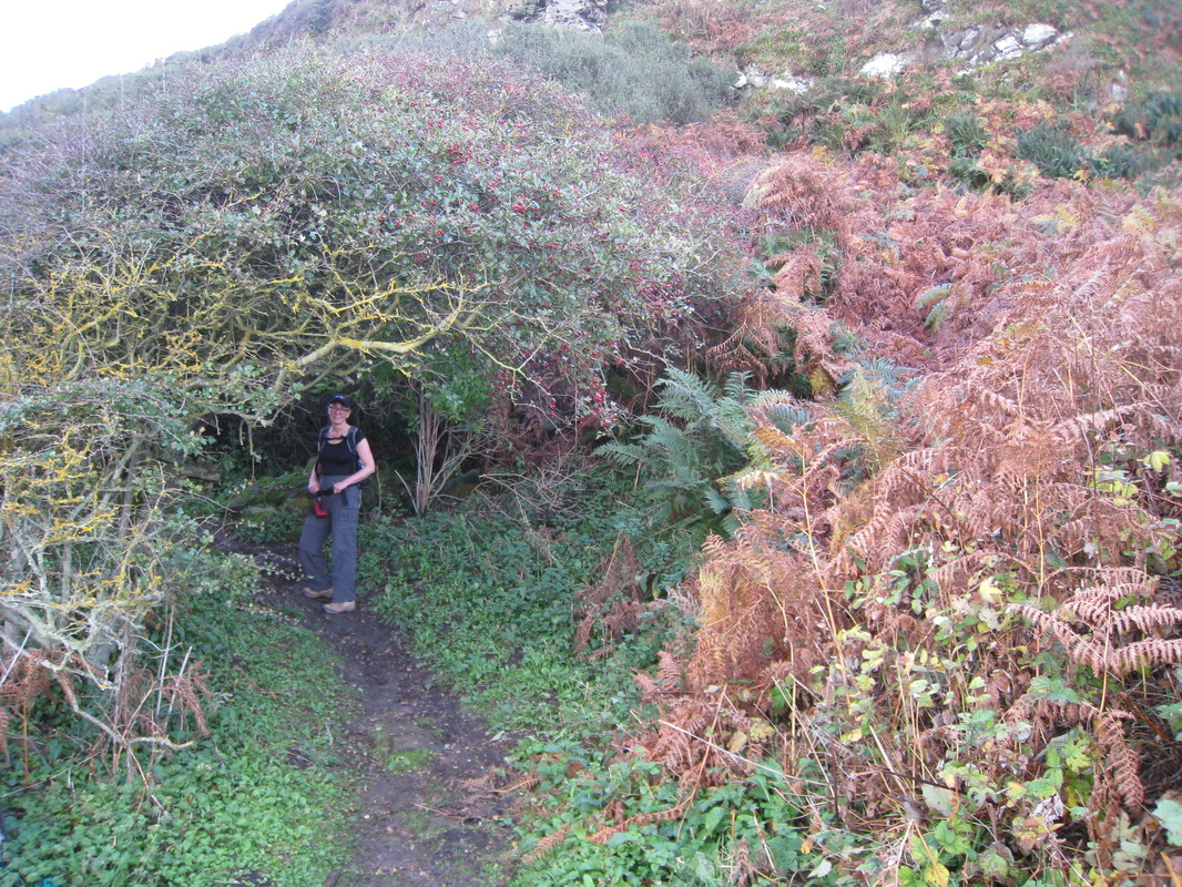
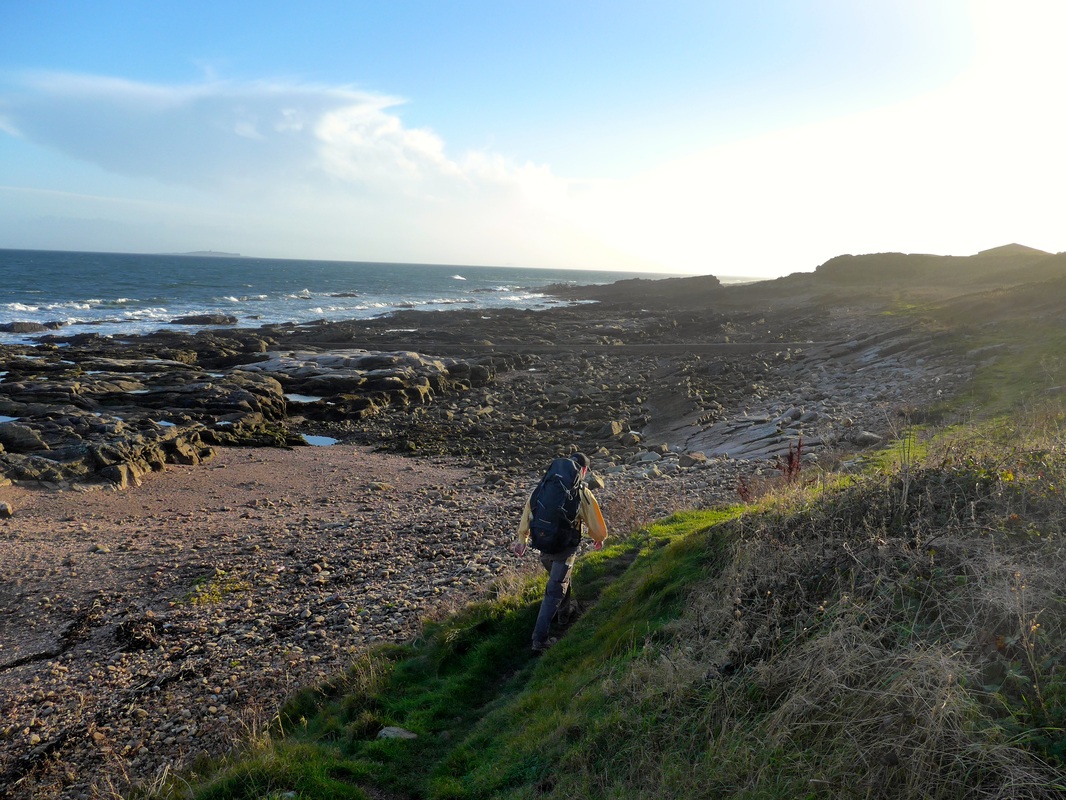
The sections up and over Kinkell Braes and on to Boarhills and Kingsbarns are coastal walking as you would want it to be: fantastic views at the top of the Braes; challenging but not too dangerous walking; the isolation of the little sandy beaches that encourage you to lean back against the rocks and count the waves, the opportunity to watch the antics of the flocks of sea birds, or just to watch the minuet of the sparse white clouds in blue sky as they move to the music of the wind. Here in a geological time warp, the hurry scurry of modern life is so very far away.
 Maiden in a Bower
 The Maiden Rock, an ancient sandstone sea stack that was formed about 6,500 years ago, is one of the first major geological features to pass. Used occasionally by climbers it sits in an area of earth faults and folds. Moving over the Braes we passed Kinkell Cave that, along with Constantine’s cave (passed later) have a proven history of habitation that goes back to Neolithic times. An archaeological paper on both caves from 1913, makes quaint and interesting reading and locates the caves in an historical context that encompasses the bronze/iron ages, Roman occupation and later medieval Scotland.
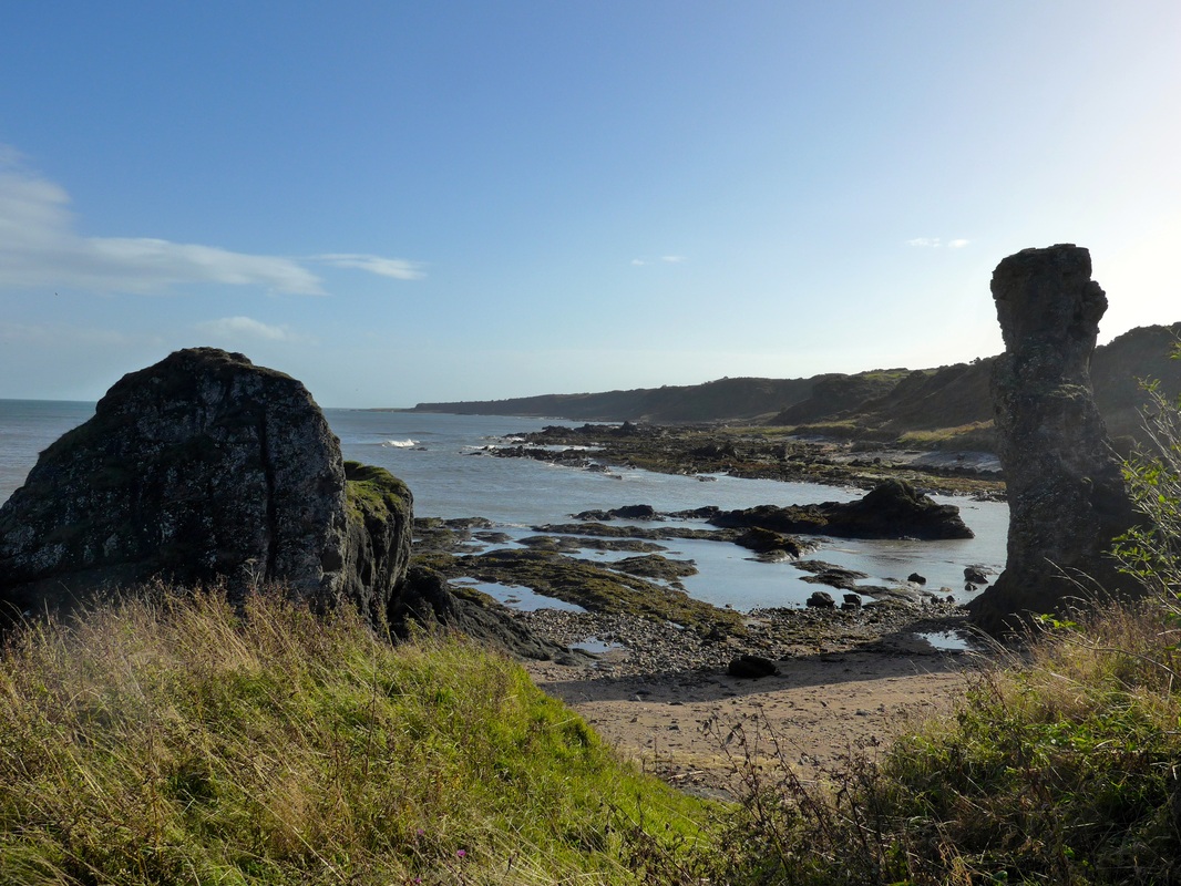
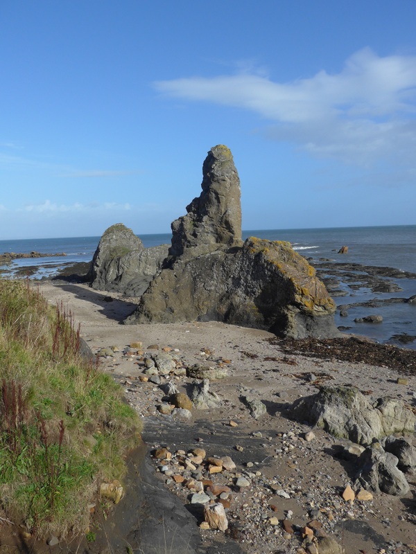
Dropping down from the braes towards Kinkle Ness (Ness meaning ‘a headland’) the fabulous ‘Rock & Spindle’ comes in to view. The rock part of the feature is a volcanic plug in the shape of a tall sea stack and the spindle, made up of twisted basalt columns, is a wheel shape with radials cut in to the wheel face. This mixing of two different geological processes in the same feature is typical for this part of the coastline where major geological events can be seen beside or on top of each other. There is also a natural harbour at this location.
The walk from Kinkle Ness to Buddo Ness is variable, moving from walking on the upper shore to using muddy and at times steep paths. Along the way you pass the lovely named ‘Kittock’s Den’. ‘The Concise Scots Dictionary’ gives one meaning of kittock or kittok as a term for a woman or girl of low character. I much prefer the other more charming local interpretation I found of ‘ a romping girl’, making Kittocks Den the den of the romping girl. Sadly, there were none around that day. Given that kittok is also a term for a kittiwake and this is a sea location I suspect the derivation of the name is more than likely ornithological but I might still chance my arm and go back another day ‘just in case’.
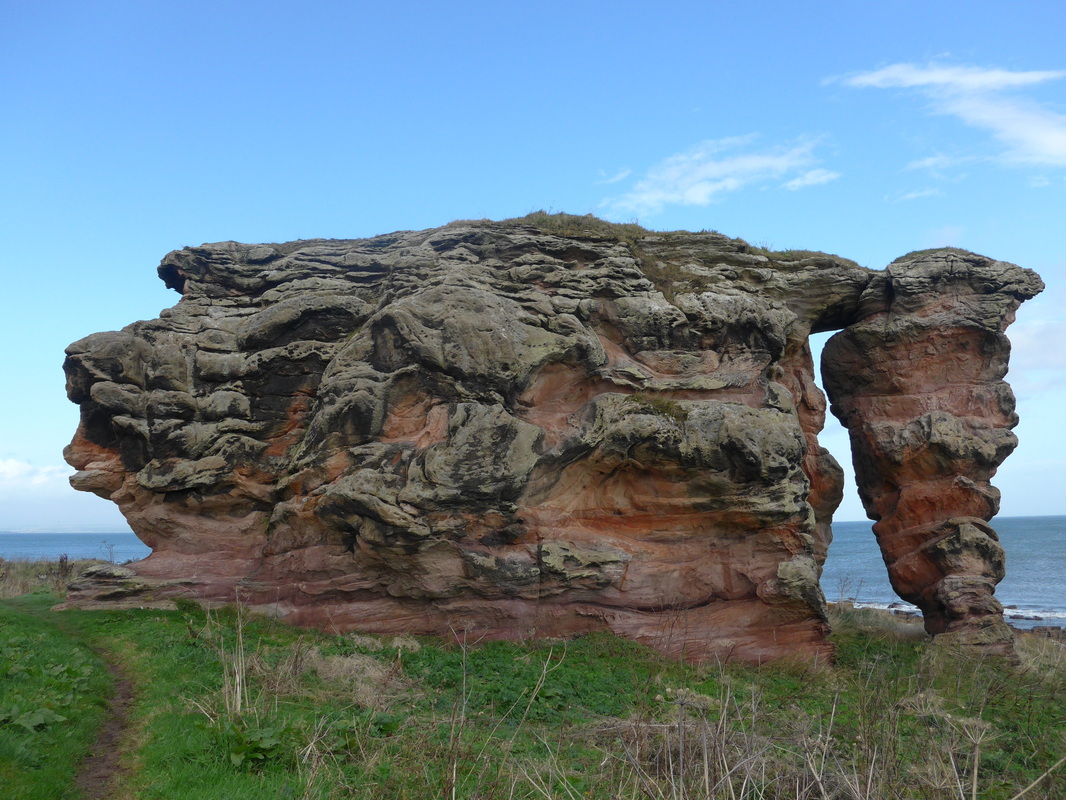
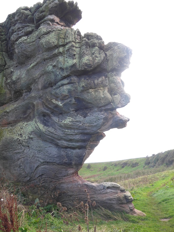
Shortly after Buddo Ness, Buddo Rock comes in to view, lying across the path like some huge sea monster. Looked at it from the far side (i.e. looking back to St Andrews) it has the appearance of a crocodile-like creature lying on top of the main platform waiting to pounce on unwary walkers. Made of pink sand stone the rock was once part of the cliffs behind, but the softer rock has been worn away and it now stands in isolation from the rest of the raised beach of which it was part. There are a number of raised beaches (at least three) behind the rock, working back towards the current farmland. There are also the remains of an old lifeboat station on the beach built somewhere between 1860 – 1890 and long since derelict.
 Cabbages & King
 The route continues along the shoreline heading towards the area below Boarhills Farm where you are forced inland to be able to cross the Kenly Burn. The early part of the detour, as you walk uphill is through arable farmland where we could see farm workers harvesting cauliflowers in the fields. There were acres of vegetables as far as the eye could see and in the sunshine the dark green of the cauliflowers contrasted sharply with the steely blue-grey of cabbages in the nearby fields.
 Kenly Den
 Cutting through by Hillhead Farm to enter the lovely, wooded Kenly Den, the Kenly Burn was in full spate following the recent rains and the speed of the water was frightening as it roared and crashed over hidden rocks in foamy cascades. The walk through the trees by the side of the burn was one of the highlights of the day. Apart from the roaring of the water, the den is a very tranquil place and the play of light, shade and shadow provides a changing scenario that encourages you to slow down and meander in this peaceful space. There are the remains of an old mill in the den on the banks of the burn and we were taken by the incongruity of the branches and leaves of fully-grown trees growing up from inside the buildings to fill the space where the roof should be. A reminder that left to its own, nature soon takes back what it has lent to us.
Shortly after emerging from the den we came to the small sandy beach at Airbow Point where we decided to stop for lunch ‘al fresco’ . Rain threatened and we spent a few minutes pulling out the rainwear only for the threat to recede. When I was working (I’m retired, did I tell you? he, he, he!) I would have paid to have a quiet lunch on an isolated beach with only the sound of the crashing waves, the chatter of 'Jonathon Livingston Seagull' and his chums and the long slow sigh of the wind for company. No need for words or conversation; just the occasional shy, satisfied smile to your walking partner to indicate appreciation of the silence.
 View to the Forth
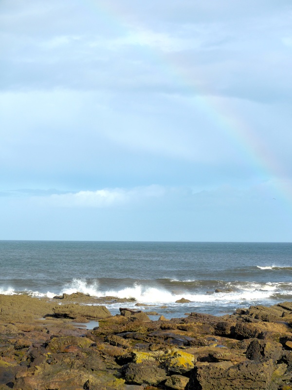
 The next stage from Babbet Ness to Fife Ness is a mixture of walking on the beach, off the beach and, at times, well above the beach. Because of the time of year there was little to be seen regarding wild flowers or wild life for that matter. However, the expanse of the sea and the by now wide, wide blue sky continually caught the eye. It is from here, particularly after turning Fife Ness that the perspective and psychology of the walk changes. Up until now the attention and the senses have been drawn back to the St Andrew’s coast and Tayside (Dundee & Angus) coastlines beyond; the miles you have already walked. The interest now becomes the confluence of the mighty River Forth and the North Sea and, the Lothian coastline on the opposite bank and the challenge that lies ahead. When the walk rises up the brae at Kingsbarns and beyond you start to get glimpses of the islands on the Firth of Forth, including the Isle of May.

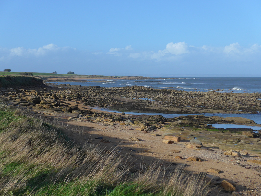
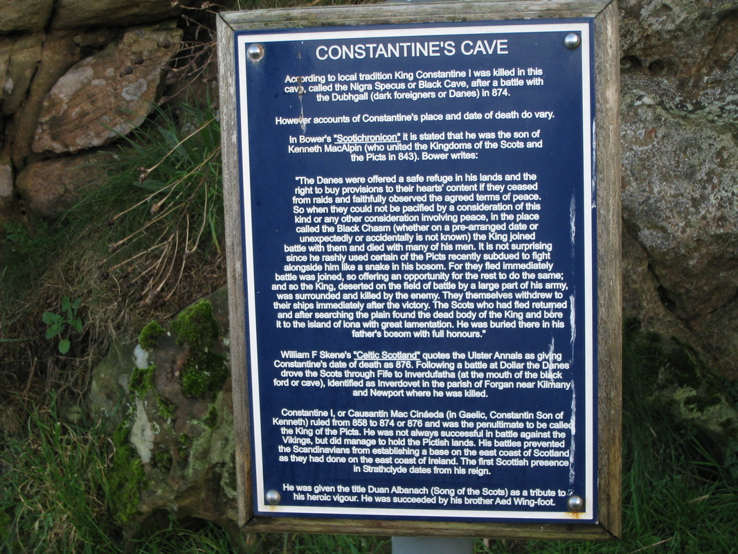
Heading for Fife Ness in the distance (the most easterly point in Fife) the walk passes Constantine I’s Cave at the Balcomie Golf Links. Above the Ness there are world war gun emplacements. Once round the Ness it is a long and undulating walk towards and through the Kilminning Nature Reserve passing Long Man’s Grave and Dane’s Dike on the right. Dane’s Dike is thought to be a defensive structure erected by the Danes in the time of their battles with King Constantine I (e.g. Battle of Leven) with the grave structure possibly related to the death of a Danish warrior. Further on there is a sandstone feature known as Kilminning Castle in the area of which have been found ancient stone burial chambers. Exiting the nature reserve a relatively short walk takes you to a long straight stretch through a caravan park before passing Roome Bay and journey’s end.
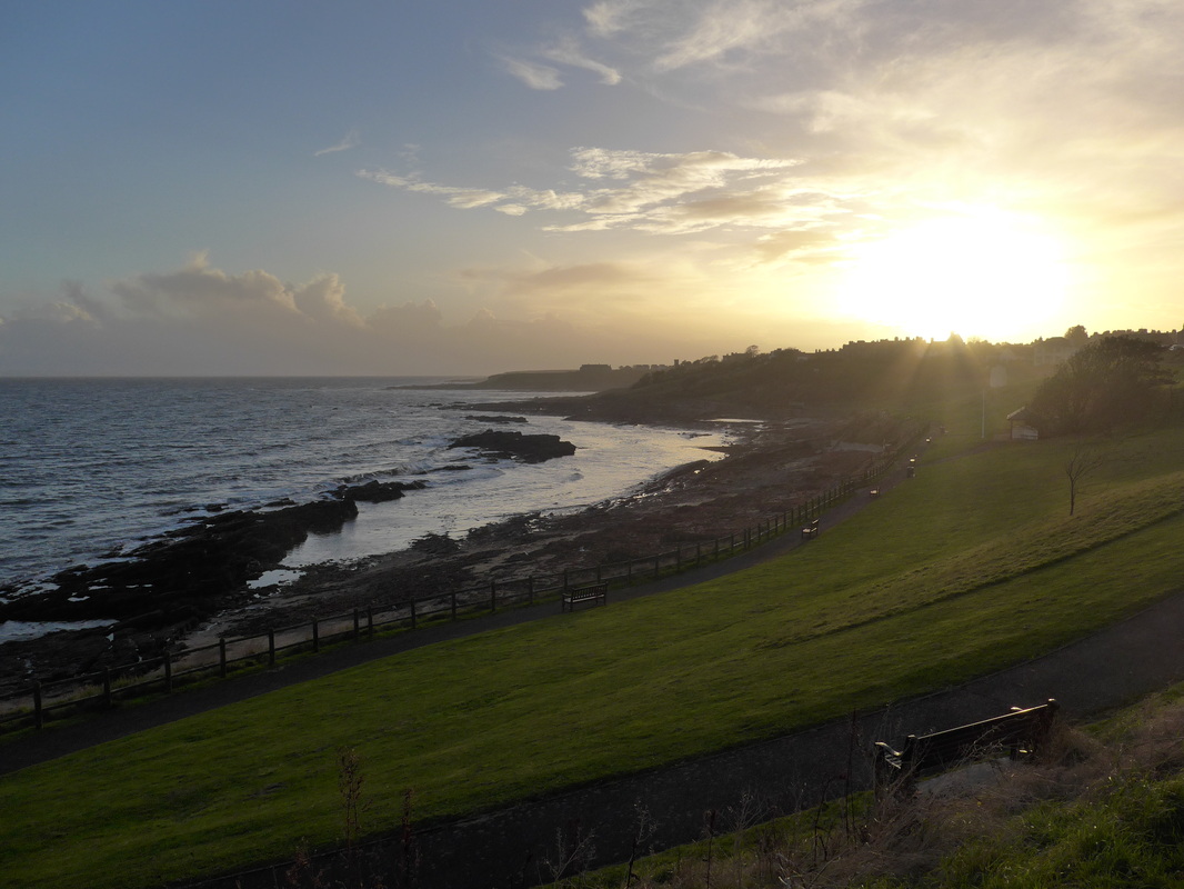 Crail Sunset
 It did not take us long to return to the car and as we did the sun was just starting to set on the western horizon. A welcome change of footwear in to soft and comfortable trainers and Joanna drove us home while I, sad old cratur, fell asleep in the passenger seat.
 RSS Feed
