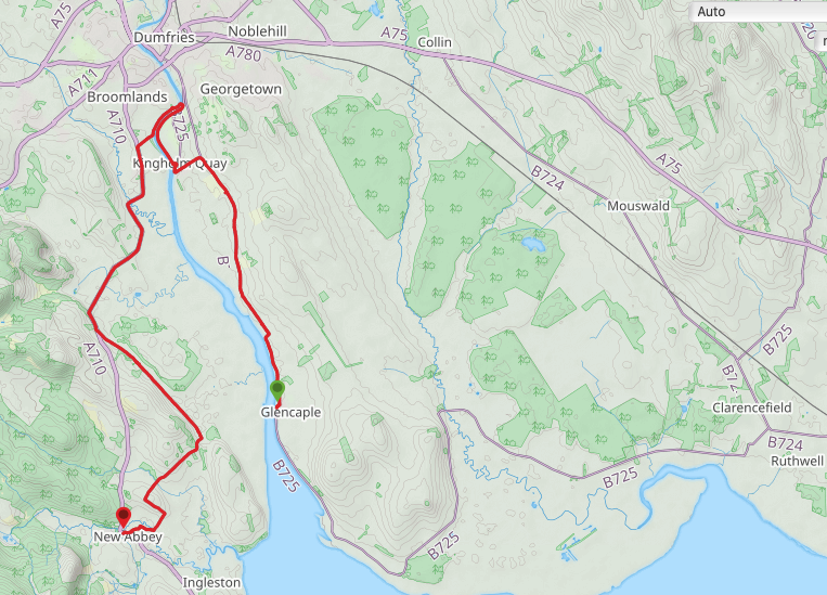
Route Map
 River Nith to Criffel Hill
 We really enjoyed our hotel last night where there was a bath, as well as a shower and, joy of joys, endless hot water. The food was pretty good as well and this morning we wakened feeling refreshed and comfortable.
Today is another one of road walking, with a little bit of riverbank thrown in approaching and coming away from Dumfries. We did our usual last night and spoke to a few locals to query our route choice. The OS 1:50 map did not show a through-route from Glencaple to Dumfries and local opinion agreed. In general, the route is flat with a small degree of up and down on the road sections, the main rise coming at the end of the day as we climb up to above Sweetheart Abbey.
Towards the end of the walk the map shows a path part-way through the Kirkconnel Flow Nature Reserve but it does not appear to continue up the New Abbey Pow waterway to the village. Consequently, we decided to follow the unnamed road that runs parallel to the nature reserve and which brings you in above and to the back of Sweetheart Abbey, providing you with wonderful views over the abbey and surrounding countryside.
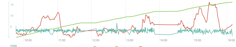
Altitude, etc.
 River Nith towards Mabie Forest
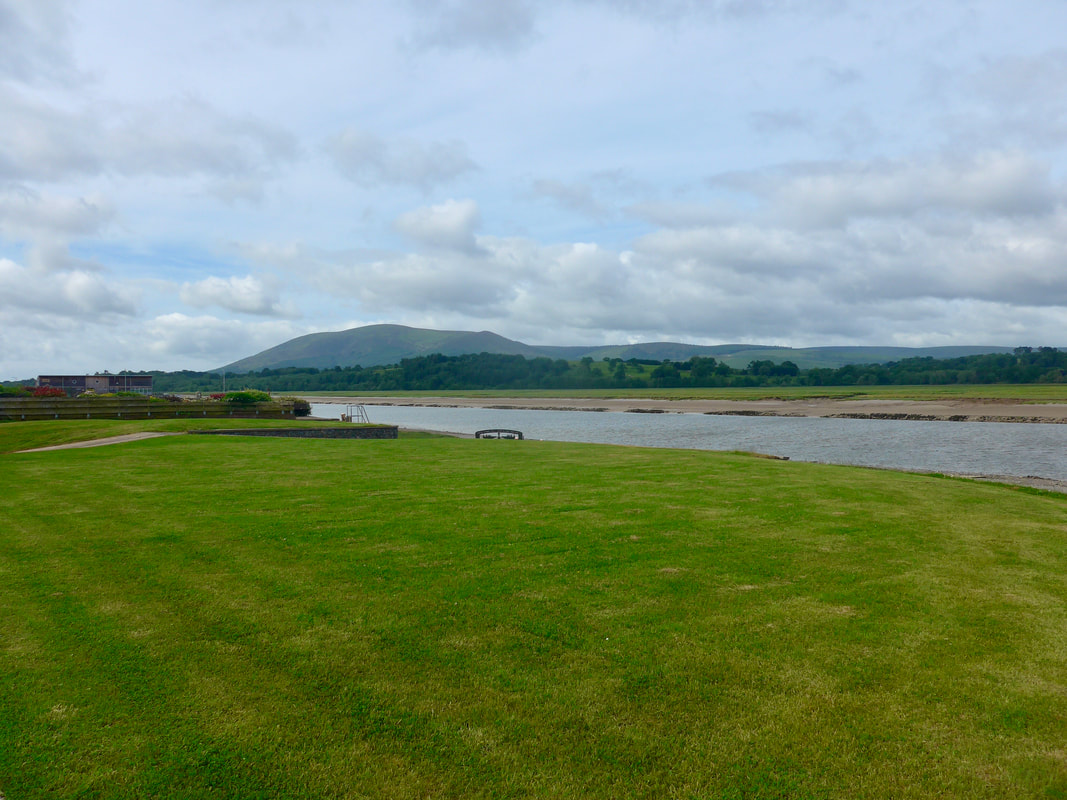
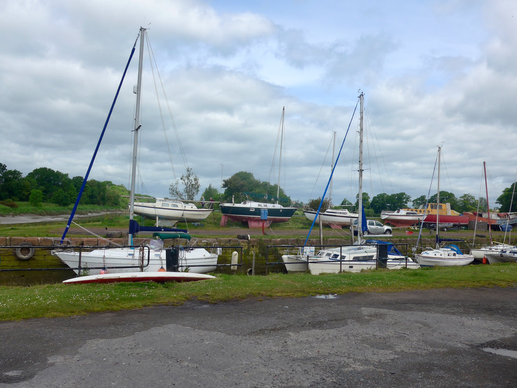
 Leaving Glencaple to head for Dumfries, the road follows the line of the river for about three kilometres. The river is within sight until the route reaches the small hamlet of Keltonbank where it starts to move inland at an angle to the river. Road walking continues until you reach a turnoff to head down to Kingholm Quay where, passing through the small restored harbour, you take up position on the banks of the River Nith.
Built in 1747, Kingholm Quay was originally one of two or three smaller harbours on the River Nith that supported the port of Dumfries. In its hey day, the harbour with its associated ports at Carsethorn and Glencaple, was a very busy port, perhaps best known for supporting the tobacco trade and transporting immigrants leaving for a new life in the colonies, particularly Canada. With the coming of the railways and ever larger sailing ships requiring larger berths and deeper draughts (the river is prone to silting), Dumfries and the supporting harbours were no longer able to support the ships. The harbour is now home mainly to pleasure craft.
Built in 1747, Kingholm Quay was originally one of two or three smaller harbours on the River Nith that supported the port of Dumfries. In its hey day, the harbour with its associated ports at Carsethorn and Glencaple, was a very busy port, perhaps best known for supporting the tobacco trade and transporting immigrants leaving for a new life in the colonies, particularly Canada. With the coming of the railways and ever larger sailing ships requiring larger berths and deeper draughts (the river is prone to silting), Dumfries and the supporting harbours were no longer able to support the ships. The harbour is now home mainly to pleasure craft.
Kingholm Quay & Harbour
 Upriver, River Nith at Kingholm
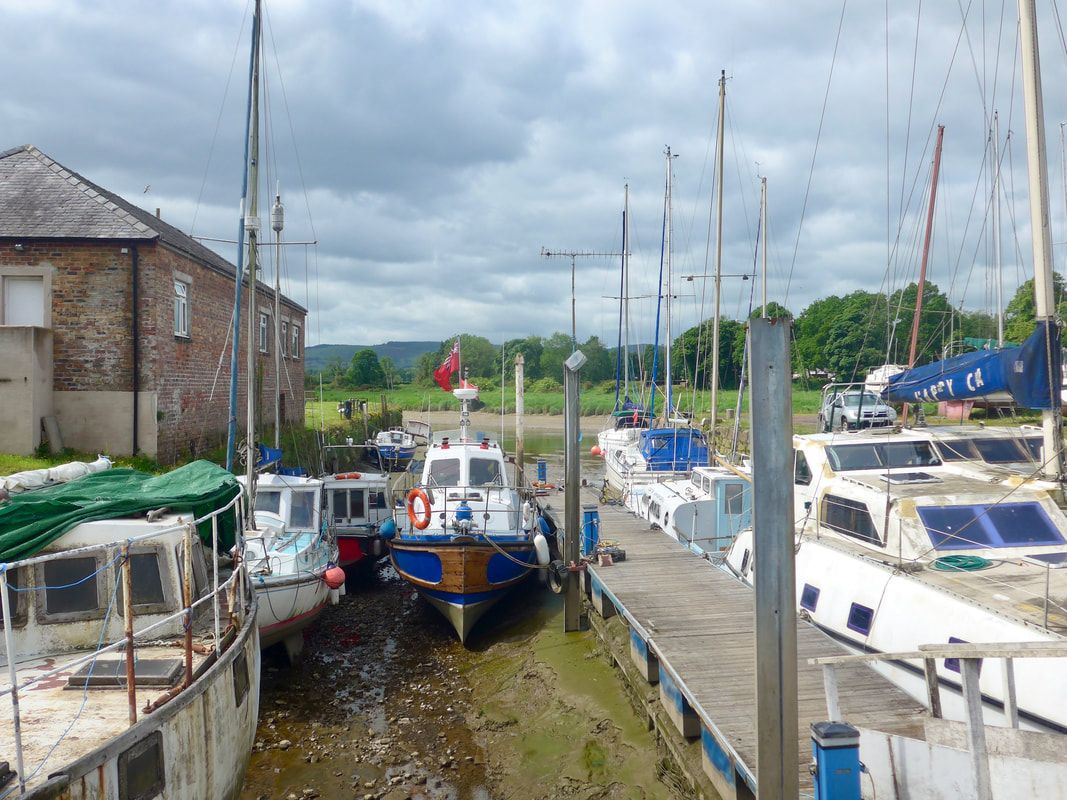
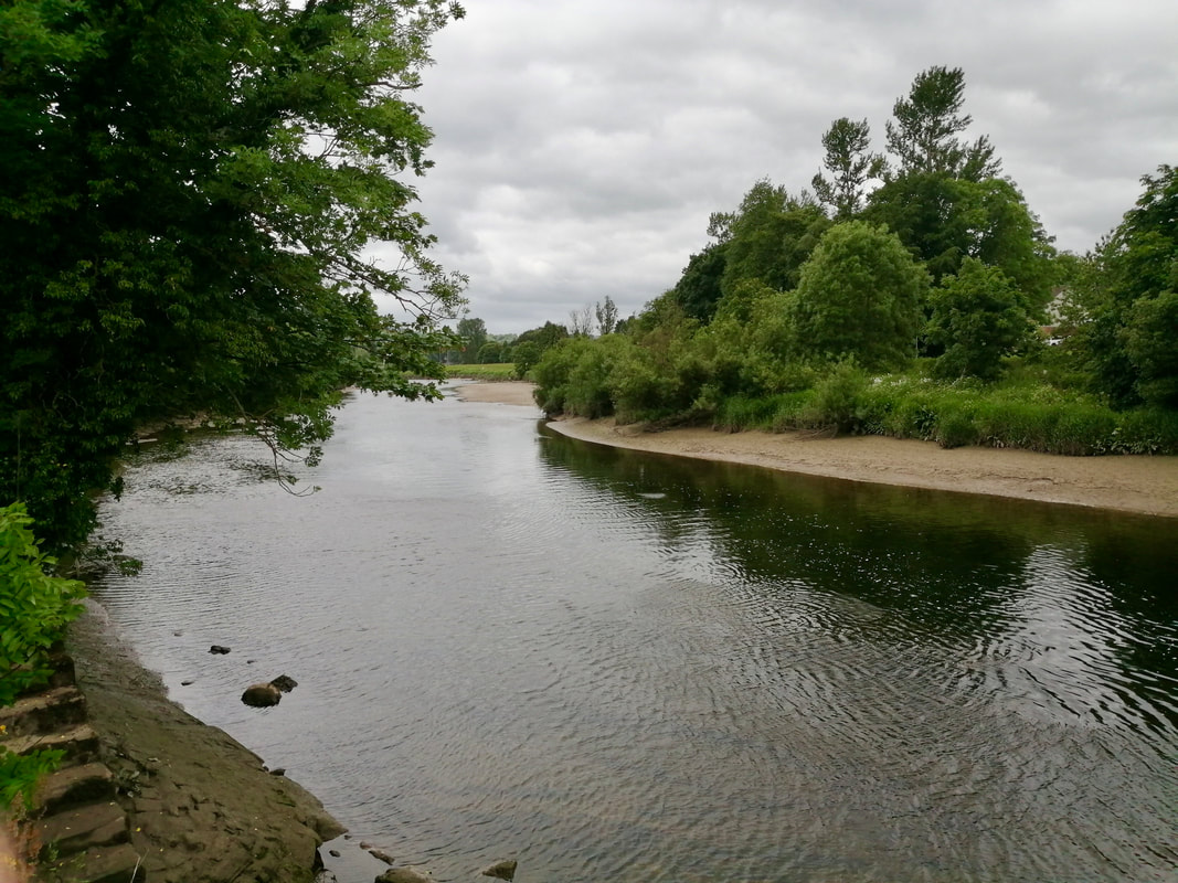
 It is a very pleasant walk from Kingholm Quay up the river on a clear path, popular with local people. There is the occasional bench to encourage you to stop and just enjoy the peace and tranquility of the riverbank, an offer we could not refuse.
Just before the bridge that takes you over the river, on your right, you pass the location of the Castledykes Park motte and bailey, medieval castle. You cannot see the remains from the path but in the park it is visible in the form of a series of earthworks. The remains include a 12th C motte and bailey castle and, the earthwork remains of an Edward I, 14th C castle. The remains have Scheduled Monument status.
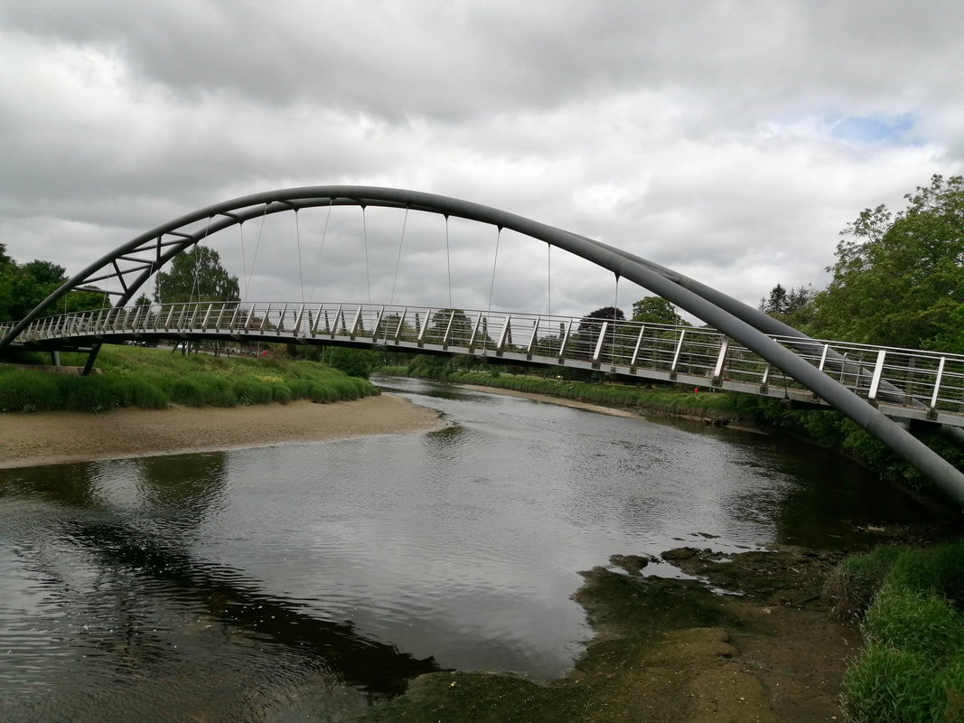
Not long after passing the motte we reached the Kirkpatrick Macmillan Pedestrian Bridge which crosses the River Nith and takes you into Hamilton Starks Park. The bridge commemorates the life of the man who invented the bicycle. Born in 1813, Macmillan worked on the Duke of Buccleuch's Drumlanrig Estate to which he had to travel some fourteen miles. He is thought to have seen an example of a 'hobby' or Dandy horse, which he subsequently developed in to the world's first bicycle by applying pedal operated, fixed cranks to the rear wheel.
There was, surprise, surprise, a handy bench nearby as we came off the bridge and we took the opportunity to stop, brew up and further meld into the day.
Just before the bridge that takes you over the river, on your right, you pass the location of the Castledykes Park motte and bailey, medieval castle. You cannot see the remains from the path but in the park it is visible in the form of a series of earthworks. The remains include a 12th C motte and bailey castle and, the earthwork remains of an Edward I, 14th C castle. The remains have Scheduled Monument status.
Not long after passing the motte we reached the Kirkpatrick Macmillan Pedestrian Bridge which crosses the River Nith and takes you into Hamilton Starks Park. The bridge commemorates the life of the man who invented the bicycle. Born in 1813, Macmillan worked on the Duke of Buccleuch's Drumlanrig Estate to which he had to travel some fourteen miles. He is thought to have seen an example of a 'hobby' or Dandy horse, which he subsequently developed in to the world's first bicycle by applying pedal operated, fixed cranks to the rear wheel.
There was, surprise, surprise, a handy bench nearby as we came off the bridge and we took the opportunity to stop, brew up and further meld into the day.
Kirkpatrick Macmillan Pedestrian Bridge

 Passing Kirkconnel Flow Nature Reserve
 After a break we continued on down the river, pleased to find a reasonable path for much longer than we expected. Just below Redbank House, however, just as the rain came, it was overgrown and further progress was difficult. Later on this path you are forced to move up to the road anyway by the Cargen Pow waterway. Rather than continue on the overgrown path we headed up to the A710 and started our road walk slightly earlier than we had planned.
On the road the volume of traffic increased considerably from that we had seen in the early morning. It meant a stuttering kind of journey as we were forced to move on to the verge whenever cars were passing. In general, we find most drivers are considerate and will take the outer lane to give us space, but there is always the idiot!
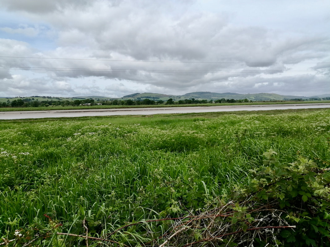
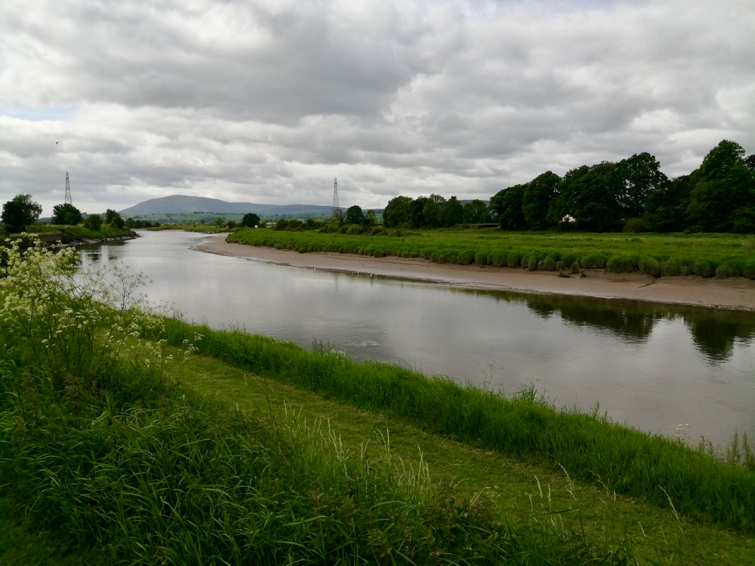
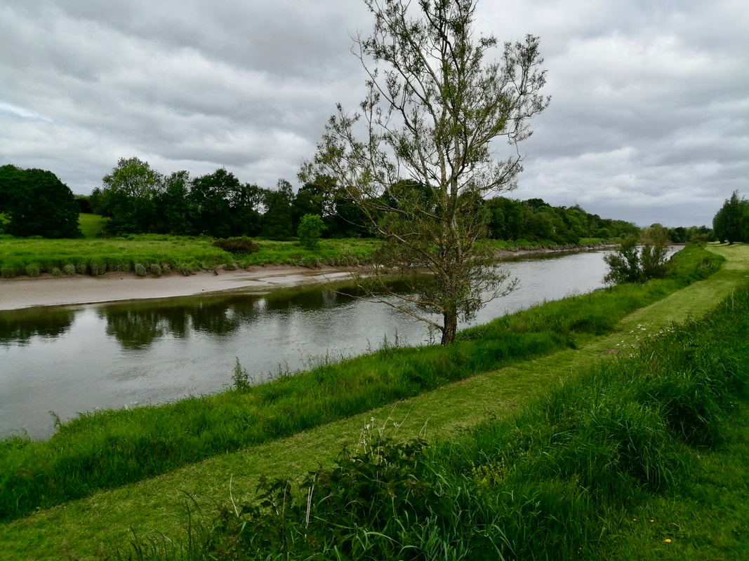
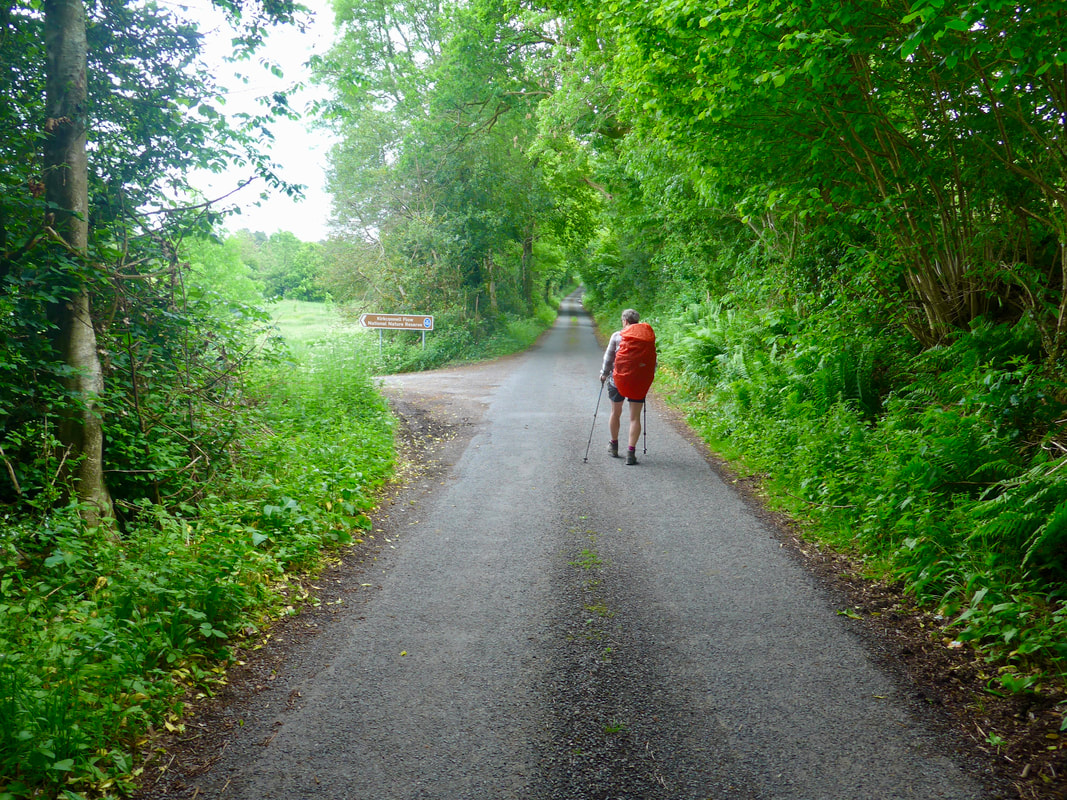
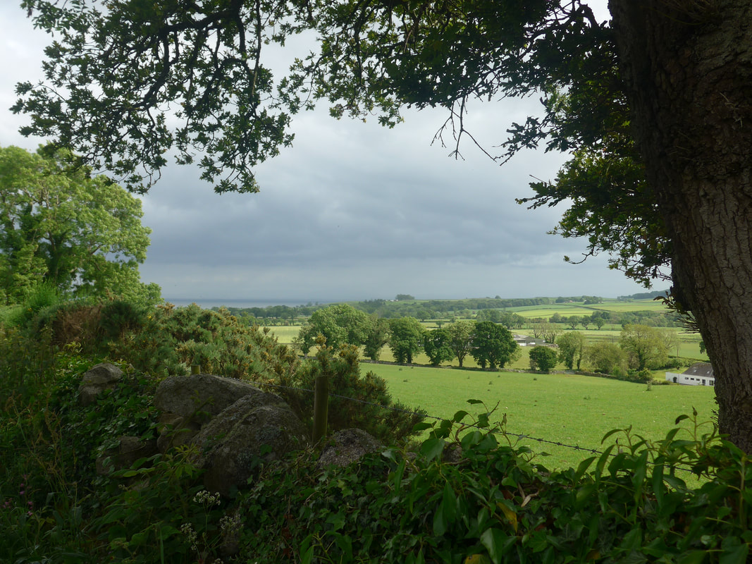
Initially, there were some nice views down the River Nith to the Solway Firth in the distance, but eventually we left even the River behind as the route moved further inland. This section of road walking was just short of five kilometres, ending at the turnoff at Gillfoot where we headed down towards the Kirkconnel Flow Nature Reserve which is an ancient raised peat bog.
On the road the volume of traffic increased considerably from that we had seen in the early morning. It meant a stuttering kind of journey as we were forced to move on to the verge whenever cars were passing. In general, we find most drivers are considerate and will take the outer lane to give us space, but there is always the idiot!
Initially, there were some nice views down the River Nith to the Solway Firth in the distance, but eventually we left even the River behind as the route moved further inland. This section of road walking was just short of five kilometres, ending at the turnoff at Gillfoot where we headed down towards the Kirkconnel Flow Nature Reserve which is an ancient raised peat bog.
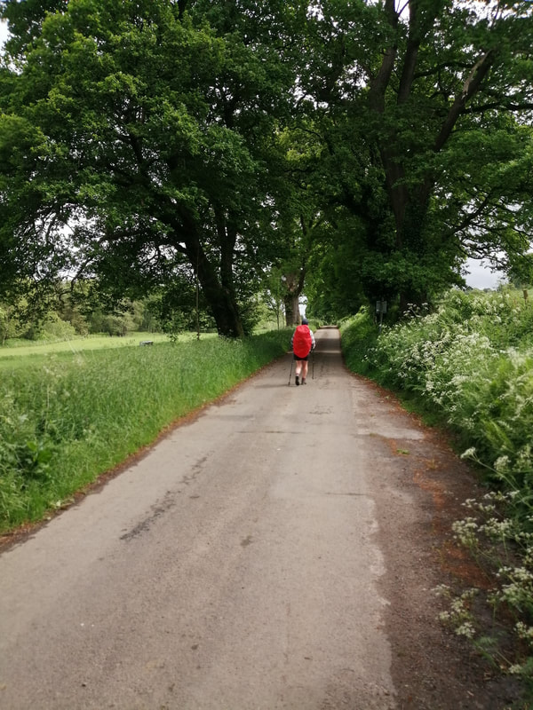
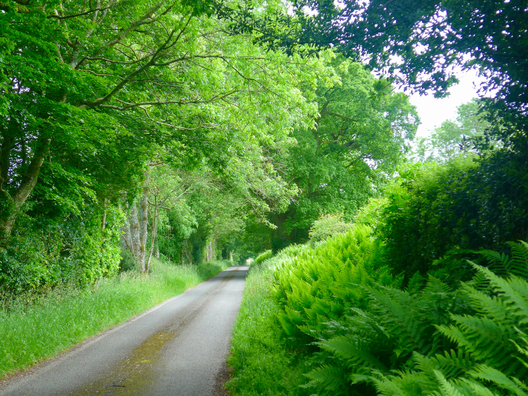
The route from Gillfoot to Kirkconnell was a joy to walk. Lined by a seemingly endless line of old trees. It felt like walking back in to a past where there were no cars on the road. The colour and light was just sublime, the quality of birdsongs from the hedgerow exquisite and the walking fairly flat and easy until near the very end. If ever I have walked in a cathedral of trees, it was this day.
Cathedral of Trees

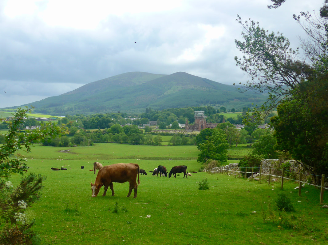
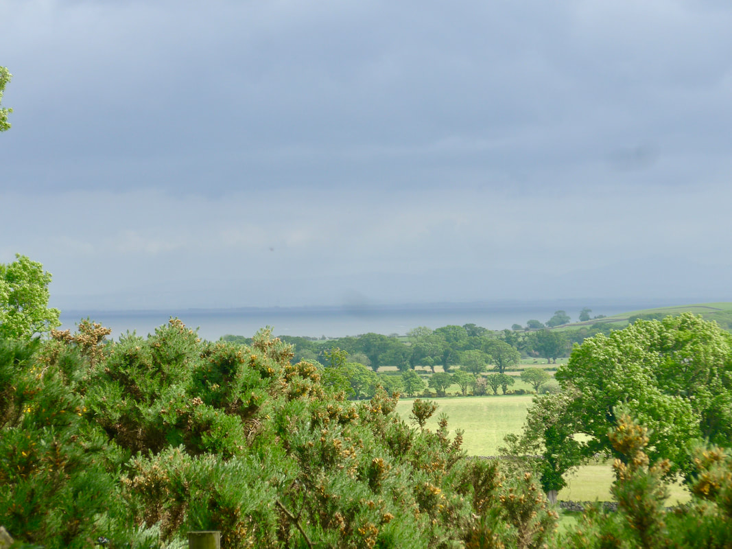
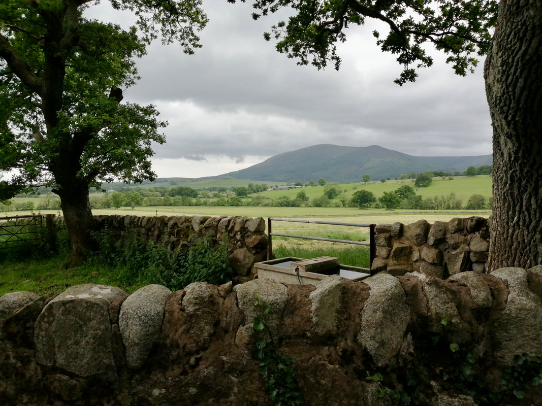 Criffel Hill
 The tree-lined route continues until Kirkconnell where the road takes a sharp turn to the right and starts a climb up to the heights above Sweetheart Abbey and the village of New Abbey. At the t-junction by Shambellie Grange, we took a left to the area of Maryfield which gave us a wonderful view of the abbey and surrounding countryside.
Despite the presence of scaffolding around one of the gables of the abbey, it was clear that this had been a major religious house in its time. Established in 1273, it commemorates the life of Lord John Balliol, commissioned by his wife, Lady Dervorguilla of Galloway, who is also buried there. It was the last Cistercian abbey founded in Scotland and was manned by the monks of nearby Dundrennan Abbey. In common with many of the great houses in Scotland, its demise was occasioned by the Protestant Reformation of 1560.
Looking south, we could see down to the Solway Firth and Southerness Point and, behind the village the hill range that includes the hill of Criffel (569 metres). From Maryfield, we dropped down the hill to take a cross-country path down to and over the New Abbey Pow waterway via a small footbridge. From there, we followed a rough path up the side of the graveyard and directly in to the grounds at the back of the abbey, from where it was a short walk to our accommodation for the night in the local tearoom.
Sweetheart Abbey
 RSS Feed
