 Folkestone Harbour
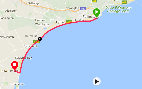
 There was a slightly overcast sky when we wakened but the forecast was good, albeit a strong wind coming in to our faces is forecast, and it was still warm enough to wear t-shirt and shorts when we started off. Today's route is slightly suspect, as there is a military firing range at Hythe that might have live firing on it. If we are lucky with the range, then we are set to spend the whole day walking on the coast round St Mary's Bay, passing through Sandgate, Hythe, Dymchurch, the village of St Mary's Bay and finally Littlestone, just below New Romney, where we will stop for the night.
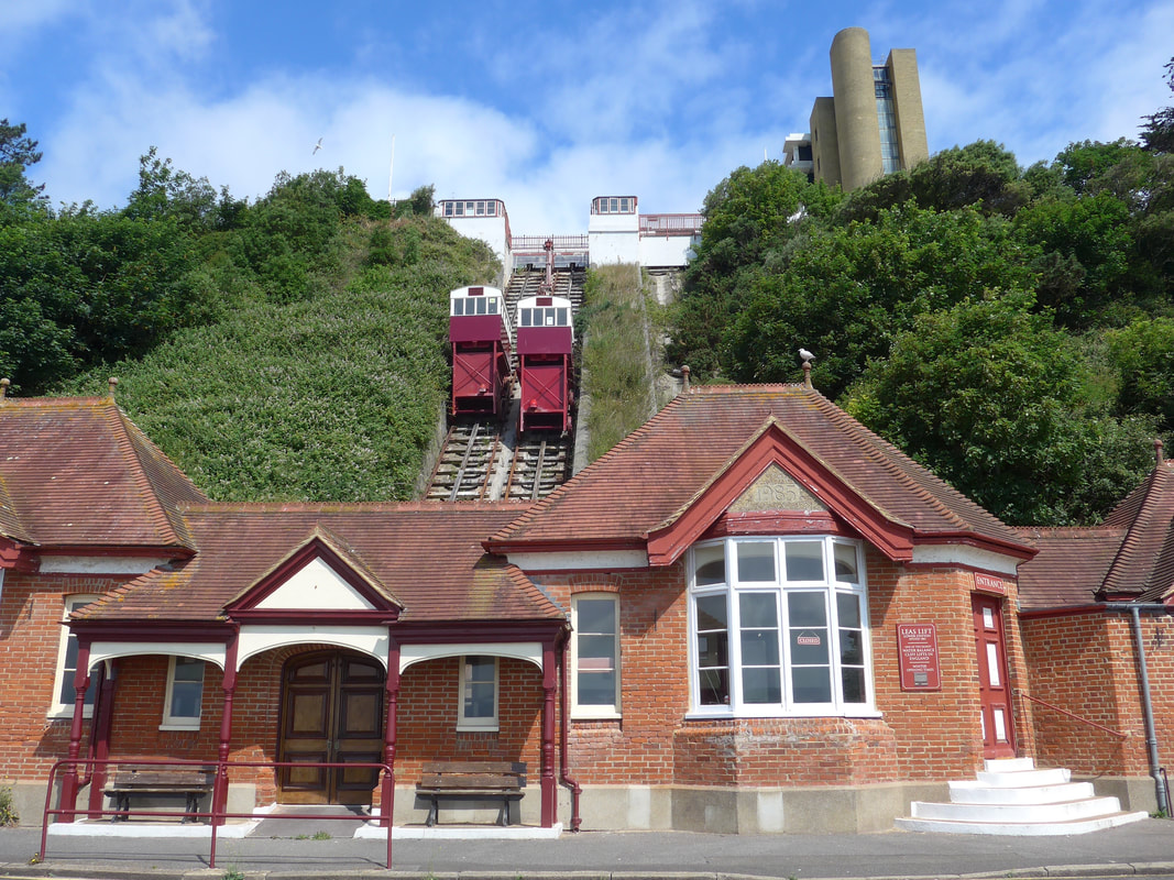 The Leas Cliff Lift
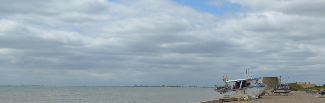
 After breakfast we made our way down to Folkstone Harbour Pier where we had finished up yesterday. It was beautifully sunny by the time we reached it and the area round the pier had a lovely maritime, tranquil feel to it. The views across the harbour to the arches of the pier and on over to the Martello Tower No 3, on Copt Point in the distance were 'chust sublime'. Setting off along the beachside road we passed the Leas Cliff Lift, currently suspended half-way up the cliff, (or down depending on whether you are a half full or half empty kind of person), a state they have enjoyed since January 2017. The lifts were closed by the Health and Safety Executive on the grounds that a secondary braking system was required to operate them. The existing operating company decided they did not have the funds to complete the work and withdrew. The lifts were first opened in 1835. (There was a subsequent news report in September 2017 that funding has been acquired and a new operating company was being formed, with plans to complete repair work and re-open the lifts.
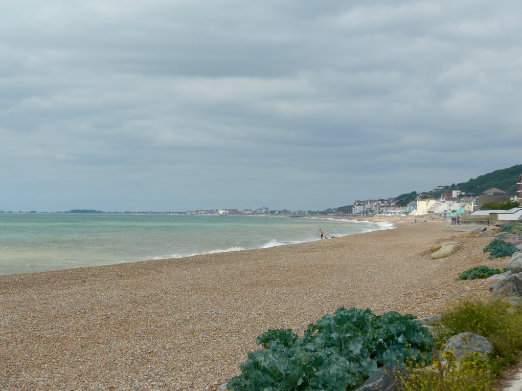 Across St Mary's Bay
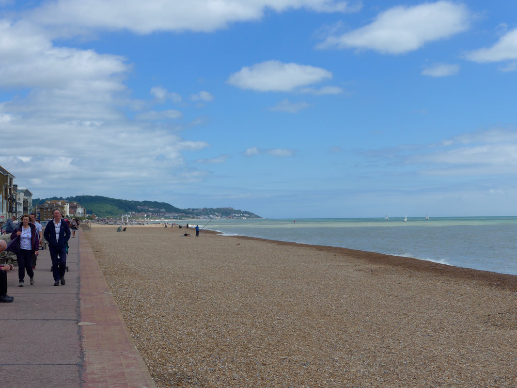
 From the harbour we set off along the bay with an incoming tide slowly making its way up the shingle beach. Part of the shingle beach here are on their way to becoming vegetated and it was interesting seeing this development in an early stage with oarticularly sea cabbage starting to take hold. Walking on shingle for long distances is not something we particularly like so we stayed on the lower road. The weather was good, with breaks in the cloud cover where we could see lovely blue sky beyond but the clouds were persistent and, despite the heat, we kept expecting it to rain.
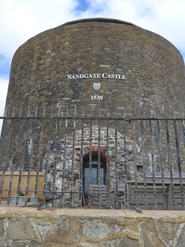 Sandgate Castle
 Between Folkestone and Sandgate, the Lower Leas Coastal Park links the two communities. As well as a 350-seated amphitheatre and other atractions, the park has an undercliff where a variety of wildlife can be found. Sandgate Castle towers over the beach area on the approaches to the town. An artillery fort, like many of the defensive structures on the south coast, it was built by Henry VIII as a bulwark against the French. Constructed between 1539 and 1540, it had over one hundred and forty firing points for cannons and pistols. The castle was subject to numerous re-fits over the years but by the 19C was in a state of disrepair at risk of disappearing in to the sea, which had by then reached the edge of the walls. It was eventually sold off, initially to a railway company, latterly to private individuals. IN the 1950's, the southern part of the castle was lost to coastal erosion. The remaining part, now resembling a Martello Tower, was turned in to private residence and remains so to the current date. As well as the castle, all along this route from Folkstone to when we stopped at Littlestone, was dominated by Martello Towers on the beachhead.
 Back to Folkestone
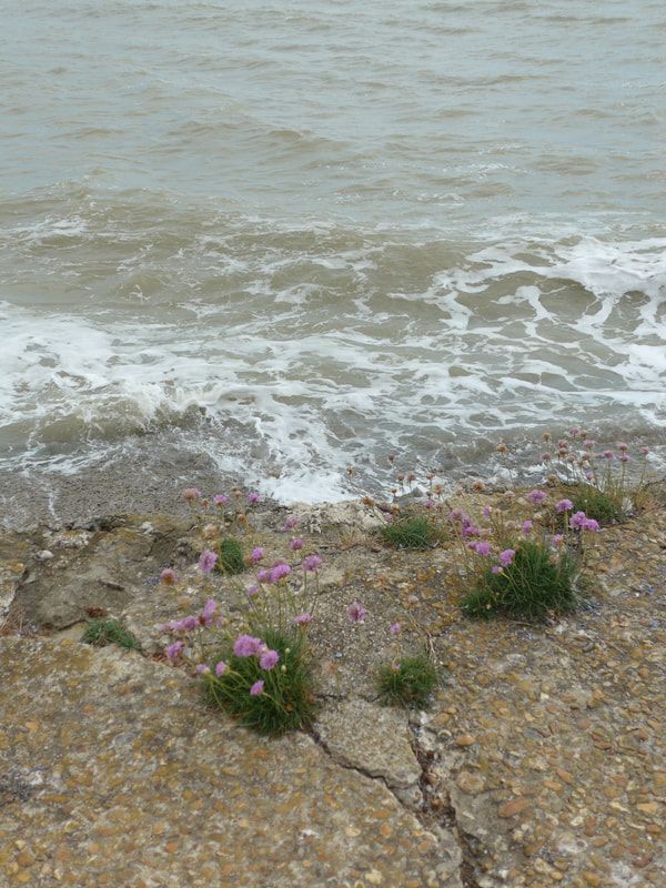
 Leaving Sandgate, the breaks in the cloud cover were beginning to dominate and we were enjoying some nice, warm sunshine. With the blue skies, the colour sequence over the water consisted of constantly changing shades of blue, green, white and silver. We passed another very nice area of vegetated shingle where the growth was really starting to take hold and you cou could clearly see sea cabbage, kale, sea holly, rock samphire yellow poppy and teazel. Be warned! We were not so sure about the 'glove garden', which might not be natural! as well as the typical sea plants, we passed numerous little areas where wild flower predominated and which, against the background of the brown shingle, were very pretty.
Vegetated Shingle Beach & Glove Garden


 Exiting the Range
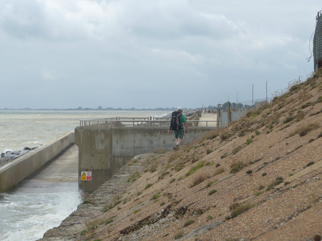
 Leaving Sandgate, we continued along the beachside path, passing along the front of ther town of Hythe. At the eastern end of the town, Hythe Ranges are located and we were not sure whether or not they were opened to the public today. We were all prepared for the detour inland when we seen a person go along the seawall and disappear behind the Martello Tower that sits at the beginning of the range. Being the kind of people who would do anything not to have to walk extra mileage, we decided to chance and were pleased to find a path running along the bottom of the range. You would be forgiven for thinking there was no path there because it is difficult to it at the back of the tower. A local that we met confirmed that there was no firing planned for the day and we could safely walk through to the outskirts of Dymchurch. Walking through the range on a good solid path saved us five kilometres of detour. At the end of the range, with the tide at full and right against the wall we were walking on, we had a wee bit of a fiddle to get round a fence but thankfully there were no mishaps.
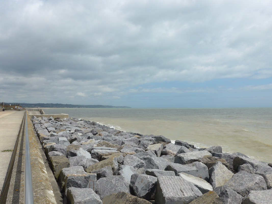 Sea Defences
 A considerable amount of work has been undertaken at Dymchurch to protect the coast and to try and hold back the sea. Exiting from the range we were met by a huge new expans e of sea wall with rock armour placed in front of it to break up the energy of the waves. Up until relarively recently, hard architecture such as this was the 'go to' when thinking about sea defences. More recently, the use of more natural resources such as raised sand and shingle beaches are being considered which, along with practices such as sand replenishment (which you might remember from our walks on the Norfolk coast) are being used. As much as anything, the use of hard architecture can be expensive as these estimated costs indicate: seawall approximately £5,000 per metre; rock groynes £125,000; rock used as 'armour', £1-3,000 per metre; timber revetments £1,500 per metre; timber groynes £1,00 per metre.
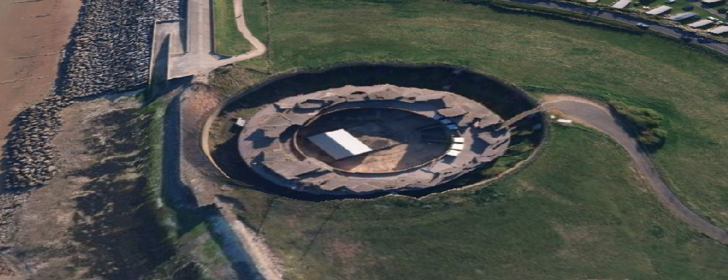
Also just at the Dymchurch exit from the range is the impressive Dymchurch Great Redoubt. Like many of the other defences on the south coast, it was built as a bulwark against French invasion. Constructed between 1804 and 1812 its purpose was to support the line of Martello Towers both militarily and strategically that run through Kent and Sussex. Unfortunately, by the time they finished building the Redoubt the invasion threat had receded and it was never used for its original purpose. It served various other purposes during the two World Wars before being adapted to function as a coastguard look-out station post-war. It is currently still in the hands of the Ministry of Defence.
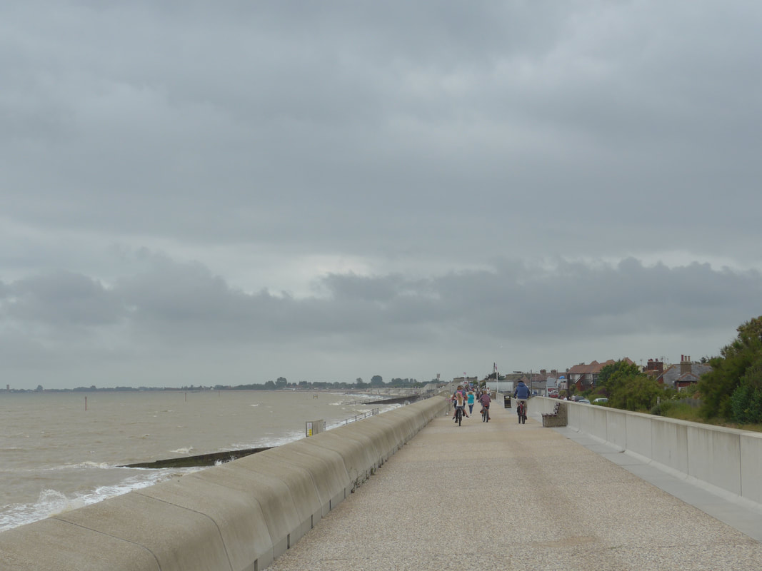
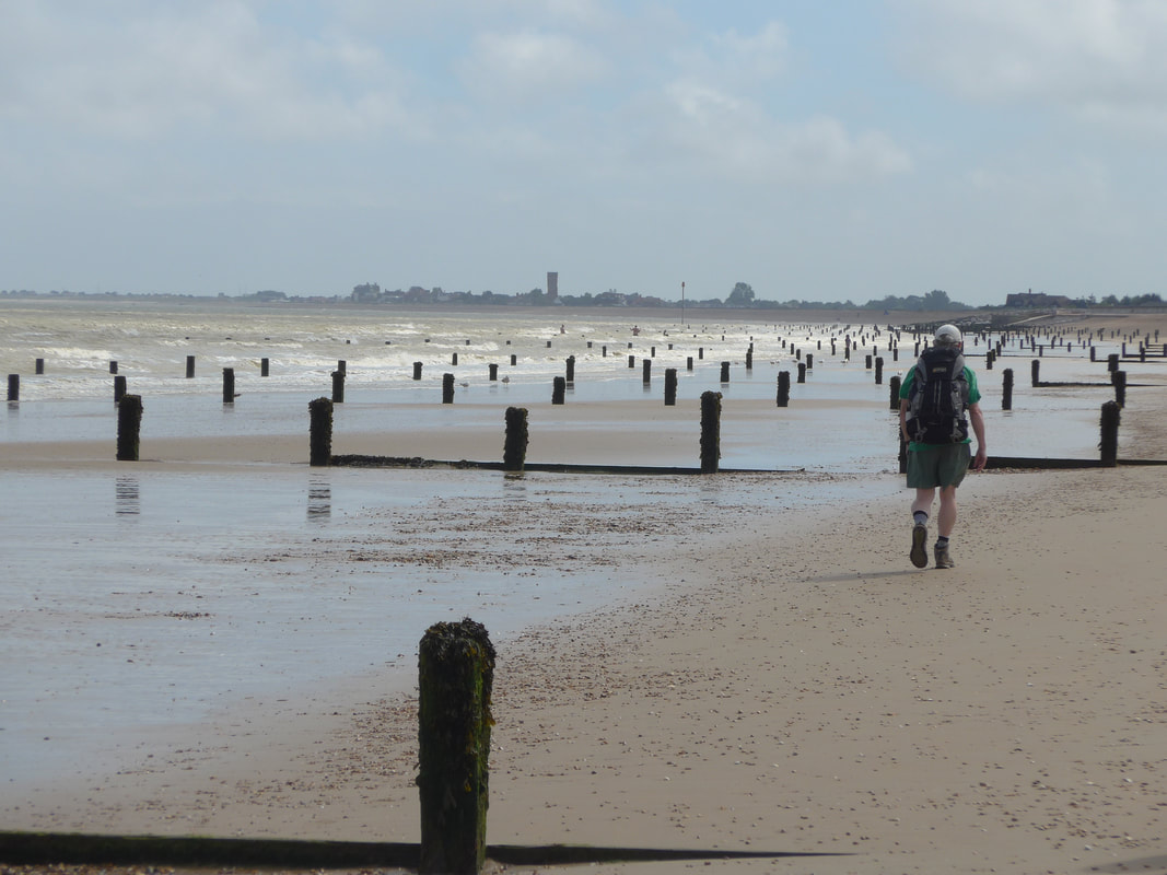
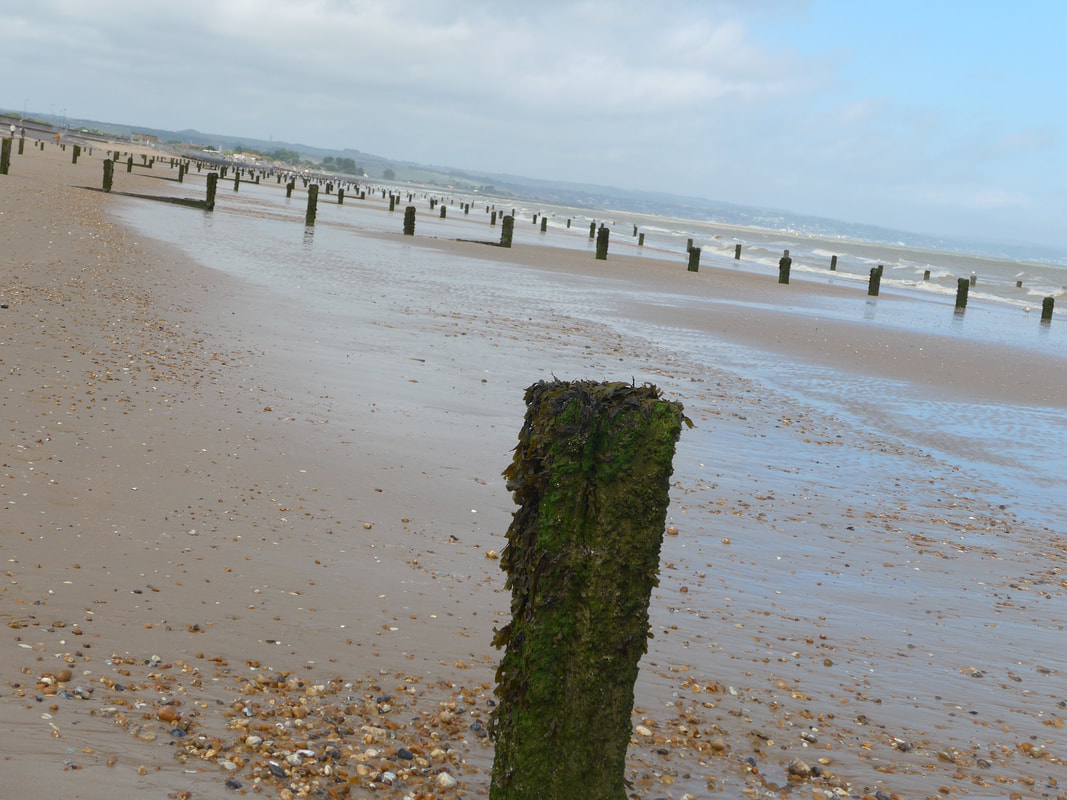
From the exit at the firing range we continued along what is known as the Dymchurch Wall, by -passing the village of the same name. Of course, we could not ignore the village completely; that would be rude, so we stopped and enjoyed a nice cream tea! At the end of the wall and with the tide now ebbing away, we were able to move down on to the sand that had been exposed by the retreating tide. The beach here is covered in wooden groynes and, the groynes are increasingly being covered by the sand and by the tide twice daily. Just how effective they are now at breaking up the energy of the waves now that they are effectively buried is subject to debate. They do make for a nice picture, though!
 Dungeness Nuclear Power Stations
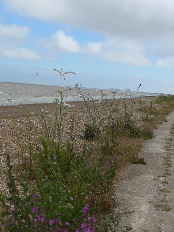
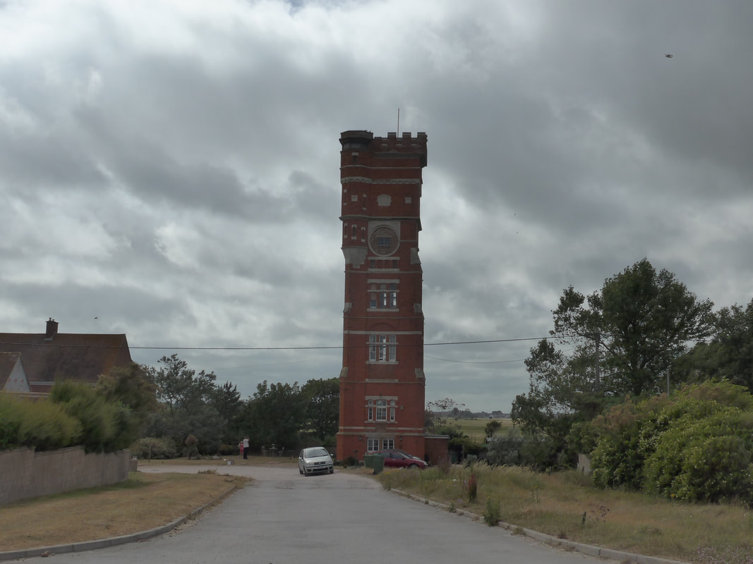
 As we walked now we could see the end of our walk on the horizon, highlighted by the tall, red water tower that looms over Littlestone. Further round the bay we could see the outlines of the Dungeness A & B Nuclear Power Stations, which we would be passing tomorrow. For the last mile or so of the walk the beach reverted to shingle and we left the water's edge to move back on to the concrete apron in from of the seawall. Where the shingle beach butted up against the path various wild flowers were struggling to get a hold on the little earth that was around. Seagulls dive-bombed here, fighting amongst themselves for the titbits left behind by the retreating waters.
 Littlestone Water Tower
 Arriving at the beachfront of Littlestone the Water Tower seemed immense up close. At one hundred and twenty feet in height, it dwarves everything around it. Built in 1890 to provide water to the interests of local entrepreneur Henry Tubbs. Founder of the local Littlestone Golf Club, Mr Tubbs had great plans for Littlestone, few of which came to fruition. The structure was not successfull in providing water, as what it did provide was tainted by sea water. It was used by the military as a lookout post during World War II and they made some changes to it internally and externally, the external changes said to account for the slightly skew-wiff look it has.. The tower fell in to disrepair before being bought and converted for residential use, which is it is still being used for today.
From the Littlestone beach front we had a fairly straight walk up Blenheim Road to our accommodation in a local B&B. After we had settled in, we ventured out to do a little food shopping before going back to cook our evening meal. Fed, watered, showered and the plans for the morrow made, we were soon in bed to dream of the highlights of the day.
 RSS Feed
