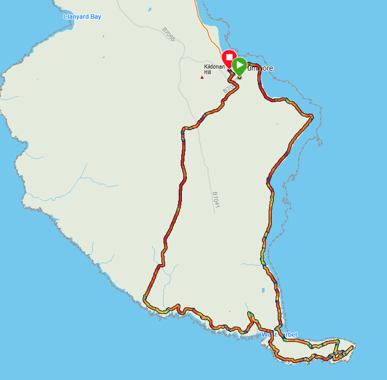
Route Map
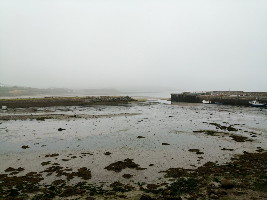 Drummore Harbour, Low Tide
 After a day off in Stranraer, we returned to the walking trail today to complete a circular walk round the Mull of Galloway. Our walking for the next few days will not be in sequence as we try to cope with the dearth of accommodation on the west coast of the Mull. We have also delayed the leg from Glenluce to Terally Point until the weekend when we will have access across the seven-mile long sands. The sands are part of a military bombing range which only has access at weekends. On the subsequent walk we will complete Terally Point to Port Logan, again via Drummore. This results in us missing out a stretch of coast between Stockmill and Clanyard Mill, which we will come back and do on another trip.
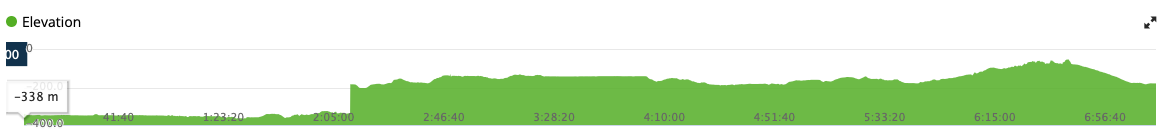
The first part of the walk coming out of the village of Drommore is fairly level, starting to rise gently at Portankill on the climb up to the Mull of Galloway Lighthouse (255 feet). The route drops again as you come off the Mull at West Tarbert and then rises consistently at the start of the exit until Creechan Park (436 feet), before dropping down back to Drommore.
The first part of the walk coming out of the village of Drommore is fairly level, starting to rise gently at Portankill on the climb up to the Mull of Galloway Lighthouse (255 feet). The route drops again as you come off the Mull at West Tarbert and then rises consistently at the start of the exit until Creechan Park (436 feet), before dropping down back to Drommore.
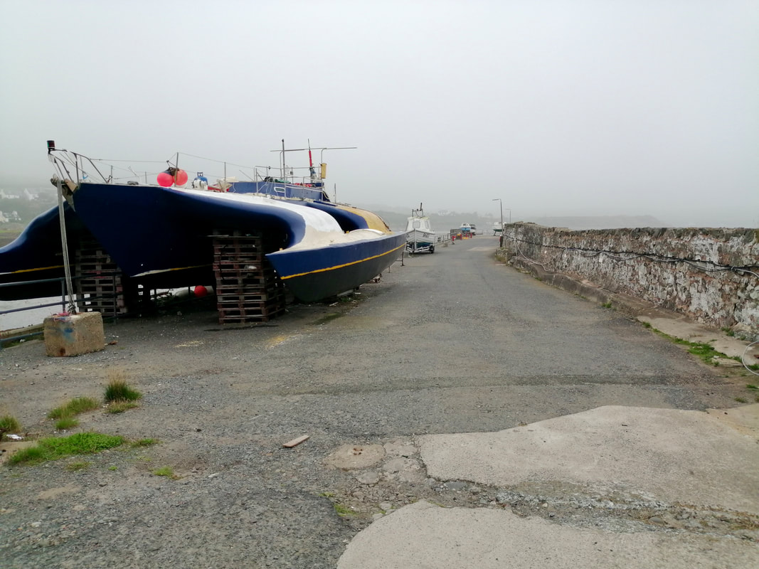 Drummore Quay
 Our adventure started at the pretty little village of Drummore, which is the southernmost village in Scotland. While it is difficult to determine an exact date for the establishment of the village, the area was central to early Christian activity in Scotland and just north of Drummore at Low Curghie a gravestone was discovered which appeared to date to the 5th or 6th century.
In the early 19th C, there was a substantial lime industry in the area that resulted in the building of the village harbour. Following the demise of the industry, the harbour was taken over by the Ministry of Defence as part of the support services for the nearby bombing range on Luce Bay. The harbour is currently owned by the local authority who are thought (sic) to have plans for a leisure facility in the area.
In the early 19th C, there was a substantial lime industry in the area that resulted in the building of the village harbour. Following the demise of the industry, the harbour was taken over by the Ministry of Defence as part of the support services for the nearby bombing range on Luce Bay. The harbour is currently owned by the local authority who are thought (sic) to have plans for a leisure facility in the area.
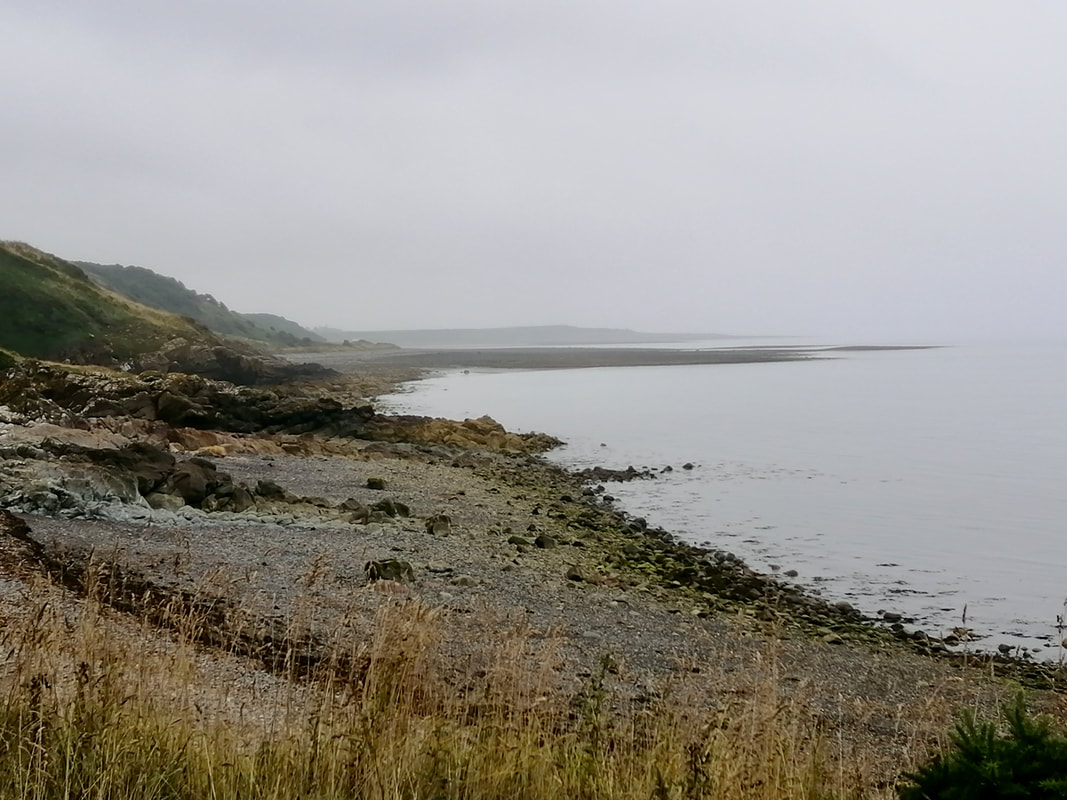
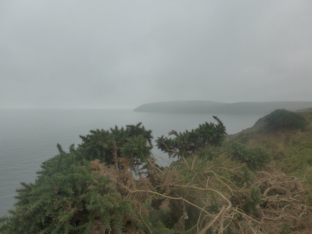
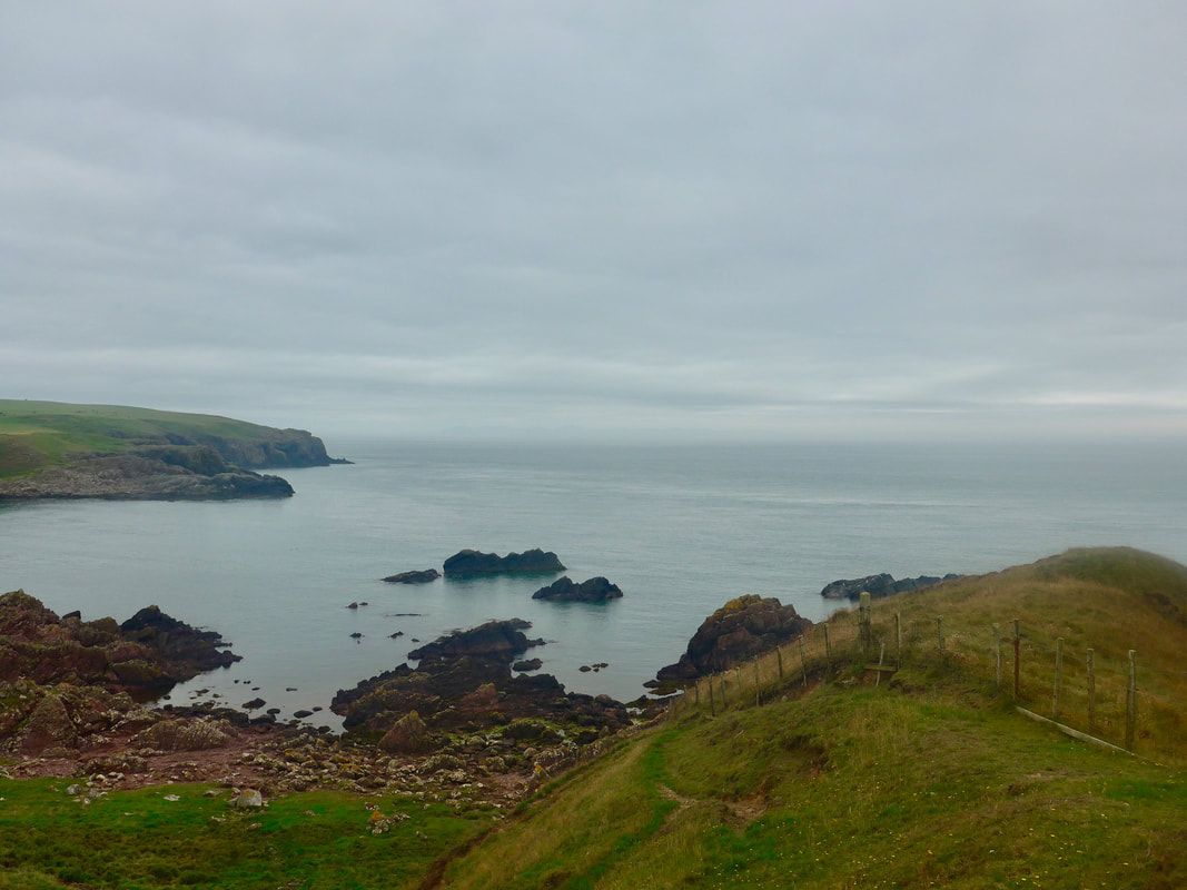
Cairngarroch to Crawar Bay
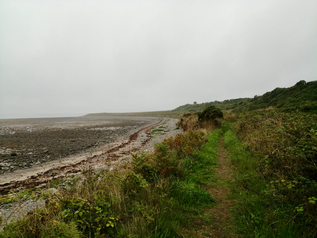
Although it was low tide, the exposed areas consisted mainly of pebbles, stones and mud and for a time we chose to walk on an earth path at the back of the beach. There was a cold chill to the early morning and over sea and land a thin, grey mist persisted for some time before lifting. It never fully disappeared, staying with us for most of the day.
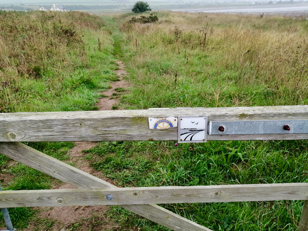
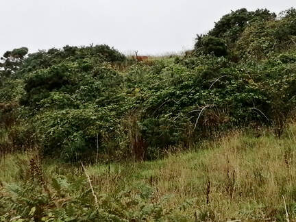
The Mull of Galloway Coastal Path runs off of the pier, initially following the line of the Cailiness Road before cutting off on to the earth path at the back of the beach. It is reasonable walking and, despite the poor visibility, we had good views all around. In between Cairngarroch and Crawar Bay, in the thick undergrowth on the low hill, a young deer with a fawn at heel, watched our progress carefully.
The Mull of Galloway Coastal Path runs off of the pier, initially following the line of the Cailiness Road before cutting off on to the earth path at the back of the beach. It is reasonable walking and, despite the poor visibility, we had good views all around. In between Cairngarroch and Crawar Bay, in the thick undergrowth on the low hill, a young deer with a fawn at heel, watched our progress carefully.
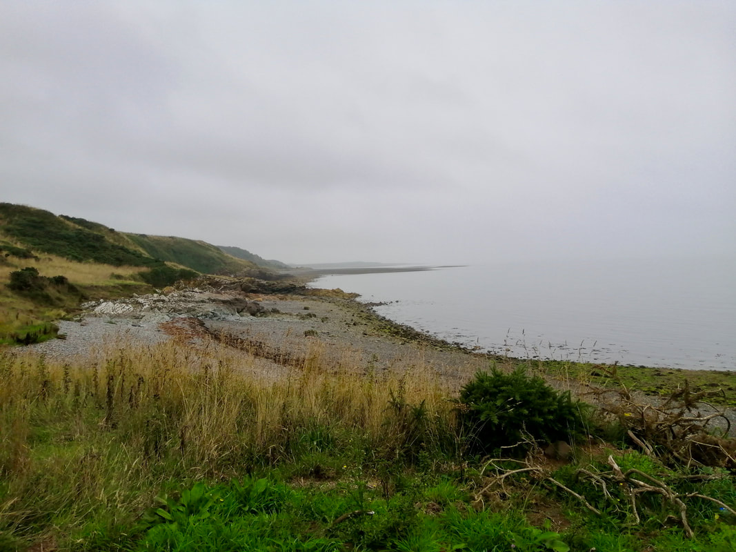
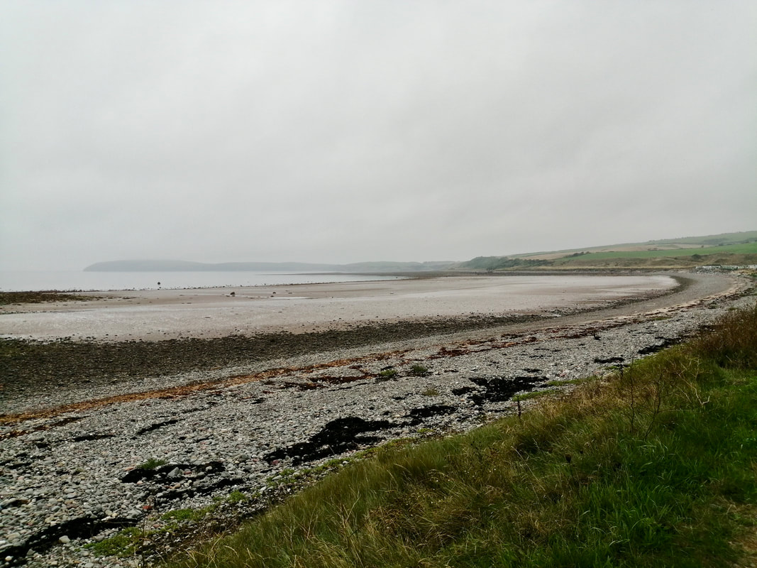 Maryport Bay
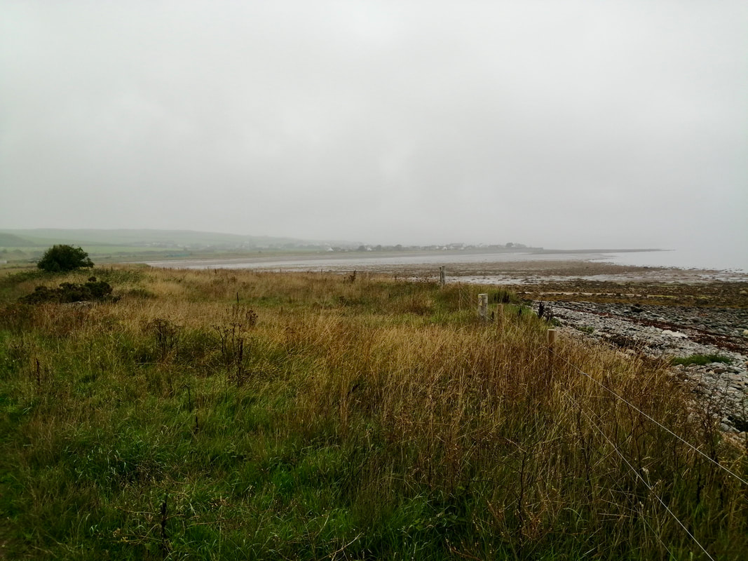
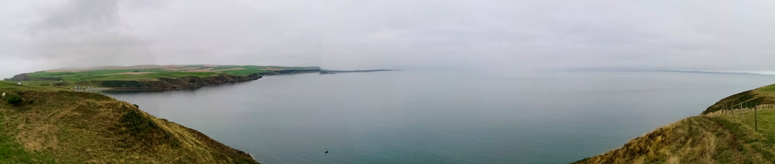
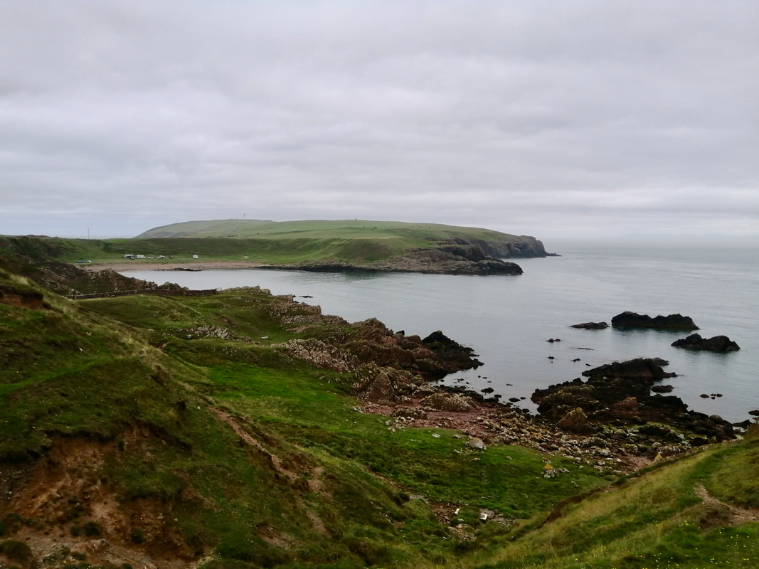
 Rounding Cailiness Point and on to the long Maryport Bay, the land ahead opens up with good, clear views to the Mull of Galloway. With the mist clearing slightly, out over the sea. to the east we could see to the Machars Peninsula and, looking more south east, clear down to the fells of the Lake District.
With the tide still low, there was a considerable expanse of sand and pebbled shore exposed. The green, grassy, undulating and inviting coastline, writhing like a snake, ran all the way to the Mull. At the hamlet of Maryport itself there is, perhaps unfortunately, a caravan park, which somewhat spoils an otherwise impressive view. Beyond the caravan park there is an area that can be subject to an overabundance of the local herbiage. Lucky for us, there were some workmen there cutting a way through it and clearing a path for us to follow.
With the tide still low, there was a considerable expanse of sand and pebbled shore exposed. The green, grassy, undulating and inviting coastline, writhing like a snake, ran all the way to the Mull. At the hamlet of Maryport itself there is, perhaps unfortunately, a caravan park, which somewhat spoils an otherwise impressive view. Beyond the caravan park there is an area that can be subject to an overabundance of the local herbiage. Lucky for us, there were some workmen there cutting a way through it and clearing a path for us to follow.
 Back Bay
 At the end of Maryport Bay the land starts to rise, gently at first, leading to more open views as you gain height. The walking surface is pretty good on a grassy path on the brow of the hill, if a tad over-grown in places. There are plenty nettles, brambles and thistles to be aware of on this walk. On the shore below there are a number of pretty, pebbled-shored, little bays. At various points on the walk there are 'kissing gates' to take you through the dry-stone dykes and fences.
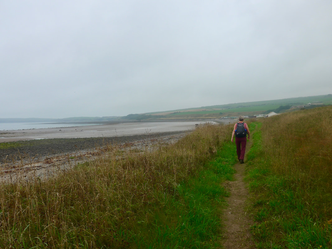
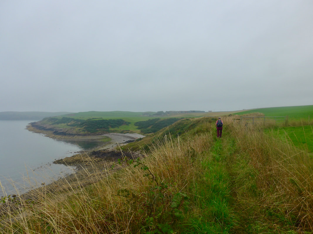
There is a little drop-down to Portankill where the Kirk Burn discharges. The kirk of the burn's name is Kirkmaiden Church, the remains of which are to be found on the hilltop above. Just after Portankill on the hillside there are the remains of a promontory fort known as 'The Dounnan'. These consist of the remains of an earth and stone rampart, with two outer, defensive ditches. Joanna Elizabeth is just approaching the area in the photograph below.
There is a little drop-down to Portankill where the Kirk Burn discharges. The kirk of the burn's name is Kirkmaiden Church, the remains of which are to be found on the hilltop above. Just after Portankill on the hillside there are the remains of a promontory fort known as 'The Dounnan'. These consist of the remains of an earth and stone rampart, with two outer, defensive ditches. Joanna Elizabeth is just approaching the area in the photograph below.
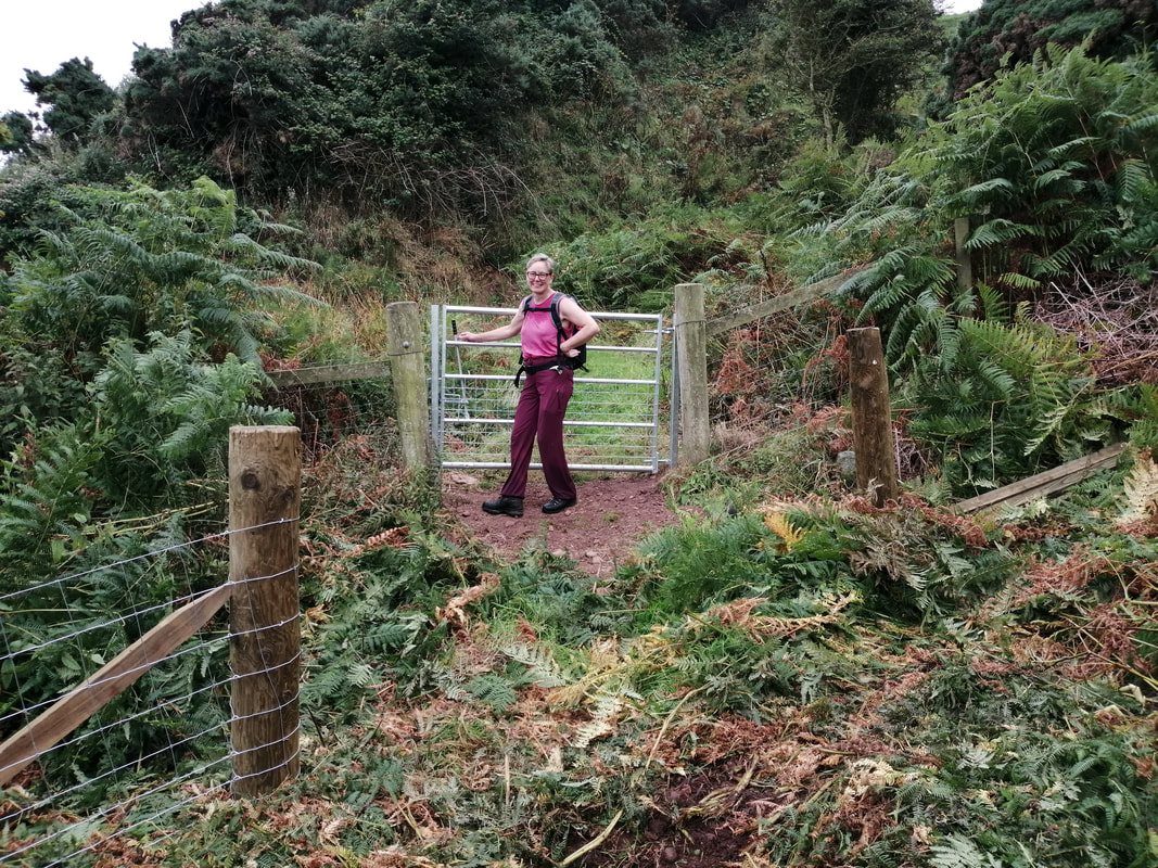
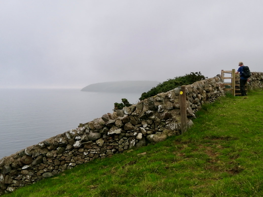
Portankill to St Medana's
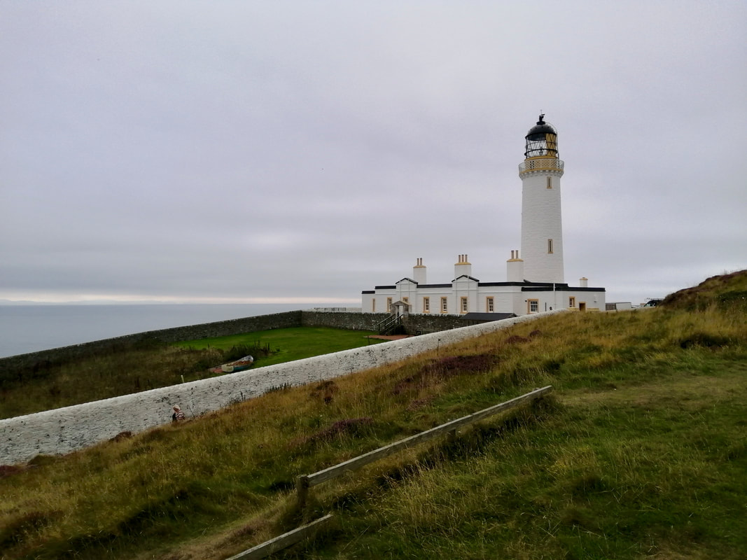
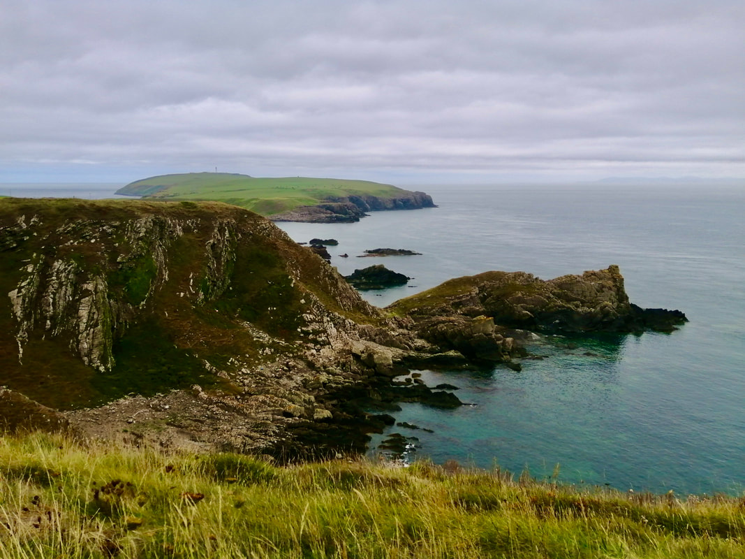
 Mull of Galloway
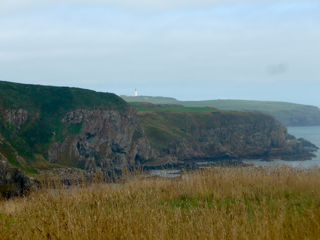
 From Portankill the land rises to just over one hundred feet. Just after you pass below Mull of Galloway Farm there is the location of St Medana's Cave and Chapel. Both the cave and the chapel are of unassigned periods, as are all the finds associated with the place. Readers of previous walks will remember we passed St Medana's Well at Front Bay on the Machars Peninsula on the opposite side of the bay. As we progressed on to the next section a haar moved in from the sea, clothing the Mull of Galloway in a light grey sheen, the end result making it even more enigmatic and mysterious.
St Medana's to East Tarbert
 East Tarbert
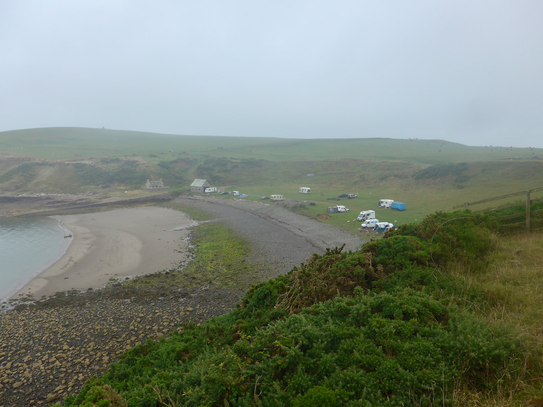
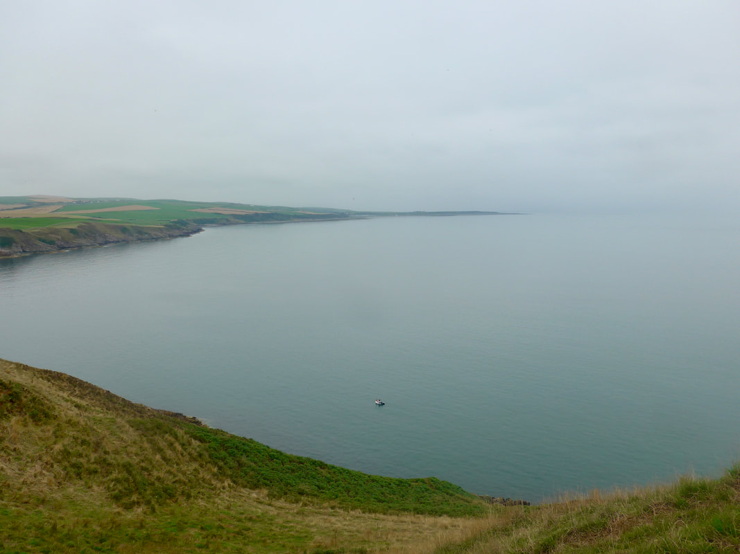
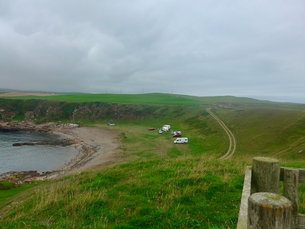
 Continuing on from our high point at St Medana's (124 feet), the route drops back down on the approaches to East Tarbert, a lovely little bay just at the bottom of the start of the Mull of Galloway. There were a number of camper vans and caravans here and one could understand the attraction of the quiet and secluded bay.
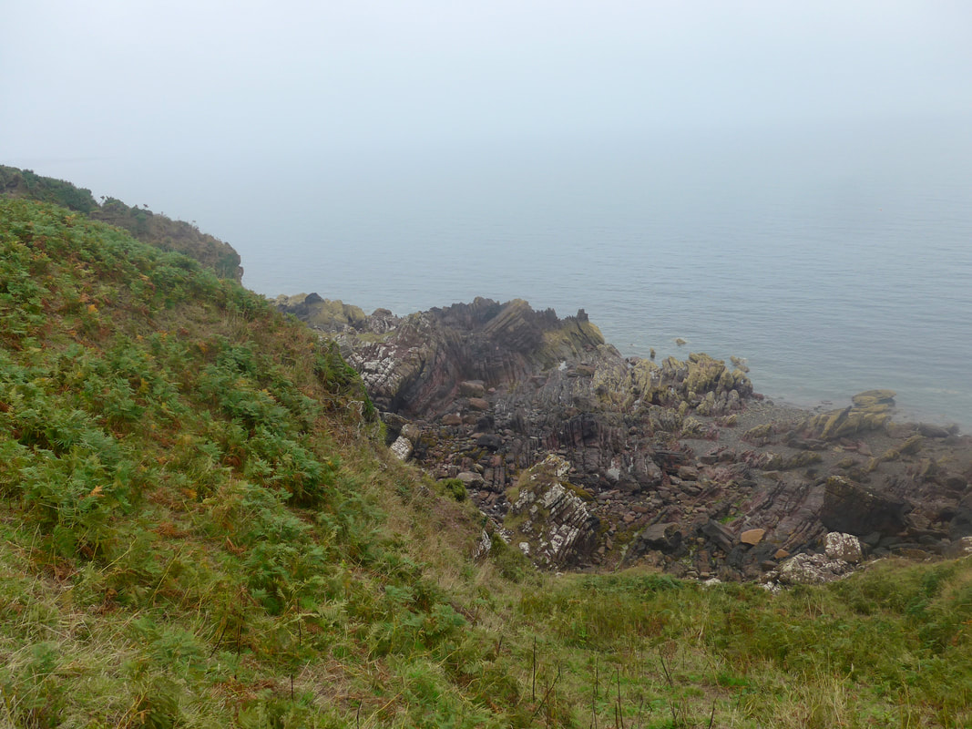
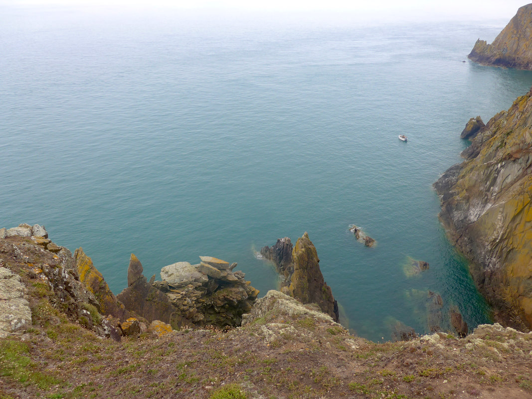
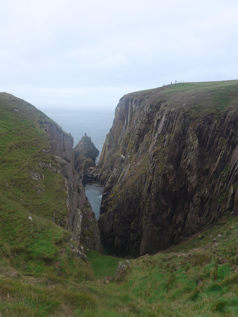
All along this route there are nice views down in to the secluded little bays, some with interesting rock forms. There are numerous caves on the sections, as well as small and larger stacks (rocks that have become isolated from the surrounding rock face due to erosion). Most of the rock on the southern end of the Mull of Galloway dates from the Silurian period (419-443 million years ago [MYS]) and consists of sandstone and mudstone. On the western side of the Mull there is a section where there is a substantial network of caves, created where the softer rock forms have been worn away. The rock on the northern end, roughly from Port Patrick onwards, is from the later Ordovician Period (443-485 MYA).
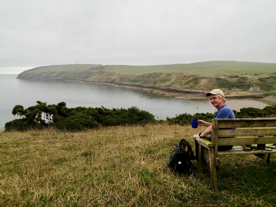
We stopped for lunch on the hills above East Tarbert, stopping by a handy bench on the hilltop with lovely views across the bay. While the idea of visiting the bay itself was attractive, we did not want to break the sense of solitude we had garnered on the walk across the braes by interacting with others. The peace would be disturbed soon enough when reach the Mull, now in view and where we expected there would be crowds.
All along this route there are nice views down in to the secluded little bays, some with interesting rock forms. There are numerous caves on the sections, as well as small and larger stacks (rocks that have become isolated from the surrounding rock face due to erosion). Most of the rock on the southern end of the Mull of Galloway dates from the Silurian period (419-443 million years ago [MYS]) and consists of sandstone and mudstone. On the western side of the Mull there is a section where there is a substantial network of caves, created where the softer rock forms have been worn away. The rock on the northern end, roughly from Port Patrick onwards, is from the later Ordovician Period (443-485 MYA).
We stopped for lunch on the hills above East Tarbert, stopping by a handy bench on the hilltop with lovely views across the bay. While the idea of visiting the bay itself was attractive, we did not want to break the sense of solitude we had garnered on the walk across the braes by interacting with others. The peace would be disturbed soon enough when reach the Mull, now in view and where we expected there would be crowds.
Starting back, the Mull of Galloway trail keeps to the east on the hillside, with a road running on the west, giving a choice of surface. If you take the road option you miss out on the lovely walk on the approaches to the point and round the Mull itself.
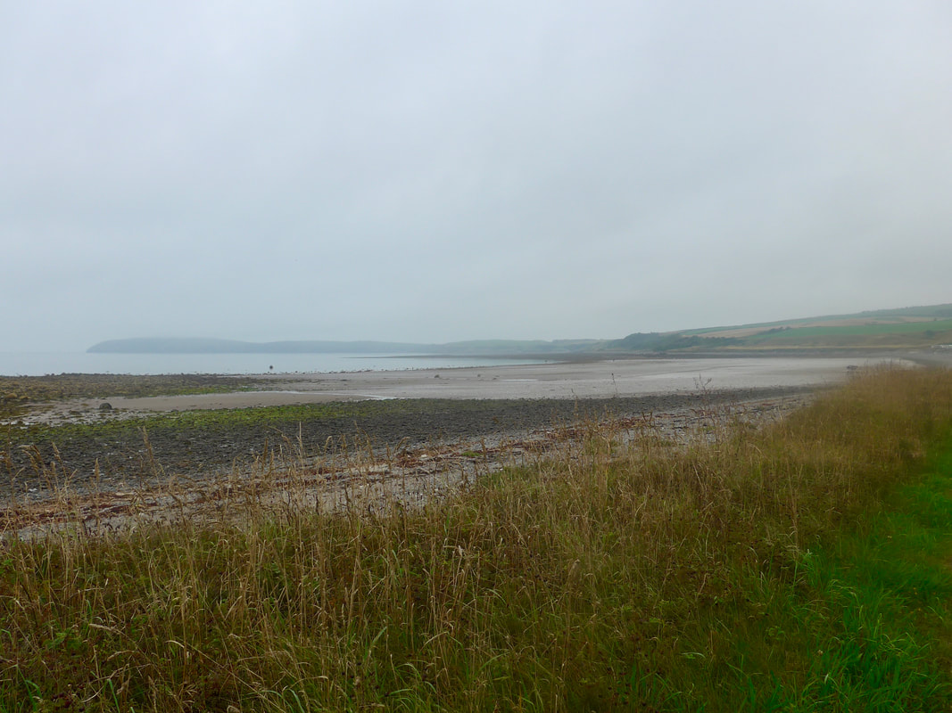
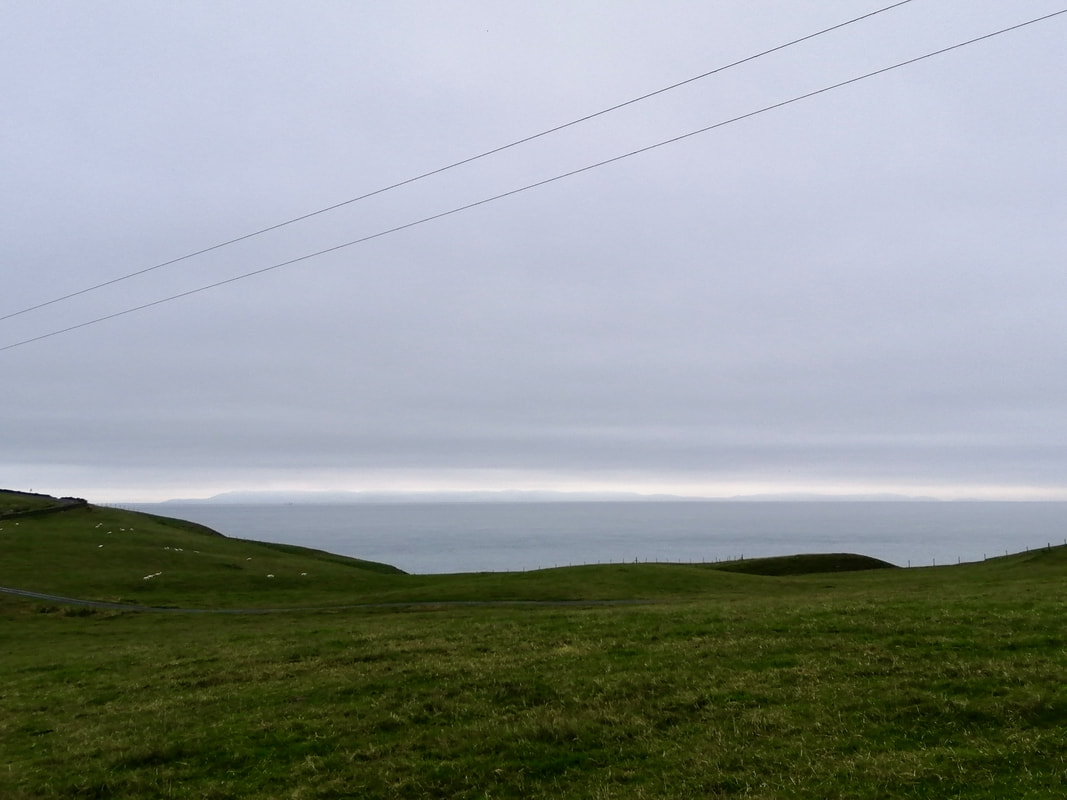
Looking Back to Maryport Bay
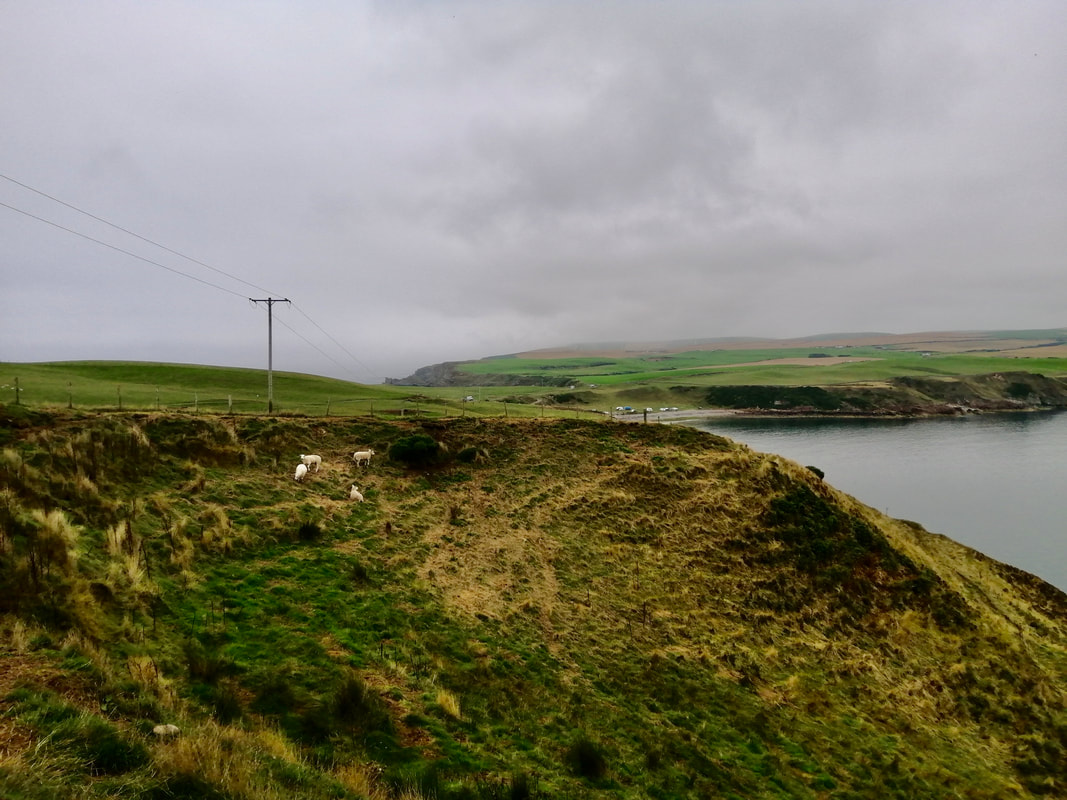
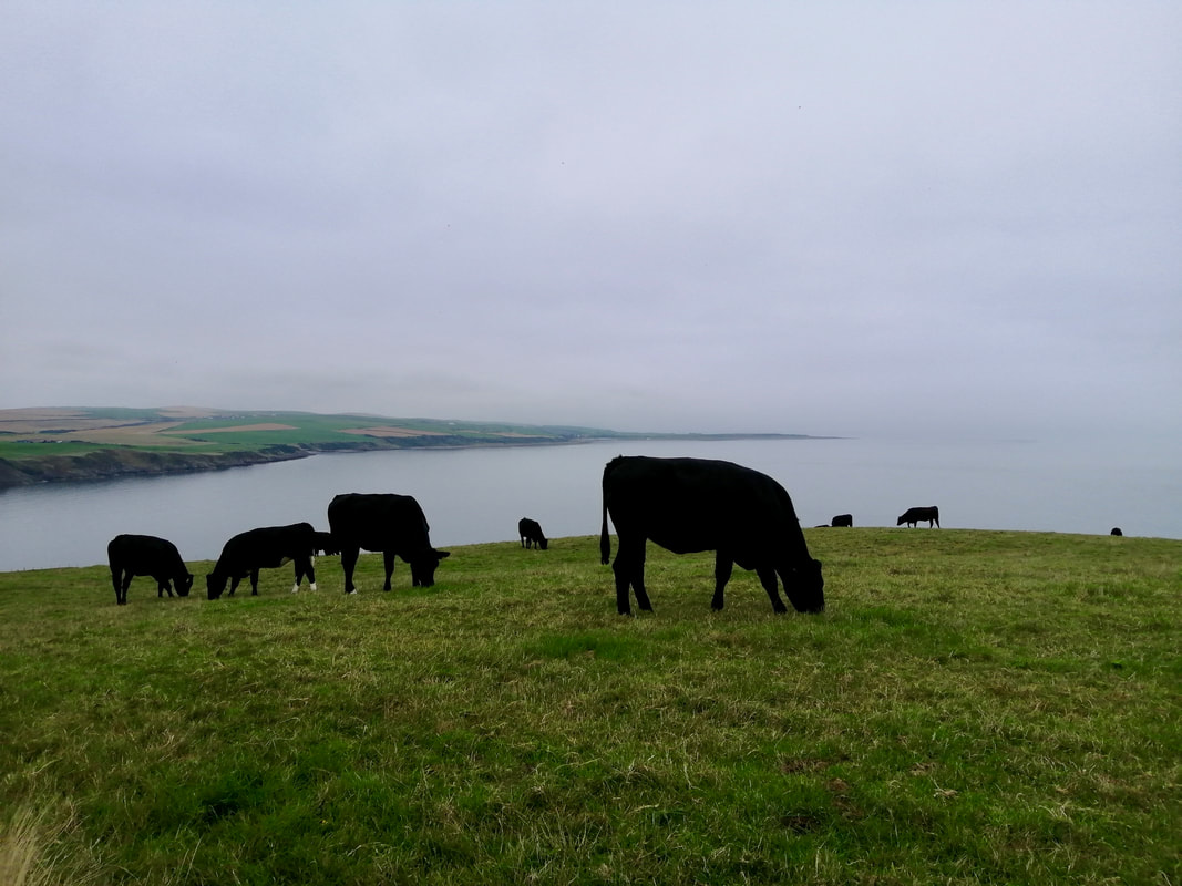
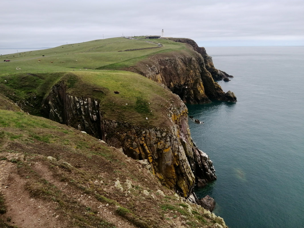
It is a delightful walk, the elevation gently rising from sea level at East Tarbert Bay to over two-hundred and fifty feet on the Mull of Galloway. To the east and south are the Machars Peninsula, Lake District fells and, on a good day, the Isle of Man. Looking westwards from the western side of the Mull out over the Irish Sea, you are looking towards the coast of Northern Ireland, Strangford Lough lying behind the Ards Peninsula. There are herds of cattle grazing on the Mull but they were amazingly benign and showed no interest in us at all.
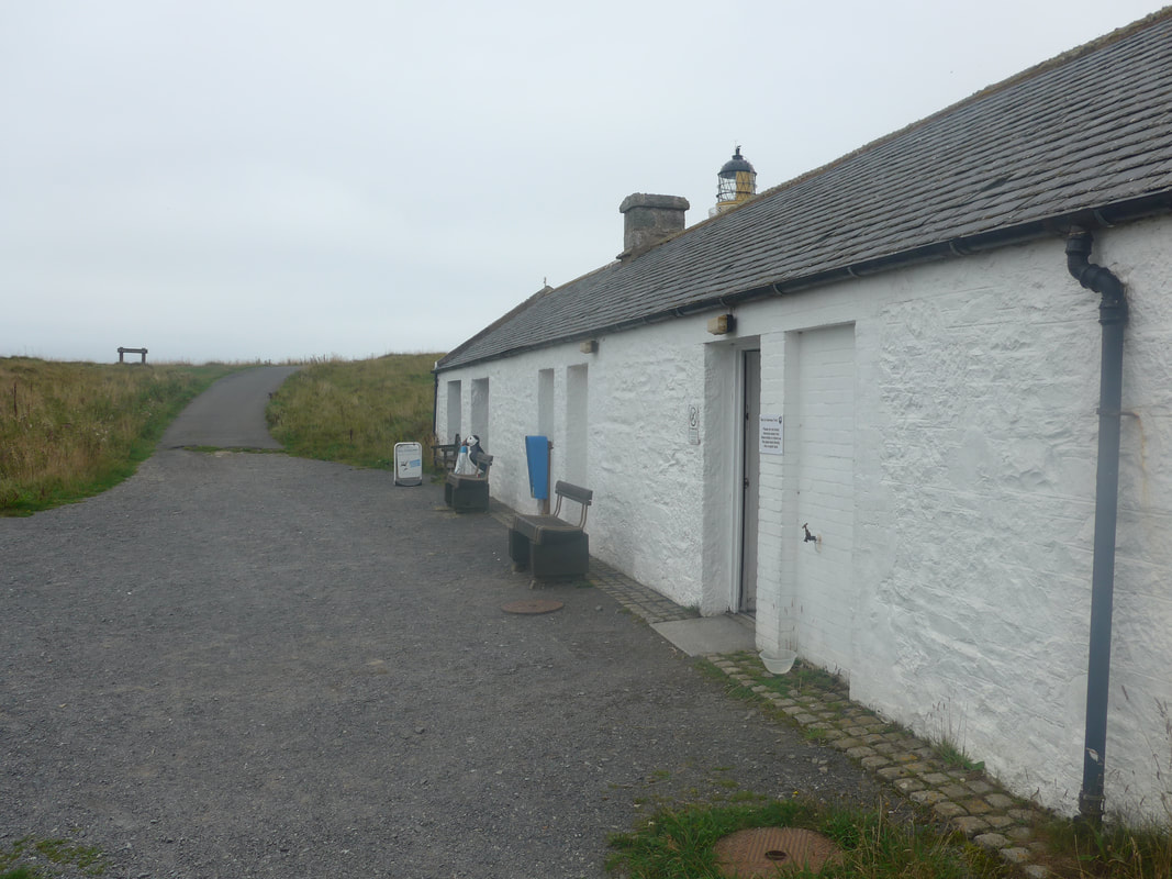
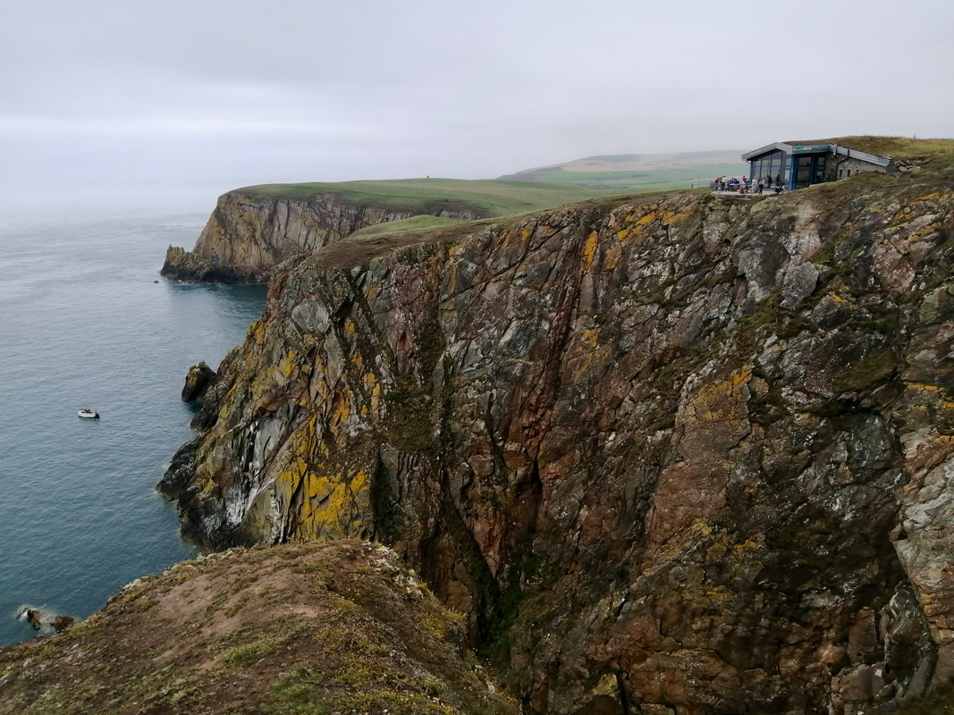
Coming off the eastern side of the Mull and on to the headland, below is the first of the many caves that dot the cliffs from here until you reach round to West Tarbert. There are visitor facilities on the Mull, including a cafe and the RSPB centre, as well as the lighthouse. As we expected, it was pretty noisy and crowded and we were lucky to get a seat in the cafe, where we stopped for coffee and cake. After visiting the RSPB office and walking about the Mull, we were happy to leave it behind us and head back to the quiet of the road less-travelled.
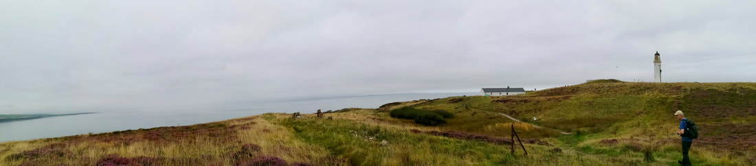
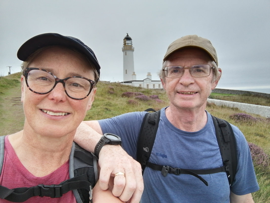
Mull of Galloway & Lighthouse
Mull of Galloway

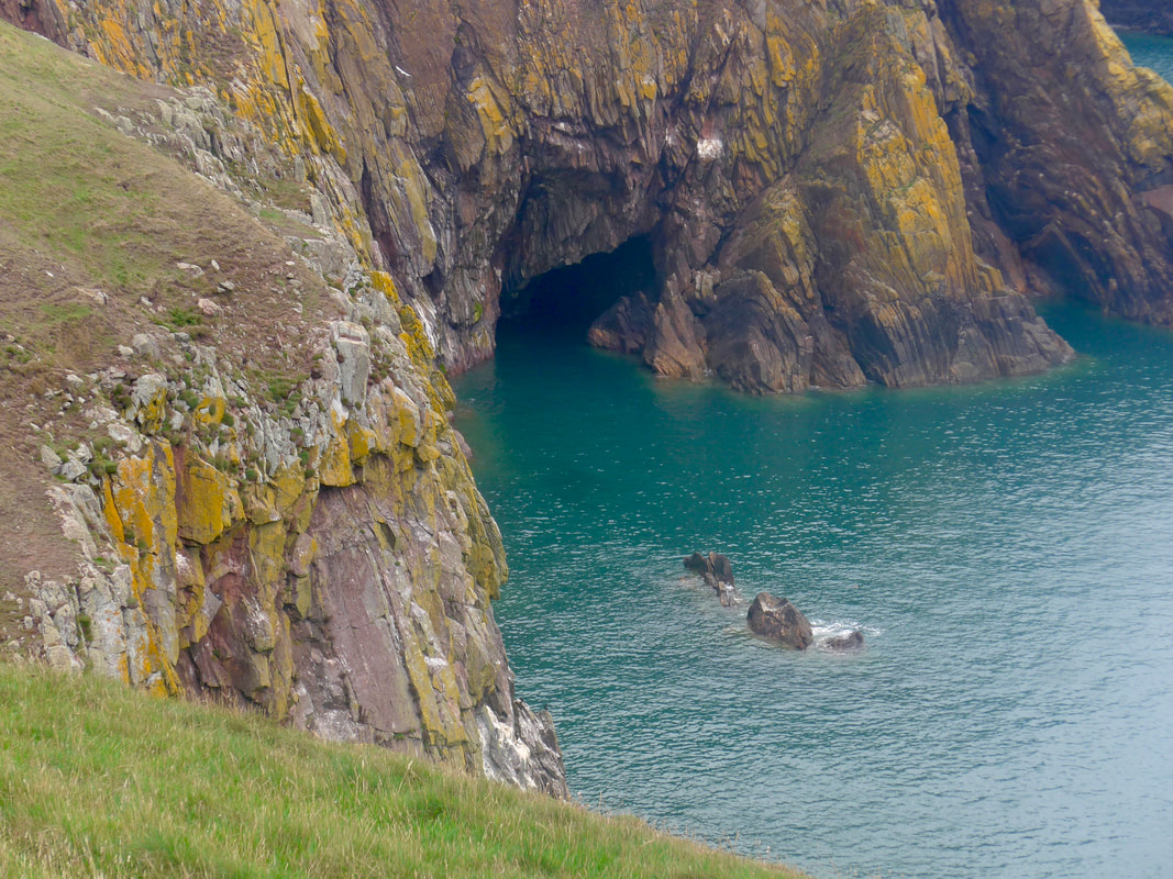 Mull of Galloway Cave
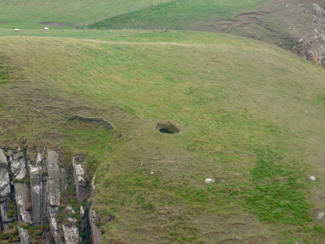
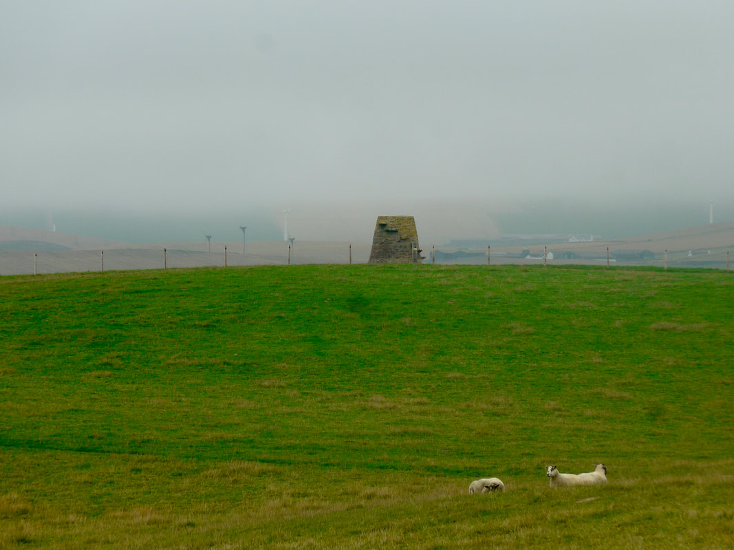
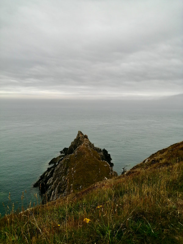
 The walk off of the Mull of Galloway on the formal trail, is dramatic as it is lovely. The craggy cliffs and rocks, dramatic rock stacks, mysterious caves and beautiful little bays and coves, are a feast for the eyes. As well as the natural drama of the rocky places there is the no less mysterious 'Kennedy's Cairn', about which very little is known. It does not appear on the OS map of 1848, but does by the early 1900's. Just before the cairn, on the middle of a rising brae, there is a nice little example of a blow hole in the middle of the sloping hill. The sea water on the day we visited was crystal clear and a wonderful shade of dark blue. Up against the open maws of the dark, craggy cave openings it created a sense of wonderment.
Mull to Carrickcorie
 West Tarbet Bay
 Just after Carrickmore but before West Tarbert Bay, you are roughly on the line of the major Iron Age earthworks that crossed the neck of the Mull of Galloway. It is believed that the line marks out what was the largest Iron Age settlement in Galloway. Later as you pass the foot of Mull Glen, there is another hill and promontory fort that was a domestic dwelling (homestead), as well as a defensive feature.
Coming off the Mull we got ourselves into a bit of a fankle at the King's Well (gully) and ended up having to walk up the gully to get over. We had taken the high line coming round West Tarbert Bay and perhaps we would have been better served dropping down in to the bay and walking along the shore to come up on to the cliff after the gully? It ended up with us having to climb over numerous electric fences to get back on track. The fences were a real pain. Down here they seem to think one fence is not good enough and they often have two or three in very close proximity to each other (like every twelve inches!). You get zapped climbing one, jump off the fence in response, stumble and get zapped by the next one.
Coming off the Mull we got ourselves into a bit of a fankle at the King's Well (gully) and ended up having to walk up the gully to get over. We had taken the high line coming round West Tarbert Bay and perhaps we would have been better served dropping down in to the bay and walking along the shore to come up on to the cliff after the gully? It ended up with us having to climb over numerous electric fences to get back on track. The fences were a real pain. Down here they seem to think one fence is not good enough and they often have two or three in very close proximity to each other (like every twelve inches!). You get zapped climbing one, jump off the fence in response, stumble and get zapped by the next one.
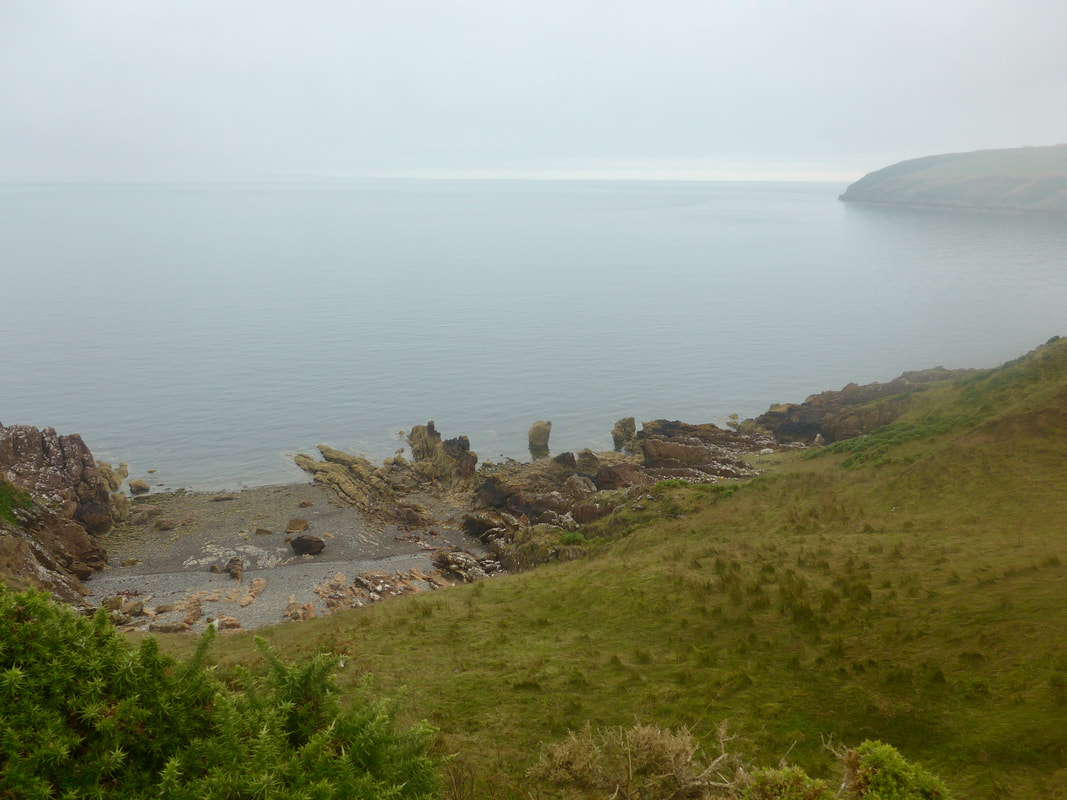
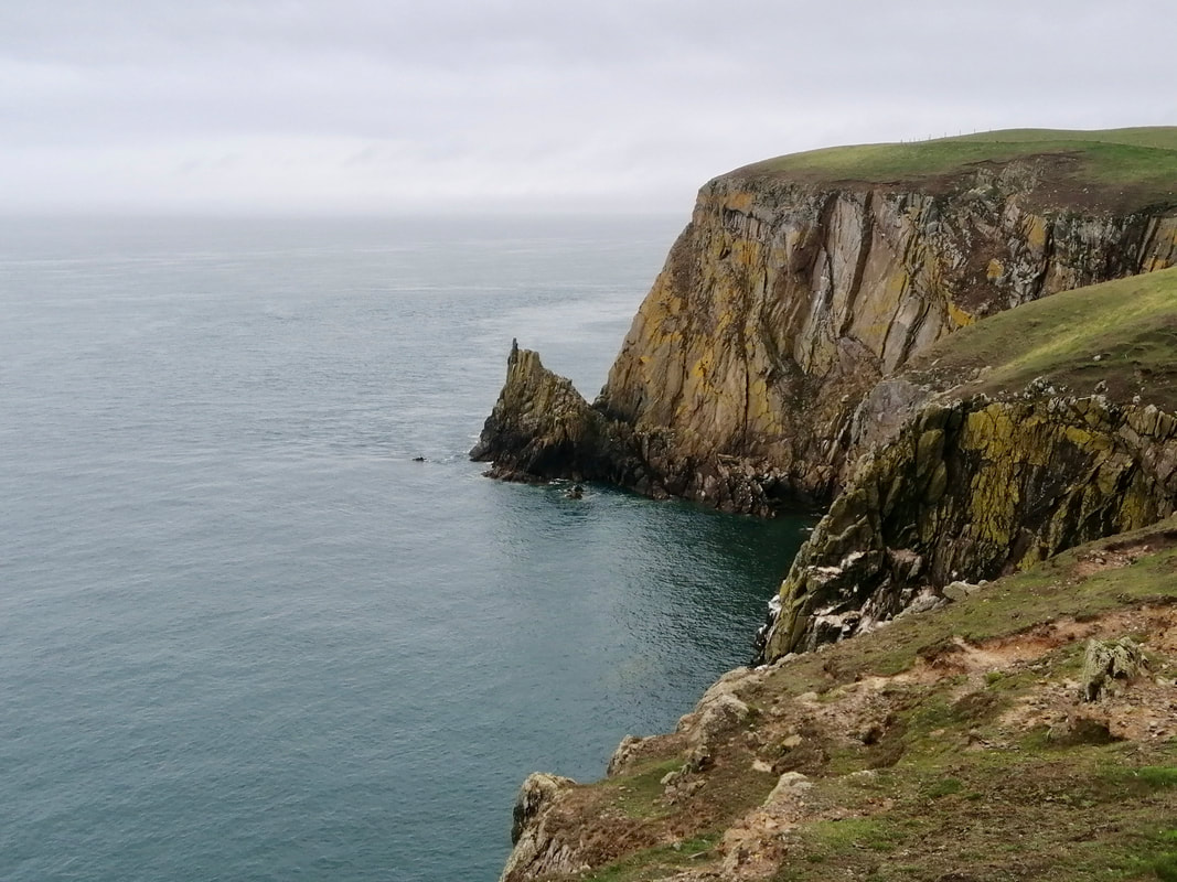
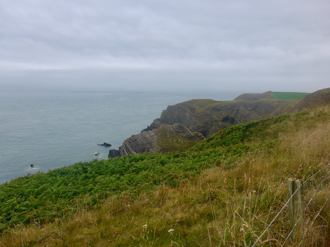
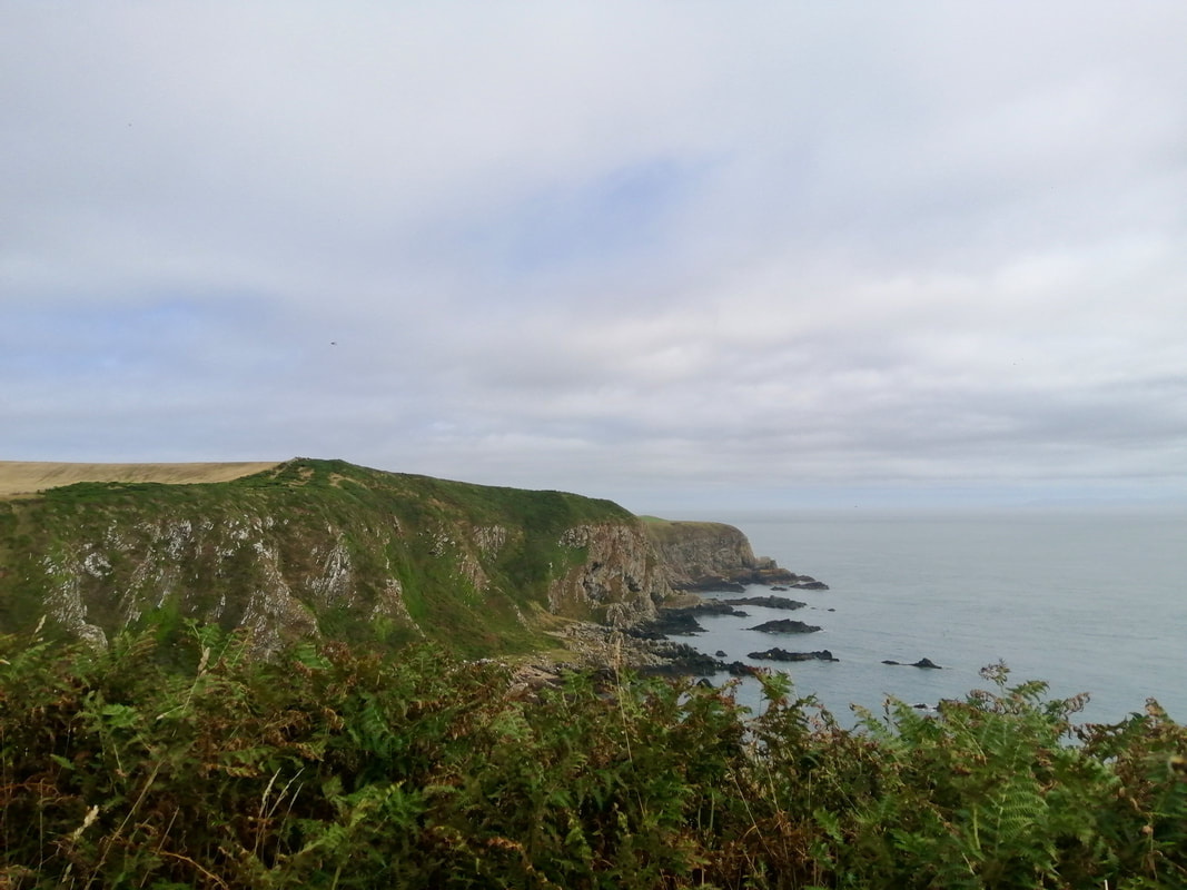
 Across West Tarbet
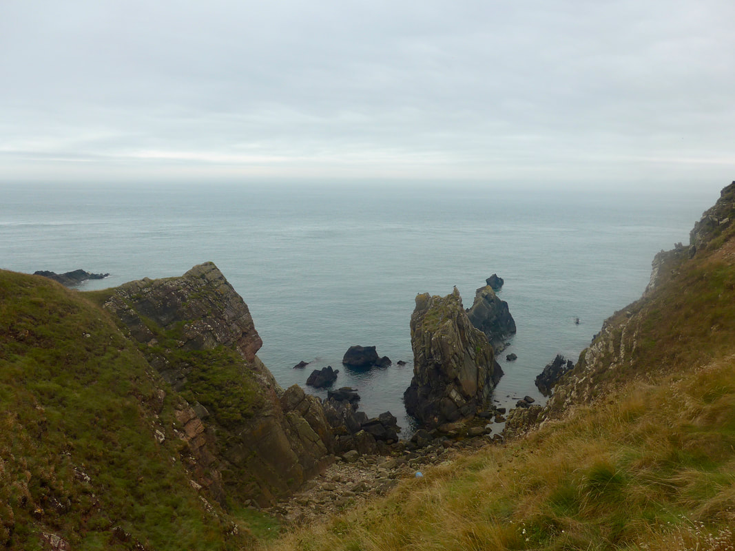
 Despite our travails with the gully, we really enjoyed this section of the walk from West Tarbet to our exit point below Cardryne Farm. We were really tempted to continue on to the next exit point at Port Mona but were deterred by the extra mileage. This is a dramatic coastline, natural rock arches, the cliff face lined with caves and rock stacks alive with varied birdlife.
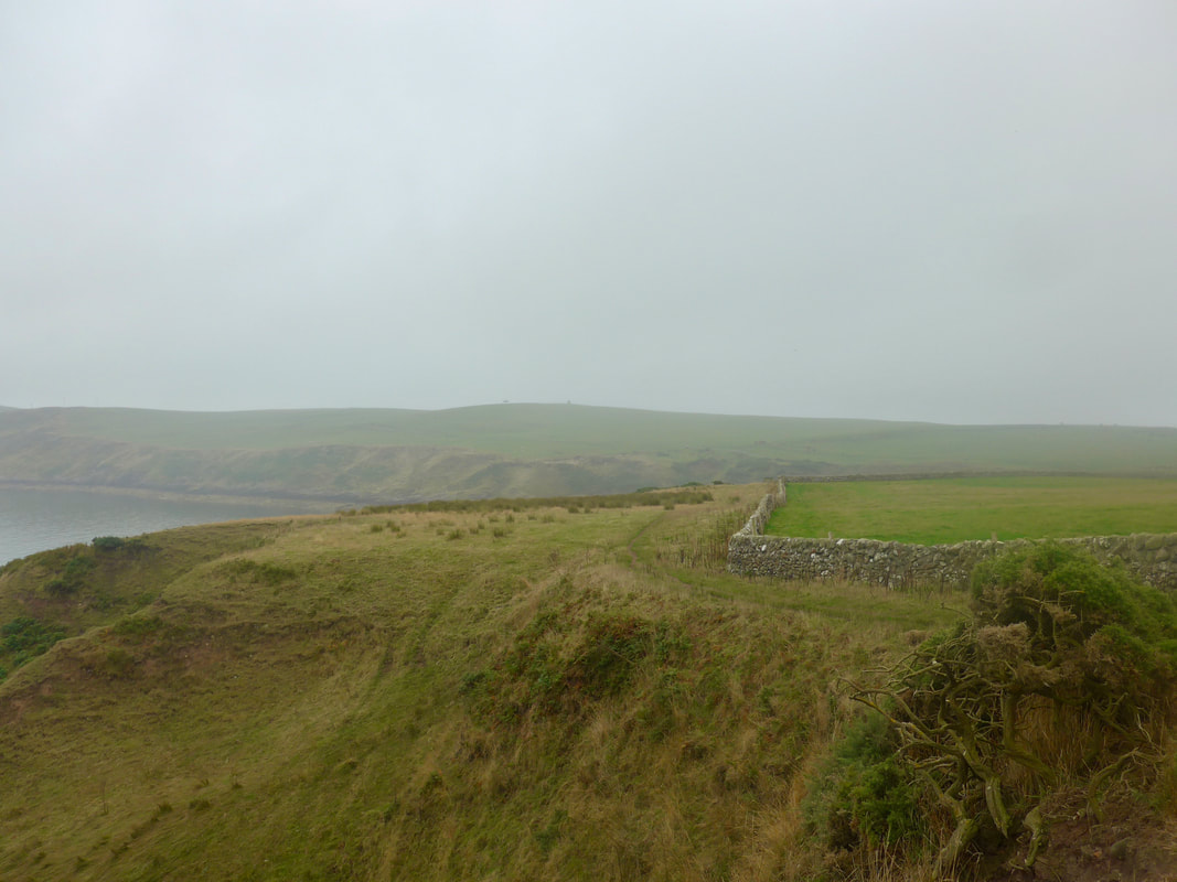
Once past the gully, it is very pleasant walking across mostly arable farmland. There were areas, particularly when walking on the shore side of the fence, when the gorse was very overgrown and progress was difficult. The added height on the low cliff gives good views back to the Mull of Galloway and forward up to Crammag Head. There are various options in terms of exit points if you want to do a circular walk, including at West Tarbet Bay, later below Cairngaan and again at Cardryne where we headed back to Drummore.
Once past the gully, it is very pleasant walking across mostly arable farmland. There were areas, particularly when walking on the shore side of the fence, when the gorse was very overgrown and progress was difficult. The added height on the low cliff gives good views back to the Mull of Galloway and forward up to Crammag Head. There are various options in terms of exit points if you want to do a circular walk, including at West Tarbet Bay, later below Cairngaan and again at Cardryne where we headed back to Drummore.
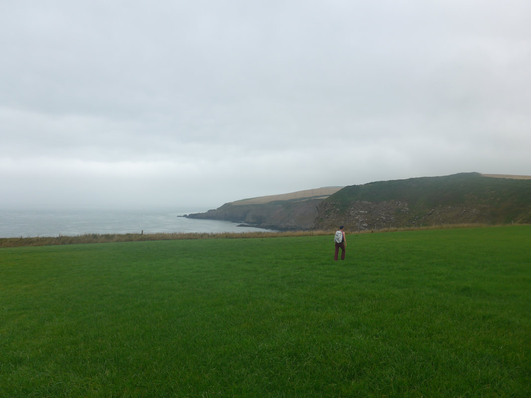
 Looking to Drummore
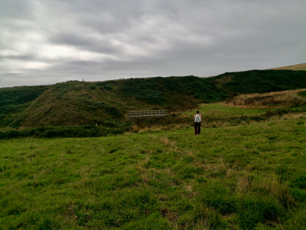
 Just before Pulinkum Burn, we turned inland to access a bridge over the burn which with high tide, was quite fulsome. After crossing we returned to the coast for a final short section before reaching our turn off at Cardryne.
From accessing the farm track to the centre of Drummore is just short of four miles. It is not a particularly heart-warming walk, but it is not ugly either. The road gently rises from the clifftop (two-hundred feet) to Creechan Park to reach the highest point of the day (over 430 feet), before dropping back down on the approaches to the village.
From accessing the farm track to the centre of Drummore is just short of four miles. It is not a particularly heart-warming walk, but it is not ugly either. The road gently rises from the clifftop (two-hundred feet) to Creechan Park to reach the highest point of the day (over 430 feet), before dropping back down on the approaches to the village.
 RSS Feed
