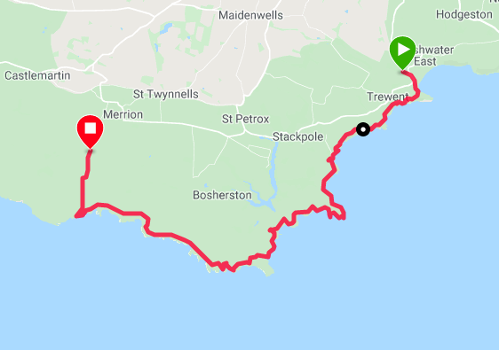
Route Map
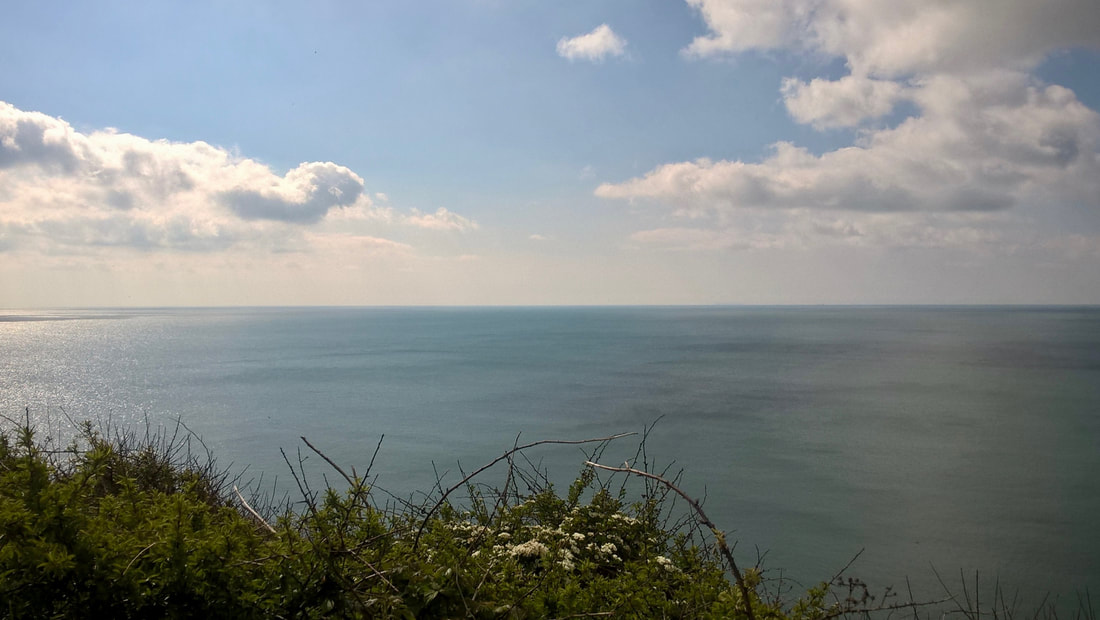
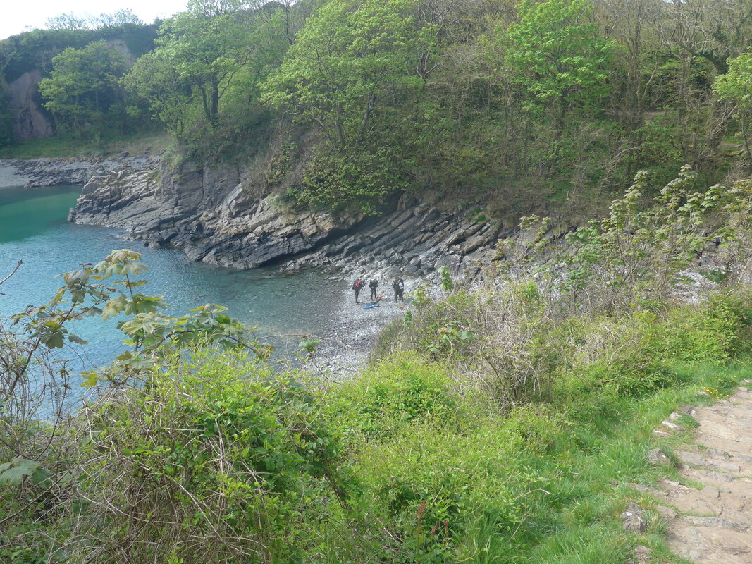
Despite a number of mobile homes and caravans passing by our pitch in the course of the evening, we managed to have a good night's sleep. Wakening about 7.00am, we made and ate breakfast before breaking camp and packing up. It was a nice, bright morning and just across from our pitch there was a small copse of trees from where we were treated to a lovely dawn chorus. From our campsite back down to the beach was just short of a kilometre and we were on the trail for about 9.30am.
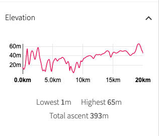 Walk Profile
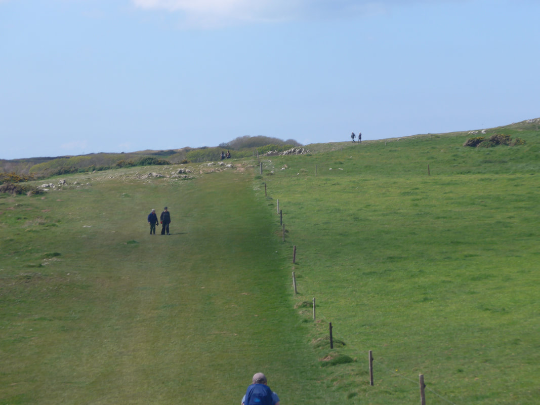
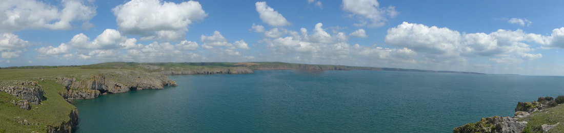
 The route today is mainly on the coast until the final section when we are pushed inland by a military firing range. There are two ranges on this stage of the walk, but we understand the first of them (east) will be open and the second closed. On this final section we will have a long walk inland to start the route round the range, but we will not complete it as we are staying in Airbnb accommodation just before the village of Castlemartin. The weather forecast is fair, albeit occasional cold winds are forecast. The early part of the route is rolling countryside until the final, gentle but steady ascent starts just before St Govan's Head and continues to Castlemartin.
 Climbing to Trewent Point
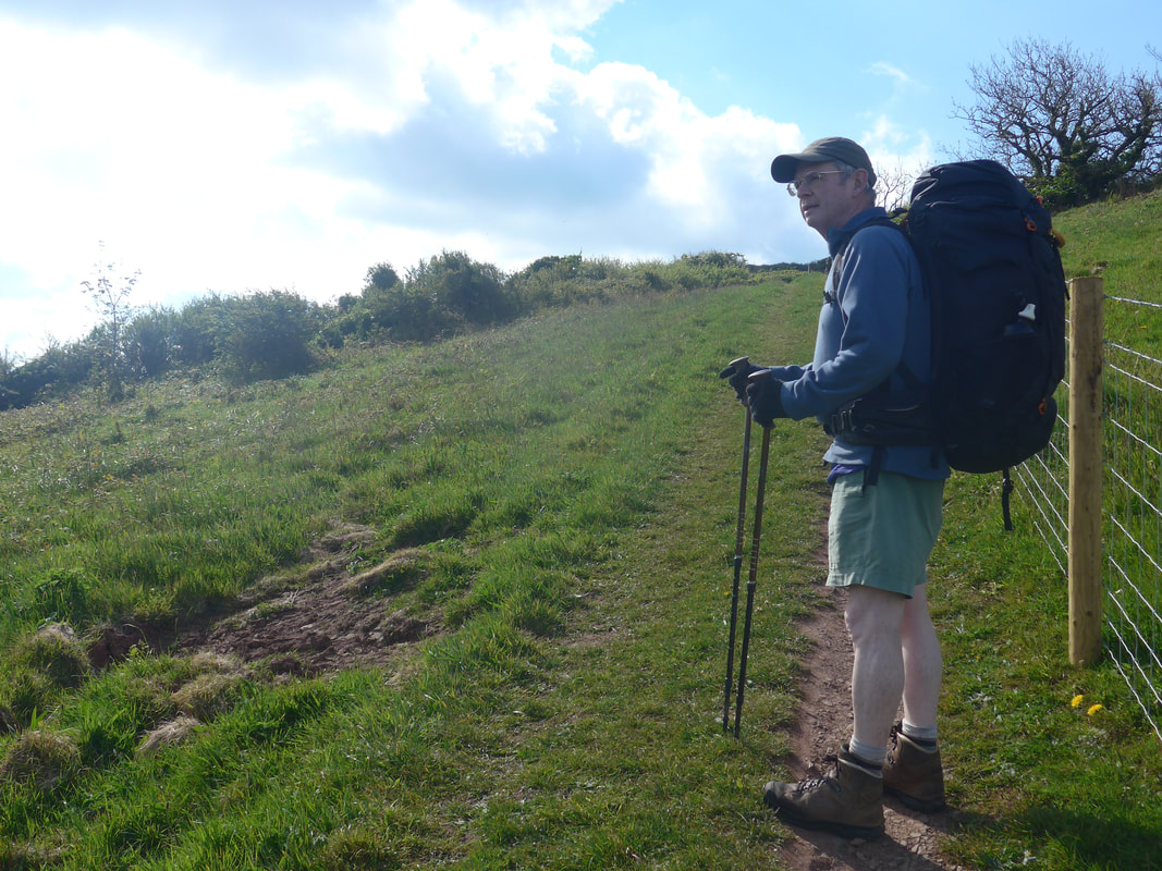
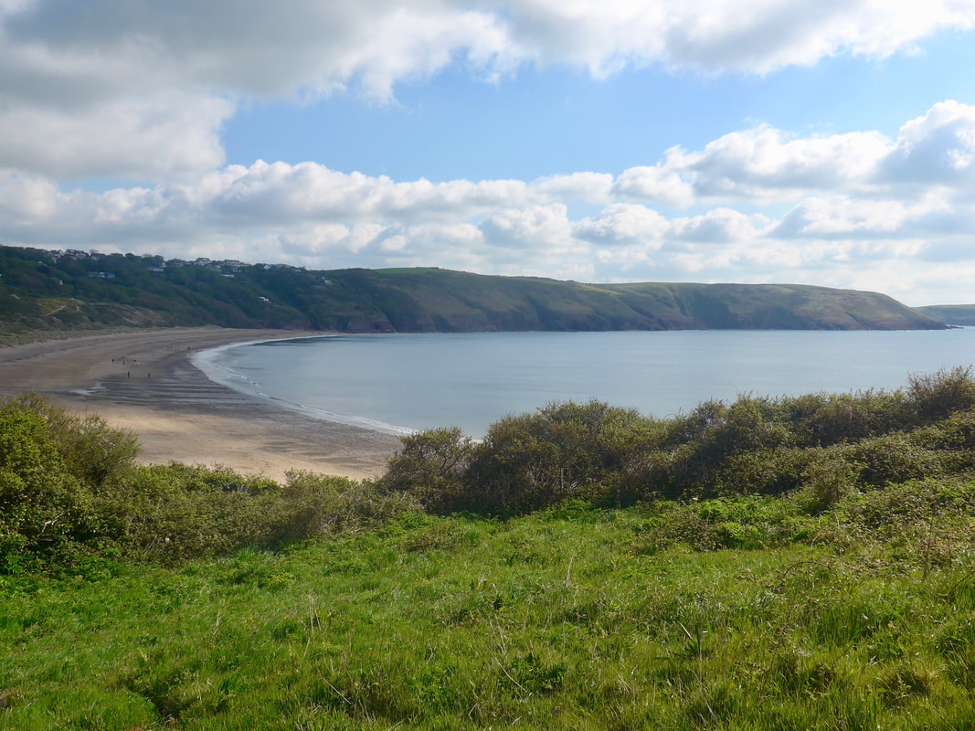
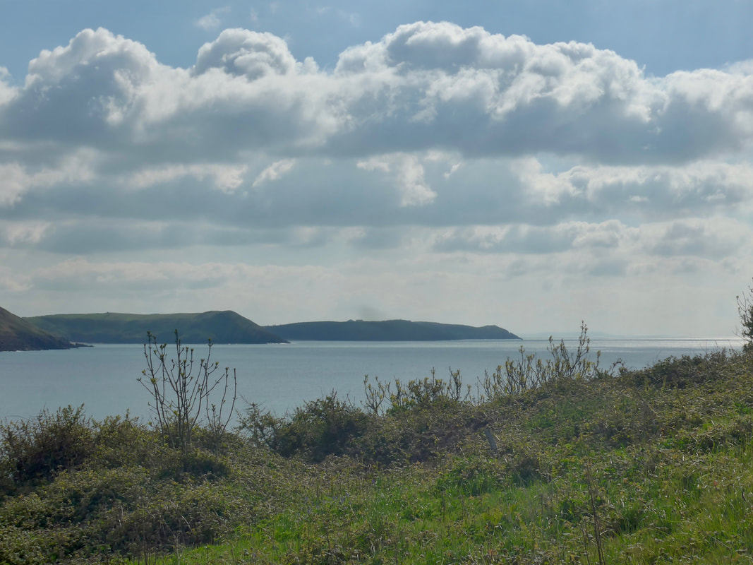
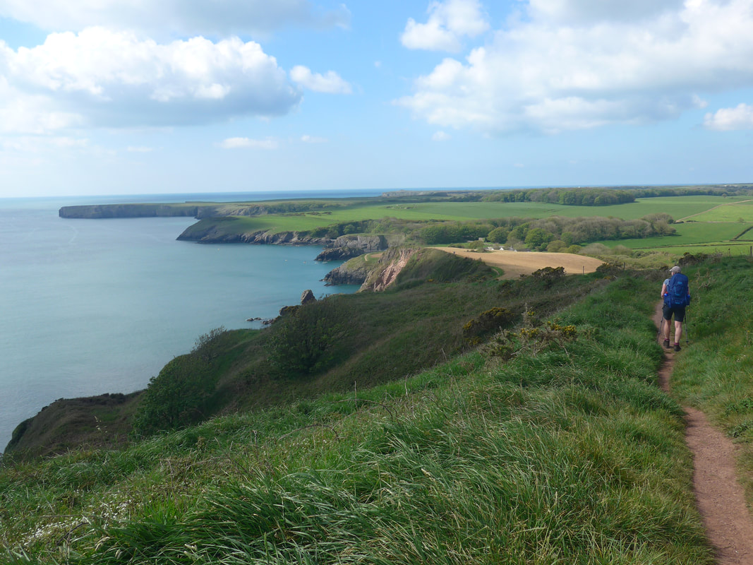
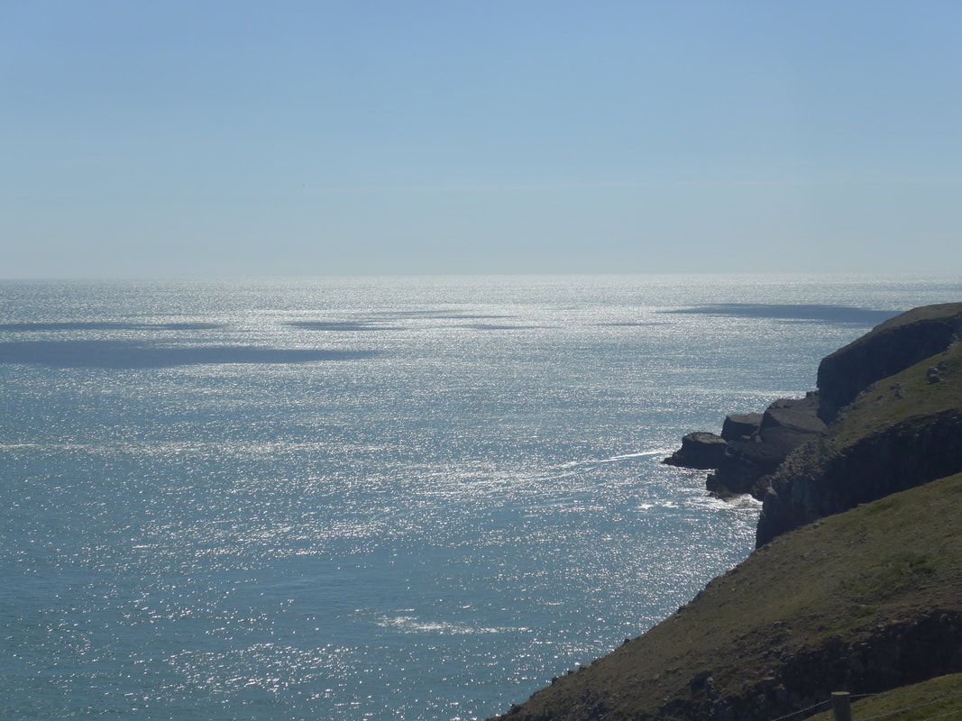
 It was still a bit chilly when we set off and we wore fleecy and gloves to ward off the cold. Despite the early morning cold, the sun was out and there were nice views to land and sea. Once we had gained a little bit of height we could see and appreciate the grand sweep of the bay at Freshwater East. Beyond the bay, the cliffs ran round as far back as Old Castle Head with the entrances to Swanlake Bay and Manorbier clearly visible. Inland, the road from East Trewent snaked up the hill to disappear over the summit of the Downs. Gaining a little more height, stopping at a kissing gate on Trewent Head the view forward went over beautiful blue / green waters as far as Stackpole Head.
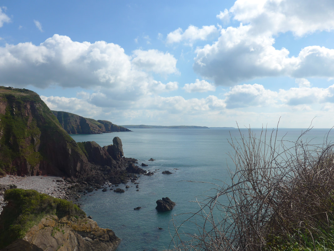
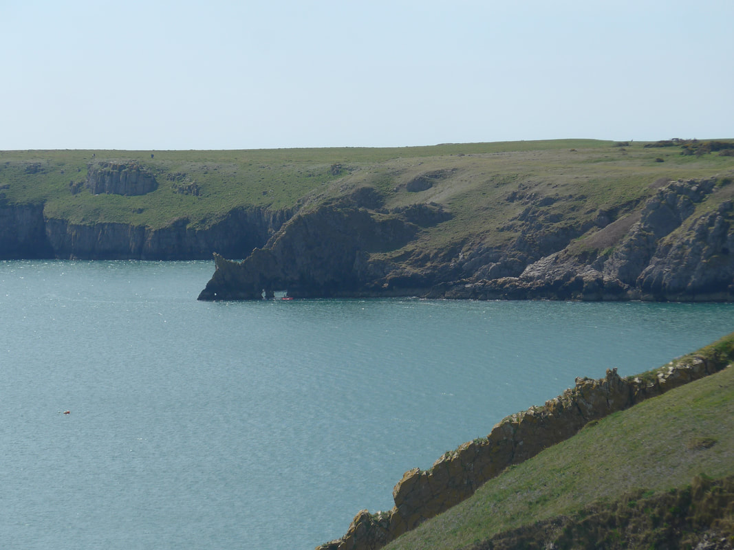
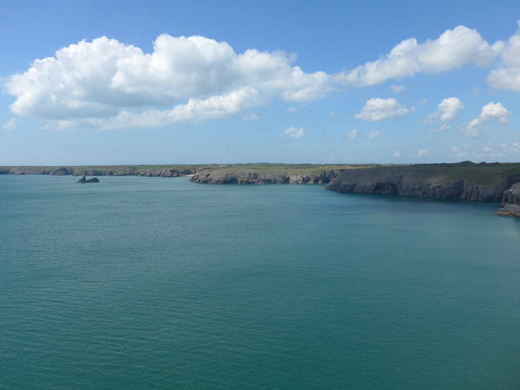
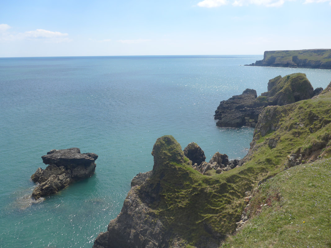
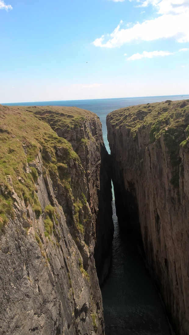
Looking in to the face of the cliffs on the eastern edge of Greenala Point caves, stacks and sea-cut rock formations could be clearly seen. On top of Greenala Point there was an Iron Age promontory fort ( 800 BC - AD 43. The cliffs on the south and east provided natural protection to the fort, with the addition of constructed defences to the north.
Many of the cliffs on this section of the Pembroke coast are sites of scientific interest and are owned by the National Trust. The Pembrokeshire Coast Path, as well as being a national trail is also a designated National Park (1954).
 Heading for Greenala Point
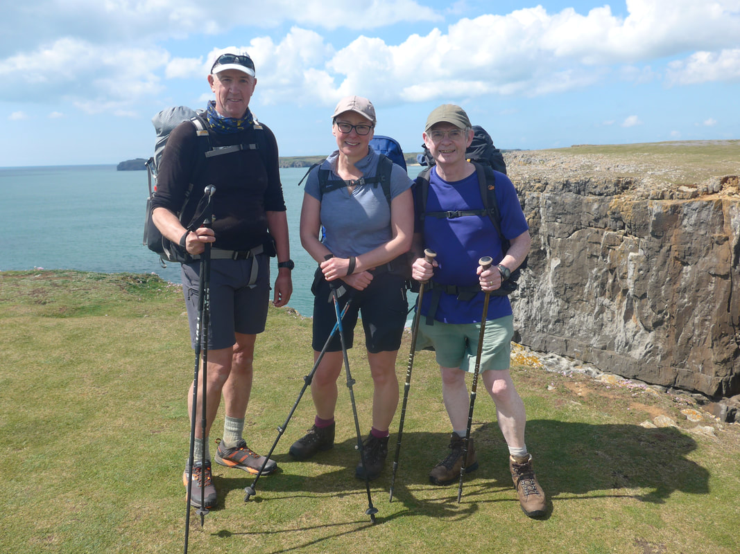
 Going through the stile we spoke briefly to another Wales Coast Path walker, who with a huge stride was covering the ground a lot quicker than we were. After a short conversation, Martin went striding out, quickly disappearing over the horizon but we were to meet again at Stackpole.
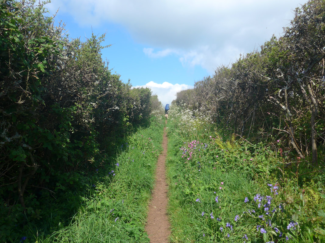
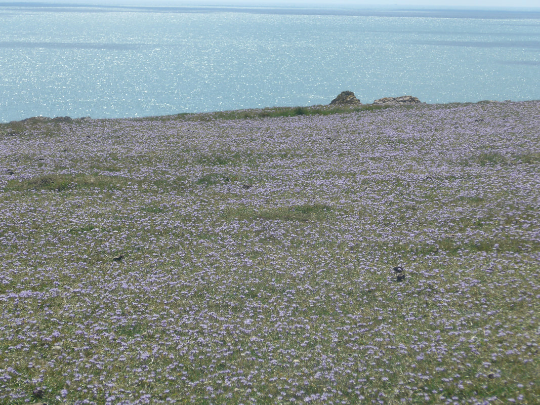
The walking environment on this section was changeable, sometimes on an open path, at others hemmed in by the occasional bit of hedgerow, but always enjoyable. There were wild flowers aplenty (Bluebell, Ragged Robin, Sweet Cicely, Sea Pink) and a number of butterflies on the wing, albeit they never stayed still long enough for us to photograph them. The walking itself was good on a dry, hard-packed earth path with good views all around.
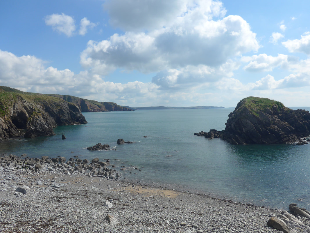
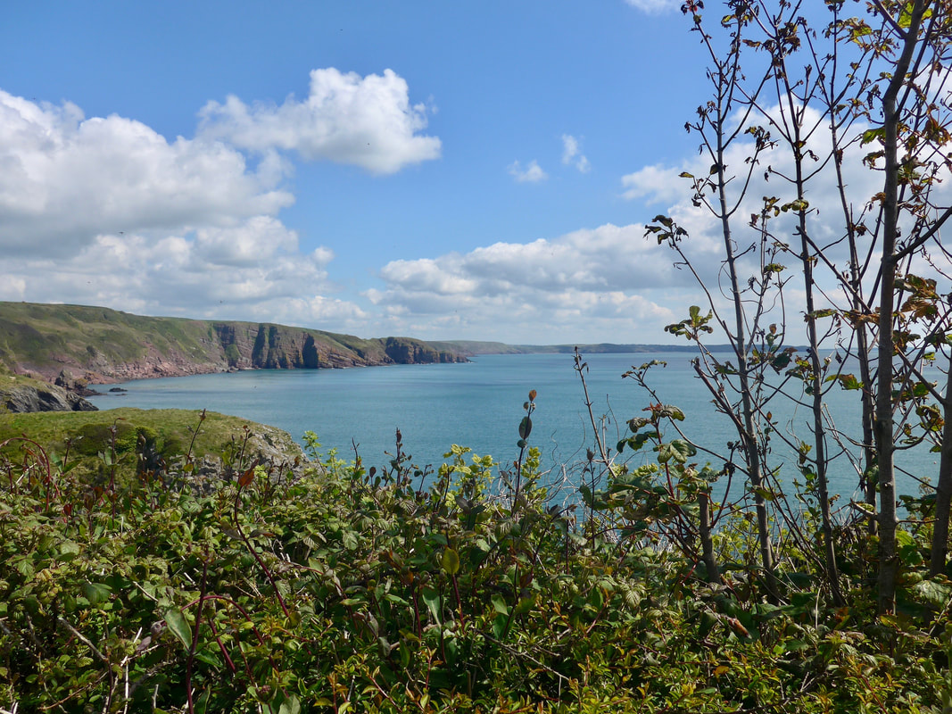
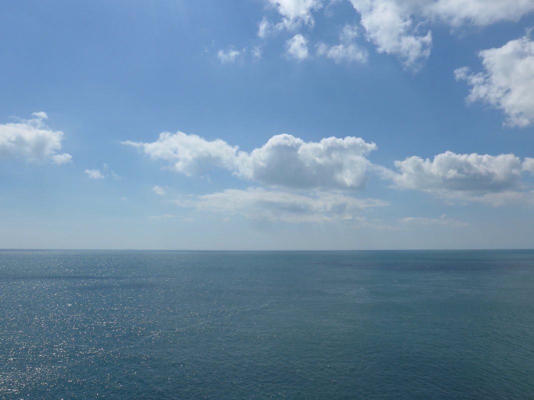
The star of the show was the sea which on that day just seemed immense, stretching endlessly in three directions. From the high ground just after Greenala Point, the route goes steadily downhill to the hamlet of Stackpole Quay. On the way to the Quay we passed people going in to the sea diving and many swimmers and paddleboarders. There is a lovely little National Trust cafe here that does good food and coffee. The National Trust also own and manage much of the local estate and the village of Stackpole We met up again with Martin Howe here, who was busy tucking in to a three-course breakfast. That man has some appetite! Of course, it is powered by a prodigous appetite for exercise and activity. Over the years, Martin has walked all of the British National Trails, as well as done a power of cycling including round the North Sea and the Lands End to John O’ Groats via the Wild Atlantic Way in Ireland! Martin records his adventures on his website which the link will take you to.
The walking environment on this section was changeable, sometimes on an open path, at others hemmed in by the occasional bit of hedgerow, but always enjoyable. There were wild flowers aplenty (Bluebell, Ragged Robin, Sweet Cicely, Sea Pink) and a number of butterflies on the wing, albeit they never stayed still long enough for us to photograph them. The walking itself was good on a dry, hard-packed earth path with good views all around.
The star of the show was the sea which on that day just seemed immense, stretching endlessly in three directions. From the high ground just after Greenala Point, the route goes steadily downhill to the hamlet of Stackpole Quay. On the way to the Quay we passed people going in to the sea diving and many swimmers and paddleboarders. There is a lovely little National Trust cafe here that does good food and coffee. The National Trust also own and manage much of the local estate and the village of Stackpole We met up again with Martin Howe here, who was busy tucking in to a three-course breakfast. That man has some appetite! Of course, it is powered by a prodigous appetite for exercise and activity. Over the years, Martin has walked all of the British National Trails, as well as done a power of cycling including round the North Sea and the Lands End to John O’ Groats via the Wild Atlantic Way in Ireland! Martin records his adventures on his website which the link will take you to.
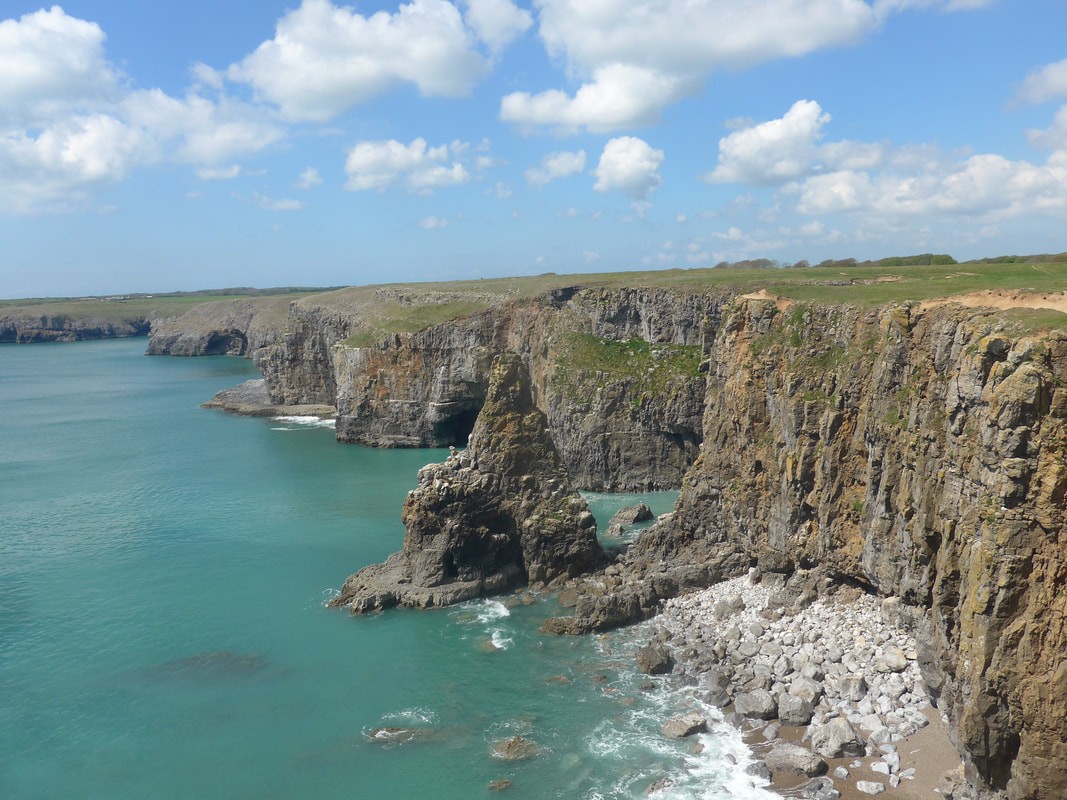
Leaving Stackpole Quay there was a fairly steep climb back up on to the cliff top but it was worth the effort with wonderful views across Barafundle Bay to the natural aches known as Griffith Lort's Hole. Below us on the nearside of the bay is the location of Lort's Cave. During the English Civil War the local estate was owned by the Lort family who took the side of the Royalists. There is a local legend that in trying to evade his enemies, Roger Lort hid in this cave on Barafundy Bay.
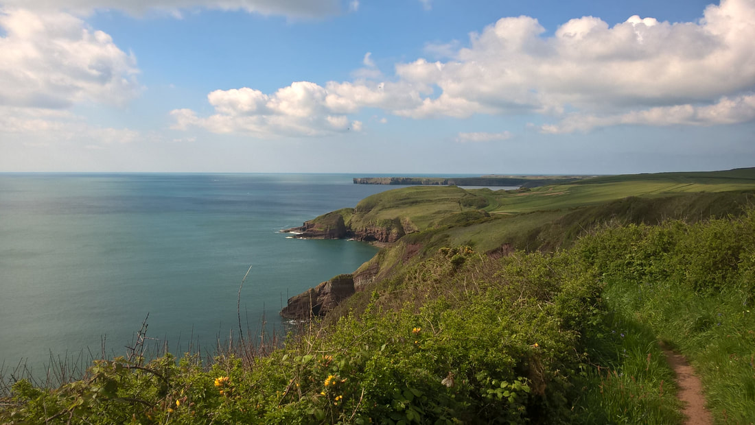
From Above Stackpole Quay
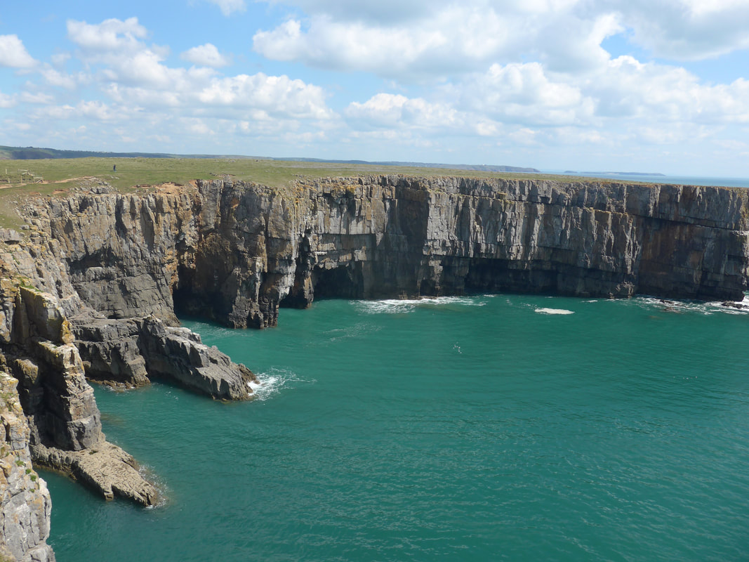
The walk round Stackpole Bay was full of interest with lots of different kinds of rock features and various bird species nesting under the eaves of the clifftop. Barafundle Bay is important geologically sitting as it does between the end of Carbioniferous Limestone cliffs on one side and the beginning of the Devonian Old Red Sandstone on the other. At the end of Barafundle Bay we walked on to and out to the end of Stackpole Head for great views over the sea and along the cliff edges to right and left. While we were standing at the end, enjoying the view over the sea, Martin Howe caught up and walked with us for most of the afternoon. On and coming off the Head, as well as walking along Stackpole Warren there were wild flowers all around us including large swathes of Daisy, Dandelion and Spring Squill.
From Stackpole Head
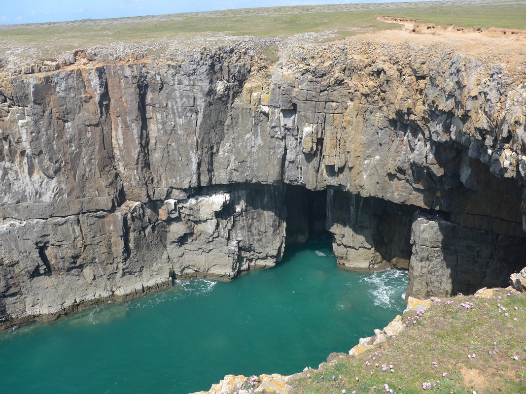
From Stackpole Warren we could clearly see Church Rock, which sits off of Saddle Point at Broad Haven beach. On the shoreline at the bottom of the cliffs there are a number of caves and stacks and, crossing over Raming Hole towards Saddle Point, Sandy Pit which is a collapsed blowhole. Blowholes are created by the sea wearing away the carboniferous limestone to first create cave, which wears even further to make a blow hole that eventually collapses as more material is worn away. There are a number of blowholes in different stages of development on this section of the walk.
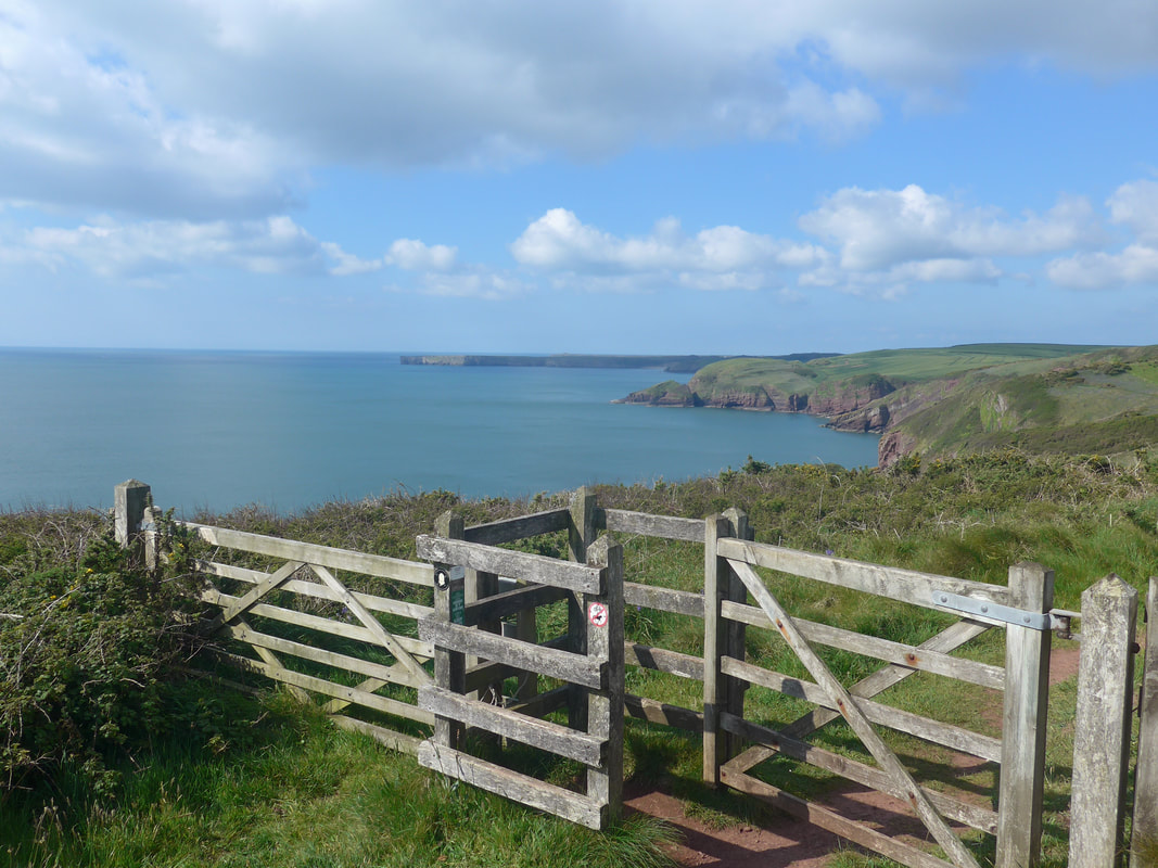
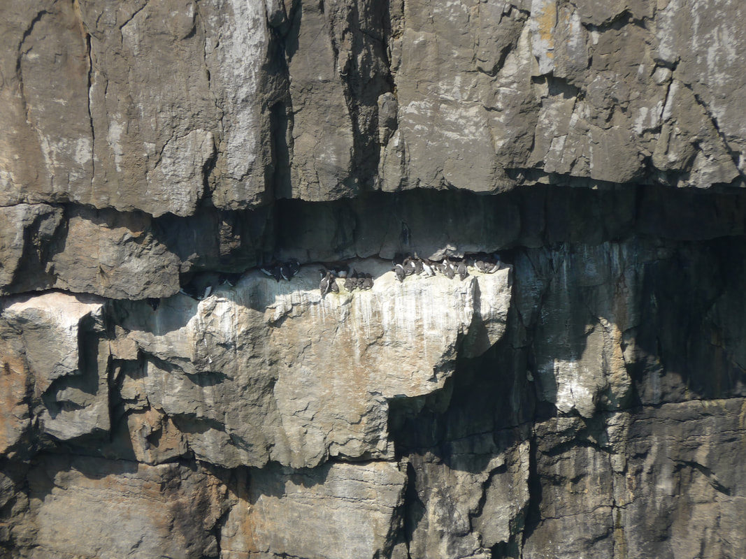
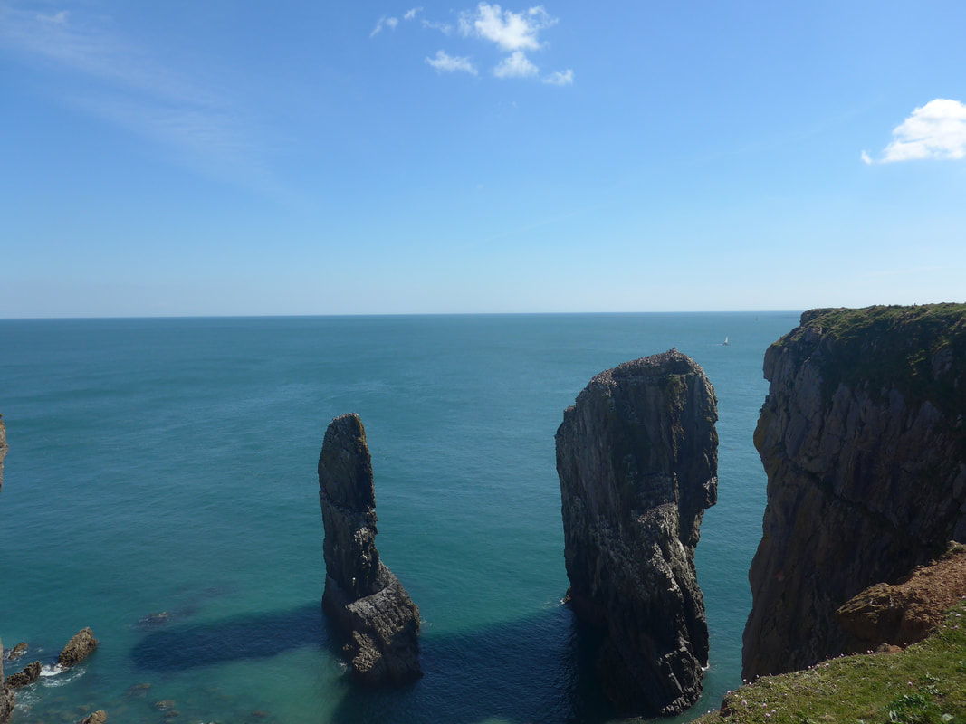
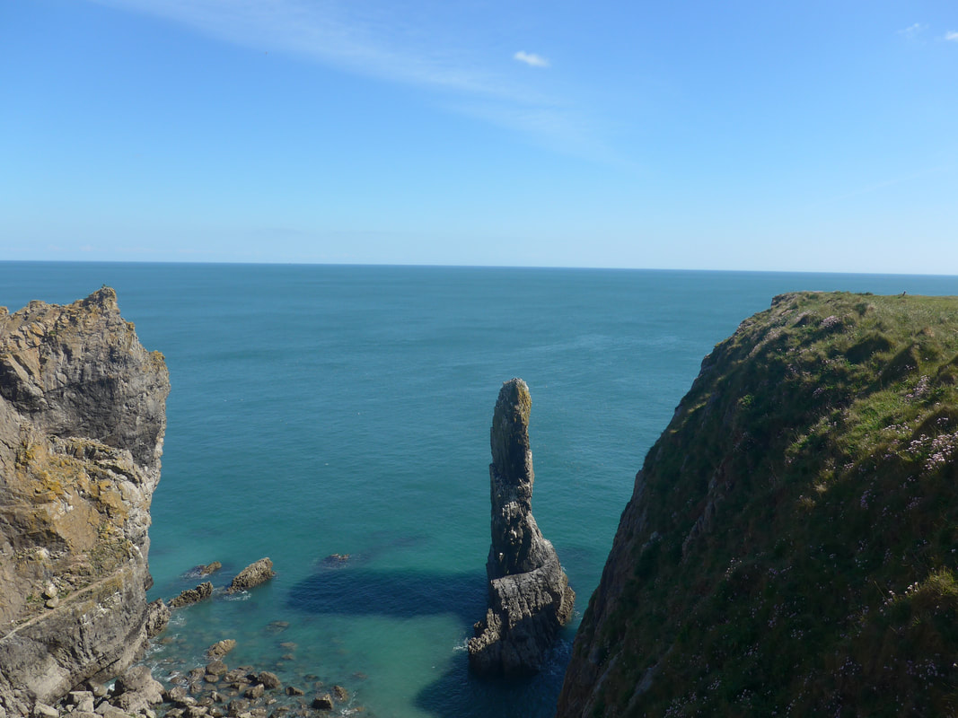
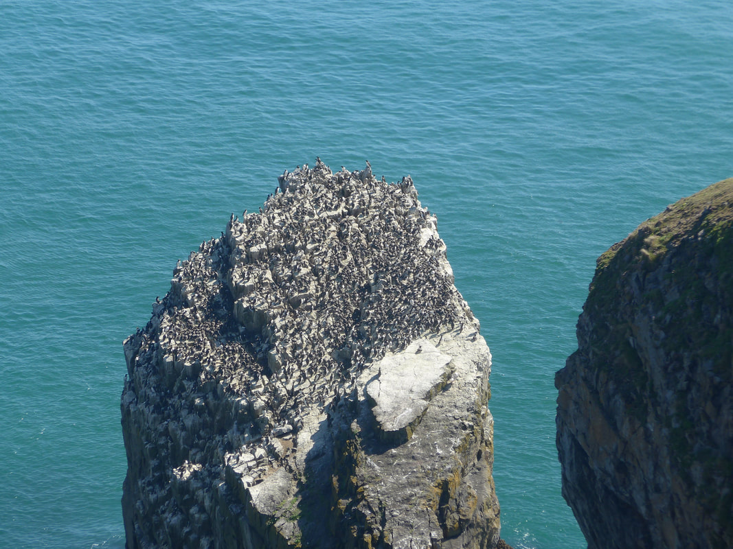
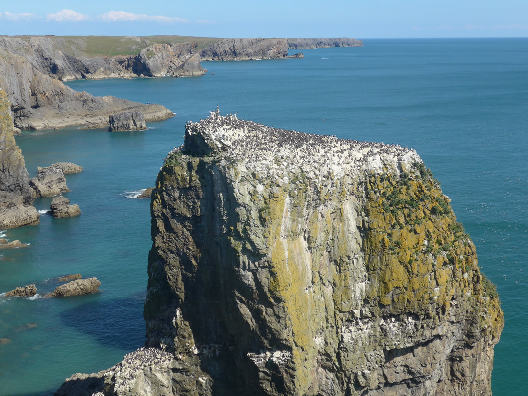
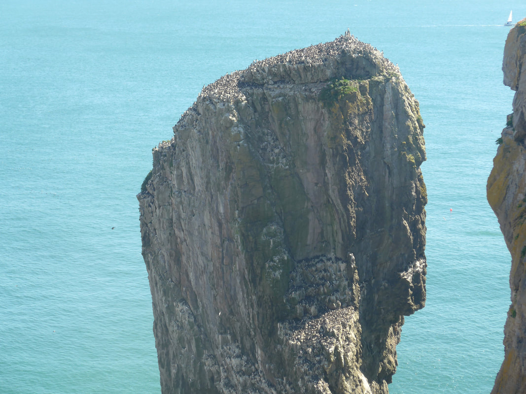
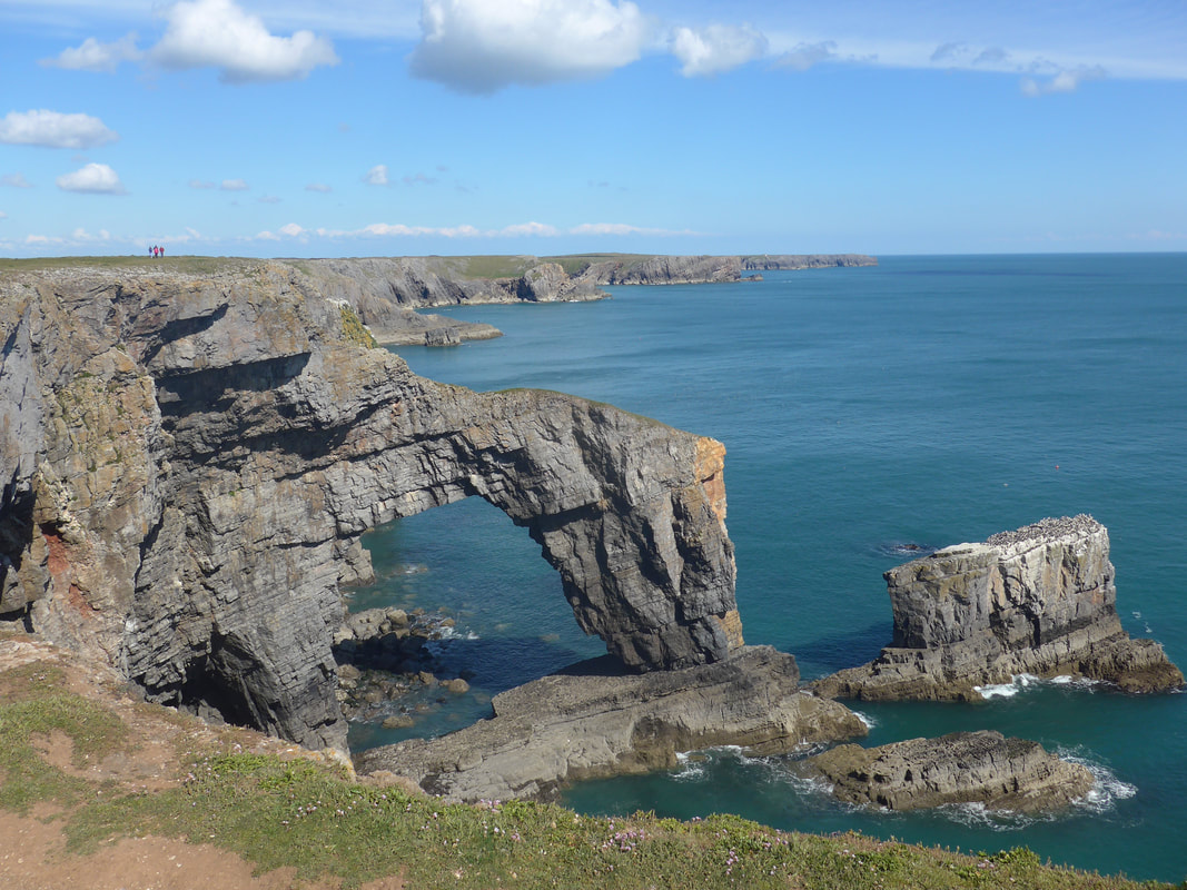
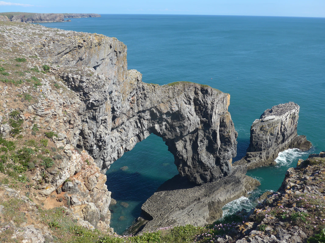
From Sandy Pit we went out and round Saddle Point, returning to the clifftop for the descent down to Broad Haven beach. We crossed over the back of the neck to start the climb back up to the approaches to St Govan's Head. At the top of the hill we entered the eastern part of the firing range which thanfully was open on the day. As we had gone out to the end of Stackpole Head, we decided to give St Govan's a miss, little realising that it meant we missed out on the little chapel of St Govan's that nestles below the clifftop just after St Govan's Head. Despite looking out for signposts for the chapel, we missed it completely, too busy chatting with Martin about our different adventures. The walk from St Govan's Head to the Green Gate was a joy and delight with numerous features of interest along the way including beautiful little bays and coves, headlands and saddles, caves, stacks and archways. The stacks and towers were covered in nesting and roosting Guillemots and Razorbills, Fulmars and Cormorants and the sides of the rock white with their guano. 'Elegug' is Welsh for Guillemot.
St Govan's Head to the Green Bridge & Elegug Stacks
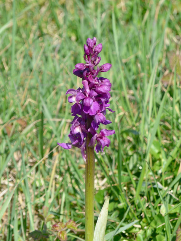 Early Purple Orchid
 We lay on the grass at the Green Bridge for a time, eating a very late lunch (after having had a second breakfast earlier in the day) in the afternoon sunshine. We were on the eastern edge of the western artillery range which sadly was closed to visitors. It is an area that is generally closed with only one or two site seeing opportunities a year. From the Stacks we had a long road walk inland to our accommodation a mile or so before Castlemartin. With the open range land on our left and more moorland to our right there was little to see on the way out. At a crossroads, Merrion Camp is on the right, a post-war Army training camp, built in the early 1940's as a training camp for the Armoured Corps.
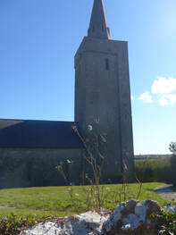
At the crossroads we said goodbye to Martin who was turning left to follow the WCP in to the village of Castlemartin. Our route was on the alternative path that lay straight ahead, going in the direction of Warren Farm. The WCP turns off before the farm to cut across fields to Paddock and our bed for the night, but we chose to carry on to Warren to see the 13th C St Mary's Church, built some time around 1290. The spire on the top of the church tower was added by the Admirality to increase its visibility to shippiing. In the 1970's the church was in a bad state. Following a major renovation in the 1980's, on the back of increased use of the military ranges by the British and German Armies, ti returned to regular useage. From the church we moved up to the next crossroads, turning left to reach our accommodation about 5.00pm.
When we arrived at our accommodation it appeared deserted. There were numerous buildings obviously used for holiday purposes but little signs of life. After wandering around a bit we went back to the main house, opened and shouted in the doorway and a bleary-eyed David Williams appear, disturbed from an afternoon slimber. While the accommodation was at it said on the tin, basic, David and his fiance, Annwen, were wonderful hosts, putting on a barbecue for us that night which saved us having either cook or eat cold rations. Annwen, a pharmacist at a local hospital had also bought in groceries for us from a list we had previously emailed. It was a really nice night as we sat chatting round the barbecue and watched the setting of the sun. Wonderful people, lovely food and nice sunset. What more could youask for to send a fantastic day's walking?
 RSS Feed
