
Route Map
As the rains came again last night I was grateful to be in the shelter of the Pilgrim Pod. Despite the pitter-patter of the downpour on the roof there was still sleep to be had. Feeling physically tired this morning, mentally I felt brighter after a stinker of a day yesterday. When planning this day of the route at home I had to make a decision between a short ten-mile day, or a monster twenty-three miler to reach the next again campsite at Parsal. I opted for the two shorter days and am relieved that I did so, as yesterday really took it out of me.
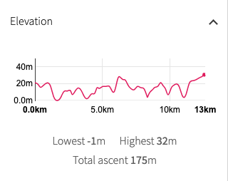
As a consequence of that planning decision, today's route is a tiddler at about ten miles. The terrain is very manageable with a low rollercoaster ride with nothing over thirty metres elevation. Staying on the coast, the plan was to just walk the ten miles and have lunch when I arrive at my destination. Taking advantage of the Pilgrim Pod right to the end, I lingered at the campsite making a full breakfast on the Jetboil, hoping this would keep me going for the journey. By the time I took my leave of the owner and the Scottish couple in the caravan, it was 10.00am before I was on the trail.
 Porth Ychain to Mynydd Anelog
 Yesterday I had approached the campsite the long way round by road, not appreciating there was a direct path from the coast trail. It does not show up on the OS 1:50k that I use, but it does on the 1:25, which I would have seen on my phone had BT not cut off my internet service when I purchased a new phone in Aberystwyth.
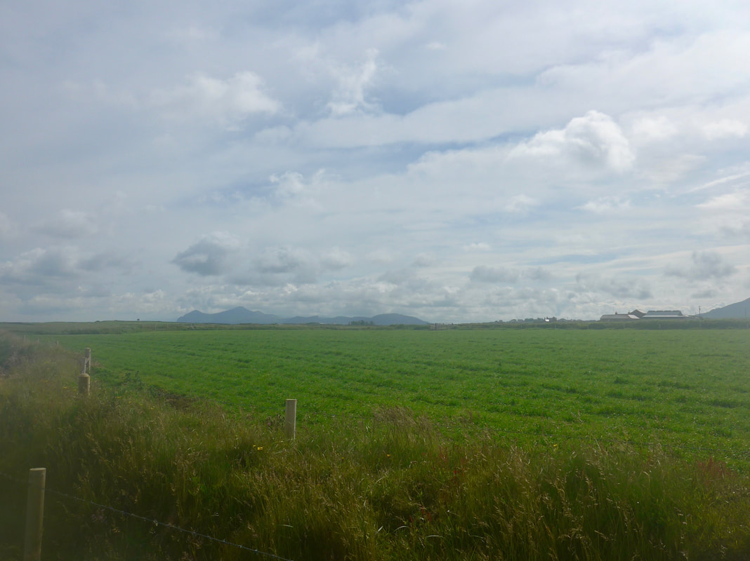
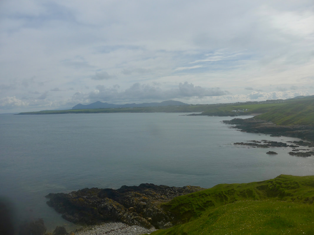
Starting off today it was only a walk of a few hundred yards and I was back on the trail at Porth Ychain. The weather did not quite know what it wanted to do at this stage of the day and it was a bit chilly, overcast and with some light mist on the coast. However, it was not thick enough to prevent me having a view and, to the south, I could see along the line of the cliffs all the way back to Mynydd Anelog. The view north was blocked by the undulations of the land, but looking inland I could see over to Garn Boduan (279 metres), site of one of the largest Iron Age hillforts in Great Britain and on which there are still substantial remians to be seen.
Starting off today it was only a walk of a few hundred yards and I was back on the trail at Porth Ychain. The weather did not quite know what it wanted to do at this stage of the day and it was a bit chilly, overcast and with some light mist on the coast. However, it was not thick enough to prevent me having a view and, to the south, I could see along the line of the cliffs all the way back to Mynydd Anelog. The view north was blocked by the undulations of the land, but looking inland I could see over to Garn Boduan (279 metres), site of one of the largest Iron Age hillforts in Great Britain and on which there are still substantial remians to be seen.
 Inland to Garn Boduan
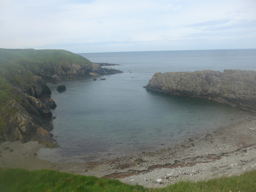
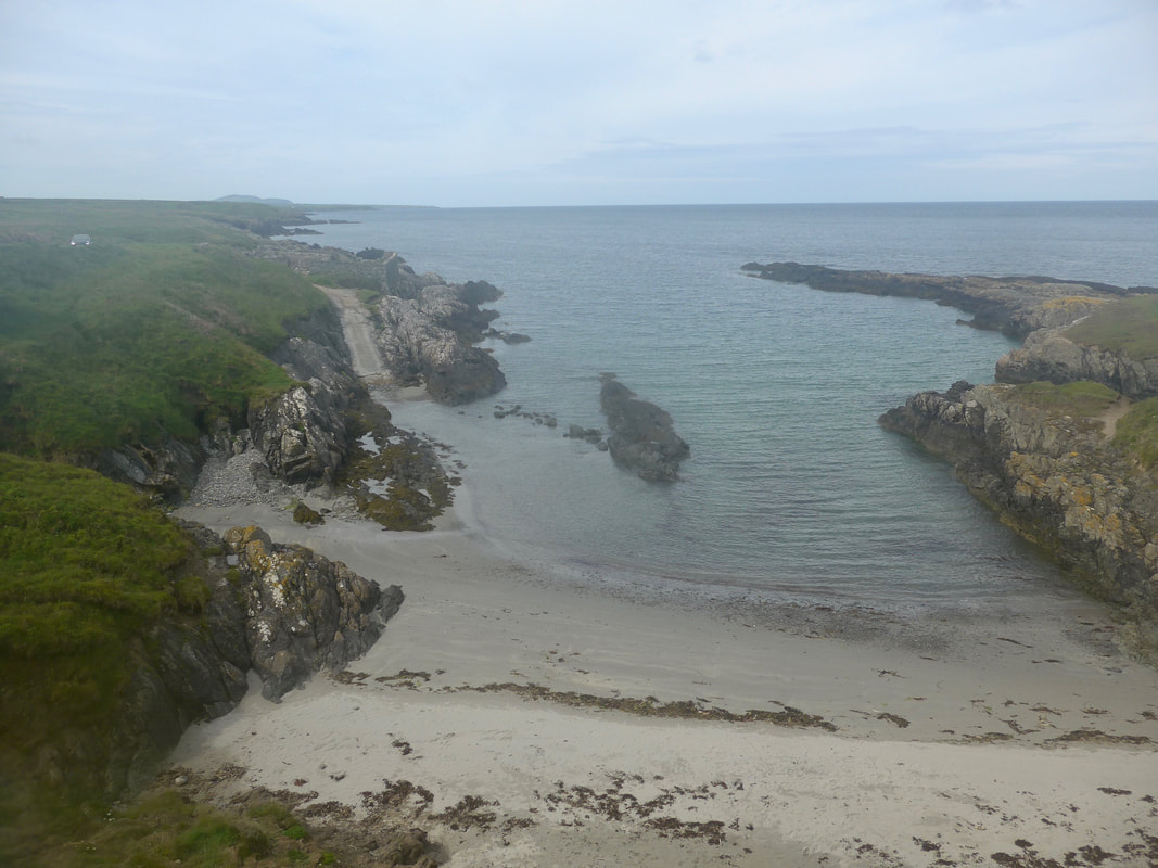
 Walking from Porth Ychain on the top of the low cliffs, which stay at a fairly steady twenty metres, it is a short stroll to the pretty little bay at Porth Gwylan. Translating as "Seagull Port" this is a nice little beach, protected by an arm of rock reaching out at an angle from thr mainland. It looked as if it would be a safe place for a wee swim. Rising back up from the beach there is a interesting view forward to the next bay at Porth Ysgaden where you can see the outline of the gable end of a building standing on a low incline. Even from distance you can see that the rest of house is long gone. It is a pleasant walk along this stretch of coast with the sea close to hand and wild flowers and grasses beneath your feet and beautiful views over to the Snowdonian mountains.
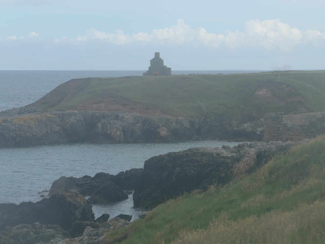
 Porth Ysgaden
 The gable end of the house that you can see at Porth Ysgaden is all that remains of the customs house that once sat here. In previous centuries this would have been a fairly isolated area but a busy port, with few if any good roads for access and egress. The highways were the sea routes that linked the area with the larger settlements on the coasts and rivers and from where the requisites of daily living would be brought in using little sailing boats. A number of the commodities that were shipped here would have been subject to taxation and the custom house was where the taxes would have been collected. The customs officer would also have been on the look out for smugglers in the area. I understand the name translates as some thing like 'port of the herrings' and fish would also have been landed here.
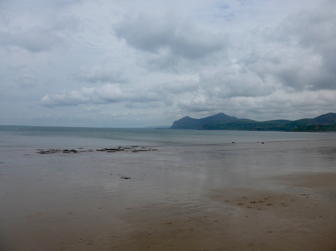
 (L) Garn For; (C) Garn Ganel & (R) Mynydd Carnguwch
 Moving on from the custom house there were fine views across to the distant Caernarfon Bay and slightly closer to the three peaks of Yr Eifl ( The Forks or The Strides), consisting of, from the left in the photograph: Garn For, the lowest at 444 metre); the highest Garn Ganel (561 metres) and the middling Tre'r Ceiri (485 metres). Garn Ganel is the highest peak on the Lleyn peninsula and it has a ancient cairn at the summit, as well as being the trig point for the local area. To the extreme right in the photograph is Mynydd Carnguwch (351 metres). In the foreground you can just make out the beach at the small Porth Towyn.
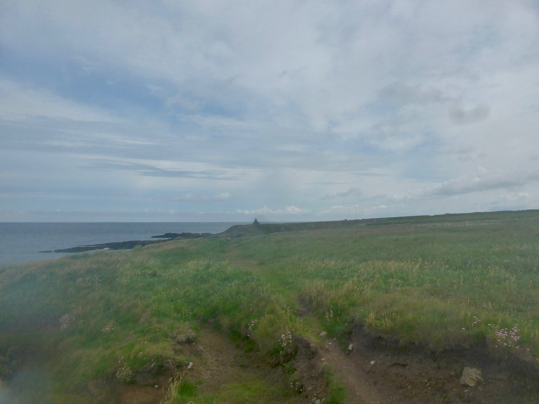
From Porth Ysgaden you cross a small headland to pass above another couple of small coves, Porth Llydan & Porth Ysglaig, before coming to the slightly larger Porth Towyn with its sandy beach. At the back of the beach there is a large camping site, operated by Towyn Farm, a sheep and beef farm. There is a steep path running down to the beach, which gives you easy access.
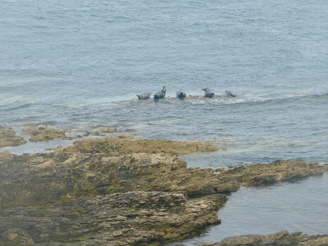
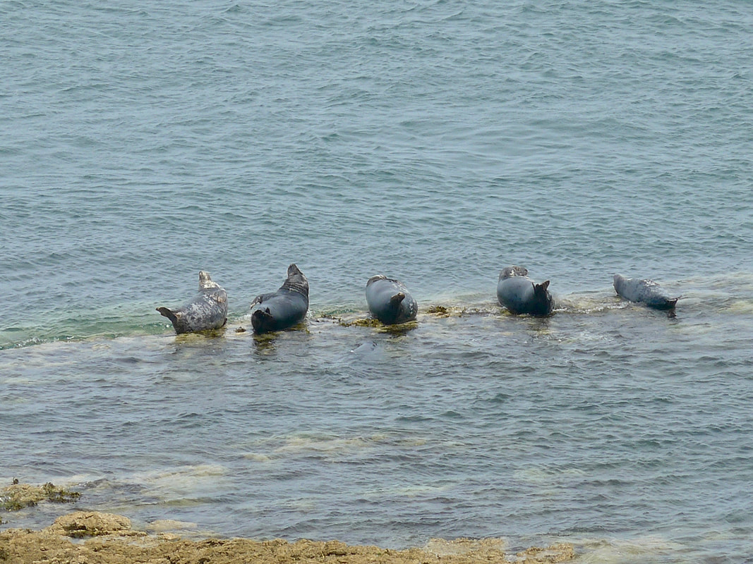
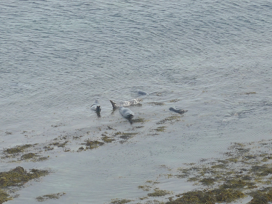
Despite the fact there was no rain, the beach was completely empty. Although I could hear the shouts and laughter of children on the wind there was not hide nor hair of them to be seen. As I moved on from Towyn the noise of the invisible children faded to be replaced by the cry of equally invisible seals. I could hear the forlorn lament of the seals for some distance as I walked the cliff, their sad wail carrying on the wind. When I eventually found them they were frolicking on small sand bars just off shore, two or three small groups enjoying the cooling waters. Standing on the low cliff edge I was far enough away not to disturb them but close enough to see them in some detail.
Despite the fact there was no rain, the beach was completely empty. Although I could hear the shouts and laughter of children on the wind there was not hide nor hair of them to be seen. As I moved on from Towyn the noise of the invisible children faded to be replaced by the cry of equally invisible seals. I could hear the forlorn lament of the seals for some distance as I walked the cliff, their sad wail carrying on the wind. When I eventually found them they were frolicking on small sand bars just off shore, two or three small groups enjoying the cooling waters. Standing on the low cliff edge I was far enough away not to disturb them but close enough to see them in some detail.
Seals at Penrhyn Cwmistir
 Penrhyn Cwmistir to Garn For & Garn Ganol
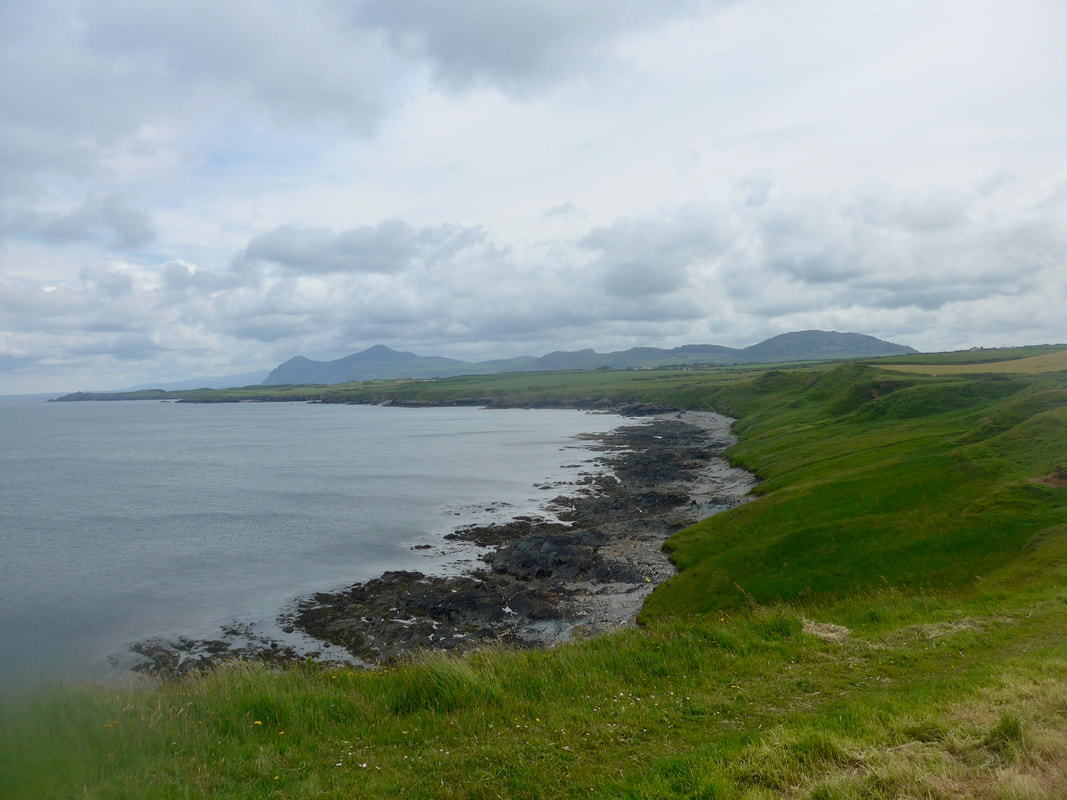
 From Penrhyn Cwmistir the peaks of Yr Eifl dominated the horizon. In the gloom of a overcast sky the peaks seemed to brood and glower over the scattered house on the outskirts of Morfa & Nefyn. Despite the gloom, it a was a warm afternoon, the air close and heavy. The walking was good and I made quick progress along this section. Ragged stretches of rock rose above retreating waters, with narrow bands of shale behind, the low, sloping sides of the emerald green cliff rising up to meet tidy arable lands.
In the middle distance I could now see the green swards of the Nefyn & District Golf Club as it rises up the Carreg Ddu headland. Just before you start the walk on to the grounds of the golf course there is a small beach known as Aber Geirch. The river 'Afon Geirch' splits the beach, with what I presume is a waste pipe running down one side. In 1913, the first Anglo-Irish telephone cable was laid from here to Howth, Ireland. Howth is located on a small headland that juts out from the mainland just east of Dublin.
In the middle distance I could now see the green swards of the Nefyn & District Golf Club as it rises up the Carreg Ddu headland. Just before you start the walk on to the grounds of the golf course there is a small beach known as Aber Geirch. The river 'Afon Geirch' splits the beach, with what I presume is a waste pipe running down one side. In 1913, the first Anglo-Irish telephone cable was laid from here to Howth, Ireland. Howth is located on a small headland that juts out from the mainland just east of Dublin.
 Porth Dinllaen
 The route passed above a final small beach at Borth Wen, just before the golf course, but as beaches go it was nothing to write home about, mainly gravel and stones. On the headland of Carreg Ddu it is a bit of a slog climbing up on the edges of the golf course, the path weaving in, out and around various hillocks to avoid disturbing the 'gowfers'.
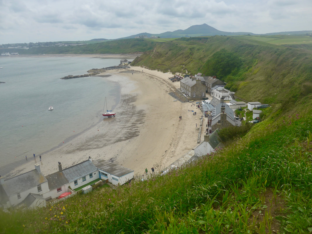
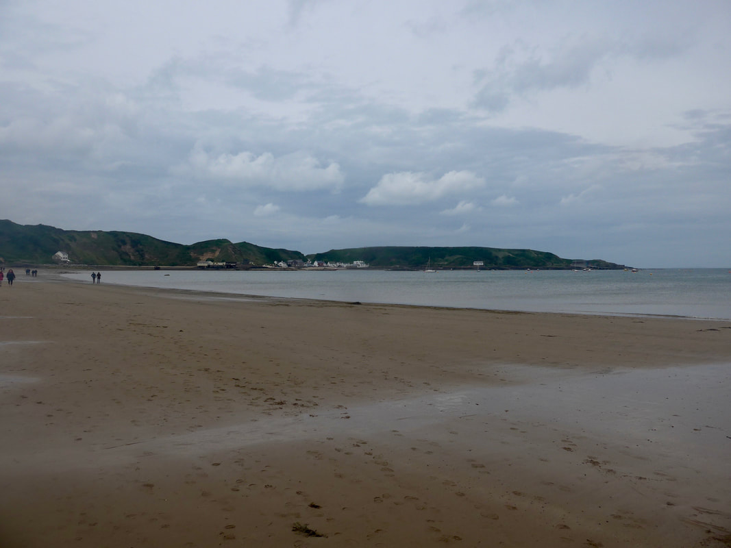
There are various 'formal' paths on the headland and they were heaving with people, both golfers and walkers, the latter all making for the top of the headland. By the middle of the headland I had enough of the crowds and crossed over to the other side of peninsula to make my way down a tarmac road on to the beach by the village of Porth Dinllaen. Seen from the clifftop the village is a wonderful spectacle, crouched on the actual beach, directly below the green cliff face. Originally a small fishing port and at one time considered a contender as the main port for ferry traffic to and from Ireland, it is mainly a tourist attraction now. The small village and immediate area are owned and managed by the National Trust since 1984.
There are various 'formal' paths on the headland and they were heaving with people, both golfers and walkers, the latter all making for the top of the headland. By the middle of the headland I had enough of the crowds and crossed over to the other side of peninsula to make my way down a tarmac road on to the beach by the village of Porth Dinllaen. Seen from the clifftop the village is a wonderful spectacle, crouched on the actual beach, directly below the green cliff face. Originally a small fishing port and at one time considered a contender as the main port for ferry traffic to and from Ireland, it is mainly a tourist attraction now. The small village and immediate area are owned and managed by the National Trust since 1984.
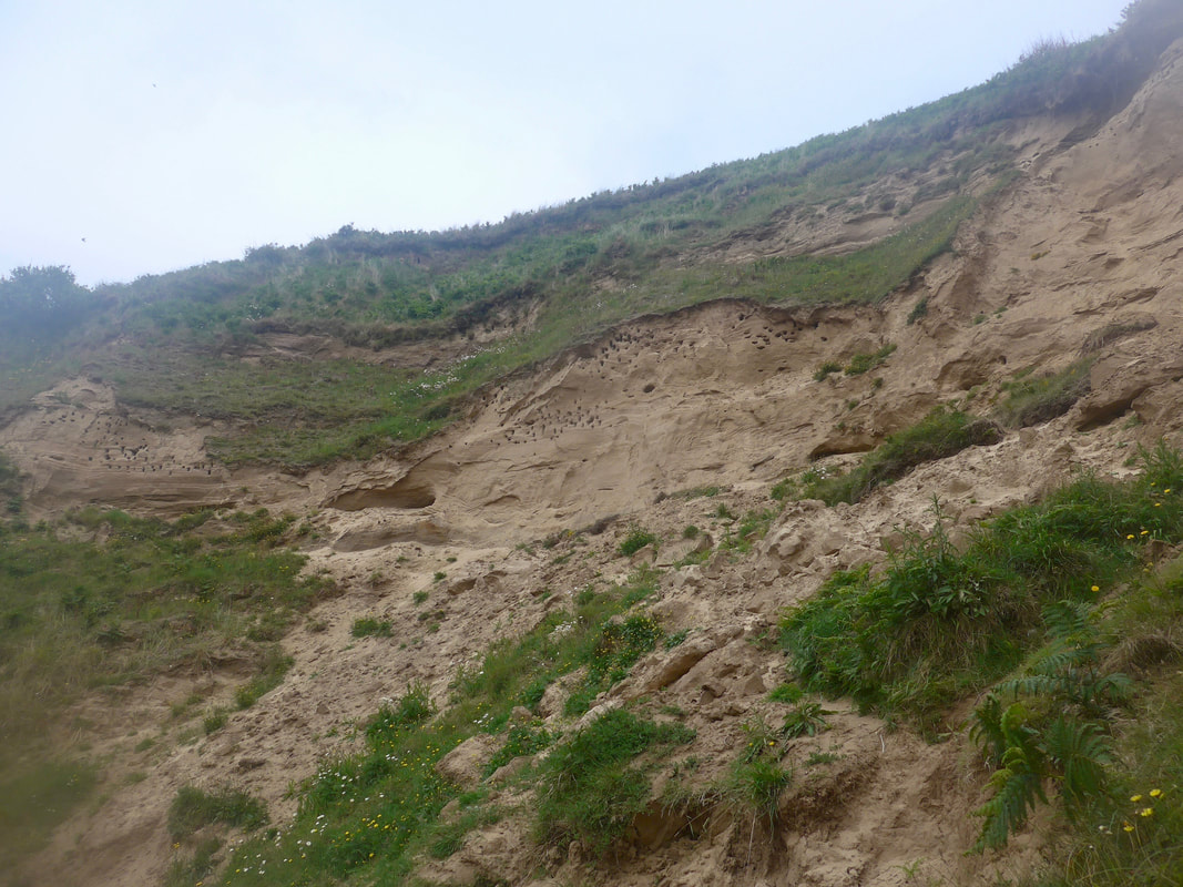 Sand Martin's Nests at Porth Dinllaen
 There is a pub at Porth Dinllaen, 'Tŷ Coch, often described as the best beach pub in the world. Although I knew my hostess for the night worked there as the resident chef, I decided not to go in but to continue and complete my journey for the day.
With the tide still pretty low, albeit on the turn, I was able to walk along the wonderful sandy beach and to go round a small headland on to the even larger sandy beach of Morfa Nefyn. These two beaches, along with a third beach at the front of the village of Nefyn, just after the headland at Penrhyn Nefyn, provide an expanse of sand for over three kilometres. There was a wonderful sense of space and light walking along the beach, where I stopped to watch a flock of Sand Martins coming and going from their nests in holes in the sandy cliffs. As I watched an elderly couple stopped to speak with me, the gentleman telling me of his many forays on to the hills of my homeland.
With the tide still pretty low, albeit on the turn, I was able to walk along the wonderful sandy beach and to go round a small headland on to the even larger sandy beach of Morfa Nefyn. These two beaches, along with a third beach at the front of the village of Nefyn, just after the headland at Penrhyn Nefyn, provide an expanse of sand for over three kilometres. There was a wonderful sense of space and light walking along the beach, where I stopped to watch a flock of Sand Martins coming and going from their nests in holes in the sandy cliffs. As I watched an elderly couple stopped to speak with me, the gentleman telling me of his many forays on to the hills of my homeland.
 Porth Dinllaen to Garn For & Garn Ganol
 About half-way along Porth Dinllaen there is an exit from the beach and a road runs up from the beach to join the B4417, which I took to reach my accommodation. On my adventures I always carry a paper copy of my walking plan which contains all the information I think I might need for the journey, including names, addresses and, usually, telephone numbers. Two mistakes for this stop: one, I thought I had written down the name of the house in Welsh, in fact what I had written essentially meant 'Main Road'; two, I had transposed two of the numbers in the mobile number I had and could not, therefore, contact my hostess for the night. Thanks to some detective work with a local shopkeeper, I eventually located the right house. Too early for arrival, I found a local cafe where I happily whiled away an hour or two on lunch and with a copy of the Guardian. Its not often my walking days finish before 2.00pm and I made the most of it.
Porth Dinllaen round to the Lifeboat Station
My Airbnb hostess for the night, when I eventually mad her acquaintance, was bright, vivacious, friendly and the perfect landlady. Catherine insisted on providing me with dinner and, after I had showered and rested, we shared a full roast chicken dinner and much conversation. Although it was quite late by the time I reached bed, I was pleasantly replete, relaxed and more than happy to go and meet the Sandman.
 RSS Feed
