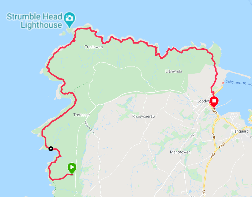
Route Map
Last night, at the last minute, we changed our arrangements from camping in a field some distance from the toilets to B&B in our hostesses house, in a large double room with nice en-suite facilities. With my walking partner still under the weather, it seemed like the right thing to do and we were rewarded with a bit of luxury we did not expect.
The luxury of our stay continued when Teresa informed us she was popping out to attend a National Trust lecture on the NT as landlords. Before leaving, however, she popped a moussaka meal in the aga for us which we enjoyed in her warm & cosy kitchen before bedding down for the night. The spirit of luxury continued this morning with Teresa preparing breakfast for us and providing a packed lunch for the day. When it came to settling our bill Teresa, despite our protestations, included a very generous discount on the usual price for which we were very grateful
Teresa was very knowledgeable about the history of Wales and last night, over tea and biscuits, she spent some time explaining to us about the 'Landsker Line', which divides Welsh speaking Wales in the north from the English speaking region in Pembrokeshire and Carmarthenshire. South of the Landsker Line is also known locally as 'Little England beyond Wales'. The 'line' follows a rough but invisible line created by the run of Norman castles, mainly built during the 11th & 12th Cs to reinforce the imposed border.
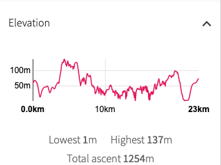
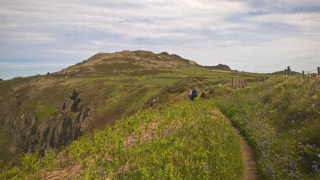
There is a very hard day in front of us as we tackle a day of rolling coastline with elevation in excess of twelve hundred metres (over four thousand feet) over the course of the day. The highest point of the day comes on the cliffs, just below the small hamlet of Trefasser and before the hill of Garn Fawr. If you are in the area and find you have time for a side outing, which we did not, there is a great example of an Iron Age hill fort at Garn Fawr. This is generally an historic landscape and there are other forts and a number of other Neolithic monuments in the area behind and around Garn Fawr.
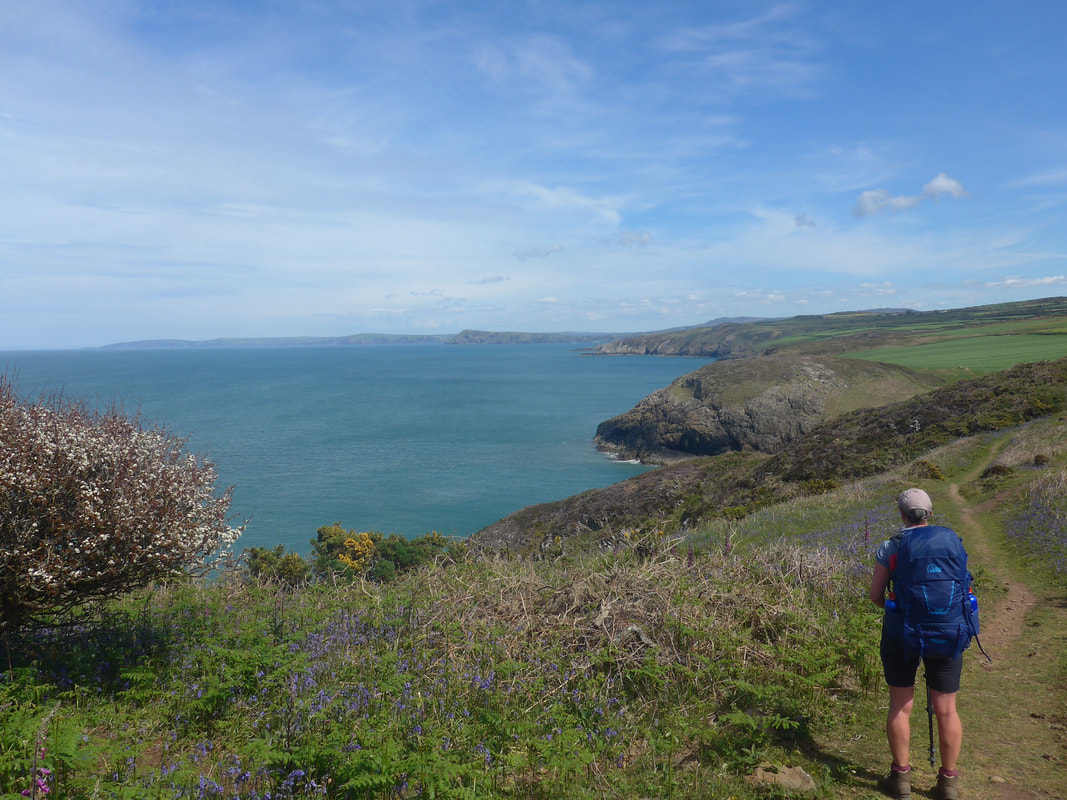
 Carreg Golchfa Promontory to Penberry
 Leaving Tresissllt Farm via the lane we had come up last night, we re-joined the coastal path at Aber Bach. Although there were clouds overhead and the early morning still had a slight chilly to it, the light was good and we could look forward to good views again.
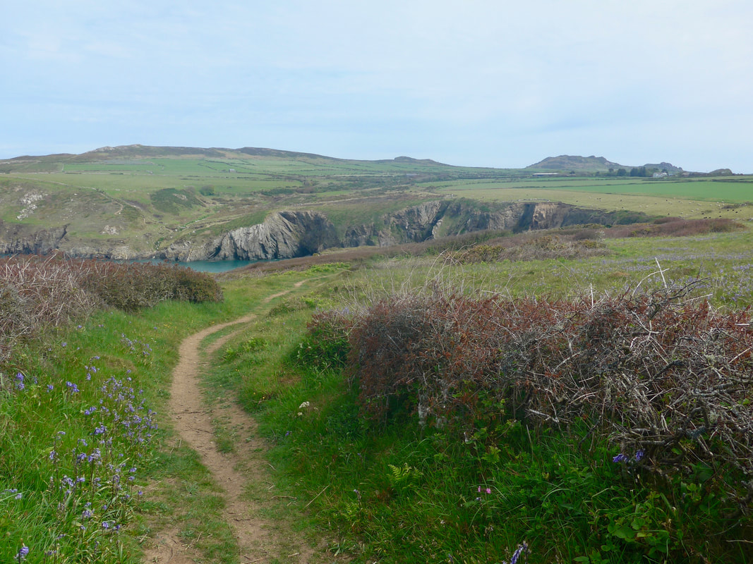
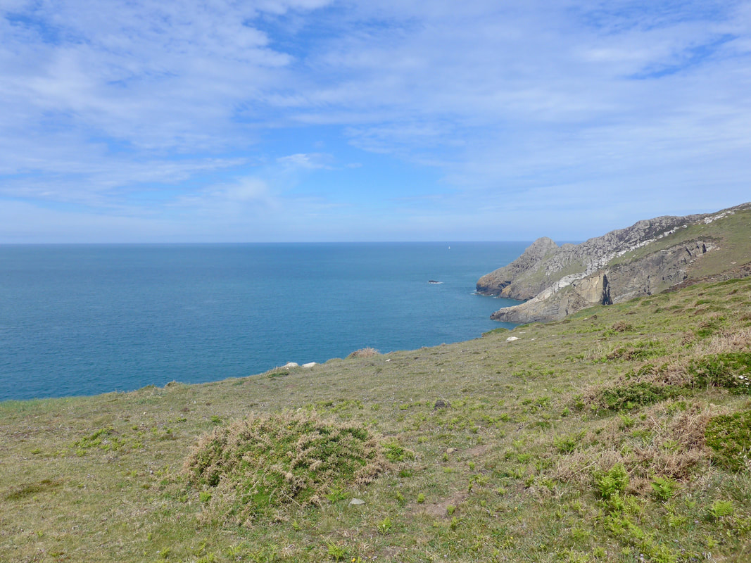
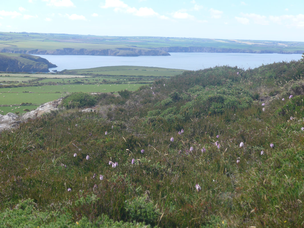
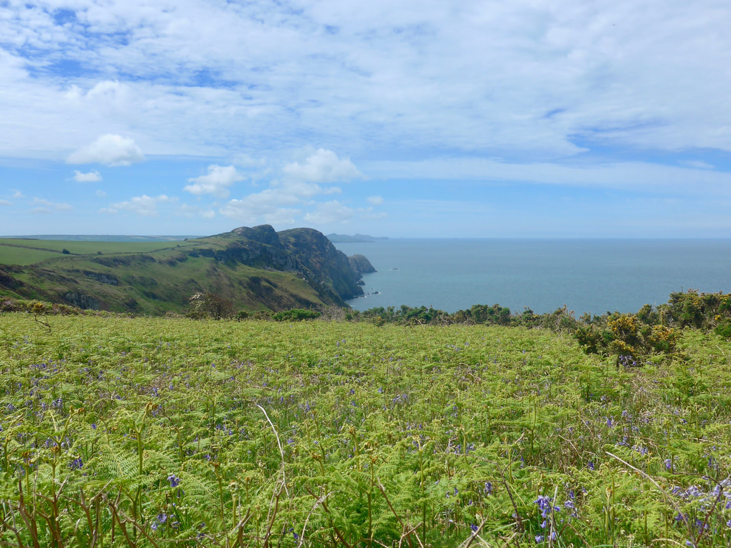
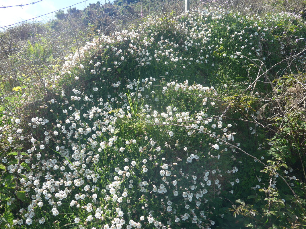
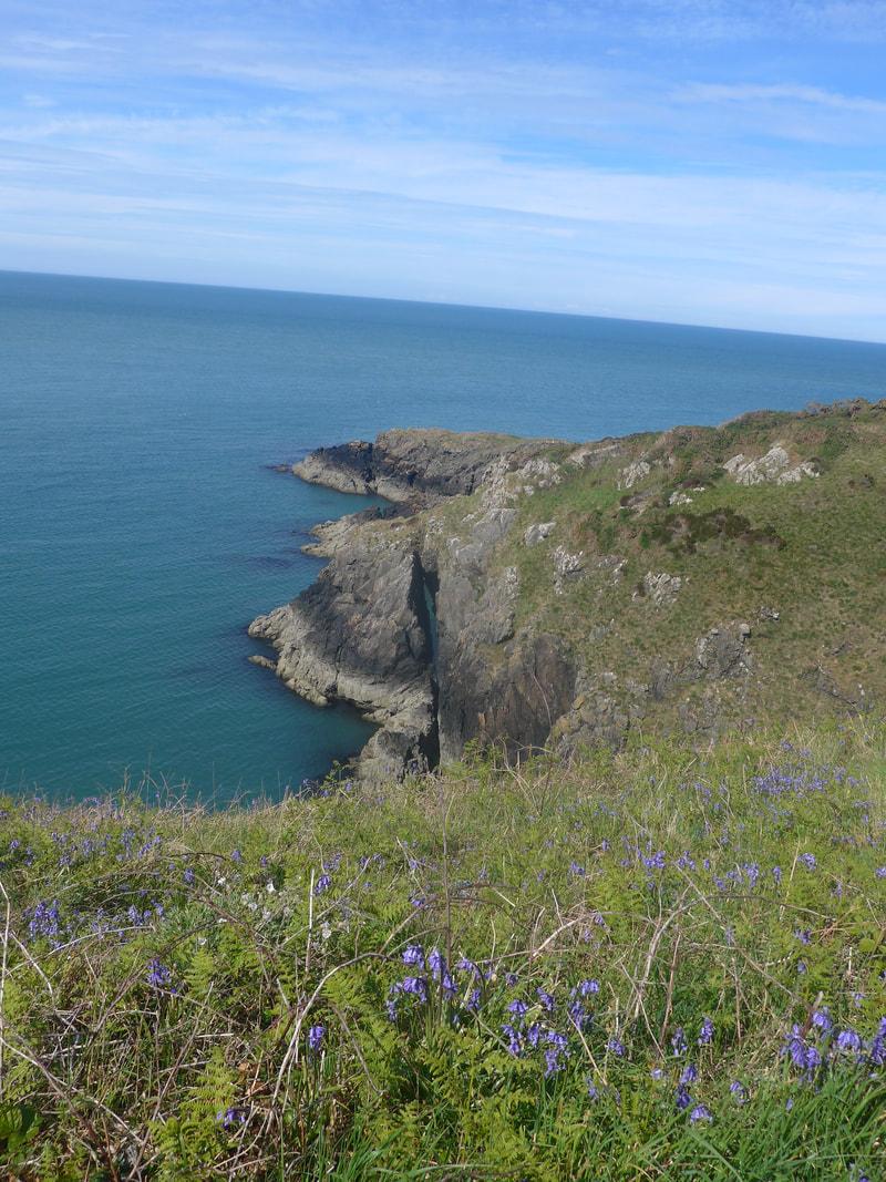
Approaching Carreg Golchfa promontory on the west side of the bay, on which there are the remains of another Iron Age Fort, the view over to Penberry hill, away over towards St David's Head in the far distance, was as clear as a bell. On the clifftop there was a plethora of colour with Buttercup, Daisy, Blue Bell, Pink and White Sea Thrift and pink Ragged Robin, all putting in an appearance.
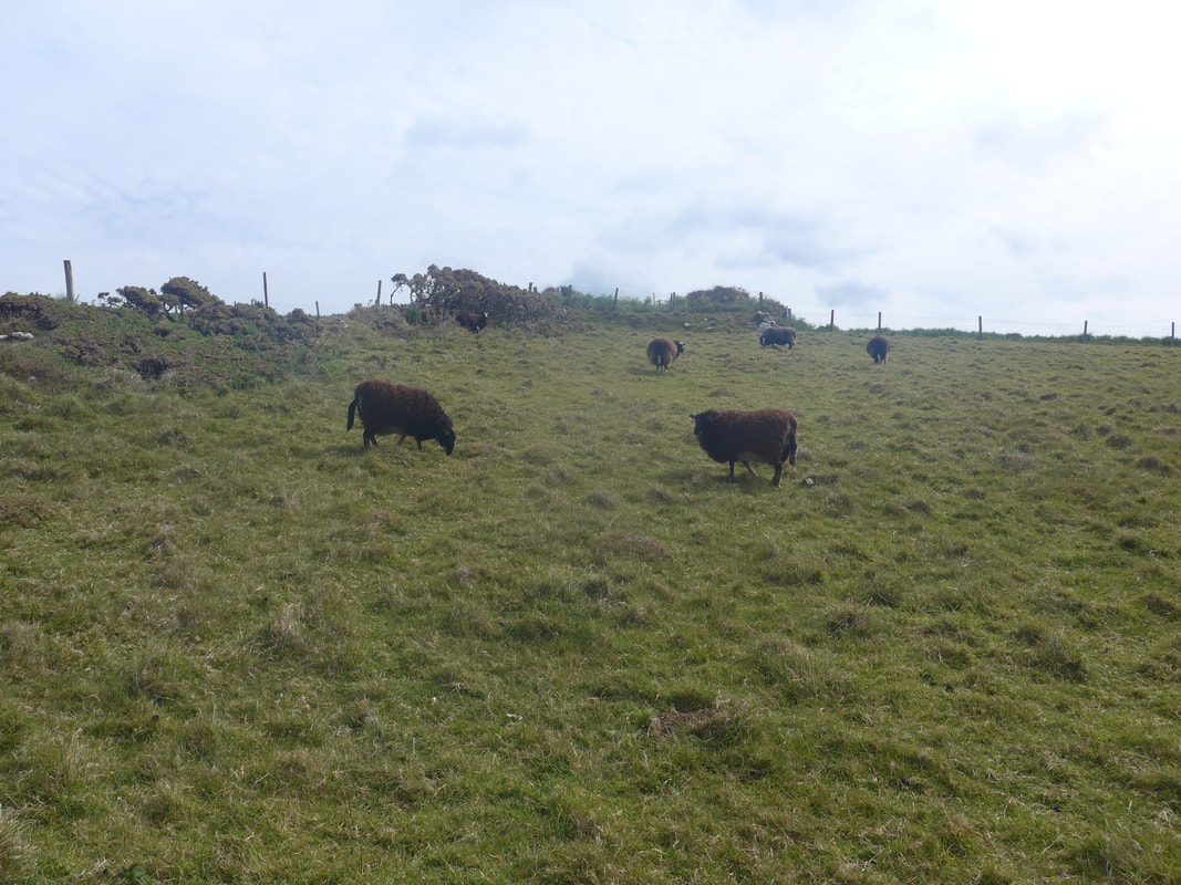
For much of the morning, it would be Garn Fawr that dominated the forward horizon, its jagged peak caressing the grey skies. Looking over the bay, Pwll-chrochan, Garn Fawr dominated the hilltop view. There is a mixture of arable and wilder grasslands on the clifftop here and a herd of very dark brown sheep grazed contentedly on the slopes undisturbed by our presence. On this initial section and periodically as the day went on, there were lots of little gaily coloured and patterned moths, no bigger than an old sixpence. There was yellow with black spots, pure sky blue and little gems a kind of deep russet with black edging and spots. Their colour, size and wonderful detail made them just exquisite.
Approaching Carreg Golchfa promontory on the west side of the bay, on which there are the remains of another Iron Age Fort, the view over to Penberry hill, away over towards St David's Head in the far distance, was as clear as a bell. On the clifftop there was a plethora of colour with Buttercup, Daisy, Blue Bell, Pink and White Sea Thrift and pink Ragged Robin, all putting in an appearance.
For much of the morning, it would be Garn Fawr that dominated the forward horizon, its jagged peak caressing the grey skies. Looking over the bay, Pwll-chrochan, Garn Fawr dominated the hilltop view. There is a mixture of arable and wilder grasslands on the clifftop here and a herd of very dark brown sheep grazed contentedly on the slopes undisturbed by our presence. On this initial section and periodically as the day went on, there were lots of little gaily coloured and patterned moths, no bigger than an old sixpence. There was yellow with black spots, pure sky blue and little gems a kind of deep russet with black edging and spots. Their colour, size and wonderful detail made them just exquisite.
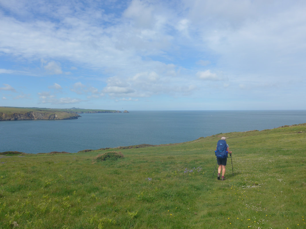
This first section is very hilly, with a fair bit of up and down as the clifftop meanders along towards Strumble Head and its lighthouse. The hillscape is craggy and a bit difficult in parts with a some scrambling to be done and, the path is very stony and uneven in sections. It sometimes calls for you to keep watching your feet at the expense of seeing the scenery. I don't know what it is about narrow paths, but the narrower they are the more unsteady I feel. Walking in heavy German-made, leather boots I am already slightly clumsy in my foot placement (as my recent falls testify) and the narrow paths exaggerate the effect. Throw in long grass and weeds tugging at the ankles and I can be virtually staggering at times.
The highest point of the day is on the cliffs of this early section on the approaches to Carn Ogof. It is glorious coastal hillwalking and on a day like today a joy to behold. Despite our exertions, we still enjoyed the views and loved the little patches of wild flowers that we came across, including a section filled with beautifully delicate spotted Orchids.
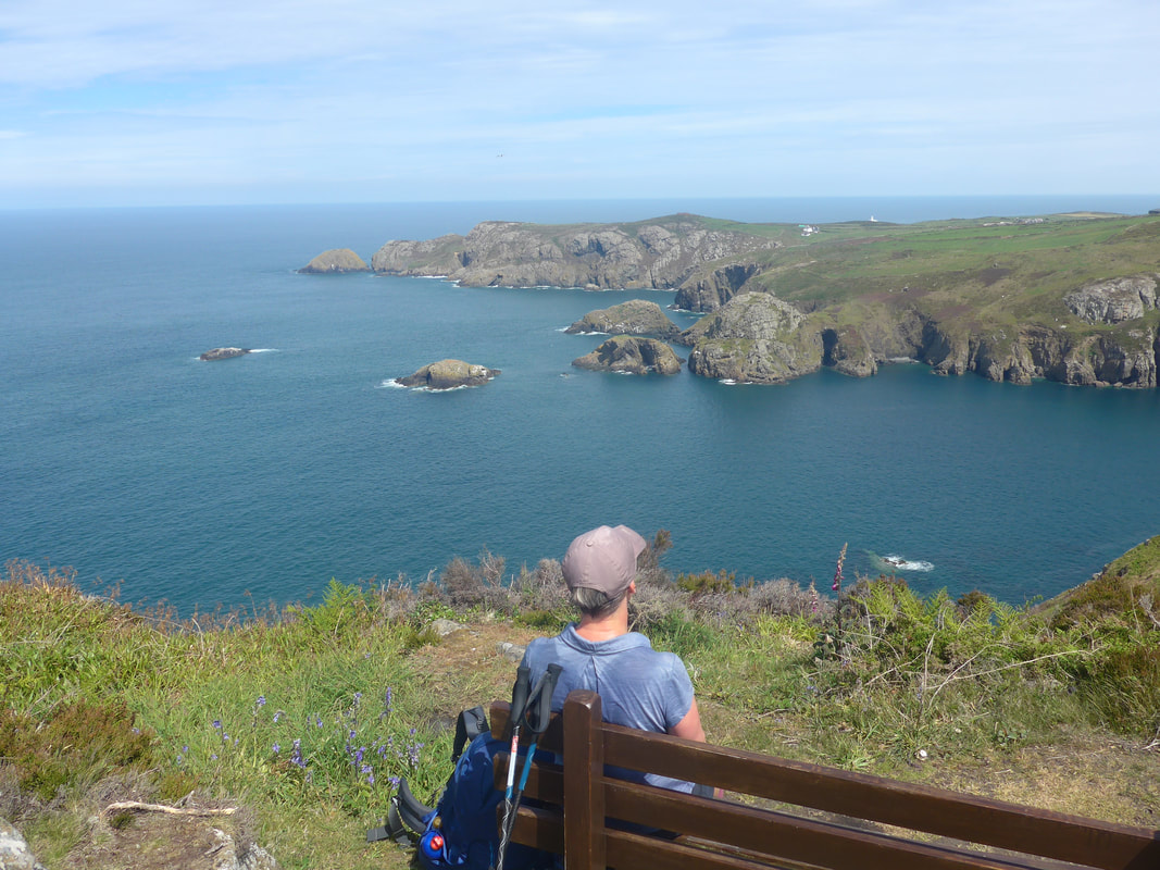
Above the bay of Pwll Deri, just before Dinas Mawr, there was a lovingly located bench seat on a high point where we stopped to brew up and to enjoy the view over the bay and headland to St Georges Chanel. In roughly the same location as the bench there is a memorial stone to Welsh poet Dewi Emrys, who wrote a poem about the bay called 'Pwllderi'. On the western side of Pwll Deri there is a youth hostel in a lovely clifftop location.
The highest point of the day is on the cliffs of this early section on the approaches to Carn Ogof. It is glorious coastal hillwalking and on a day like today a joy to behold. Despite our exertions, we still enjoyed the views and loved the little patches of wild flowers that we came across, including a section filled with beautifully delicate spotted Orchids.
Above the bay of Pwll Deri, just before Dinas Mawr, there was a lovingly located bench seat on a high point where we stopped to brew up and to enjoy the view over the bay and headland to St Georges Chanel. In roughly the same location as the bench there is a memorial stone to Welsh poet Dewi Emrys, who wrote a poem about the bay called 'Pwllderi'. On the western side of Pwll Deri there is a youth hostel in a lovely clifftop location.
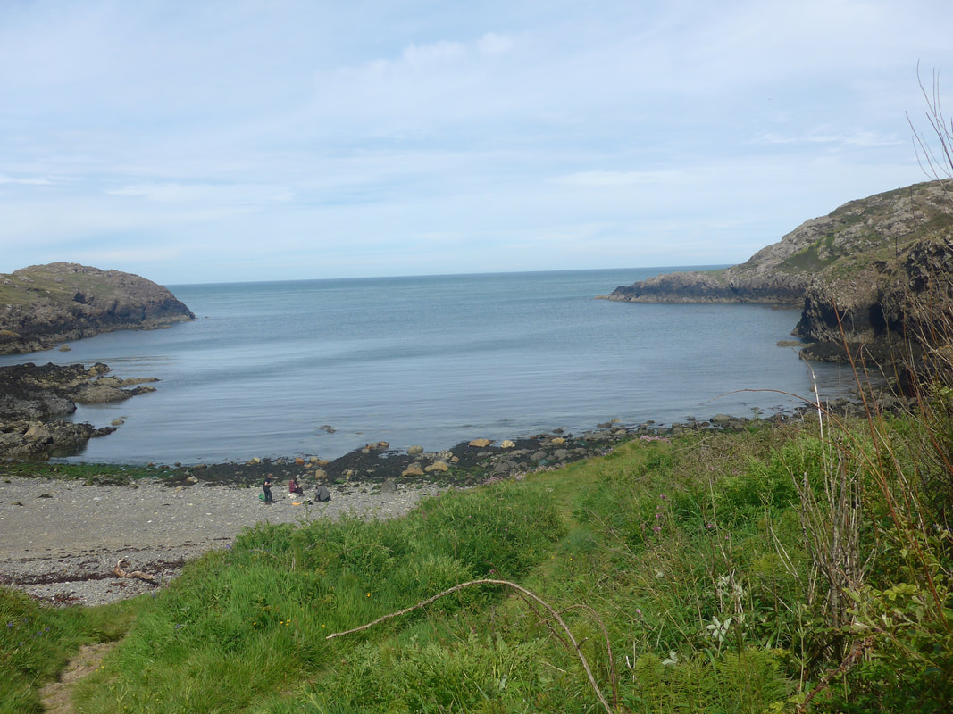
Back to Aber Bach & Castell Coch
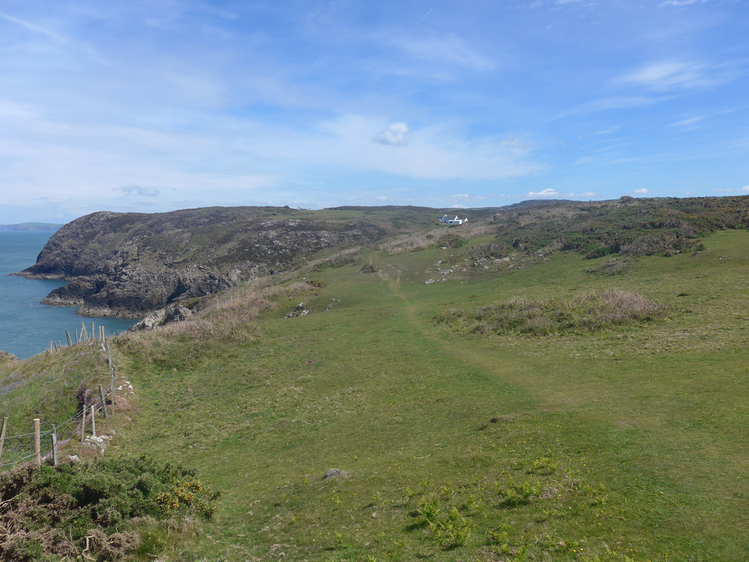
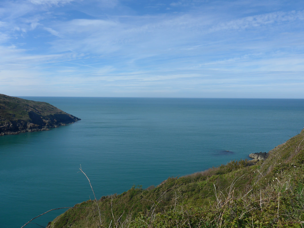
 Perfect Peace over Pwll Deri
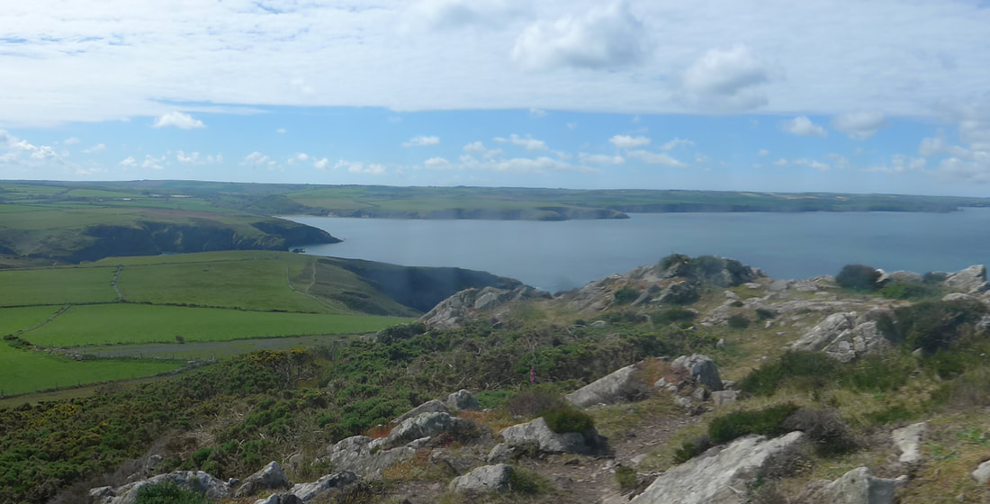
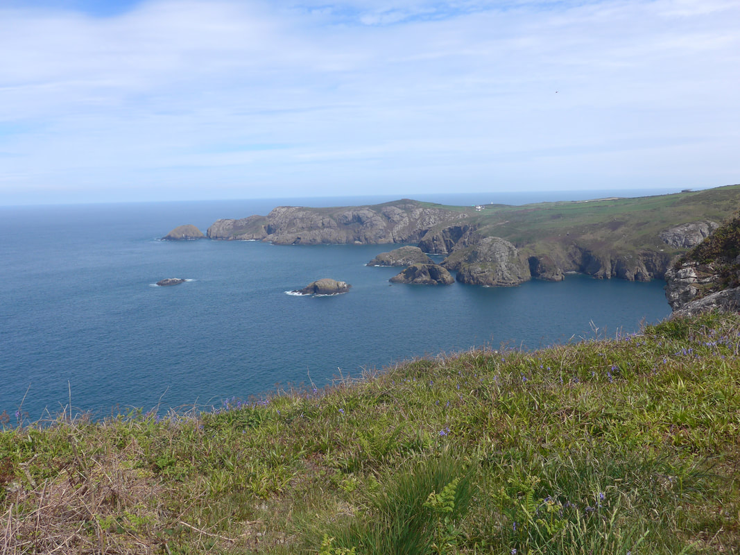
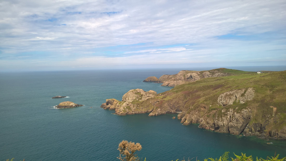
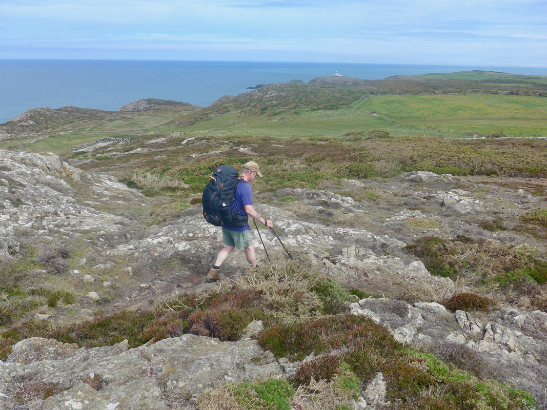
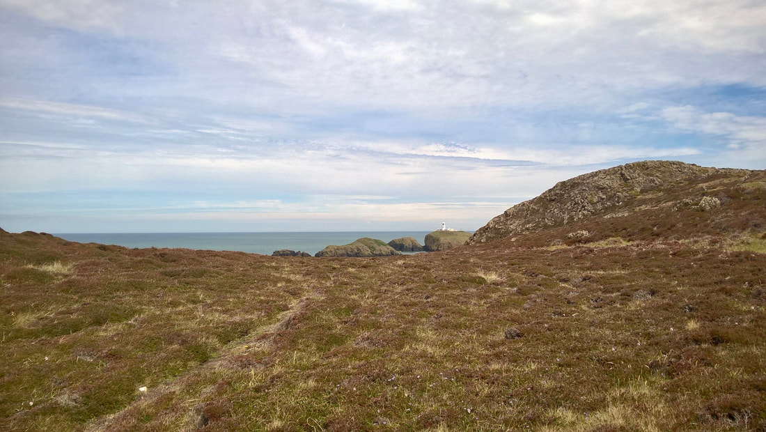
 From just below Garn Fawr, we could see over the hills to the top of the Strumble Head Lighthouse, which from this perspective did not seem too far away. From the eastern side of Pwll Deri the route moves on to a road / track for a short distance, passing the youth hostel off to your left. Just beyond the hostel a narrow path runs off on to the clifftop again to begin what was actually a long walk round to the lighthouse. The path was very narrow and, at times, boggy, with a fair bit of surface water. From here the temperature began to cool and as we were approaching the Strumble Lighthouse it actually became quite cold. What with the rocky terrain, bogs and cold, it almost began to feel like a day on the Scottish hills.
The view remained good, however, with a lovely wild grandeur to the landscape. Finally, after a long sweep round the cliff we reached Strumble Head. After looking around we progressed to an old military lookout shelter slightly further on here that has been converted to use as a wildlife viewpoint and it is said that you can see various sea creatures from it such as seals and porpoises, as well as various seabirds. Sadly, not on our day, but we did take the opportunity to break out the Jetboil to brew up and have lunch in the viewpoint, out of the cold wind.
The view remained good, however, with a lovely wild grandeur to the landscape. Finally, after a long sweep round the cliff we reached Strumble Head. After looking around we progressed to an old military lookout shelter slightly further on here that has been converted to use as a wildlife viewpoint and it is said that you can see various sea creatures from it such as seals and porpoises, as well as various seabirds. Sadly, not on our day, but we did take the opportunity to break out the Jetboil to brew up and have lunch in the viewpoint, out of the cold wind.

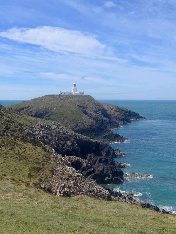 Strumble Lighthouse III
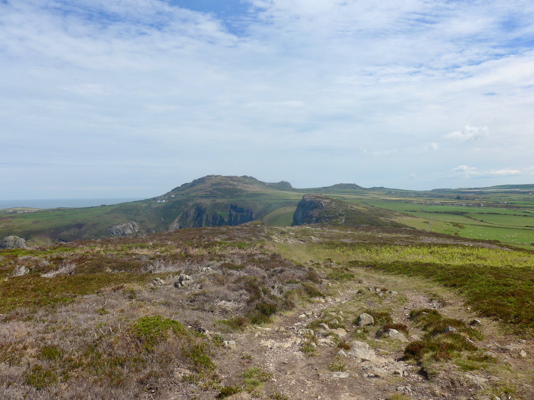
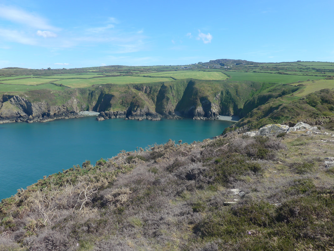
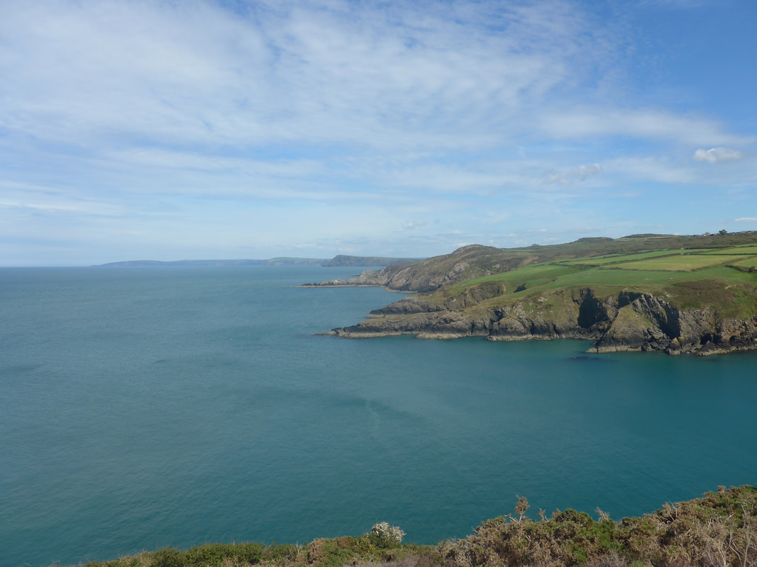
 It was still cold when we started back after lunch to walk along the hilly Pen Caer coast to Fishguard but soon warmed up and the heat stayed with us for the remainder of the walk. This is a lovely section of coast with about fifteen to twently bays and coves of various sizes. The coastal views were dramatic and the fertile farmland on the headland a wonderful jigsaw of colour and texture. Looking back, we had a fine view of the lighthouse against the afternoon sky. Going forward the cliffs marched off in the distance, heading up towards the location of Aberystwyth. The path remained narrow and rocky underfoot and a bit of care was required to avoid falling. In various locations there lovely banks of white wild flowers tumbling down small hillocks and dry stane dykes.
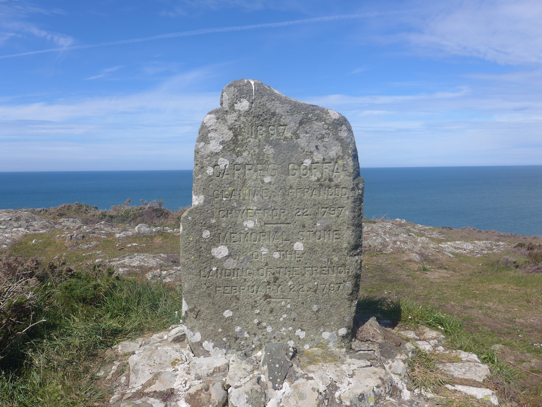
Above Carragwastad Point there is a memorial stone to mark the landing of French troops in 1797, said to have been the last invasion of the UK. Designed as an aid to the Irish rebels in their fight against England, the 'invasion' was a failure with all the enemy troops captured. The Carragwastad invasion was one of three prongs supposed to detract the government of the day from the main target of landings, in Ireland. The other location was to be Newcastle but this and the Irish landings were abandoned.
Above Carragwastad Point there is a memorial stone to mark the landing of French troops in 1797, said to have been the last invasion of the UK. Designed as an aid to the Irish rebels in their fight against England, the 'invasion' was a failure with all the enemy troops captured. The Carragwastad invasion was one of three prongs supposed to detract the government of the day from the main target of landings, in Ireland. The other location was to be Newcastle but this and the Irish landings were abandoned.
 Across Aber Felin to Cemaes Head
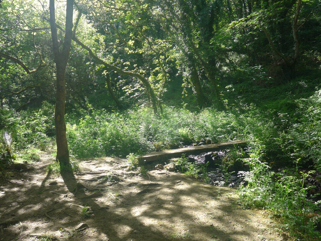
 From the bay at Aber Felin, the route weaves in and out as it goes round numerous coves and bays. Above the bay of Pant-y-Dwr there is a small detour inland to cross a small burn on a wooden footbridge in a lovely dapple-shaded woodland area. You are rewarded for the slight detour with a wonderful view out from the bay to endless blue sea beyond, while to the west the slim finger of the Penfathach headland reached out in to the waters.
Approaching the Pen Anglas headland we spied a very narrow, tall archway, indicating where the headland will sooner or later detach from the mainland. On Pen Anglas there is a single industrial chimney and a small 'lookout-type' building. The geology is also interesting with Dolerite intrusion creating many-sided cooling joints oon the eastern side, similar in shape to the standing columns at the Giant's Causeway in County Antrim, Northern Ireland.
From Pen Anglas we had our first views of Goodwick and Fishguard with the long finger of the north breakwater stretching across the harbour mouth. Across the Bay the houses of Fishguard crowd the clifftop. As we progress round the corner Goodwick is exposed, sitting snug in the dip around the harbour. Below us the ferry terminal stretches eastwards towards the town. Ferries and catamarans (summer only) leave here for Rosslare, County Wexford. The distances to Goodwick and Fishguard are deceiving as the path keeps to the high land to pass the ferry terminal, before dropping down to the harbour road just before the Goodwick railway station.
 Looking Across Fishguard Bay
 As usual with us the heart leaps at the first opportunity to think the walk is finished, not taking in that there is still a long walk yet to reach Fishguard and, even longer to our accommodation, which is on the far side of the town. When the realisation set in there was initial dismay. It had been a hard day's walking in hot conditions and we were ready to order a taxi for the last couple of miles with a promise to walk it tomorrow on our day off.
Fortunately, we were saved from our own stupidity by the fact we were too tired to even order a taxi. After resting at a picnic bench outside the Sea Trust's Ocean Lab Centre and eating a couple of snacks, we made our way along the A40 to a set of steps that took us up the cliff and on to the Windyhall road leading to Fishguard High Street. Along the way we checked out the camping shops to try and replace some gear but to no avail. From the Windyhall we had about fifteen minutes walking to reach our Airbnb accommodation, happy with the thought that tomorrow was a day off.
Fortunately, we were saved from our own stupidity by the fact we were too tired to even order a taxi. After resting at a picnic bench outside the Sea Trust's Ocean Lab Centre and eating a couple of snacks, we made our way along the A40 to a set of steps that took us up the cliff and on to the Windyhall road leading to Fishguard High Street. Along the way we checked out the camping shops to try and replace some gear but to no avail. From the Windyhall we had about fifteen minutes walking to reach our Airbnb accommodation, happy with the thought that tomorrow was a day off.
 RSS Feed
