It is always our intention to have an early start to the day when we are camping, but it never works out that way. Today was no exception as we spent our time talking to school pupils about our adventure and to the owner of Celtic Camping, Ian and his son about the adventure school. It had been a dream of Ian and his wife to run such an establishment and they were delighted when they were offered a lease on Pwll-carog farm by the National Trust. Ian and his son are continuing the dream and since its early days, the venture has grown considerably. Their website is worth a visit to see the range of adventures on offer. We thoroughly enjoyed our overnight and would recommend it as a stop if you are doing the Wales Coast Path given it is a good camping resource in a relatively wild area.
 Walk Profile
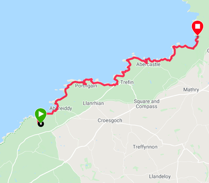
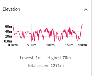
 The route today remains coastal with no detours inland. It will be a challenging day with good weather forecast and a fairly rolling hilly landscape to contend with amounting to over four thousand feet of elevation. While the gullies are not in and of themselves challenging, there are a number of them that we think will stretch us in the heat.
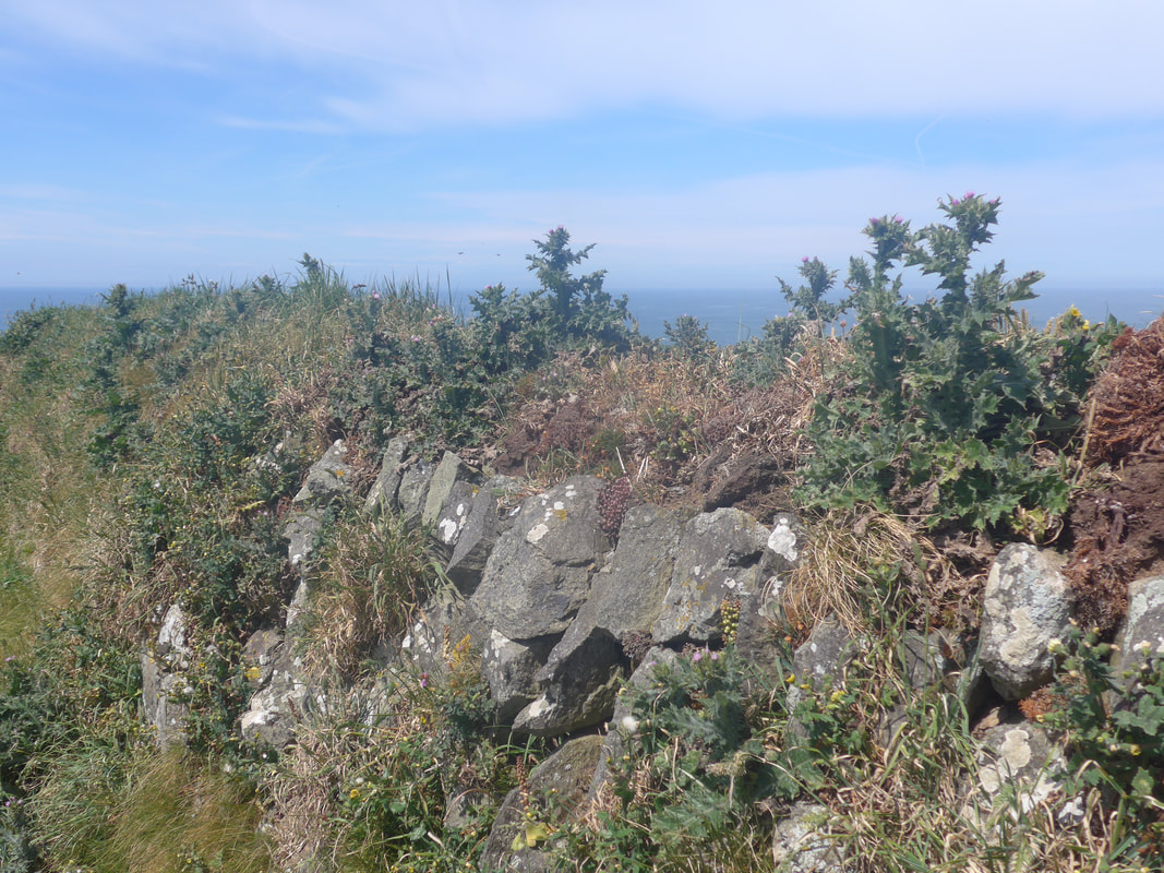
One of the features of the walking yesterday was stony paths and we expect that to continue today given the local geology. Much of the rock here is of volcanic and metamorphic origin, which explains why there was a slate quarry at our first settlement of the day, Abereiddy. Still struggling with my ankle injury, foot placement for me will be important as I could do without aggravating the injury.
There are three or four little settlements on the route, some of which offer facilities of various kinds, so we will not go short of food or drink. There is also the trusty Jetboil should we come across one of those little spots on the hillside where you just know you have to stop, brew up and sit back against the grass.
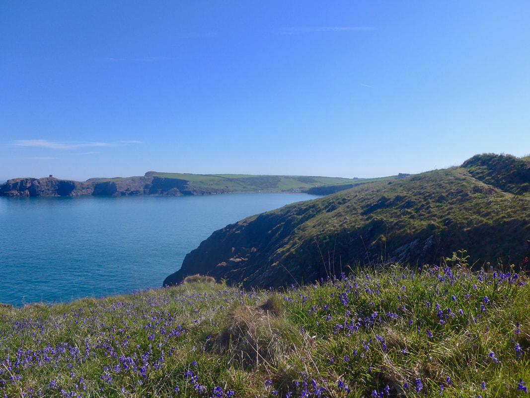
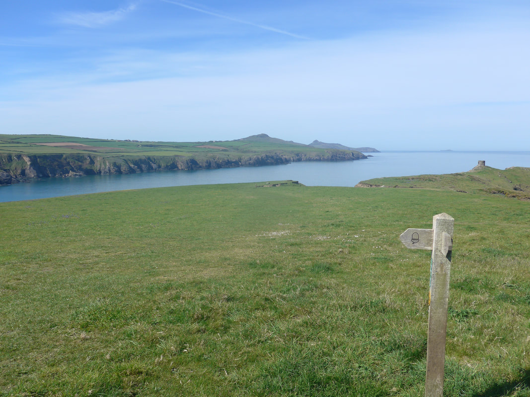
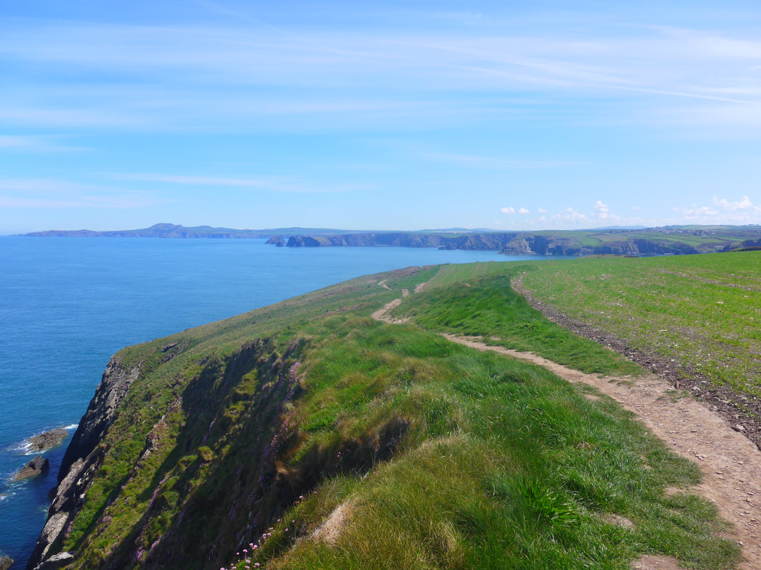
 Blue
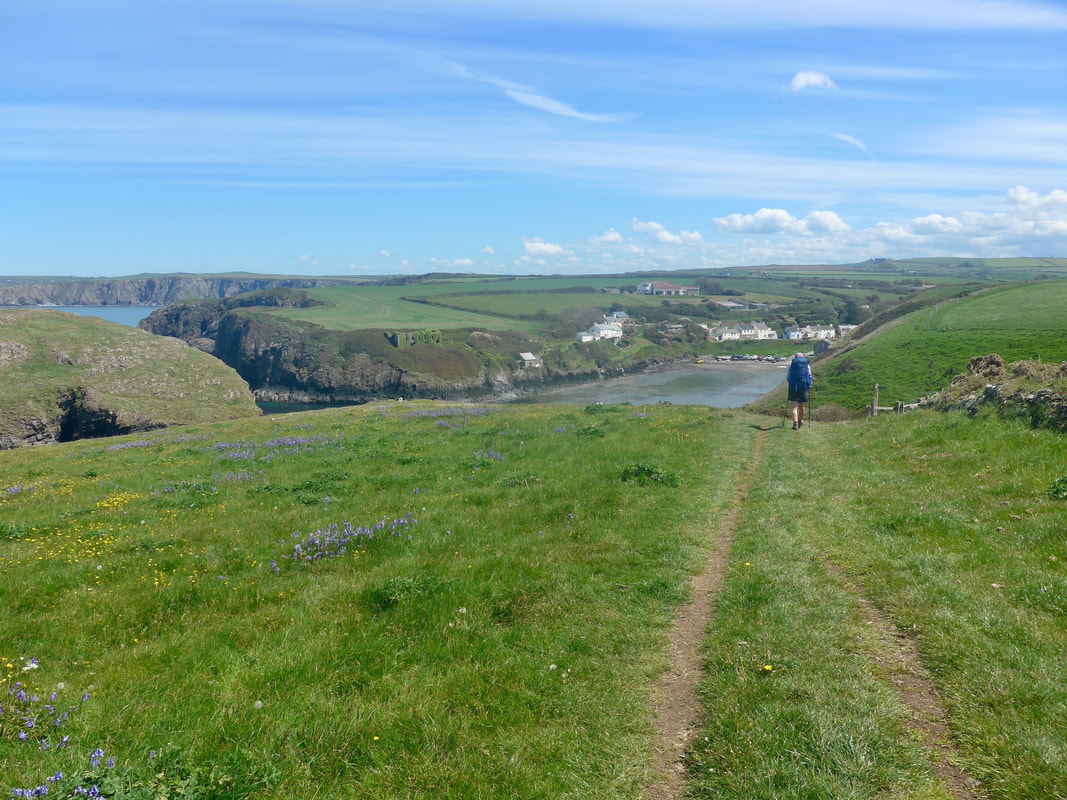
Blue Leaving Celtic Camping, the route followed the path back down the gully we had climbed last night when we arrived. At the bottom of the path there is a site of a Bronze Age fort, the outlines of which can be clearly seen and walked.
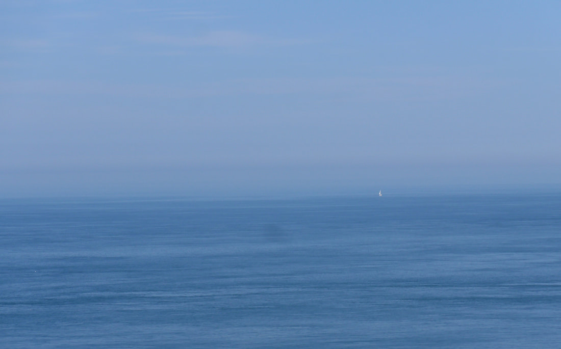
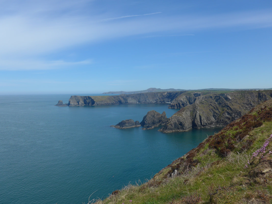
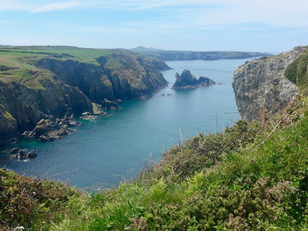
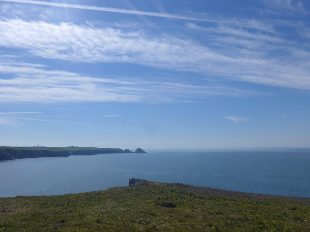
Approaching the clifftop, the view out to sea was nothing short of phenomonal, akin to a study in blue by someone like Gauguin. The blue of sea and sky was only broken by a tiny white sail on the mid-horizon.
Approaching the clifftop, the view out to sea was nothing short of phenomonal, akin to a study in blue by someone like Gauguin. The blue of sea and sky was only broken by a tiny white sail on the mid-horizon.
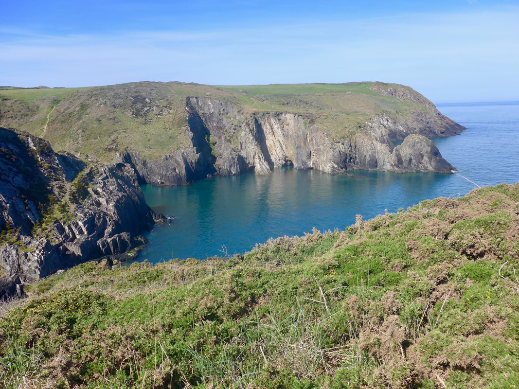
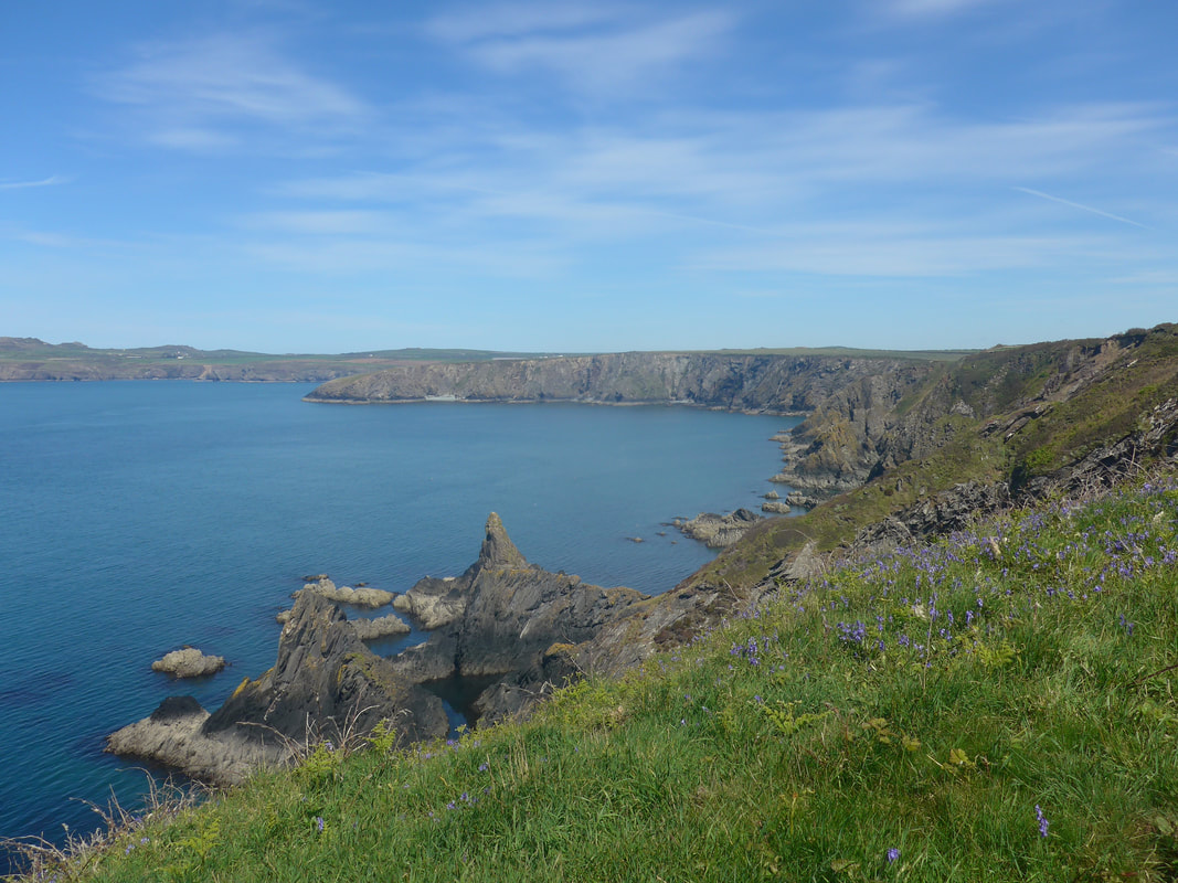
On the actual coast, in the bay of Aber-Pwll, the colour of the sea changed to a dark green that contrasted beautifully with the rocks above. On the verge of the path, the blue colour spectrum continued with large swathes of Blue Bells amongst last year's grey bracken, interspersed with rather oddly-shaped Dandelions and Ragged Robin. Looking across Abereiddi Bay, Abereiddy Tower stood out against the blue sky on the headland of Trwyncastell and below the tower, a gap in the rocky cliff showed where the Blue Lagooon, or Morlyn Glas in Welsh, is to be found. The original purpose of the tower, now a Grade II Listed Building, are unknown but it is thought to have been a navigational aid of some kind, (circa 1843-63).
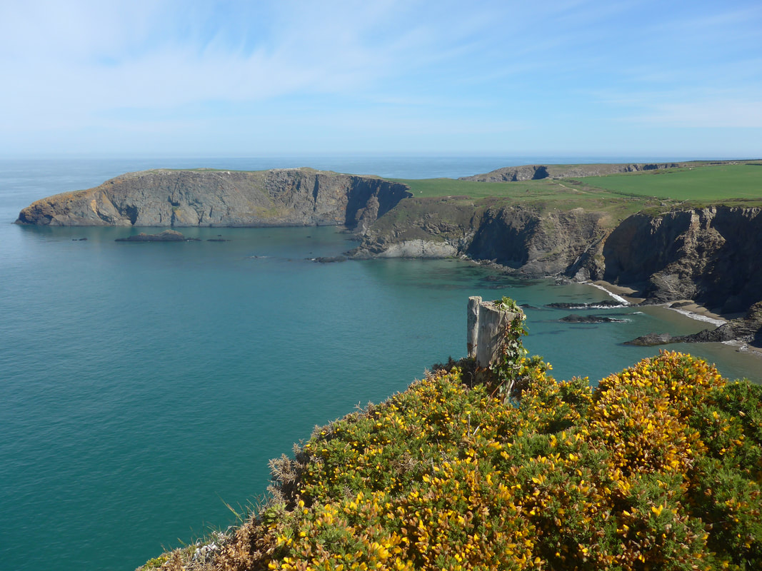
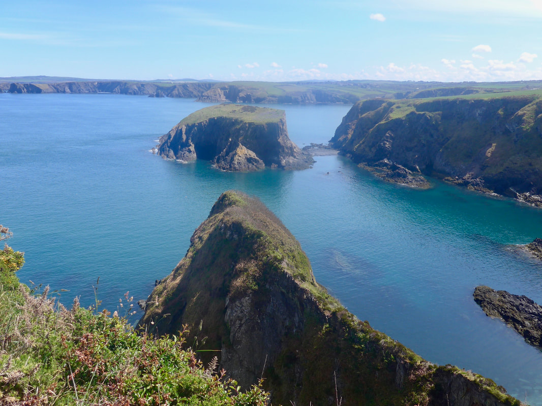
 Cyffredin Cliff to Aberreiddy Tower
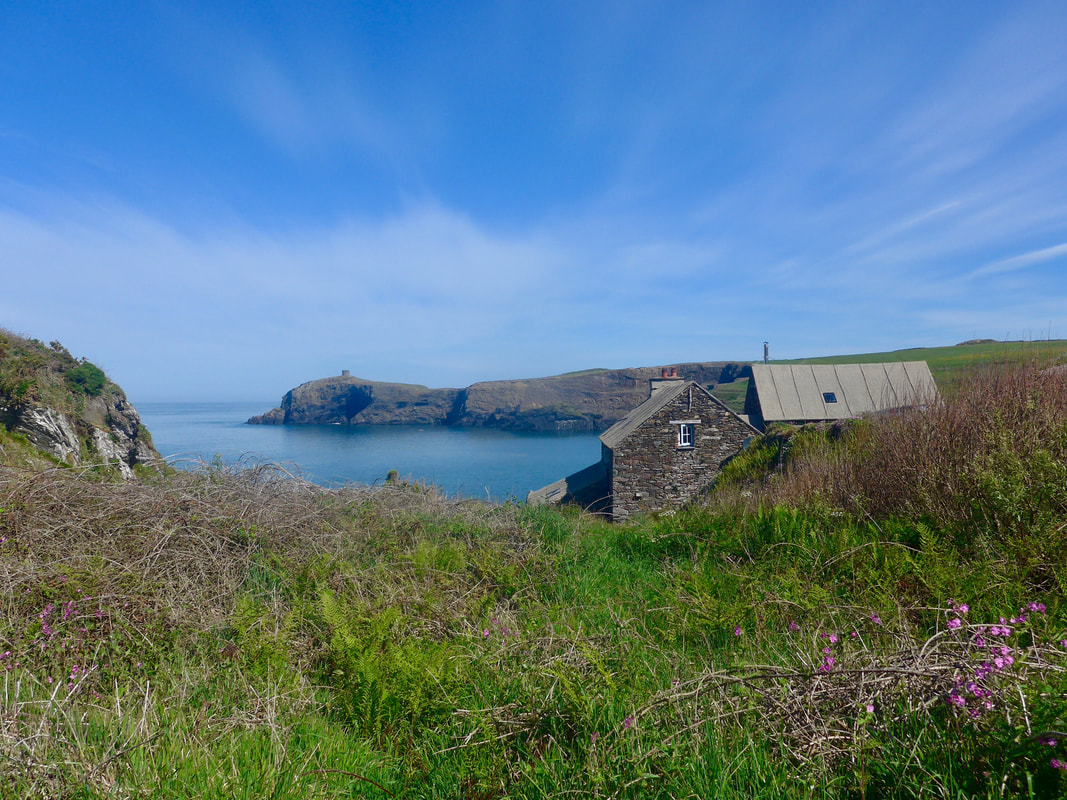
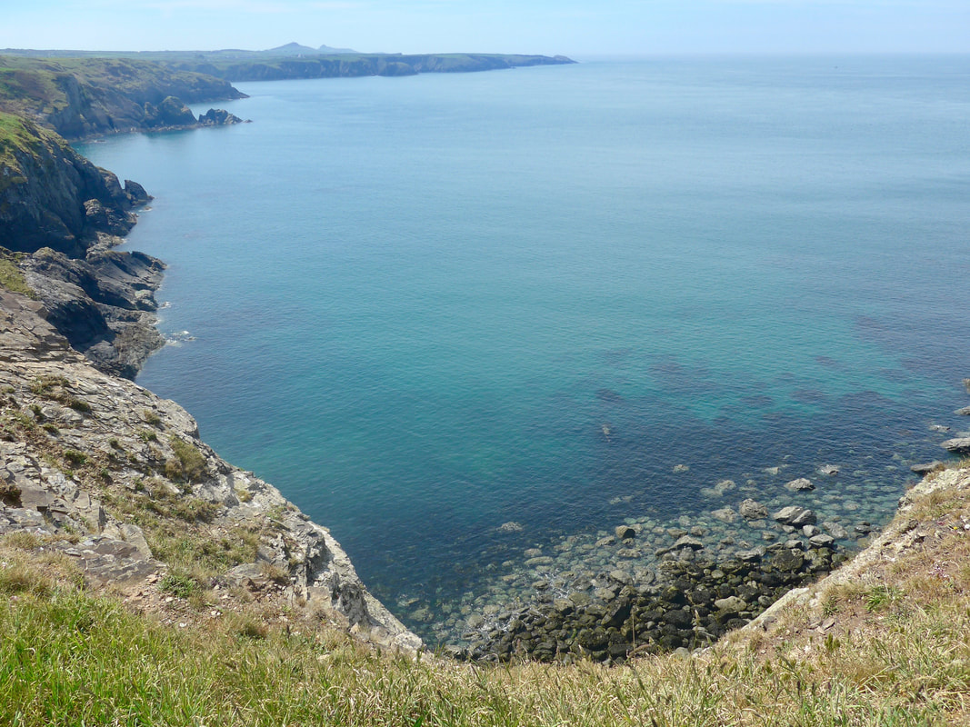
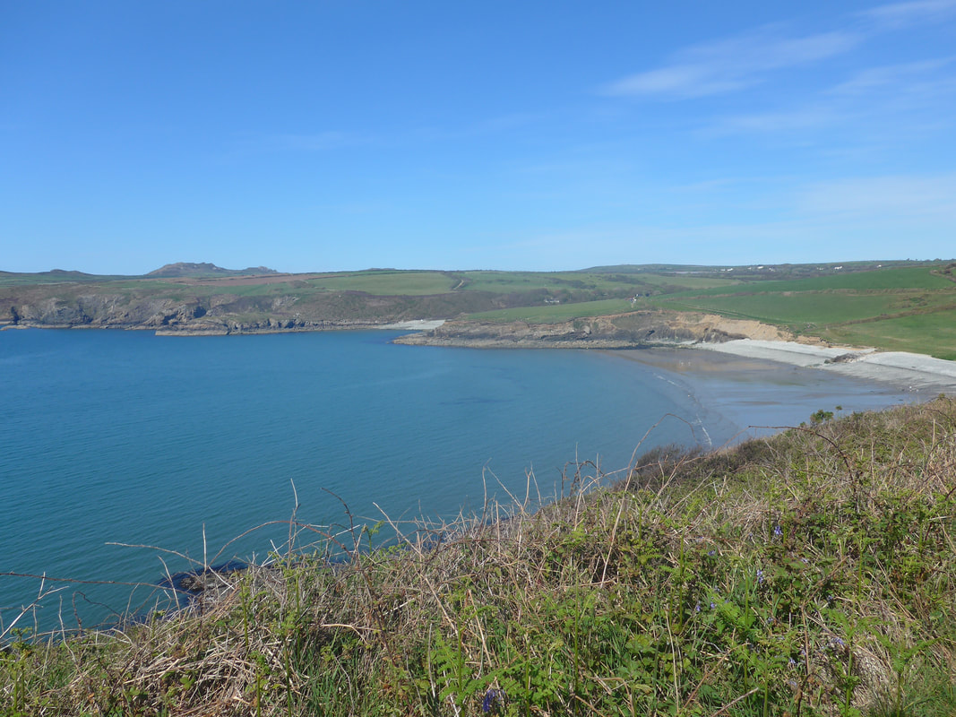
 The approaches to Abereidii Bay roll over the hills with two low gullies to be traversed at the hamlet of Cyffredin. Just before the hamlet are the remains of a disused quarry. There is a lovely little stone building sitting on the heights on the east of the bay with beautiful views across to the tower. Passing behind the beach the view out to sea over Abereidii Bay was lovely with, again, stunning blues in sky and sea. From the bay there is a gentle climb up to the neck of the headland Trwyncastell, part of which is the Blue Lagoon. The lagoon is stunning, unfortunately, on the day, I was so taken up with it I forgot to get the camera out. The lagoon was the site of an old quarry, closed in 1910 and then flooded. Over time, the sea broke through the rocks to create a salt water lagoon. It is now the location for all sorts of water sports including kayaking, diving and on a number of years was the location for the Red Bull Cliff Diving competition.
Abereidii Bay
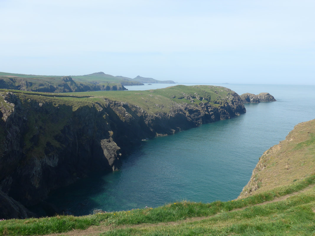
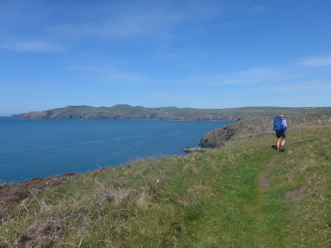
 To St David's Head
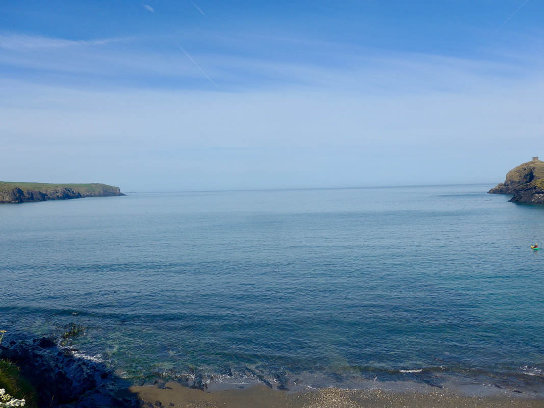
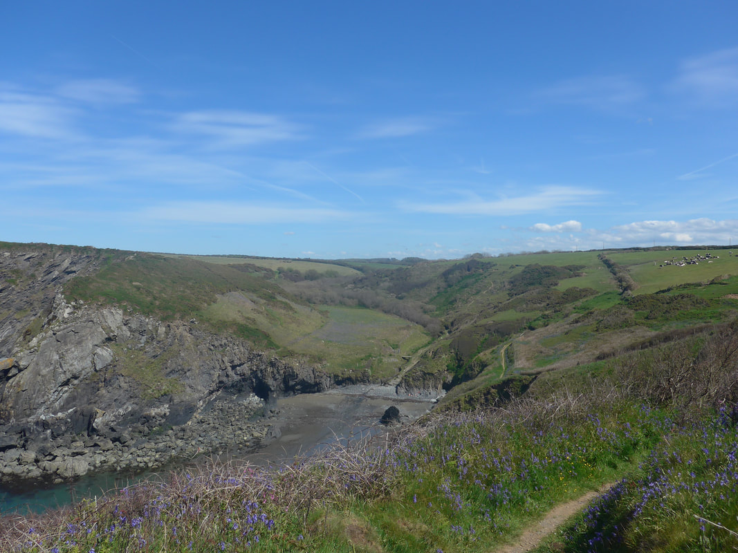
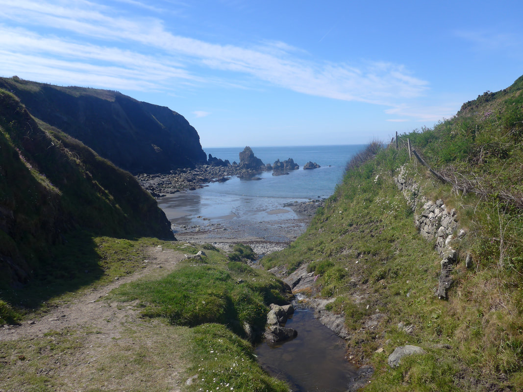
 Coming off of the headland Trwyncastell, there is a flattish walk along the clifftop until you reach the sandy bay at Traeth Llfyn. From the clifftop, we had a lovely view across the dark green waters of the bay to the solid-looking, unnamed headland on the west side. Just off the headland lay the twin rocks of Cerrig Gwylan.
Looking back to the east, we could see across all the bays and headlands of the last couple of days, including St David's Head, with the hilltops of Penberry, Carn Ffald and Carn Llidi standing out against the sky.
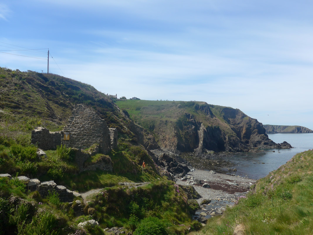
On the clifftop on the way to Traeth Llfyn bay, there is another of the many, local disused slate quarries with the remains of some industrial buildings still standing on the clifftop. The excellent weather and walking conditions continued as moved round from Porth Egr on to the approaches to the bay at Porth-gain.
Looking back to the east, we could see across all the bays and headlands of the last couple of days, including St David's Head, with the hilltops of Penberry, Carn Ffald and Carn Llidi standing out against the sky.
On the clifftop on the way to Traeth Llfyn bay, there is another of the many, local disused slate quarries with the remains of some industrial buildings still standing on the clifftop. The excellent weather and walking conditions continued as moved round from Porth Egr on to the approaches to the bay at Porth-gain.
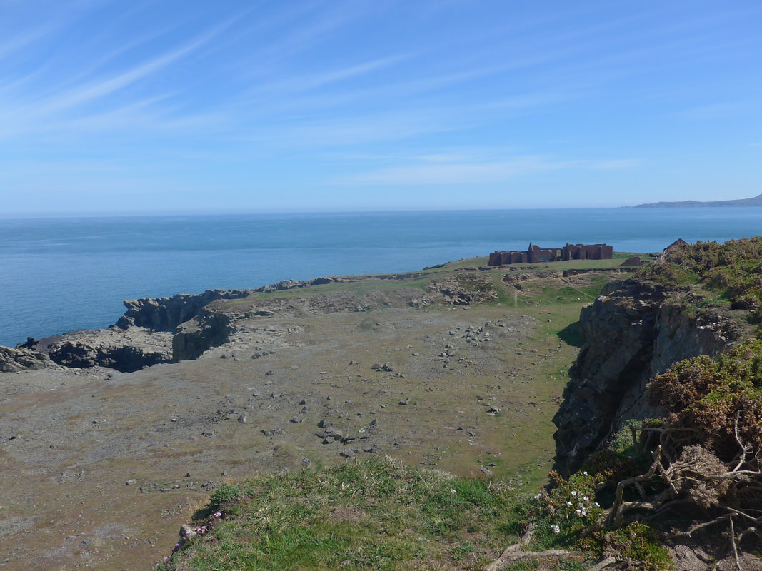
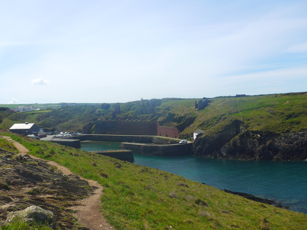
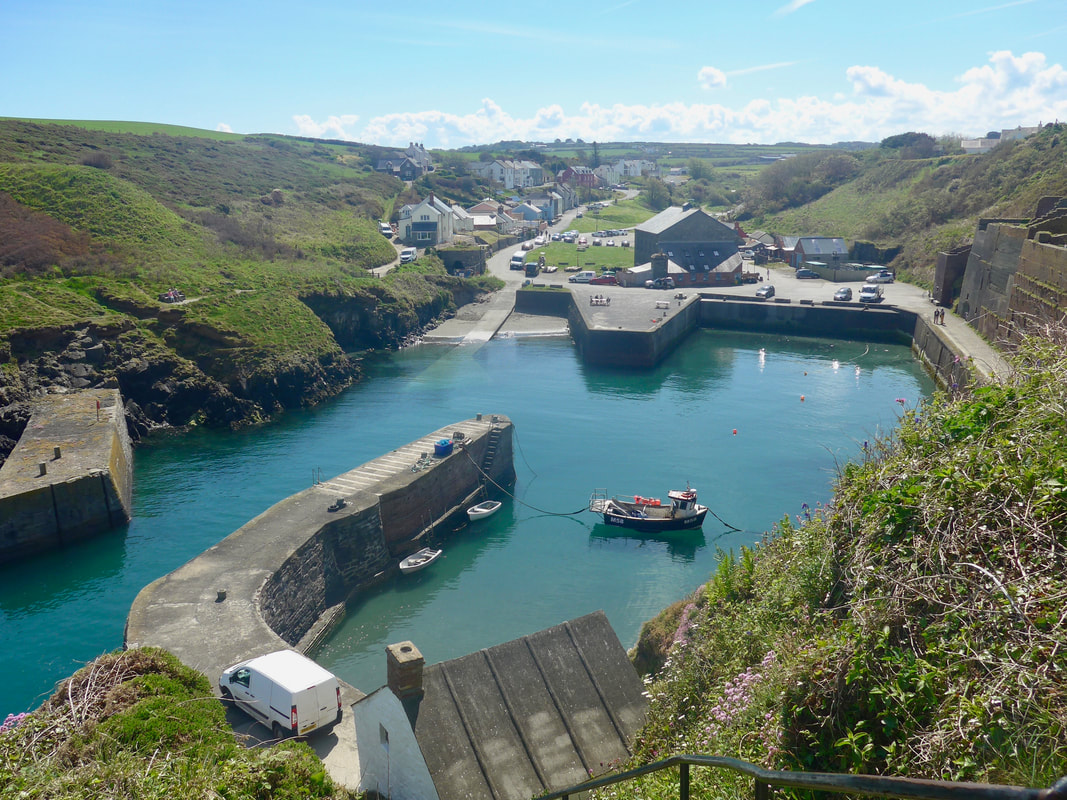 Porthgain Harbour & Village
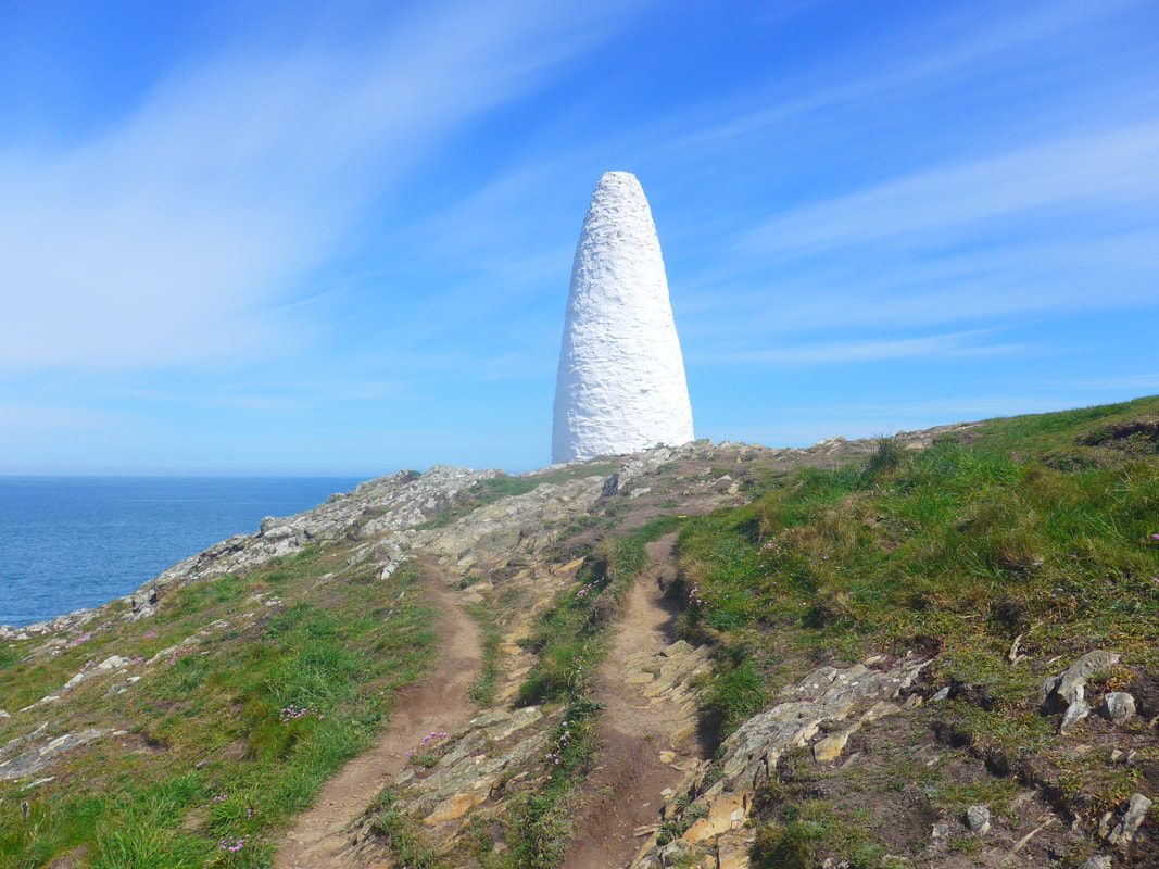
 From a vantage point on the headland above the bay there is a lovely view over the harbour with the little village of Porthgain stretched out in linear fashion up the sides of the valley that runs from the back of the harbour. On the hilltop on each side of the harbour there are tall white marker posts that guide sailing vessels in to the harbour.
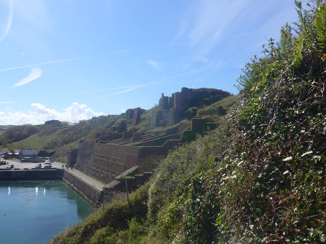
It is a lovely little harbour, solidly built in grey granite stone. It is wedged in between the green slopes of the cliff on the western side and dominated on the east by the remains of an industrial site that crushed and stored stone before shipment. The buildings were mainly built of the red bricks that were produced locally at Ty Mawr. The hard volcanic rock crushed at the factory was mainly used for road building.
As well as the factory, and brick building, there were lime kilns in the village. Running down on to the harbour there used to be a three-foot, narrow gauge, industrial railway, used to bring slate to the harbour from the local Pen Clegyr and St. Bride's quarries (1880s - 1931). The railway terminated at the end of the pier on which the white van sits in the photograph. The harbour today is still used for crab and lobster fishing and for sea-based leisure activities. We lingered on in the village and had a second breakfast at the Sloop Inn where we enjoyed crushed avocado on toast with a poached egg. Lubbly jubbly!
 Garn Fawr & Strumble Head
 Leaving Porthgain, there is a climb up on to the headland where you pass the western white cairn marking the entrance to the harbour. From here there was a lovely view along the coast as far as the mountain of Garn Fawr behind Strumble Head. After the last two days we did not think the views could be any better but with wonderful clarity to the light of the day, the views were at least on a par with, if not better, than what had come before.
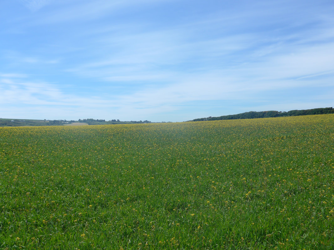
This is a beautifully crennelated coastline with numerous coves and bays, the path weaving in and out as it goes round them. The walking path is good, if a trifle stoney in places, but the views and the general 'zeitgeist' of the walk is wonderous, particularly on a fine day like today. On the clifftop, we were walking on fairly flat, extensive grasslands which were at that time a wonderfully bright emerald green. The near view west, from a standpoint on the headland of Trwyn Elen, was a nice vista over the top of the Ynys Fach Rock across Pwll Crochan Bay. Pwll Crochan beach is accessible, but apparently only with care. Over the farmland in front of us we could see on a hilltop, just slightly inland, the village of Trefin which grew up around the industries of the bay.
This is a beautifully crennelated coastline with numerous coves and bays, the path weaving in and out as it goes round them. The walking path is good, if a trifle stoney in places, but the views and the general 'zeitgeist' of the walk is wonderous, particularly on a fine day like today. On the clifftop, we were walking on fairly flat, extensive grasslands which were at that time a wonderfully bright emerald green. The near view west, from a standpoint on the headland of Trwyn Elen, was a nice vista over the top of the Ynys Fach Rock across Pwll Crochan Bay. Pwll Crochan beach is accessible, but apparently only with care. Over the farmland in front of us we could see on a hilltop, just slightly inland, the village of Trefin which grew up around the industries of the bay.

 Corn Mill, Aber Draw
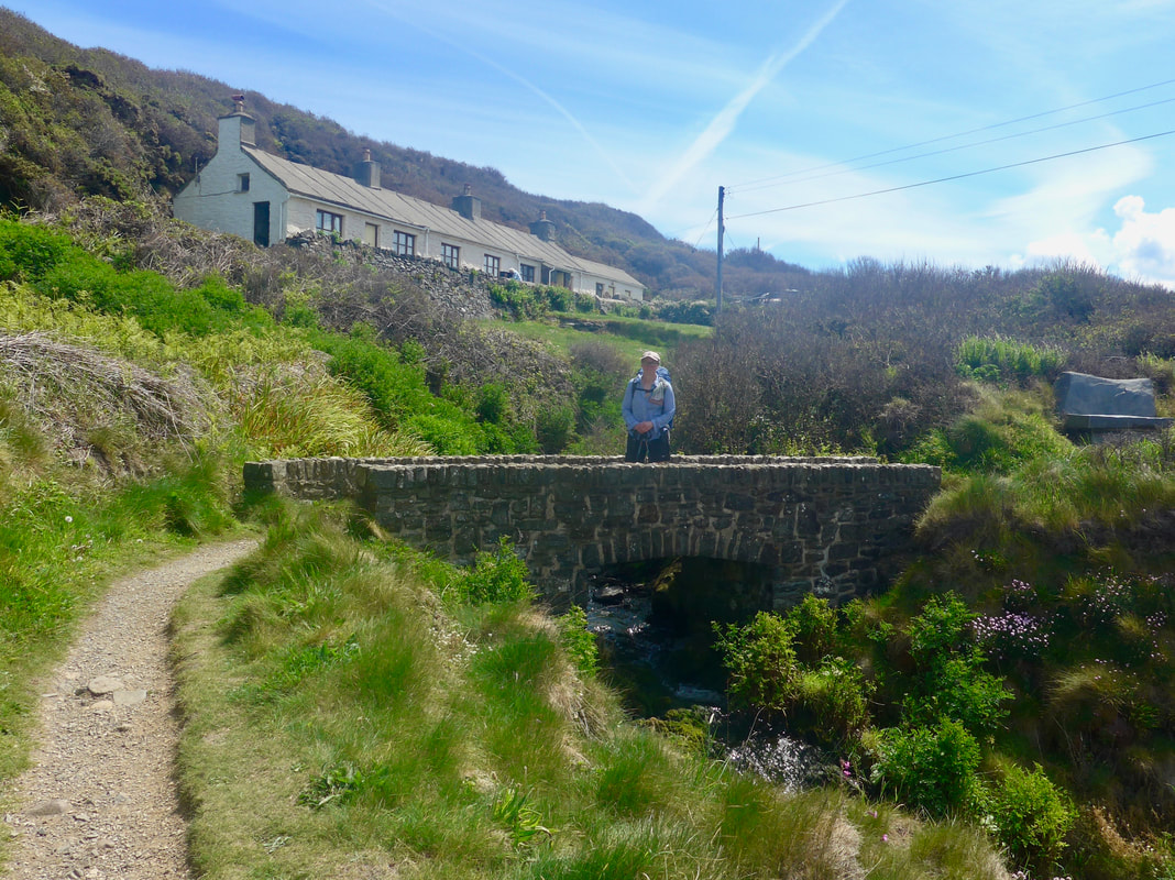
 From above Ynys Fach there are a couple of gentle rises and falls before the path drops down to the now almost deserted Aber Draw bay. There are the remains of an old corn mill here, beside a lovely little, romantic-looking bridge. Just before the bridge there is a handy stone bench on a slight rise and where you can sit awhile and enjoy the view out from the bay.
Looking at it today, it is hard to imagine the bay as a busy port but that apparently is its history with fishing, slate quarrying and work at a lime kiln nearby, all part of the industrial mix. The corn mill is thought to have operated here for about five hundred years, with the mill closing in 1918. It would have been an important attraction to the farmers roundabout inland with corn coming to the mill and much of it leaving by sea.
Looking at it today, it is hard to imagine the bay as a busy port but that apparently is its history with fishing, slate quarrying and work at a lime kiln nearby, all part of the industrial mix. The corn mill is thought to have operated here for about five hundred years, with the mill closing in 1918. It would have been an important attraction to the farmers roundabout inland with corn coming to the mill and much of it leaving by sea.
 To Trefin
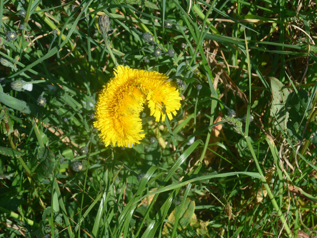
 From the beach at Aber Draw there is a steady rise back up to the clifftop and a welcome return to the lovely coastal views and, surprise surprise, a whole field full of bright yellow Dandelions.
Once back on the clifftop, the path again weaves in and out as it goes round three little coves leading to the Pen Castell-coch headland and from there we could see over the top of Ynys Deullyn to the bay off of Abercastle. From Castell-coch the route moves on to the neck of the Ynys Deullin headland before turning right to head for Abercastle. At Cwm Badau there is a path goes off to the right that leads to the Neolithic burial chamber known as Carreg Samson. Local legend has it that Samson lay the capstone of 4.5 metres long by over 2.7 wide using his little finger which he then cut off and it is said to be buried on Ynys-y-Castell, just off the beach at Aber Castle.
Once back on the clifftop, the path again weaves in and out as it goes round three little coves leading to the Pen Castell-coch headland and from there we could see over the top of Ynys Deullyn to the bay off of Abercastle. From Castell-coch the route moves on to the neck of the Ynys Deullin headland before turning right to head for Abercastle. At Cwm Badau there is a path goes off to the right that leads to the Neolithic burial chamber known as Carreg Samson. Local legend has it that Samson lay the capstone of 4.5 metres long by over 2.7 wide using his little finger which he then cut off and it is said to be buried on Ynys-y-Castell, just off the beach at Aber Castle.
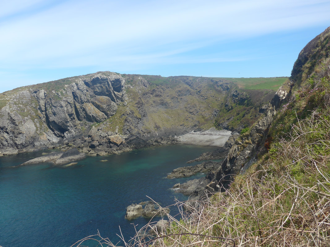
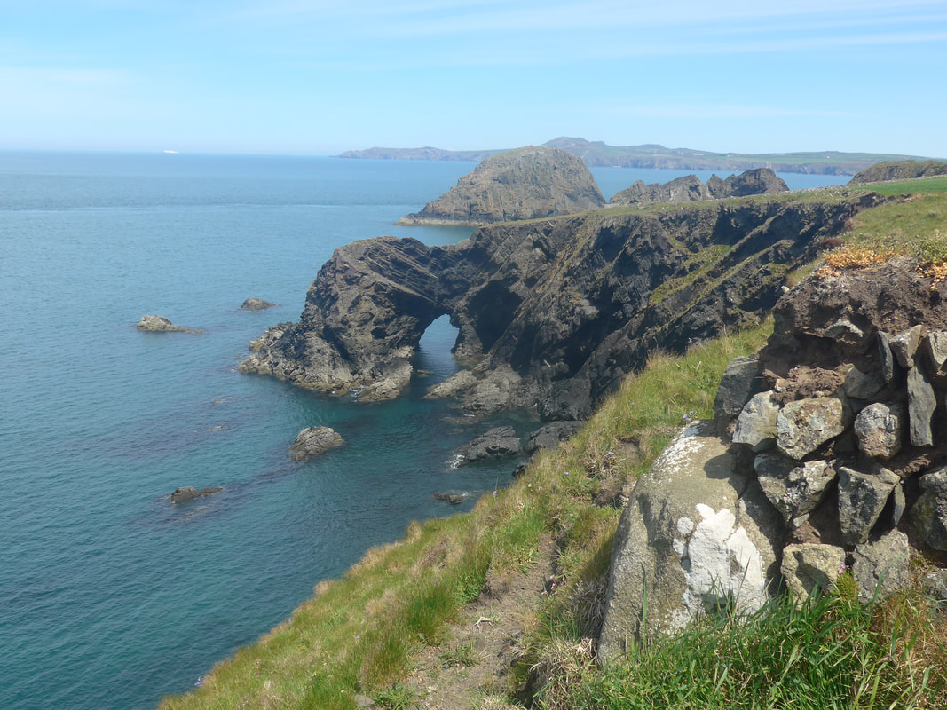 Natural arch in front of Ynys Deullin
 Approaching the rock feature Ynys Deullin, the path drops down and there is a very nice natural arch with the rock immediately behind it. No sooner down than straight back up again for a short undulating section approaching before descending in to a gully just before the beach at Aber Castle from where it runs along the bottom of the hill to enter the village.
On the way down the hill we spent some time talking a couple who lived in Elgin and were visiting the area. The lady had spent her childhood in the area, but her parents were originally farm labourers from Italy who had settled here. Despite many years in Scotland, she still loved to come home and to walk the hills that hold so many of her childhood memories.
Because we had a second breakfast at Porthgain, we had no need for further food but we did stop down by the harbour to brew up on the Jetboil, enjoy a rest and a cup of coffee and afterwards use the local toilets before moving on.
Abercastle
The pull up from Abercastle is fairly gradual, passing close to Ynys-y-Castell and the grave of Samson's Finger. Once on the top, we could see over the cliffs and the sea to the little bays (Aber Bach & Aber Mawr)) where we were scheduled to meet our hostess for the night. The lovely and unusual rock formations continued, as did the spreads of wild flowers and the beautiful colour of the sea. The path goes inland a little way and drops down to cross over the gully at Pwllstrodur, crossing a small stream on a footbridge. From the gully there is another gradual climb to about sixty metres (nearly two-hundred feet) to the headland of Trwyn llwynog, where we enjoyed the view back to Ynys-y-Castel acros the blue bay.
Walking on from the headland we passed the site of another Iron Age fort, located at Castell Coch on Penmorfa headland. From the headland we had our first clear view of the two beaches at our destination, first was Aber Mawr which we crossed to the back of the beach and then on to the smaller Aber Bach, where we met our hostess for the night, Teresa and her dog, Della.
From the beach it was fairly short uphill stroll to the field where were supposed to be camping. Unfortunately, it was a bit of a distance from the shower and toilet facilities, which are at the main farm house. Over tea and jaffa cakes in the front garden of Teresa's house, we ended up opting for B&B in the main house, rather than face the long walk in the middle of the night. Bit of comfort in your old age is to be encouraged!
From the beach it was fairly short uphill stroll to the field where were supposed to be camping. Unfortunately, it was a bit of a distance from the shower and toilet facilities, which are at the main farm house. Over tea and jaffa cakes in the front garden of Teresa's house, we ended up opting for B&B in the main house, rather than face the long walk in the middle of the night. Bit of comfort in your old age is to be encouraged!
 RSS Feed
