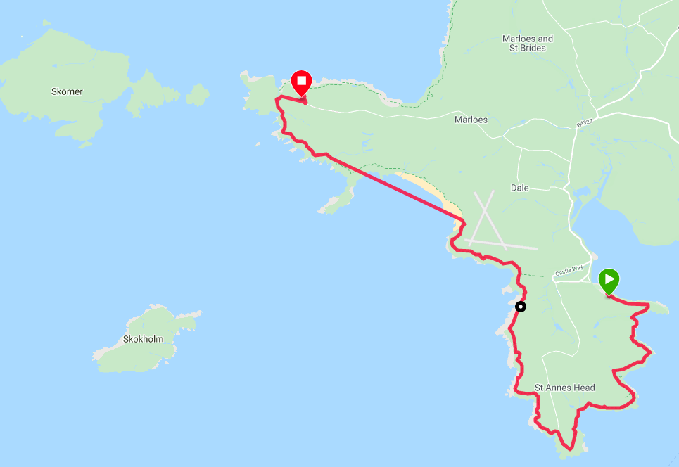
Route Map
We enjoyed a nice night out last evening with fellow walker Claire in the Griffin restaurant where the food was of excellent quality. But be warned; this is one busy place and it might be best to book ahead if you plan on eating there. Likewise, our campsite at Point Farm provided a very good level of service, particularly the wonderful showers. The site is allied with the Greener Camping Club and you need to be a member to camp here. The good news is you can sign up for a tenner when you arrive .
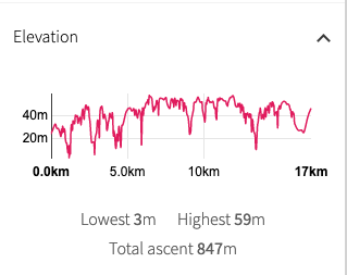 Walk Profile
 Our route today seldom leaves the coast by any great distance and there are an amazing number of lovely bays and coves on the route. Heading out to go round St Ann's Head we follow the cliff up the west side of the Dale Peninsula to Wooltack Point where we are camping just back from the coast. There is a shorter route available if you cut across the neck of the peninsula from the village of Dale to come out on the other coast just above Westdale Bay. We have opted for the longer route as the more scenic option. Like yesterday the mileage is shorter than usual, but it will still be a challenging day with over two and a half thousand feet of elevation to complete. The weather forecast is very poor with cold, wet conditions expected later in the day.
 Across Dale Roads to the Gann
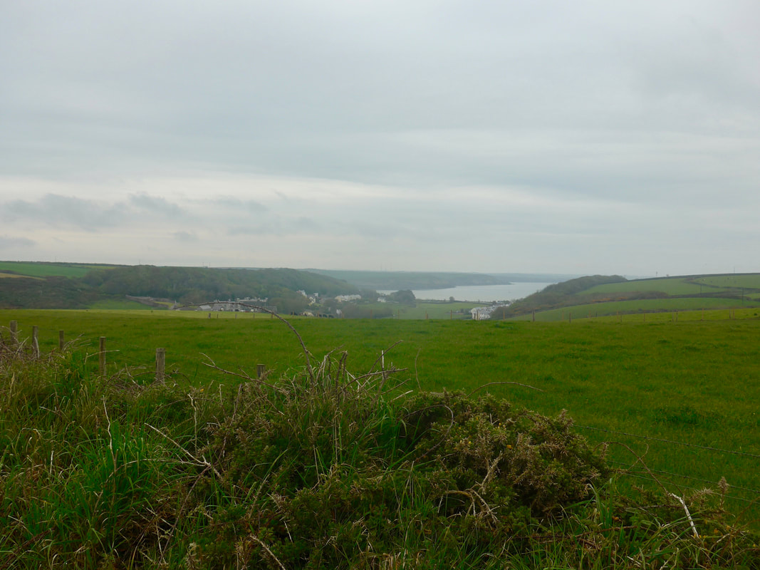
 Today's starting point was literally just the other side of the hedge from where we were pitched last night. Not being in too much of a rush, we set off just before 9.00am, after breakfasting on the campsite. The route started off on a one-way in, one-way out lane that runs up to the Dale Fort Field Centre. The fort was originally built in 1856, like so many of the fortifications along this stretch of coast as a bulwark against the threat of French invasion, part of the defences of the Milford Haven. The fort has functioned as a field studies centre since 1948. Just to the west of the centre lie the islands of Skokholm and Skomer, both major locations for bird watching including including razorbills, guillemots and puffins. The field centre offers a range of field study courses including, for example, fieldwork, natural history and various art classes.
The Milford Haven to Angle
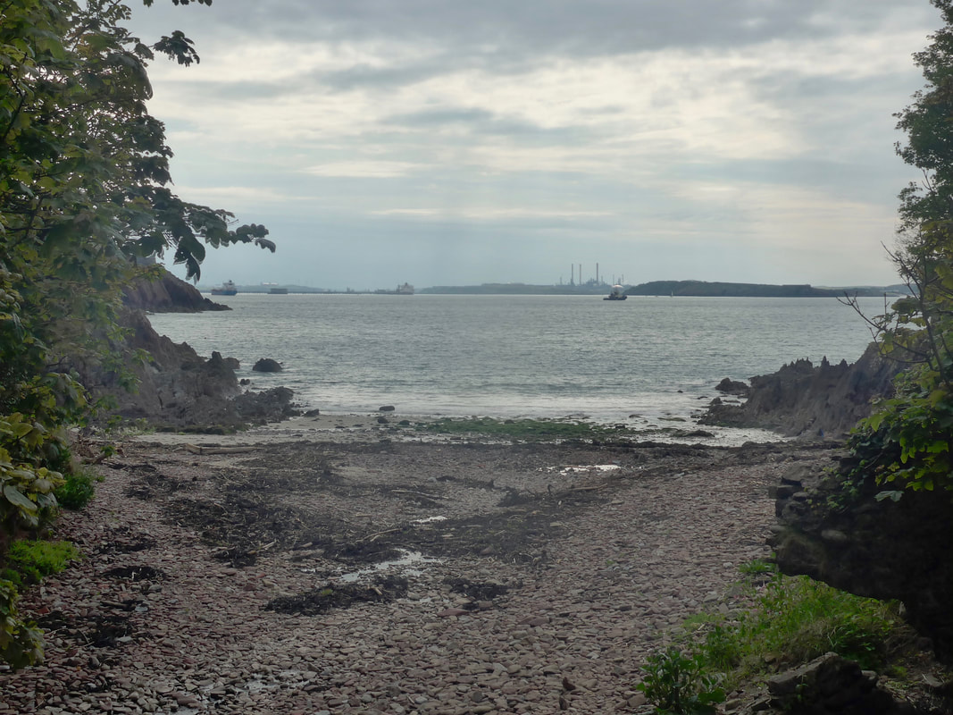 Castlebeach Bay
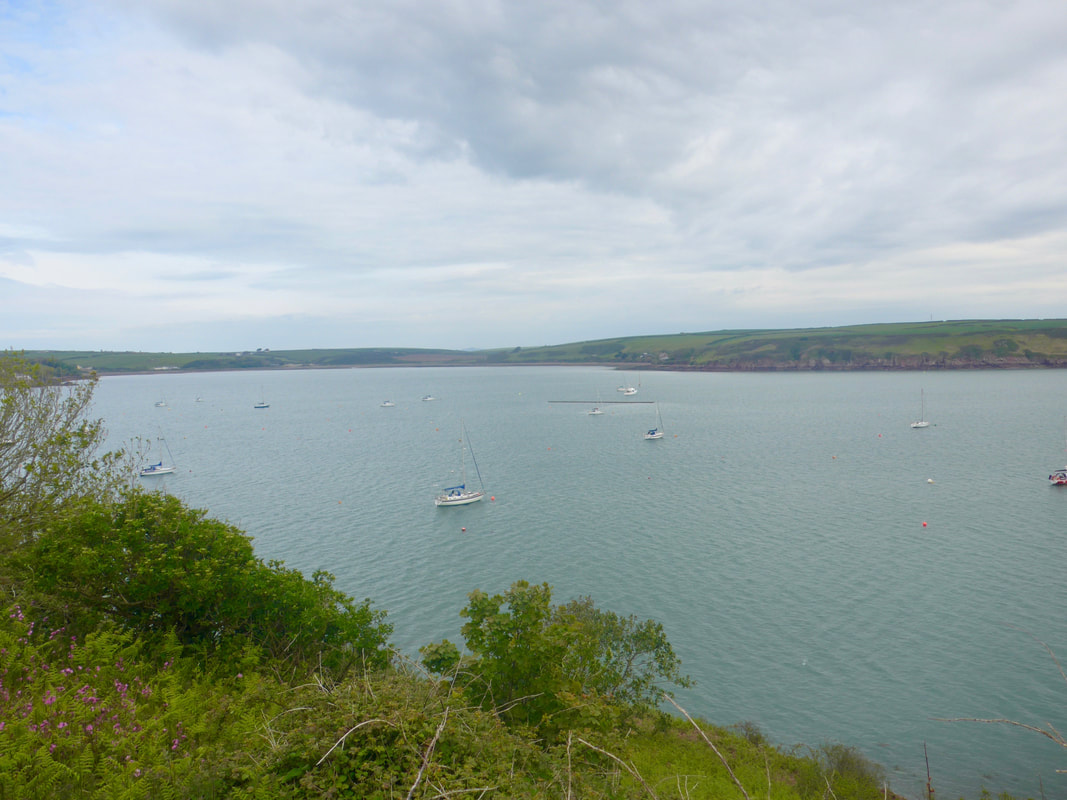
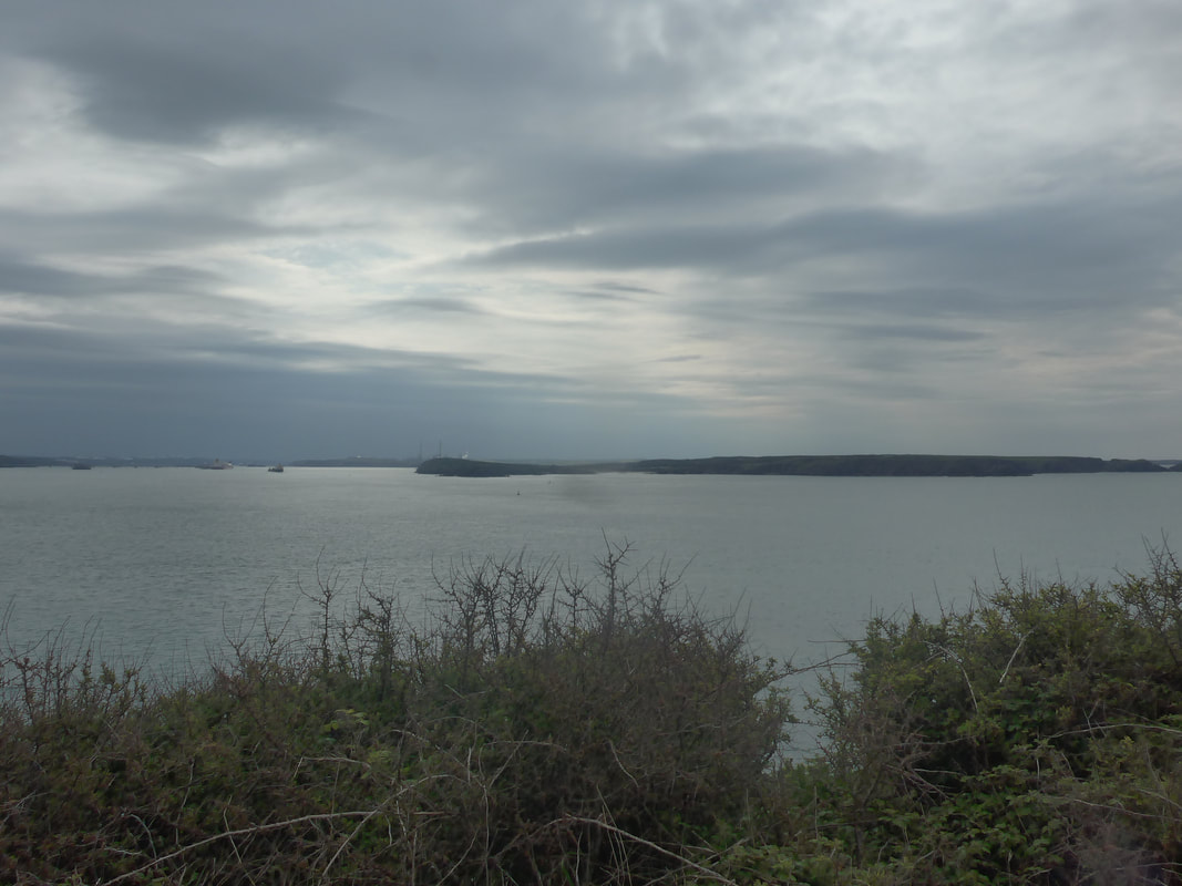
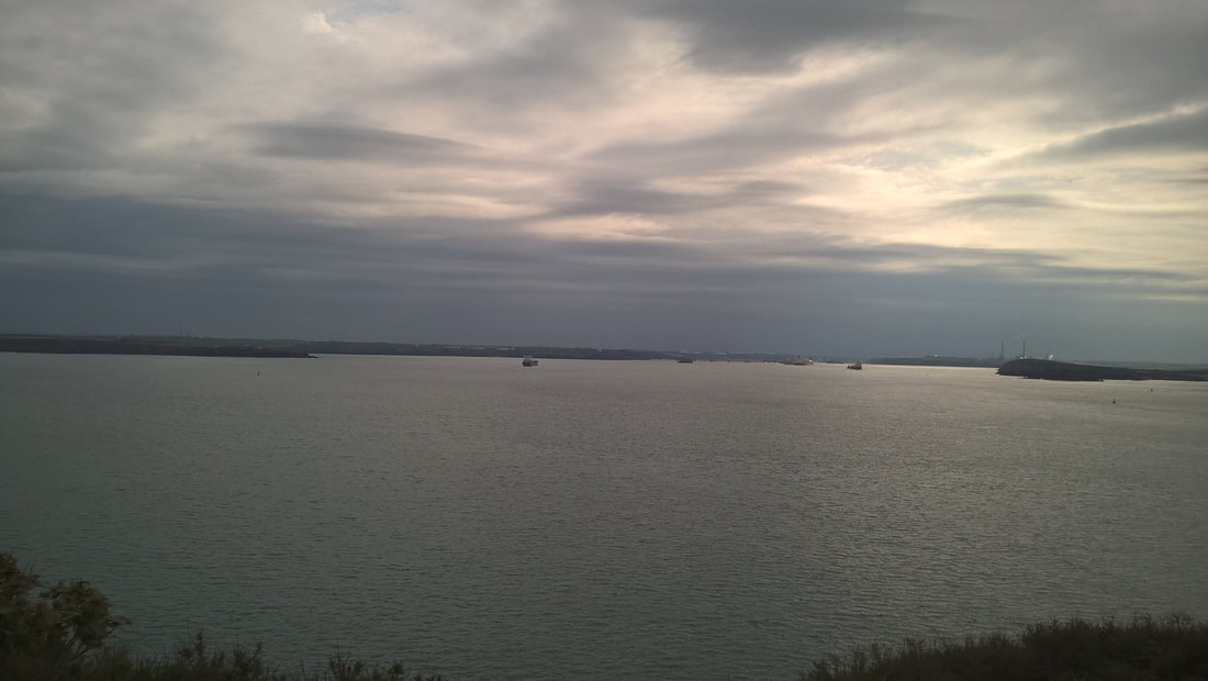
 Towards the road end the Wales Coat Path (WCP) cuts across the neck of the peninsula, although you can if you like walk right out to the Dale Point headland. Cutting across the neck we were above the small Castlebeach Bay where from the shore we had a nice view across the Milford Haven to the refinery at Angle on the opposite shore. The waters of the Haven were busy with both tankers and pilot boats coming and going.
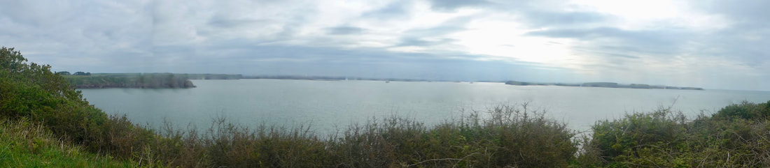
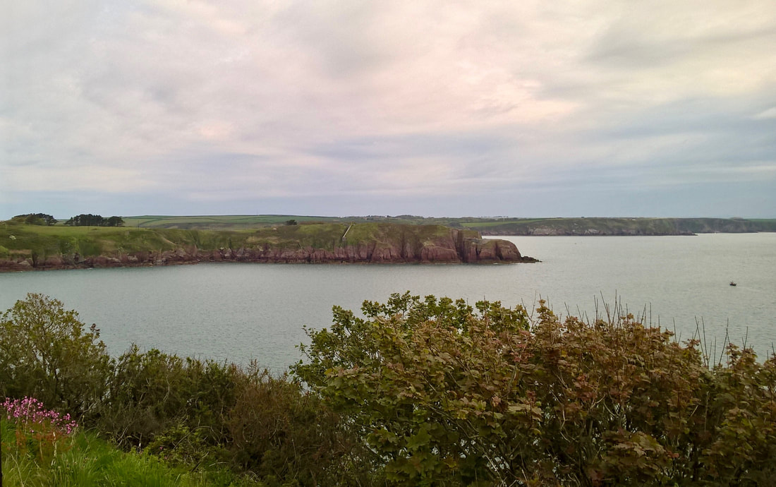
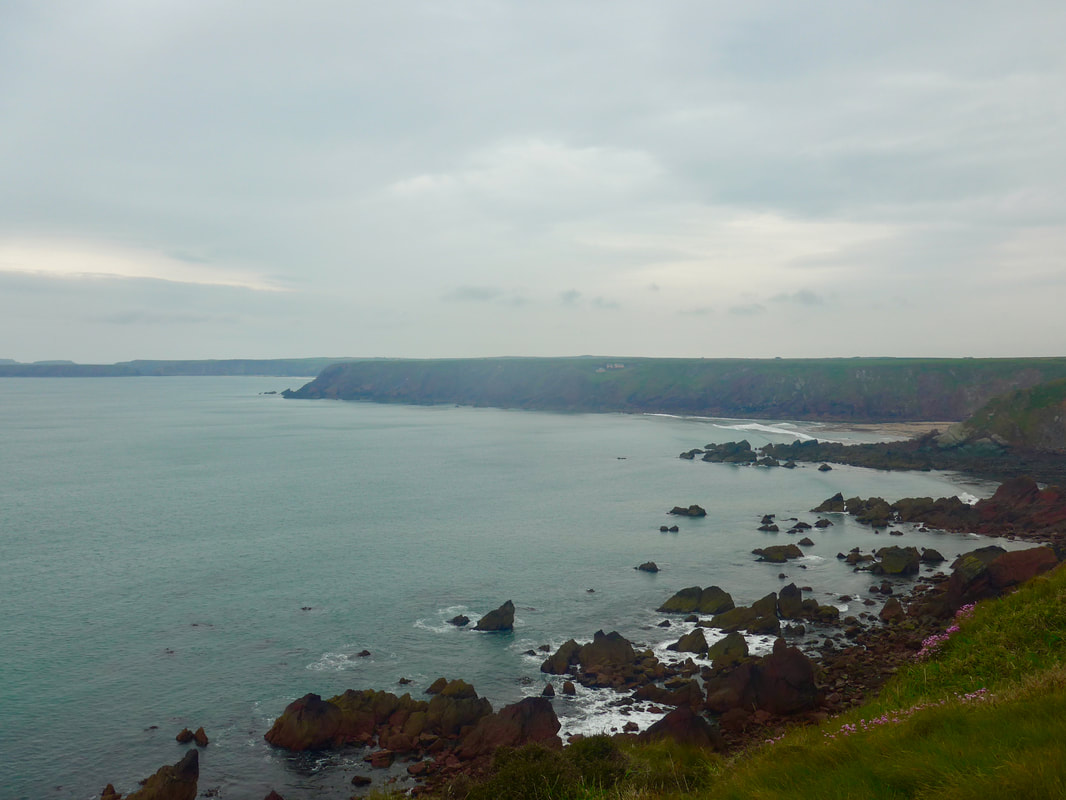
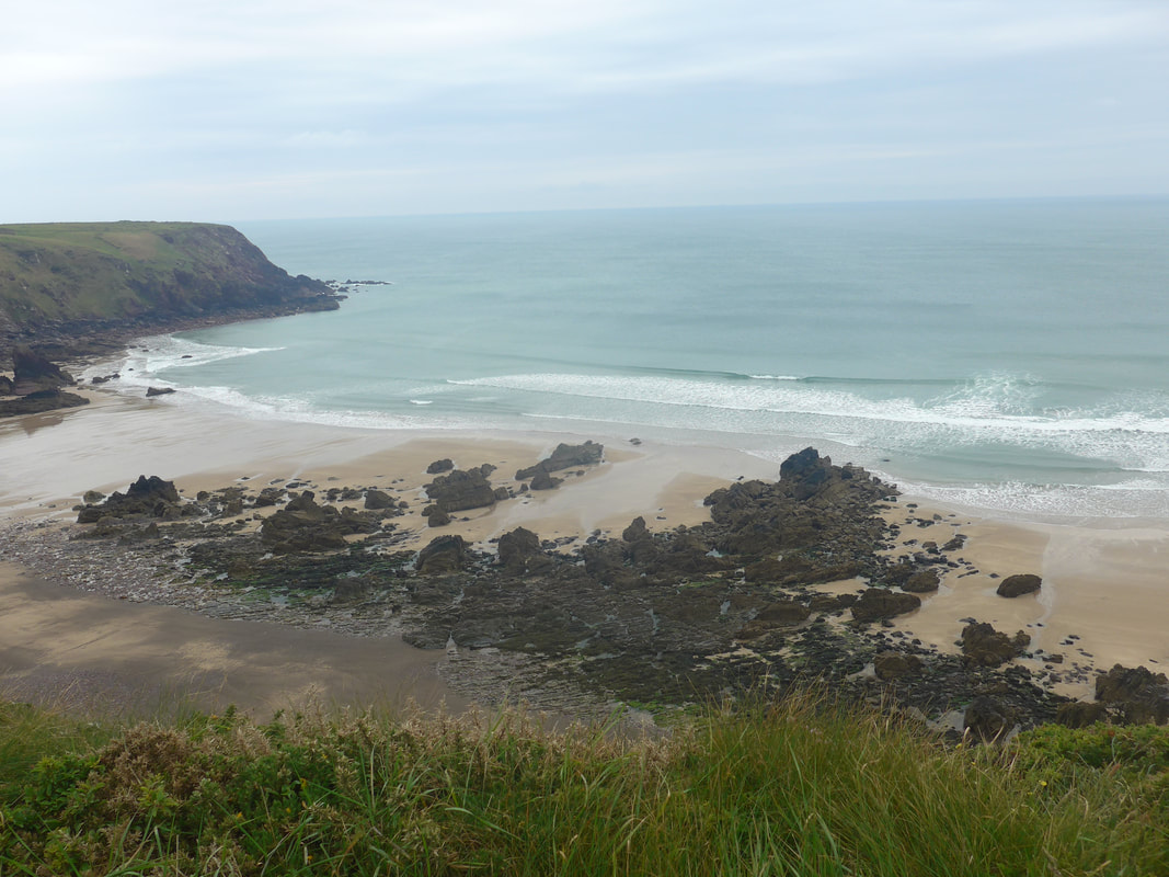
There are three nice little bays on this section including Watwick and Mill Bays. The views from the cliff top were superb, enhanced by the changing nature of the light over the water. With differing thickness to the cloud cover the light that was coming through created magical effects over the Haven. At times it seemed we were almost walking in the dark, only for it to suddenly change as shards of light penetrated the grey skies. Of course, where the cloud was thick it was also very cold. With a cold stiff breeze it was hard to get the leg muscles warm and moving and the early walking was stiff-limbed and ponderous.
There are three nice little bays on this section including Watwick and Mill Bays. The views from the cliff top were superb, enhanced by the changing nature of the light over the water. With differing thickness to the cloud cover the light that was coming through created magical effects over the Haven. At times it seemed we were almost walking in the dark, only for it to suddenly change as shards of light penetrated the grey skies. Of course, where the cloud was thick it was also very cold. With a cold stiff breeze it was hard to get the leg muscles warm and moving and the early walking was stiff-limbed and ponderous.
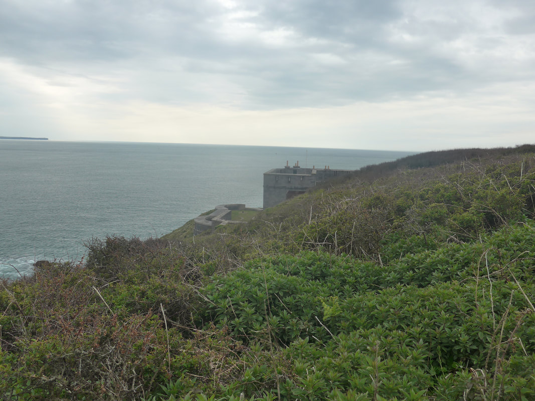 West Blockhouse Point
 Approaching West Blockhouse Point you have clear views of the defensive structures on the headland. Another of the defences built in response to the threat of French invasion in the mid-19th C, the current buildings were built on the site of a previous defensive outpost built by Henry VIII. The blockhouse was in and out of use until 1956 when it fell into disrepair. It was bought by the Landmark Trust in the 1960's and converted to holiday accommodation in the 1980's and is still used for that purpose.
From West Blockhouse there is a good, narrow packed earth foot path passing above Mill Bay leading on to St Ann's Head which you have clear views of from some distance away. Mill Bay was the landing spot for Henry Tudor, Earl of Richmond and his troops in 1845 en-route to the battle of Bosworth where he defeated Richard III and founded the Tudor dynasty.
From West Blockhouse there is a good, narrow packed earth foot path passing above Mill Bay leading on to St Ann's Head which you have clear views of from some distance away. Mill Bay was the landing spot for Henry Tudor, Earl of Richmond and his troops in 1845 en-route to the battle of Bosworth where he defeated Richard III and founded the Tudor dynasty.
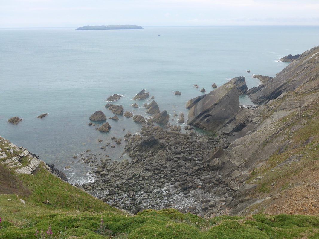
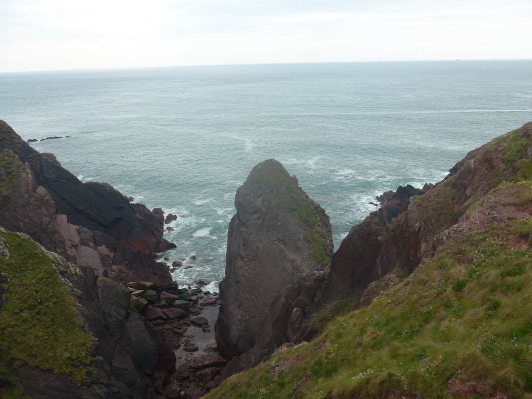 In to The Vomit
 Coming off of Mill Bay we moved on to St Ann's Head through a gate and on to the road that leads to the lighthouse. The lighthouse was built in 1844, replacing two leading lights that had been placed there in 1715. Of these, the front lower light was re-built in 1844 and the back light discontinued in 1910. The light was converted to mains electricity in 1958 and was automated in 1998. It is now controlled from Harwich in Essex. Both the lighthouse and the lighthouse keeper's cottages can be rented for holiday breaks.
From the lighthouse there is now a path that takes you to the Cobbler's Hole which is known for the rock formations on its steep, almost vertical cliffs. There is both anticline and syncline folds in the Old Red Sandstone rock, which, unfortunately, our photographs did not capture clearly as we came at it from the wrong side. It can, however, be seen in this photograph by another hiker.
If you are interested in more information about the geology of the area, I found this short paper quite interesting.
From what I can gather the Vomit is so called because of the white foam-like substance that gather in the cove when the waves strike against the rocks.
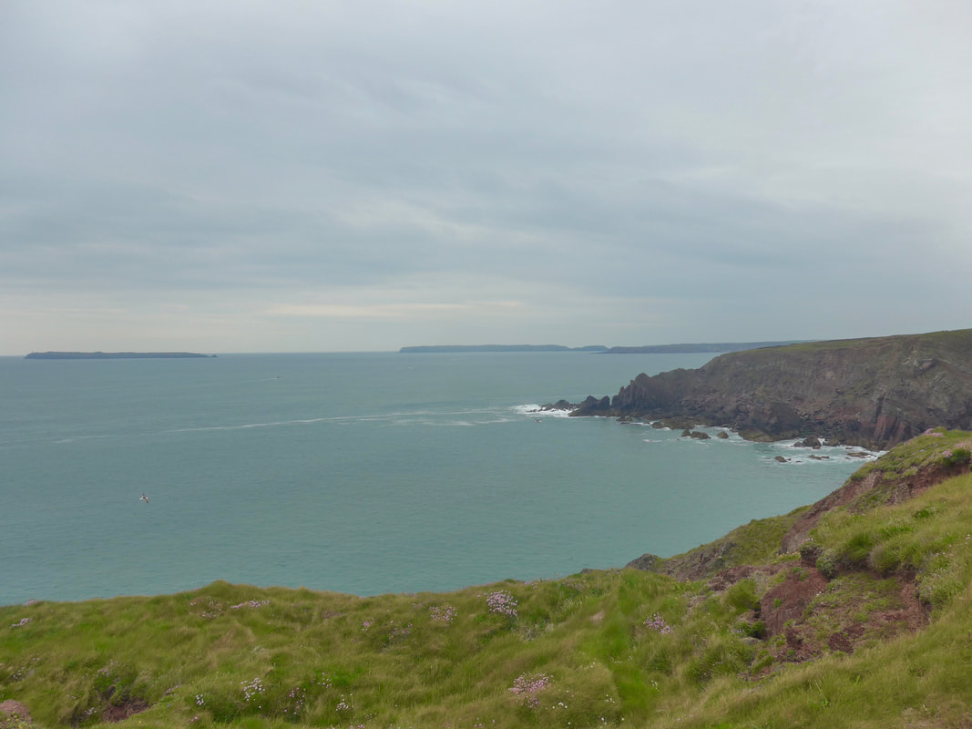 To Skokholm, Skomer & Gateholm Islands
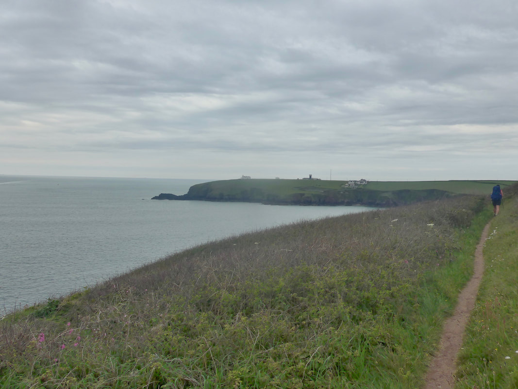
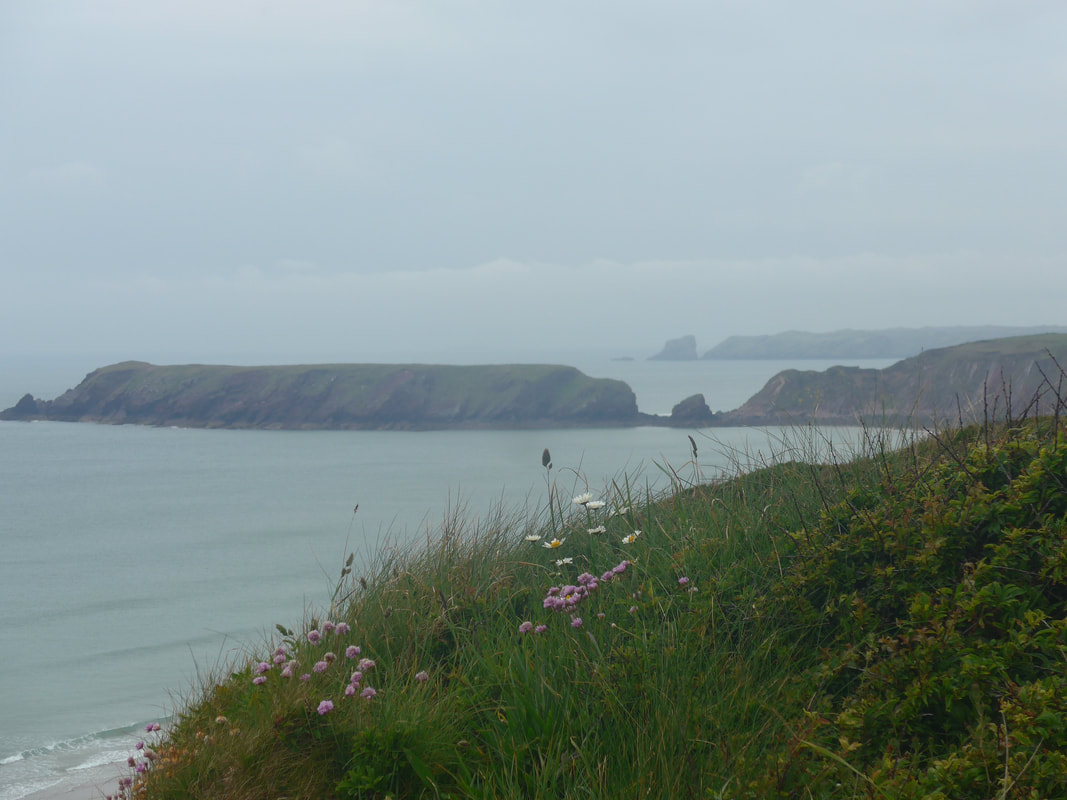
 From St Ann's Head to Wooltack Point is a beautifully wild section of coast with numerous bays (Frenchman's, Welshman's and Westdale) and small coves and inlets all along the bottom of the cliffs. Looking out to sea there are a number of islands and all along the coast prominent rock 'points' reaching out to the Celtic Sea and offering standpoints from which to appreciate the wild grandeur of the scenery. On the clifftop there were lots of wild flowers including Marguerrites and the white and pink varities of Sea Thrift, drifting on down the slope of the cliff. From above Frenchman's Bay we could see out and over Skokholm Island, with the blunt ends of Little Castle Point, Long Point and Hooper's Point all reaching out in to the sea. Looking inland, you could see back to the village of Dale and over the bay to St Ishmael's on the coastline beyond.
Too taken up with the scenery here and not paying attention to the walking, I took a tumble when my feet became caught up in the long grass and weeds. No fall when you are carrying a forty pound pack is an easy one and, as well as turning my ankle I gave the back of my head a hard bump that resulted in a headache for the rest of the day.
Too taken up with the scenery here and not paying attention to the walking, I took a tumble when my feet became caught up in the long grass and weeds. No fall when you are carrying a forty pound pack is an easy one and, as well as turning my ankle I gave the back of my head a hard bump that resulted in a headache for the rest of the day.
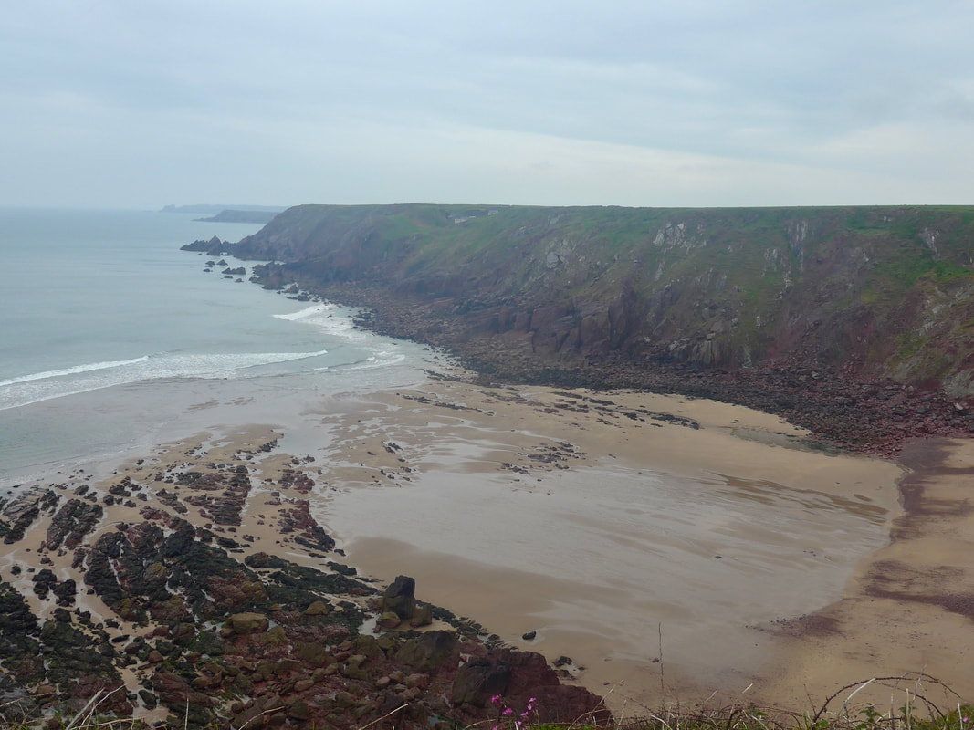
 Marloes Sands to Gateholm Island
 Leaving Westdale Bay and heading for Hooper's Point there is an old airfield to the right on the top of the cliff, Royal Naval Air Station (Dale), or HMS Goldcrest as it was also known. Only one RAF regiment ever served here before it was transferred to the naval Fleet Air Arm. Operational from 1942, it was decommissioned after the Second World War and is now in private hands.
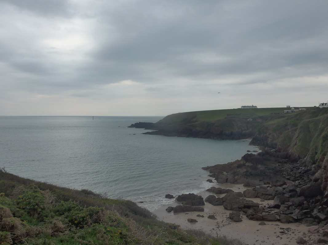
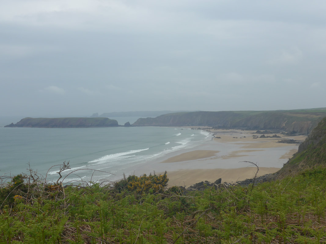
Marloes Sands, despite the deteriorating weather, was as nice as we expected. With the tide still some way out and the sands exposed, it seemed huge and spacious. From the top of the Red Cliff we had long views along the beach, Gateholm Island guarding the western end of the beach. Despite its name, it is actually a tidal island and you can cross to it, with care, at low tide. Close to the landward end you can see clearly the gaps where the waters come in at high tide to cut of the main island feature. In the distant past it would have been an extension of the main land, the landbridge having become victim to the crashing sea. There are traces of use from over various time periods including the Roman/British period with evidence of roundhouses found on site. It was the site of a Time Team investigation in 2013. As well as the island, Time TEam also investigated the remains of an Iron Age fort on the mainland itself, slightly to the west of the island. Marloes Sands and the surrounding area are all in the care of the National Trust.
Marloes Sands, despite the deteriorating weather, was as nice as we expected. With the tide still some way out and the sands exposed, it seemed huge and spacious. From the top of the Red Cliff we had long views along the beach, Gateholm Island guarding the western end of the beach. Despite its name, it is actually a tidal island and you can cross to it, with care, at low tide. Close to the landward end you can see clearly the gaps where the waters come in at high tide to cut of the main island feature. In the distant past it would have been an extension of the main land, the landbridge having become victim to the crashing sea. There are traces of use from over various time periods including the Roman/British period with evidence of roundhouses found on site. It was the site of a Time Team investigation in 2013. As well as the island, Time TEam also investigated the remains of an Iron Age fort on the mainland itself, slightly to the west of the island. Marloes Sands and the surrounding area are all in the care of the National Trust.
As we left the Albion Sands on the western edge of Gateholm, just as Wooltack Point started to come in to view, the weather deteriorated rapidly with heavy rain and mist settling in and the temperature plummeted as a storm blew in. The camera went in to the bag and it did not see daylight again until the next morning. As we came on to Wooltack at Martin's Haven we could see the area was pretty much deserted. There was a sign up saying that the ferry sailings had been cancelled due to the poor weather. The small shop that we had been counting on for coffee and cake to cheer us up was likewise closed due to the weather. In the driving rain we could not find the heart to walk out to the point and back again, instead we headed up the road to try and find our campsite, pitch up and get out of the rain.
We had about a half mile road walk before turning up to Wooltack Farm. There was a choice of two pitches, one 'with a sea view' that while stunning was also being whipped by a strong wind coming off the sea. We left that pitch to the caravans and camper vans and set up behind the main farmhouse where we had the protection the dykes and the farm buildings. It was no easy matter putting the tent up but we managed in the end after borrowing a hammer to put in the tent pegs in very stony ground.
Cooking in the conditions would have been difficult but the campsite owner offered us the use of the barn, set up as a wee information centre and with fridges. After borrowing matches from him to light up the damp Jetboil, we soon had a hot dinner made and sat back to eat it watching and being watched by the swallows that were nesting in the roof of the barn. The one drawback about the site was the very drafty showers that we were determined to brave in the interests of hygiene. When you share a close-fitting two man tent some standards are non-negotiable. After dinner, we settled down in the tent to read and to try and find some warmth in the cosy sleeping bags. Despite the good bags we had, it was a cold, cold night with the sound of driving rain on the canvas stopping us from enjoying sleep of any length. What a lark!
Cooking in the conditions would have been difficult but the campsite owner offered us the use of the barn, set up as a wee information centre and with fridges. After borrowing matches from him to light up the damp Jetboil, we soon had a hot dinner made and sat back to eat it watching and being watched by the swallows that were nesting in the roof of the barn. The one drawback about the site was the very drafty showers that we were determined to brave in the interests of hygiene. When you share a close-fitting two man tent some standards are non-negotiable. After dinner, we settled down in the tent to read and to try and find some warmth in the cosy sleeping bags. Despite the good bags we had, it was a cold, cold night with the sound of driving rain on the canvas stopping us from enjoying sleep of any length. What a lark!
 RSS Feed
