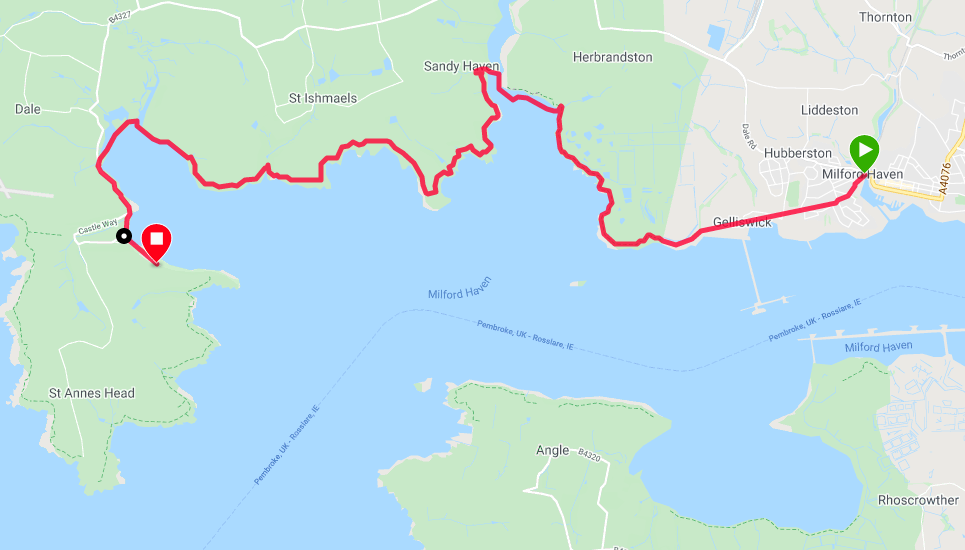
Route Map
We have an urban start to a reasonably short walk today, as we move on from a welcome and restful day off in Milford Haven. With the laundry done, malfunctioning equipment replaced and ourselves rested, fed and watered, we are ready for what will be a hard week's walking and camping in the days ahead.
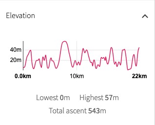
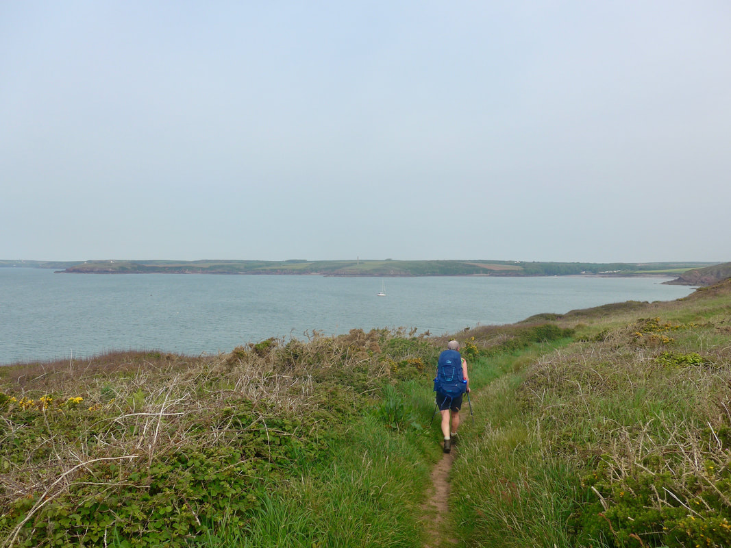
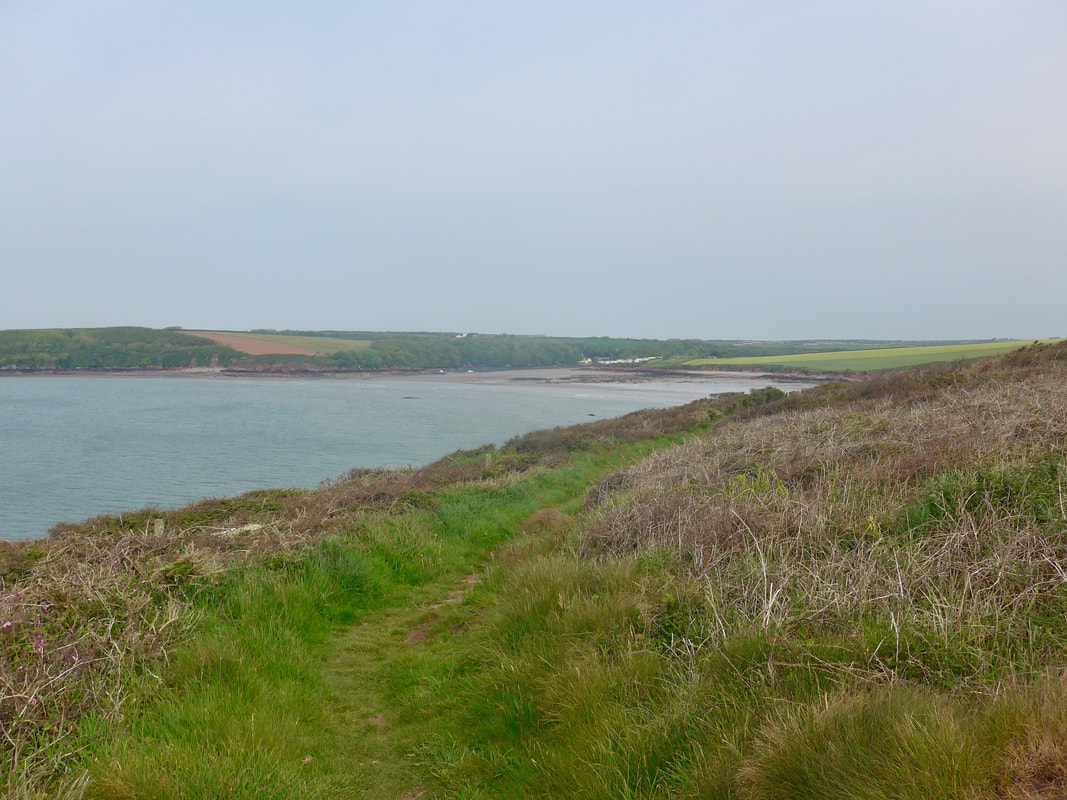
Apart from the urban start point, today's route sticks rigidly to the coast as we progress round the Milford Haven again, heading for the Dale Peninsula. There are two river crossings to negotiate, both requiring low tide, so we will put a spurt on it, one of the reasons why the day's walking is so short. If we do not reach the crossings at low tide, we will need to take the longer inland way round at both crossings, adding about another seven or eight miles to the day. As the coastal days usually are, the route rolls up and down on low rises. Potentially, the highest point of the day, over fifty metres, will be at Herbrandston if we miss the tide, alternatively it will be just over 45 metres on the clifftop. Most of the other ascents and descents are in the forty metre mark and while there are a few of them they should not be difficult. The weather is forecast to be slightly overcast, but no rain expected.
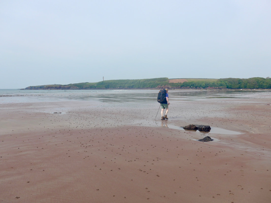
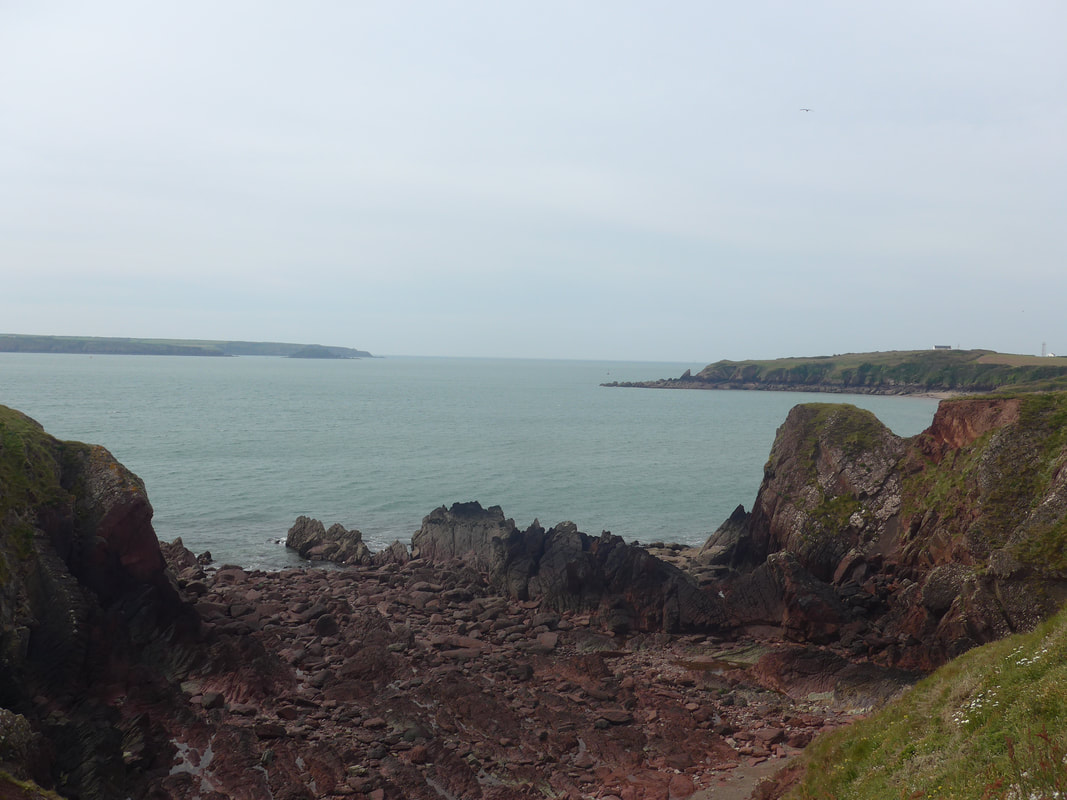
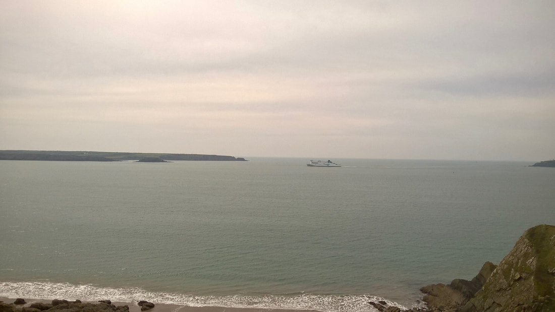
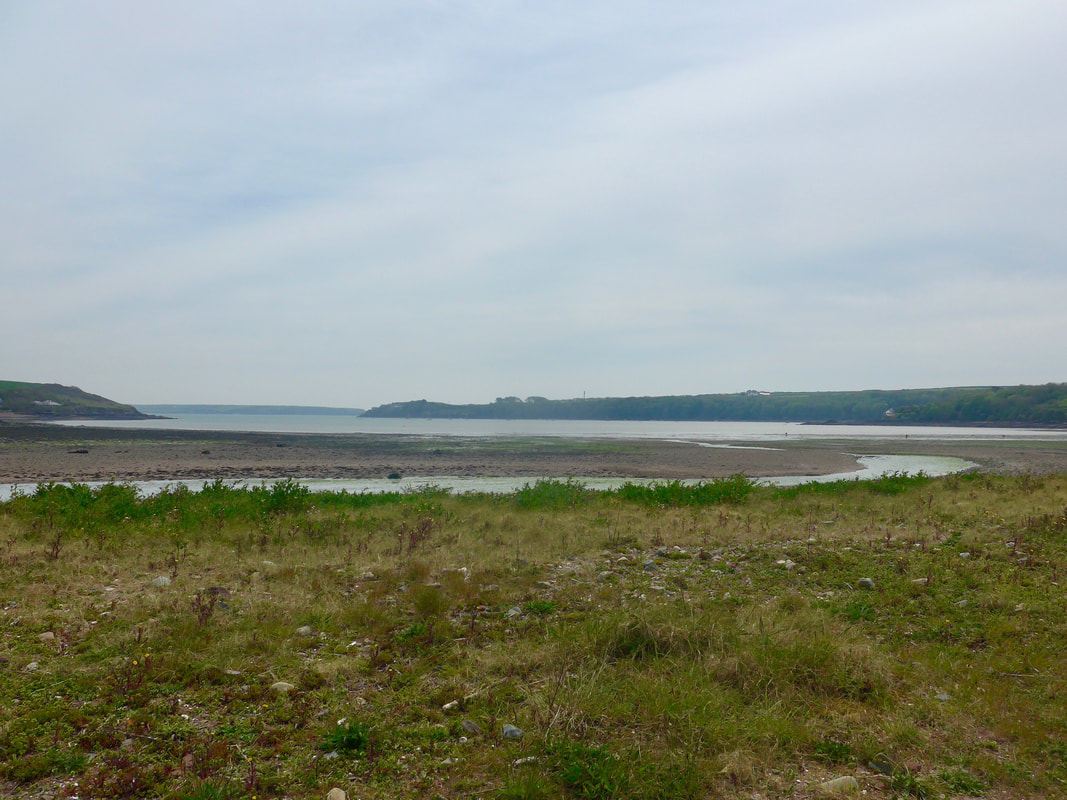
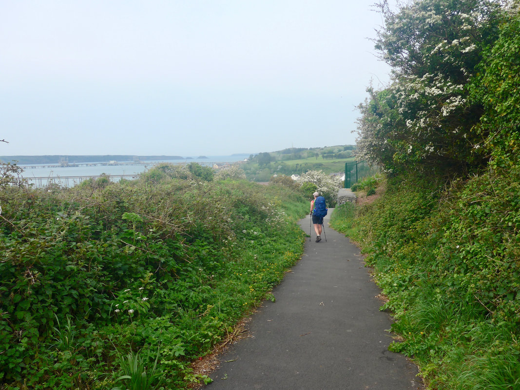 Approaching Gelliswick Bay
 Setting off at 8.30am, we made our way through Milford Haven via the suburb of Hakin and out on to the coastal path just above Gellswick Bay. Approaching from the east you pass Hubberston Fort, built in the 1860's, with Popton Fort on the opposite bank. Hubberston is a huge construction and would have contained about thirty large guns in its time. While it was used for a variety of purposes during the two World Wars, I do not believe the guns were ever fired in anger. It is closed to the public and can only be viewed from the outside.
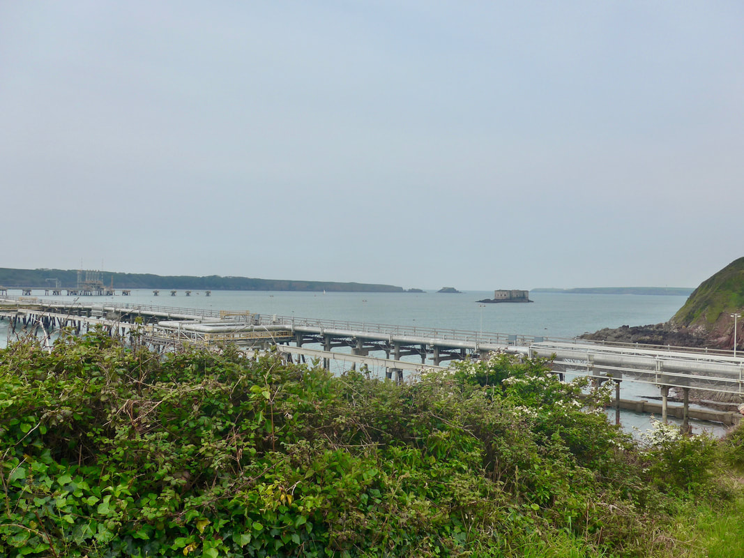
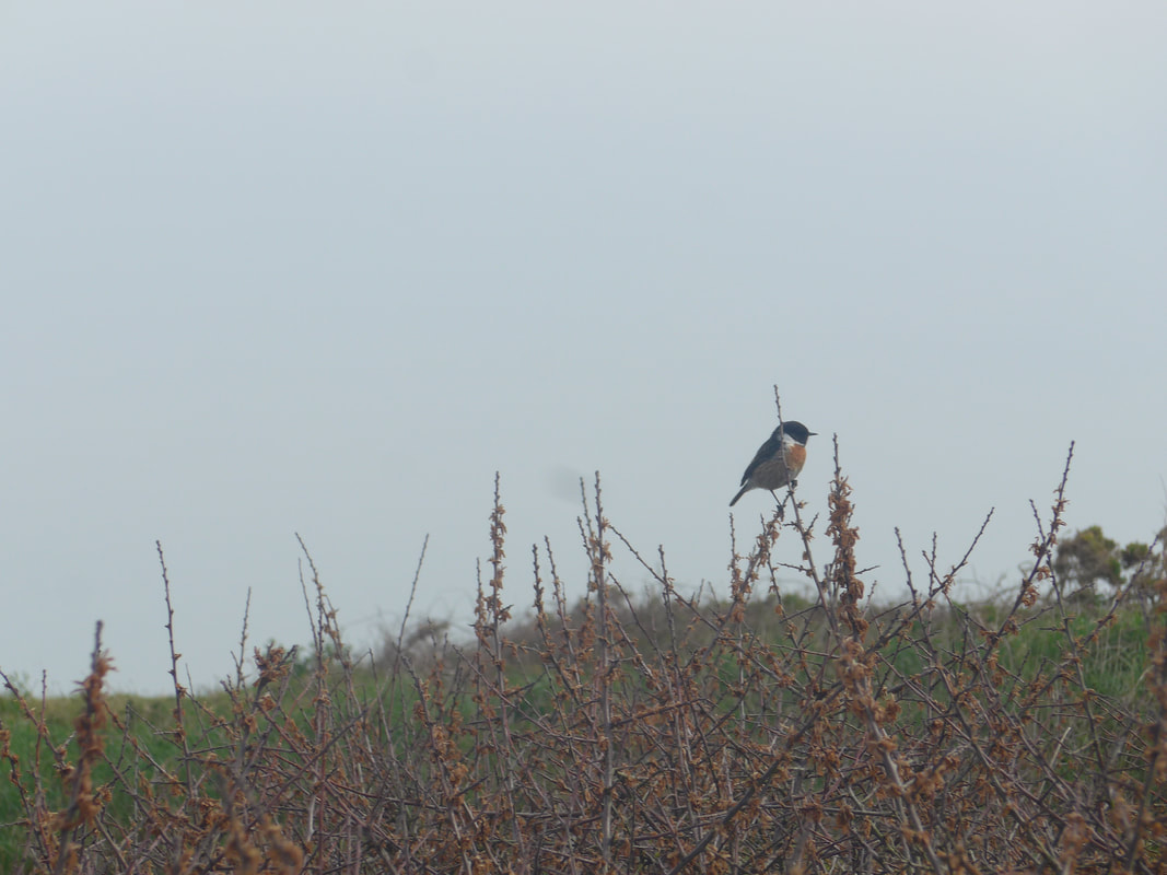
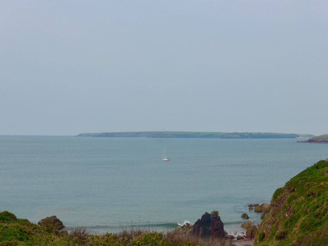
From the bay we had good views out to the defensive forts on Stack Rock and Thorn Island. Above and slightly to the west of Gelliswick Bay lies a large oil refinery and the area is littered with structures related to the oil and gas industry, in particular the two enormous jetties that jut out from the mainland in to the Haven. The bay is a port of call for tankers that serve the refinery and over the years there have been a number of ecological disasters of one kind or another. The Milford Haven in general is known for the number of ship wrecks that lie off the coast and the bay is no exception. As we left the bay behind and moved in to the open countryside the hedgerow was well populated by Stonechats and we heard their distinctive cry as we walked along the clifftop. It sounds a bit like two pieces of wood being rubbed together.
From the bay we had good views out to the defensive forts on Stack Rock and Thorn Island. Above and slightly to the west of Gelliswick Bay lies a large oil refinery and the area is littered with structures related to the oil and gas industry, in particular the two enormous jetties that jut out from the mainland in to the Haven. The bay is a port of call for tankers that serve the refinery and over the years there have been a number of ecological disasters of one kind or another. The Milford Haven in general is known for the number of ship wrecks that lie off the coast and the bay is no exception. As we left the bay behind and moved in to the open countryside the hedgerow was well populated by Stonechats and we heard their distinctive cry as we walked along the clifftop. It sounds a bit like two pieces of wood being rubbed together.
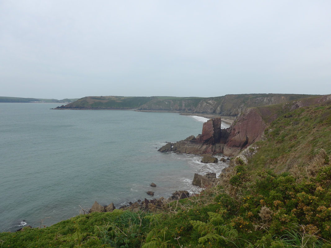
 Kilroom to St Ann's Head
 Still only 10.00am, it was shaping up to be a lovely day with good visibility in all directions and a nice country path that offered firm walking. Rounding South Hook Point, we were walking just below the disused fort of the same name, albeit little is visible from the path. Similar in design and armaments to Hubberston Fort, it has been out of service for a number of years and is also closed to the public.
On the land above South Hook Point is located the South Hook liquefied gas terminal which ships gas from Qatar and processes it in Pembroke.
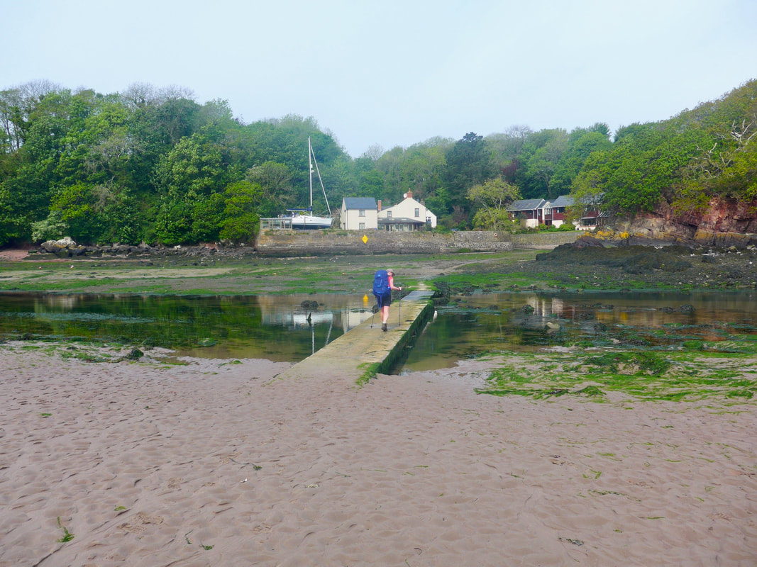
As you turn the corner at South Hook, you have sight of the first water crossing of the day at the Sandyhaven Pill. The Sandyhaven Pill area is locally important geologically because there is visible evidence here of the switch between the marine and desert conditions that dominated in the local area at different geological times. It can be seen in an area on the upper reaches of the Pill where Silurian-era marine deposits have been wrapped in the Old Red Sandstone of the desert-like Devonian era.
The route continues along the cliff to the old ferry crossing, but we dropped down on to the beach just below the reservoir for a nice walk across the sands The planning of my walking companion had judged it right and we arrived at low tide meaning we could use the sunken bridge over the Pill and thereby avoid the long walk up the Pill to Rickeston Bridge, the next feasible crossing. There used to be stepping stones here but they have been replaced by a wooden bridge.
On the land above South Hook Point is located the South Hook liquefied gas terminal which ships gas from Qatar and processes it in Pembroke.
As you turn the corner at South Hook, you have sight of the first water crossing of the day at the Sandyhaven Pill. The Sandyhaven Pill area is locally important geologically because there is visible evidence here of the switch between the marine and desert conditions that dominated in the local area at different geological times. It can be seen in an area on the upper reaches of the Pill where Silurian-era marine deposits have been wrapped in the Old Red Sandstone of the desert-like Devonian era.
The route continues along the cliff to the old ferry crossing, but we dropped down on to the beach just below the reservoir for a nice walk across the sands The planning of my walking companion had judged it right and we arrived at low tide meaning we could use the sunken bridge over the Pill and thereby avoid the long walk up the Pill to Rickeston Bridge, the next feasible crossing. There used to be stepping stones here but they have been replaced by a wooden bridge.
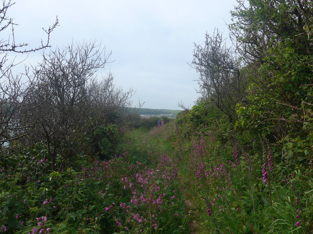
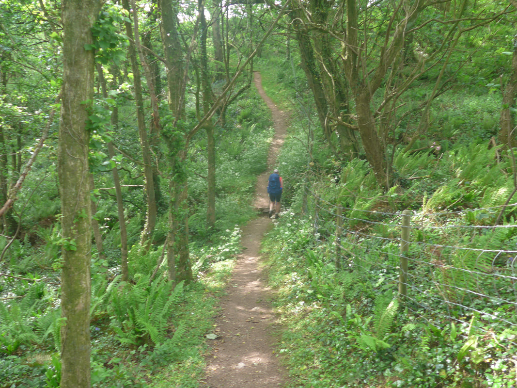 Moving up from Sandyhaven
 From the far side of the crossing there is a short uphill walk on the road to access a nice path that goes through woodland heading out to Little Castle Head. There were lots of wild flower on the verges and in the midst of the trees, the sweet, almost-acrid aroma of wild garlic floating on the air.
We were soon back on the clifftop and on the section that leads out to Great Castle Head, identifiable from the radar station on its summit and which we could see from the shore at the location of its wee brother, Little Castle Head. Great Castle Head contains the remnants of yet another Iron Age fort which was located to the south end of the headland, protected on three sides by the cliffs and to the north by a ditch and bank.
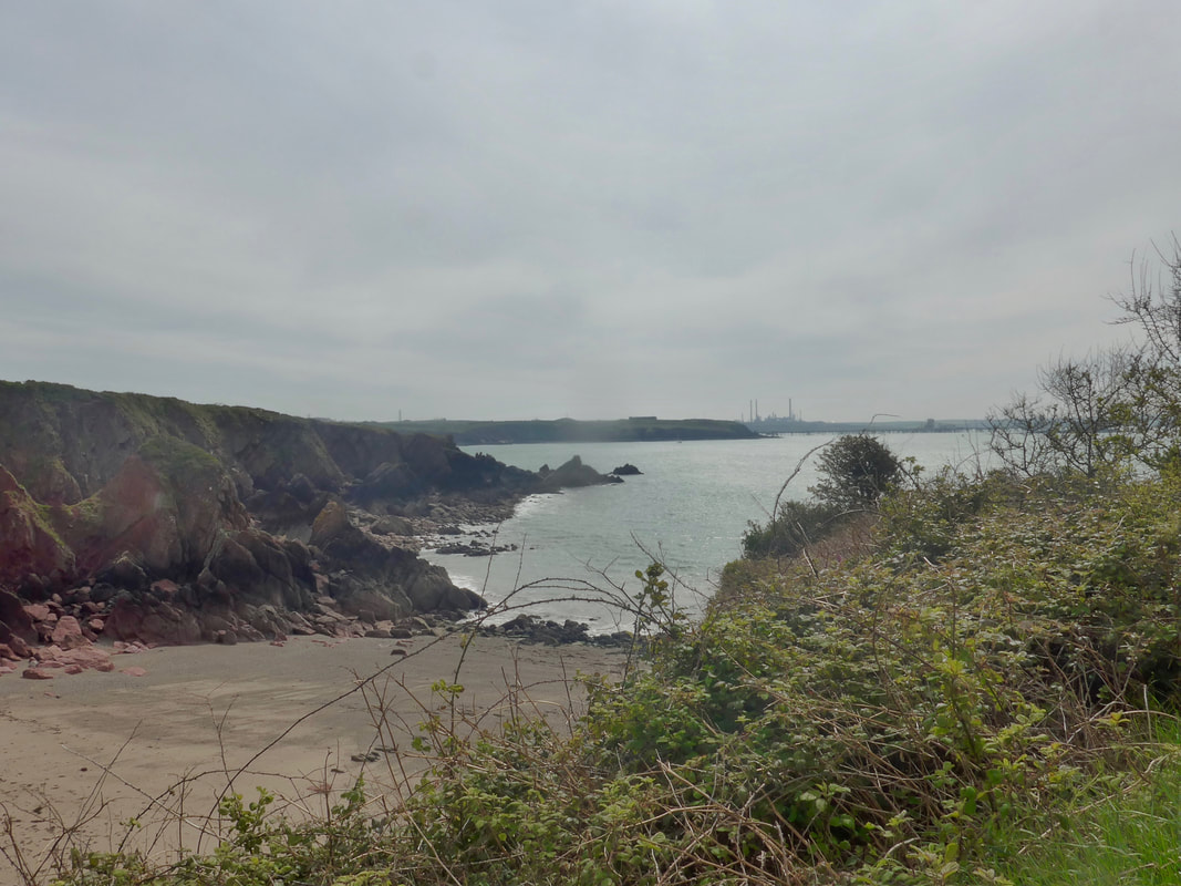
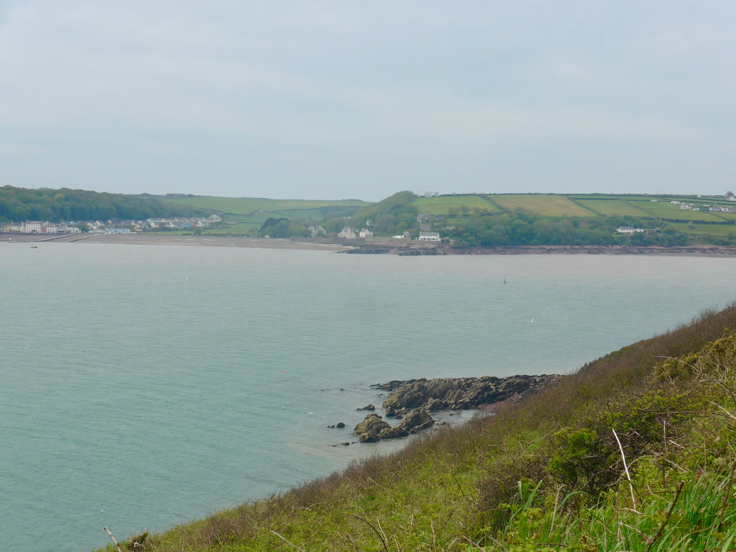
Coming out of the woods we found that the skies had greyed over and as a consequence the views were slightly bleaker than they had been, the lack of white light flattening everything out. Nonetheless, we could still see right back to South Hook Point, the towering structures of the refinery at Angle Bay peaking over the hilltops. Forward, we were looking in to the Dale Roads, the name for the waters just off Dale Point, and the cliffs running out from Dale to St Ann's Head.
We were soon back on the clifftop and on the section that leads out to Great Castle Head, identifiable from the radar station on its summit and which we could see from the shore at the location of its wee brother, Little Castle Head. Great Castle Head contains the remnants of yet another Iron Age fort which was located to the south end of the headland, protected on three sides by the cliffs and to the north by a ditch and bank.
Coming out of the woods we found that the skies had greyed over and as a consequence the views were slightly bleaker than they had been, the lack of white light flattening everything out. Nonetheless, we could still see right back to South Hook Point, the towering structures of the refinery at Angle Bay peaking over the hilltops. Forward, we were looking in to the Dale Roads, the name for the waters just off Dale Point, and the cliffs running out from Dale to St Ann's Head.
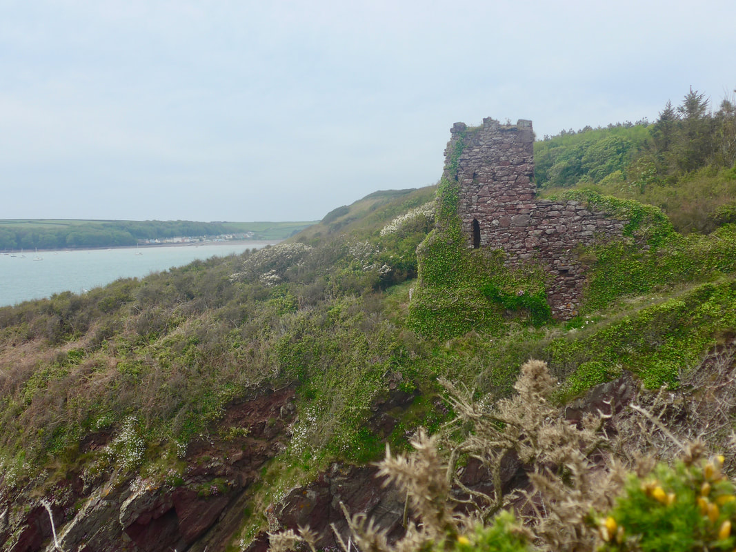
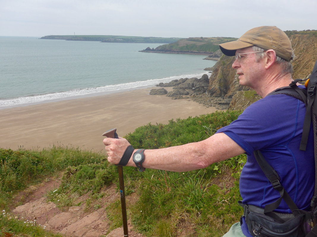 Lindsway Bay to Watch House Point
 Coming off of the Great Castle there are nice views across Lindsway Bay to Watch House Point on which there are the remains of another military camp. We had great views out to sea and spent five minutes here watching the regal progression of a ferry as it sailed up the Milford Haven. Just beyond Watch House Point, on the edge of a little gully just before Monk Haven, we could see the remains of a building which, on closer inspection and given its location, we concluded was a folly. Slowly and inevitably falling to pieces, clothed in ivy and with rough growth all around the base, it had a kind of Heathcliff romanticism about it.
While the path here was slightly narrow it was still good walking and coming along here on a bright, sunny day would be, I think, a lovely day's walking.
While the path here was slightly narrow it was still good walking and coming along here on a bright, sunny day would be, I think, a lovely day's walking.
 Up from Monk Haven
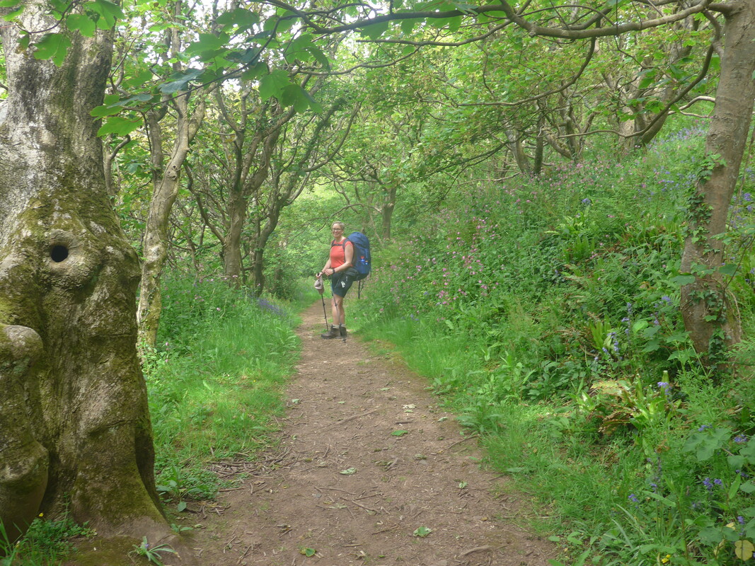
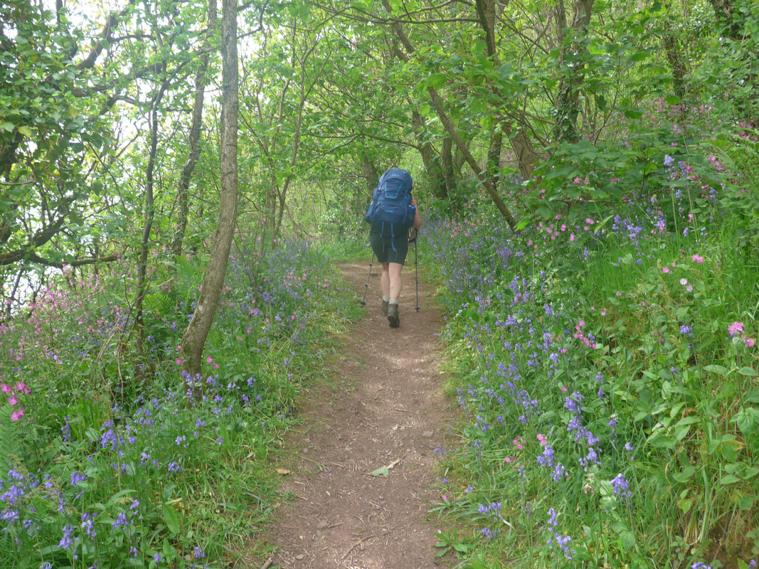
 The route drops down at a gully at Monk Haven, an isolated cove which leads to a lovely beach. The Haven is so called after a monastery that was said to have been in the local area. At one time Monk Haven was a landing spot for pilgrims on the way to visit what is now the city of St David's where the Saint founded a monastery at Minevi and a cathedral was subsequnetly built. It is also his final resting place. At the back of the beach there is a lovely 18th C red brick wall which marked the end of the Trewarren Estate.
From the cove the path goes uphill again very quickly through a small copse of non-coniferous trees. The edges of the path were covered with wild flower with plenty of tall, stately Red Robin and pert Bluebells. The trees, although small and somewhat stunted, had a wonderful sense of age about them with some unique shapes as well. Through breaks in the trees we had lovely views all the way back to Milford Haven and, closer to home, to the Dale Point Field Centre at Dale Point. Passing the disused quarry just after Monk Haven the path became overgrown for a bit with grasses, nettles and wild flowers all tugging at your ankles at near to ground level. It soon cleared, however as we neared Musselwick Point, where we dropped down on to the beach to approach our second river crossing of the day at The Gann.
From the cove the path goes uphill again very quickly through a small copse of non-coniferous trees. The edges of the path were covered with wild flower with plenty of tall, stately Red Robin and pert Bluebells. The trees, although small and somewhat stunted, had a wonderful sense of age about them with some unique shapes as well. Through breaks in the trees we had lovely views all the way back to Milford Haven and, closer to home, to the Dale Point Field Centre at Dale Point. Passing the disused quarry just after Monk Haven the path became overgrown for a bit with grasses, nettles and wild flowers all tugging at your ankles at near to ground level. It soon cleared, however as we neared Musselwick Point, where we dropped down on to the beach to approach our second river crossing of the day at The Gann.

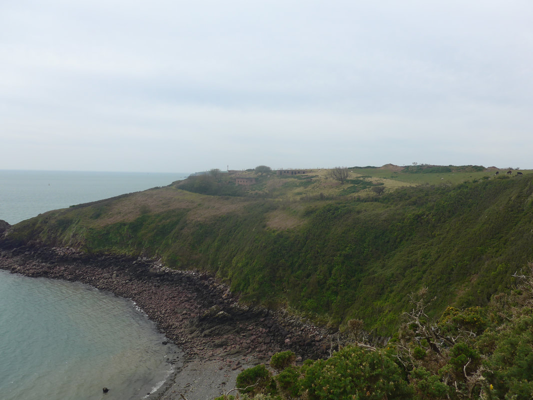
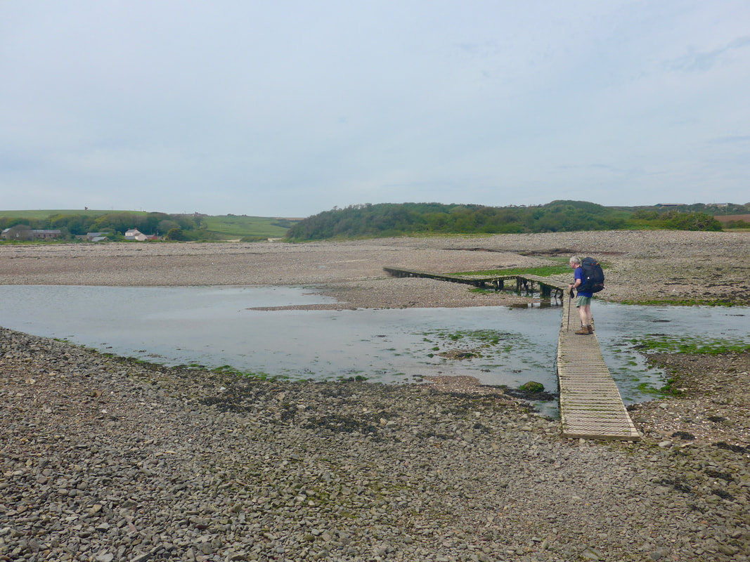
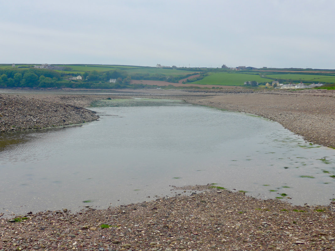
 Dale & Pickleridge
 We had made good time from the Sandy Haven Pill and reached The Gann just before the tide was due to turn. As a consequence we could use the sunken duckboard crossing, avoiding the long walk in to the Mullock Bridge and back down the river again. Once you cross the river the path runs along the back of the beach on a feature called Pickleridge, behind which there are a number of small pools. The pools were created during the 1940's when material was taken from the site to assist in building defences on Angle Peninsula. Primarily fresh water, the pools also fill with salt water when the tide is high. They are a popular destination for birdwatchers as, because of the variety of habitats in the area, the ridge offers a wide range of birds to be seen.
The Gann Crossing & Environs
 Dale Lime Kilns
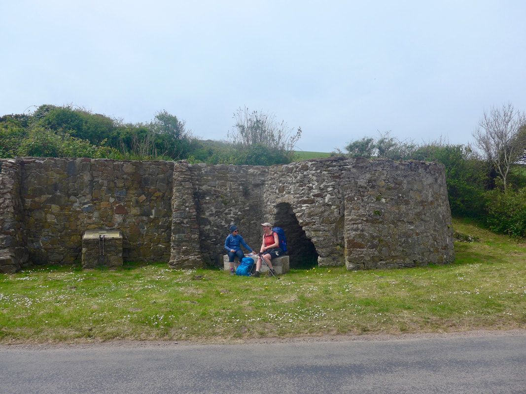
 The Pickleridge is also the location of the Dale lime kilns which were active between 18-20th C. Lime would be transported down nearby rivers to be processed at Dale. The resultant product had a number of different uses including as a soil sweetner in agriculture, as a component in mortar used in construction or used as a white wash.
Earlier in the day as we were leaving Milford Haven we had been passed by an intent young woman who, after the pleasantries of the day had walked on ahead of us to enjoy the solitude of solo walking. We caught up with Claire at the lime kilns and enjoyed a chat and some snacks before completing the walk together. We subsequently had dinner that night in the local hostelry where we were very fortunate to secure a table in the very busy restaurant.
Earlier in the day as we were leaving Milford Haven we had been passed by an intent young woman who, after the pleasantries of the day had walked on ahead of us to enjoy the solitude of solo walking. We caught up with Claire at the lime kilns and enjoyed a chat and some snacks before completing the walk together. We subsequently had dinner that night in the local hostelry where we were very fortunate to secure a table in the very busy restaurant.
 Dale Harbour
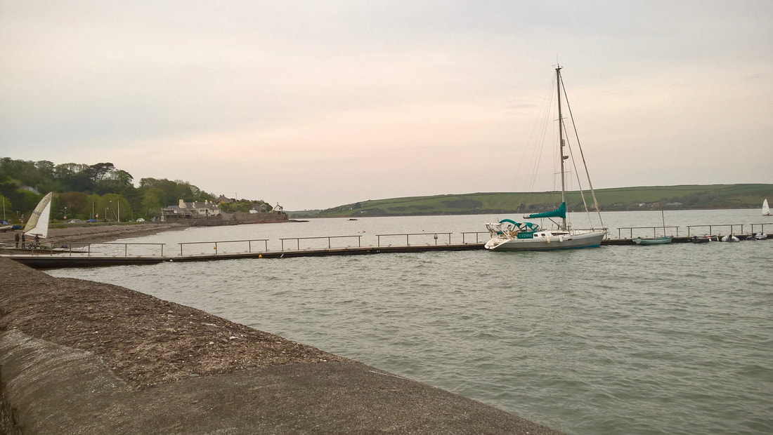
 From the kilns it was a walk along the road to reach Dale, which was not as bad as it sounds as the surrounding countryside was very picturesque. On arrival we made for the Boathouse Cafe and Shop where we stopped for coffee and cake.
While we were there, there was a kerfuffle on the water as it seemed a boat had come adrift from its mooring and was free-wheeling across the water and theatening to run up against the rocks below the cliff. It was quite exciting watching all the services running about. When we finally went to our campsite we mentioned the incident to the owner who immediately stopped his grass cutting, jumped in his car and made off for the harbour. Turned out he was also the moorings officer. He told us later it was the boat of a friend who had been onboard preparing to sail but had been knocked off in to the water. He was successfully recovered from the water and so was the boat.
While he was off securing the drifting boat, we pitched up using the super-duper tent pegs the site kindly provides because the ground is so har. Tent up and gear stowed, we took advantage of the very good showers on site, in preparation for a fine dining experience in the Griffin restaurant. We met up with our new friend, Claire and all enjoyed the lovely food. For your information the Hake, red pepper and chorizo is wonderful.
After dinner, Jo and I wandered about the village for ten minutes before walking back to the campsite in the dark for a good night's sleep.
 RSS Feed
