Route Map
 Kirby Moor to Walney Wind Farm
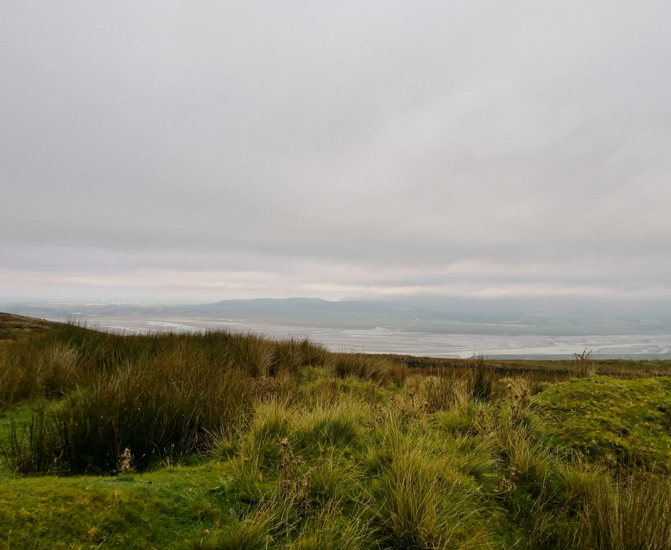
 After a few days based in a hotel Ulverston we moved today in two stages to our next base in Millom, where we have rented an apartment. First thing this morning we drove from Ulverston to Kirby-in-Furness. It was beautiful drive over Kirby Moor on a minor road that offered lovely views, as well as some very steep climbs and descents. The view from the hilltop just before you descend to Kirby was lovely, even in the light rain that was falling on the high moor.
Slightly to the south of our position we had a good view out to sea to the huge Walney Wind Farm and other smaller wind farms round about it that lie offshore opposite the mouth of the Duddon Estuary. On reaching Kirby, we parked the car by the railway station and then took the train back to Barrow-in-Furness to start the walk along the coast. Waiting for the train, we spoke to a local woman who told us how hard it was during lockdown living in a small village where what little activities there were, were closed down for the duration.
Slightly to the south of our position we had a good view out to sea to the huge Walney Wind Farm and other smaller wind farms round about it that lie offshore opposite the mouth of the Duddon Estuary. On reaching Kirby, we parked the car by the railway station and then took the train back to Barrow-in-Furness to start the walk along the coast. Waiting for the train, we spoke to a local woman who told us how hard it was during lockdown living in a small village where what little activities there were, were closed down for the duration.
 To Millom & Black & White Combes
 The route today, apart from the urban section in Barrow, sticks fairly close to the coast, with one or two short tidal diversions or to cut round land features.
It is a walk that remains fairly constantly at sea level with only a couple of small rises over the length of it. The weather forecast was good, with a small risk of showers at the Kirby end later in the day.
Walking light, we carried only day packs with map, waterproofs, lunch and snacks. At the other end, we will pick up the car again and move to our next accommodation, a rented flat, at Millom. Millom will be our base for the next three days, before moving on to Whitehaven for our final sections.
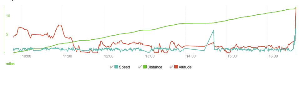
Speed, distance & altitude
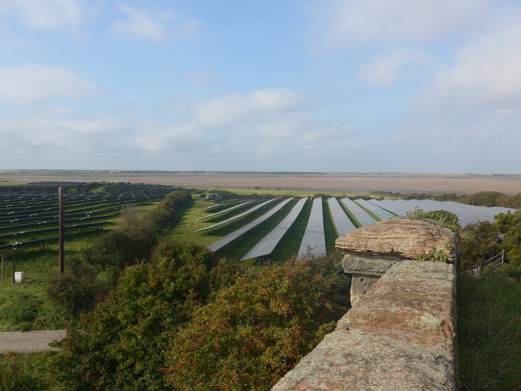 Solar Array at Palace Nook
 In over 3,000 miles so far, we could count on one hand how often we have lost our way in the open countryside. Urban sprawl is a different matter and our record on negotiating the streets of the towns and cities of the coast is pretty poor. In the interest of maintaining some sense of integrity as a navigator, I will skate over our experience of trying to find a short-cut to the coast in Barrow-on-Furness. Suffice to say that after a number of deadends and 'no through ways', I admitted defeat and took my wife's advice to stick to the dual carriageway (A590) to the outskirts of Ormsgill.
Just beyond Ormsgill we could take a public right of way down to the coast by Sowerby Lodge. On the way, crossing a railway bridge, we passed a huge solar farm in the fields of an area known as Palace Nook. In the planning application for the development it is estimated to consist of over twenty thousand panels, generating almost 5mw of energy. There are good views of the array from the bridge. Once over the bridge we followed local paths down on to the beach just below Sowerby Lodge.
Just beyond Ormsgill we could take a public right of way down to the coast by Sowerby Lodge. On the way, crossing a railway bridge, we passed a huge solar farm in the fields of an area known as Palace Nook. In the planning application for the development it is estimated to consist of over twenty thousand panels, generating almost 5mw of energy. There are good views of the array from the bridge. Once over the bridge we followed local paths down on to the beach just below Sowerby Lodge.
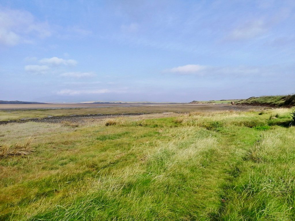 Shore at Sowerby Lodge Area
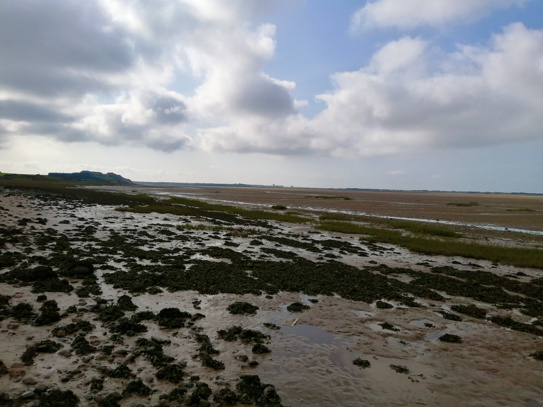
 Lying just off the shore at Sowerby Lodge is the North Walney National Nature Reserve which lies to the landward side of Walney Island. The site is known for its large population of natterjack toads. The reserve protects a number of different habitats including sand dunes, saltmarsh and intertidal flats.
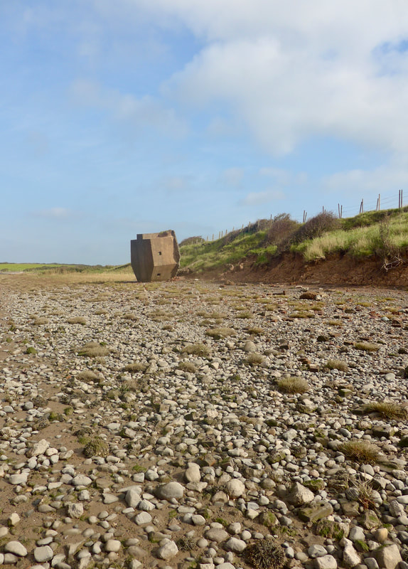
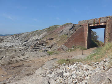
The coastal area around here has seen a lot of military activity over the years, particularly since the early 1900's with the growth of military industries in the local area. With the growth in industrial activity more defences were constructed locally and there are numerous reminders of this military past as you walk along the beach, including the upended pillbox in the attached photograph.
The coastal area around here has seen a lot of military activity over the years, particularly since the early 1900's with the growth of military industries in the local area. With the growth in industrial activity more defences were constructed locally and there are numerous reminders of this military past as you walk along the beach, including the upended pillbox in the attached photograph.
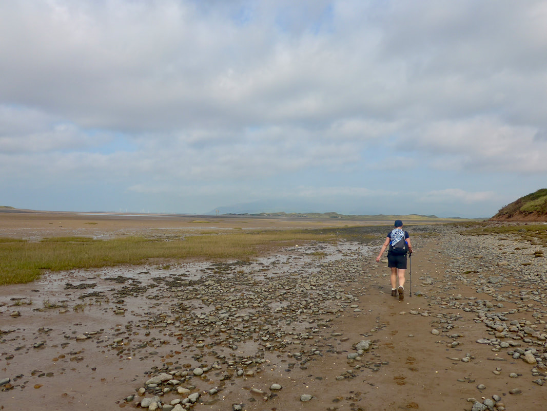
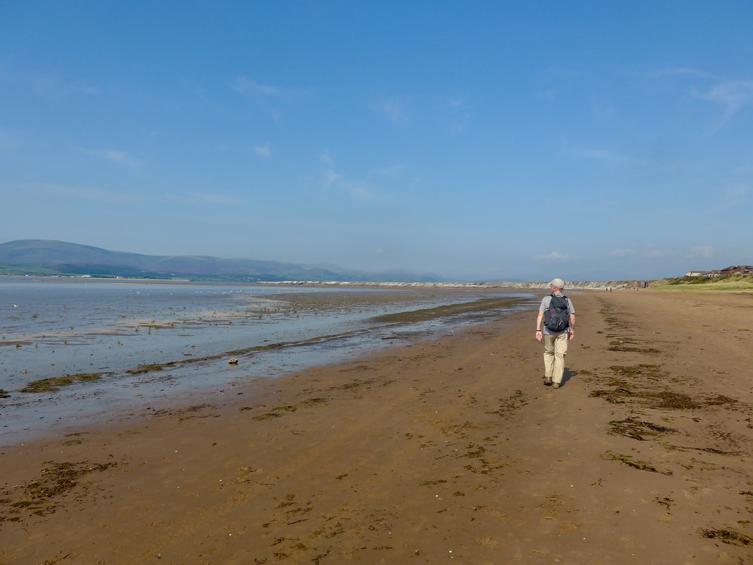
 To Lowes Point
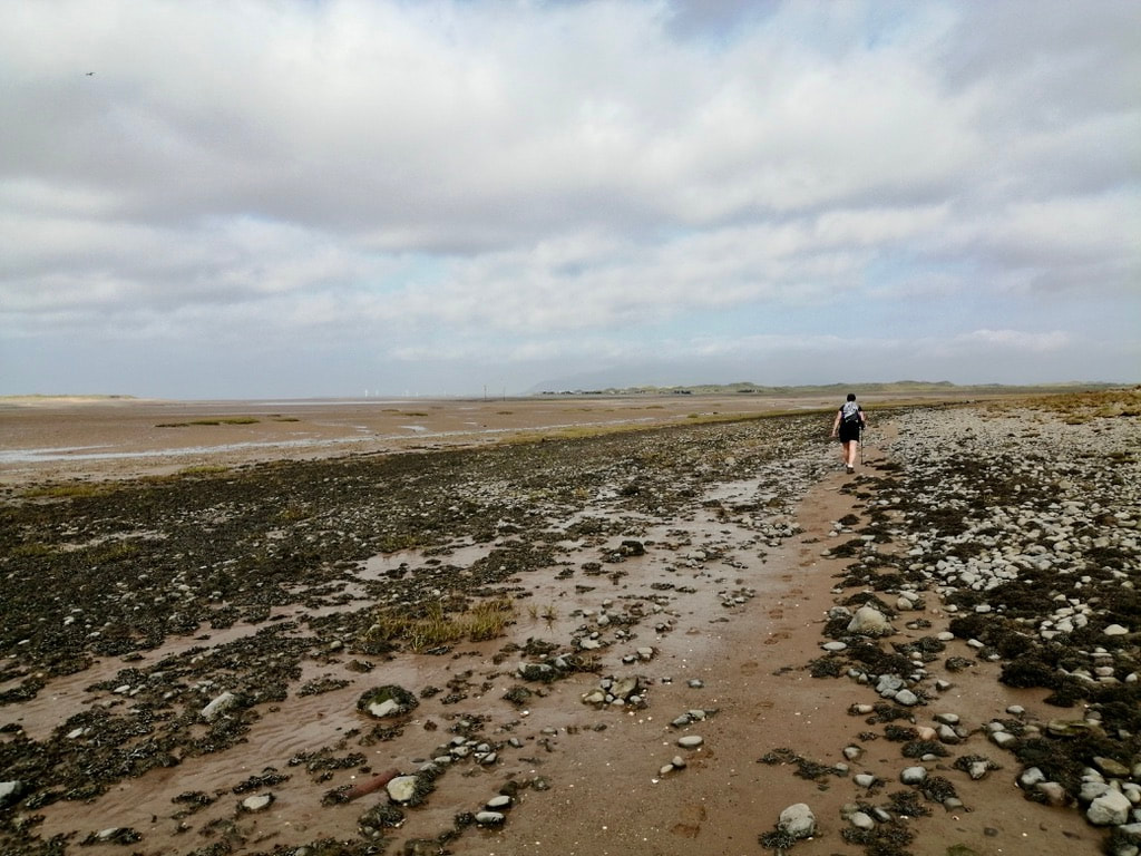
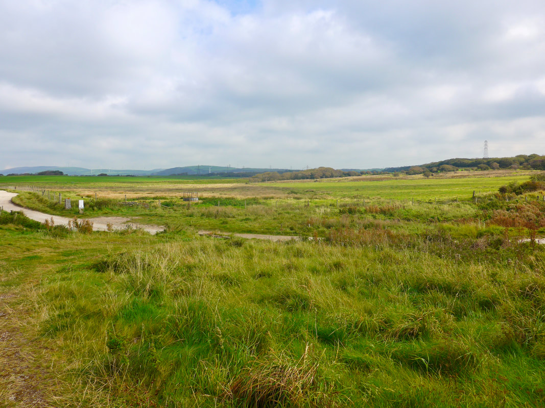
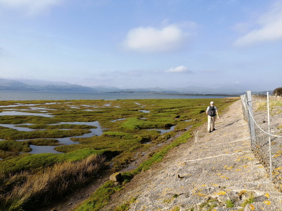
 The walking here was relatively good on either rough paths cutting through the back of the saltmarsh or walking on the rough stone beach. The view up toward Scarth Blight and the headland of Sandscale Haws was very clear on a bright but chilly morning. On the right as you walk there is a line of sand dunes, while on the seaward side there was just an expanse of mud and seaweed, with the sea a distant glimmer.
Sandscale Haws dominates the view to the front and because of its size you think it is much closer than it actually is. Consequently, you feel like you walk for ages and make little progress. Sandscale is a national nature reserve, managed by the National Trust and there is a Visitor Centre on site, but currently closed due to the Covid situation.
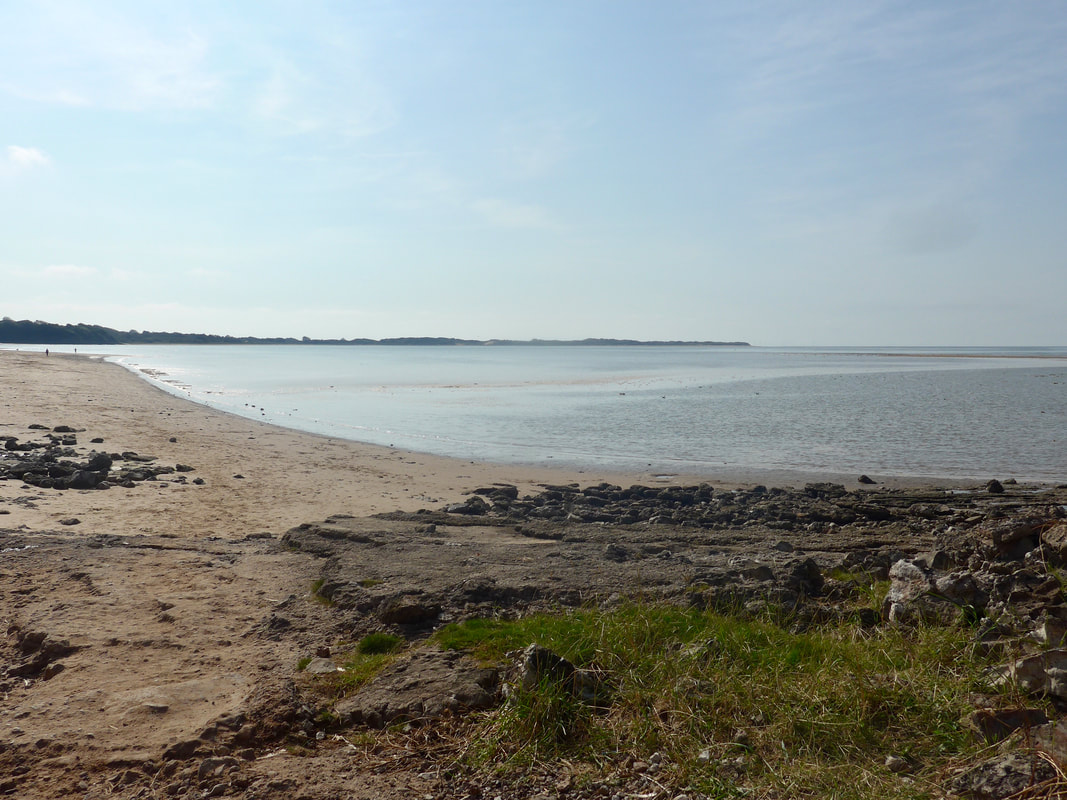
This first beach section ends at Scarth Blight. To your left here, the end of Walney Island, North End Haws, is separated from Sandscale Haws, which is on the mainland, by the Scarth Channel, which runs down from here to discharge in to the Irish Sea.
Sandscale Haws dominates the view to the front and because of its size you think it is much closer than it actually is. Consequently, you feel like you walk for ages and make little progress. Sandscale is a national nature reserve, managed by the National Trust and there is a Visitor Centre on site, but currently closed due to the Covid situation.
This first beach section ends at Scarth Blight. To your left here, the end of Walney Island, North End Haws, is separated from Sandscale Haws, which is on the mainland, by the Scarth Channel, which runs down from here to discharge in to the Irish Sea.
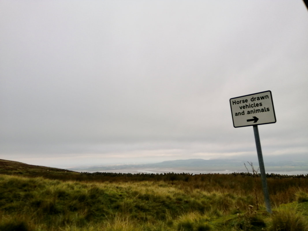
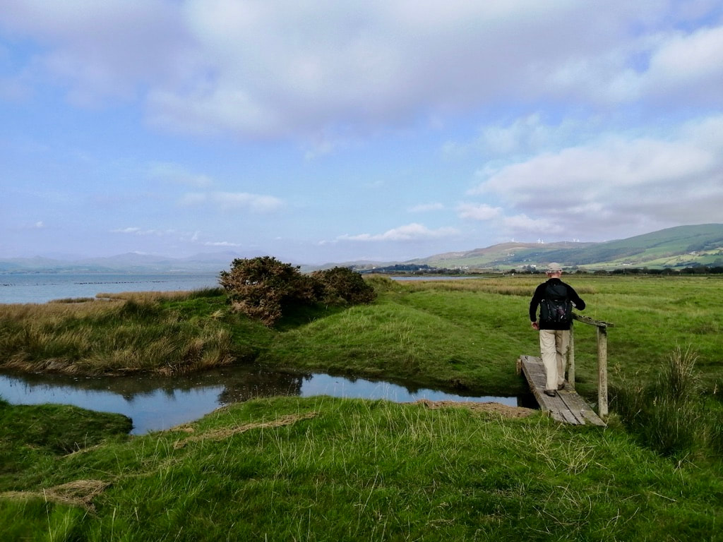
On Sandscale, at Lowsy Point, a small collection of holiday homes crowd round the southern shore, the black and white outlines of the superstructures picked out against the dunes behind them and, beyond, the dark hills behind Millom on the opposite side of Duddon Sands. Approaching the Blight we started to walk across the tidal sands where a pubic footpath is said to exist. However, because it is a tidal flat, there is no clear path to follow ,albeit we tried to follow it on our Rangefinder. As we progressed across the sands, however, we were put off by how far we were sinking in to it . Eventually, Joanna Elizabeth's common sense won out over my valour and we diverted off the sands just below Sowerby Cottages to take the slightly longer road route round to the neck of Sandscale Haws.
Leaving the Sands
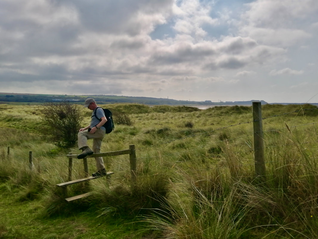
 To Lowsy Point
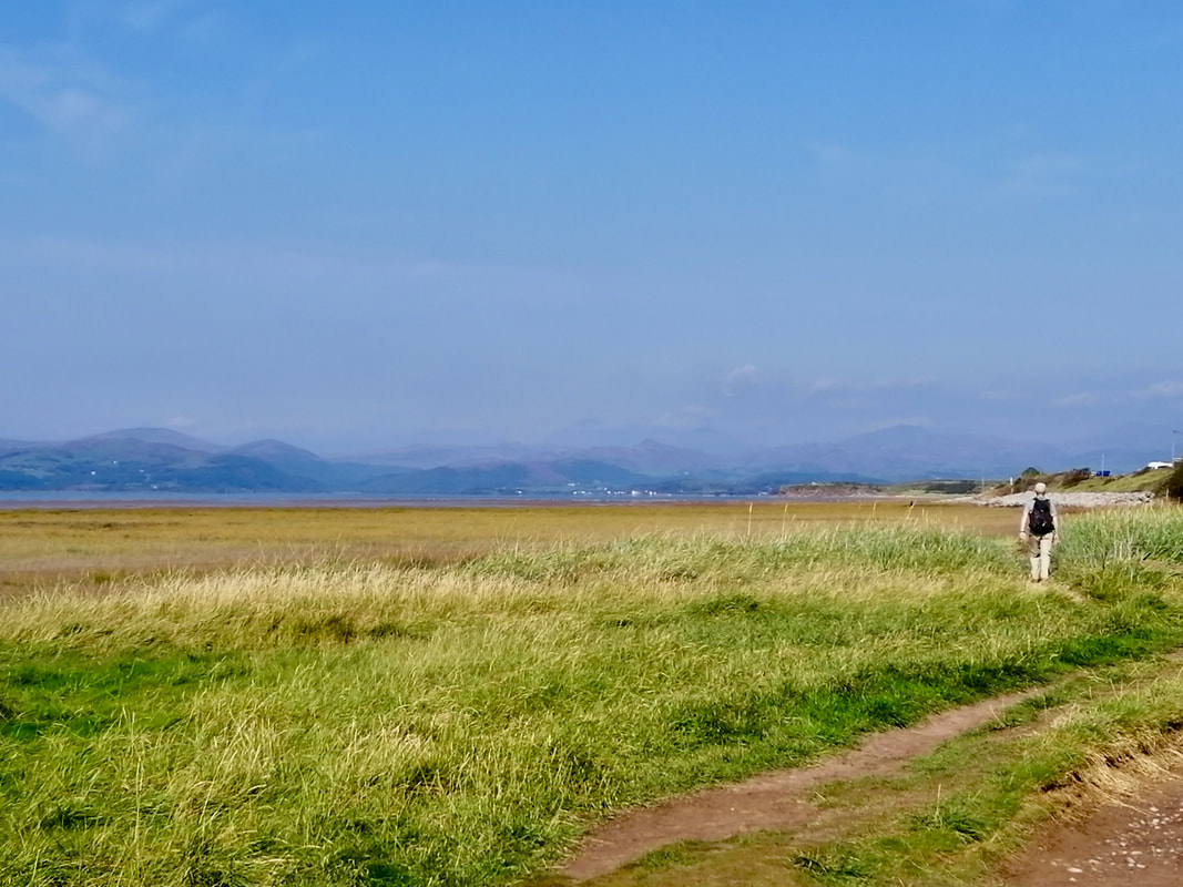
 Following the road round the small bay and moving on to the line of sand dunes that run off Sandscale Claws was the easy part. What followed next was the equivalent of Moses wandering in the desert.
I find moving through sand dunes difficult at the best of times. When the path keeps disappearing, or when mountain after mountain of sand dune block your path putting you off in different directions, it is not long before the lost flag goes up. A quick look at the map will demonstrate where we were not paying attention to the route and for some inexplicale reason took a left instead of going straight on and ended up wandering in the dunes. When you are hot and tired and following very faint outlines on the ground it is easy to do. Eventually, sitting down for five minutes, taking a cold drink and thinking it through, we were soon back on the route. But just for that infinitesimal moment you experience a wee sense of panic and that is when you know it is time sit down and take stock.
I find moving through sand dunes difficult at the best of times. When the path keeps disappearing, or when mountain after mountain of sand dune block your path putting you off in different directions, it is not long before the lost flag goes up. A quick look at the map will demonstrate where we were not paying attention to the route and for some inexplicale reason took a left instead of going straight on and ended up wandering in the dunes. When you are hot and tired and following very faint outlines on the ground it is easy to do. Eventually, sitting down for five minutes, taking a cold drink and thinking it through, we were soon back on the route. But just for that infinitesimal moment you experience a wee sense of panic and that is when you know it is time sit down and take stock.
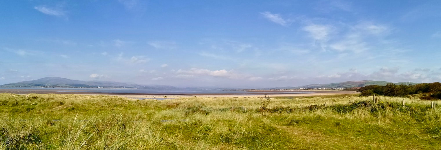
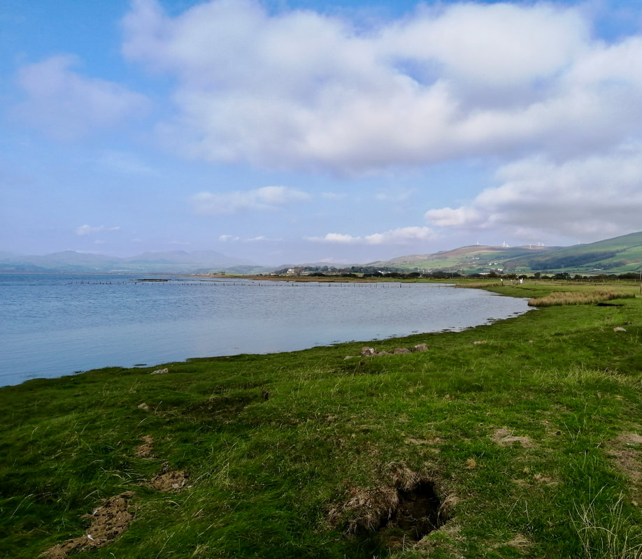
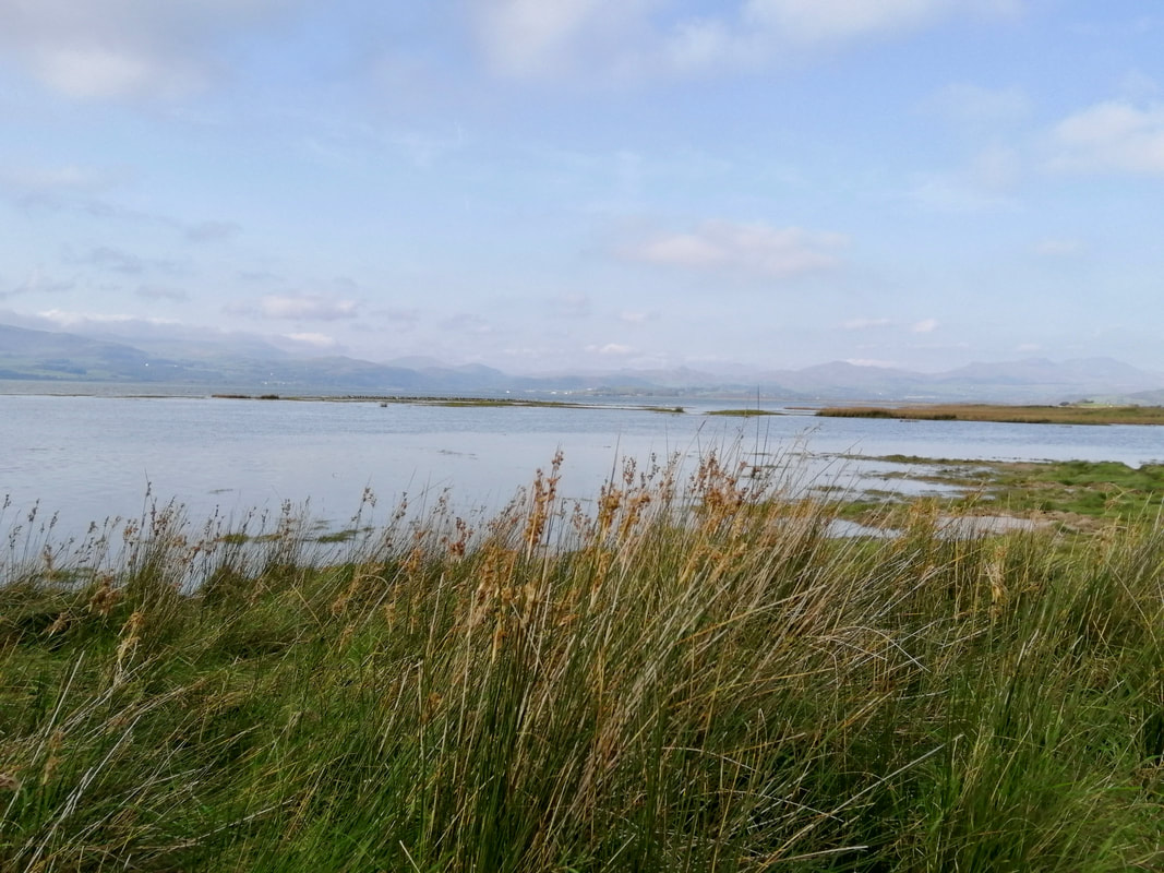
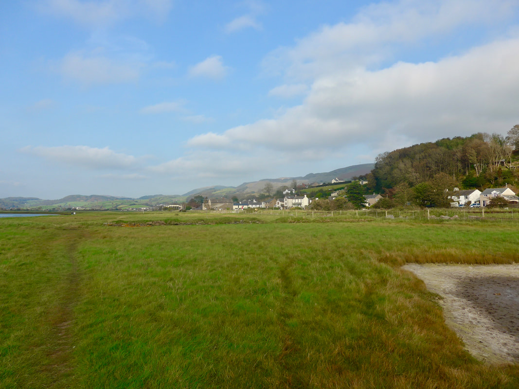
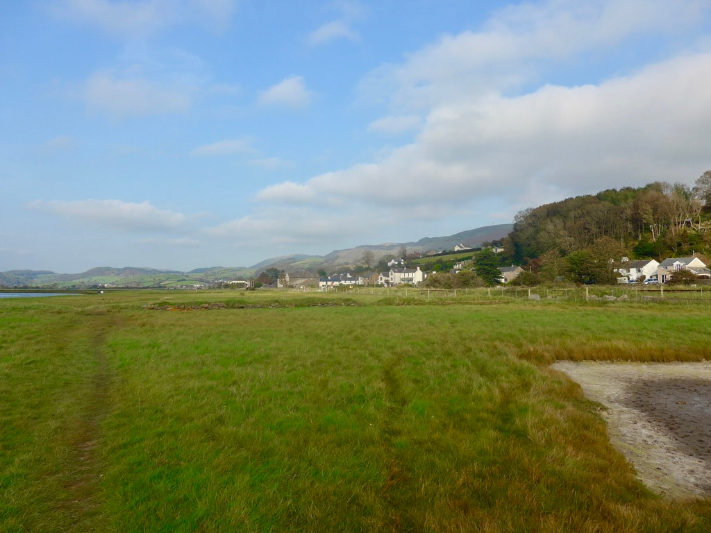
Once back on the path it was a straightforward walk out to the visitor centre which was unfortunately closed. Passing through remainder of the reserve we dropped back down on to the beach just below Roanhead Farm. By this juncture we were clear of the sand dunes of Sandscale Haws and the views opened up with a lovely view across Duddon Sands & Estuary to Hodbarrow Point on the other shore, which is mid-way between the villages of Haverigg and Millom. We took advantage of a handy bench here sit in the sun and enjoy the view.

To the north, the village of Askam-in -Furness nestled in the edge of the estuary. It was a nice walk round the small bay, the concrete-like Askam Pier prominent against the blue sky. The settlement is actually two villages. The older of them, Ireleth, lies slightly inland behind Askam and has a history that reportedly goes back to Viking times.
The younger of the two, Askam, was established in the 1850's when iron ore was discovered in the area. On the back of this a local steel industry developed. The Askam pier was constructed from the slag that was part of the steel making process. Not the most beautiful of piers, I suppose it served a utilitarian as opposed to aesthetic purpose. We stopped on the approaches to the village for lunch, sitting on a bench, looking over Duddon Estuary, enjoying the view and watching the wading and roosting seabirds, taking the opportunity to check out the next section. To progress after lunch, we simply stepped through the large arch that is part of Askam Pier and on to the shore beyond.
The younger of the two, Askam, was established in the 1850's when iron ore was discovered in the area. On the back of this a local steel industry developed. The Askam pier was constructed from the slag that was part of the steel making process. Not the most beautiful of piers, I suppose it served a utilitarian as opposed to aesthetic purpose. We stopped on the approaches to the village for lunch, sitting on a bench, looking over Duddon Estuary, enjoying the view and watching the wading and roosting seabirds, taking the opportunity to check out the next section. To progress after lunch, we simply stepped through the large arch that is part of Askam Pier and on to the shore beyond.
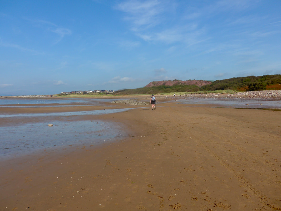
 Askam-in-Furness to Millom
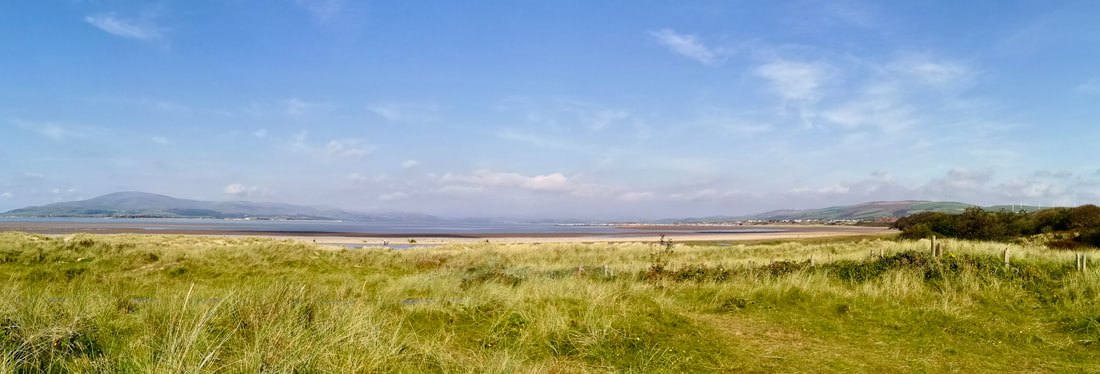
 Exiting the archway the countryside opens up to provide spectacular views of the various ranges of the Cumbrian Mountains, part of the Lake District National Park. To the left from Askam, looking over towards Millom, the heights of the Bootle Fells can be seen, including the Black & White Combes. Black Combe rises to a height of six hundred metres (1970 feet) and is said to offer some of the most beautiful views in Great Britain. On a good day it is said that you can see the Isle of Man and outlines of the Welsh and Scottish Hills. To the right as you look at it, the sub-top known as White Combe rises to four hundred and seventeen metres (nearly fourteen humdred feet).
To the north from Askam you are looking towards the Woodland Fell, beyond which lies the Old Man of Coniston and the famous Conisten Water, location for a number of the Arthur Ransome stories in 'Swallows and Amazons. On a day such as today it was simply breathtaking. A number of the mountain features on this panorama are included in Alfred Wainright's 'The Outlying Fells of Lakeland'.
To the north from Askam you are looking towards the Woodland Fell, beyond which lies the Old Man of Coniston and the famous Conisten Water, location for a number of the Arthur Ransome stories in 'Swallows and Amazons. On a day such as today it was simply breathtaking. A number of the mountain features on this panorama are included in Alfred Wainright's 'The Outlying Fells of Lakeland'.
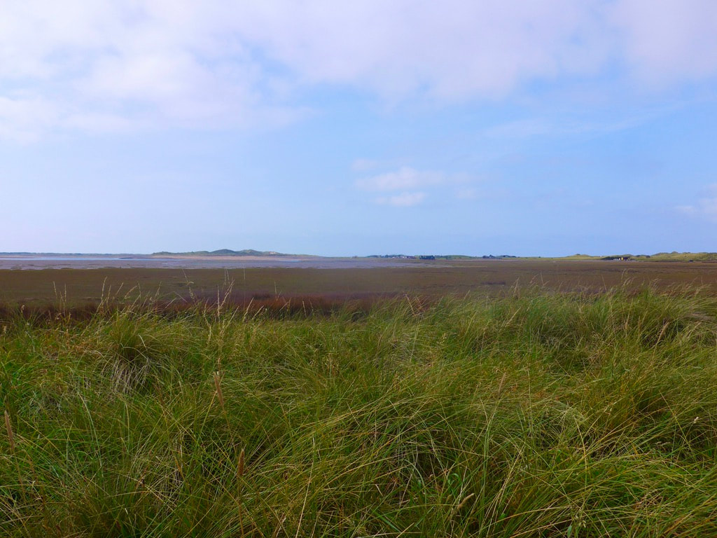
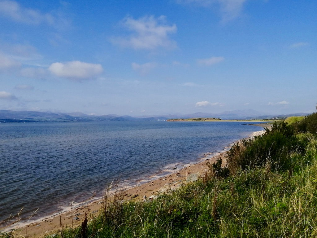 Looking to Dunnerholme headland
 As sat and ate lunch we watched with amazement as the tide raced in across Morecambe Bay. Aware of the reputation of the bay we were nonetheless taken by surprise how quickly the tide rises. The rapidity with which the water comes in is just amazing. Care is required as you walk the beaches because the water does not come in in a straight line. If you are focussed only on what lies in front of you, unbeknownst, the water can be creeping in behind you and it is easy to be cut off.
Where before lunch we had walked on the lower shore, for the afternoon we were confined to the back of the beach. At times we were some distance from the sea, walking behind large stretches of delightfully coloured saltmarsh. The grasses and sea shrubs were, despite the season, a wonderful range of Autumn golds and browns, burnished by the afternoon sun. Gone now were the flocks of waders that had accompanied us in the morning and we were left to walk in splendid isolation. At times it was a bit of a clamber as the 'walkable' beach became narrower and narrower and we were occasionally forced to walk up against the retaining fence.
Where before lunch we had walked on the lower shore, for the afternoon we were confined to the back of the beach. At times we were some distance from the sea, walking behind large stretches of delightfully coloured saltmarsh. The grasses and sea shrubs were, despite the season, a wonderful range of Autumn golds and browns, burnished by the afternoon sun. Gone now were the flocks of waders that had accompanied us in the morning and we were left to walk in splendid isolation. At times it was a bit of a clamber as the 'walkable' beach became narrower and narrower and we were occasionally forced to walk up against the retaining fence.

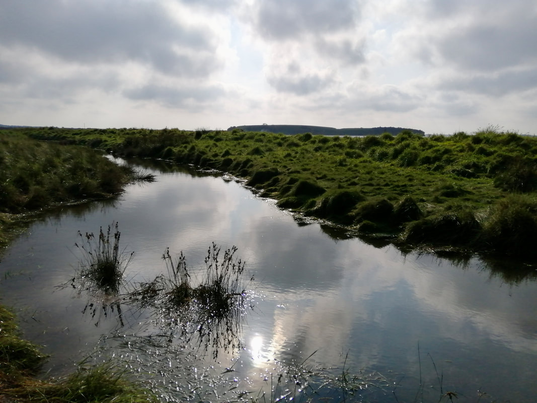
 Crossing the Rill
 Not too long after leaving Askam we moved on to the edges of Dunnerholme Golf Club, walking on a good path through areas heavy with marram and other rough grasses. The occasional rill or channel running in from the sea was an early warning of some of the difficulty that lay ahead, albeit one or two had small foot bridges. With high tide the water table for some distance inland rises considerably. As well as making the walking slightly quelchy, it also raises the level of the water in the channels, substantially in some cases. Coming off the golf course, our route passed over the neck of Dunnerholme headland on which there is evidence of the local quarrying industry referred to earlier.
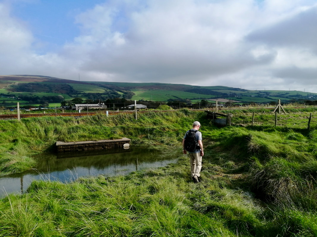
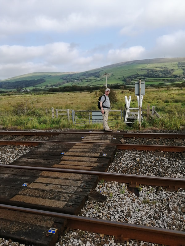
North of the headland there is a large expanse of saltmarsh that runs right up to the edge of the railway line. Walking through here we were often called upon to jump over some of the channels that had filled up with high tide. At one point we came to a long channel runnning north to south that was just too wide and deep to cross. As stood trying to puzzle out a way forward, a train passed on the line and we enjoyed waving to the passengers. Fortunately, before turning back on the path to retrace our steps, I took the time to follow the bank of the channel back and after about two or three hundred yards found where it petered out and we were able to walk round it.
North of the headland there is a large expanse of saltmarsh that runs right up to the edge of the railway line. Walking through here we were often called upon to jump over some of the channels that had filled up with high tide. At one point we came to a long channel runnning north to south that was just too wide and deep to cross. As stood trying to puzzle out a way forward, a train passed on the line and we enjoyed waving to the passengers. Fortunately, before turning back on the path to retrace our steps, I took the time to follow the bank of the channel back and after about two or three hundred yards found where it petered out and we were able to walk round it.
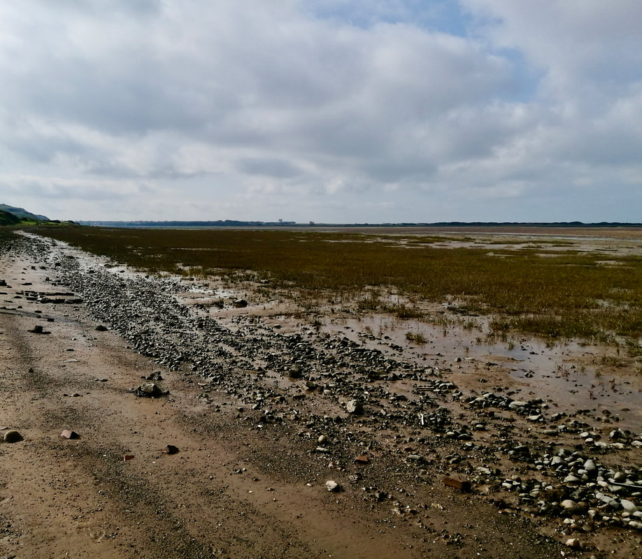
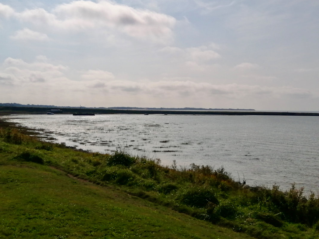
Soutergate Saltmarsh & Water Channel
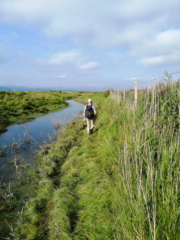
 Crossing the Marsh
 Once we were beyond the water channel the route opened up again and the walking was a bit easier on a worn grass path. We continued to walk parallel to the railway as far as Souter Gate railway crossing where a water feature moved us to the other side of the track as far as the next crossing, just below Soutergate Farm. On this diversion you are almost in to the farmyard at Soutergate before you cut off left across a field to re-cross the rail track.
Once we were back over the railway again the walking became a bit more difficult as we pretty much lost our path to the water of the saltmarsh. For much of this section we walked on the sloping concrete bank that ran down from the railway line. The path eased again a bit further along and we found the odd bit of dryish path to walk on which, after the strain of walking on the angle, was a relief.
Once we were back over the railway again the walking became a bit more difficult as we pretty much lost our path to the water of the saltmarsh. For much of this section we walked on the sloping concrete bank that ran down from the railway line. The path eased again a bit further along and we found the odd bit of dryish path to walk on which, after the strain of walking on the angle, was a relief.
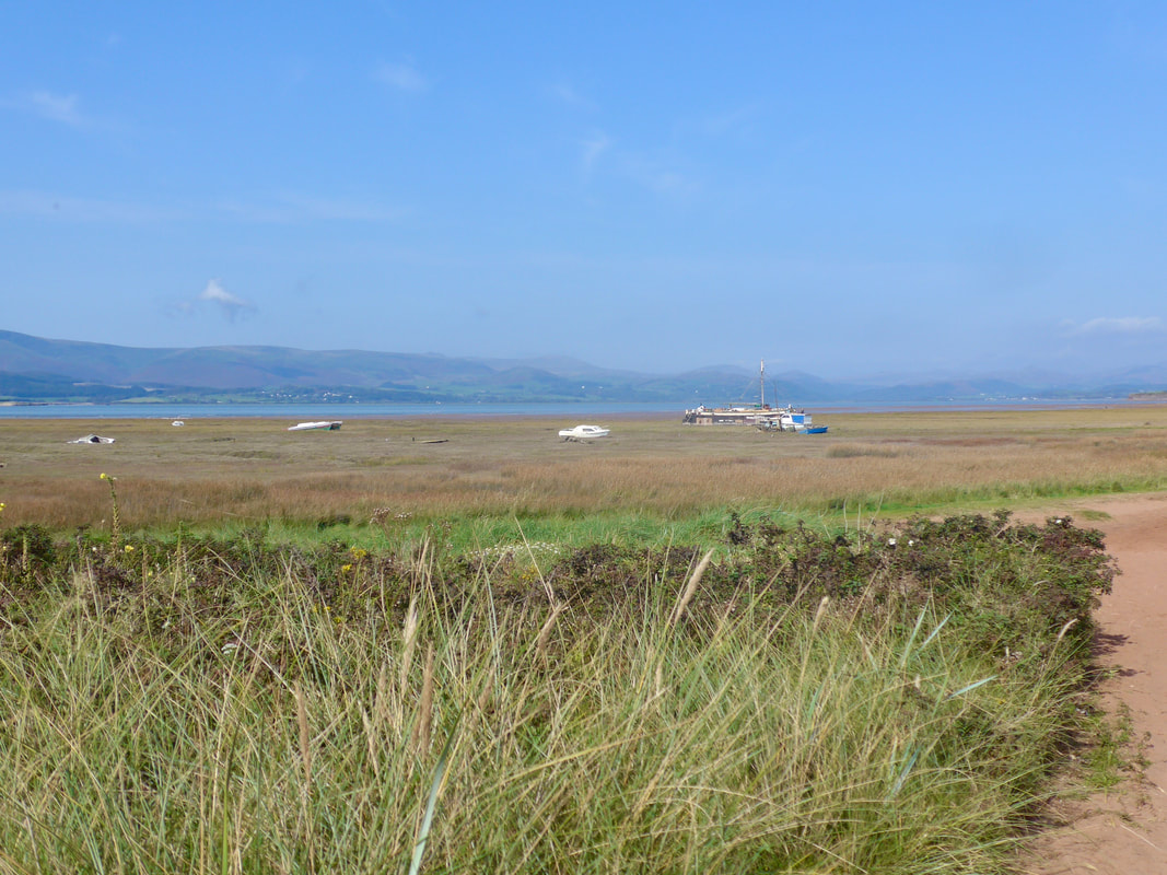
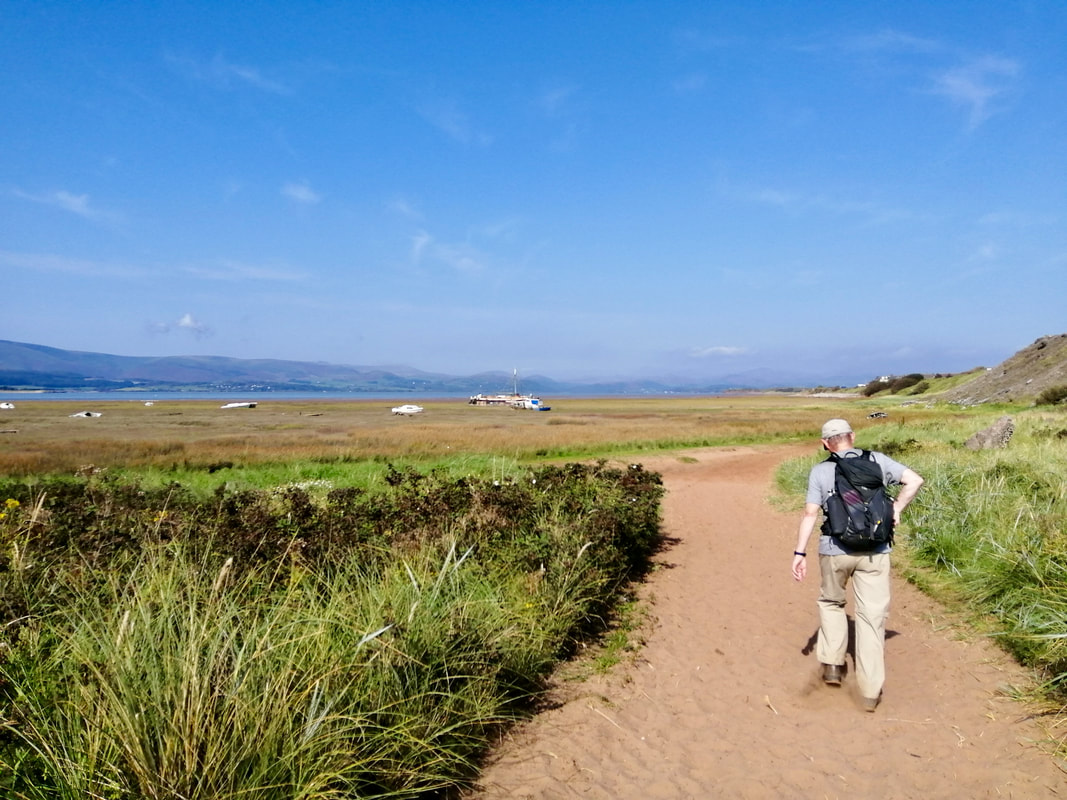
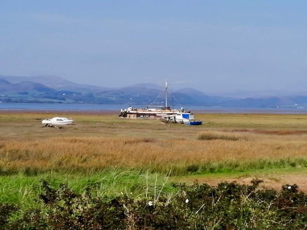
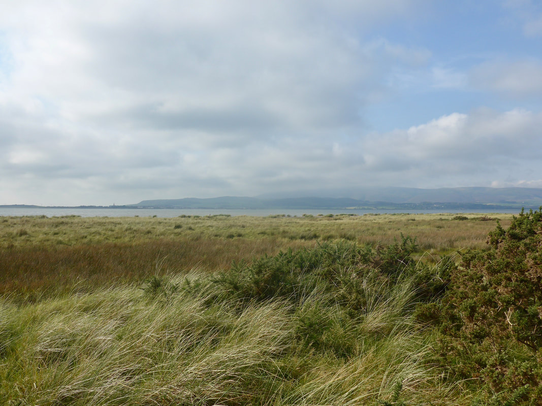
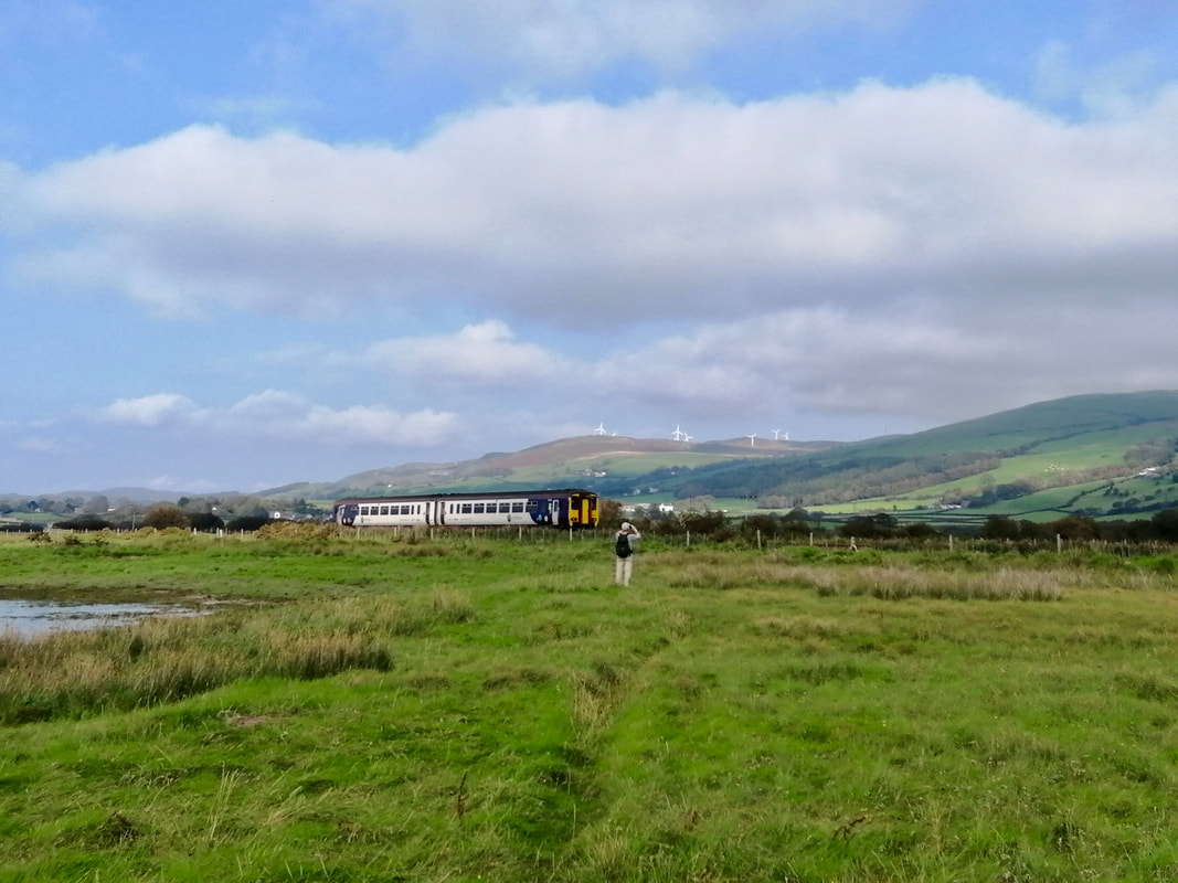
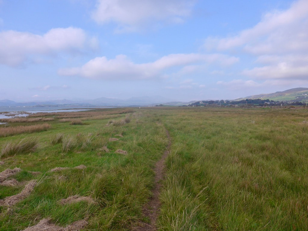
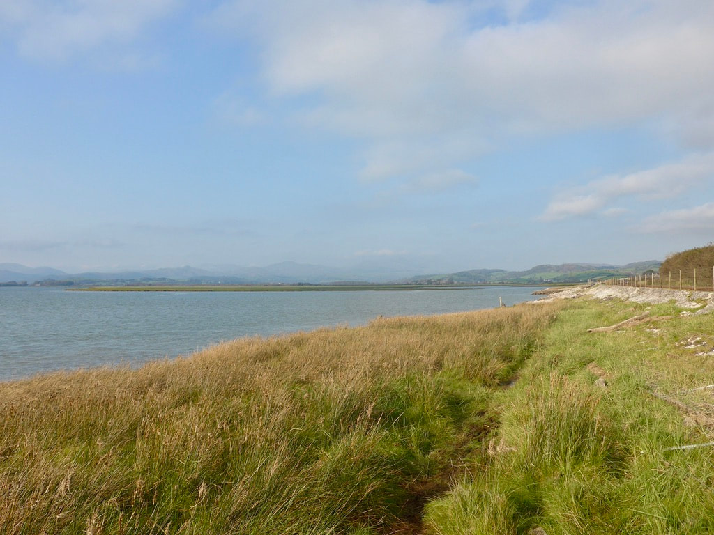 To Kirby-on-Furness
 It was fairly straightforward after the railway crossing to reach the finish line at Kirby-on-Furness where we had parked the car by the railway station. Like yesterday, it had been a day of superlative views as we followed the Duddon Estuary, with sea and wonderful mountain panoramas. While a nice wee lunch a local hostelry would have been welcome there was nothing on offer close to our route. Despite our schoolboy navigational errors it had been another good day's walking on a route I would not hesitate to recommend. Once clear of the town the scenery is at times exquisite
Kirby-on-Furness
 RSS Feed
