The Scottish Vagabond - Walking the British Coast
  • Welcome
  • The Vagabond
  • Progress
  • Walking Journal
  • Stages of the Walk
    • Scotland >
      • Eastern Scotland
      • Dumfries &Galloway
      • Ayshire & Clyde Valley
      • Argyllshire
      • North West Highlands
      • North Scotland
      • North East Scotland
    • England >
      • North East England
      • Yorkshire, Humberside & Lincolnshire
      • East Anglia & Kent
      • South Coast
      • South West Coast Path
      • North West England
    • Wales >
      • South Wales
      • Pembrokeshire Coast Path
      • West & North Wales
  • Blog
  • Other Walks

Walking the coast of Great Britain

The journey begins

Sourlies Bothy to Sandaig, Knoydart   14 Miles

3/7/2026

0 Comments

 
Picture
Route Map
We stayed last night in Sourlies Bothy, at the head of Loch Nevis. The bothy is one of the possible way stops for people completing the Cape Wrath Trail which they access via Glen Dessarry. An unofficial, unmarked and very challenging route, it covers 230 miles of some of the roughest walking in Great Britain.  A backpacking route, it is personally challenging, requiring fitness, tenacity and navigation skills. Some of our fellow guests were on this route and from 4.00am we could hear them packing up and setting off on their next section. For us amateur walkers it was possible to have a long lie, at least until about 6.00am. We were out and on the trail by half past seven, fed and watered and ready for the day. 
Picture
Elevation of the Walk
PictureSourlies Bothy along Loch Nevis
The elevation of the walk has a fierceness at the beginning, becoming benign as the walk develops. From the bothy it is at sea level, moving round the headland at Eilean Tioram (not to be confused with the castle) and then across the extensive marsh that leads to the Carnoch River and the abandoned settlement. Across the bridge and the hard work starts with, at first, a reasonably gentle rise on to the slopes of the Mam Meadail pass and saddle that sits between Meall Bhasiter (718 Ms) and Sgurr Sgeithe (793 Ms). As the climb develops, it becomes ever more steep and challenging to, I suspect, even the fittest of walkers.

PictureStrone Sourlies
The early risers would have had the tide in mind as the waters of the loch can come right up to the bottom of the headland known as Strone Sourlies, just after the bothy. Walking along the shore, we took time to enjoy the lovely views back along Loch Nevis

It is always nice to see the places you walked the day before from a different perspective and to know that their particular hardships are behind you. There were clouds overhead which made it very muggy and, even so, early in the morning, it was disturbingly warm, particularly with a steep climb ahead.

The route starts with a walk along the pebbly beach with the hills and the headland sitting slightly behind you. The route along the front of the headland is tide dependent and if you are unlucky (or have not planned it right), the alternative is the steep, slippery rocks at the back of the headland.

PictureApproaches to Carnoch Flats
It was rocky underfoot at times, particularly going along the front of the headland. Once round the rock face, it was up and over a wee hill where we had an even better view of the route we had walked yesterday, out along the loch towards Tarbet. Looking at our route yesterday, with the tide high and seemingly no space between the water and the headlands, even we were surprised that we had managed to come along that route.

Dropping down from the hill there is a walk across the extensive marsh that protects the approaches to the bridge over the Riven Carnoch. Known as the Carnoch Flats or Sourlies Marsh, it is often waterlogged from the meanders of the River Carnoch and the high water mark of the loch and just by the nature of the ground. Looking at it from a geographical point of view, it looks like a flood plain for either the river or Loch Nevis.

The OS Map shows a path as far as the headland and from there you need to find a way across the marsh. Fortunately for us, the hot weather over the last few weeks had dried a lot of the marsh out and we traversed it relatively safe and dry. Crossing the flats, we could see over to what was the Camusrory crofting settlement, sitting at the foot of the River Carnach. The settlement now functions as the centre of a shooting and fishing estate. Historically a salmon and sea trout river, the catches on the River Carnach are now a shadow of what they once were and most of the river is now 'catch and release'.    

Picture
Carnoch Flats to Ben Aden (887 Ms)
PictureBanks of River Carnoch (bridge in background)
The level of the River Carnach was very low for our crossing, in contrast to the experiences of many other hikers over the years. A few years back (2017) the old suspension bridge was condemned and removed for safety purposes. It took a couple of years to replace it (2019). The overall cost of the replacement was £62,000 with the funding coming from different bodies.

During the interim, the river in winter spate caused problems for some walkers. The area is now owned by Camusrory Estate, an 8,000 acre sporting estate, owned in part by the Soames family (grandson of Sir Winston Churchill) and an off-shore trust.

Historically part of the Knoydart Estate, it belonged to Clan Donald, under the auspices of  the MacDonnells of Glengarry and Clanranald who ruled it from the 15th to the 19th century. The lands were sold to the Bairds of Gartsherrie in Ayrshire who carried out wholesale evictions in 1853. After their time, control passed to various financiers and absentee landlords, the area becoming known for the neglect of the land and its people. The fates of those  forcibly evicted  included forced emigration, a move south to the poverty-stricken urban areas of the central belt, find poorly paid work in the fishing trade in Mallaig if they could, or stay and live in homelessness and poverty.

PictureAbandoned Carnoch Shieling & Sgurr na Ciche
In 1933 the land came into the possession of Lord Brocket, a known Nazi sympathiser who used the estate mainly for entertainment and shooting.

This was the time of the the famous land raid by the Seven Men of Knoydart (all ex-servicemen) who tried to establish their own crofts on the estate. Although defeated in the courts on their subsequent challenge to eviction, their actions have been considered an important staging point in highlighting the issue of land misuse in the Highlands and to have influenced subsequent legislation in the Scottish Parliament regarding community rights to land ownership. A cairn  at Inverie commemorates the land raid. In 1999, the Knoydart Estate was finally subject to a community buy-out and it is now managed to the benefit of local people.

PictureStarting out on Mam Meadail Pass
With a long walk in front of us on what was proving to be a very hot day, we drank our fill of the water bottles and re-filled them from a fast running section of the river and treated them with tablets. Over the new bridge and we started up the slope behind the ruins of the old crofts of Carnoch. Like much of the surrounding area, Carnoch was populated by crofters until the time of the Highland Clearances. Now it is an isolated wilderness, but still an important crossroads for hikers. There are no roads for miles and the only access is to walk in and out.

From the bridge, the route runs a little way parallel to the bank of the river, before turning to head straight up the hill pass that lies between two of Knoydart's mountains. From the bridge to the top of the pass is just over two miles. It is hard going, steep and rough walking. There is a bit of path at the early sections, zig-zagging up the hill, but it can be faint and at times, particularly on the last third, the path seems to disappear all together. Of course, it might be that as we staggered in the heat we wandered off the path!

PictureSgurr Sgeithe & Contentment
On a very hot day with full packs it was a difficult climb. Between the difficult underfoot walking on the marsh and the steepness of the hill, the first three miles from the bothy to the saddle of Mam Meadail took us almost 4 hours (including breathing stops). One of us was slow, one of us faster! I'll let you guess. As we progressed up the hill, the grandeur of the surrounding landscape was laid our before us. Such joy to be had in seclusion!

It was a great relief to reach the saddle at the top, as much because the path reappeared and was much easier to see. It had taken us four hours from the bothy to the saddle and I for one was puggled. Out with the Jetboil and a couple of cups of coffee later I was ready to run the rest of the way.

From the saddle between Sgurr Sgeithe and Meall Bhasiter, the route turns to the left to follow Gleann Meadail for the long walk out to Inverie, the main settlement on Knoydart. It was a dramatic walk, surrounded by high peaks and with appearing and disappearing glimpses of Inverie Bay on Loch Nevis. The path goes along the shoulder of the range of hills that separate Gleann Meadail from Gleann an Dubh-Lochain (Glen of the Black Lochan). 

Picture
Gleann Meadail
At times, it was rocky underfoot and the walking was sometimes not easy, sharp stones cutting into the soles of the boots and through to the feet, but it was better than the vertical climb up the hill pass. We had used up most of our water on the brew-up and were on the lookout for another source of water. We need not have worried, as we found numerous little waterfalls tumbling down the hill from which we replenished the bottles. 
PictureBridge over River Inverie
The route consistently moved westwards, gradually dropping down the glen. We crossed over the River Inverie on an old wooden bridge and came to a junction with the path coming down from Gleann an Dubh-Lochain. There was a young man on a digger at the junction, laying down aggregate on the path. I was tempted to tell him to desist as from a walkers point of view it is a difficult surface to walk on for long distances. In general, it is becoming difficult now to find areas where the old mountain paths still exist, trodden down by the feet of generations of hill walkers. Instead, there are these aggregate paths designed to enable various vehicles and their passengers access to the high places, no doubt to shoot the wee birdies. I held my wheesht, however, remembering that I was a visitor and he was only doing a job. 

River Inverie
Picture
Sgurr Coire Choinnichean & Inverie
PictureAdmiring Inverie Bay
From the bridge we still had about 2.5 miles to walk to reach the main settlement of Inverie. The route passed along at the bottom of Sgurr Coire Choinnichean (Peak of the Mossy Glen or Valley), coming in to the village through a lovely forest walk. We arrived in the village just as the weather broke, the heavens opening and laying down torrential rain. We would have taken refuge in the only pub but it was closed for refurbishment. We would have sheltered in the small shelter opposite the shop but it was full of people, like us, caught out by the downpour. So we sheltered in the shop, blocking the narrow aisles while taking the opportunity to phone our Air BnB hostess on the outskirts of the village and looking for directions to find it. With nearly five miles still to go, we were content to have a breather before tackling the final leg.  

Picture
Loch Nevis Looking East
We had two options to reach our accommodation at Sandaig. We could take the coastal route, which might be tricky as we did not know the route of how it changes with the movements of the tide. Or we could take a slightly inward route that follows a single track road at the end of the village, up a small glen, with a grassy path dropping off the road to go down to Sandaig. We opted for the latter as the safe bet, but determined to walk the coastal route as part of another walk when we had more detailed information about it.

The final section was a hard slog, uphill and in intermittent rain, the rise of the hill almost constant until we reached our road marker. We expected a road down to the house, but instead were met with another 'vanishing' path. For the road access we needed to go another half mile and we did not have that in us. So down the grassy path we went, following idiosyncratic markers, until we stumbled on to the house. 

PictureHeading down to Sandaig
Our hosts were a Swiss couple who have stayed in Knoydart for a few years. Once we were cleaned up and presentable, Bettina provided us with a lovely meal and we spent a long time talking about Knoydart and its recent history. Both Roland and Bettina were ultra runners and their home is filled with their trophies and achievements. 

Like yesterday, today's walk was full of challenges and, for me personally, full of moments when I questioned my sanity about why, at this time of my life (in my 70's), I had chosen such a difficult and foolish endeavour. Answers on a postcard, please.

It had been another day of great beauty and another example of how the pendulum swings on adventures from one partner supporting another through the difficult times. If I could share one benefit from my coastal adventures with other people it would be the wonderful bonding that Joanna and I have experienced as we have faced various adversities. The climb up Mam Meadail challenged me and it was Joanna who kept me going (not that there was any other option when you are in the middle of the wilderness). But here we are. Another day off beckons, an opportunity to restore the spirit and prepare for the next challenge.  

Picture
Over the Sound of Sleat
0 Comments

Lochgilphead to Tarbert - 14 Miles

5/5/2024

0 Comments

 
Picture
Minor Walk
Picture
Main Walk
PictureView from Canal Bank
While walking in 2022, I acquired an injury that prevented me walking longer distances. I managed to walk from Lochgilphead to Ardrishaig before I had to call it a day, hence the two maps above. We continued the trip as planned, walking when I could, but I needed to return at a later date to complete a number of walks that were cancelled. Such is the life of a Vagabond!

The rest of the 2022 trip was a mish-mash of days when I could walk, and days when I could not. The main walk above, completed much later, was planned for early on a Sunday morning because it is mainly completed on the busy main road (A83), and there is not a lot of pavement. The traffic from the ferry in Tarbert can be crazy, both fast and big, so care is required when walking on the road. There are also sections where the crash barriers force you to walk on the road. Be mindful!  

PictureCrinan Canal Sea Lock, Ardrishaig
03-06-22 Despite a knee injury, I was able to walk the short length of the Crinan Canal from Lochgilphead to Ardrishaig. From Lochgilphead to Ardrishaig is only just over two miles, and on a sunny day is a nice, pleasant, level stroll along the canal banks. At the canal junction with the river, there are nice views out over Loch Fyne and it was interesting watching the boats move through the different stages of the canal junction.

The Crinan Canal is nine miles long, and is popularly known as 'Scotland's most beautiful shortcut'. Running from Ardrishaig to Crinan on the Sound of Jura, there are fifteen locks on the canal and it reaches a height above sea level of sixty-five feet. The Crinan Canal Act was passed in 1793, building work started in 1794, with Mr James Patterson appointed as the resident engineer,  but the canal was not opened until 1801, two years late due to problems with financing and buying and acquiring the requisite land. The canal cuts out the need to go round the Mull of Kintyre and was a considerable time saver for the early industrial users of the canal including commercial sailing and fishing vessels and the ubiquitous 'Clyde Puffers'. These days it is mainly leisure boats that use the canal. Prior to the building of the canal, Ardrishaig was only a small hamlet with, perhaps, four or five houses.

In the hills above Ardrishaig there is an area known locally as 'Robber's Den'. Within the area there are a the remains of a possible hillfort and a couple of abandoned buildings of unknown origin which may or may not be Medieval or Prehistoric. The name of the area is thought to be related to a member of the MacVicar Clan who laid up here following a battle at the Carse. In the hills above Robber's Den, lies the Kilduskland Reservoir. A concrete built structure completed in 1906, it is the main source of water for Ardrishaig. 
PictureLoch Fyne
For most of this walk, the road runs parallel or very close to the main A83 which links Lochgilphead and Tarbert. There is little room for walking on the rocky shore, and on our walk the tide was high which was an additional obstacle. For this reason it was for much of the time a road walk, with occasional forays onto the shore. For safety, we wore high visibility vests and kept the high vis covers on the rucksacks. When we could venture onto the shore, there were nice, slightly eerie views through the light mist along and across the loch. Throughout our walk through Argyll, we found the early morning light and the accompanying mist to be things of beauty, adding another layer to the sense of mystery of this ancient landscape.

Picture
PictureInverneill Island & Meall Dubh
Three miles below Ardrishaig lies the small village of Inverneill. The local lands of the Cowal, of which Inverneill is a part, came into the hands of the Campbell Clan circa 1480. The Inverneill Estate was purchased for one Sir Archibald Campbell KB in 1773, by his brothers, James and Duncan. Sir Archibald was a professional soldier (Royal Engineers), who at that time was serving in Madras, India, where he was the governor. At the end of his military career, Sir Archibald was described by the the Institution of the Royal Engineers as "the most brilliant of the engineers who served in India during the eighteenth century". His skills as a colonial administrator were also highly regarded. Held as a prisoner during the American Civil War, he subsequently became the governor of Georgia (USA) and of Jamaica (1785). From his position in Jamaica, he was said to have aided the continuing struggles of the British in the American war.  He was awarded Knight of the Bath (KB) for his exploits.

Moving to India as commander-in chief and governor of Madras (1786-89), he is reported have brought peace and prosperity to the province, and also made his personal fortune.  In poor health, he left in India in 1789 and retired from the Madras post in 1790. He died at the age of fifty-one in March 1791.

PictureInverneill to Cowal Peninsula
Sir Archibald belonged to the Campbells of Craignish, whose main home was Dunderave Castle, outside of Inveraray (mentioned in a previous walk (Cairndow to Inveraray), and which is where he grew up. On Sir Archibald's death, the estate of Inverneill passed on to his brother, Sir James and it remained in his family until 1954. The last of the line to own the estate were Misses Olive and Una Campbell. The house is currently owned by an American couple who were reported to be restoring the house and gardens. 

In the hills above Inverneill there are the remains of various mines, evidence for the lead and copper mining which took place in the area, perhaps as early as the 14th C. In Argyll records, an entry for 1326, a record shows that the Constable of Tarbert paid for coal and materials supplied to the lead mines. This is the earliest known evidence for such activity in this area. It is unknown, however, if it specifically refers to the mines at Inverneill (Canmore). Also in the hills above the village are the remains of an old burial ground, and the mausoleum of Sir James Campbell (see above), with the date 1802 carved on the lintel above the doorway. As well as the burial ground, somewhere on the hill are thought to be the remains of the church that would have accompanied the graveyard. Lying just off the shore of the south side of Whitehouse Bay, is the Isle of Inverneill, which is still in the ownership of the Campbells.

Picture
From Inverneil to the headland at Aird nan Ron, is a distance of just over five miles. The area around the Aird headland is really the first opportunity on this walk that you have to move off the main road and on to quieter byways. The track eventually leads to the Stonefield Castle Hotel, passing through some beautiful woodlands on the way. The early part of the track is through old, traditional Scottish woodland, the trees and the dry stane dykes covered in emerald green moss and with that lovely dusky pink hue that sometimes comes through the green.

Built in 1837, Stonefield Castle was built on the site of a previous house called Barmore. The name derives from the name of a nearby valley. To the south of the castle lies Barmore Hill, which overlooks the Stonefield Estate and the lovely forested mound of Barmore Island. The island is actually connected to the land and there is a walk on the island of about 2.5K.

Barmore House was built and owned by the MacAlister family, who at one time were tenants in Tarbert Castle, owned by the Duke of Argyll. Following their removal from the castle, the Duke of Argyll sued the MacAlisters for neglecting the property during their tenancy. Subsequently, the Barmore property and estate were acquired (1746) by the Sheriff of Argyll, one Sir Archibald Campbell. The current baronial mansion was built in 1837, by the grandson of Sir Archibald, John Campbell. It was his son, also John Campbell, who later restored the castle and developed the wonderful gardens that you see today.  The castle has been a hotel since the 1950's.

PictureStonefield Castle Garden
Under the auspices of John Campbell, the gardens and arboretum were laid down and developed. His cousin, Archibald Campbell, a well-known member of the Bengal Medical Service, provided a number of the seeds used to grow on the  Rhododendron and Magnolia, many of Himalayan origin. The garden has also been known for its 'champion' trees, including the UK's oldest Eucalyptus.  As well as his cousin, the famous British botanist and explorer, Sir Joseph Dalton Hooker, played a part in seeding the garden. Sir Joseph was a close friend of the equally famous Charles Darwin. As well as his expeditions to the Himalayas among many other places, Sir Joseph was known for his tenure as the director of the Botanical Gardens at Kew, a position where he succeeded his father. 

Stonefield Castle Gardens
PictureEast Loch Tarbert
As the path exits the garden there is a choice to go either to the front of the castle, or to the rear. On the south side of the castle the Barmore Burn crosses the garden. It was clear on our OS map that to the front there definitely was bridge over the burn and into the woods beyond, not so clear as to what the situation was to the rear. So, we passed in front of the castle and resisted taking photographs as all the guests were out enjoying the weak afternoon sun. After crossing the burn, we kept to the lower path (coastal) which continued to run through the woods to eventually join on to the main A83 for the last 1.5 miles into Tarbert. We had previously walked round the small Barfad peninsula and did not feel the need to do so again today.

For most of the journey it is a road walk. The Himalayan Rhododendron and Magnolia collection, as well as the champion trees, made it worthwhile. What is there not to like when you can walk on the waters of Loch Fyne!

0 Comments

Ardentinny to Dunoon - 15 Miles

5/4/2024

0 Comments

 
Picture
Route Markers:
The walk yesterday finished in Ardentinny and we took the bus to Dunoon to a hotel for the night. The journey was reversed for this walk, taking the bus from Dunoon to arrive back in Ardentinny for a slightly later start than usual at about 9.45.

The elevation of the walk was mainly at sea level. What variation there was, was mainly small, low rises as the road follows the contours of the shore. Almost the whole of the walk was on the road, initially following the A880 from Ardentinny, to its junction with the A815. The A815 is the main road from Dunoon to Strachur, and from there up on to the A83 to Inveraray. The weather forecast was poor and we set off in waterproofs, and were in them for most of the day, apart from a longish stop in a lovely tearoom in Blairmore. Because of the weather there was poor visibility and there were limited opportunities to take photographs.
Picture
Elevation of the Walk
PictureAcross Finart Bay to Ardentinny
It had been cold overnight, but still we were surprised to find snow cloaking the high peaks to the back of Ardentinny and over the loch on the Rosneath Peninsula.

As we set off, it was cold, grey and overcast, with a light rain falling. At the very beginning of the walk, we were able to go on the beach at Finart Bay for a short time. Knowing we were to be walking on the road for most of the day, we lingered at Finart, enjoying the dramatic views across the loch to Rosneath. We took to the road just after the Schoolhouse Burn. Shortly after setting off from there the rain lightened somewhat, but a thickish mist persisted over the water, limiting what we could see of loch and hillside. Despite the lessening of the rain, as a protection against the cold the waterproofs stayed on. Heavier rain did not look too far away.

PictureGairletter to Rosneath Peninsula
With the views across the loch limited by the sea haar, we just put the boot down and headed for our first stop at Blairmore, where we had heard there was a very nice cafe.

Between Ardentinny and Blairmore, the only settlement was the hamlet of Gairletter, sitting on Gairletter Point. To the back of the hamlet of Gairletter, that is on the landward side, just off the road is Stronchullin. The delightful  Stronchullin Burn runs down here, discharging into Loch Long just slightly to the north of Gairletter Point.

Just opposite the domestic buildings at Stronchullin, that is on the south side of the burn, lies the location and the remains of an old corn mill, and slightly to the north of it, the remains of some old farm buildings. The mill would have been operated by water driven power and was one of thousands of water-wheel mills in Scotland at that time. The date of the mill is unassigned, but it does appear on a map from 1896. The remains are, perhaps, an indication that in earlier days, the area was busier than the sleepy hamlet we see today. To the north of the houses at Stronchullin there are adventure activities on offer in the form of quad biking, clay shooting and archery at an outdoor centre.

PictureHappy Chappy!
We were ever-so slightly damp by the time we arrived at Blairmore and ready for a stop. Ideally, we would have walked another few miles before stopping, but this cafe (The Blairmore) had a great reputation and it did not disappoint. They offer a huge array of cakes , all made either in the cafe itself or in the little bakery-come shop next door. As you can see in the photograph there is something for everybody from vegetarians, to vegans, to gluten-free. As you can imagine, we not only ate our fill at the time, but also managed to fit a wee bit bite for later in the day into the rucksack .


Picture
The Blairmore Cafe
By the time we left the cafe the cold wind had picked up, albeit the rain had stopped. Still, the cold made sure we did not linger on the wind-swept shore. Shortly after leaving Blairmore, what was the west shore of Loch Long becomes the north shore of the Firth of Clyde for a short distance, before morphing into the north shore of the Holy Loch. Despite the overhead conditions, it was possible to see enough of the view down the Firth of Clyde to appreciate that on a sunny day it must be spectacular. Such is the luck of the draw when walking in Scotland.
Firth of Clyde
PictureKilmun Parish Church
Towards the top end of Loch Long, Blairmore, Strone and Kilmun adjoin each other, and it is difficult to know when you move from one to the other.

In common with a number of the other settlements on the banks of sea lochs of the Clyde, the three settlements were in part built around the developments of the Clyde paddle steamers able to convey people from the larger towns and cities up and down the River Clyde. You can still see the old and disused stone pier at Strone (circa 1847). In 1855, Blairmore pier was opened to replace the aging Strone pier, which was also at that time part of a dispute involving one Mr. David Napier. Large ferries stopped using the pier in 1971, albeit the pier did not close until 1973. The pier was eventually taken over by a Trust, re-opened and in May 2023 welcomed the PS Waverley.

The three villages (Blairmore, Strone and Kilmun) were built up around about the 1840's and have a style and architecture similar to the other sea loch villages on the Firth of Clyde. Victorian-style villas dominate the landscape, snaking up the hill to the impressive 'Dunselma,', once owned by the Coates family of Paisley, and later by the Scottish Youth Hostel Association which closed its doors in 1965.

In the village of Kilmun there was a 7th C monastic community founded by an Irish monk by the name of Fintan Munnu (St Munn), and from him the village takes its name. There are the remains of a 12th C church in the grounds of the current parish church, which also contains the impressive Argyll mausoleum, final resting place for the leaders of the Campbell Clan. On the reputation of St Munn and his church in Kilmun became a popular spiritual destination. It was adopted by the Campbell Clan and became the location of the family mausoleum. Sir Duncan Campbell became the first Campbell to be buried there in 1453.

Picture
Remains of the 12th C Church
Firth of Clyde / Holy Loch
PictureSound of Scarba
On the approaches to Kilmun we passed what could be thought of as the descendant of the Clyde paddle steamers, a modern Clyde ferry.

The Sound of Scarba is what is known as a Ro-Ro ferry (roll on, roll off). Built by Fergusons Shipbuilders of Port Glasgow for Western Ferries (approx. cost £2.5M), it is used on the Gourock / Hunter's Quay (Dunoon) route, as is its sister ship 'The Sound of Shuna). It entered service in May 2001. The ship has a single car deck with bow and stern ramps, and a passenger lounge. Somehow, it just does not have the romantic nature of a 'Waverley'.

On the hillside above Kilmun there is an arboretum. The site has been used by wood producers since the 1930's to try out different varieties of trees in the Scottish environment prior to larger scale production, if successful. There are over 150 different species in the forests, including differing varieties of Conifer, Eucalyptus, Maples, Japanese Cedars, Redwoods and Sequoias. There are a number of different trails through the forest if you fancy making a day of it.

PictureTo Sandhaven
Moving on from Kilmun you are heading toward the head of the Holy Loch and the road junction with the A815 on its long journey to meet up with the A83 Inveraray. Just before the junction there is an old bridge on your left the Eachaig Bridge.

In days of yore, a ferry journey was necessary to cross the River Eachaig, at the head of the loch. A local entrepreneur, David Napier, wanted to be able to transport passengers from Kilmun ferry to Inveraray, via Loch Eck and then on to Inveraray by ferry from Strachur. To do so he built a road from the Kilmun Pier to the junction with the main road coming up from Dunoon. At about the same time, a wooden bridge was built to replace the ferry service. The old wooden bridge met local needs for about fifty years, but with changes in vehicle size and weight (passengers eventually had to disembark and  walk over the bridge) it was replaced with an iron bridge in 1885. Spanning at about seventy feet, the new bridge was twenty-two feet wide. The bridge stayed in use for about one hundred and thirty years. It became redundant when new road works re-routed the main road to the other side of the old iron bridge. There was a sign up advising us to avoid the bridge, and ever mindful of past calamities, we gave it a wide berth.

Kilmun
PictureIt's a Mad World
Not long after Kilmun we came across a group of local hardies who had decided today was a nice day for a wee dook in the watters of the Holy Loch, As you can see from the photograph, very few of them were keen to actually put their heads below the water, or to go any deeper than just above their knees, albeit a couple were actually swimming. They were so sooner in, than they were back out again. Wise folk live in Kilmun!

 Approaching the road junction with the A815, heavy rain came on, making it difficult to even see the traffic coming toward us. We opted to walk on the verge, with the consequence that the boots were soon soaked through. There is nothing like long grass to give you a good soaking. Now heading down the west shore of the Holy Loch, the first major settlement you come to is Sandhaven.

Just before you reach Sandhaven, on your right the A836 wends its way up Glen Lean, round loch Tarsan and Striven to a junction with the A886 coming up from Colintraive. Not too far up tGlen Lean, to the south side, lies the location of the old (1838) Robert Sheriff gunpowder factory. There are a number of ruins still present on the site, which in its heyday was quite an extensive venture. Initially, it provided work directly for about thirty men, and numerous more in the businesses that supported the factory. The factory was one of four black gunpowder sites in Argyll, chosen because of its relative isolation from major populations. The Glen Lean location would also have given a direct source to natural woodland, suitable for charcoal.Sheriff did not own the site long, selling it on to the Kent-based company Curtis and Harvey.At that time, the number of jobs increased and the factory was an important part of the economic structure of the district. 

As well as the factory buildings, there were houses for the workers, a single-storied five-bay manager's house and a small schoolhouse located at Clachaig. The powder mills were water driven, with at least five water wheels in operation on the site, driven by the Little Eachaig Burn. The site operated until 1876, when the owners acquired a new works at Kames (just below Tighnabruaich), only to re-open in 1891, to produce sporting gun powder. It was finally closed in 1903, at which time all the machines were removed and the roofs on the buildings were taken off.

A local blacksmith was provided with work shoeing the one hundred or so horses that were required, as well as repairing the carts that were used at the mills. They also made the iron bands that went round the wooden casks containing the gun powder. Established in 1851, the company is still in business in the local area and trading under the name G. H. Currie, Blacksmiths.

Sandhaven itself is a village primarily created in the 1970's to house the American servicemen and women who were based at the Holy Loch. The Holy Loch was used by the UK during WWII as a base for the submarine fleet. In 1962, the USA navy moved in and the loch became the base for the US ballistic submarines. Ballistic submarines are capable of launching ballistic missiles with nuclear warheads. The missiles were an important element in the notion of 'nuclear deterrence'. Over three thousand Americans were based on the Holy Loch at one time, and they were an important economic influence on the Cowal Peninsula.

There were essentially three elements to what was known as 'Site One': the submarine squadron; the submarine tender (USS Proteus ), and the dry dock (USS Los Alamos). At the end of the Cold War the base became surplus to requirements, and in March 1992 the last US Navy ship sailed out.
There is a small cafe at Sandbank, the Holy Loch Cafe, and it seemed rude not to stop and say hello! When we left it was teeming it down and we walked fast, jogged the last couple of miles down to Dunoon, finishing our walk by Kirn. Despite the weather and the fact it was a road walk, it was a nice enough day's walking, with some dramatic scenery and a wee bit history thrown in.
0 Comments

Lochgoilhead to Ardentinny - 12 Miles

4/4/2024

0 Comments

 
Picture
Route Map
Route Markers: Drimsynie (Lochgoilhead) - Lettermay Burn - Blairlomond - Douglas Pier - Argyll Forest Park - Culimuich - Carrick Castle - Ardnahein - Toll a' Bhuic - Knap - Stronvochlan - Ardentinny
Picture
Elevation
PictureDrimsyme House across Loch Goil
The day started off with clear, blue skies, but it didn't stay that way. As the morning wore on, clouds gathered overhead to provide a slightly gloomy outlook to the day. There was a cold, sharp wind later also, that saw the waterproofs going on, at times to provide warmth, at others to protect from the occasional showers.

The elevation for the day started off at sea level and then meandered up and down low rises for the rest of the day. The highest point was in the Argyll Forest, just above the point at Rubha nan Eoin (395 feet), as you turn the corner back on to Loch Long. 

PictureLettermay Burn
Taking up the route again from our hotel was easy, A wander out the door, across the grass lawn and off we go. The views up and across the loch were spectacular, wonderful colour and a really sharp light that highlighted contours of the surrounding hills and loch.

It didn't take us long to make the first mistake of the day. We took up the shoreline, hoping to be able to walk along the beach as far as Blairlomond. The Lettermay Burn and the wild growth on its banks had other ideas. Our plan had been to wade the burn, or at least to walk up the side of it to the road and back down the other side of the burn. Neither option was possible with the water too deep in the middle (unless we wanted to swim), and the upper reaches of the burn  were too overgrown. The only other option was to back track to the road and hope not too many people saw us. It doesn't take much to make us feel embarrassed. Before we did so, however, one of us just had to have a wee shot on the tree swing.

Loch Goil
Picture
When we reached the road it was still fairly quiet, with little traffic on the road. By the time we reached Blairlomond, around about the eleven o' clock mark, it started to pick up. As we turn a corner we could see why, in front of us the beautifully located Boatshed cafe.  Despite the fact we  had been walking for less than an hour, it seemed a shame to pass by and not call in to say hello.

We had no great difficulty finding acquiring a table, but just fifteen minutes later the place was heaving, with not a seat to be had. Outside there were cars parked all over the place, and umpteen people all waiting for a table. Apparently, at the time, the cafe was a wee bit of a social media sensation and was the place to be visit and be seen. I think we were the only people in the cafe not taking selfies and photographs of whatever was on the plate. We were satisfied just eating the cakes, slurping the coffee and drinking in the view.

Picture
After our illicit stop, and with the morning galloping away from us, we resumed our route march on the road, heading for Carrick. The road follows on the line of the shore very closely, and you are never very far away from the loch shore. The shore itself is fairly un-walkable.

One of the abiding features of a walk round the sea lochs of the Firth of Clyde, are the ghosts of the paddle steamers that used to ply their trade here. The leisure cruises, or 'a wee trip doon the watter' as it was colloquially known, touched on all the jetties and quays that line the various lochs.  

PictureLoch Goil
Not long after leaving Blairlomond you pass perhaps the least known of the piers, the Douglas Pier, which was a local destination for the paddle steamers. The age of the steamers is long gone, but their memory lives on in the used and abandoned jetties that you pass by on the sea lochs. Just raise your eyes to the hills and mountains that surround the area and you can see the attraction.

PictureDry Stane Dyking - Loch Goil Style
The Douglas Pier was commissioned by Major General John Douglas sometime in the late 1850's, at the same time as he opened up the land of the Glenfinnart Estate to general housing development. The housing project was not overly successful, but the pier continued to attract paddle steamers and the day trippers.

Following the closure of the old pier in the 1942, a new pier was built by the MoD, the buildings becoming a new naval station and location for a submarine testing station, possibly sonar. The pier still forms part of the navy's noise testing service, known as the Loch Goil Noise Station. The service measures the noise signals or signature of various navy vessels.

The local company providing paddle steamer services was the Lochgoil and Lochlong Steamship Company, formed in 1825 and it enjoyed some years of success in its early days. The company went into liquidation in 1909, when its assets (paddle steamer) were transferred to the Lochgoil & Inveraray Steamboat Company. This latter company was formed to take over both the Lochgoil and Glasgow & Inveraray Steamboat Companies, including their two main paddle steamers, PS Edinburgh Castle and PS Lord of the Isles.

Picture
Major General John Douglas had a long and interesting military career. One of his claims to fame is that he lead the 11th Hussars in the famous Charge of the Light Brigade at Balaclava during the Crimean War. The Light Cavalry Brigade, of which Douglas was part, was led at that time by the 7th Earl of Cardigan, General James Thomas Brudenell. A close associate of the Earl, Douglas took the role of his Second in the Earl's infamous illegal pistol duel with Captain Harvey Tuckett a retired officer of the 11th Hussars, who in The Times had criticised the Earl for his treatment of a fellow officer. In a subsequent trial, both the Earl and Douglas were cleared. Douglas died in bed in 1871.

PictureRoadside Pool
Although you are walking on the road at this juncture, there are many interesting features in the landscape should you care to look. In one garden there was a very lovely stand of unusual Rhododendron bushes, possible of the Himalayan or Chinese variety. There was also a particularly lovely piece of dry stane dyking that did not see a major rock as an obstacle, but just something else to go up and over.

All around you on the walk are delightful views of the Arrochar Alps and the wonderful lochside. Beech and Birch line the fringes of loch and road and add a particular frisson to the views which are generally seen through the overhanging branches of the light trees.  On the landward side of the road, small waterfalls tinkle down the hillside, forming dark brown pools of intrigue, fringed with overhanging greenery and the tragic remains of dead trees. We were just into the county of Argyll, and in Argyll in Springtime you expect to hear the cry of the Cuckoo. Sure enough, as we wandered along the road the harbinger of Spring sounded his song over the hills and mountains.

PictureCarrick Castle
There are few settlements down this side of Loch Goil. What hamlets there are, are generally just a scattering of houses, each jealously protecting the privacy of their owners. It is not until you are approaching Carrick Castle that there are any buildings of interest. From some way out you enjoy your first view of the iconic castle itself.

The small hamlet takes it name from the 15th C tower castle. It is thought that an earlier fortified  construction, possibly 13th C or earlier, was on the site. Robert the Bruce regained the castle from English hands in 1307, and Mary, Queen of Scots is reputed to have stayed here in 1563.

The castle was originally a Clan Lamont stronghold, passing to Clan Campbell in 1358. The castle was burned in 1685 during what was known in Scotland as the 'Argyll Rebellion' (The Monmouth Rebellion in England). This was part of the Duke of Monmouth's rebellion to overthrow James II and VII: Monmouth was the eldest illegitimate son of Charles II. The rebellion was  led in Argyll by Archibald, 9th Earl of Argyll. However, on landing in Scotland from mainland Europe, Argyll's rebellion was not supported in Scotland as he had hoped and the rebellion was fairly quickly defeated. The Duke of Argyll was subsequently executed on 30 May 1685.

In England, the rebellion resulted in what came to be known as the 'Bloody Assizes', and as a result of which some 320 people were condemned to be hanged and over 800 transported to Barbados and slavery.Not all the condemned were actually hung, but those that were, were hung, drawn and quartered, and their heads were taken and displayed on spikes in Dorchester and other towns around Dorset (The rebellion had been raised in Taunton). Monmouth was executed (beheaded) in 1685. James II and VII was eventually overthrown in 1688.

PictureHillside Place, Carrick Castle
Another interesting building in Carrick Castle is Hillside Place, a rare and unusual rural tenement building. Commissioned by the aforementioned Major General John Douglas. The building is dated to about 1877, the same date of the original timber pier. The construction of the pier enabled the ubiquitous Clyde paddle steamers to call in to Carrick Castle.

A three-story Baronial-style tenement block, Hillside Place is rare evidence of the 19th C tourist trade in Carrick Castle and the other sea lochs in the area. The original wooden pier was closed in 1945 and replaced by the MoD with a concrete pier. The tenement and other nearby villas were attempts to encourage people to either stay full time in the area or at least to stay for longer.


PictureTo Lochgoilhead
The unnamed, single track road that goes to Carrick Castle continues for only a short distance beyond it, stopping just before the hamlet of Ardnahein. From here until Stronvochlan on Loch Long, it is mainly forestry track or forest footpath that is underfoot. From Carrick there is nice shore walk until Ardnahein where you turn into the Argyll Forest to cross over the corner of Rubha nan Eoin, moving from Loch Goil onto Loch Long. On the Carrick stretch there are lovely views back up the loch to Lochgoilhead and the mountains behind.

Loch Goil & Environs
PictureBen Donich (847Mts)
The photograph of the rock above is interesting in that the rock is probably what is known as a 'glacial erratic'. In a previous posting, I referred to the last small Ice Age in Scotland in what is known as the 'Loch Lomond Readvance' which occurred about 12,900 years ago. From about 800,000 years ago, ice-ages have occurred about every 100,000 years. At the end of the last Ice Age, a large glacial lake in Canada (Lake Agassiz) which had been dammed by ice during the last major glacial period, burst through the ice and flooded into the North Atlantic ocean. The sudden cooling off of the waters affected the warmth of the Gulf Stream, a consequence of which was that the Ice Age continued, particularly in Western Scotland, for a further 1,200 years.

One of the bits of evidence for the Loch Lomond Re-advance is the presence of glacial erratics in places like Loch Goil and Loch Lomond, where the ice sheet covered the glen of the loch down to its junction with the ice sheet in Loch Long. In the photograph above, there is lovely folding in the rock, caused by another geological process called 'compression'. This is when tectonic plates are pushed together and the rock folds over, instead of breaking.

Picture
From Ardnahein we walked just on the fringes of the Argyll Forest, continuing to enjoy nice views on Loch Goil and up to the junction with Long Long. At Roinn Diomhain there is a lovely 'spit' reaching out into the waters of the loch, and behind it a very graceful, small bay has formed.

Spits form when the energy of the sea water is diminished, perhaps by some feature of the sea or landscape. When the energy is lost, the water deposits any sediment it has been carrying and over time a spit is formed. The spit can acquire a 'hooked form', created by changes in the energy of the wind, and behind the hook bays can be created, like the one above, which had a particularly graceful curve to it.

On this early part of the forest walk there was also a small bridge crossing over a delightful little burn where the land and the trees are covered in moss and lichen, giving the area a sense of other-worldliness and wisdom. The songs of the water as it trips over the stones seemed to be tales of ages past.

PictureToll a' Bhuic
The route crosses over the neck of the point at the juncture between Loch Goil and Loch Long. The route follows a narrow footpath that weaves in and out of the forest, at the same time as it gently rises to its highest height of the day above the point at Rubha nan Eoin . There is no real view of the coast at times on this section as it is hidden behind the trees. However, the trees are great company and the sweet, tangy aroma of pine in the area is reminiscent of taking a long soak in a pine-scented bath.

After crossing the Allt na Moine Burn, the path starts to zig-zag down the hillside, reaching sea level at the small rocky cove of Toll a' Bhuic. With a break in the rain at this point, we decided to stop at the cove for lunch and broke out the Jetboil from the rucksack to enjoy coffee by the shore. From our location we had clear views down Loch Long, over to the naval base at Coulport and far down the loch to a lovely band of light over the Firth of Clyde. We had not long sat down when the rain returned and we took shelter beneath the trees. The rain did not last long.

PictureRock Pool
After lunch, our walk continued through the forest on a clear track that was occasionally made uncomfortable by the presence of the stones coming through the sand of the track. When there were breaks in the trees we were able to drink in many fine views along the loch and out towards the Firth of Clyde. It never fails to amaze me that when you are walking in this kind of countryside the nature and perception of the views can change in seconds. I could never understand why Joanna would take ten photographs of the same view within seconds of each other. It was only when I paid more attention to the detail of the light, shadow and texture, that I began to understand the fascination with the changing conditions. Sad to say, the insight never changed me as a photographer and I am still a 'point and click' man. Philistine!

PictureAbove Port Dornaige to Firth of Clyde
Following the forest track, we weaved in and out of the treeline. For the most part, we walked fairly close to the shore, still able to enjoy the vistas. The track rose and fell with regularity, often uncomfortable underfoot.

We were supposed to be looking out for a footpath that would take us down the hill early to come into Stronvochlan along the shore. However, we were so busy talking and caught up in looking at features of the woodlands that we missed the cutoff. By the time we realised it, we were about a mile along the road. Following discussion, we decided to keep going forward and to take the main route down to the shore just after the Grotto Burn. Going down this way we dropped in to the village just by Finart Bay. Staying on the road until we had crossed the Glen Finnart Burn, we took station on the rough sandy beach for the walk round the bay to Ardentinny, destination for the day.

Stronvochlan & Ardentinny
0 Comments

Arrochar to Lochgoilhead - 15 Miles

3/4/2024

0 Comments

 
Picture
Route Map
Route Markers: Arrochar - Ardgartan - Ardgartan Forest - Coilessan - Corran Lochan - Duke's Path - Stuckbeg - Inverlounin - Woodlands - Lochgoilhead
Picture
The weather forecast for the day was changeable, and it lived up to expectations. The elevation for the walk was of the up and over variety, starting off close to sea level and gradually rising as we climbed up to the Corran Lochan on Clach Bheinn (437M / 1,400 Ft). What followed was a fairly gradual downhill on to the shores of Loch Goil and a slightly rolling, forest track into Lochgoilhead.
PictureLoch Long to Ardgartan
Our adventure started from the hotel on the main street of Arrochar, from where we made our way by road around the head of Long Long. We took a few minutes on the shore to admire the view up the long shoreline of the loch. All around you here the magnificent peaks of the Arrochar Alps rise up to the skies, including the iconic 'Cobbler' (884M; 2,900 feet). The Cobbler, or Ben Arthur to use its Sunday name, is one of the most popular hill climbs in the area, its twin peaks visible from many directions. It is a hill I climbed many times in my youth, and quite a few times in my adulthood as well. The views from the top all along Long Long out and over the Firth of Clyde, are difficult to beat.

PictureLoinWater
There is a shore pathway running along the high water line at the head of the loch. In the early morning, it was a very pleasant meander, taking our time to enjoy the stunning view and to watch the seabirds and ducks sailing serenely on the waters of the loch. Roughly half-way along the path there is a small bridge over the Loin Water, which rises at the top of Glen Loin. From Arrochar, the Cowal Way and the Three Loch's Way turn here to go up Glen Loin, following the line of the Water. It is a very pleasant walk from which you have great views of the two Munros to the north, Ben Vane (916Ms) and Ben Vorlich (943Ms).

PictureBridge over the Loin Water
After crossing the bridge, if you continue along the path, it leads to the A83 road, which goes up and over the Rest and be Thankful, heading for Inveraray and all points north. As you reach the road,  you are just below the village of Succoth, the location of which, if not the the village itself, has a long history. Sitting at the head of the loch, it straddles the boundary between the shires of  Dumbarton and Argyll. An archaeological dig in 2017 uncovered evidence of settlement in the area dating back to around 5,800BC. It is thought that the location was being used by hunter-gatherers, probably as a temporary location, with the area being used for a period of between 200 - 400 years. The earliest finds of carbon were related to wood burning in this period. Later finds, including of quartz and flint tools, were found in the area, dating to the Late Mesolithic/Early Neolithic period.

PictureLoch Long & Doune Hill
The A83 at this stretch is very straight. Looking at it you could be forgiven for thinking the road is of Roman origin so straight is it. You would be half right, in that the building of the road had a military purpose, but it was not the Romans that caused it to be built but the Jacobites.

It is in fact one of the miltary roads built during the tenure of General Wade. The purpose of the road was to give the military easier access to the highland strongholds of the Jacobites following their rebellion in 1715. It is also not strictly a 'Wade Military Road'. Appointed in 1824, General Wade was responsible for building the northern roads, as follows: Inverness to Fort William; Dunkeld to Inverness; Crieff to Dalnacardoch (by Aberfeldy); Dalwhinnie to Fort Augustus.  But the A83 is not a General Wade military road. General Wade retired in 1847 and was succeeded by his assistant, Major William Caulfield. It was Caulfield who oversaw the construction of the Dumbarton to  Inveraray road, as well as a number of others. Begun in 1843, construction was interrupted by the Jacobite Rebellion of 1845. Following the put-down of the rebellion, the road was finally completed in 1849, memorialised in the plaque that sits at the top of the Rest and be Thankful section of the road.

The English Romantic Poet, William Wordsmith, wrote of the road in one of his poems, 'Rest and be Thankful - At the Head of Glencoe', which accounts for the name of Glen Croe section.

PictureEast shore of Loch Long
Coming off the bridge,  with the tide still at a low point, we avoided the road for another wee while, taking a short diversion along the shore. The views up and along the loch were magnificent. The gathering clouds above had not yet obliterated the light, which was gentle in nature and took the sharp edges off of the surrounding countryside. By and large, we were able to maintain station on the shore until just before the jetty at Ardnagal.

PictureForest on the Shore
The area around Ardnagal is quiet now, but some years ago it was a busy place, due in large part to its use as the location for the Royal Naval Torpedo Testing Station and Range. More recently (August 2022), it saw the return of the paddle steamer Waverley which returned to the area for an anniversary visit.

Prior to the arrival of the torpedo station, the pier was originally an Admiralty facility. Plans to set up the range were initiated about 1907, with work beginning on the lochside some time in 1908. The contractor was McAlpine and the work was completed by 1912. Over the years, various means were used to test various types of torpedoes, including from Clyde 'Puffer' boats, submarines and from tubes beneath the Ardnagal pier. The ammunition was fired without a warhead, and was fired up the loch towards a string of targets. The munitions were designed to be recovered, but not all were and some still lie on the loch seabed, a continuing attraction for divers. With advances in torpedo technology the base was eventually unable to test the more modern torpedoes and was considered to be surplus to requirements in 1986. It was not until 2007 that most of the Admiralty buildings were removed.

East Shore, Loch Long
PictureArgyll Forest Park
From Ardnagal pier our route followed the road until the entrance to the Ardgartan campsite and hotel, which sits at the foot of Glen Croe. Rounding the hotel, we crossed over the Croe Water on a small bridge for nice walk through some light woods. On a small peninsula just after the Ardgartan campsite, there is a small woodshed and we stopped here for ten minutes to catch our breath and enjoy the scenery. Just to our right in the woods, we could see the Cowal Way footpath running down the low brae. We followed the footpath along the shore, passing Coillesan Cottage, heading for Coillesan Houses. The path passes above this small collection of houses into Coillesan Glen, where the Cowal Way turns sharply uphill on its inland route to Lochgoilhead. The route we were following continued straight on to rise up the hill through the Argyll Forest Park, heading for Corran Lochan and then on to Loch Goil.

Picture
There was good forestry track to start with, fairly smooth and not too hard on the feet. Unfortunately, it did not stay that way deteriorating, at times, into a ragged, jagged road that was very hard on the feet. There were also sections where it became muddy, and where there was on a slope, very slippy. At times, we were better off walking on the narrow margin at the side of the road, than on the road itself. Whenever we came to a junction in the path, we took the high road. As far as we knew none of the lower paths would take us round the Meall Daraich headland and on to the lower path leading in to Lochgoilhead. There is a lighthouse beacon on the point at Carraig nan Ron, just below Meall Daraich that sometimes goes by the name Dog Rock. It roughly marks the junction of Loch Long and Loch Goil.

PictureThe Dukes Path
The walk up the hill was worth it for the views. As we gained height, the glory of Loch Long was revealed in all its fjord-like beauty. The first photograph in the triptych below looks over Loch Long to the bonny banks of Loch Lomond.

Looking around, the Arrochar Alps split the sky, and the contrast in colours on the landscape were just sublime. Broom and gorse were in flower and their bright yellow displays lightened an otherwise slightly dark landscape. The patchwork nature of the landscape was heightened by the nature of the light, divisions between mountain and forest starker, flowering shrubs brighter in the slightly overcast conditions. The rain arrived as we ploughed up the hill, and we decided to shelter in the lee of the trees, to brew up and to have lunch, hopefully while the rain eased.

PictureHuffing & Puffing
It is a relentless slog up the hill until you reach the delightfully small Corran Lochan, which sits below the peak of Clach Bheinn (437Ms). Again, we were unsure whether we could go fully around the end of Binnein an Fhithich and opted to take the route slightly more inland, and known locally as the Duke's Path Drove Road. This path is also a cycle route. This is a lovely, if at times slightly challenging path. It moves between forest and open moorland and is quite steep in some places. The intermittent rain did not help, but it was not until nearer the end that it became a serious issue. I am not the greatest fan of the pine forests that cover Scotland, but the paths through the Ardgartan Forest have an openness about them that make the walk quite attractive. 

Picture
Corran Lochan is a lovely little place, quiet and secluded, full of beautiful autumnal colours and just made for a wee bit of silent contemplation, which we duly enjoyed. While you have the height, it is an idea to enjoy the views to the rear as they disappear as you make your way downhill to the lower path.

On the route down towards Lochgoilhead, either the hills or the forest restrict the view until you clear the woods and walk on open moorland, or drop down to the lower path. From the lochan you lose the forestry track to move on to a proper hillside  grassy path. With you are in and among the trees, it is like entering another world. Every where you look in the woods, green moss covers everything. At times it grows amazing distances up the trunks of the trees, and on the ground it climbs and clambers over stones, rocks and fallen trees and branches. It is very other-worldly, and occasionally slightly spooky.

PictureOver Loch Goil
One of the joys walking in this kind of landscape is the almost constant tinkle of running water, falling down the hillside in the numerous small waterfalls, or just tumbling over the stones that lie in the many burns. While we were tempted to partake of the cold, cold refreshment, we were ever mindful of the possibility of a dead animal lying in the water further upstream. On the descent, occasional breaks in the trees enabled nice views of the hills that line the western shore of Loch Goil, including a fine view of Beinn Bheula, at seven hundred and seventy nine metres, one of Scotland's 'Corbetts'.

We opted to walk through the woods which, thankfully for us, was reasonably dry. The cycle path runs along the top of the forest. With the number of small burns that run off the hill there must be times when the paths are either under water or just very wet. At the first path junction just above Stuckbeg, we opted to go downhill to reach the lower cycle path just before Inverlounin. From there we stayed on the cycle path, walking the upward and downward slope through the woods. There was a small exit road just above Woodlands, which we took to join up with the coast road.

We were staying the night at Drimsynie House Hotel which meant a walk around the head of Loch Goil, meeting up again with the Cowal Way as it drops down from Coilessan Glen and continues on over to Strachur. Tempted as we were to stop for a coffee on the way round the loch end, the thought of a wee swim, a hot sauna and a nice meal at the hotel won out and we continued to the hotel without stopping.

0 Comments

Garelochhead to Arrochar - 11 Miles

2/4/2024

0 Comments

 
Picture
Route Map
Route Markers: Garelochhead - A814 - A817 - Three Lochs Way (N) - Glen Mallan - Culanach - Creagan - Creagan Sithe - Tighness - Arrochar
It is possible to walk a considerable length of this walk on the road (A814), mostly at sea level, after a sharp rise up and over the hill from Garelochhead to just after Portincaple. It is a road walk, albeit the road is very close to the shore for a lot of the route after the Finnart Oil Depot.

We decided against this and opted to take a high road by climbing up from Garelochhead on to the A817, and then joining the Three Lochs Way as far as Arrochar. This route starts with a steep climb, and then settles in to an up and down (highest point about two hundred and twenty metres), meandering walk along the shoulder of the hills above Loch Long. The route is on both road and rougher pathways. It affords wonderful views out and across the lochs, hills and glens of the Loch Long area.
Picture
Elevation
PictureStation Road, Garlochhead
A friend dropped us off in Garelochhead, just along from the railway station. From our starting point there is a clear path through a small wood to exit on to the A814, just before the roundabout at the Snow Gate. From there, we turned on to the A817 for a relatively steep climb up the hill until a turn off at a gate which takes you on to the Three Loch's Way.

From here you are walking on an MoD training ground, Garelochhead Training Centre, and the usual restrictions apply. The area is well used by the military and it is not unusual to see soldiers and / or navy personnel yomping the roads and hills hereabouts

PictureFootpath to A814
Once you have gained some height on the climb up, the land and seascape behind you open up to provide wonderful views of the peaks of the Arrochar Alps, the shores of Lochs Long and Goil, and on the shores of Long Long, the Finnart Oil Depot. 

Much of the recent history of the area is tied up in one way or another with the military including, for example, the oil storage depots, the military training area and the development of housing in Garelochhead during WWII to accommodate military personnel.


PictureFinnart Oil Depot
The Finnart Oil Depot was first constructed in the early days of WWII, by an American construction consortium known as TAF (Temporary Aviation Facilities). At the time, the USA had still not entered the war as adversaries, but were providing 'hidden' assistance under the auspices of the Lend-Lease arrangements, under which the facility was completed. As well as the depot at Finnart, the USA were also involved in the construction of another depot at Rosneath. The Finnart Depot is connected to the chemical complex at Grangemouth in Falkirk district by underground pipes which carry both crude and refined oil. Following recent upgrades, all of the processes are controlled from the Finnart end.

Three Loch's Way
PictureArrochar Alps
To the north of the Finnart depot, also on the shores of Loch Loch, is the recently refurbished Glen Mallan Northern Ammunition Jetty, part of the Royal Navy's supply chain. Commissioned in 2019, and completed ahead of schedule in 2022, the jetty was redeveloped to serve the needs of the navy's surface fleet, including the new class of aircraft carrier, HMS Queen Elizabeth and HMS Prince of Wales. It was necessary to bring the work on the jetty forward to meet the deployment needs of HMS Queen Elizabeth which visited the jetty in March 2021.

PictureArdgartan
Part of the work completed at this time was the road known locally as the 'Yankee' or 'American' road, which is on the hillside above Finnart and now forms part of the Three Loch's Way. This road runs from Finnart to the top of Glen Fruin and is an integral part of the maintenance support for the pipeline to and from the depot.

Another military connection on the Three Loch's Way is the Gurkha Road, which runs on from the end of the Yankee Road. Known as the “Gurkha Bato”, the road was built by the men of 70 Gurkha Field Support Squadron, to provide access across boggy ground on the Glen Mallan section of the Three Loch's Way. The road work included a new bridge across the Glen Mallan burn, and which now bears a plaque to the memory of Dave Markland, who worked on the project and sadly lost his life later on service in Afghanistan

Three Loch's Way
PictureTumbling Burn
It was a mixed day weather-wise, with alternating sun and cloud cover. When the sun was shining the views were lovely. There was a nice light over the top of the water and the hilltops that enhanced the colour palette of the landscape. There are a number of burns that run down the hillside here and the water was crystal-clear. In the areas where the water tumbled down over rock and stone there was a delightful sing-song element to its tinkle-tumble. Tempted as we were to partake of its delicious coldness, the thought of a dead sheep or worse lying in the water further up the hill put us off.

Try as they might, the road makers were unable to remove the undulating nature of the hillside from the road and it can induce a wee bit breathlessness on some of the steeper sections. Or maybe that's just my age!

Picture
By two o' clock in the afternoon we feared the worst. The sun disappeared to be replaced by rolling and roiling clouds overhead. In a wink of an eye, we went from daylight to nigh time (or so it seemed) and we struggled for the last few miles under the gathering darkness. While it made for a different perspective, with a ring of light running round us, it did not reassure us about what was coming. Fortunately, luck stayed with us and we managed the descent in to the village of Arrochar before the rains came and were able to finish with a smile still on our faces.

NEWS
Since the walk was completed, the closure of the Finnart Oil Depot has been announced. This follows a similar announcement regarding the close of the Grangemouth oil refinery.
0 Comments

Kylesmorar to Sourlies Bothy         6 Miles

16/6/2023

0 Comments

 
Picture
The view from our camp pitch the previous evening was exquisite. The sun setting over the mountains, the play of the shadows of the hill's on the water, the change in the colour palette and the texture of sea and landscape as darkness set in, they all charmed the heart. The damsel and dragon flies, Burnett moths, strange blue / green beetles, red spiders, all had an fragile, even ethereal beauty in the fading light that softened the harsh and rugged landscape .
But oh, the midgies! They had tormented us from the minute the sun started to rest, and continued to torture us through the long night and as soon as we popped our heads out of the tent to greet the morning. Neither of us had any sleep at all with the constant slapping and scratching. It would have been lovely to linger on our small headland overlooking Loch Nevis, have a leisurely breakfast,  soak up the early morning sun, but the midgies would not let us be.

As well as the midgies, I needed to manage Joanna's 'tide anxiety' as she fretted about us missing the window of opportunity to walk along the shore. Today's short but challenging walk relied on low tide as we needed to manoeuvre round headlands that had their feet in the waters of the loch at high tide. If we missed the tide, our journey would be harder trying to force our way through the thick bracken on the higher hill.  
Picture
Elevation of the Walk
PictureSgùrr na Cìche in early morning light
On the day, the elevation of the walk was determined by the conditions on the ground, including at what stage we caught the tide. The plan was to try and stay on or as near to the shore as we could and to try and avoid the high ground where the hillside was steep and overgrown with gorse and bracken.

As it turned out, apart from one or two ventures up the lower part of the hill where we could not avoid forcing a path through the deepest of the gorse and bracken, and a couple of occasions when we went to the back of a headland, we were successful in staying on the shore. This was not without its hazards. The ground underfoot was rocky with numerous potholes and, despite the recent hot spell, there were still areas of bog waiting to catch us out. It became a little hairy at one point when faced with a choice of climbing up one of the headlands or going on our toes along a narrow, five or six inch rock ledge hanging over the cold waters of Loch Nevis! 

Picture
Loch Nevis at its thinnest point
PictureTo Kylesknoydart
As soon as exited the tent the midgies were on us and it was quickly clear we could not eat breakfast in that location. Packing the bags inside the tent, when we came out it was only to pull out the tent pegs and run with the tent still in hand.

It was only later, about a mile along the shore that we stopped and brewed up and had some energy bars for breakfast. Nonetheless, we did take the time to enjoy the view to Sgùrr na Cìche (Rocky Peak of the Breast or Pap), which sits at the head of Loch Nevis, towering over Sourlies mountain bothy. The view back up the loch and over the narrows to Kylesknoydart was equally attractive but in a cooler, calmer measure. There is a wonderful melancholic calmness and sense of solitude to this area, an atmosphere that is reinforced by the history of Culloden and the Highland Clearances.

PictureEn-route to Ardnamurach
High tide was at 12 noon and we were relying on the water being low at one or two of the headlands to avoid having to go up the hill. It had been some time since we walked with full rucksacks and they felt so heavy. With the day very hot, even in the early morning by the water, it was a short brutal walk. We expected it would be about five or six miles over difficult terrain. Some of the headlands that we could go over were steep, rocky and covered in bracken.

The first mile from the headland where we camped  took us to the abandoned settlement of Ardnamurach. The route to the settlement was back from the shore over what we were sure should have been bog, evidenced by the dancing white heads of the bog cotton. 

Eriophorum angustifolium, to give it its' formal name, is a member of the sedge family that likes to grow in peat or acidic soils. It particularly likes wetlands or boggy areas where it can have its feet in damp earth. When you see it from a distance when you are out walking you can be pretty sure the ground is wet. But not today, thankfully, because that there has been a long period of very hot weather and the bogs and many of the small burns that usually run down the hillside have pretty much dried out. Along the way, we did find one small burn that had water in it and took the opportunity to fill all four of our water bottles. This was after our first few burns were empty.

Picture
Water Hole
PictureThe Narrows, Loch Nevis
Ardnamurach used to be a small farming settlement that included a main house and a number of smaller croft houses. It was used during the 18th / 19th C., but was pretty much abandoned following the Clearances and subsequent changes in economic outlook. Many of the population emigrated to Canada, particularly to Nova Scotia. 

After the farming ended, the main house was used for a time in the late 50's early 1960's as an open bothy, however, the last structure in the settlement succumbed to fire about the mid-1960's.

Like Kylesmorar further west, the houses sit back from shore, lying in the lee of Coire na Murrach (the Corrie of the Sandhill or Mound'). Passing through there is little to see now apart from the remains of the sheep pens and the corrugated raceways that were used to sort the sheep and load them on to landing craft for onward shipment to Mallaig.

Ardnamurach Abandoned Settlement
PictureRuins of Ardnamurach
Despite the bucolic outlook, the settlement was not without crime, the most famous of which was the alleged murder of Catherine Gillies, a woman said to have been subject to mental illness, found dead on the nearby shores of Kylesmorar. Her husband, Archibald MacLellan, subsequently stood trial for her murder but the jury returned the infamous Scottish verdict of 'not proven'. Nobody was ever convicted of her murder.

Generations of the Gillies family are reported to have lived in the main house, with other families such as the said MacLellans living in the crofts.

The inhabitants included a well-known 'step-dancer', Alexander Gillies, who emigrated to Canada and took the step-dancing style with him. A well known dancing teacher, he traveled around the area giving lessons.

In step-dancing, the focus is on intricate movement and sound of the feet, as opposed to movement of the arms and body. Arguably, the rhythmic sounds the feet make are as important as the actual movement of the feet. Dance masters like Gillies would have created specific dances or dance pieces almost as show dances. Alexander was one of eight children, five of whom emigrated to Canada, two of whom stayed behind. Alexander moved to South West Margaree, Cape Breton, Nova Scotia. At least one of his dances, known as ‘The Flowers of Edinburgh / Dannsa nan Flurs’, is still danced in Canada today. The link above shows one of the Canadian descendants of his sister who is still showcasing the step dance today.

PictureSweet Nectar!
We rested at the settlement where we brewed up and had our late breakfast. There had been almost no sleep during the night owing to the infiltration of midgies. The day was incredibly hot and under the heat and the weight of the pack, I was wilting. Joanna's answer was to make a double strength cup of coffee with three sugars which seemed to do the trick, albeit my heart felt as if it was jumping out of my chest. 

The next section was tricky, climbing round slippy, seaweed covered rocks on the shore. While it was manageable, you did need to keep your wits about you because when you slip, it all happens very suddenly. The last thing thing you want in an isolated area like this is to crack your head or break an arm of a leg.

The backpacks do not make it any easier, sometimes unexpectedly swinging one way or the other putting you off balance. Not far from Ardnamurach, we came to another abandoned croft at Camusaneighin. The last records show a John Gilles living here during the mid-19th C. Like the other settlements on this shore, there are only ruins left now to whisper stories to the wind of the people who lived and died here.

PictureJust after the headland
Shortly after Camusaneighin we came to our biggest challenge of the day when we came up against a headland, too steep to climb and with its feet in the water. At the time it felt like a major setback and we had visions of having to turn round and go back the way we had just came. Hot, tired and probably dehydrated, there was a moment of panic. After we had calmed down a bit, we were able to stop and take a close look at the face of the headland.

We could see a small ledge four or five inches wide and just above the waterline. It ran along the length of the headland almost to the end, with only a matter of about two to three feet to jump over at the end. At best wet feet. At worst a swim in the loch with a full pack on. What to do? What to do? Joanna did not fancy it and took a bit of persuading.

Before tackling it, we released the straps of the rucksack so that if we did fall in, it would be easier to free ourselves of the weight. Going first, I found that by leaning heavily in to the face of the rock I could distribute some of the weight of the backpack on to the rocks which made it easier. Balancing on our toes, it was then just a matter of slowly and carefully shuffling along the ledge in small increments, taking care to ensure one foot was fully located before moving the next one. The blood flowed and the heart beat until I was on the far side and with a final jump, landed in the edges of the water. I was then able to talk Joanna over. We sat down after that to gather our breath, hoping and praying there would be no more similar situations.    

Picture
From our planning for the expedition, we knew that we were not out of the woods yet, the headland before Finiskaig, under the shadow of the high Bac Ghobar, could be underwater as the tide rises. This put a wee spurt back into the legs and we fair hared along the shore at this point. I say hared, but it was rough and rocky walking which limited the speed at which we could walk. Maybe it was only the heart that was going faster.

My age might also have had something to do with it but there is nothing to be done about that. Despite all the training we did, there are times when the body does not play the game. When we reached the headland at Bac Ghobar, it was clear that the water would reach the bottom of the headland shortly, but it had not done so by the time we passed by, there still being a couple of feet of leeway.

Prior to coming away, we had read a couple of blogs of other walkers who had walked here and they had spoken about having to wade the River Carnach when it was in spate, with water up to their waist. This was the next challenge which we were approaching. It had been on our minds, but when we came to it we passed over the main river and all its little tributaries and barely got our feet wet. One of the benefits to the period of extreme weather Scotland had been enduring was that the river had almost dried up.

Picture
By Finiskaig
PictureSourlies Bothy
For some time we had had the bothy at the head of the loch in our sight and were trying to discern if other walkers had got there ahead of us. When we arrived there were two young woman having a rest inside the bothy, but their intention was to camp outside at night. We had had enough of the midgies and were determined to sleep inside. That we had a choice of sleeping platform was a bonus. I would have slept on the table or the floor rather than outside with the midgies.  

Mountain bothies are free to use, but it is first come, first served. That is why if you plan on using one, you need to also pack a tent because they are often full and you need to camp outside. Sourlies offers a roof over your head and a wooden sleeping platform (sleeps 8) and the option of a wood fire, but there is no running water, electricity or toilets. For water we had a wee walk back to the river. There was a shovel hanging on the door for toileting purposes and with which you disappeared into the bracken, and we carried head torches for light. For cooking we were using a gas Jetboil and had carried in our own food. Once we had the gear sorted and packed away, we made a meal and enjoyed the company. 

One of the delights of bothy life is the wide range of people you meet there. As well as us and the two young woman, later on a group of five walkers from Germany joined us, as well as a three canoeists  who camped outside. We were a lively bunch, despite the tiredness of the day. By 9.00pm, however, we were all down and ready to go meet the Sandman.

Walkers from Germany
Canoeists from England
This was a walk that had preyed on our mind. Despite the fact it was short, the terrain was challenging and the extreme heat took its toll of us. I do not do well in heat, as my experiences in the Grand Canyon in the USA taught me. However, for all the challenges, it was a walk of great beauty, the hills and loch constantly changing their mood and presentation. It is also a walk of great melancholy and sadness, with the ruins of the abandoned settlements poignant reminders of the cruelty and barbarism after Culloden and imposition of the Highland Clearances. 

A good rest tonight and we should be set up to take the challenge of Mam Meadail tomorrow.
0 Comments

Morar to Kylesmorar - 11 Miles

15/6/2023

0 Comments

 
Picture
Route Map
PictureBack to Backpacking
It was a busy morning before we ever got near to the walking. We needed to pack up the van at Bunacaimb and drive to Mallaig, park the van (for 8 or 9 days) and from Mallaig take a train back to Morar. The itinerary for the next period is complicated as we leave the campervan behind and return to walking and camping with full rucksacks. Accommodation over the next week or so is a mixture of wild camping, mountain bothies and Air BNB. 

If there was a sure coastal route from Mallaig along the southern shore of Loch Nevis, we would have taken it and walked either the shoreline or the high land or a mixture of the two. Unfortunately, neither is straight forward with cliffs and headlands dropping sheer into the loch and the high land, particularly at this time of the year, virtually impassable with bracken, bramble and gorse and laden with ticks.

Given the problems with that route, we are taking what we call the John Merrill route. Faced with the same difficulties, on the first walk round the coast of Great Britain, John walked this route in 1978. This sees us drop back to Morar to walk along Loch Morar as far as South Tarbet Bay. From there, the route follows a hill pass over to the settlement of Tarbet where we are back on to Loch Nevis. From there we hoped to continue along the loch to the loch head and refuge in Sourlie's Mountain Bothy.

This is the first part of a two-day walk to Sourlie's and is relatively straightforward. The challenge will come tomorrow when we need to hope we can find a route to the top end of the loch; a route which has some of the difficulties of the Mallaig option including tide issues, submerged headlands and overgrown low, middle and high ground.

The plan tomorrow is to have a very early start and to try and keep to the shore, which should be possible as the tide is initially in our favour until about 12 noon. We will try to avoid the difficult high ground and pray we can manoeuvre round or over the  headlands that populate the route. Wet feet are almost a certainty. As we would be wild camping for the first night and, given the extreme heat we were walking in, drinking water was a bit of an issue. We were carrying water treatment tablets, however, that we trusted would keep away any bugs in the water taken from the lochs and highland streams. The other problem was that with the recent very hot weather many of the streams were running dry.  
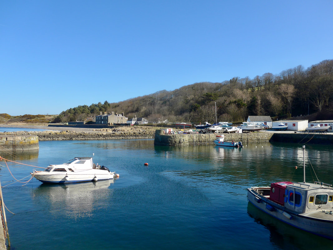
Mallaig Harbour & Morar Station
Picture
Elevation of the Walk
The elevation of the walk was not a major concern. The first high point is a climb on the road up to the area around the hamlet of Bracara. The road meanders, rises and falls until after Swordland where we tackled the rise up and over the mountain pass to the settlement of Tarbet. There was a bit of rough walking from Tarbet through to Kylesmorar and on to our preferred camping spot below Creag Chruachain, a remote and craggy area on the shores of the loch. Once beyond this point the area is incredibly isolated. There are only abandoned settlements and the potential sanctuary of Sourlie's Bothy at the head of the loch. It is  a full day's walking through a trackless wilderness.  
PictureIslands of Loch Morar
Arriving at Mallaig, with time to spare before the train back to Morar, there was opportunity for coffee and cake; a last taste of the luxuries of civilisation for a couple of days. Ten past ten train, we traveled back to Morar and from there the walking adventure started.

On a small single track road that follows the northern shoreline of Loch Morar, there are lovely views to be had of the loch itself and the small group of islands that sit at the western end. Known simply as the islands of Loch Morar, they include Eilean Bàn (White Island), Eilean a' Phidhir, An t-Eilean Meadhoin and Eilean nam Breac.

PictureTor na Ba & Loch Morar Islands
While not routinely inhabited, over the years the islands have provided succor and sanctuary to various people either on the run or who wanted to be hidden for some reason or other. For example, after Culloden, the 11th Lord Lovat of Clan Fraser (known as 'The Fox')  was said to have hidden on Eilean Bàn before his capture by Royalists. At that time, the Morar area was not his main fiefdom, the lands of Clan Fraser being around Inverness. He was literally on the run. Lord Lovat was subsequently captured, arraigned before the House of Lords in England, tried for treason and became the last person in Great Britain to be executed by beheading (1747). His lands subsequently forfeited, it was his son, General Simon Fraser, who subsequently purchased the North Morar Estate (1768) to try and recover the family's fortune. The estate was sold by the family in 1995 to cover inheritance tax. 

The island was also used as a hideaway for Roman Catholic priests and hosted a forbidden theological school for a brief period during the long years that Catholicism was banned in Scotland. The religion was banned for almost three hundred years from the time of the Scottish Reformation (1560) until the passing of the Roman Catholic Relief Act in 1829. The school, known as 'The Clandestine Seminary', was the first Roman Catholic Seminary in Great Britain. It was set up in 1714 on Eilean Bàn, but was closed following the 1715 rebellion. Following the later rebellion in 1745, the college building was burned down by the Duke of Cumberland in 1746. After 1716, the college moved to Scalan on the Braes of Glenlivet where it continued in operation until 1799. Both locations trained what came to be known as 'heather priests', who operated clandestinely in the highlands until the passing of the 1793 Catholic Relief Act which repealed many of the anti-Catholic laws.
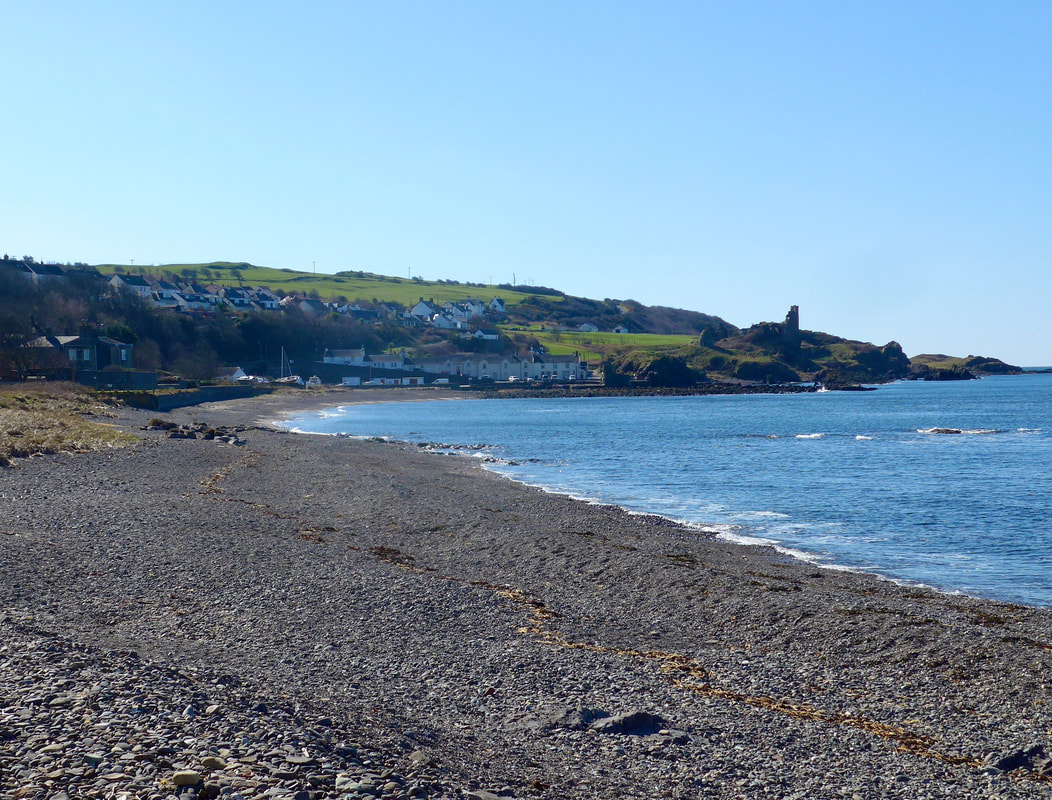
PictureRubha Ban & Sgur Liath
As you go along on Loch Morar, you are in the lands historically ruled by the MacDonells of Lundie, a cadet branch of Clan MacDonell of Glengarry, which was itself an affiliate of the powerful Clan Donald, Lords of the Isles. Many of the MacDonald cadet branches in this area were descendants of Somerled, descended from a noble Gaelic family, albeit his mother was of Norse descent. The Lundie line was started by Allan MacDonell, 1st of Lundie, son of the 6th Clan Chief of Glengarry but was actually granted his lands (1571) from his brother, Angus, 7th Clan Chief. Clan Glengarry ruled from Invergarry Castle in the Great Glen, the castle perched on a rocky pinnacle known as 'The Raven's Rock'.

Both Donald 6th and his son, Donald 7th Laird of Lundie fought for the Bonny Prince in the 1745 rebellion but surprisingly did not forfeit the estate. In later years, Donald the 7th, fell on hard times following financial changes in his status which resulted in him becoming a tenant on his own lands. He finally lost his house and lands in 1784, following which he lived a kind of itinerant existence, reliant on friends and family for financial support. The changes were occasioned by Marjory, wife of Duncan MacDonell, 14th of Glengarry in an attempt to improve her clan's financial position. Eventually, in distress and poverty, Donald 7th Laird of Lundie, assisted by his friends and supporters, emigrated to Canada where he died in 1805. 
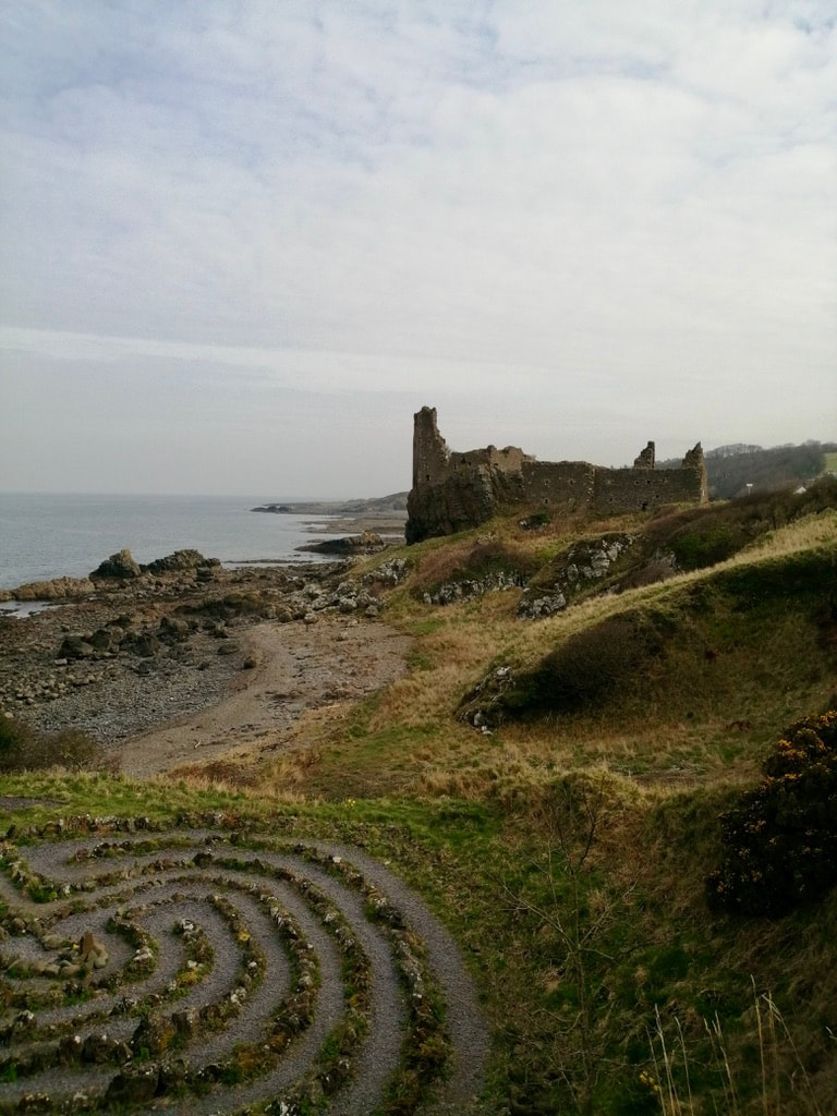
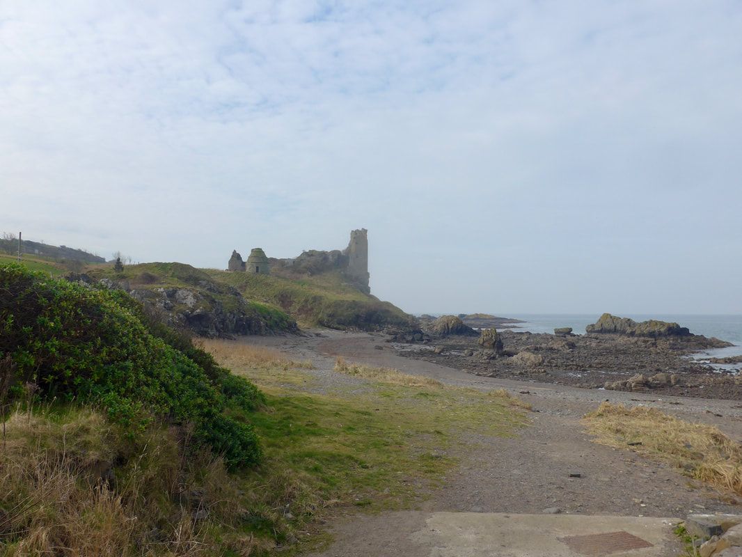
PictureChurch of Our Lady of Perpetual Succour and St Cumin, Loch Morar
The small, single track road leads initially to the small communities of Bracora and Bracorina. At Bracorina the public road ends and you move onto rougher walking. All of the small hamlets that exist in the area today are the remnants of the small crofting communities that populated the northern shore prior to the 1715 and 1745 rebellions.

The local populations, belonging to clans that were staunch Jacobites and Catholics, paid a bitter price after Culloden. As well, the area was ravaged by the forced resettlement policies of the Highland Clearances when people were moved off the land and sheep were moved on.

There are still some stone remains from the houses of this period and, further up the road from Bracorina, are the remains of Inverbeg Chapel which served the local Catholic population. The chapel was built by the locals in 1780, replacing the island chapel and served the community until 1836.  The current church was built in 1889 by the Lovat Family. It was built from grey basalt stone quarried at the nearby Kinlochmorar which sits at the head of Loch Morar, just below Gleann an Lochain Eanaiche (Glen of the Little Boggy Loch). The inside of the church is lovely, the wooden ceiling built to resemble an upturned boat. There are also interesting stained glass windows, one dedicated to the Irish Saint Cumin.
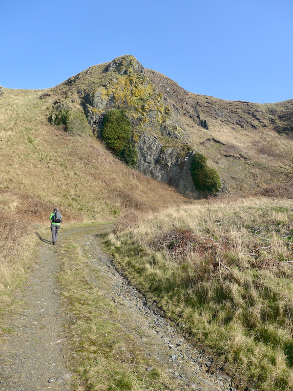
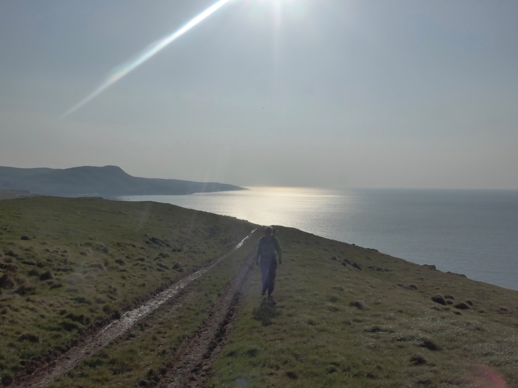
PicturePier on Loch Morar
Loch Morar is the deepest loch in Scotland (1,017 feet) and is a place of great beauty and tranquility. On the day it was very still, bathed in sunshine, the glassy waters reflecting the sublime beauty of the islands, the trees on the shoreline and the deep blue sky.

It was a very warm day. Our first day with a full camping rucksack for some time, it was hard walking in the heat. Even the weight of our leather, German-made boots seemed to slow us down.

Despite being so close to the water, there was very little breeze to help us cool down. The midgies and the cleggs were out in force and were a constant nuisance. They produced a weird kind of walking pattern on us of 'walk, swipe, slap and scratch, repeat'! Along the northern shore of Loch Morar we stopped a few times to sit on the banks or on the stones that lined the shore. We drank lots of water, re-filling the bottles numerous times either from the loch, or from a burn when we could find one with water in it.

Shores of Loch Morar
Picture
Picture
PictureHill Pass to Tarbet
When we started back after one of our rests, we were passed by a fairly large group of walkers who were walking at pace, hoping to reach Tarbet on Loch Nevis, to catch the last ferry back to Mallaig. With only small day packs to carry, they were walking much faster than us and soon disappeared into the distance.

After Swordland, we turned up in to the hill pass that leads to Tarbet. While uphill and in the heat, it was not too hard a struggle and quicker than we expected. Soon, we were stood on the hilltop looking down to the small harbour on Loch Nevis where we could see the laggards in the walking party running the last few hundred yards to catch the boat.

We passed a few houses and a restored church which now serves as an outdoor centre / bothy. I believe it was originally known as 'Star of the Sea Chapel'.  The village currently has permanent population of between one and six! There is no road access, only walking in or taking a boat from Mallaig. It was once a busy, seasonal fishing port and an important transport hub for the far flung local populations with the possibility of portage down to Loch Morar. In a contrast to today, there would have been hundreds of people crowding on to the small harbour area, unloading fresh herring for smoking and packing, shouting and jostling, laughing and crying. 

PictureCaution! Landslide
From the hill above Tarbet (Druim Chuilinn), there is a rough hillside walk to the small settlement of Kylesmorar. Our first encounter with the open cliff face of the hill was not reassuring as a notice warned us of a recent landslide. To continue would be at our own risk. The consequences of the landslide were obvious from the displaced earth and rock to the scaffolding lying on the hillside itself.

As we pondered and cogitated, a communications worker came down the hillside, just slightly further on where we stood. He explained he was working there to install the Wi-Fi connection for luxury holiday cottages at nearby Kylesmorar. He advised us there was a small, faint path and that he used it to come and go from the settlement. We decided what was safe for him was safe for us and decided to take a chance with the onward route.

PictureHillside path, Loch Nevis
As we progressed, on the faint path that went round the hillside and down to the approaches to the small group of houses at Kylesmorar, we did do with trepidation.

The views along the loch were lovely, the banks verdant green, the sky blue and the waters reflecting both the blue and green in different places. 

At the settlement, the houses sit back from the shore just where the loch thins to its narrowest point, with Kylesknoydart sitting on the opposite shore, almost an extension of Kylesmorar. If you shouted I am sure they would hear you on the other shore. Idyllic would sum it up. A broad green plain sitting in front of the houses and running down to the shore. It is like being in a bowl, all around the hills and mountains of Knoydart and Morar tower over you. A herd of wild red deer, mixed in with the flock of sheep, graze contentedly on the grass. There is only the buzzing of insects and the flap of their wings to disturb the peace. It is a place of great rugged beauty, quiet and reflecting an air of solitude, but in winter I would imagine it to be wild place.

Historically a crofting and fishing community, the Kylesmorar settlement had its heyday in the 19th C., when with the nearby Tarbet it served as a hub for the herring fishery. Changing economic and political conditions, especially following Culloden, led to the almost complete abandonment of the area, with many people cleared off the land and subsequently emigrating. The area is now mostly bothies and summer lets. The crofters are gone and with them the practice of using some of the low lying ground both here and further along the loch for summer grazing. However, you can still see why people made and still make the effort to come here. There were a couple of people around, but they did not speak to us, only viewed us it seemed with suspicion and an almost sullen silence, their discontent at our presence in their little bit of heaven clear to see on their faces.

Picture
Kylesmorar
PictureLooking to the lochhead


The route we had planned went along the front of the settlement, beyond the houses and out past an old sheepfold, beyond which there was no obvious path to take us around the headland of Creag Chruchain. We stumbled on along the shore and through the thick vegetation, at times forcing our way through the tall bracken, rounding the headland, looking out for a suitable pitch on which to wild camp. There was little choice, much of the shore under a thick blanket of bramble, nettles and thick ferns. But we kept going, finally reaching a small headland that looked over to Kylesknoydart on the opposite shore, and along the loch to the hill top of Sgurr Sgeithe (793Ms), which we knew we would be climbing in a day or two. The presence of extensive, dead bog cotton suggested that the headland was usually wet and boggy. The recent bout of very hot weather, however, had dried out the moss such that it provided a nice, springy mattress on which to lay our weary bodies. After stamping down the vegetation, we had what appeared to be a pretty pitch.
PictureView to Kylesknoydart
It was a glorious pitch, until the sun went down and the midgies came out. Millions of them, in huge thick clouds that attacked ferociously and soon drove us into the tent. Even inside the tent, however, there were wild hordes of them and we spent about half an hour trying to rid ourselves of their presence. Later, in the early hours of the morning Joanna, thinking the serried battalions of insects had retreated, ventured outside only to find they were lying in wait for her and she was again bitten all over. We spent the rest of the night in restless sleep, sensitive to the loud beat of the midgie's wing inside the tent. By the next morning, covered in bites and tempted to endless scratching, we ran without stopping for breakfast, rather than linger any longer on our idyllic pitch. 

It was a day of great beauty and interest and, despite the insects that populate the damp places and the extreme heat of the day, I will return some day on a shorter excursion to take in more of the wonderful extravaganza and to soak up the atmosphere of silent solitude. Sometimes when you are on an adventure, it is the cutting edge of experience that makes the day memorable. Many of our more straightforward days, walking at sea level on a flat beach or following a road along the coast, I have already forgotten. For long, I will remember the day I walked to Kylesmorar.
0 Comments

Bunacaimb to Mallaig - 8 Miles

14/6/2023

0 Comments

 
Picture
Route Map
Today's walk is a fairly short one. It is a mixture of shoreline and road walking for the latter part of the walk. The route is on the road as the section of the coast between Morar and Mallaig is not accessible at high tide. The walk finishes looking over to Knoydart. From Mallaig, there are two ways into Knoydart; either take the ferry from Mallaig, or walk in via Sourlie's Bothy which takes a minimum of two days via fairly strenuous routes. As we try not to take ferries, we need to find an alternative route. More about the options are at the end of this entry. 
Picture
Elevation of the Walk
PictureBunacaimb
The elevation of the walk is fairly straightforward. The first part of the walk from Bunacaimb to Morar is at or close to sea level following the shore line and visiting a couple of lovely white sand beaches. Coming out of Morar, back on the road, the route climbs to go through the pass between Beoraidbeg Hill and Bourblach Hill, topping out at one hundred and seventy feet. From the top it then drops down and into Mallaig at sea level. 

PicturePara-gliders
With the tide high we were unable to go round the coastal headland known as Maol na Readhra (The Bare Headland). Taking to the road just outside our campsite at Bunacaimb we walked round to the next beach and bay, Portnaluchaig. By the time we arrived after a hold up at the campsite, the tide was on the turn and we were treated to a fine, white sandy beach.

A coastal hamlet about two miles north of Arisaig, there are fine views of the Small Isles of Eigg, Rum and Muck from the lovely beach at Portnaluchaig. On a fine, bright day it was just so beautiful we could not understand why it was so deserted. High above us, two para-gliders soared across the blue skies, enjoying we imagined, wonderful views over the Inner and Outer Hebrides. Despite the retreating tide, we had to go slightly inland a couple of times to go over headlands, which resulted in us at times going sideways through thick, jagged gorse and bracken; very itchy for the one of us who had chosen to wear shorts.

PictureView to The Small Isles


PictureView to An Sgurr on Eigg
As we move north from the Back of Keppoch, although we continue to be in MacDonald lands, the minor or cadet branch changes from MacDonald of Keppoch to the Lordship of MacDonald of Morar. Historically, the lands were the fiefdom of Clan MacRory, a fierce Jacobite supporting clan who ruled in the 12 - 14th Cs. The MacDonells (Morar & Glengarry) took over the lands in 1539 and in 1726 a MacDonald cadet branch received a Crown Charter for lands in Morar. Like the MacRorys, these MacDonalds were enthusiastic Catholics, supportive of the Jacobite Cause. After the Battle of Culloden, a terrible price was paid by the highlands clans. Many changes followed, and with clan chiefs becoming landowners, they started to accrue debts until eventually in 1768 the North Morar section of the estate was sold. Over subsequent years, further lands in Morar and on the isles of Eigg were sold.

The man known as the last laird of Morar, Eneas Ranald MacDonell, sold the last of the estate in the 19th C., only to subsequently buy back some 70 acres of the estate, centered around about Traigh and Camusdarroch and where he built the fine Camusdarroch Lodge, which is now part of a modern camp site. Coming more up to date, the lovely white, sandy beaches in the local area were part of the location for the iconic film, 'Local Hero'.

Picture
Traighe to The Small Isles
With tide well out now, we were able to stay on the beach up until we joined the River Morar, which discharges into Morar Bay roughly on a line with the village of Morar. This stretch of beach is nothing short of marvelous, with lovely colour and texture and a wonderful sense of solitude and peace.

Unsure if we could wade the river we stayed down on the shore until reaching the banks of the river where we found to our dismay it was far too deep and strong for crossing by foot. With reluctance, we left the shoreline behind us and walked up the river to the bridge which carries the main A830 up to Mallaig. The rest of the walk was on the road and for that stretch the camera stayed in the rucksack. The distance from when you are back on the road to Mallaig is about four and a halve miles. At Mallaig we had a look around, specifically looking for somewhere we could park the campervan for the seven or eight days we would be walking into and around Knoydart and out to Glenelg. After finding a suitable place, we headed for lunch, which was not easy task as all the cafes and restaurants were full, the village of Mallaig heaving with tourists enjoying the warm sunshine. Eventually, fed and watered, we headed for the railway station where we caught a train back to Arisaig and a final walk of 2.5 miles back to the campsite. 

The Onward Journey
As we did not want to take a ferry on to Knoydart, we needed to find an alternative route. The usual walking route is via the Cape Wrath Trail which includes a walk into and an overnight at Sourlie's Bothy, the walk in via Glen Dessary. As this is not a coastal route, we did not consider it. 

An alternative and possibly more problematic route (and the one used by John Merrill on his seminal walk round the coast of GB), owing to tide times and the need for a bit of rock climbing,  is to drop back to Morar, walk along Loch Morar to South Tarbet Bay, cross over a low hill pass to Tarbet and on to Loch Nevis, walk along the shore for a couple of miles and wild camp just after the hamlet of Kylesmorar. This positions you for the final stretch to Sourlie's Bothy the next day, a short distance of six miles, but over very challenging conditions and terrain and for which you need to allow six to eight hours to complete and for the Tidal Gods to be with you.

From Kylesmorar there is not formal footpath and you need to make your route as you go along. Both the high and the low ground are problematic owing to the waters of the loch and the terrain on top of the hills.  Our plan is to leave the van behind for a week and to walk into Knoydart via Sourlie's and walk what we can of the coast on Knoydart. We will exit via Glen Barrisdale and over to Kinlochhourn, from where we will walk via Glen Arnisdale to Corran, from there to Glenelg and then round the shore to Shiel Bridge, from  where we will take the local bus back to Fort William, stay in a B&B for the night, and the next day return to Mallaig to pick up the van and return to Ardelve, above Shiel Bridge from where we will resume walking. I'm tired just thinking about it. 
0 Comments

Bunacaimb to Port Nam Murrach        16 Miles

13/6/2023

0 Comments

 
Picture
Route Map
To complete the coastal route on the south side of the Arisaig  peninsula, we were advised locally that the tide would need to be in our favour. Even then, there are sections where the cliffs drop straight down into the water from some of the headlands which cannot be passed on the shore and there is no guarantee of a route up to the top of the cliffs. There is also no formal footpath over the hilltop on this section. Therefore, we concocted a there and back route on the north side that was possible and not dependent on the tide so much, but which let us reach the western edge of the peninsula. 

Picture
Elevation of the Walk
What elevation there is in the walk are primarily bumps on the road. On the section from Rhumach to Port nam Murrach there is a hill climb up and over the hills and down the sand dunes, with the order reversed coming back out. Other than that it is mainly flat.

PictureBanks of Allt Cam Carach
The walk started from the beach at our campsite which was only a few hundred yards from our campervan. Following the sands until just before a small bridge over a small mountain burn (Alt Cam Carach), we headed for a small road back to the coast in the area known as Back of Keppoch (more about the name below). The Alt Cam Carach is a small mountain burn that rises from the western end of Loch Morar, high in the hills above Arisaig, flowing across the lovely Keppoch Moss. It discharges into the Sound of Sleat at the Back of Keppoch.

PictureBack of Keppoch
The Back of Keppoch was traditionally a small crofting community, peopled by members of Clan MacDonald of Keppoch, a branch clan of Clan Donald, Lords of the Isles. The clan traditionally ruled from their seat at Castle Keppoch, close to Spean Bridge (hence the name, Back of Keppoch, which lies far to the west of the castle). Hundreds of years ago, the life was a subsistence living at best, involving small scale farming, fishing and the collection of seaweed or kelp.

The history of the MacDonalds of Keppoch is long and bloody one, including an episode where a MacDonald tacksman (Alexander Macdonald of Inverlair), and his six sons, were known to have attacked and killed Alexander, 12th Laird of Keppoch and his brother, Ranald at a reception at the mansion of Insch. The famous Gaelic war poet John MacDonald, known by the sobriquet of Iain Lom, unsuccessfully sought justice for them from Lord MacDonell of Glengarry. The perpetrators were eventually captured by men sent by the MacDonald of Sleat. It is said they were  were beheaded by Iain Lom (John MacDonald using the same sword that was used to kill Alexander MacDonald and their heads, duly washed, delivered to Lord MacDonell of Glengarry, who had refused the clan justice. The well where the heads were washed is known as 'Tobar nan ceann', the well of heads.

The clan were involved in many of the wider battles and skirmishes in Scottish history and are reputed to have struck the first blows against the forces of the Crown in the opening conflict of the 1745 Jacobite Rebellion that eventually led to the Battle of Culloden. That early encounter is now known as the Highfield Skirmish. A small force of about eleven MacDonald of Keppoch clansmen ambushed two companies of Royal Scots regiment. Using subterfuge, the small force overcame superior numbers and provided the first victory and the first prisoners of war for the Jacobites.

PictureLoch nan Ceall to An Sgurr
Turning on to the small road that runs to Back of Keppoch, we followed it to the road end on the coast. From this perspective on the shoreline, the views out across the Sound of Sleat to the Small Isles is nothing short of glorious. The slight tilt of the distinctive An Agurr on Eigg, (at 393 M, the highest point on Eigg) gives it a resemblance to a witches hat.

An Sgurr is made of Pitchstone, which is a volcanic rock similar to obsidian, but with a higher water content. The rock originated from a volcanic eruption 58 million years ago (Paleocene Era) on the Isle of Skye. Skye lies about fifty kilometres north of Arisaig. Pitchstone is a harder rock than the surrounding geology and while other rock around it has been worn away over the last 56 million years, An Sgurr has proven to be much more durable. 

PictureWhere is the path?
We were amused to find that we were sharing the beach with a herd of cows that were lying on the beach enjoying the rays of the sun. The evidence of their presence could be seen earlier on the trail which is little more than a cow track. Walking at the back of the shoreline, we were walking through low hanging branches and high bracken. Despite the recent bout of heat, the path was still very wet and muddy and, no doubt attracted by the water and the heat, the insects were about. It was tricky walking at times but persevering we reached the other side of the headland and on to a rocky beach in places with old, slimy seaweed covering the rocks making walking hazardous. Reaching a track going in to the village of Arisaig, we headed for the Sound Bites cafe, where I had left my hat yesterday. Of course, it would be bad manners to visit the cafe and not partake of the pleasures on offer. Pot of tea and egg and black pudding rolls later, we were back on the trail.

Shoreline to Arisaig
After our unnecessary break, we continued out of Arisaig on a small single track road heading to Morroch and further on to Morroch Point. The road continues on round the southern shore of Loch nan Ceall until just beyond the small hamlet of Rhumach, ending by a boathouse and where there is a small parking area. From here, a track goes over the hills to the west, bypassing Rhu farm and on towards Port nam Murrach. 

On the way you pass just above the location of a WWII memorial to Czech and Slovak soldiers who trained here with the Special Operations Executive (SOE) during war. The memorial is in the form of a fallen parachute, reflective of the type of work the troops undertook. Many of the men and woman who served in this way died overseas, their bodies never recovered. In view of this, the memorial has status as an official war grave. The sculpture was designed by the famous Czech sculptor Josef Vajce.
Loch nan Ceall to the Small Isles
If you have never been here, coming up over the hill, it is a complete surprise to find two beautiful, white sandy beaches at Port nam Murrach. The waters of the two small bays are crystal clear and the sand almost pure white, with only a hint of yellow discernible. While I was able to resist to the allure of the old briny, I cannot say the same for my partner who is a bit of 'water babe' and enjoyed an extended dip in the cool waters of not one but both bays. Resting on the sands, I was content with the views out to the Small Isles and the quiet and tranquility of the isolated and secluded area which we had all to ourselves. The sun shone, the birds sang, and all was well with the world.

Afterwards, we reversed our journey and walked back to Arisaig. It was still very hot and the walk distinctly uncomfortable in the extreme heat. Back in the village, we were revived by cold iced lollies and equally cold soft drinks. It had been a long day's walking, but with glorious views from start to finish had certainly been worth it.

0 Comments
<<Previous

    Author

    Recently retired from a career in social work after previously working in the army and the catering industry. Educated at senior secondary school, Strathclyde University (Politics & Psychology) and Dundee University (Social Work).  I am looking forward to exploring and learning more about the places and communities that populate the coastal regions.

    Archives

    May 2024
    April 2024
    May 2023
    March 2023
    November 2022
    September 2022
    August 2022
    June 2022
    May 2022
    March 2022
    January 2022
    November 2021
    August 2021
    June 2021
    September 2020
    August 2020
    July 2020
    December 2019
    June 2019
    May 2019
    April 2019
    August 2018
    July 2018
    June 2018
    May 2018
    April 2018
    March 2018
    October 2017
    August 2017
    July 2017
    June 2017
    May 2017
    April 2017
    October 2016
    September 2016
    July 2016
    May 2016
    April 2016
    March 2016
    October 2015
    July 2015
    June 2015
    May 2015
    April 2015
    March 2015
    October 2014
    September 2014

    Categories

    All

    RSS Feed

Powered by Create your own unique website with customizable templates.