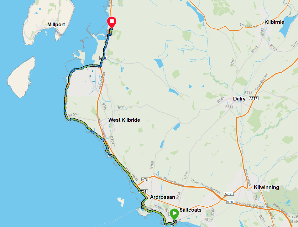
Route Map
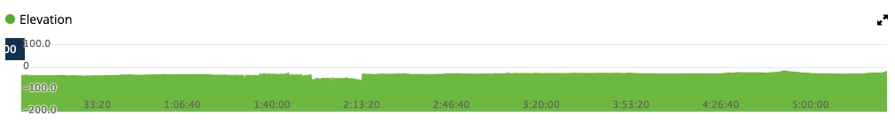
Elevation
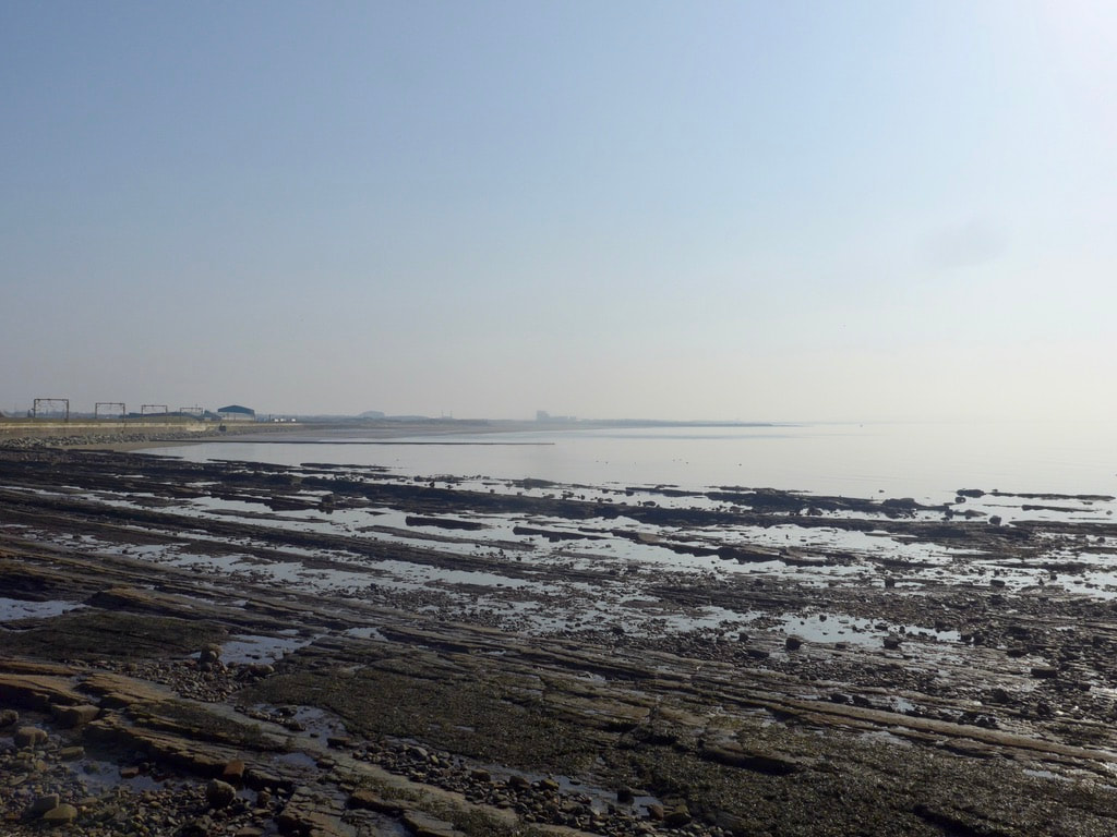
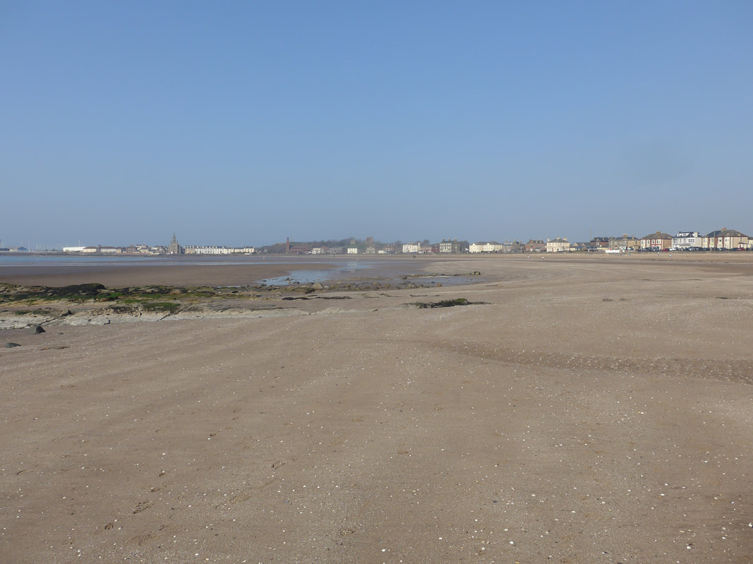
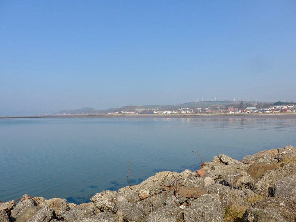
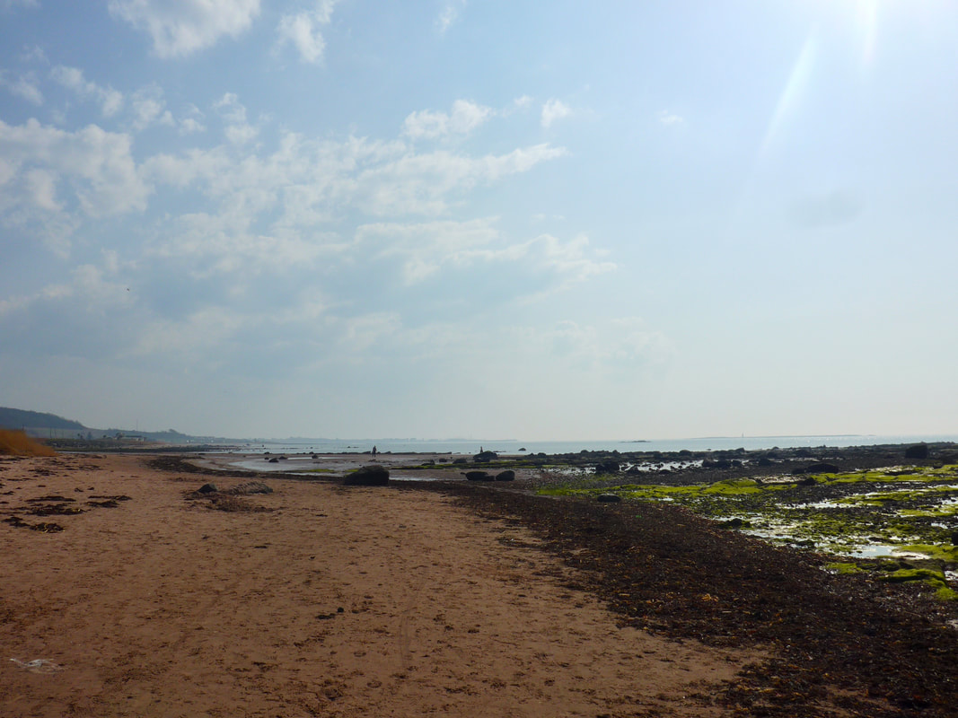
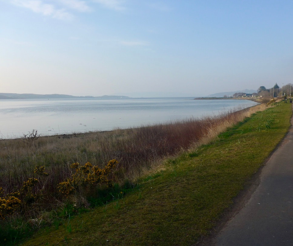
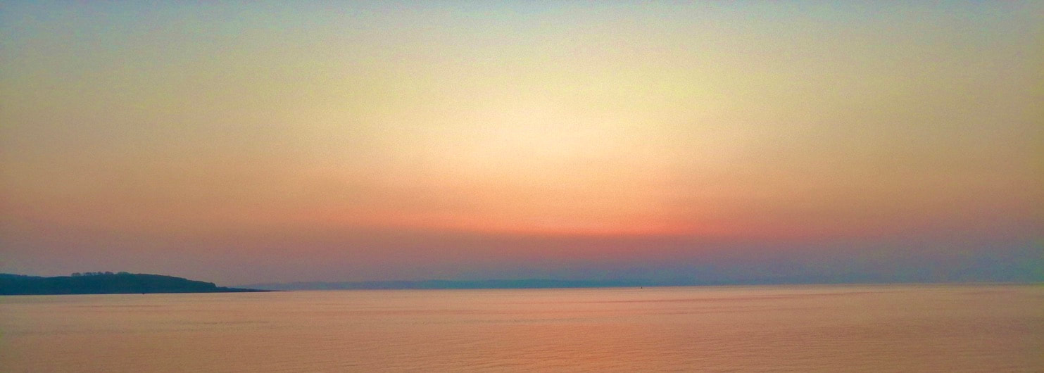
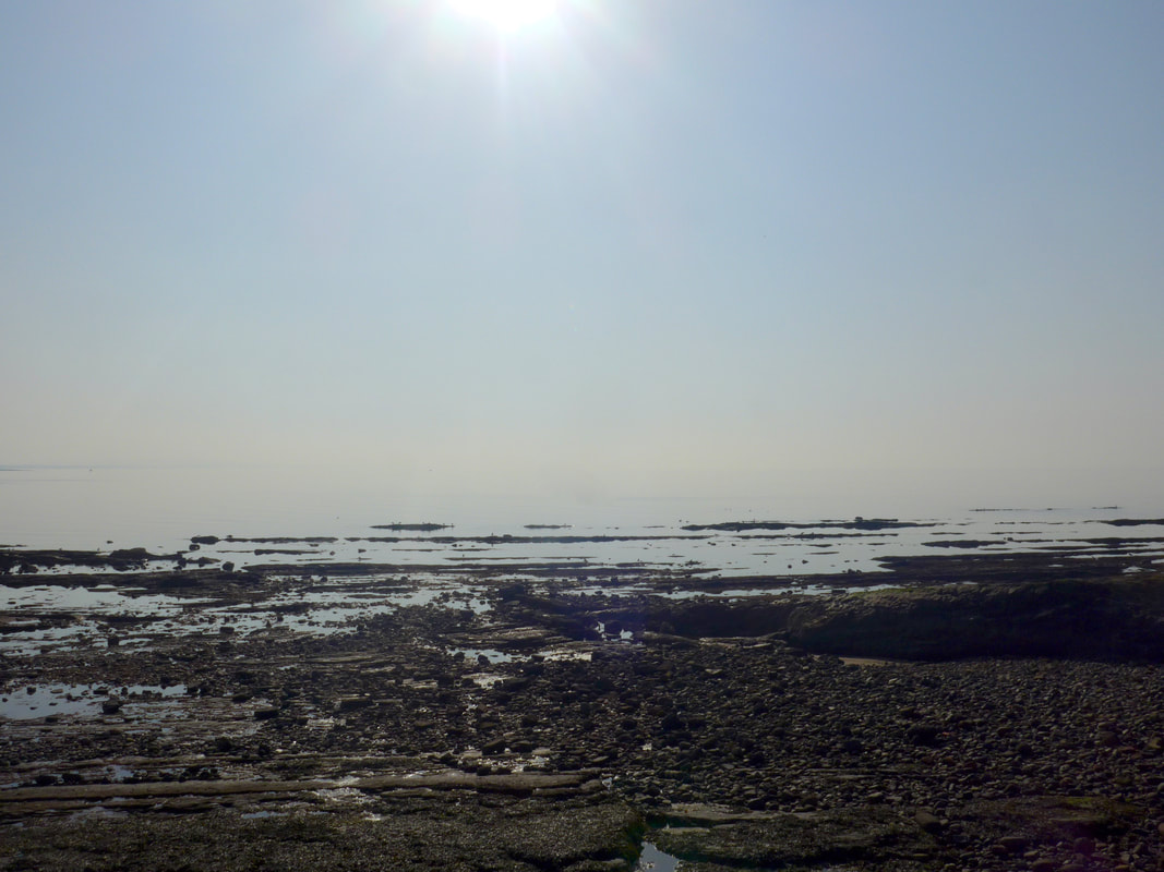 Shoreline by Saltcoats Harbour
 We had a fairly late start today as we needed to catch the train from Largs back to Salcoats Station to start the walk. The weather forecast was good, with the chance that it might even be too hot for comfortable walking. When we started there was a sea haar offshore that initially hid the seascape from us but it soon cleared. In the event, we walked in t-shirts for most of the day and at one point in the afternoon the temperature settled at around about twenty-eight degrees C. Now that is hot for Scotland in March!
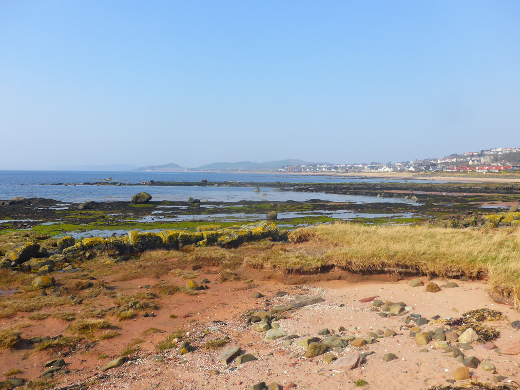
The plan for the day was to stick close to the coast, walking on the shore when we could. In this endeavour we were assisted by the location of the A78 road, which runs close to the shore on the sections which was helpful at times when it was too rocky to walk comfortably. We were walking light with only day packs, with plans to eat-in somewhere on the route, which we did on more than one occasion.
The plan for the day was to stick close to the coast, walking on the shore when we could. In this endeavour we were assisted by the location of the A78 road, which runs close to the shore on the sections which was helpful at times when it was too rocky to walk comfortably. We were walking light with only day packs, with plans to eat-in somewhere on the route, which we did on more than one occasion.
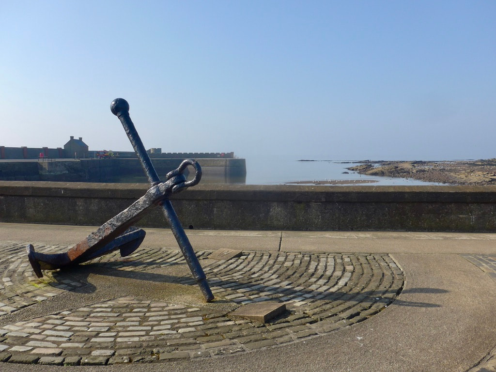 South to Stevenston
 It is a short stroll from Saltcoats Railway Station to take up the shore by the harbor. The route we took was Vernon St., Nineyard Street, Finlay's Brae. The story behind the name Nineyard Street is interesting. The Saltcoats Harbour website notes that in 1495, the Earl of Glencairn granted nine fishermen a 999-year lease on land known as the 'Nine Yards'. In return, the fishermen had to agree that every spring they would move his furniture and other belongings via the creek at Saltcoats to his city home Finlayston, Glasgow and bring it back in the autumn when the family returned to Ayrshire.
The home of the Earl of Glencairn was at Kerelaw Castle. Built circa 1180 / 90s, the castle was originally in the hands of Stephen Lockhart, after whom the town of Stevenston, next door to Saltcoats, takes its name. It passed through the hands of the Campbells of Loudon and the Cunninghams. It was while in the hands of the Cunninghams that a feud arose with the local Montgomerie family who sacked and burned the castle. In revenge, the Earl of Glencairn, of Nine Yards fame, noted above, returned the favour and burnt Englinton Castle in revenge. The castle was rebuilt in 1488, went through various other owners until in 1787, Kerelaw House (or Grange) was built nearby, after which Kerelaw Castle fell into ruin.
The home of the Earl of Glencairn was at Kerelaw Castle. Built circa 1180 / 90s, the castle was originally in the hands of Stephen Lockhart, after whom the town of Stevenston, next door to Saltcoats, takes its name. It passed through the hands of the Campbells of Loudon and the Cunninghams. It was while in the hands of the Cunninghams that a feud arose with the local Montgomerie family who sacked and burned the castle. In revenge, the Earl of Glencairn, of Nine Yards fame, noted above, returned the favour and burnt Englinton Castle in revenge. The castle was rebuilt in 1488, went through various other owners until in 1787, Kerelaw House (or Grange) was built nearby, after which Kerelaw Castle fell into ruin.
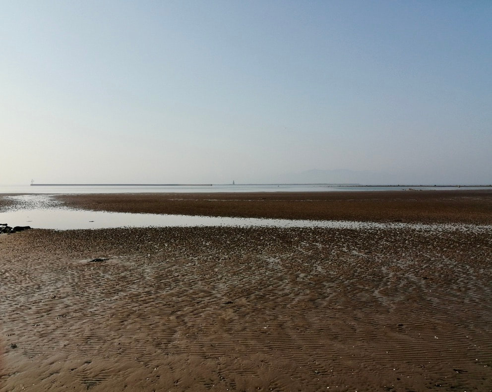
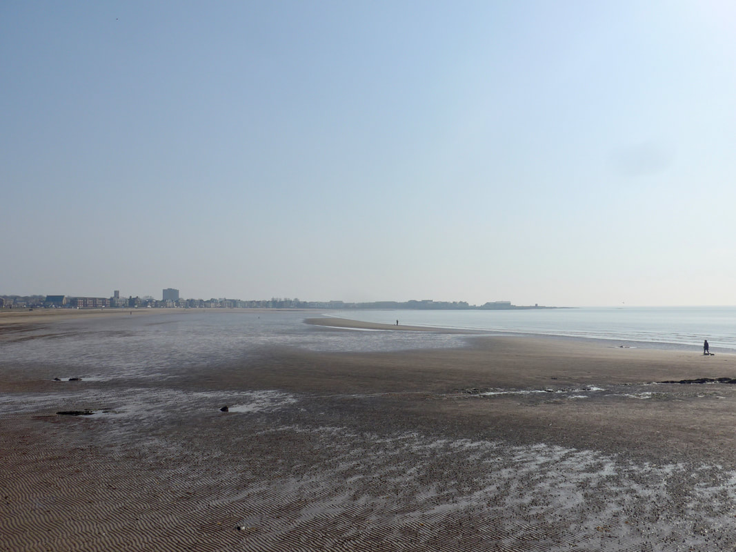
 Inner Nebbock to Stevenston
 The photograph to the left is from the Inner Nebbock, looking slightly south west over the gantries of the railway in the direction of Stevenston. Along this line of sight lies Ardeer. It is of interest because while now firmly a part of the mainland, in old maps it is shown as an island. Not only is the Ardeer area an island, on old maps there is another island shown lying off what would have been the tip of the Ardeer island. It is no longer visible, just as Ardeer is no longer an island. The reason for the changes is primarily thought to have been due to the shifting sands in the sand dune system that fronted both of the islands.
Also located in the Ardeer island area was the Stevenston Canal. In the 1700's (18th C) there were a number of coal mines operating in the area. They needed to take the coal to the coast for onward transfer to their customers. At that time there were tolls on the road they used which reduced the profit from the mining. To avoid the tolls the canal was built. It was not, by all accounts, a great structure. It did not, for example have any locks, nor was it of any great size, at best four feet deep and thirteen feet wide. The canal ceased operations some time in the 1830's. To the best of my knowledge there is little if anything remaining of the canal today.
Also located in the Ardeer island area was the Stevenston Canal. In the 1700's (18th C) there were a number of coal mines operating in the area. They needed to take the coal to the coast for onward transfer to their customers. At that time there were tolls on the road they used which reduced the profit from the mining. To avoid the tolls the canal was built. It was not, by all accounts, a great structure. It did not, for example have any locks, nor was it of any great size, at best four feet deep and thirteen feet wide. The canal ceased operations some time in the 1830's. To the best of my knowledge there is little if anything remaining of the canal today.
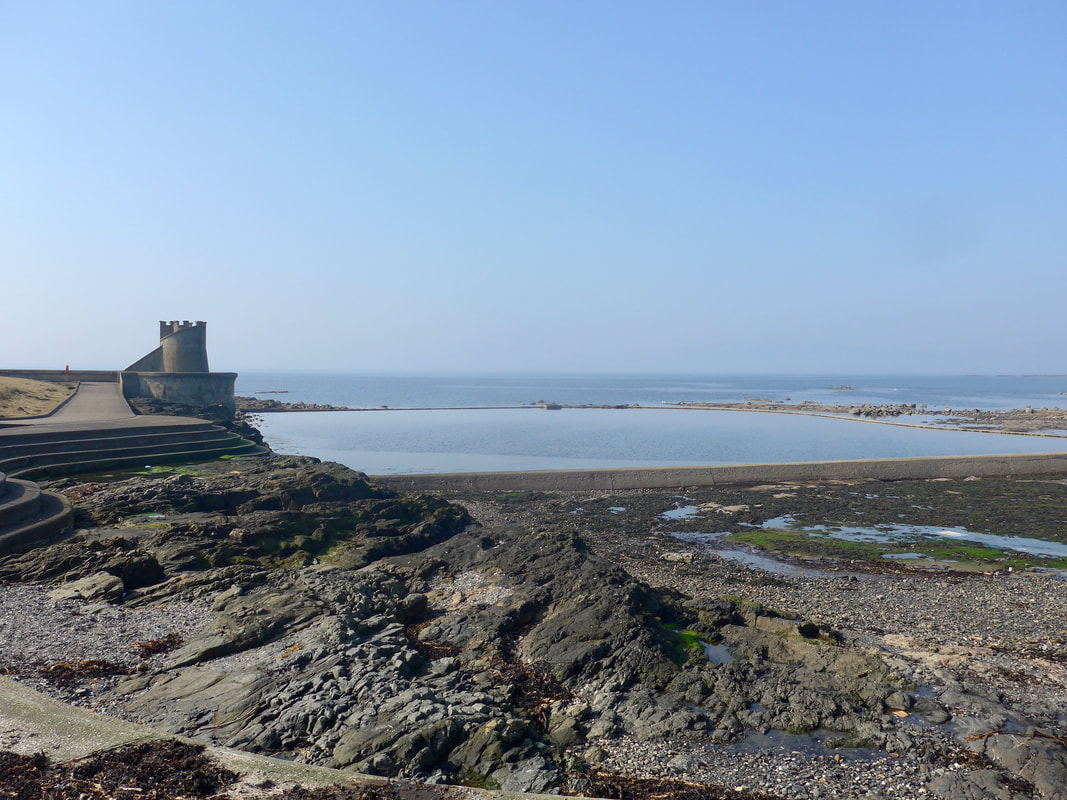
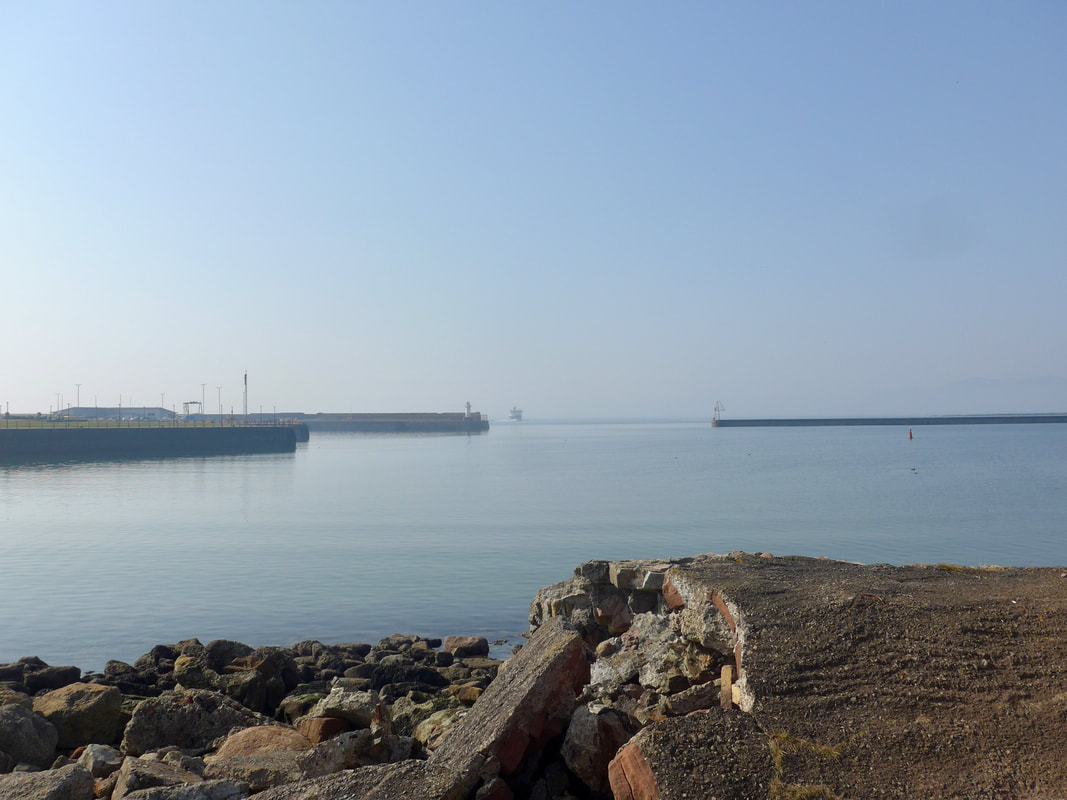
 Ardrossan Breakwater
 To the right of the harbour the Salcoats outdoor swimming pool continues to hold on to life, slowly deteriorating, dying from neglect. The pools were based around the location of the old saltpans that were here when the town was just a wee fishing village. I have wonderful memories swimming in there with my father and older brothers when we were nippers and on our annual holiday was at Saltcoats. I understand there may be plans afoot to try and restore the pools. In this era of wild swimming there might not be a better time.
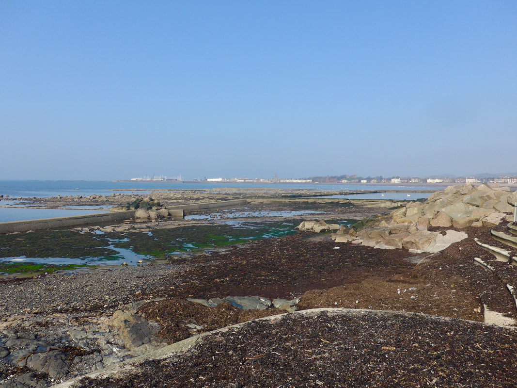
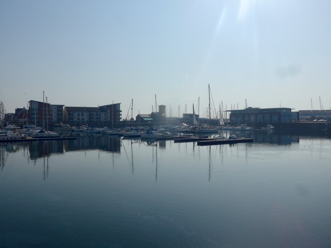
Crossing from Inner Nebbock to West Shore and down on to South Beach, it was a very pleasant walk across the sands to the town of Ardrossan. There were nice views from the harbour and marina out through the breakwater which sits off the marina, and on over the Firth of Clyde.
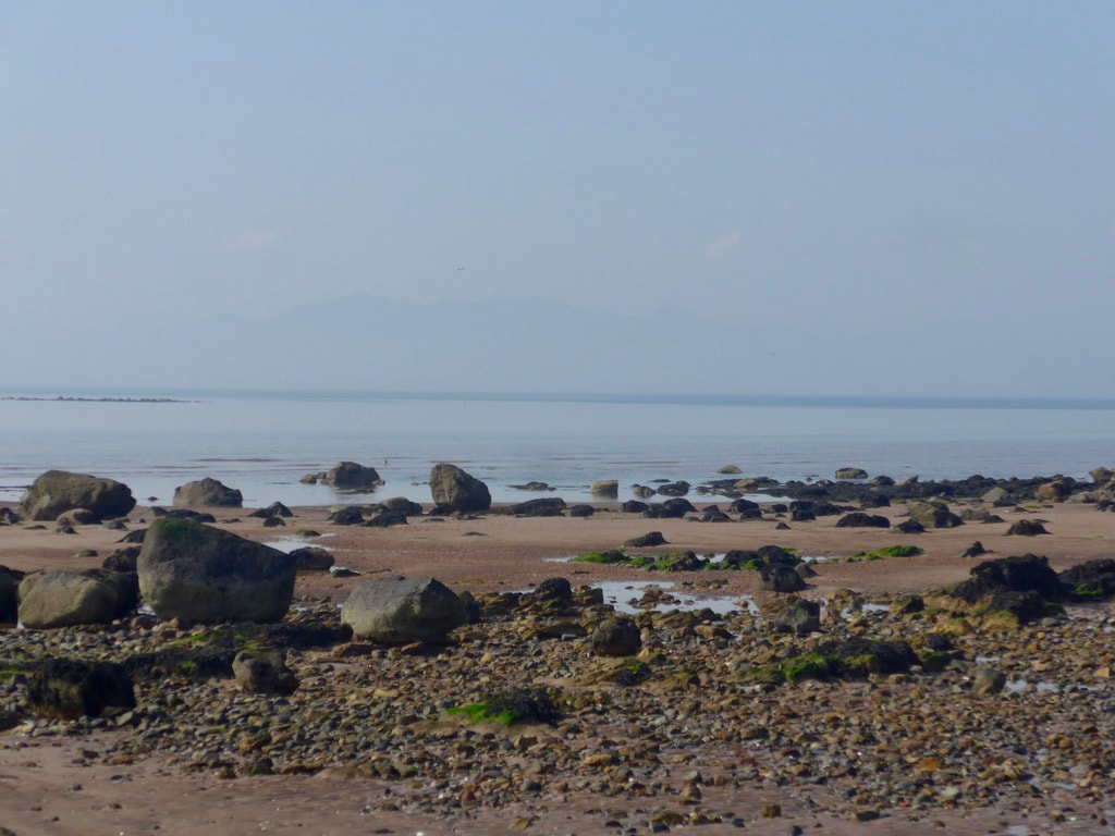
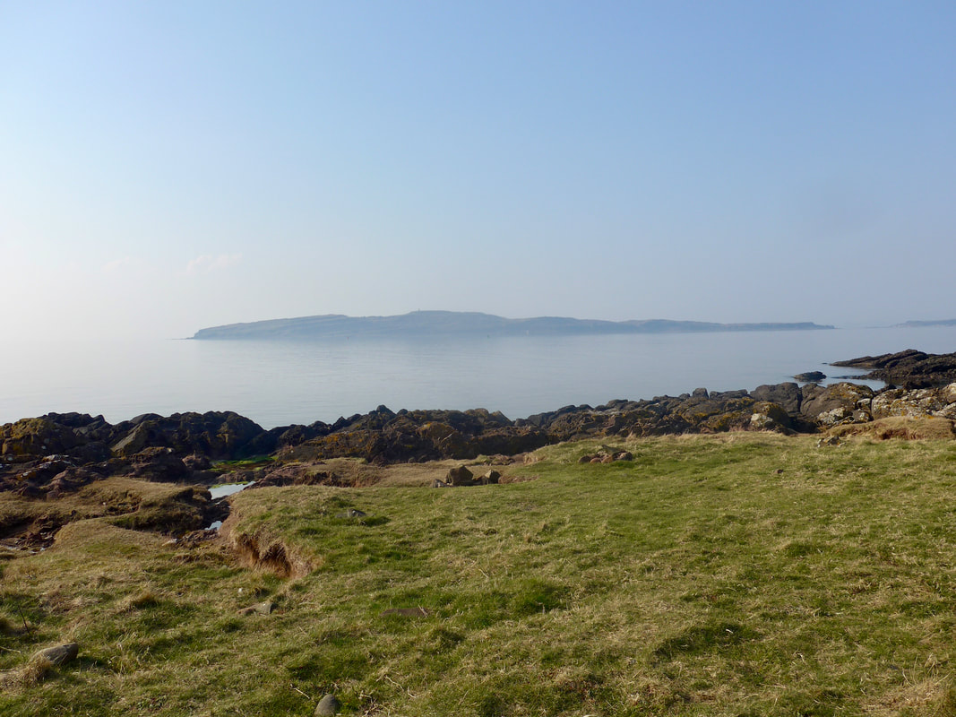
Lying just off the coast is the Isle of Arran. If you look through the mist on the photograph you can just see the outline of the 'Sleeping Warrior'. The warrior is actually the profile of the Arran Hills. The earliest known settlers on Arran, at least those for whom some evidence exists, were Neolithic settlers who lived there for the period 4,500 BC to 2,000 BC. Across the island there are standing stones, stone circles and cairns (burial sites), particularly on Machrie Moor.
Crossing from Inner Nebbock to West Shore and down on to South Beach, it was a very pleasant walk across the sands to the town of Ardrossan. There were nice views from the harbour and marina out through the breakwater which sits off the marina, and on over the Firth of Clyde.
Lying just off the coast is the Isle of Arran. If you look through the mist on the photograph you can just see the outline of the 'Sleeping Warrior'. The warrior is actually the profile of the Arran Hills. The earliest known settlers on Arran, at least those for whom some evidence exists, were Neolithic settlers who lived there for the period 4,500 BC to 2,000 BC. Across the island there are standing stones, stone circles and cairns (burial sites), particularly on Machrie Moor.
Saltcoats & Ardrossan
 View to Haupland Muir
 The view from the edge of the North Bay is out to the Rownside Hills, dominated by Ardrossan Windfarm on the braes of Haupland Muir. The windfarm consists of 15, 2MW turbines which are sixty metres in height and produce enough clean electricity for nearly 24,000 homes. The first 12 masts were fully commisioned in 2004, with another 3 added in 2009. The local community benefits froom the windfarms at a rate of £2,015 per installed MW. Owned by Ventient Energy, the company have applied for an extension to the planning consent to operate the farm for another ten years. If this is granted, in 2031 the community benefit increases by another 25%. Nice for the locals in these straitened times.
 By Seamill
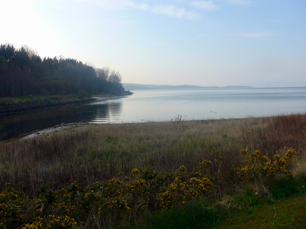
 After rounding the marina at Ardrossan, we dropped down on to the beach at North Bay and stayed there until just before Seamill. With the day warming and the sea harr clearing, it was a very pleasant walk by the breaking water line. There were lovely views out across the water to Arran and, just to the north, Little Cumbrae and the Isle of Bute. This area, including the north and south inches, are a haven for wildlife with numerous bird species populating the shoreline and the field margins of the arable land at the back of the shore. Just off-shore, seals can often be seen basking in the sun. Occasionally we would see a seal head bobbing about on the surface but they never fully showed theirselves to us.
 Ghostly Arran
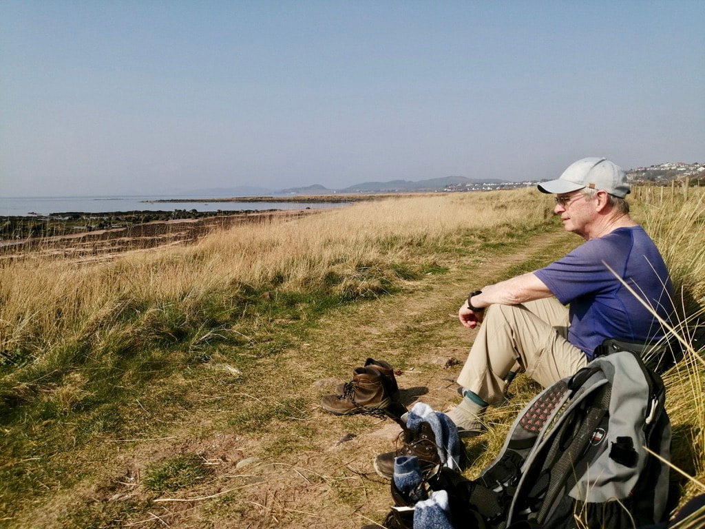
 Just before we reached Seamill we had our first stop of the day, sitting by the side of the path against a grassy hummock, enjoying the sunshine and listening to the silence grow.
Seamill is called after a mill of the same name, the remains of which lie just off the shore, up the line of the Kilbride Burn which you walk over as it crosses the beach. Dating from at least the 17th C., it was a grain watermill. Just above the remains of the mill is the lade or lochan that stored the water that was used to turn the waterwheel. In the late 19th C., Seamill was part of the fashion for hydropathic therapy which sprang up across the UK. The treatments included the taking of lots of water internally and externally. The Seamill Hydro hydropathic opened about 1880 and over time morphed into a hotel. The current hydro hotel still has a swimming pool and full gym setup.
Seamill is called after a mill of the same name, the remains of which lie just off the shore, up the line of the Kilbride Burn which you walk over as it crosses the beach. Dating from at least the 17th C., it was a grain watermill. Just above the remains of the mill is the lade or lochan that stored the water that was used to turn the waterwheel. In the late 19th C., Seamill was part of the fashion for hydropathic therapy which sprang up across the UK. The treatments included the taking of lots of water internally and externally. The Seamill Hydro hydropathic opened about 1880 and over time morphed into a hotel. The current hydro hotel still has a swimming pool and full gym setup.
Seamill to West Kilbride
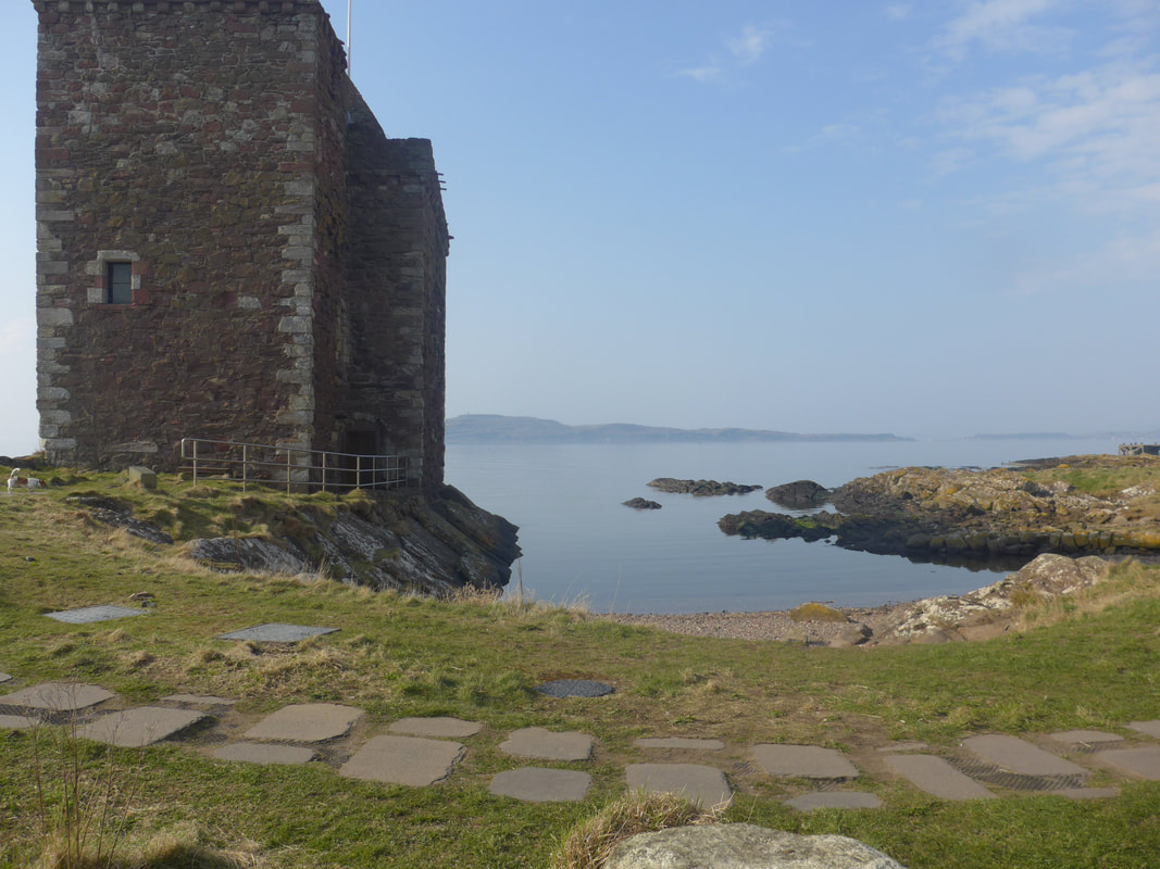
 Portencross Castle
 From Seamill our route continued along the shore, passing beneath the small town of West Kilbride. West Kilbride is an interesting place with a name for its arts and crafts shops. It is sometimes called the Craft Town after winning an award and its status as Scotland's first 'Craft Town'. While we did not visit today, we were back in a couple of days to purchase some wool for weaving and some pottery.
Just after passing the town we walked below the Kilbride Golf Club, which in its time has hosted a number of important Scottish championships. Established in 1893 as a nine-hole course, it was developed to conventional size in 1905.
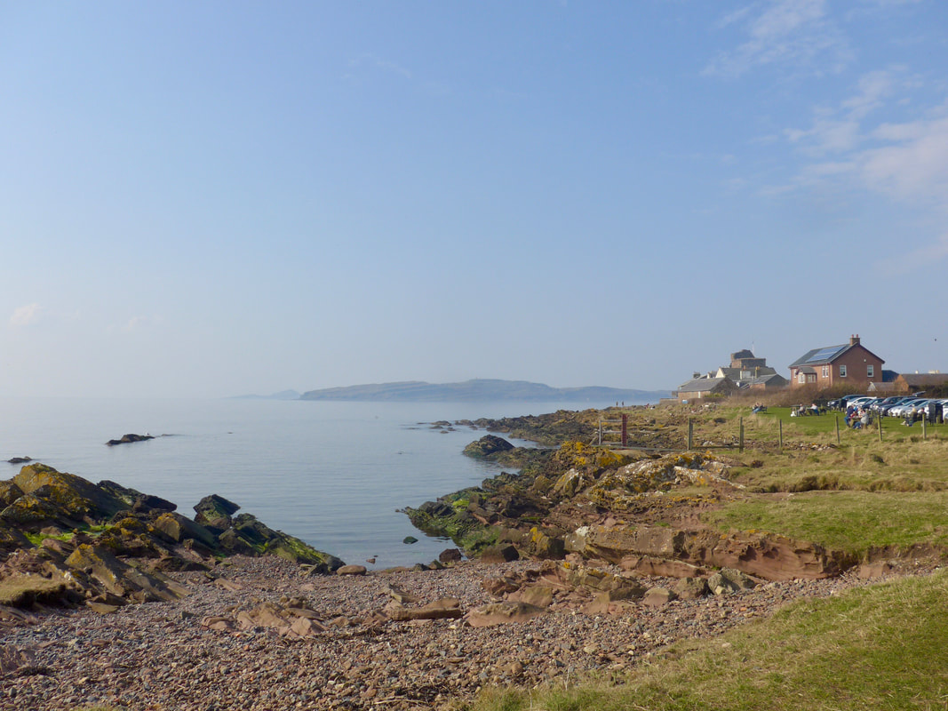
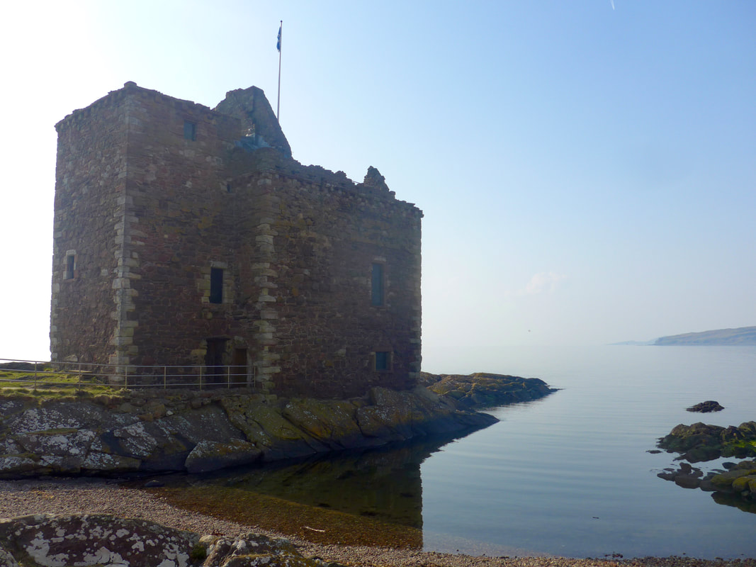
After the golf club, the route moves on to a nice sandy beach that moves along Ardneil Bay leading to Farland Head and the small settlement of Portencross with its very fine Medieval castle. The current castle on the site dates from the 14th C., but the site is thought to have been occupied since at least the 11th C. There is a suggestion that the castle was sometimes used as a last stop for the deceased kings of Scotland on their way to their final resting place on the island of Iona. Originally in the hands of the de Ross family, they were on the wrong side in the Wars of Independence and the property passed to the Boyds, another well-known- Ayrshire family. The castle and the land round about was bought out when the nearby Hunterston Power Station was being built.
Just after passing the town we walked below the Kilbride Golf Club, which in its time has hosted a number of important Scottish championships. Established in 1893 as a nine-hole course, it was developed to conventional size in 1905.
After the golf club, the route moves on to a nice sandy beach that moves along Ardneil Bay leading to Farland Head and the small settlement of Portencross with its very fine Medieval castle. The current castle on the site dates from the 14th C., but the site is thought to have been occupied since at least the 11th C. There is a suggestion that the castle was sometimes used as a last stop for the deceased kings of Scotland on their way to their final resting place on the island of Iona. Originally in the hands of the de Ross family, they were on the wrong side in the Wars of Independence and the property passed to the Boyds, another well-known- Ayrshire family. The castle and the land round about was bought out when the nearby Hunterston Power Station was being built.
Portencross Castle
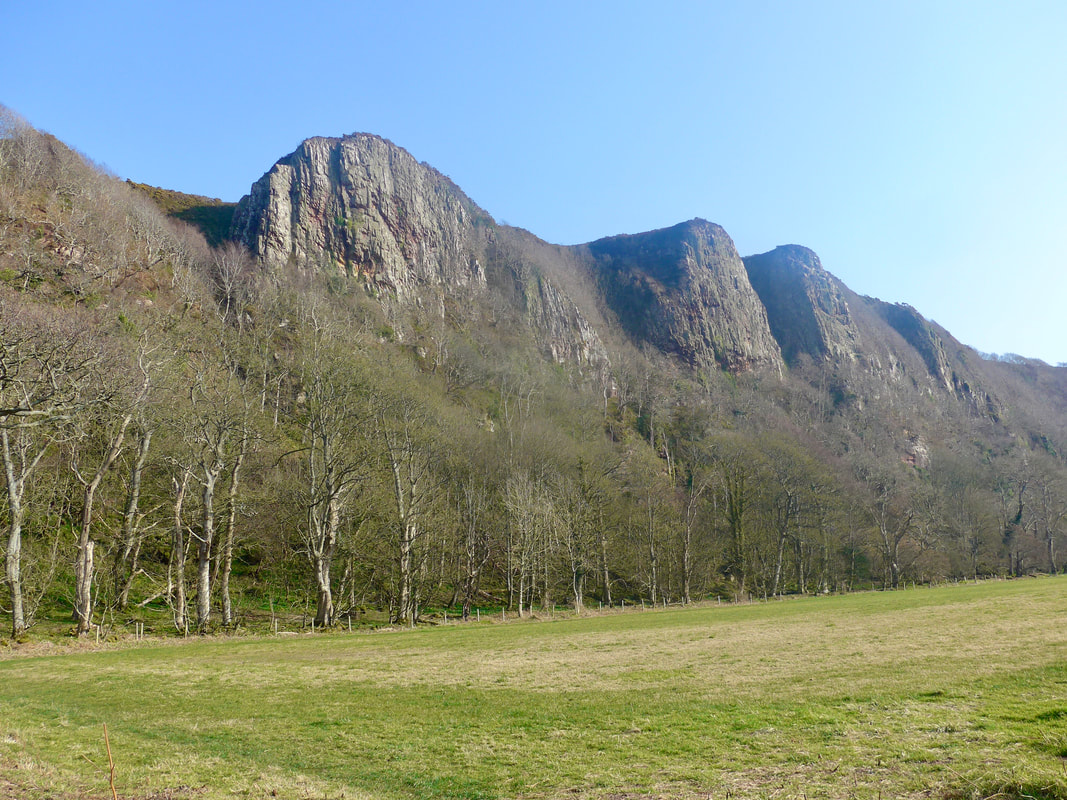
From Portencross we continued along the top of the shore, moving on to a pathed section known as Jenny's Dyke. This is a an interesting flat area at the back of which the cliffs rise suddenly. The cliffs are known as the The Sister's Cliffs, part of the Ardneil Hills. At the back of Ardneil lies Goldenberry Hill. There are three prominences on the front of the cliffs that reminded us of Mount Rushmore in USA and where the faces of Presidents are sculpted (don't mention this to Boris Johnstone).
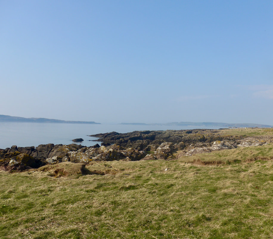
From the flat frontage below the cliffs there were nice views out to Arran and both Little Cumbrae and Great Cumbrae Island were clearly visible and slightly more to the west the tip of the Isle of Bute. Just off the eastern shore of Little Cumbrae there are the remains of a 16th C castle. There was an earlier 13 / 14th C defensive structure that was destroyed by Oliver Cromwells's army. On the top of the island is the Wee Cumbrae Old Lighthouse, dating from 1757 and is the second oldest lighthouse in Scotland. There is another lighthouse known as the Wee Cumbrae New Lighthouse built slightly later in 1793.
From the flat frontage below the cliffs there were nice views out to Arran and both Little Cumbrae and Great Cumbrae Island were clearly visible and slightly more to the west the tip of the Isle of Bute. Just off the eastern shore of Little Cumbrae there are the remains of a 16th C castle. There was an earlier 13 / 14th C defensive structure that was destroyed by Oliver Cromwells's army. On the top of the island is the Wee Cumbrae Old Lighthouse, dating from 1757 and is the second oldest lighthouse in Scotland. There is another lighthouse known as the Wee Cumbrae New Lighthouse built slightly later in 1793.
 Firth of Clyde
 From Jenny's Dyke the route moves towards the site of Hunterston Nuclear Power Station. Construction of the power station started in 1957 and was opened by the Queen in 1964. Known as Hunterston A, it had two Magnox reactors. By 1990, both of these reactors were shut down. In 1968, the construction of Hunterston B had commenced and in February 1976 and March 1977 its two reactors came on stream. The station was finally decommissioned in January 2022 when the final 45-second steam release was precluded the shut down of the turbines. There had been plans for a Hunterston coal-powered station with carbon-capture and storeage in the area but, with changing economics and the switch to cleaner energies, the plans for the development were withdrawn by Ayrshire Energy.
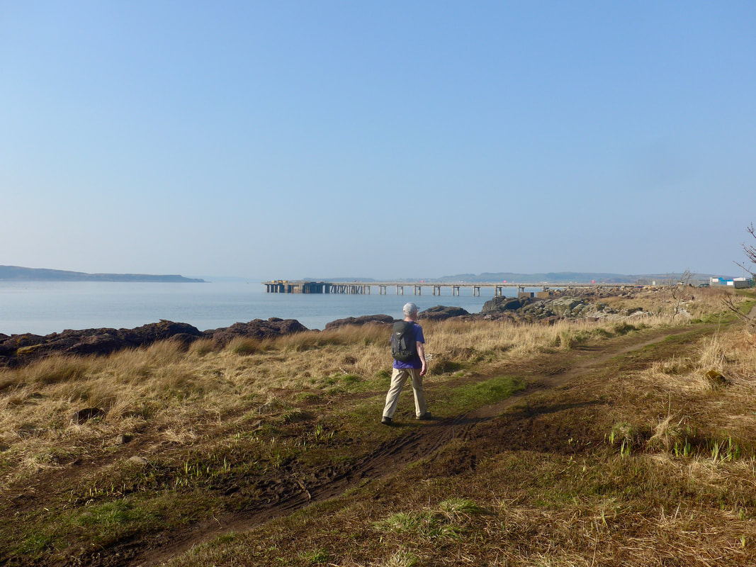
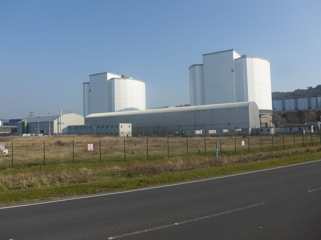
After walking along the front of Hunterston Power Station the path takes a turn to the right to go around the Hunterston Ore Terminal. The terminal was constructed by British steel to bring in supplies, mainly iron ore and coal, for the steel industry in Scotland, England and Northern Ireland. It closed in 2016 and work was commenced in 2019 to clear the site. A company by the name of XLCC bought a heaby terminal and aims to establish a facility for HVDC subsea cable manufacturing. These cables are used to move power around the UK & European grid and from offshore windfarms to distributor points on the mainland. In November 2023 the company were awarded a £9 million grant by Scottish Enterprise to continue the development of the Hunterston manufacturing facility.
Exiting from the coast and on to the main A78, I was hobbling quite badly with considerable pain in my feet. Whatever the problem was it was not going away. I had walked for quite a few miles with it hoping it would wear off or I could at least walk through it. Approaching the railway station at Burnfoot I finally had to admit defeat and we decided to terminate the walk and add on the extra couple of miles to tomorrow's walk which I hoped to be fit for. Such is the fate for the long distance walker. You can go for months and walk hundreds of miles with no comeback and out of the blue a relatively straightforward, level walk does for you.
Largs to Arran
 RSS Feed
