 Old Severn Bridge
The stages section of the website records our progress so far by regional and then the individual stages of our walk around the coast of Great Britain. It records the miles walked on each section and the accumulated mileage for the whole walk up to and including any individual section.
The miles recorded are the complete miles walked on any specific day and journey. This will include where we have had to walk additional miles to reach accommodation at the end of each stage and any diversions encountered. Occasionally, it includes a ferry journey because my Garmin automatically links up two points so that even if I turn it off for the ferry journey it joins up the journey anyway.
Mileage is generally recorded on a Garmin 110 device and where this has not been possible, e.g. battery runs out, approximate mileage has been calculated using OS Map service. In the destination column the letter C indicates camping; WC wild camping; B&B (self-explanatory) includes Airbnb. Est is estimated mileage and used for the planning stage, replaced when the walk has been completed with the actual mileage.
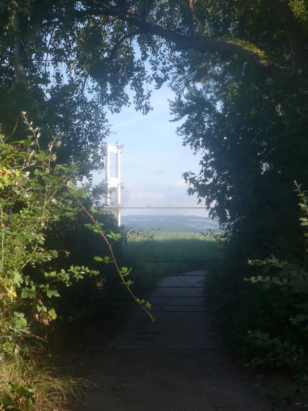
For the purposes of the journal, I have started the South Wales section from Severn Beach, which is where we started the walk from to enter Wales via the Severn Bridge. I have taken the designation of South Wales as far west as Brook for simplicity, but acknowledge that many people west of Swansea would consider themselves living in either South West or West Wales and acknowledging that the Pembrokeshire Coast Path formally starts at Amroth.
The miles recorded are the complete miles walked on any specific day and journey. This will include where we have had to walk additional miles to reach accommodation at the end of each stage and any diversions encountered. Occasionally, it includes a ferry journey because my Garmin automatically links up two points so that even if I turn it off for the ferry journey it joins up the journey anyway.
Mileage is generally recorded on a Garmin 110 device and where this has not been possible, e.g. battery runs out, approximate mileage has been calculated using OS Map service. In the destination column the letter C indicates camping; WC wild camping; B&B (self-explanatory) includes Airbnb. Est is estimated mileage and used for the planning stage, replaced when the walk has been completed with the actual mileage.
For the purposes of the journal, I have started the South Wales section from Severn Beach, which is where we started the walk from to enter Wales via the Severn Bridge. I have taken the designation of South Wales as far west as Brook for simplicity, but acknowledge that many people west of Swansea would consider themselves living in either South West or West Wales and acknowledging that the Pembrokeshire Coast Path formally starts at Amroth.
Stage |
Date |
From |
To |
Accum Mileage |
Written Up |
27/07/18 |
Severn Beach |
Caldicot, Wales (Airbnb) |
14 (2,264) |
Yes |
|
28/07/18 |
Caldicot |
Newport |
20 (2,284) |
Yes |
|
29/07/18 |
Newport |
Cardiff |
16 (2,300) |
Yes |
|
16-08-18 |
Cardff |
Barry |
12 (2,312) |
Yes |
|
17-08-18 |
Barry |
Llantwit Major |
12 (2,324) |
Yes |
|
18-08-18 |
Llantwit Major |
Ogmore, Bridgend |
12 (2,336) |
Yes |
|
19-08-18 |
Ogmore, Bridgend |
Kenfig Sands |
15 (2,351) |
Yes |
|
20-08-18 |
Kenfig |
Briton Ferry |
16 (2,367) |
Yes |
|
21-8-18 |
Briton Ferry |
The Mumbles, Swansea |
11(2,378) |
Yes |
|
22-08-1 |
Mumbles |
Port Eyno |
17 (2,389) |
Yes |
|
23-0-18 |
Port Eynon |
Langennith |
14 (2,403) |
Yes |
|
24-08-18 |
Llangenith |
Pen-clawdd |
11 (2,414) |
Yes |
|
25-08-18 |
Pen-clawd |
Gowerton |
4 (2,418) |
Yes |
|
04-05-19 |
Gowerton |
Burry Port (B&B) |
13 (2431) |
Yes |
|
05-05-19 |
Burry Port |
Tanylan, Bryn Towy (C) |
12 (2,443) |
Yes |
|
06-05-19 |
Tanylan |
St Clear (B&B) |
14 (2.457) |
Yes |
|
07-05-19 |
St Clear |
Brook (C) |
9 (2,466) |
Yes |
