Route Markers:
Our last expedition finished unexpectedly when Joanna's father took ill and we had to return home. Since then, initially needing to stay closer to home, we organised one or two days out which we used to pick off the walks up the south side of the River Clyde. They will be written up in due course. For this adventure we have managed to come away for about seven days (we are 'on call'), resulting in five walking days on the Ayrshire coast, with luck! Cairnryan to Ballintrae was the first walk. We used B&B, based ourselves in Girvan for four nights before moving to Largs for a further three. Although we had the car with us, we utilised the local buses and trains to start and from finish points.
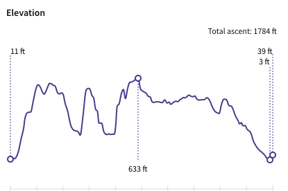
Elevation
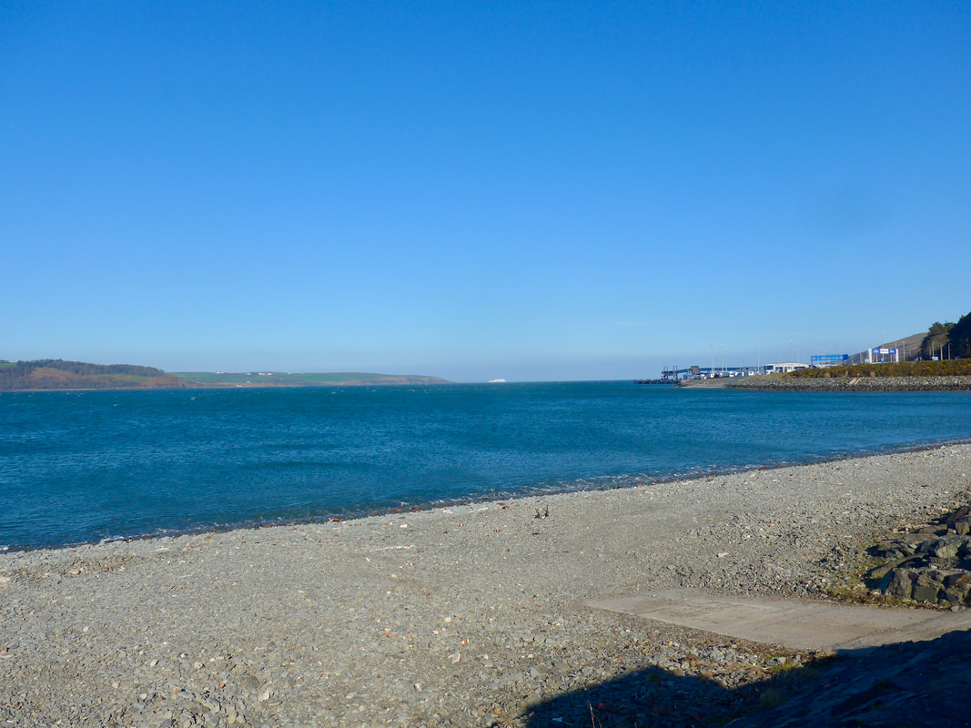
 To Cairnryan Ferry Terminal
 As you can see above, the walk had a bit of up and down to it. The initial climb is just under six hundred feet (above the wonderfully named 'Old Park of the Gleik), the highest point of the day at over six hundred and sixty feet is on the shoulder of Finnart's Hill, on the other side of Glen App essentially the start / finish point for the Ayrshire Coast path. The walking is a mixture of road, track and rough moorland walking, the latter, boggy at times, was heavy on the legs. The weather was bright enough but in the early morning there was a cold wind blowing and that meant we started off with the jackets, hats and gloves on.
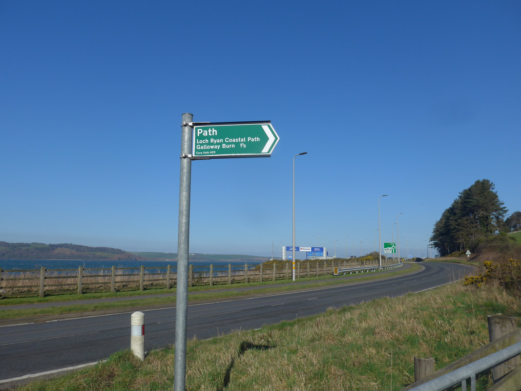
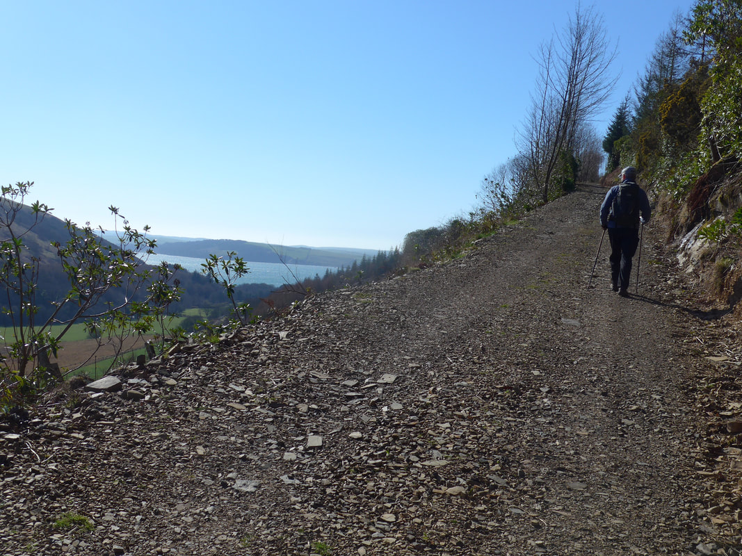
 Track up from A77 over Loch Ryan
 There are choices on how you walk the early part of the route. You set off walking on the main A77 road coming out of Cairnryan which carries all the heavy ferry traffic. You do not need a timetable to know when a ferry is leaving or arriving, you can tell by the volume of the heavy lorries passing you by on the road at close quarters.
We wanted to leave the road as quickly as possible, so followed the route of the Loch Ryan Coastal Path (LRCP), which leaves the road on to the hillside about half a kilometre from the village. I think it might be possible to stay on the road until it turns into Glen App by Finnarts Bay, if you want to walk on the roadside verge and put up the heavy traffic. A small road goes round Finnart's Bay from where there is a path through the farm (not sure if you have right of access) to Craiganlea House where you meet up with the LRCP on the rise up Finnart's Hill.
We wanted to leave the road as quickly as possible, so followed the route of the Loch Ryan Coastal Path (LRCP), which leaves the road on to the hillside about half a kilometre from the village. I think it might be possible to stay on the road until it turns into Glen App by Finnarts Bay, if you want to walk on the roadside verge and put up the heavy traffic. A small road goes round Finnart's Bay from where there is a path through the farm (not sure if you have right of access) to Craiganlea House where you meet up with the LRCP on the rise up Finnart's Hill.
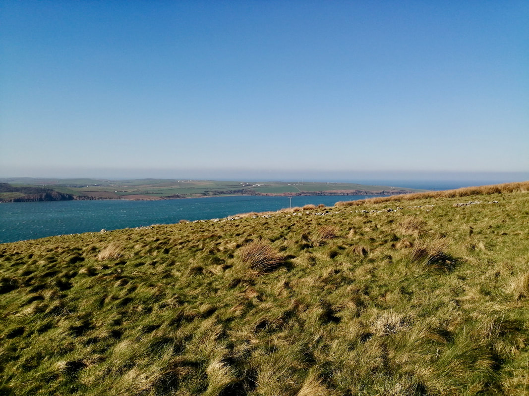
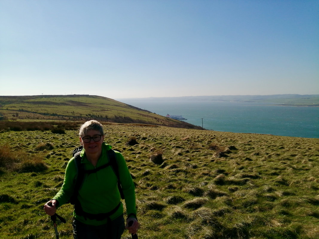
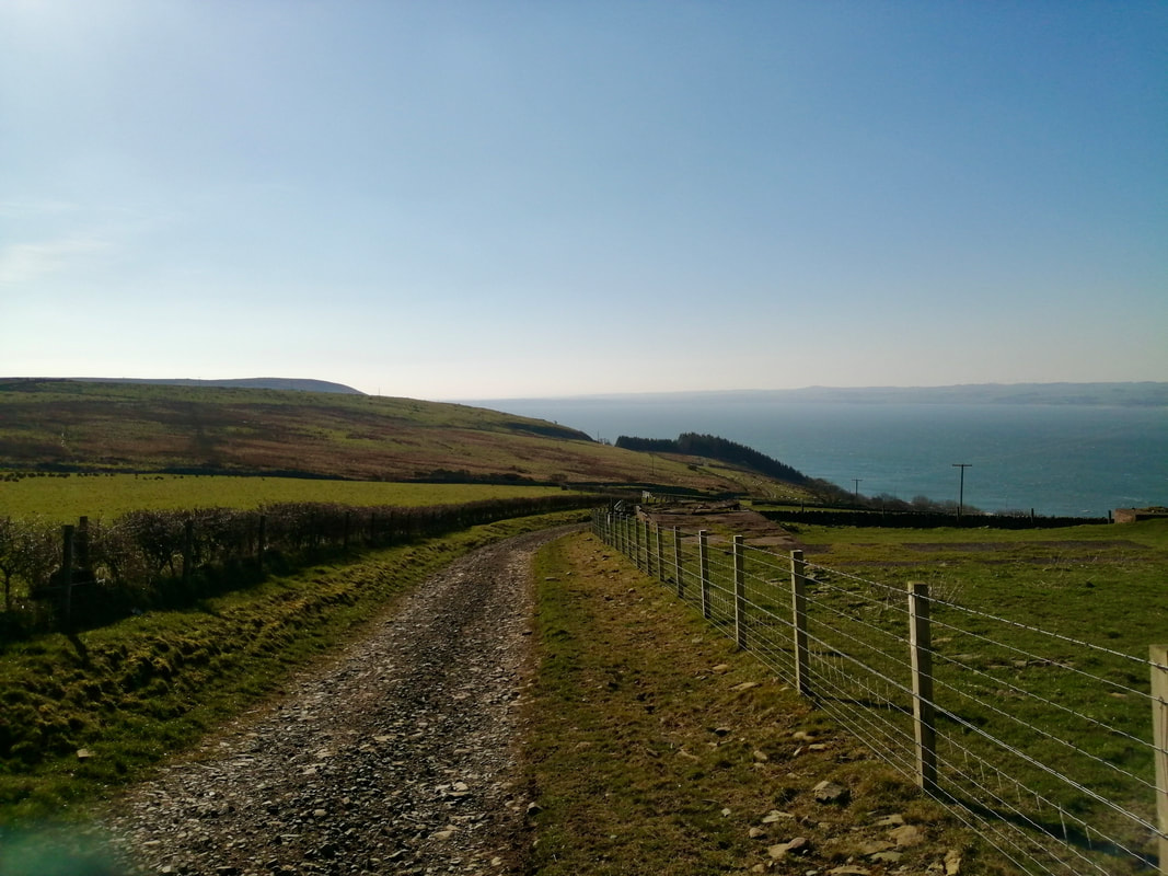
As you move up the initial hill just after Cairnryan you quickly start have lovely views out and over the Loch Ryan to the Rhins of Galloway on the other side. Looking north you can see clear to the region of Milleur Point and looking south, back over to the town of Stranraer.
The track you are walking on going up the hill is the old coach road which was the main road between Stranraer and Ayrshire in the 17th and 18th centuries. Remembering that it would all have been primarily horse-driven, it would have been quite a pull for the heavy horse and, I would not have fancied your chances if the coach was a runaway.
The track you are walking on going up the hill is the old coach road which was the main road between Stranraer and Ayrshire in the 17th and 18th centuries. Remembering that it would all have been primarily horse-driven, it would have been quite a pull for the heavy horse and, I would not have fancied your chances if the coach was a runaway.
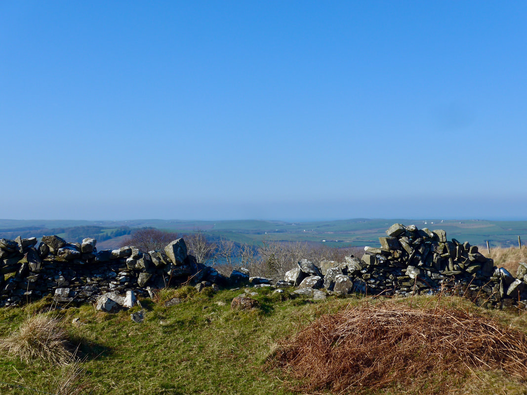
 The Taxing Stane
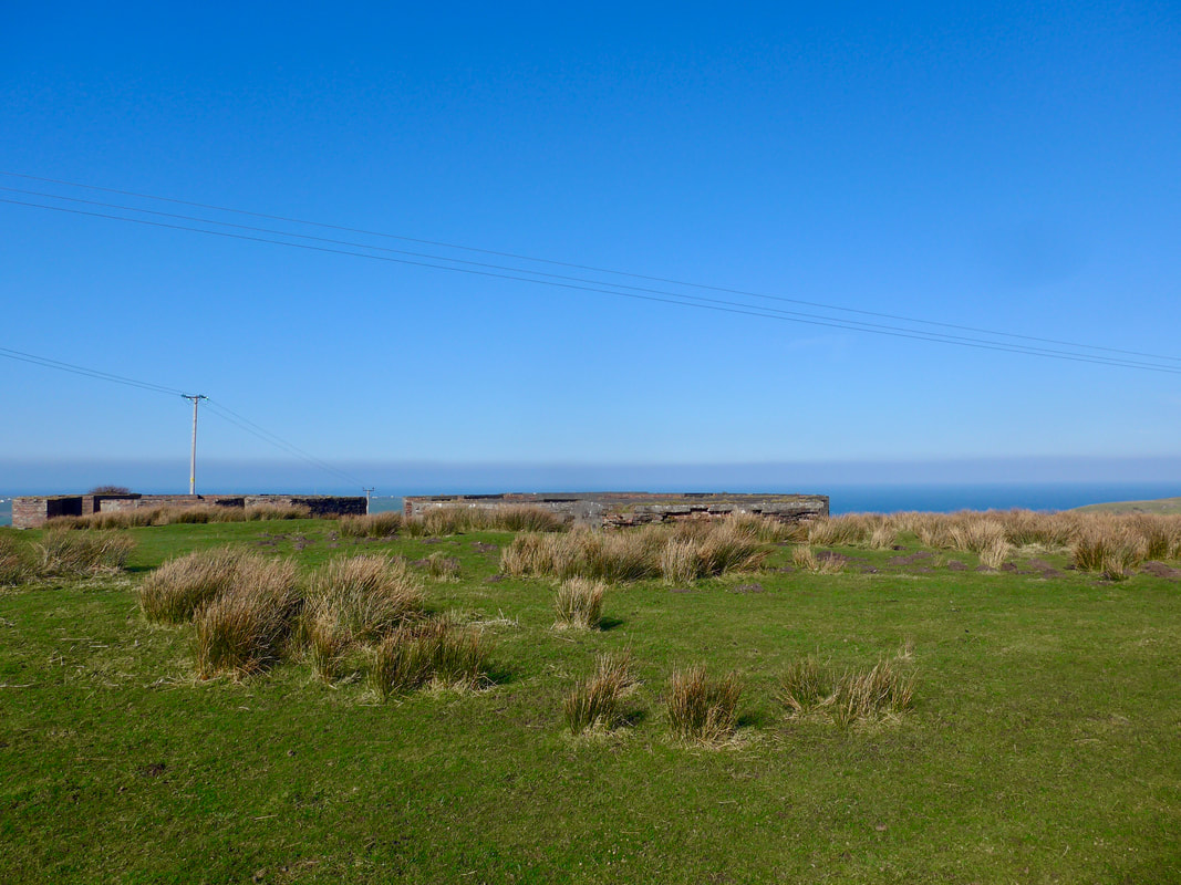
 The first rise on the hill levels out on the shoulder of Little Laight Hill where there are the substantial remains of a WWII anti-aircraft gun battery, one of four at Loch Ryan.
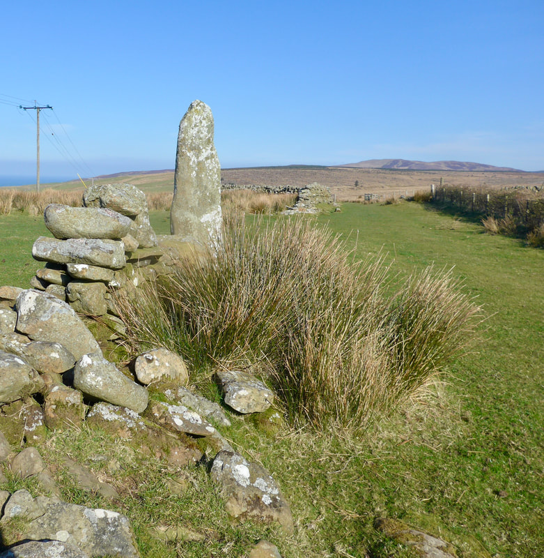
Little Laight Hill is also the location of a standing stone known as the 'taxing stone'. The stone is said to commemorate the burial of a Celtic Prince who invaded Pictish-controlled Galloway in the 8th C. Initially successful, he was eventually defeated and subsequently killed during his retreat in nearby Glen App in about AD741. The taxing stone is also sometimes taken as the border between Galloway and Ayrshire, hence the need for taxation.
On the hill behind the Taxing Stone and even further back but now lost in the forests, there are numerous Neolithic historical sites including standing stones, cairns and hut circles, that remind you that this hillside has an ancient history. For example, on Milldown Hill is the Long Tom standing stone, which measures over six feet tall and, arguably, was used for lunar observance purposes.


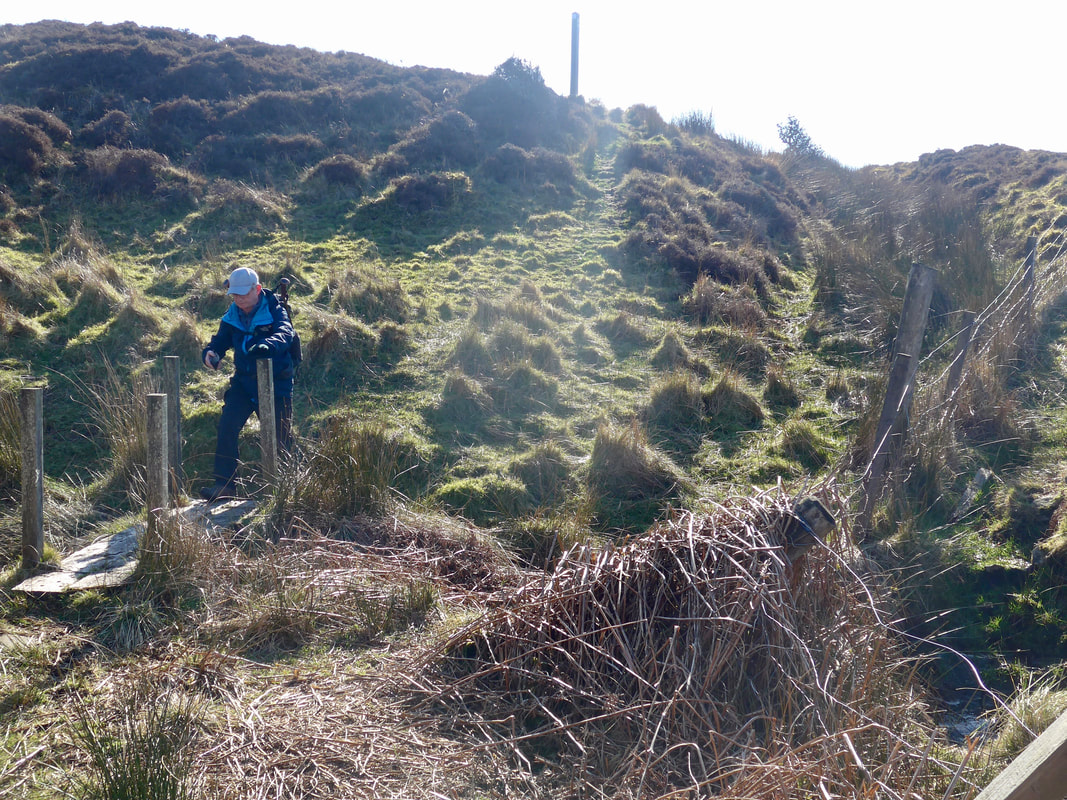
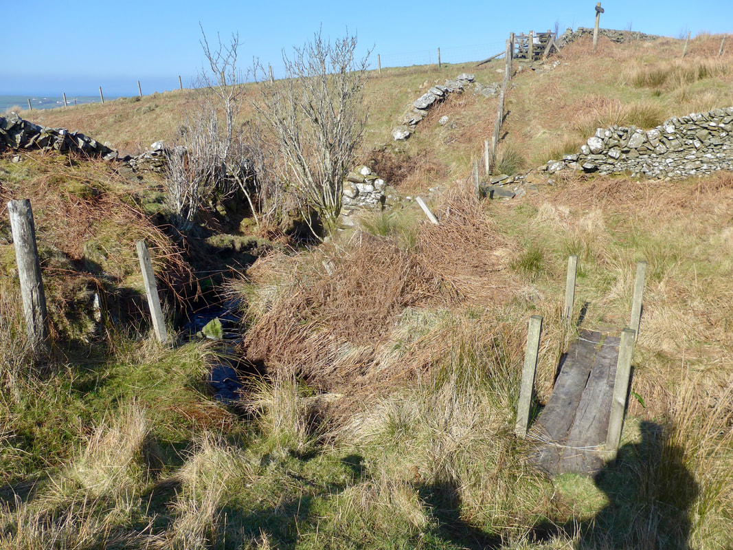 Rickety Bridge
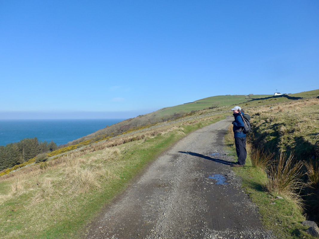
 The route goes through a couple of changes of walking surface on the way up the hill until you are eventually (roughly after Little Laight) in open countryside and crossing rough hillside. The way forward is not always clear and there are a couple of places where what path there was has become overgrown. There are one or two wee bridges that to describe them as rickety is to praise indeed.
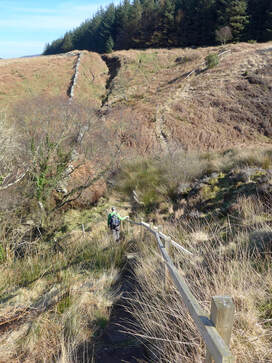
There was lovely colour on Laight Moor with lots of browns, red and yellows from last year's grasses, ferns and shrubs and the first beginnings of early Spring flowers. The views over to the Rhins of Galloway at Milleur Point were clear as a bell, as was the view up the length of Glen App. As the morning warmed up it was a great bit of hillwalking. Just after crossing the Galloway Burn there is a small gully that you go up to take line along the forest. There is a small bridge and a set of steps up the face of the hill to be manoeuvred. Going down it feels a bit steep but there is a handrail. It all looks a little bit rickety but it was quite safe. This is, if I remember correctly, one of the sections where there is a signpost to locate the path.
Head of Glen App
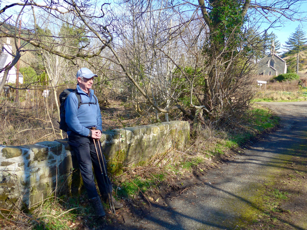
 Resting at Bridge of the Mark
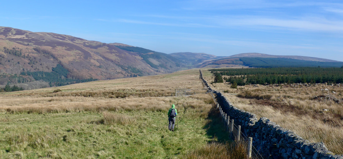
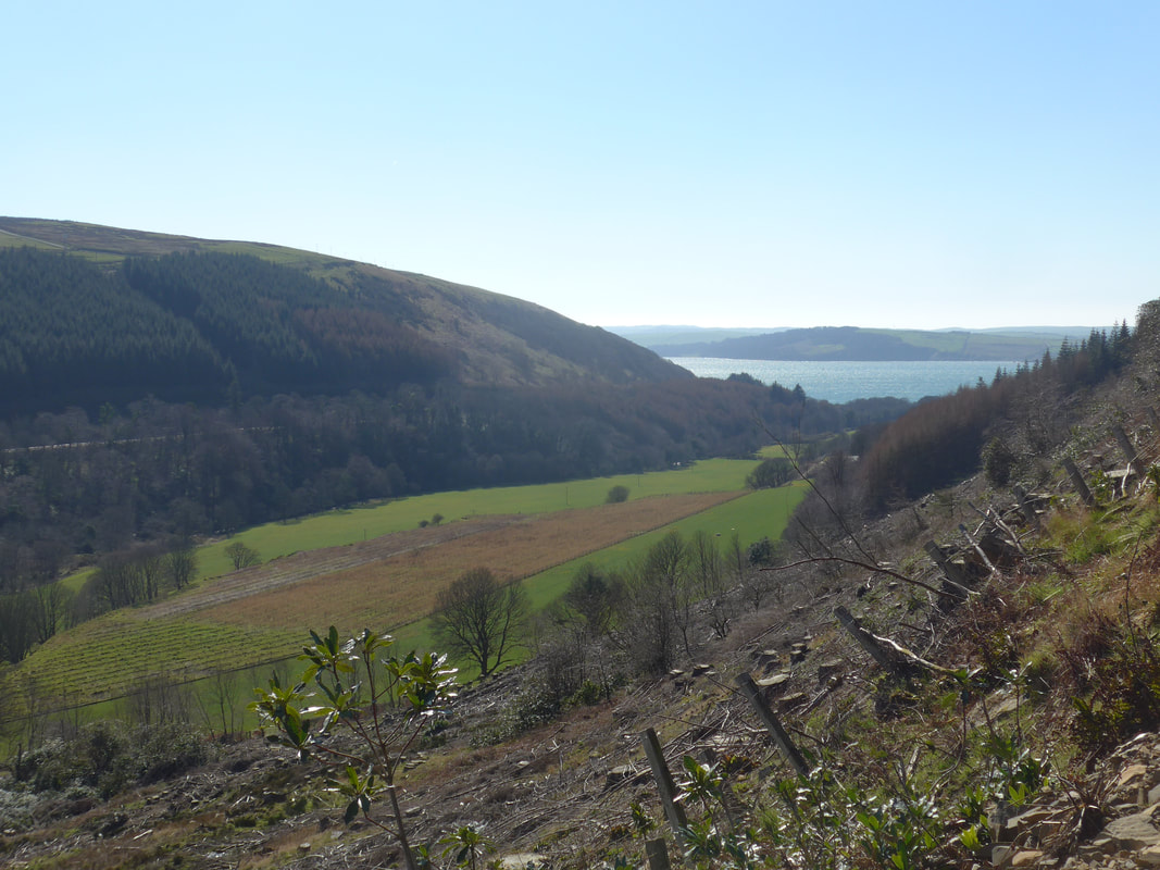
 You can follow LRCP the whole way on this side of the glen, but we chose to stick to the rough hill walking at the point where the LRCP dropped down the hillside, taking a lower level below Whidana Wood on to a track, that would come back up to meet us above Haggstone Bridge.
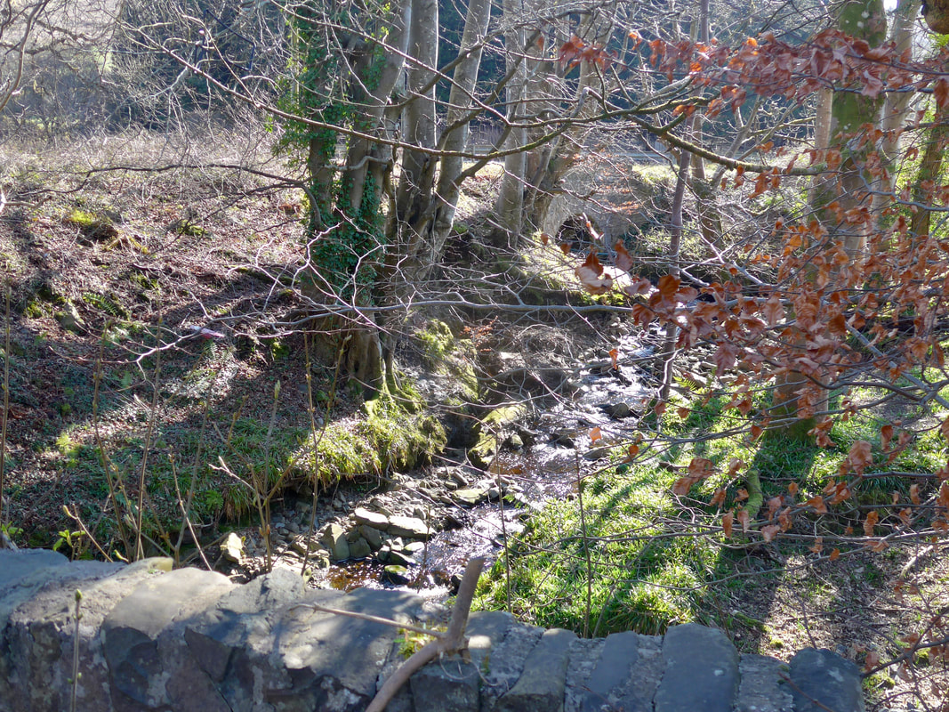
At the end of the rough moorland section (see Glen App photo above) , you meet the LRCP coming back up the hill again. From there the path starts to go downhill, dropping down to the floor of Glen App. There is a very short distance on the road until you take the small road on the left, opposite Glen App Church, and from where you access the next set of hills via the Bridge of the Mark over the Water of App. There is a small information hut by the first bridge as Tthe church at Glen App marks the end (or the beginning) of the Loch Ryan Coastal Path.
At the end of the rough moorland section (see Glen App photo above) , you meet the LRCP coming back up the hill again. From there the path starts to go downhill, dropping down to the floor of Glen App. There is a very short distance on the road until you take the small road on the left, opposite Glen App Church, and from where you access the next set of hills via the Bridge of the Mark over the Water of App. There is a small information hut by the first bridge as Tthe church at Glen App marks the end (or the beginning) of the Loch Ryan Coastal Path.
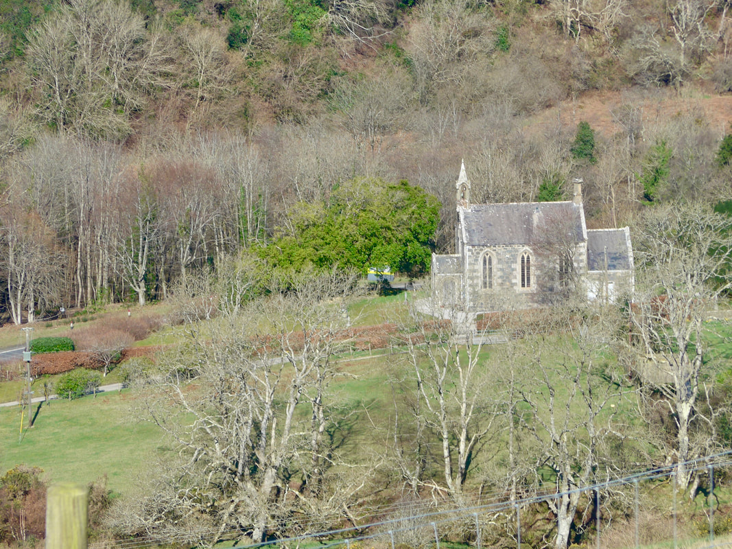 Glen App Church
 The Glen App Church was built in 1849 / 50 and modified slightly in 1910. It is well known for the stained glass memorial window in the chancel in memory of the Honorable Elsie Mackay, daughter of the 3rd Earl of Inchcape who died in 1928 while trying to fly across the Atlantic. As well as being an aviator and an actress in silent movies (known as Poppy Wyndam), Ms Mackay was also a talented interior designer and worked on some of the staterooms on the major P&O liners, said company of which her father was chairman.
Unfortunately, the church was closed and locked the day we visited and we could not see the stained glass window. The family seat of the Earls of Inchcape was at Glen App Castle (1870), now a hotel and which you pass below on the way to Garleffin.
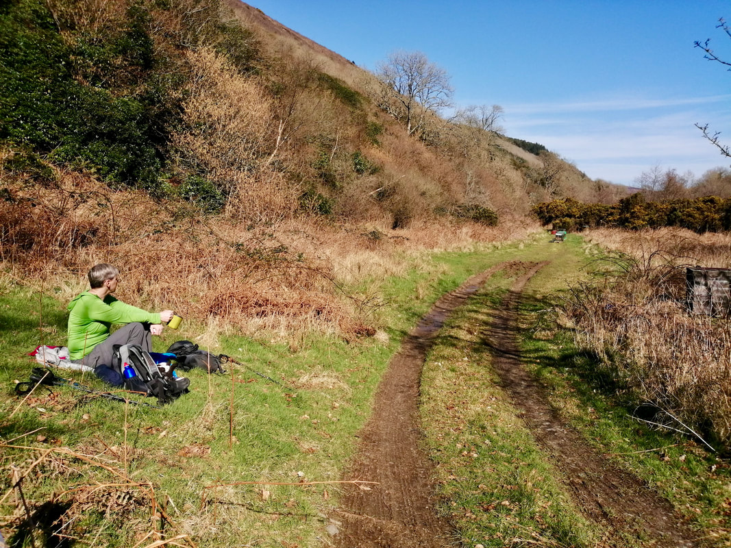
Once on the other side of the glen, we stepped off the main track for a brew up and lunch. Just a few yards along the track from us and just opposite from where we were sitting, there was a collection of eight or nine bee hives. Fortunately for us, the majority of the bees were still in hibernation mode and only a very few bothered to investigate us.
Unfortunately, the church was closed and locked the day we visited and we could not see the stained glass window. The family seat of the Earls of Inchcape was at Glen App Castle (1870), now a hotel and which you pass below on the way to Garleffin.
Once on the other side of the glen, we stepped off the main track for a brew up and lunch. Just a few yards along the track from us and just opposite from where we were sitting, there was a collection of eight or nine bee hives. Fortunately for us, the majority of the bees were still in hibernation mode and only a very few bothered to investigate us.
By the Village of Mark

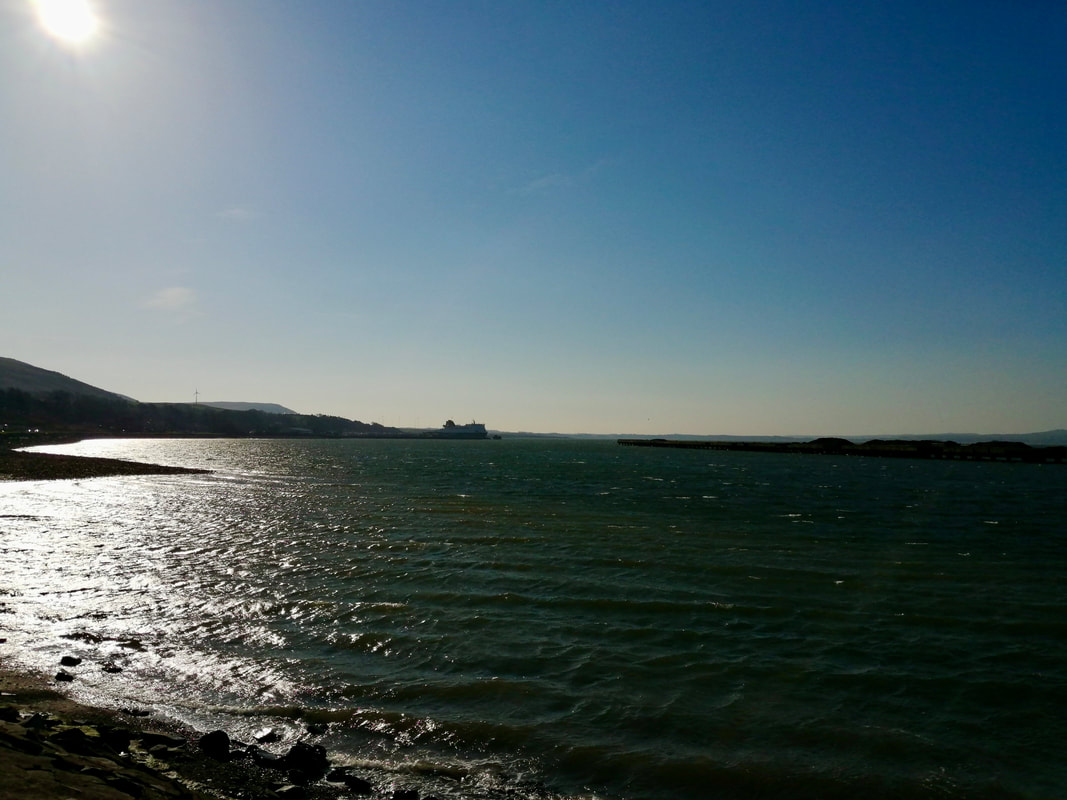
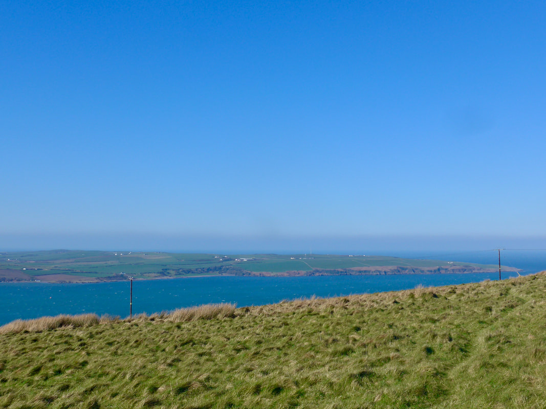
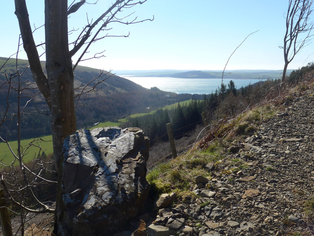
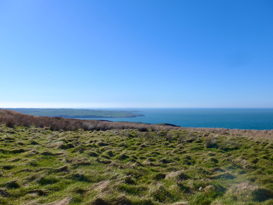
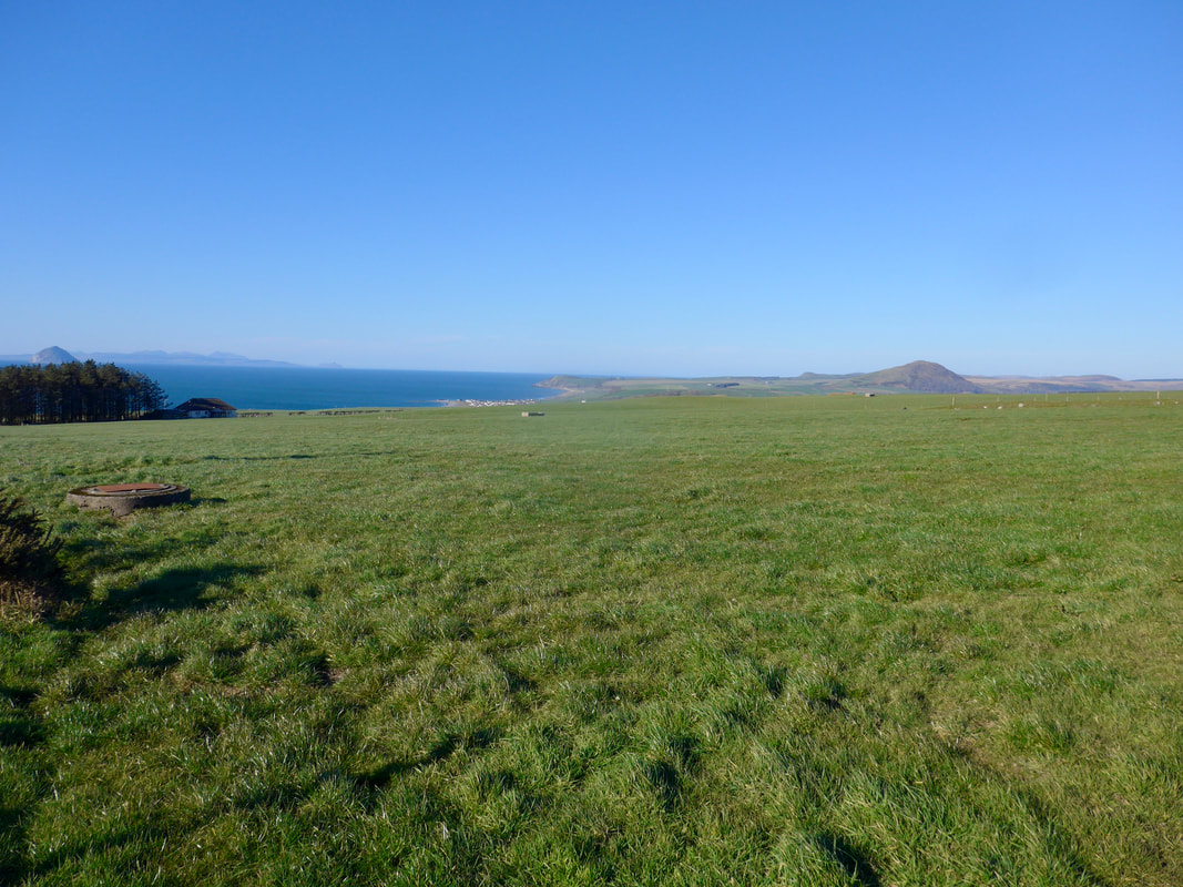
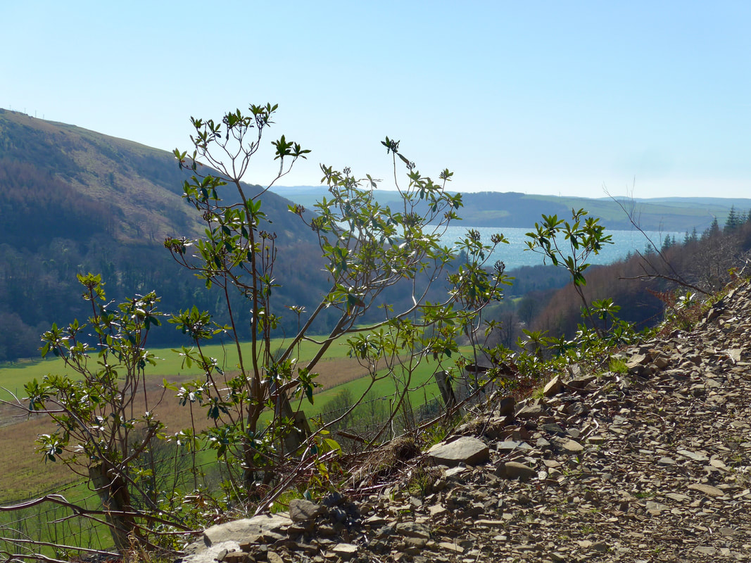 Mouth of Glen App & Loch Ryan
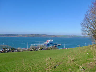
 Starting back after lunch we were on the route of the Ayrshire Coastal Path (106 miles long) which starts / ends here. The small road rising up the hill is fairly steep and in the midday sun was a bit of a challenge. The walking surface of broken slate and rock was not ideal and in places slightly difficult to walk on. As you rise up the hill the vistas of Loch Ryan start to unfold again until with height nice views to the mouth of the glen and across the loch to Clachan Heughs, which caused us some difficulty on our last expedition. At the top of the wee road it takes an elbow turn to the right and you start to head up Altygunnach Glen that runs off the main Glen App. The route continues with hills on each side for a bit, restricting the views.
Edge of Sandloch Hill
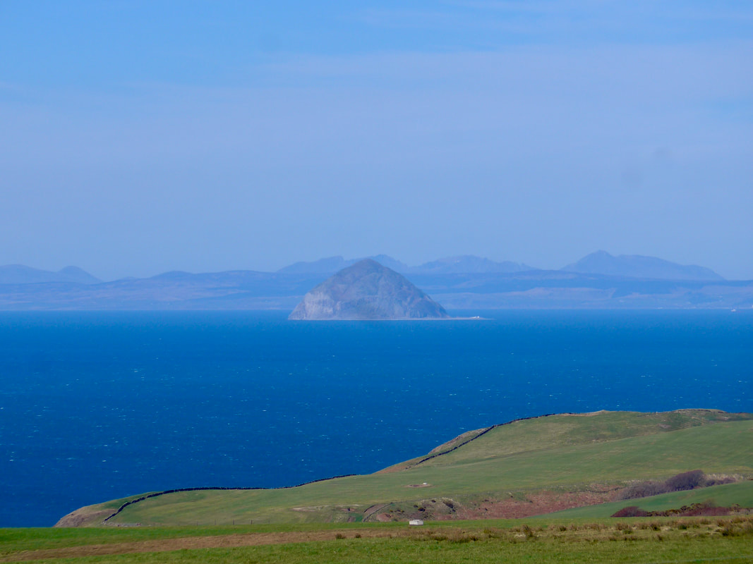
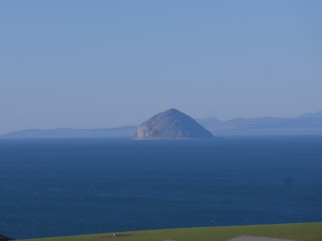
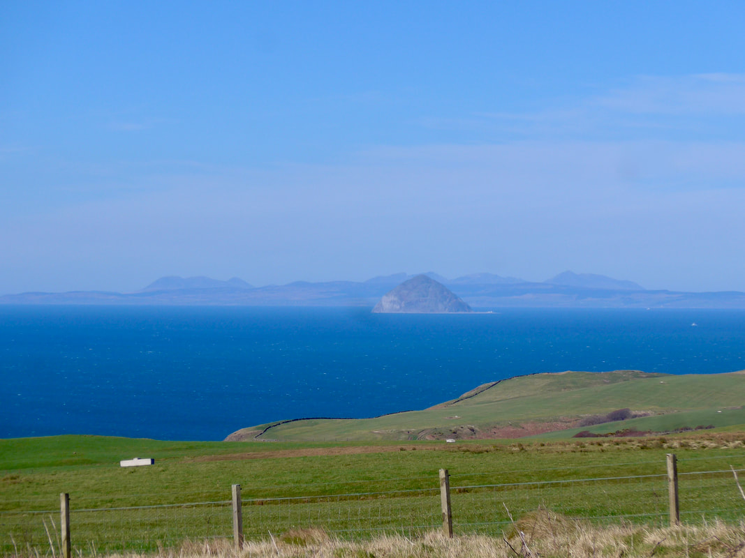 Ailsa Craig
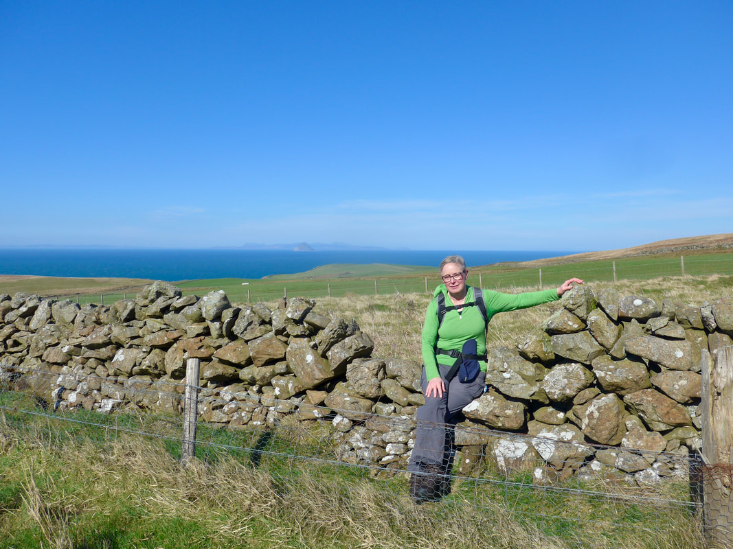
 The route continues with hills on each side for a bit, restricting the views. However, the best is yet to come when you clear the hills on your left and the majesty of the Ailsa Craig, the Isle of Arran and the far southerns shores of Kintyre lie in from of you, so close you think you touch them. We were fortunate that the sun had come back out again, the sky had cleared and both sky and sea were the most wonderful shades of blue. With the heat of the sun there was a gentle haze tween us and them that gave an added layer of mystery and intrigue to the scenery. Sheep grazed the steep hillside below us and a dry stane dyke ran along the edge of the hill, closely following the contours of the land; rising and falling, rising and falling.
Ailsa Craig & Milleur Point
Once you clear Sandloch and Penderry Hills on your right as you walk, the route gradually turns slightly north east, taking you further inland than you might perhaps like. As you walk this line, Ailsa Craig continues to rise and fall behind the low hills on your left.
For most of the ACP section you are walking on track or secondary road, until you reach the junction between Craigmore Hill and Drumduff Hill where there is the option to go back on the hillside. There are signposts at the junction but we found them pretty confusing. The short and curly of it was that on a normal day you could go left and follow the ACP initially on road or track, later on the hillside. Or, you could go right for a very long road walk to Ballintrae via Kiltringan Bridge, where you swing left to follow the unnamed road to Garleffin, where it meets up again with the ACP, before going on to Ballintrae.
The first option was closed off to us because the ACP was closed that day below the junction while they did work on it. We had no option but to take what turned out to be a fairly boring road walk until we reached Garleffin where we started to have nice views again. If you have the choice and you are hale and hearty, take the other option.
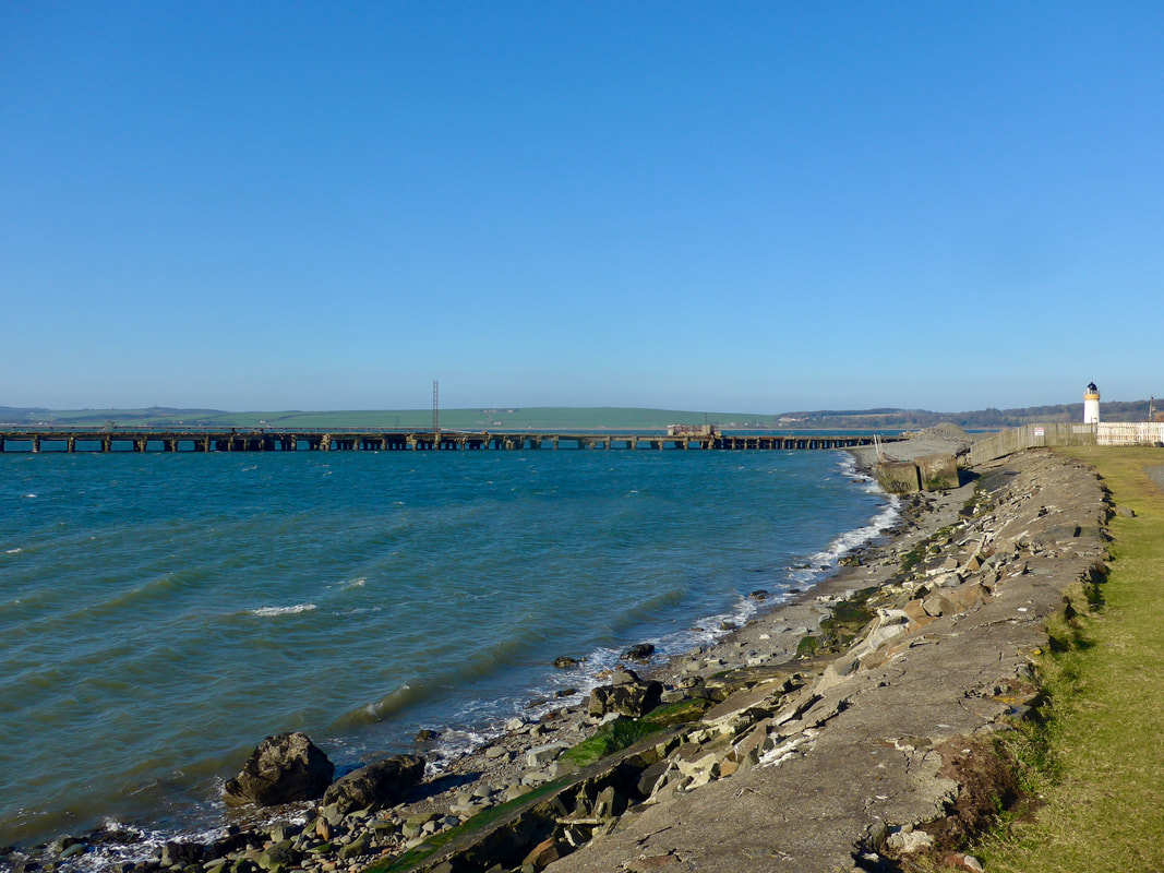
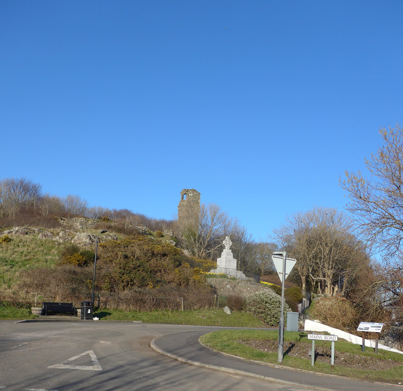 Ardstinchar Castle
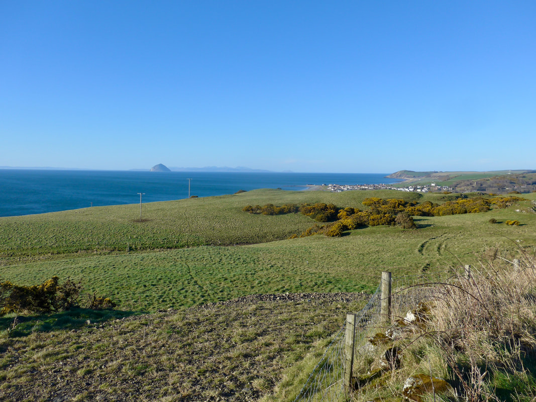
 The road walk was just a case of head down and get on with it. There was nothing spectacular to see, hear, touch or smell on the road walk. From round about Craigalbert Farm we had our first, clear views of the white houses of Ballantrae, sitting on the shore below Mains Hill. Our old friend Ailsa Craig was back with us, looking glorious in the sunshine.
On the approaches to the town, in order to pass by the remains of Ardstinchar Castle, we took the small unnamed road approaching the Ballantrae bridge. The castle was the family seat of the Kennedy's of Ardstinchar (taking its name from the burn that flows beside it). Built in about 1450, there is little of it left to see apart from a remaining keep and some foundation stones. The castle fell into disrepair mid-to-late 18th C. Much of the castle stone was used to build a nearby three-span bridge, local houses and a local hotel.
On the approaches to the town, in order to pass by the remains of Ardstinchar Castle, we took the small unnamed road approaching the Ballantrae bridge. The castle was the family seat of the Kennedy's of Ardstinchar (taking its name from the burn that flows beside it). Built in about 1450, there is little of it left to see apart from a remaining keep and some foundation stones. The castle fell into disrepair mid-to-late 18th C. Much of the castle stone was used to build a nearby three-span bridge, local houses and a local hotel.
The car was parked down a wee lane just round the corner from the castle and from there we headed for our accommodation in Girvan. The first part of the walk we thoroughly enjoyed, particularly the slightly rougher hill walking section. Not so much the second part which had too much road walking for our liking. That would have been avoided had we been able to access the ACP from Currarie Glen northwards. Still, it is what is and at the end of the day we were glad just to be back out on another adventure.
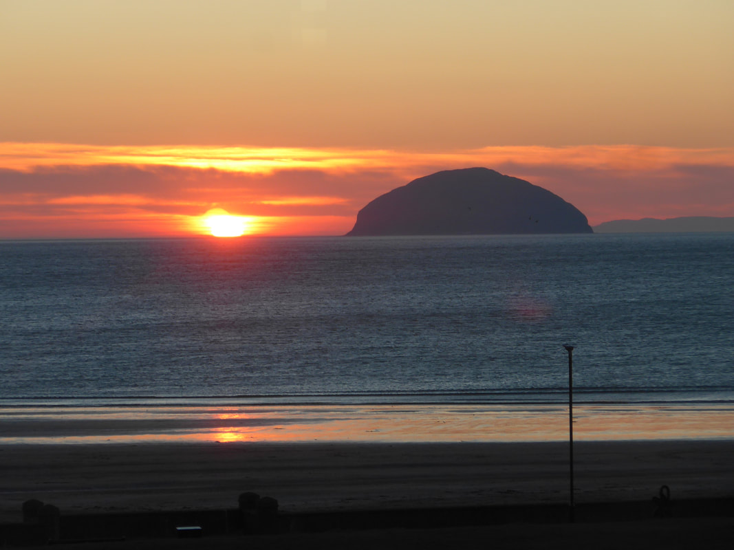
That night we received another little gift from Ailsa Craig to see us off to our bed.
That night we received another little gift from Ailsa Craig to see us off to our bed.
 RSS Feed
