
Amazing what a nights' sleep does for you! Despite the fact I had walked twenty miles yesterday and there was no breakfast in my accommodation, I was feeling good and ready for walking. Today's walk saw me cross the River Hamble by ferry to make my way up Southampton Water to turn in to the River Itchen. After crossing the River Itchen by bridge, I cross Southampton Water by ferry from Town Quay to Hythe.
There is no coastal route on the Hythe / Fawley side of the water as it is a very busy port with industrial areas north and south, as well as the huge oil refinery at Fawley. If I was to walk down inland, I would be forced back up by the Dark Water, down and back up again later by the Beaulieu River. So instead, when I crossed Southhampton Water, I cut inland from Hythe, up to just below Dibden Purlieu and then down to the village of Beaulieu where I had booked into the Embers campsite.
The long distance path, The Solent Way, continues on the other bank but, for no apparent reason, it swings very wide of the town of Hythe, only to come back in again to intersect with the main road out of the town at its junction with the by-pass just below Dibden Purlieu. If I cannot walk the coastal route, I might as well walk as the crow flies. My intention, therefore, was to walk straight up through the town to the large roundabout on the Hythe By-pass and cross over from there to the B3054 for a walk through the edges of the New Forest to Beaulieu. Estimated at sixteen miles, I suspected that on the ground it might be a tad longer but was happy to be proved wrong.
 Warsash to Hamble-le-Rice Ferry
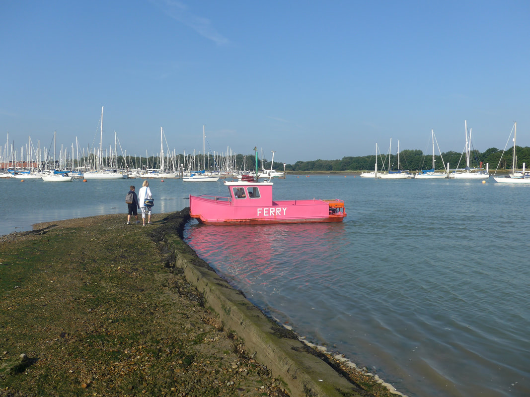
 The day started well with a quiet, sun light morning. Walking through the town of Warsash all was quiet with nary a person to be seen. The ferry quay on the River Hamble is just a short walk from the edge of the town. Arriving early, I had a wait of about half an hour before the service started and it was at least fifteen minutes before I saw the first person of the day. The ferry was a surprise, very small and painted a very lurid shade of pink. But for all that, it was efficient enough and we crossed the short section of water in good order. On the quay at Hamble-le-Rice, I stopped for breakfast at the Beach Hut Cafe where I partook of a huge bacon and egg bap and had a sandwich made up for lunch.

The walk from Hamble-le-Rice, down the River Hamble back down on to Southhampton Water is about two kilometres but I extended it a little bit by taking the path that runs down the side of Hamble Common. It was down in bright sun with very few clouds in a blue sky. From my position on the bank, I had great views up and down the river and spent some time just watching the ships come and go, including the huge oil tanker, tied up at the jetty by an oil terminla.
The Common is a nature reserve and a Scheduled Ancient Monument, containing the location of an Iron Age settlement and a castle, St Andrews, built for Henry VIII in 1543. Little remains of either of the monuments apart from the ditch and bank of the Iron Age settlement and the foundations of the castle. Across the ages the site has performed defensive duties and, as well as the castle, there are the remains of a 19th C gun battery and during World War II, there was a gun battery placed here and there is still a Bofors gun of the type used, still on the Point. From the Point I stuck rigidly to the coast, including squeezing along the front of the oil terminal. It was a very nice section of the walk with lots of interest both on the water and on the land.
The Common is a nature reserve and a Scheduled Ancient Monument, containing the location of an Iron Age settlement and a castle, St Andrews, built for Henry VIII in 1543. Little remains of either of the monuments apart from the ditch and bank of the Iron Age settlement and the foundations of the castle. Across the ages the site has performed defensive duties and, as well as the castle, there are the remains of a 19th C gun battery and during World War II, there was a gun battery placed here and there is still a Bofors gun of the type used, still on the Point. From the Point I stuck rigidly to the coast, including squeezing along the front of the oil terminal. It was a very nice section of the walk with lots of interest both on the water and on the land.

Just before the village of Netley, I passed by what is now called Royal Victoria Country Park. In my army days it was known as Royal Victoria Hospital and it functioned as the main psychiatric hospital for the army and the navy, with D Block (Victoria House) and E Block (Albert House) providing the accommodation. In its heyday, it was a stunning location, with the most wonderful extensive park and gardens. Only the hospital chapel remains, now performing duties as a heritage centre. Some of the other building are used by the police for training purposes and the officers mess is now private accommodation.
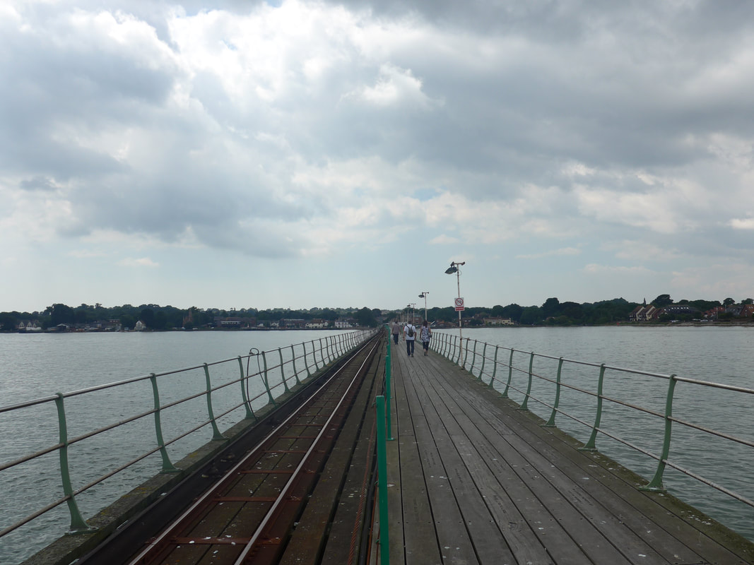
 View from Itchen Bridge
 Continuing on through the village of Netley, I stopped to purchases supplies at a local shop. As I moved through the village I passed the remains of the old Netley Abbey, nestling on the banks of the river. Founded in 1238, the abbey is perhaps the best surviving example of a Cistercian monastery in the UK. Like many of the lesser monasteries in England, the abbey fell victim to Henry VIII's purge in 16th C, when it was at first suppressed and later turned in to a private mansion. It remained in use as a mansion until 1704, after which it slowly fell in to disrepair. In later years it was to play a role in the development of the 'Romantic' movement with various artists, authors and poets finding inspiration in its Gothic ruins.
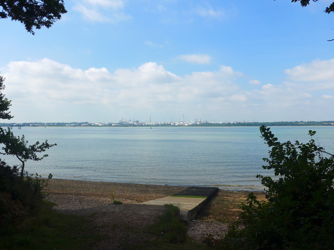
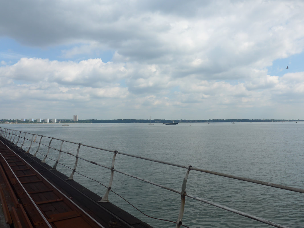
Just after the abbey, I dropped back down on to Southhampton Water for a short walk along its length before turning right on to the River Itchen, which I crossed on, you guessed it, the Itchen Bridge. The views from the top of the bridge back down to Southampton Water were lovely, all blues and steely-grey. Once over the bridge I followed a cycle route to the Town Quay, where I caught the ferry over the River Test to Hythe. This was a more modern ferry and had none of the character of the wee pink ferry on the Hamble. Embarking on the other side on to Hythe Pier, I had a choice of taking the small train or walking. As there was no justification for taking the train, I walked and for days afterwards regretted that I had not taken the chance to ride on the train. Sometimes, principles just get in the way!
Just after the abbey, I dropped back down on to Southhampton Water for a short walk along its length before turning right on to the River Itchen, which I crossed on, you guessed it, the Itchen Bridge. The views from the top of the bridge back down to Southampton Water were lovely, all blues and steely-grey. Once over the bridge I followed a cycle route to the Town Quay, where I caught the ferry over the River Test to Hythe. This was a more modern ferry and had none of the character of the wee pink ferry on the Hamble. Embarking on the other side on to Hythe Pier, I had a choice of taking the small train or walking. As there was no justification for taking the train, I walked and for days afterwards regretted that I had not taken the chance to ride on the train. Sometimes, principles just get in the way!
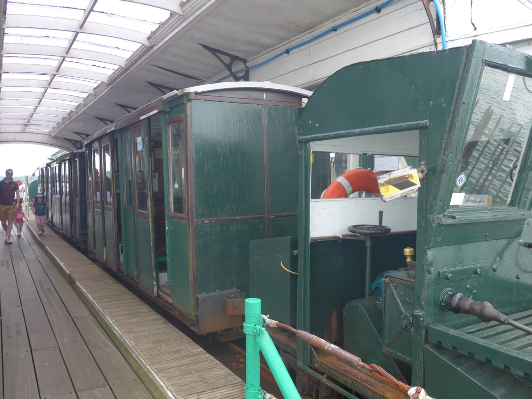
Hythe Pier was officially opened in 1881and at 2,100 feet long, it was one of the longest piers in Great Britain. Sixteen feet wide, the pier has a pedestrian lane and a cycle lane on one side and a small gauge railway on the other. Initially, small trucks carried luggage to the pier end but a hand-propelled railway was installed in 1909, subsequently replaced with an electrified version in 1922. the train usually runs with an engine, three passenger and one luggage car. The pier, ferry and train service have all experienced financial difficulties over the years and been threatened with closure oon more than one occasion.The pier, railway and ferry service are currently operated by Blue Funnel Ferries of Southampton.
Hythe Pier & Railway
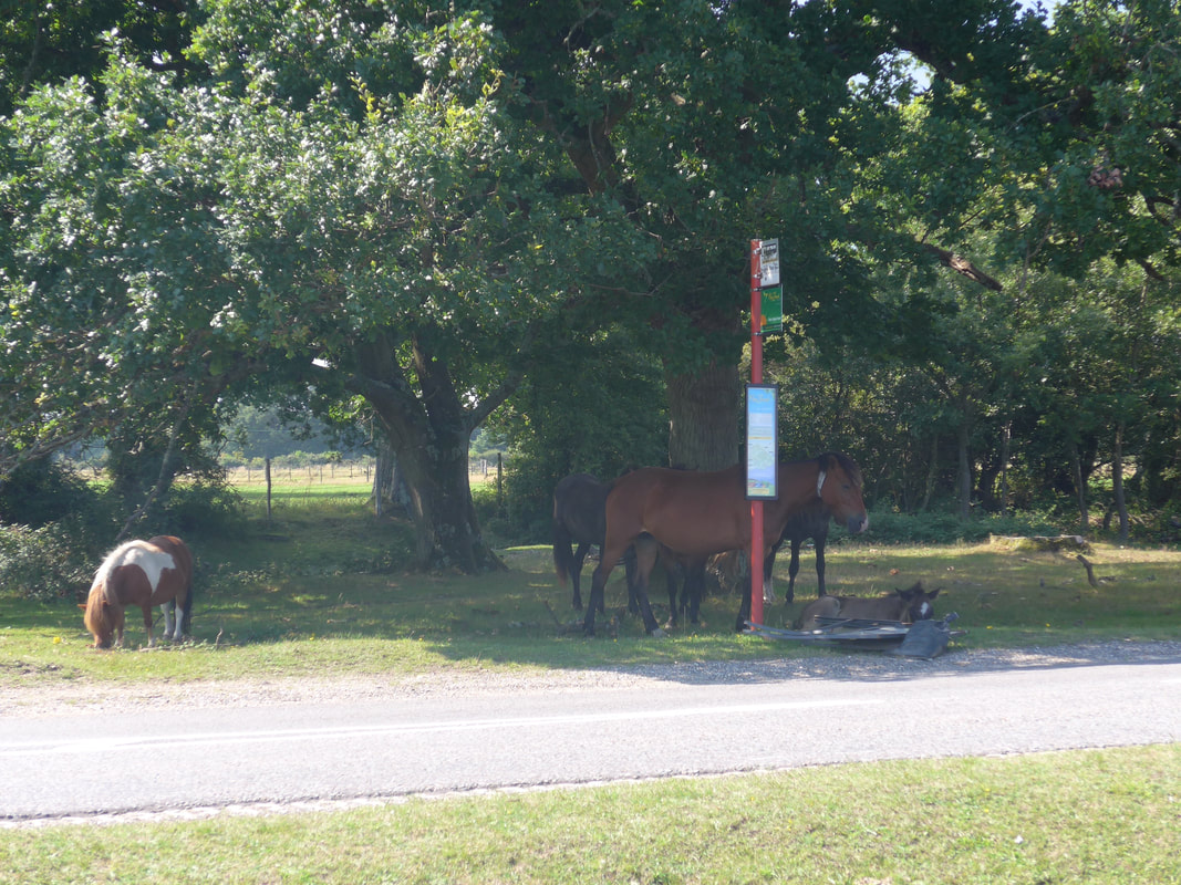 New Forest Ponies
 From Hythe I had a long urban walk up through the town to intersect with the by-pass just below Dibden Purlieu. Crossing at the roundabout here, I move from the urban to the rural. I would like to say the scenery improved but it didn't really, as I continued to walk beside a very busy road. It was hard to believe that I was walking on the edges of the famous New Forest. It was a long,hard slog in very warm conditions. The monotony of the walk was only broken by the occasional appearance of some of the wild ponies that populate the New Forest. They would turn up in the oddest places; grazing freely on the roundabout, on the grass verge at the side of the road, even waiting for buses!
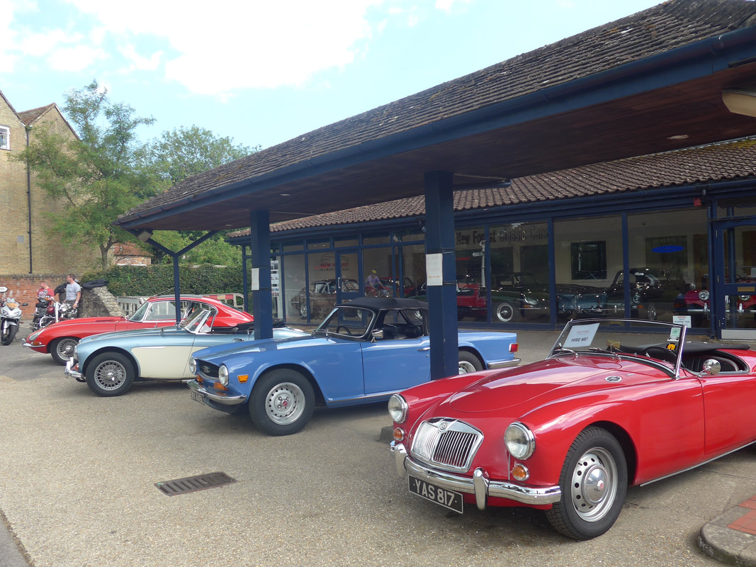 Vintage cars at Beaulieau
 I wasn't quite sure where the exact location of my campsite was in Beaulieu, but remained hopeful that local people would be able to direct me. It was a forlorn hope as nobody I asked had ever heard of it. In my efforts to find it, I wandered out to the far side of the town, passing as I did some really nice vintage sports cars. I stopped just where the buildings of the town ended and turn back into the town to try again at the other end.
Eventually, using my phone, I found a farm shop with the same name as the campsite and decided to walk up there to see if it was the right place. This entailed walking up the very busy and very blocked B3054, which was choc-a-block with vehicles nose to tail and no pavement! It seemed the sun had brought everyone to Beaulieau for the day. Eventually, I found the farm shop, relieved to find out the campsite was located in fields at the back of the shop, but not visible from the road or marked on the map. Speaking to the manager of the site he informed me there was a shortcut coming up from the town and when he described it, I realised that had I gone a couple of hundred yards further beyond where the vintage cars were, things would have been a lot easier. Too late, too late!
Eventually, using my phone, I found a farm shop with the same name as the campsite and decided to walk up there to see if it was the right place. This entailed walking up the very busy and very blocked B3054, which was choc-a-block with vehicles nose to tail and no pavement! It seemed the sun had brought everyone to Beaulieau for the day. Eventually, I found the farm shop, relieved to find out the campsite was located in fields at the back of the shop, but not visible from the road or marked on the map. Speaking to the manager of the site he informed me there was a shortcut coming up from the town and when he described it, I realised that had I gone a couple of hundred yards further beyond where the vintage cars were, things would have been a lot easier. Too late, too late!
 RSS Feed
