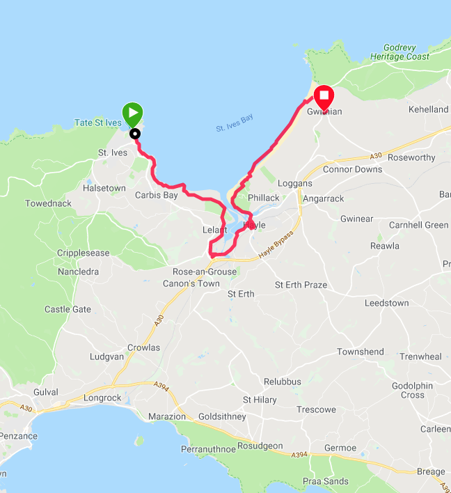
Route Map
Day 29 & 30
With St Ives falling at the half-way mark of our trip to the Severn Bridge, we had decided to enjoy a couple of days off in the town. Over the two days we spent some time resting, re-supplying, eating in some of the many restaurants and visiting a number of the galleries in the town including the Barbara Hepworth Museum & Sculpture Galleryand the Tate. Other highlights included wonderful fish and chips, Mermaid dark chocolate sorbet, almond praline and lots of rest and sleep. Wonderful!
With St Ives falling at the half-way mark of our trip to the Severn Bridge, we had decided to enjoy a couple of days off in the town. Over the two days we spent some time resting, re-supplying, eating in some of the many restaurants and visiting a number of the galleries in the town including the Barbara Hepworth Museum & Sculpture Galleryand the Tate. Other highlights included wonderful fish and chips, Mermaid dark chocolate sorbet, almond praline and lots of rest and sleep. Wonderful!
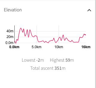
Today's route is fairly straightforward and without major challenge, any height primarily contained at the beginning of the walk with the rest being walked at or close to sea level. Likewise, the distance is manageable and expected to be between ten and twelve miles. Initially, we are on road as we leave St Ives, going up and over the hill to Carbis Bay, where we will take station on the coast. About mid-morning, there is a long detour inland going up the Hayle Estuary to cross over just above Lelant Saltings after which we will skirt the town of Hayle to the east as we go back down the estuary, crossing over the harbour at East Quay, round The Towans and return to the beach. for a three or four mile walk along the sands to our campsite at Gwithian. The weather forecast is mixed with cloud overhead and rain expected later in the day.
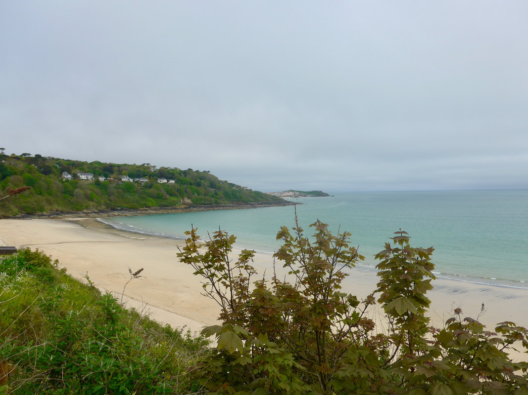
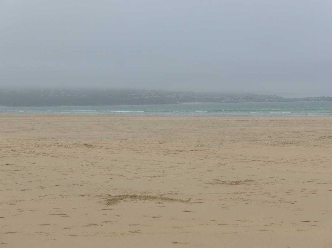
 St Ive's Beach
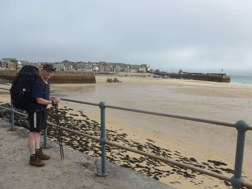
 Although it was overcast as we left St Ive's, with steely-blue cloud dominating the sky, it was still warm enough that we had the confidence to walk in shorts and t-shirts. While there was a distinct chill in the air you always know that with a full rucksack you will warm up soon enough.
Leaving the town, we walked round the harbour area and on to Porthminster Beach. We were taken up here watching a bulldozer clearing sand from the harbour area. As we had watched the same excercise yesterday, we presumed it was a daily task to clear waterways or discharge pipes.
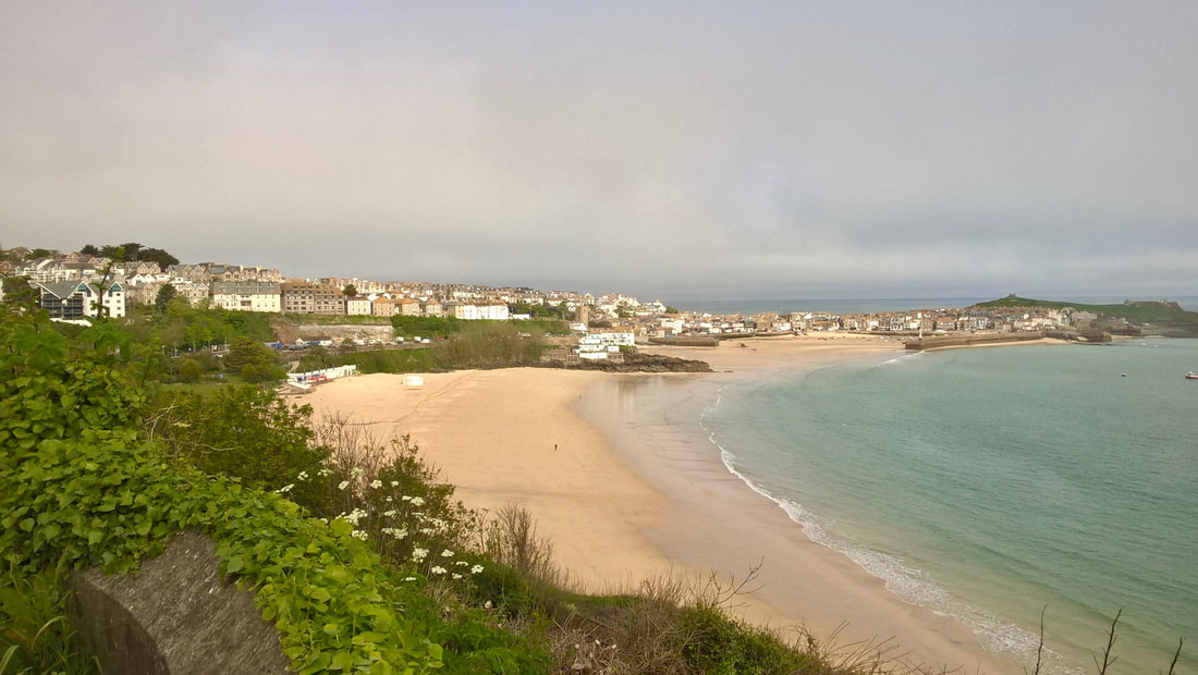
As we gained height going above Porthminster Point we had a good view across the seafront and out to St Ive's Head, location of St Nicholas' Chapel, the patron saint of sailors. The location is thought to have been the site of a chapel since at leat the 15th C, but the current chapel dates to 1911. There are records that indicate the headland was fortified in 1638 and it has gone through various rebuilds of a defensive nature since then, including during the Napoleonic Wars. HM Coastguard built and operated a lookout station on the headland that was subsequently taken over by the National Coastwatch Instiution following the closure of a number of coastguard stations in the mid-1990's.
Leaving the town, we walked round the harbour area and on to Porthminster Beach. We were taken up here watching a bulldozer clearing sand from the harbour area. As we had watched the same excercise yesterday, we presumed it was a daily task to clear waterways or discharge pipes.
As we gained height going above Porthminster Point we had a good view across the seafront and out to St Ive's Head, location of St Nicholas' Chapel, the patron saint of sailors. The location is thought to have been the site of a chapel since at leat the 15th C, but the current chapel dates to 1911. There are records that indicate the headland was fortified in 1638 and it has gone through various rebuilds of a defensive nature since then, including during the Napoleonic Wars. HM Coastguard built and operated a lookout station on the headland that was subsequently taken over by the National Coastwatch Instiution following the closure of a number of coastguard stations in the mid-1990's.
St Ive's & St Ive's Head
gentle We stayed on road to go up and over Porthminster Point to start the up and down approach to Carbis Bay where the waters, protected by the headland of Porthminster Point, results in calmer waters that are great for swimming. The views from just above the sands out and across St Ive's Bay were lovely, peaceful and calm, albeit there was a degree of sea mist lying over the land and sea to the west.
To the east we could see round Porthminster Point to St Ive's Head and, to the west as far as Godrevy Point & Island, the western extent of St Ive's Bay. The walking along this section was on a narrow, hard earth path that wound in and out of heavy hedgerow with light smatterings of wild flowers on the bank of the hill. Where the path was steep or there was risk of mud, steps had been built in to the hillside making the ascent slightly easier.
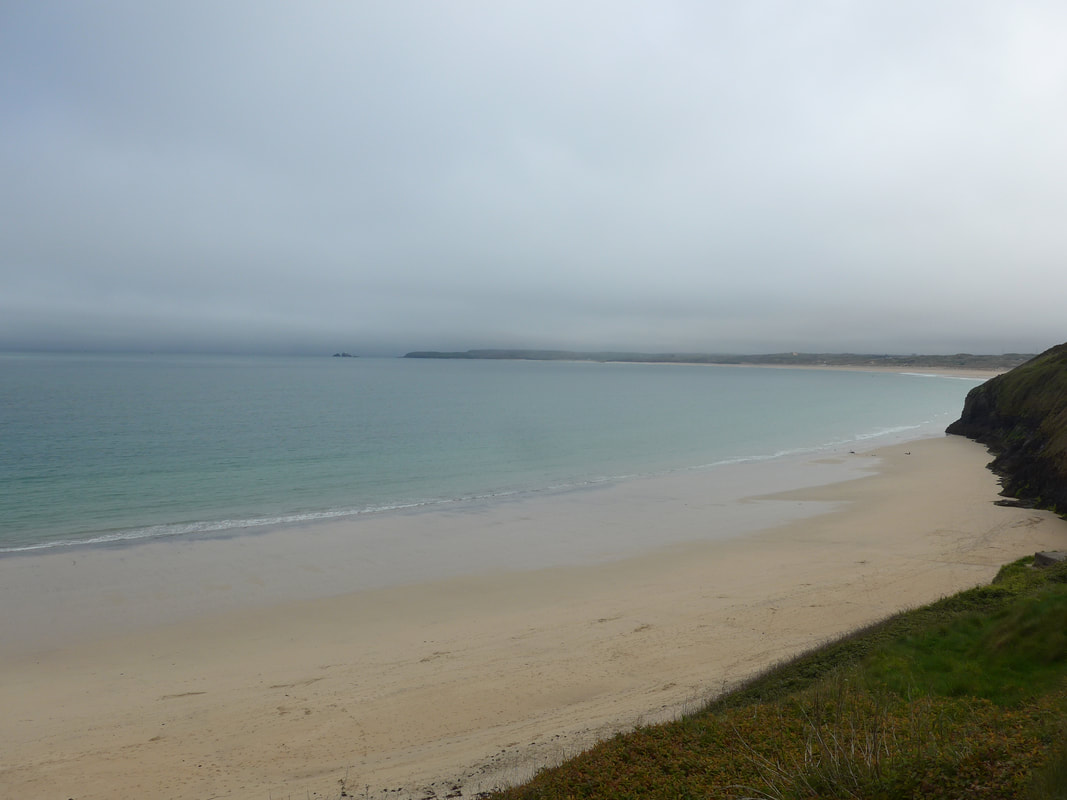
If the tide had been lower, I think we could have walked the whole distance to the Hayle Estuary on the beach. However, the rock feature Carrick Gladden intrudes on to the beach and the water was too high to walk round. From the back of Carbis Bay the cliffs of Devonian Slate rise up to over sixty metres, albeit we were walking at a lsightly lower level, before opening out and giving access to the fine Porth Kidney Sands which stretch out in front of you as you brow the hill. Beyond the outline of the River Hayle & Estuary and, on the other bank, Towan Sands disappeared in to the distance. Somewhat surprisingly, given the beautiful aspect and the wide open space on offer, both sands at that time were completely empty of people.
To the east we could see round Porthminster Point to St Ive's Head and, to the west as far as Godrevy Point & Island, the western extent of St Ive's Bay. The walking along this section was on a narrow, hard earth path that wound in and out of heavy hedgerow with light smatterings of wild flowers on the bank of the hill. Where the path was steep or there was risk of mud, steps had been built in to the hillside making the ascent slightly easier.
If the tide had been lower, I think we could have walked the whole distance to the Hayle Estuary on the beach. However, the rock feature Carrick Gladden intrudes on to the beach and the water was too high to walk round. From the back of Carbis Bay the cliffs of Devonian Slate rise up to over sixty metres, albeit we were walking at a lsightly lower level, before opening out and giving access to the fine Porth Kidney Sands which stretch out in front of you as you brow the hill. Beyond the outline of the River Hayle & Estuary and, on the other bank, Towan Sands disappeared in to the distance. Somewhat surprisingly, given the beautiful aspect and the wide open space on offer, both sands at that time were completely empty of people.
 Flowering Stone Dykes
 At the end of Porth Sands our route started turned to the right to go up the Hayle Estuary. After leaving the beach we walked through the sand dunes and then on to a road to head to Lelant and The Saltings. The early part through the dunes and later on parts of the road, was a nice, quiet and green interlude. At this point we were close to the beginning of St Michael's Way (it starts from the church of St Uny), a 12 - 13-mile path that crosses West Cornwall from Lelant to Marazion and St Michael's Mount near to Penzance.
St Uny Church, prominent on the hill at Lelant is thought to have been built around 1100 AD, probably at the time the town was an important Medieval seaport. The Irish Saint is reported to be buried in the churchyard.
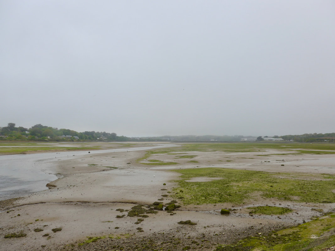
Walking still on road, we were surprised at the lovely 'flowering stone walls' we passed on this part of the route. To our left the main railway to St Ive's ran and we passed the two little rural stations of Lelant and The Saltings. Because of the location of the railway line we had little view of the estuary which lay on the other side of it. The view improved as we cleared the line of the railway. The area of water at the top of the estuary, known as saltings, is a nature reserve and bird sanctuary managed by the Royal Society for the Protection of Birds. Historically, part of the saltings was separated off to form part of the harbour area of Hayle and which later came to be called Carnsew Pool. The pool is used as a location on the 'Fishing TV' television series with presenter Steve Harrison demonstrating sea fishing techniques. At the Saltings we decided to stop for an early lunch at a delightful little cafe called Birdies where the food and coffee was of an excellent quality.
St Uny Church, prominent on the hill at Lelant is thought to have been built around 1100 AD, probably at the time the town was an important Medieval seaport. The Irish Saint is reported to be buried in the churchyard.
Walking still on road, we were surprised at the lovely 'flowering stone walls' we passed on this part of the route. To our left the main railway to St Ive's ran and we passed the two little rural stations of Lelant and The Saltings. Because of the location of the railway line we had little view of the estuary which lay on the other side of it. The view improved as we cleared the line of the railway. The area of water at the top of the estuary, known as saltings, is a nature reserve and bird sanctuary managed by the Royal Society for the Protection of Birds. Historically, part of the saltings was separated off to form part of the harbour area of Hayle and which later came to be called Carnsew Pool. The pool is used as a location on the 'Fishing TV' television series with presenter Steve Harrison demonstrating sea fishing techniques. At the Saltings we decided to stop for an early lunch at a delightful little cafe called Birdies where the food and coffee was of an excellent quality.
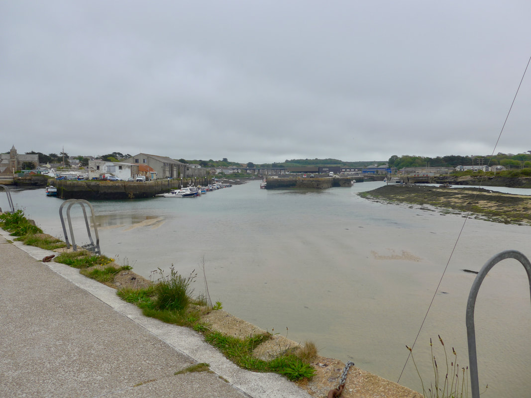
After lunch, we continued walking on road to skirt down the western edge of the River Hayle & Estuary, down past Carnsew Pool and in to the old harbour area of the town of Hayle. We were fortunate that where we came out at the South Quay there was a huge Asda store and we were able to to stock up for the run of camping that we faced for the next week. On numerous places on the harbour side there were signs foretelling the future for all the different quays that dot the area and, if the plans come to fruition, it has an exciting future.
We made our way round the different quays to cross over the harbour to the area known as 'The Towans', which in Cornish means 'sand dune'. It seemed to us the area was dominated by two things: holiday cottages and caravans and, nature reserve land. Various areas of Towan sport exotic names such as "Mexico Towan' and Riviere Towan'.
We made our way round the different quays to cross over the harbour to the area known as 'The Towans', which in Cornish means 'sand dune'. It seemed to us the area was dominated by two things: holiday cottages and caravans and, nature reserve land. Various areas of Towan sport exotic names such as "Mexico Towan' and Riviere Towan'.
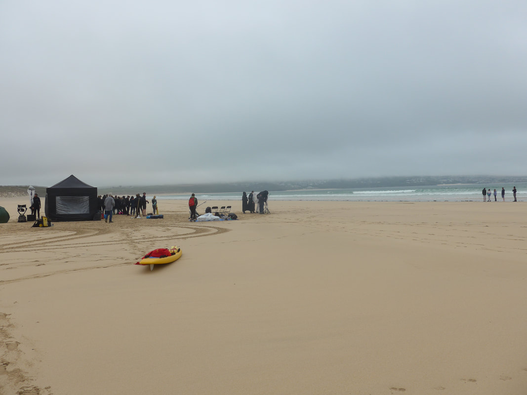
 Mexico Towans to Godrevey Point & Island
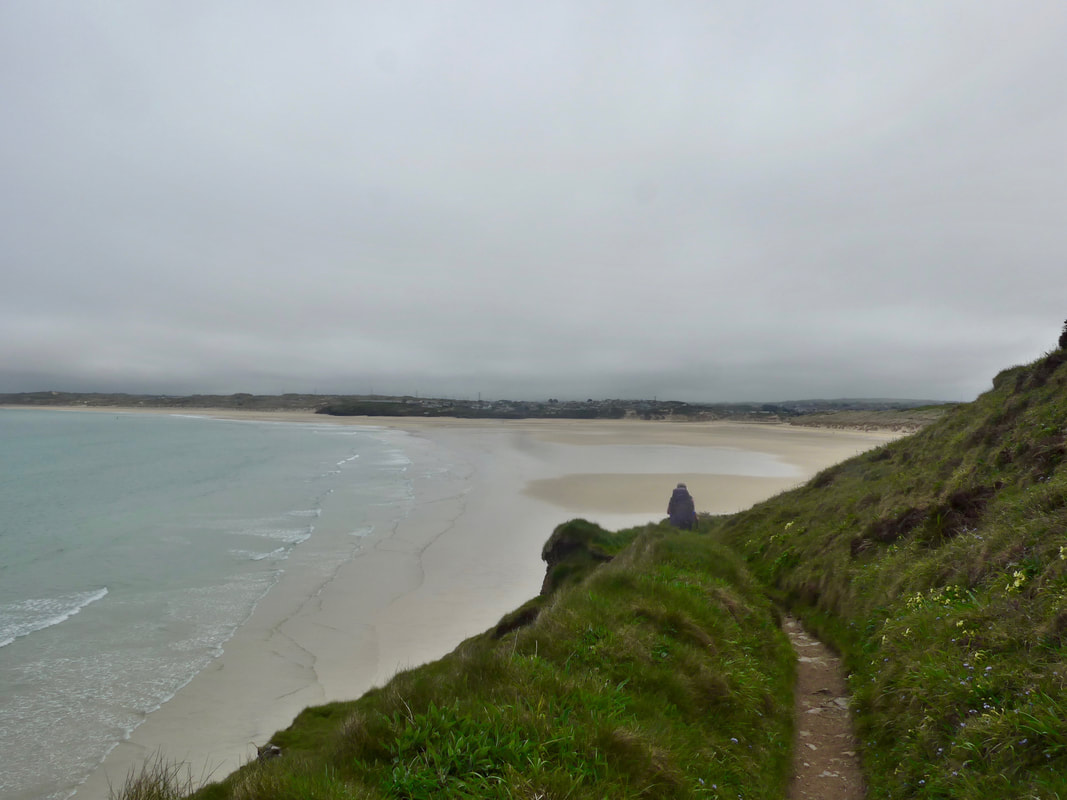
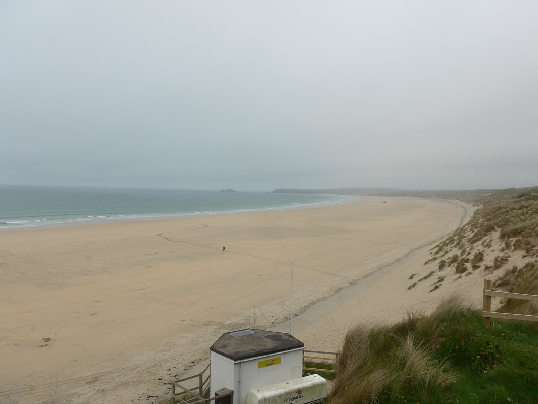
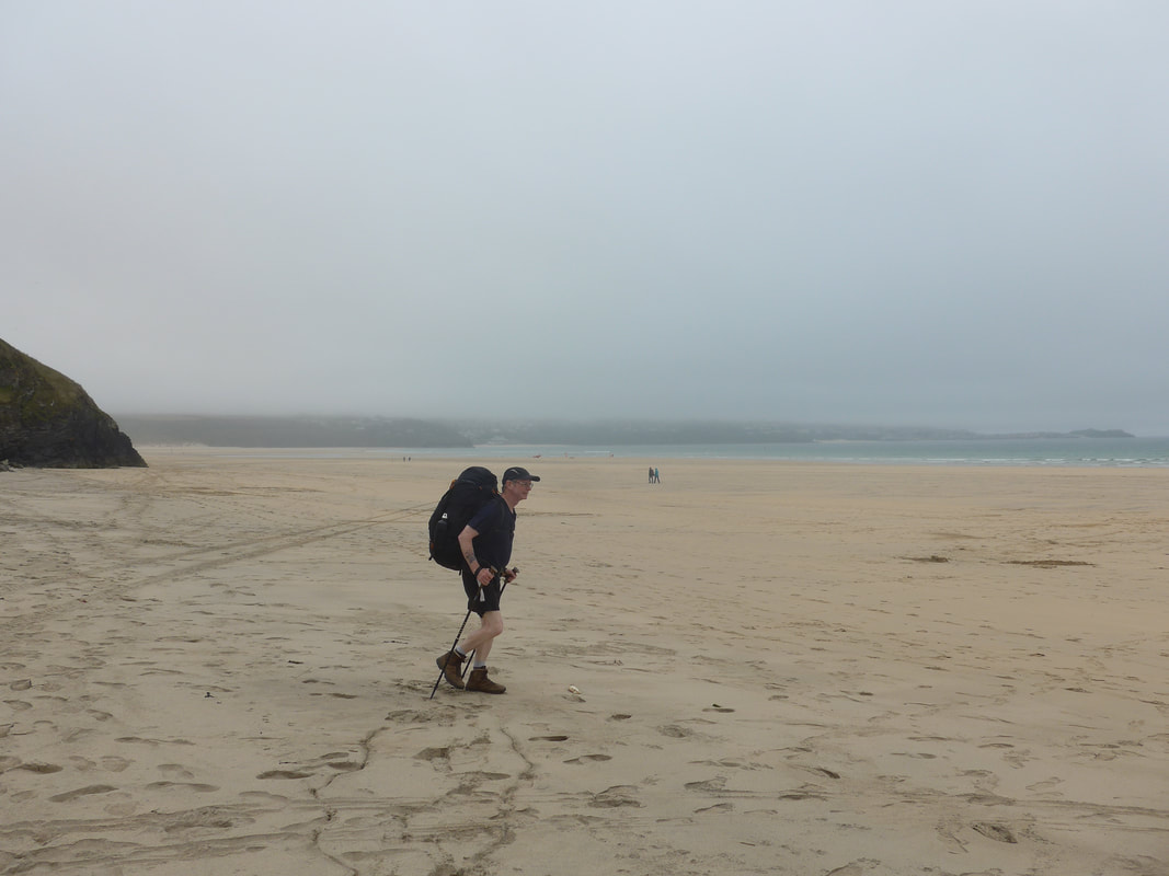
 After crossing at the harbour, we resisted the temptation to drop down on to the sands and stayed high on the sand dunes until we had 'turned the corner' where we dropped down from Mexico Towans on to Towan Sands. This was the first proper beach walk we had for some time and, for two people who like walking at the edge of the sea, it was like water to a thirsty man. Although there was a light mist around it did not stop us enjoying the lovely firm sands and the three-mile walk along the beach. From some distance away, we could see a structure of some kind had been set up on the beach but could not make out its purpose or function. Only as we came closer could we see that it was a film crew but as we neared their location the 'heavies' (actually a young woman) quickly headed our way to head us off to the back of the their filming unit. Despite our attempts to find out what they were up to they would not divulge any information, nor could we see clearly the group of actors being filmed on the water's edge.
This was a wonderful expanse of sand, very firm close to the water and lovely walking. As well as the acting crew, by now there were other people on the beach including one man we spoke to who knew our home town because of the annual AC / DC Rock Festival that is held there. He had attended the festival a couple of years ago but having recently moved house to Cornwall had been unable to return. At the end of the beach we stopped by Strap Rocks at the car park and public conveniences to take stock of our location in relation to our campsite. We decided to carry on for about another mile across St Gothian Sands and to walk through the nature reserve.
St Gothian Sands is now a nature reserve but was once a focus for the extraction of sand and gravel. Designated as a nature reserve in 2005, it includes a man-made lagoon and island. Nearby in the sande dunes above the sands (on the other side of Churchtown Road) is the site of Saint Gothian's Oratory & Chapel, now covered by drifting sands. The oratory is thought to date from 5th or 6th C, on top of which a chapel was built in 7 / 8th C, with yet another stone built chapel erected on top of that in the 9 / 10th C.
When we did eventually go up through the dunes, past the lagoon and on to Chapeltown Road, we ended up doubling back on ourselves for about half the extra distance we had walked. Still, no harm was done and we arrived in good time and good fettle at our campsite at Gwithian, which sits just off the main road.
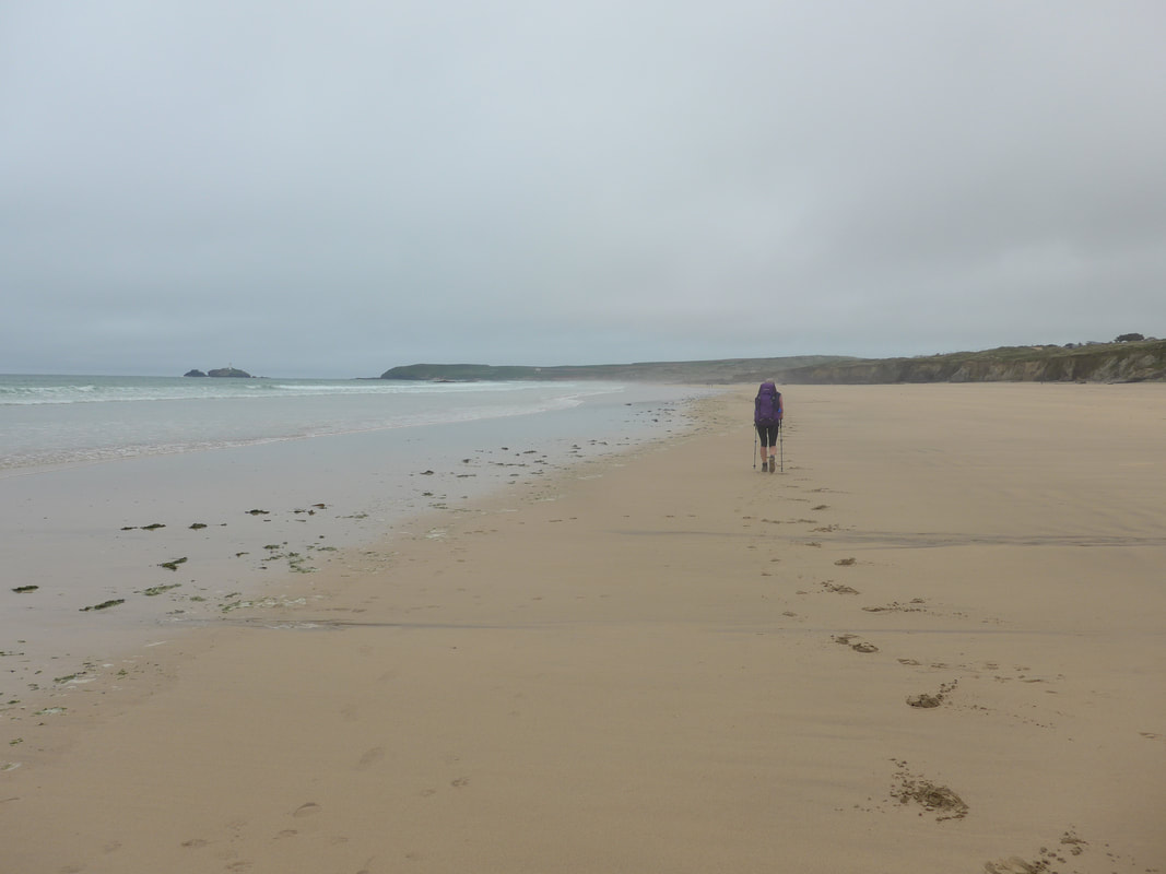 Approaching Gwithian Towans
 Gwithian Farm campsite is a wee jewel of a place and we found it after reading a review in the Guardian newspaper. With level pitches, good support services such as showers and toilets and a pub just across the road that serves really nice food, what is there not to like? Because it was so early in the season, we virtually had the place to ourselves. As soon as we had pitched up and showered, we headed for the Red River Inn just across the road where we enjoyed a very nice meal in nice surroundings, although it was a very busy pub.
While we were in the pub I chatted with four lads (I use the term loosely - none of them would have been under forty), old pals hailing from Dunkeld, Manchester and Newquay and who were walking some sections of the coast path. It was difficult to understand their route because it seemed to be heavily influenced by the location of pubs and they were not averse to a short-cut if meant reaching the said pub a bit quicker. We were to cross paths with the lads for the next three or four days as we shared campsites and eateries. They always managed to reach our destinations well before we did, even on the days when we left early and they lay on nursing hangovers, and yet on only one occasion did they pass us on the path. Must have been magic!
While we were in the pub I chatted with four lads (I use the term loosely - none of them would have been under forty), old pals hailing from Dunkeld, Manchester and Newquay and who were walking some sections of the coast path. It was difficult to understand their route because it seemed to be heavily influenced by the location of pubs and they were not averse to a short-cut if meant reaching the said pub a bit quicker. We were to cross paths with the lads for the next three or four days as we shared campsites and eateries. They always managed to reach our destinations well before we did, even on the days when we left early and they lay on nursing hangovers, and yet on only one occasion did they pass us on the path. Must have been magic!
 RSS Feed
