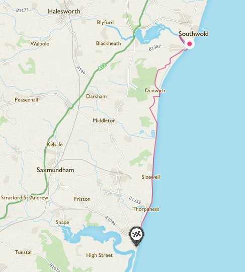
Route Map
 Weather Report
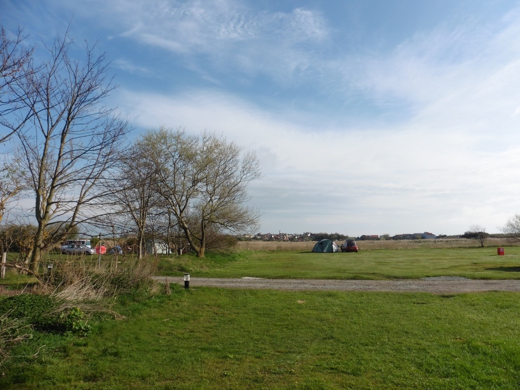
 We enjoyed a nice, quiet night on the campsite and although it was slightly chilly, it was not cold enough to stop us sleeping. A quick look out the tent confirmed a dry but cold morning. With a long day in front of us, including a long detour inland to go around the water features of Corporation and Dingle Marshes, we wanted an early start to make sure we finished at a reasonable time. Quick cup of tea and a porridge pot and we were on our way. The sky was blue with occasional white cloud but this early it was cold and we set off with coats and gloves on.
 River Blyth
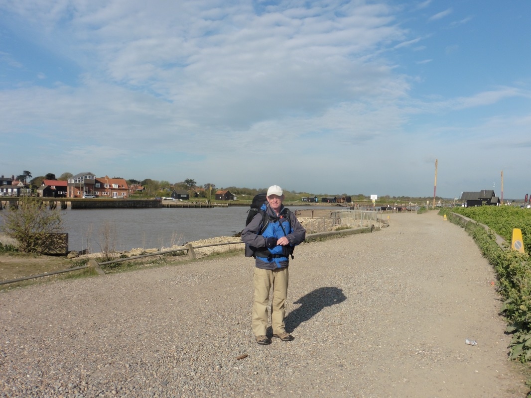
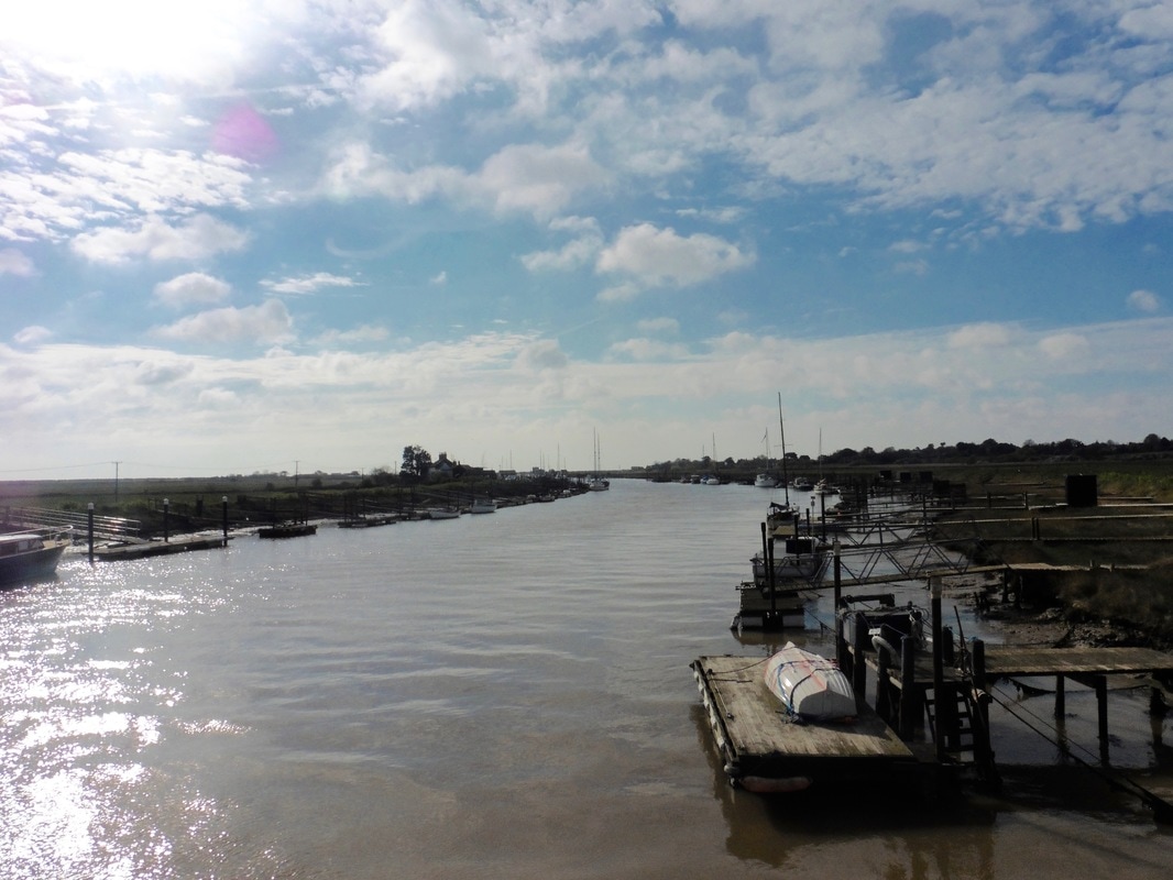
 We exited the camp by the ‘back door’, retracing our steps back to the harbour area. It was deathly quiet in the early morning in contrast to the bustle of last night when there were lots of holidaymakers around. Although there was a ferry service across the River Blyth, we reneged on it and made instead for the sluice slightly further up river. We had a short walk through the harbour area to access the crossing and then a short walk back down. As in all these coastal areas there was a wonderful sense of space and, despite the overhead cloud, some beautiful play of the light on the water.
River Blyth & Harbour
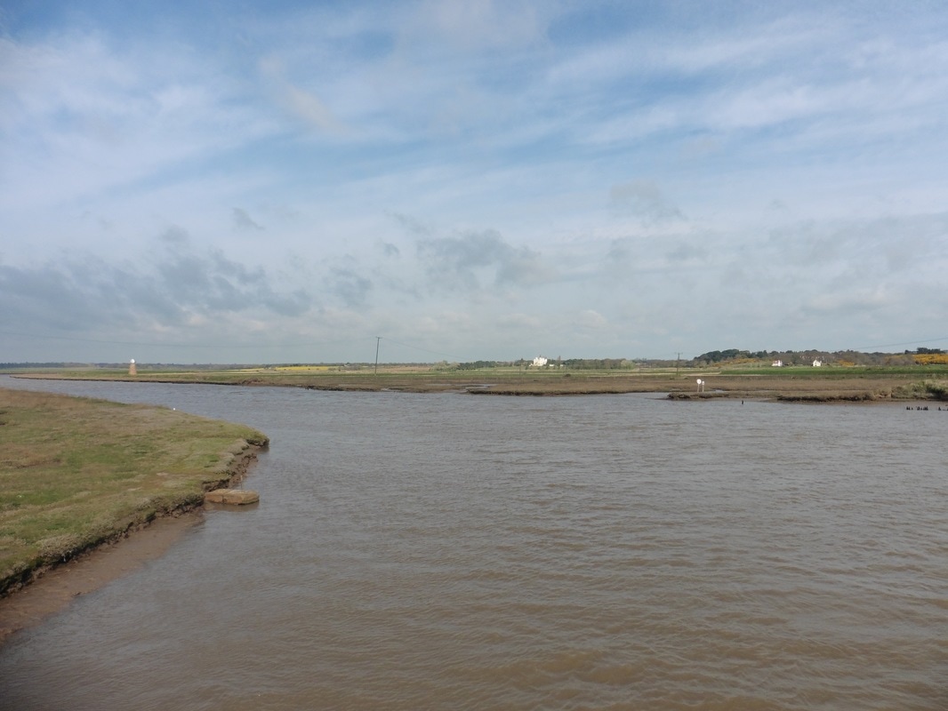

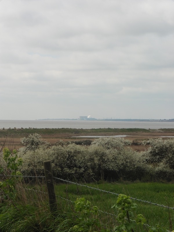
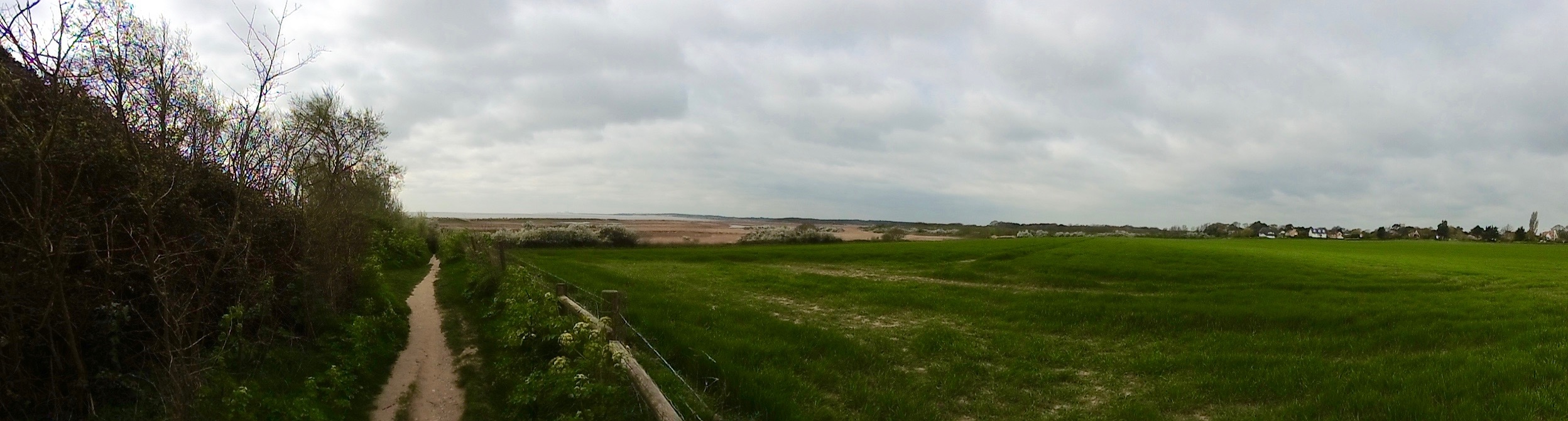
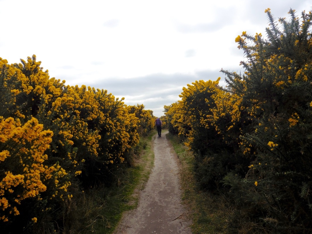
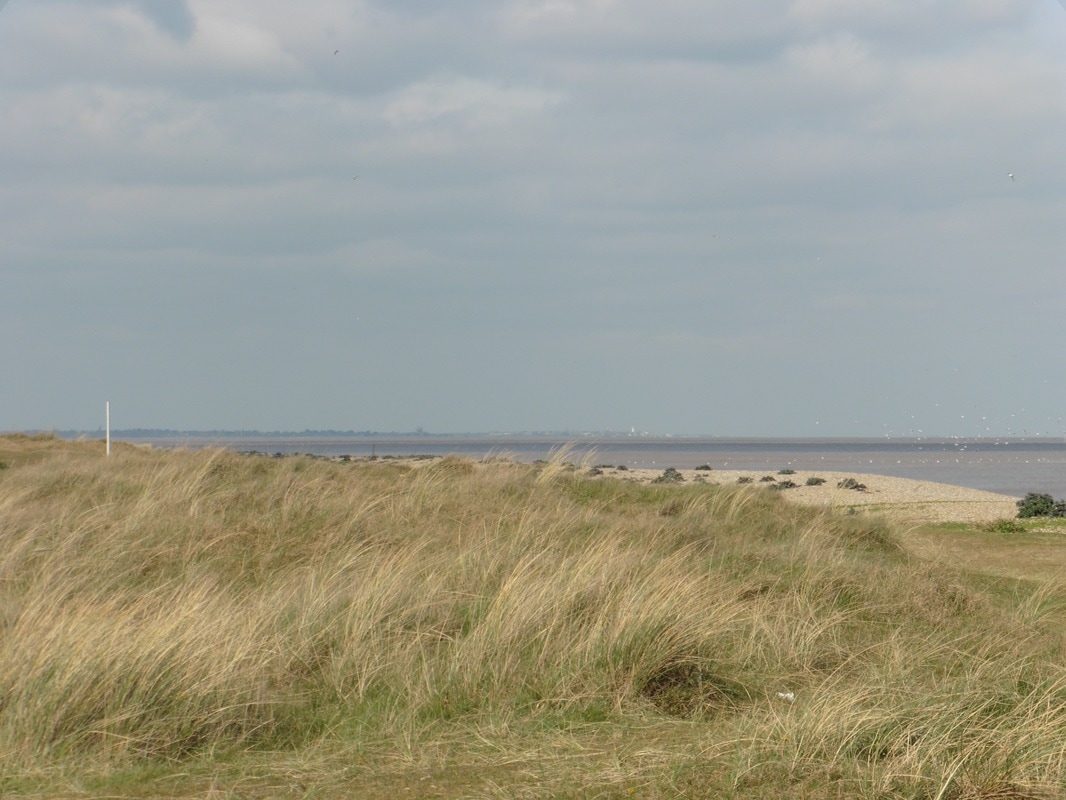
Our route today takes us inland to go around the many water features and across the marshes and fenlands that are, literally, everywhere. While we exited on to the beach, known as The Flats, after coming down the river, we were not to see it again for much of the day, albeit we did have occasional glimpses of the sea in the distance. Looking across the North Sea, we could see the white sparkle of the dome on Sizewell nuclear power station, which we would pass later in the day. From the beach we needed to cross the Dunwich River, which discharges here in to Walberswick Harbour. There was a choice between a couple of footbridges to achieve this purpose and we faffed around trying to figure out the best route for ourselves that kept us as close to the coast as possible. We are very good faffers; indeed we could and should have Degrees in Faffing so good at it are we!
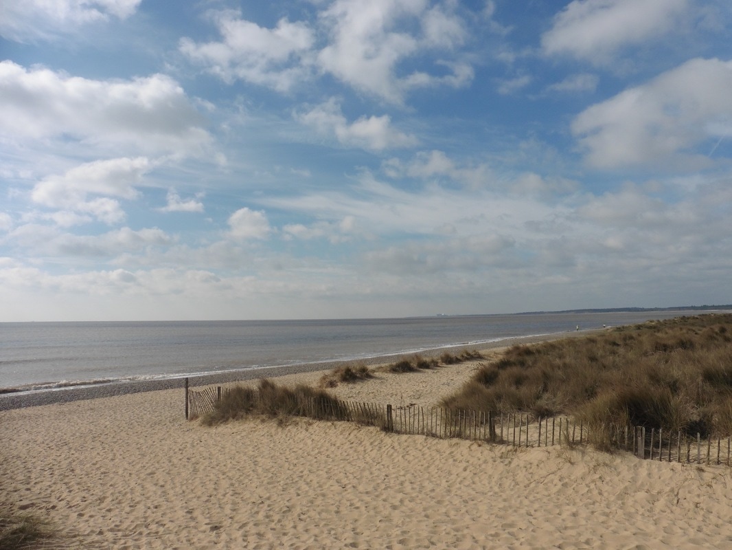
The Flats

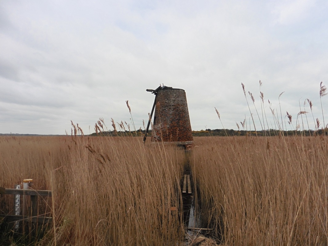
 Corporation Marshes
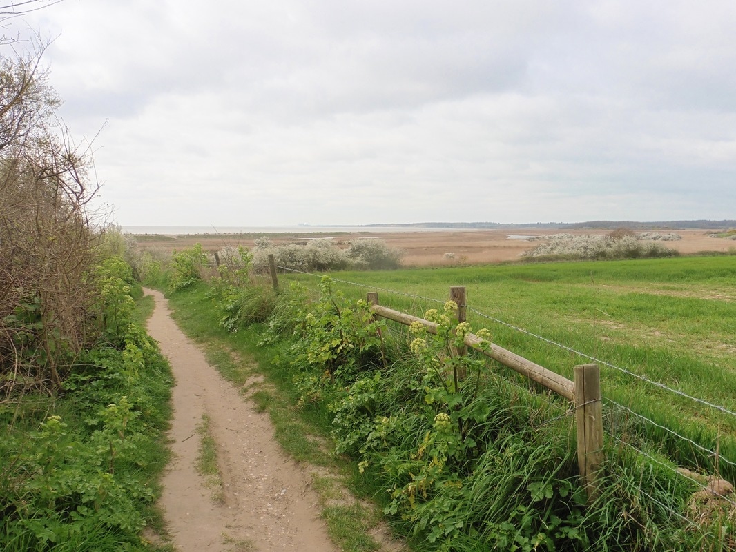
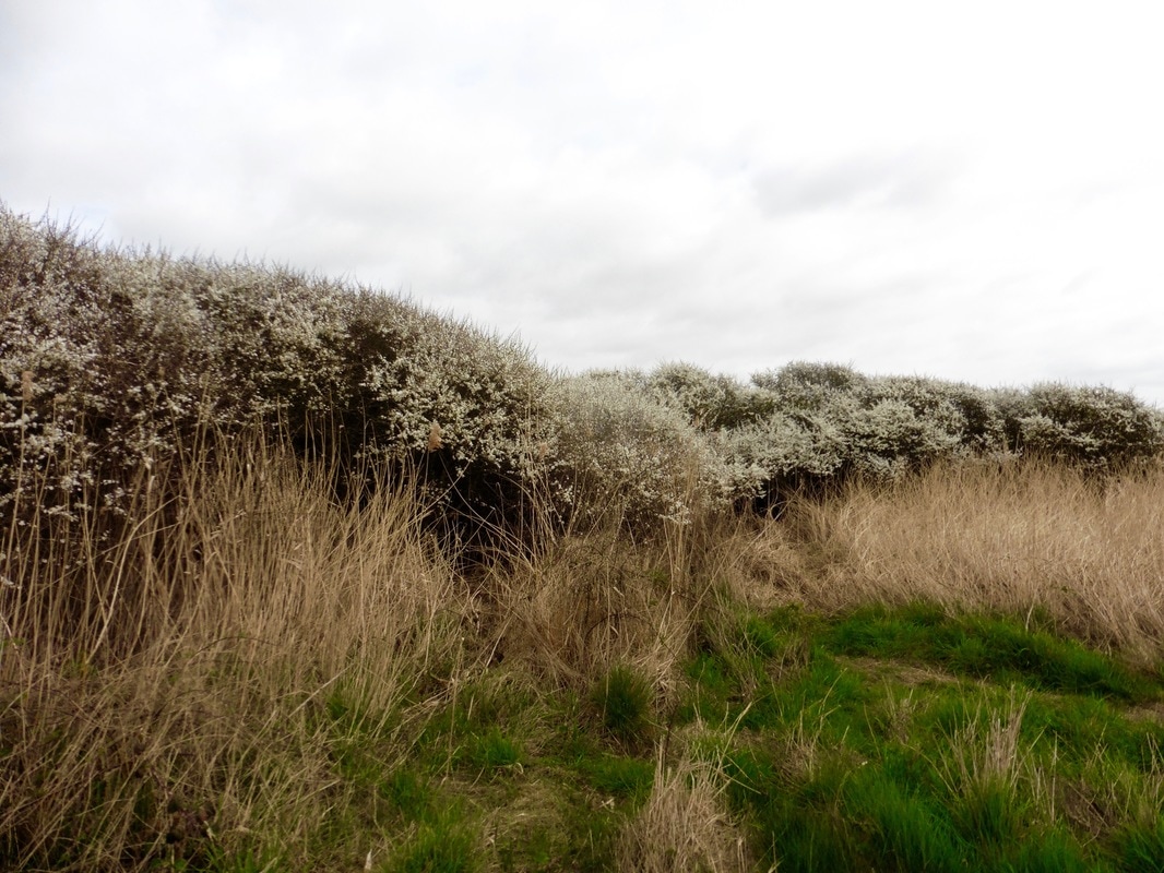
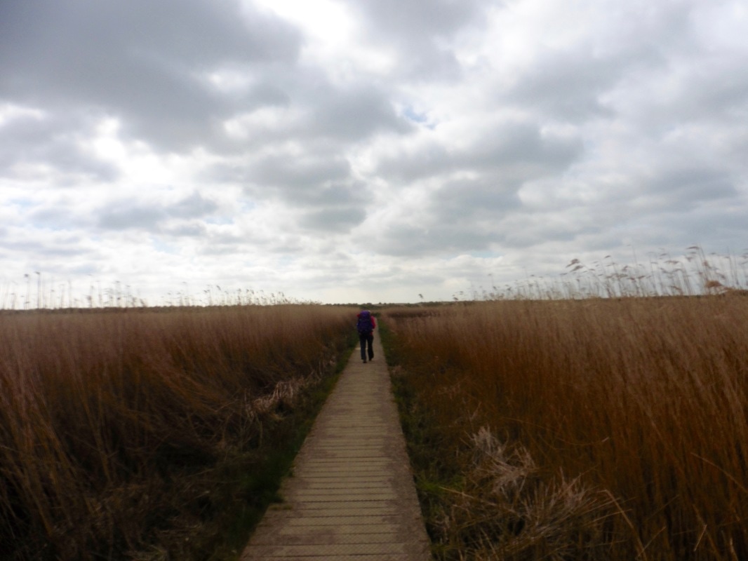
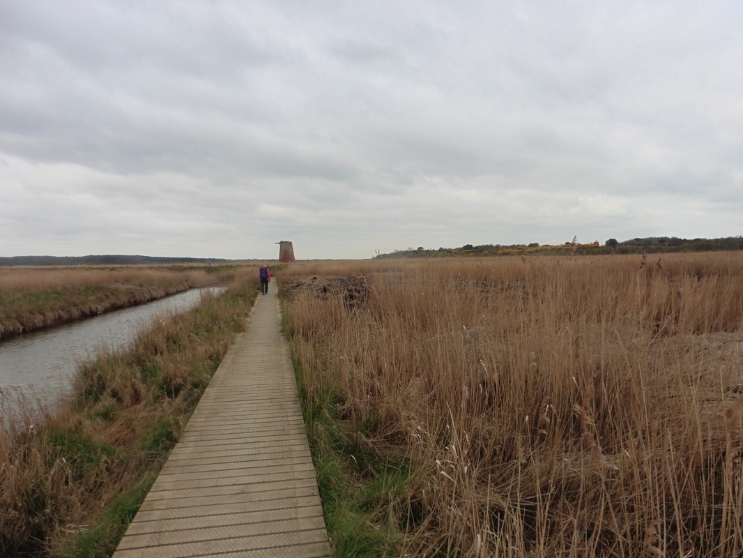
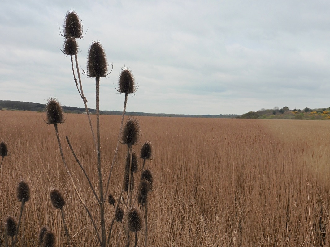
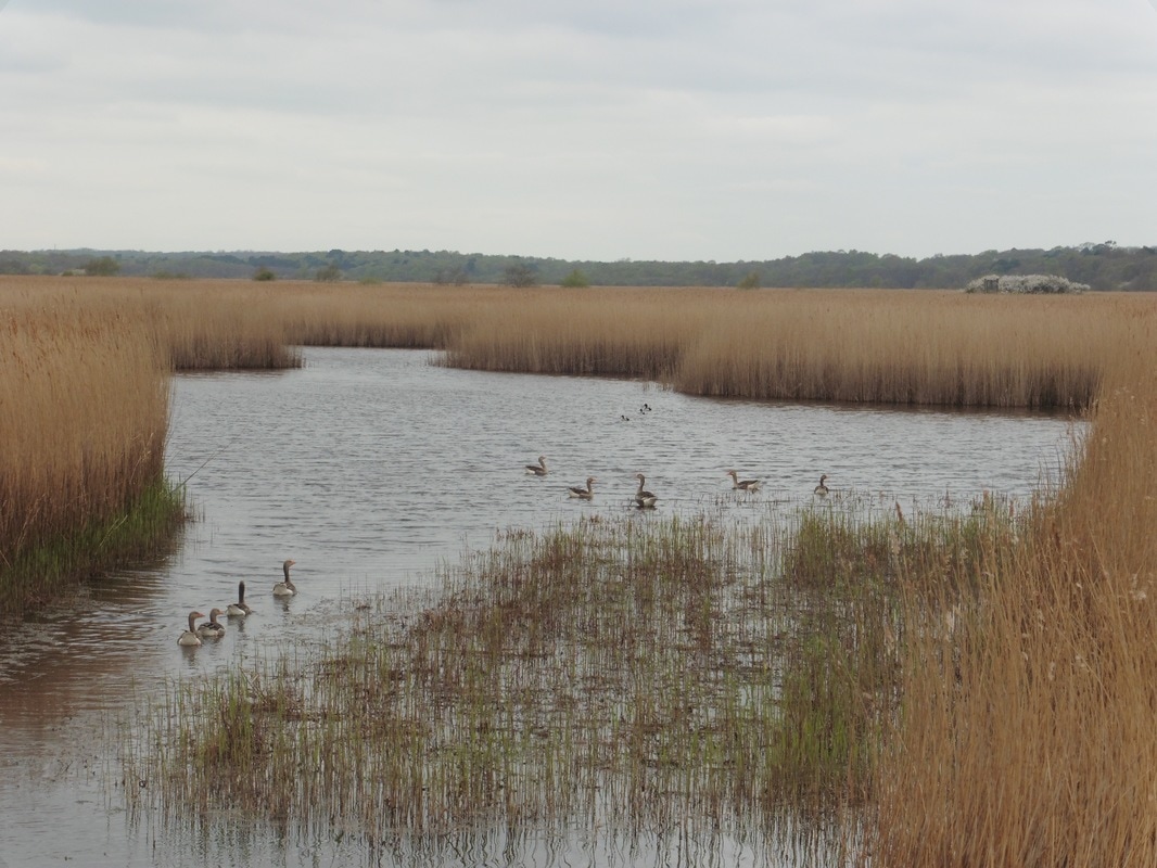
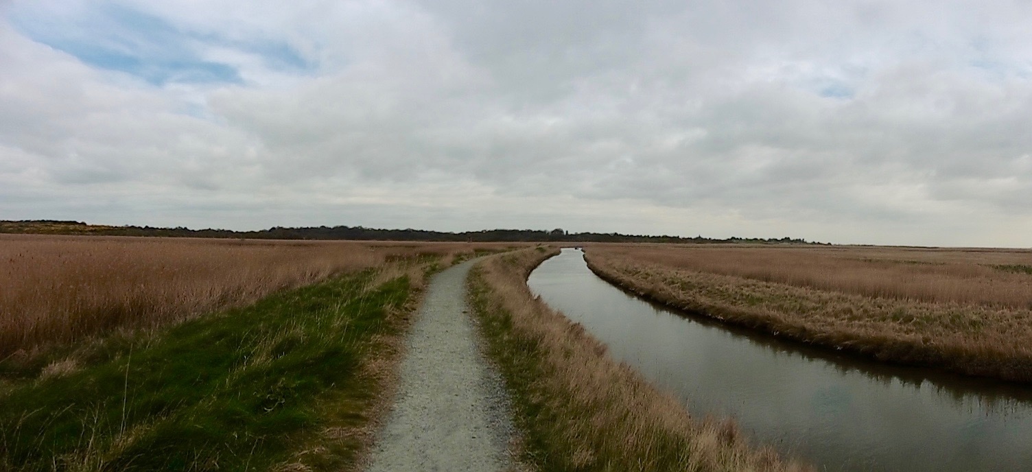
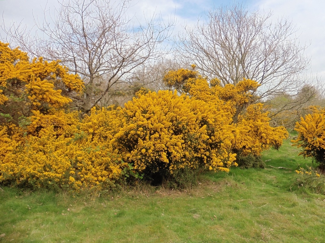
 The walk through the marshes and fenlands, often on wooden duckboards was both a joy and a delight. The landscape was stunning and throughout we were accompanied by the singing of the larks and other songbirds. As you walk the fens you are surrounded by water and the landscape is dotted with the ruins of the watermills that were used to manage the drains. The reed beds were stunning, miles of it in every direction, tall and golden, swaying in the breeze, the wind soughing gently through them providing a gentle percussion accompaniment to the song of the birds and the quiet morning. Proud stands of teasel lined the edges of the pathways and showed dark and stark against the light coloured sky. Slightly further inland, small islands of yellow broom and the white blossom of hawthorn / blackthorn contrasted with the golden reeds. In the waterways families of ducks gently swam in the clear waters, sedate, content and safe.
Corporation Marshes
 Spring Blossom
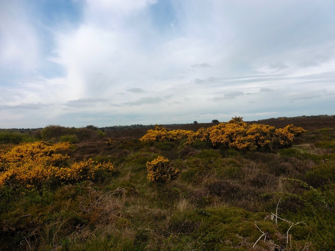
 Our route took us past the Walberswick Nation Nature Reserve at Westwood Marshes where we left the fen landscape behind to skirt the edge of Dunwich Forest. The delights continued here with huge, colourful stands of shrubbery and with good walking on a solid path. The section ended when we came to the edge of the village of Dunwich, another Suffolk village to have suffered at the hands of coastal erosion only in this case it has lasted for eight hundred years.
Reed Beds
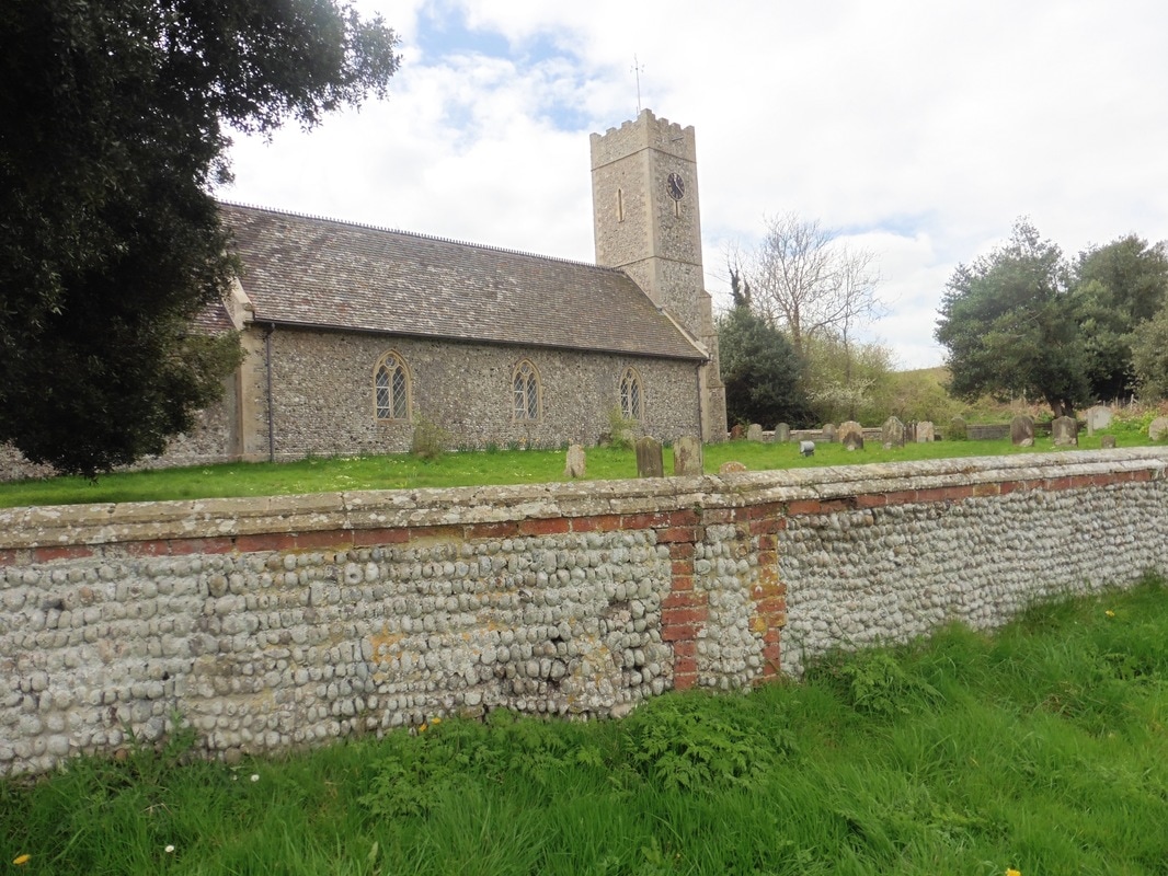 St Jame's Church
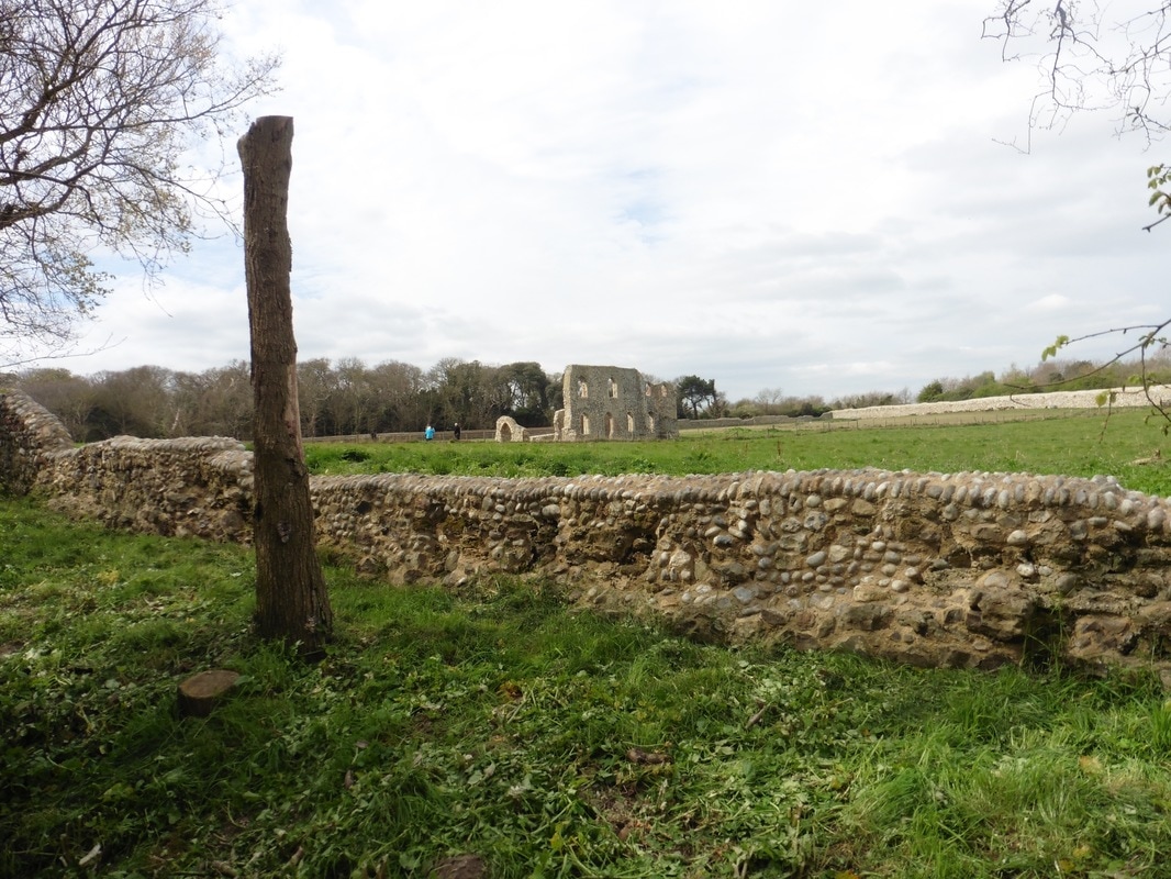
 It is possible to by-pass the centre of Dunwich village but we took the option to go through it and visit the remains of the wonderful Greyfriars Priory that stand on the cliff top. The current parish church is St Jame's Church which you pass at the crossroads. The church grounds are also the site of a medieval leper's graveyard.
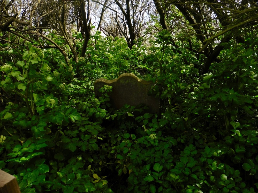
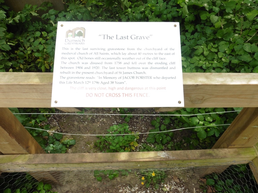
The monastery is one of the last buildings to survive from an East Anglian medieval village that has since been lost to the sea. On the edge of the monastic site there is a very poignant site where the last gravestone from an ancient churchyard cling tenaciously to the cliff edge. The remainder of the graveyard has already given up its contents to the sea. It is said that when there has been storms here there are still occasionally bones found on the beach or sticking out from the cliff face. In recent years a tremendous amount of archaeological work has been done on the site, including substantial marine archaeology, to try and understand the role played by Dunwich in medieval times, with thoughts it was the capital of an Anglian kingdom.
The monastery is one of the last buildings to survive from an East Anglian medieval village that has since been lost to the sea. On the edge of the monastic site there is a very poignant site where the last gravestone from an ancient churchyard cling tenaciously to the cliff edge. The remainder of the graveyard has already given up its contents to the sea. It is said that when there has been storms here there are still occasionally bones found on the beach or sticking out from the cliff face. In recent years a tremendous amount of archaeological work has been done on the site, including substantial marine archaeology, to try and understand the role played by Dunwich in medieval times, with thoughts it was the capital of an Anglian kingdom.
Dunwich Greyfriars
Leaving the friary we were again forced inland to avoid the dangerous Dunwich Cliffs. Our route initially took us through Greyfriar's Wood before crossing over the beautiful Dunwich Heath where we were treated to another great show of springtime blossom. From the heath we dropped back down to a path that run just behind the beach and taking us along in front of the RSPB Minsmere Nature Reserve. The reserve has a wide range of habitats ranging from beach, to heath and woodland.
Yellow Blossom
On a small hill on the reserve there are the remains of Leiston Chapel, built in the grounds where the original Premonstratensian Abbey (White Canons) would have been located. Originally founded in 1182 for 26 Canons, the abbey was moved in 1363 to another site about three miles away from the Minsmere location, in part because the abbey was being constantly flooded by the sea. Much of the stone from the old abbey was used to build the new one. The current ruins on the site are those of the Chapel of St Mary built in what would have been the nave of the old church. During World War II, a pillbox was built in to the east end of this chapel.
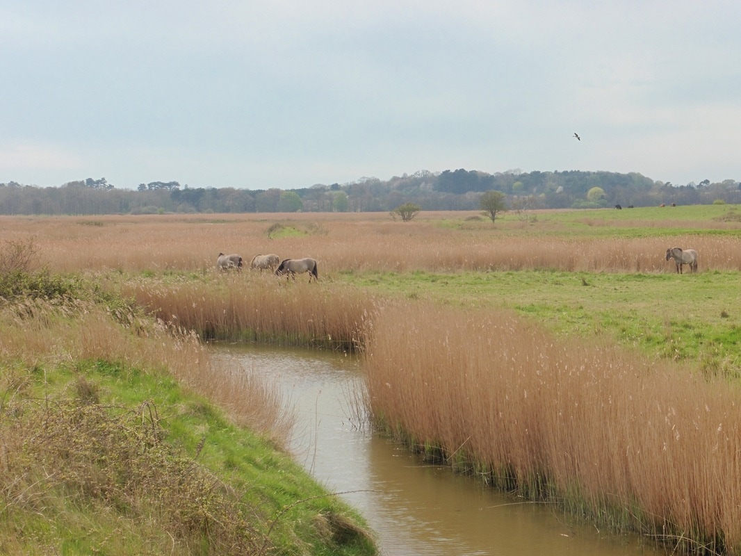
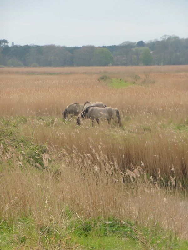
Minsmere is one of the prime bird watching sites in the United Kingdom with over 100 species including bittern, pied avocat and Savi's warbler. The management of the reed beds is highly praised and there have been over thirty species of butterfly recorded and the moth species include one never before recorded in the UK and now given the common name Minsmere crimson underwing. In 2001, nine Polish Konik horses were brought to the reserve to increase the grazing capacity and we were fortunate enough to see them at close hand. Highland cattle, Exmoor ponies and sheep are graze in the reserve.
Minsmere Nature Reserve
 Sizewell B
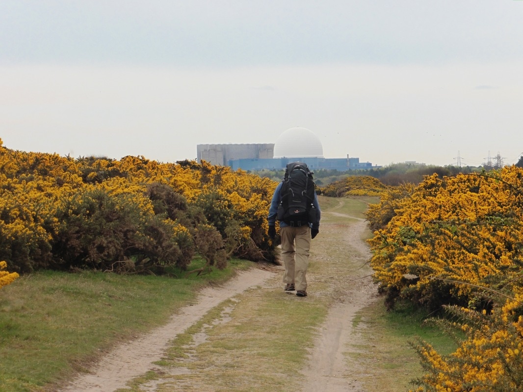
 We were still on the Suffolk coastal Path and walking just slightly back from the beach, which was hidden from us by the thick shrubbery and small dunes to our left. Leaving MInsmere we were headed for the Sizewell reactor site that had dominated the horizon for much of the day. The site consists of Sizewell A and B, with the former, which had two magnox reactors, in the process of being decommissioned having been shut down on 31 December 2006.
 View from Sizewell
 Sizewell B is the only water pressurised power station in the UK. Commissioned in 1987 and completed in 1995 and is operated by EDF Energy. The planned closure date for the plant was to be 2035, but the company hope to extend the plant life by some twenty years. The white dome structure that can be seen for miles around the plan is the outer shell of a twin-walled containment unit that shields the water reactor and the steam generators. On 21 October 2015, plans were agreed between Britain and China to build additional nuclear capacity, with one of the developments to be based at Sizewell (Sizewell C).
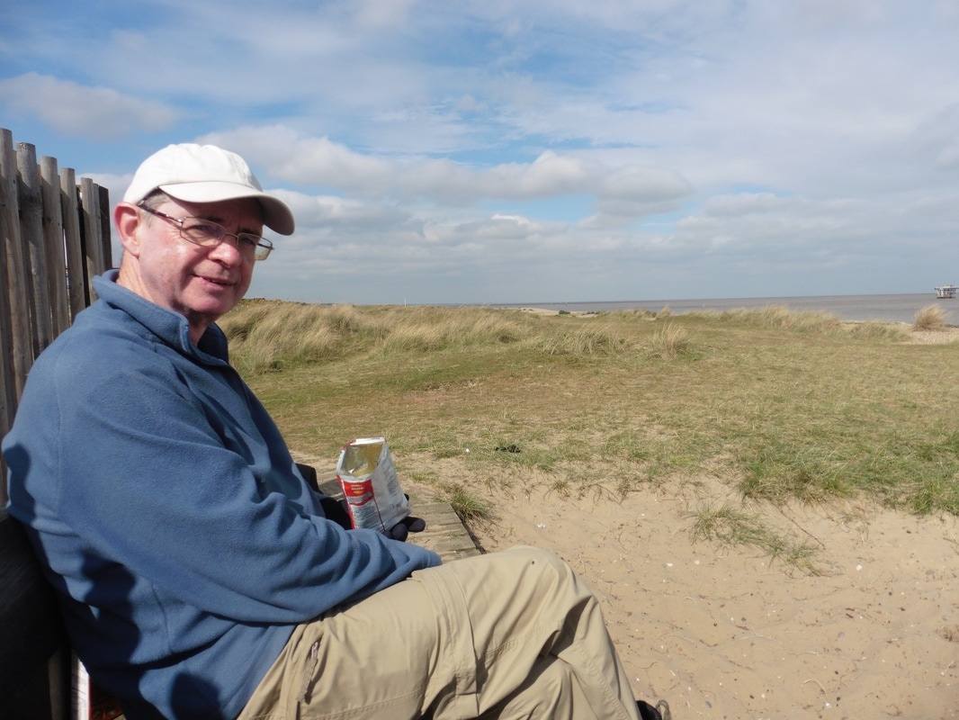
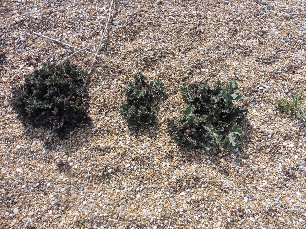
There is a cafe by the plant and we were tempted to go in for coffee but decided the comfort of a café would delay us too long. Instead, we sat outside beside the sea and had a brew up. In the shingle nearby some sea cabbage was growing but I resisted the urge to have it in the pot and left it for another day.
Nuclear-infused Tea Break
 Shingle Beach
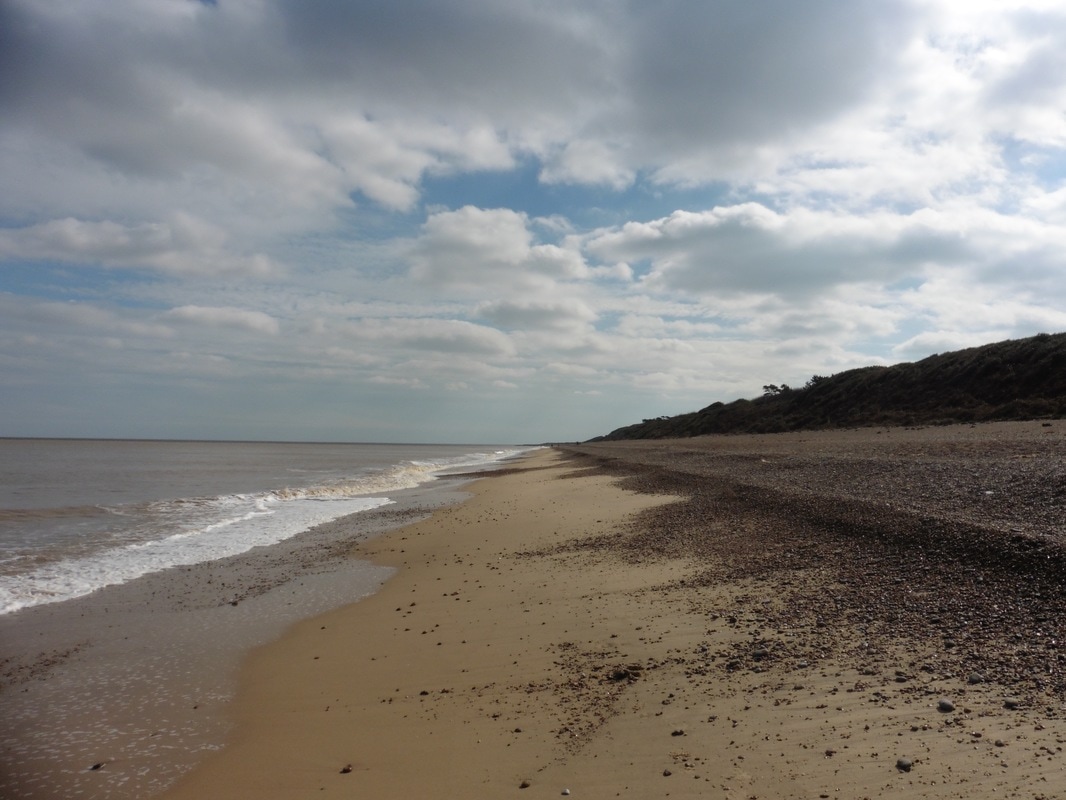
 After our break we took up station by the waters edge and set off for a relatively long beach walk to Aldeburgh. There were considerable berms (step ups) on the beach here with the shingly banks acting as protection for the shore. At the back of the pebble beach, low lying soil and gravel cliffs showed a bare face to the sea where the surface soil had been washed away. The cliffs here are very delicate and it is advisable to keep your distance from them when walking on the beach. A gentleman was killed here in January 2017 when a section of cliff collapsed on him when he was out walking his dog.
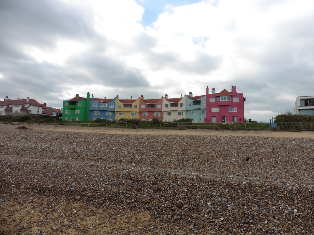
Passing Thorpeness we were impressed by this colourful row of buildings and the increasing height of the shingle beach defences. Our accommodation for the night was in a small village just outside Aldeburgh and we were not quite sure how to get there. We were fortunate that just after we entered Aldeburgh a group of men were playing boules and one of them gave us directions. A short bus rise later we were booking in and lying down at the Butcher’s Arms in Saxmundham. Later in the evening we enjoyed another very good meal in the pub restaurant, before retiring for the night after confirming our travel arrangements for the next morning.


 RSS Feed
