
After a shower and a wee rest last night, we ventured out to a hotel just down the road from our accommodation and had a nice meal in the restaurant. It always surprises me just how quickly you can recover from fairly arduous walks. Many times we have finished twenty milers and thought ' I'll never be able to walk tomorrow'. But so far we have not cancelled a walk yet because we were tired. The secret seems to be to take a walk after you have finished for the day. After dinner we partook of a wee promenade along the beach front, where we enjoyed a wonderful sunset over the sea.
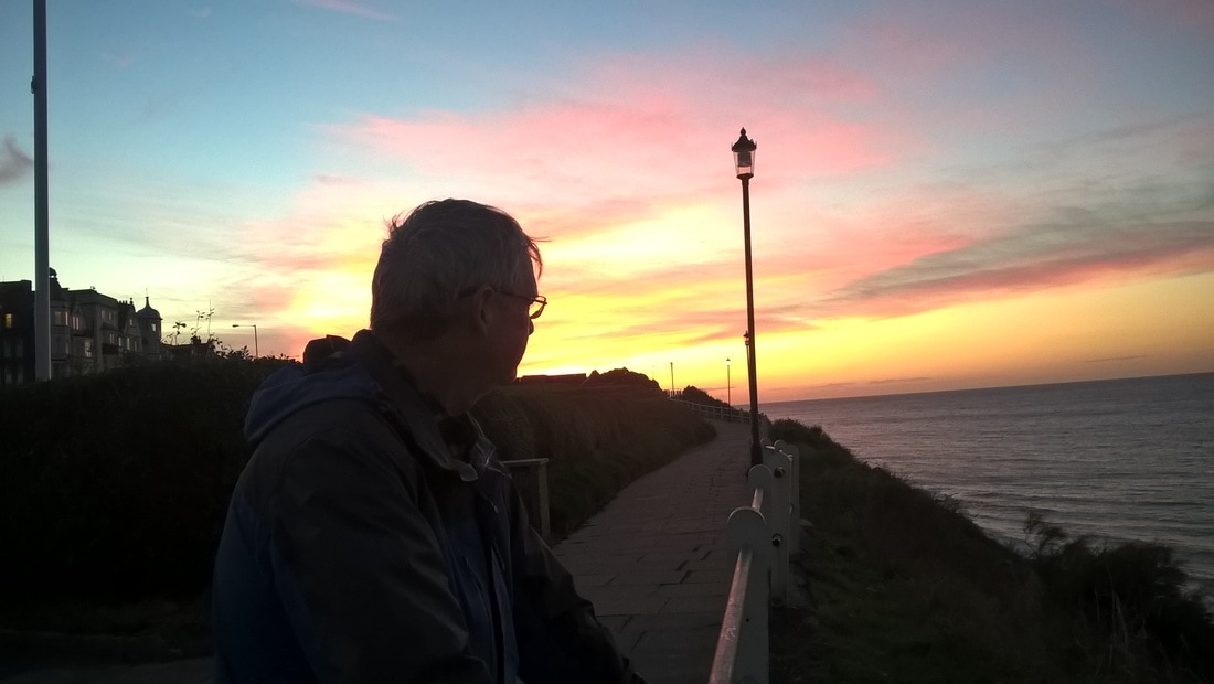
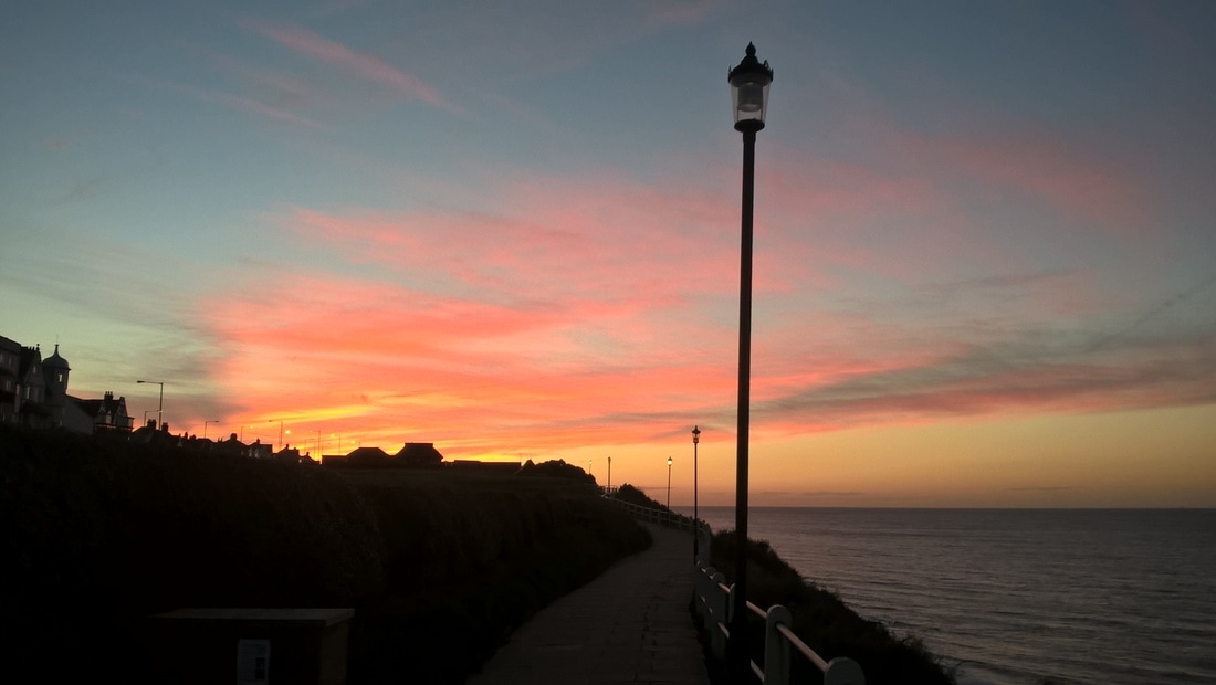

Sunset Over Cromer
After a nice and leisurely breakfast this morning, we walked to the end of the road to catch the coast hopper bus back to Weybourne and the startline for today's short adventure. We had been tempted yesterday to finish off the walk to Cromer. However, as I was just starting back after a wee health scare I did not not want to take a chance extending the walk to twenty-two miles. Plenty time for that next season when I have had more time to recover. That meant today's walk would be a very short six miles, which gave us lots of time to enjoy the land and seascape. On occasion we have crammed in the miles at the cost of enjoying the actual walk and its nice not to do that for once.
 Weybourne Hope
 From the village we made our way back down Beech Lane to stand on the stretch of beach known as 'Weybourne Hope'. The Weybourne Parish Council website gives the origin of the name as 'Wearg-Burna’ or the ‘Felon Stream’ and suggests it may have been a place where criminals were drowned. Glad I didn't live there when I was younger!
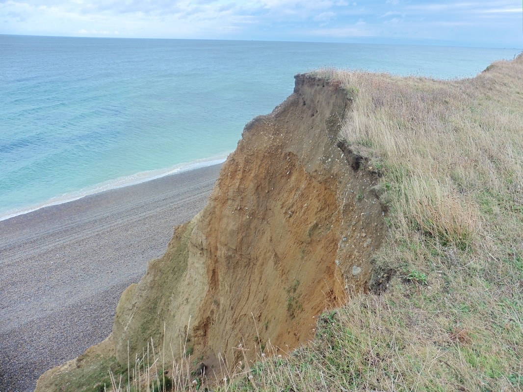
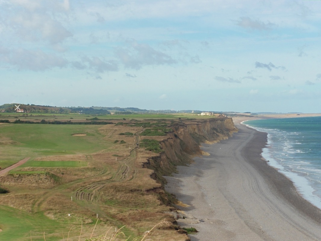
The Hope is a continuation of the steep gravel beach that we walked on yesterday. The first decision of the day is whether to continue along the beach (hard walking) as we did yesterday, or to take the 'high road' along the cliff top (slightly easier walking and more scenic). As the tide is high and we are not sure about how far up the high water line reaches, we plump for the cliff walk and and are soon making our way up Water Hill.
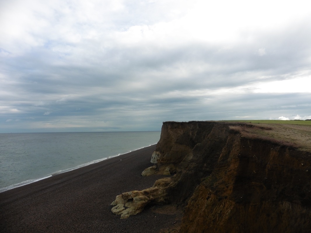
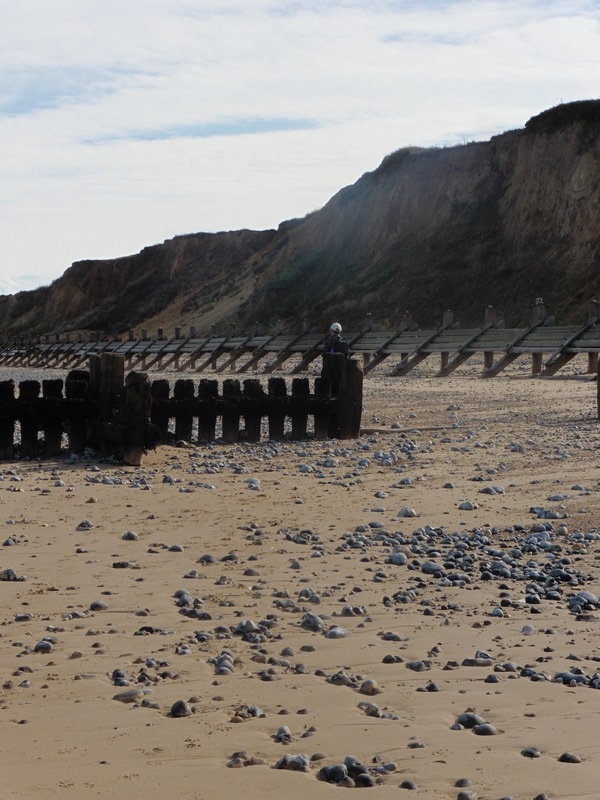
There are good views back towards Blakeney and clear evidence of the damage being wrought on the cliffs here from coastal erosion. Unlike the harder limestone cliffs of North Yorkshire, the Weybourne Chalk is softer and more susceptible to damage with the sea undercutting it at the base at high tide and, water penetration on the top, more permeable layer. If you are interested in the geology of the area, this link gives a reasonably accessible introduction.
The Hope is a continuation of the steep gravel beach that we walked on yesterday. The first decision of the day is whether to continue along the beach (hard walking) as we did yesterday, or to take the 'high road' along the cliff top (slightly easier walking and more scenic). As the tide is high and we are not sure about how far up the high water line reaches, we plump for the cliff walk and and are soon making our way up Water Hill.
There are good views back towards Blakeney and clear evidence of the damage being wrought on the cliffs here from coastal erosion. Unlike the harder limestone cliffs of North Yorkshire, the Weybourne Chalk is softer and more susceptible to damage with the sea undercutting it at the base at high tide and, water penetration on the top, more permeable layer. If you are interested in the geology of the area, this link gives a reasonably accessible introduction.
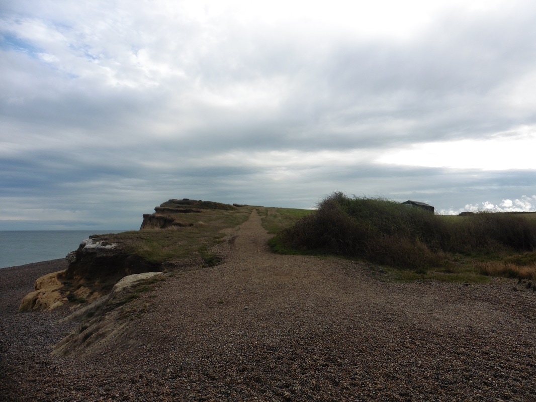

Weybourne Cliffs
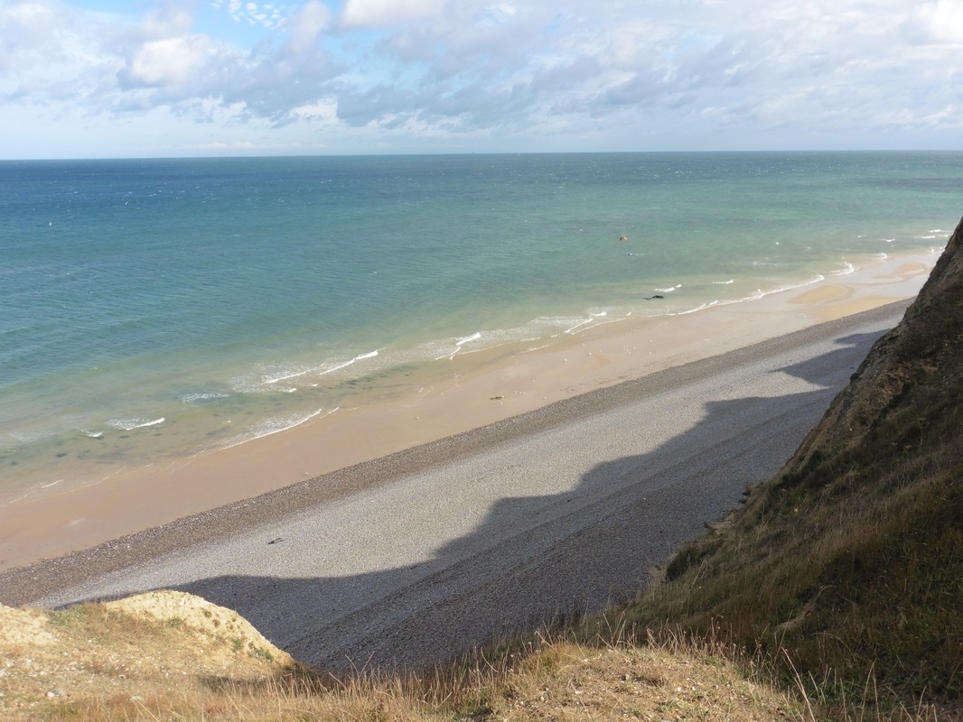
 Erosion on soil-based Cliff
 Once on the top of the hill our route follows a clear, fairly level path on the top of the cliff with the sea to our left and arable land to our right. The sky and the sea are wonderful shades of blue and green and, the cry of the gull over the cliffs and that of the peewit and the skylark over the farmland draw our attention. A mile or so back from the coast, there is a forest strip that adds dark green to the colour palette of the day.
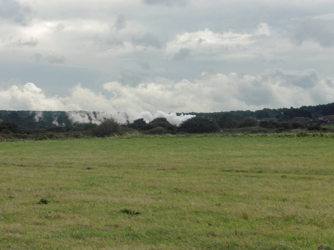
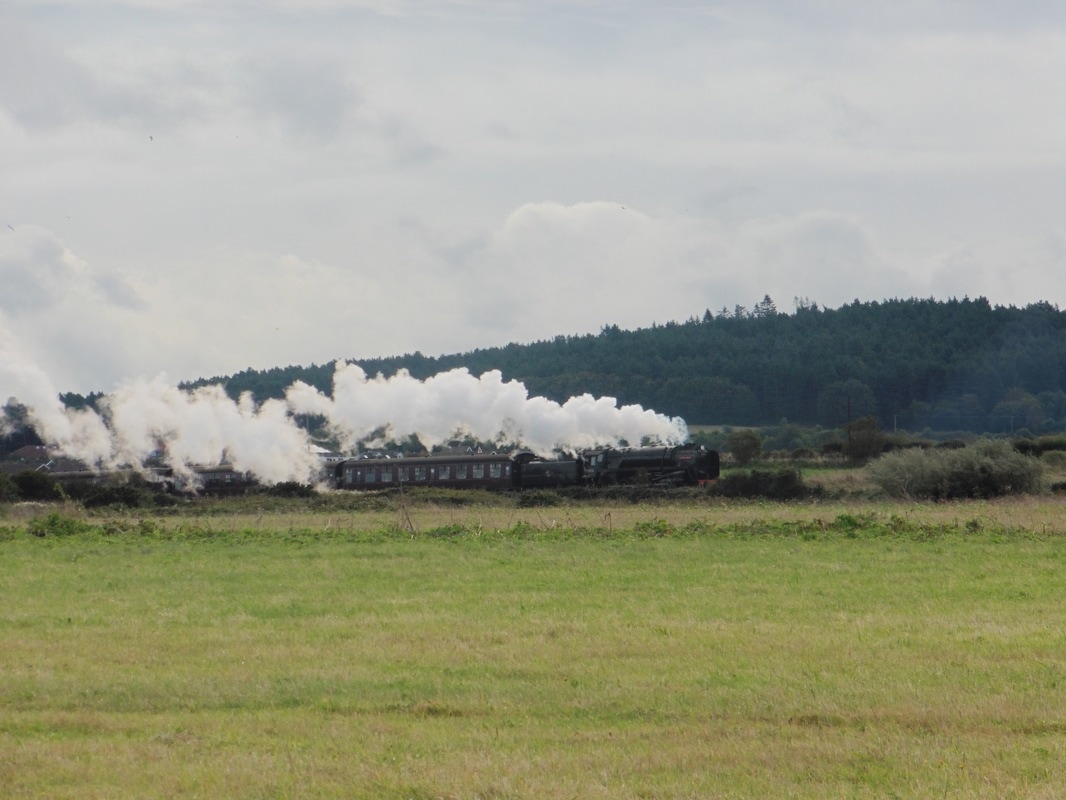
Between us and the forest the North Norfolk Heritage Railway (NNR) Line runs from Cromer inland to the village of Holt and back again. It runs both steam and diesel trains and you can book to enjoy lunch or dinner on board. We were lucky that there was a special event on this weekend and as we walked along the cliff top one of the steam trains passed on its way to Holt. This particular train is called the "Black Prince with the locomotive number of 92203. Built in 1959, during its working life it drew heavy iron ore trains in Liverpool. Withdrawn from service in 1967, it was in private ownership until purchased by NNR in 2015. It was a joy to watch it make its way across the open countryside, to watch the steam against the green of the forest and the light of the sky and to hear the toot of its whistle echo across the fields.

The Black Prince
 To Lifeboat Station
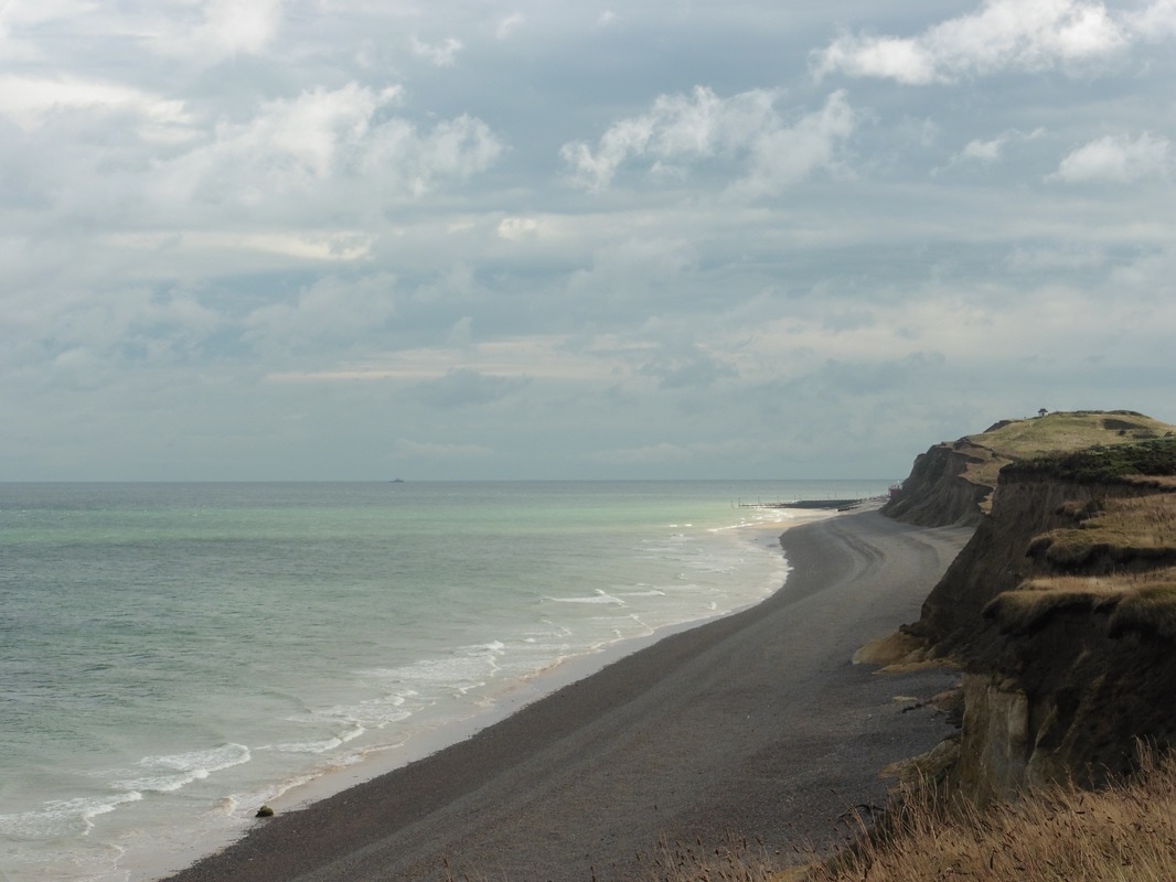
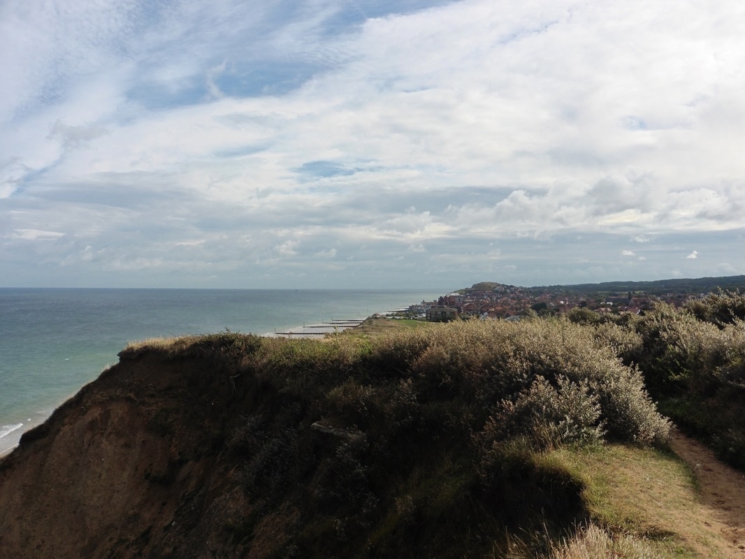
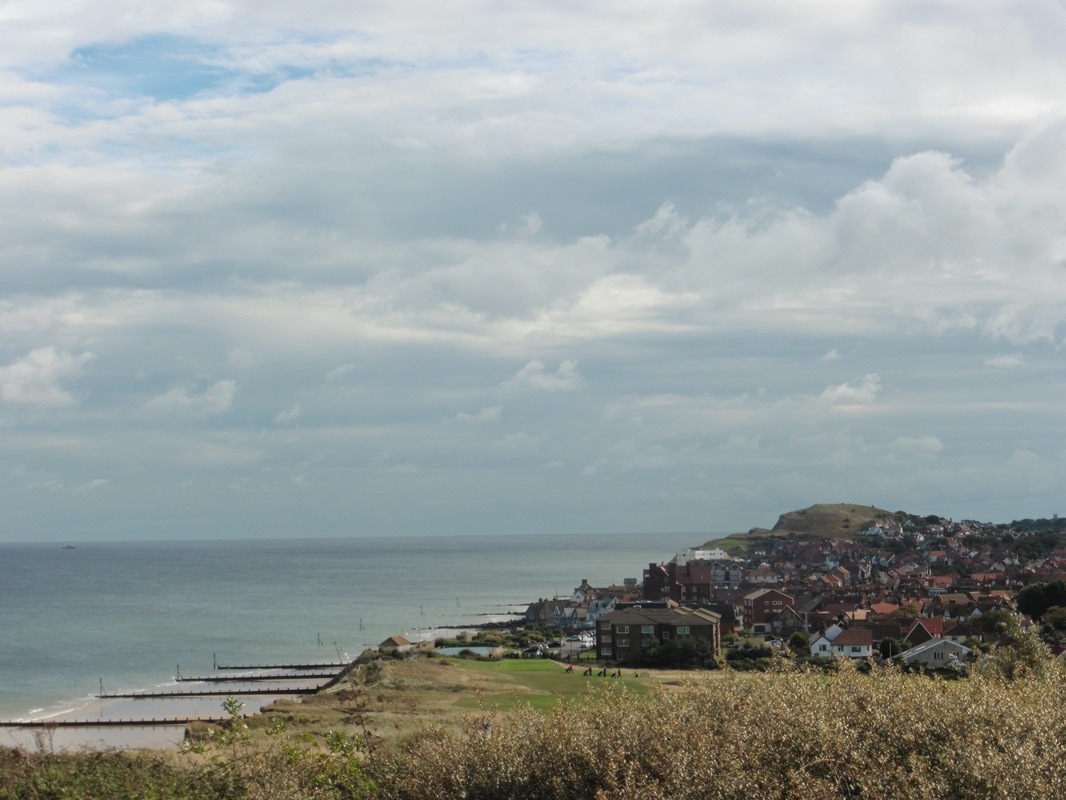
 Walking now on a section of the English Coast Path, we cleared the top of the hill with Sheringham in the near distance and a cracking view over the cliffs to the wonderfully coloured sea and sky beyond. Roughly below Sheringham golf course, which sits on the top of the cliff, we could see the launching pier for the Sheringham lifeboat station stretching out in to the water. On the cliff, the bright patchwork green of the cultivated grass of the golf course stood out against the duller browns of the wild herbage and path edges, with the cliff scallop-edged where it had fallen in to the sea.
Hilltop Views
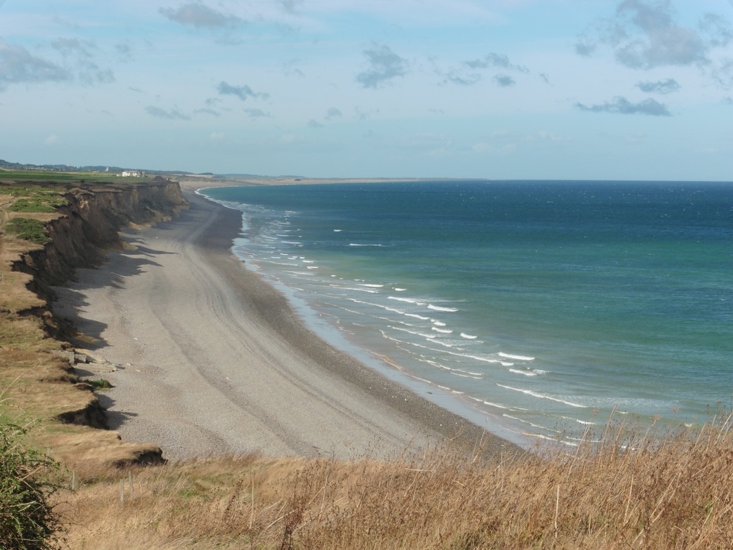
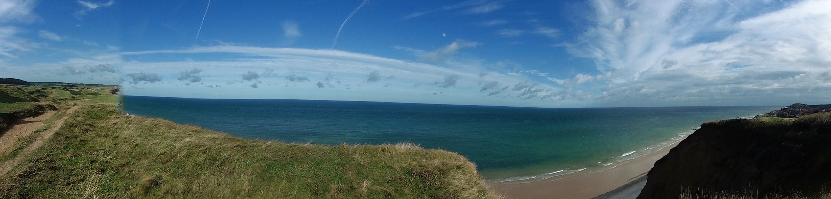 Cliff Panorama
 Despite it being slightly cloudy, the day was generally warm and clear with just a slight sea breeze to help keep us cool; it was lovely walking weather. Walking on an undulating path, the climbs were not so steep as to challenge us greatly and it turned into one of those days when you just want to stride out and keep walking. Of course, the knowledge we were only doing six miles contributed to the 'zeitgeist' and we were only carrying light day packs with waterproofs, water and snacks, so no great load.
As we topped the hills now we could clearly see Sheringham nestled in a gap in the line of the cliff. Viewed from this angle, one can see the consequences of the different flood defensive structures used at Sheringham. As the man-made defensive structures have protected the frontage of the village, nature has taken its toll on the cliffs to east and west of the village with the result that the village and the cliffs are no longer in alignment. Rather, the village protrudes beyond the cliffs for over seventy metres and the distance is likely to continue to grow as the cliff line erodes further.
As we topped the hills now we could clearly see Sheringham nestled in a gap in the line of the cliff. Viewed from this angle, one can see the consequences of the different flood defensive structures used at Sheringham. As the man-made defensive structures have protected the frontage of the village, nature has taken its toll on the cliffs to east and west of the village with the result that the village and the cliffs are no longer in alignment. Rather, the village protrudes beyond the cliffs for over seventy metres and the distance is likely to continue to grow as the cliff line erodes further.
Sheringham
The Sheringham flood defense strutures are themselves quite interesting with a range of different methods used to protect the village including traditional sea wall, gabion sea wall (generally rocks in a structure of some kind, e.g. wire), traditional revetments (sloping structures like walls), sloping wooden revetment and timber groynes (both traditional upright and semi-permeable, e.g. with gaps). If you are interested in some of the theory behind coastal erosion, this set of slides is very informative regarding coastal erosion and its management at, for example, Cley, Weybourne and Sheringham.
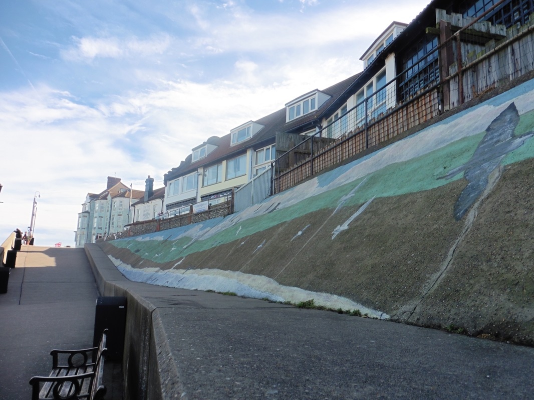
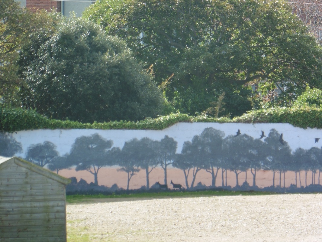
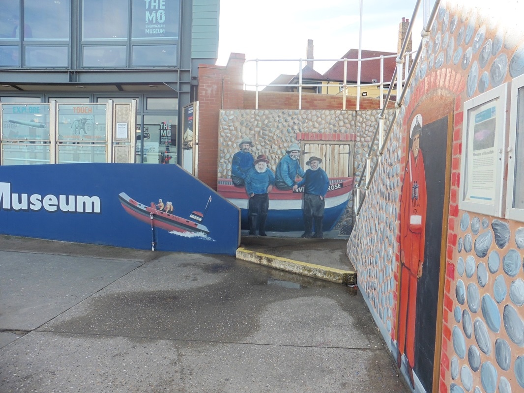
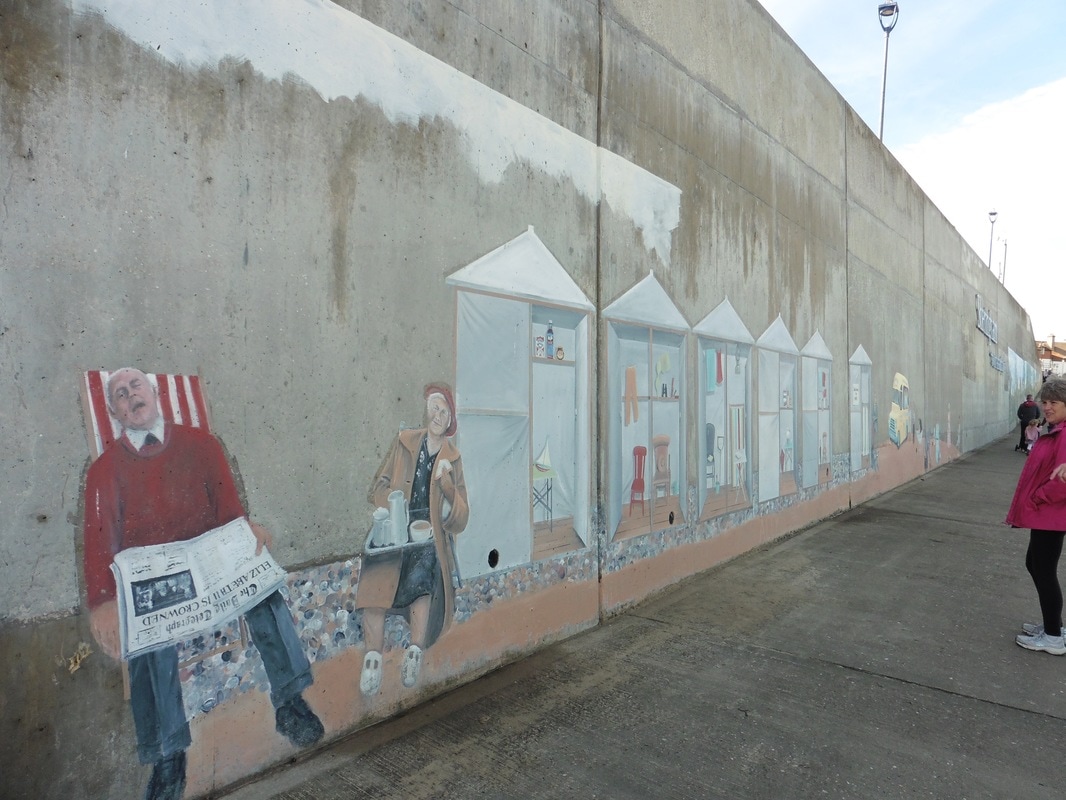 Beach Mural
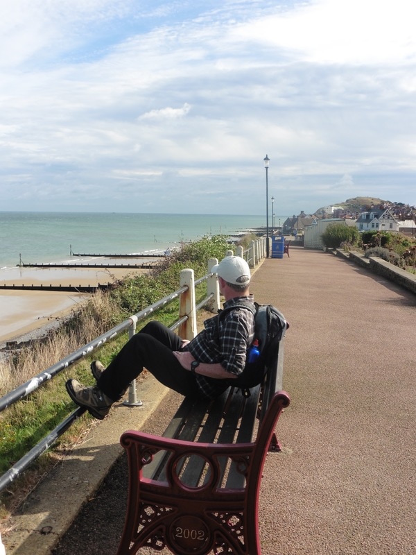
 If there is anything to be had on a Vagabond adventure it is mid-morning cake and, much as we were enjoying the walking, we were also looking forward to a wee cup of tea and a sticky bun. It was a delight to stop in Sheringham where we sat at a window counter with our goodies and enjoyed the peace of the day. Later, we walked around the front at Sheringham looking at the many murals that adorn the sea wall here.
 Mammoth Mural
 Perhaps the best known of them is artist David Barber's 'mammoth' mural. It is losely based on the story of the seven hundred thousand year old West Runton elephant remains found when the tide went out at the bottom of the cliff on a nearby beach twenty-six years ago. The project was completed in association with another local painter, Simon Seal (who also painted a depiction of a Stone Age settlement). North Norfolk District Council provided the resources. As well as containing representations of mammoths and the Stone Age settlement, the mural has depictions of other animals from the pre-historic time period. There are other murals on the promenade and we enjoyed taking the time to look at them. It is another good example of the use made of public art by the local authorities of the East Coast of England where we have admired art pieces from Northumberland to Cromer. It was also good to see a little bit of humour inserted in the project. Too often we make public art too serious.
Other Murals
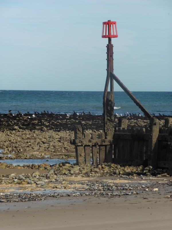
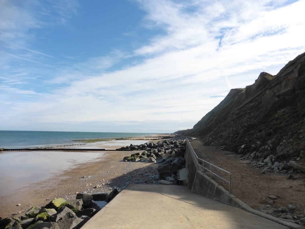 Coastal Defences
 We left Sheringham by dropping down on to the beach and heading along the water's edge. The shingles had gone to be replaced by firm sand. At the end of the promenade, at the bottom of the slipway, were more examples of the flood defences placed here to protect the village including groynes, gambion and rock armour.
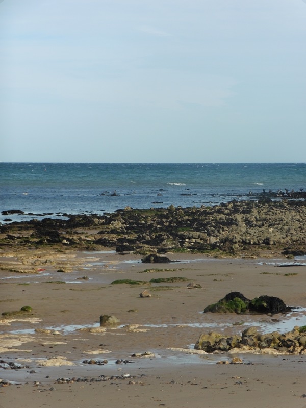
It was a beautiful day with the sun high in a blue and white sky. There was just a slight breeze coming off the water, at times struggling to even cool us down. With the tide out numerous bird species were feeding on the newly exposed rock, including shag, cormorant, gull and the occasional tern. The sharp cries of the birds and the salty aroma of seaweed filled the air. We were walking on firm sand, interspersed with the stones and rocks fallen from the cliff and left behind by the tide and were able to make rapid progress.
It was a beautiful day with the sun high in a blue and white sky. There was just a slight breeze coming off the water, at times struggling to even cool us down. With the tide out numerous bird species were feeding on the newly exposed rock, including shag, cormorant, gull and the occasional tern. The sharp cries of the birds and the salty aroma of seaweed filled the air. We were walking on firm sand, interspersed with the stones and rocks fallen from the cliff and left behind by the tide and were able to make rapid progress.
Sheringham Beach
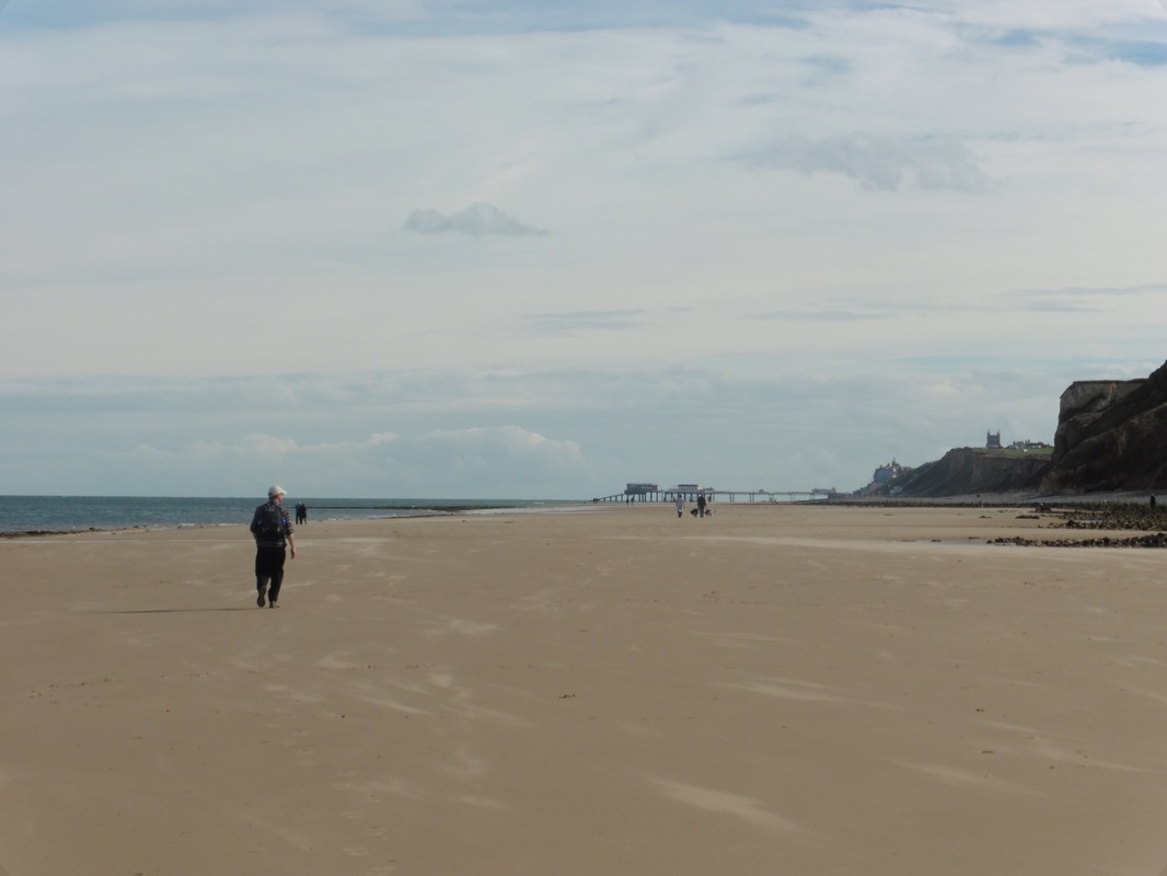
Leaving Sheringham we knew we were not too far away from Cromer but were surprised nontheless when we turned a corner of the cliff and the pier and promenade lay in front of us. Of course, distance is always deceiving and it still took us another half hour or so before we completed our journey for the day.

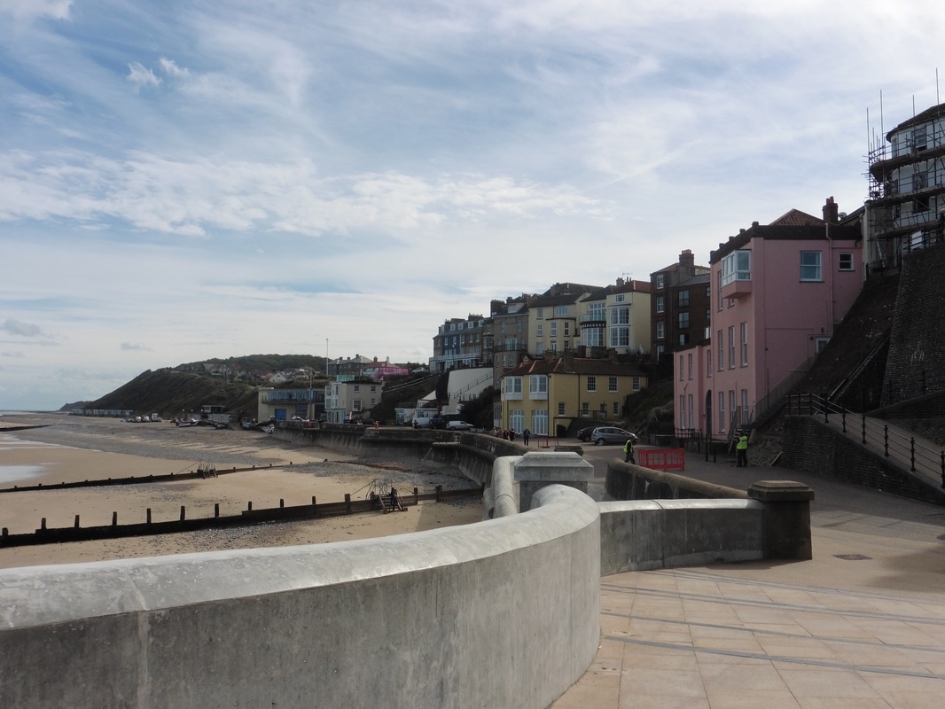
Cromer
We spent a little bit of time enjoying the pier and promenade area before going off for lunch, after which we investigated some of the High Street , including climbing the tower of Cromer Parish Church where we had stupendous views of the coast east and west and north over the pier, out to the sea. Work has recently been undertaken to both restore the existing six bells in the church tower and to add another two to provide a full octave. All that and still time to go home for a wee snooze before going out to a local pie shop for dinner. Lubbly jubbly!
 RSS Feed
