Route Map
After a hard day in the heat yesterday, I was fair exhausted by the time we reached the campsite. It was not long after the chores were finished that I was abed and out for the count. We are finding out that sometimes there is just no ryhme or reason to energy levels. There are days when you put the foot down and nothing happens. There are heavy load days when you fair skip up the hill and, fairly flat days when the engine will just not get going. All you can do is live in the moment, stay with this one step and let the rest of them take care of themselves. Sitting the early morning sunshine, eating breakfast 'al fresco', it feels like it should be a good day. Only time will tell!
 Walk Profile
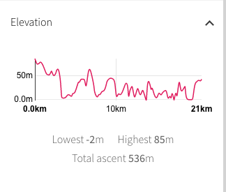
 Today's route stays on the coast and clifftop but should not be as taxing as yesterday, with the rolling countryside rarely rising above fifty metres. We estimate about twelve to thirteen miles with no diversions. We start at just over seventy metres at the campsite, dropping down to sea level at Penhale Sands. At the end of the sands we have the only climb over fifty metres as we rise above Penhale Point and Holywell. From there to Newquay it is rolling hills and heathland. There are numerous bays and coves and a number of little sandy beaches, with opportunities for food and drink along the way. The weather is set to be warm, like yesterday, so we will need to be careful not to dehydrate.
As well as walking the South West Coast Path on this outing, we are extending our walk up to the Severn Bridge which will leave us handy for the next leg of our round-Britain coastal adventure, the Wales Coast Path. In total, we will walk somewhere between eight and nine hundred miles this year, resulting in a need for a lot of maps. After much discussion, we decided to carry the OS 1:50, which meant in total we had to carry ten maps. We would have needed nearly twenty if we had gone with the 1:25. Rather than carry them all, we made arrangements to pick them up at various places as we moved on in the walk.
Using the 1:50 has it draw backs, however, specifically that they sometimes do not have the detail you need to make decisions when there are unforseen problems on the route. Our backup is the OS Map service, which we can access either on our phone (when there is a signal) or on the Kindle, where we usually have the sectional maps downloaded, which means we can access them even when we do not have a signal, as long as the Kindle works!
Using the 1:50 has it draw backs, however, specifically that they sometimes do not have the detail you need to make decisions when there are unforseen problems on the route. Our backup is the OS Map service, which we can access either on our phone (when there is a signal) or on the Kindle, where we usually have the sectional maps downloaded, which means we can access them even when we do not have a signal, as long as the Kindle works!
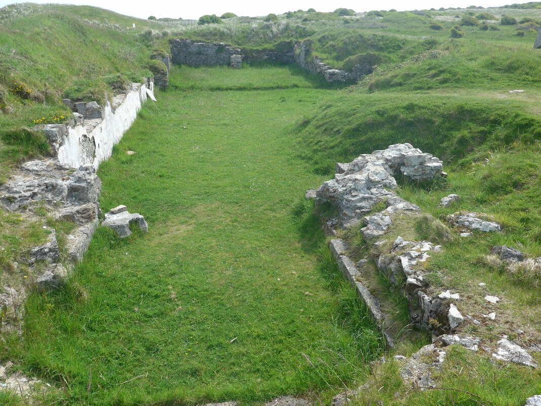
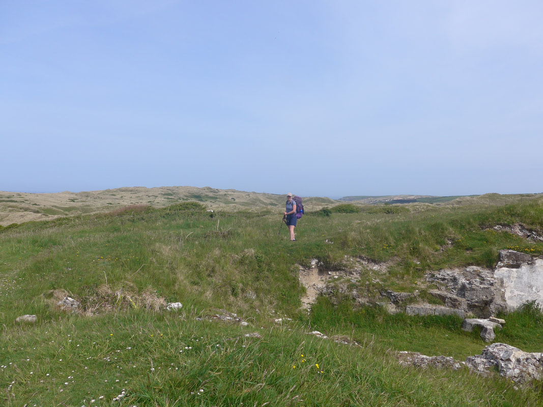 Looking Over Military Site
 All well and good if you remember to look at the internet resources before you start off, which we didn't. As we had come up through the dunes yesterday, we presumed we could take a back path out of the campsite, walk parallel to the coast for a short period and then cut down through the dunes. Easy peasy! What we didn't appreciate was that the defence establishment (Penhale Camp) at Holywell extended so far along the beach and when we tried to cut through the dunes we were met with a long metal fence and numerous warning signs. Faced with the option of staying inland until past Holywell, which would mean missing out a section of coast, Ligger and Penhale Points included, we chose to double back on ourselves and drop down on to the coast just below St Piran's Oratory. I had understood that the military training area was closed but as we walked the perimeter there was considerable helicopter activity to the front of the site that contradicted that notion, but which had quietened by the time we reached the coast.
Penhale Camp was established in 1939 to train Anti Aircraft gunners. The T remains of some of the gun sites, searchlight batteries, ‘Pill-boxes’ etc., can still be seen. On 7th June 1940, the camp was bombed by a German aircraft and 23 British soldiers were killed in the raid. In preparation for the D-Day landings in 1943, the American Army Combat Engineer Corps built the 14 Nissan Huts on the Camp, which are still in use today.
Penhale Camp was established in 1939 to train Anti Aircraft gunners. The T remains of some of the gun sites, searchlight batteries, ‘Pill-boxes’ etc., can still be seen. On 7th June 1940, the camp was bombed by a German aircraft and 23 British soldiers were killed in the raid. In preparation for the D-Day landings in 1943, the American Army Combat Engineer Corps built the 14 Nissan Huts on the Camp, which are still in use today.
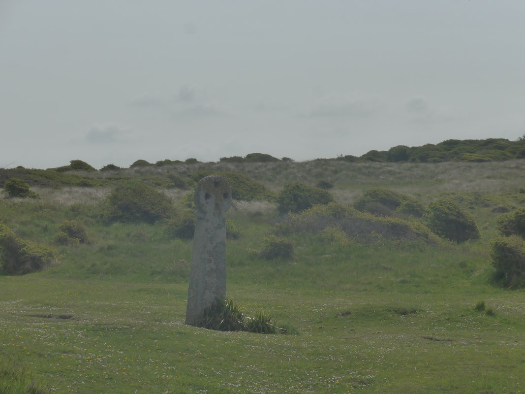 Celtic Cross
 Before we left the dunes, we visited the Celtic Cross and St Piran's Oratory at the top of the Penhale Sand Dunes. The oratory is thought to be one of the oldest Christian sites in Great Britain, established some time in the 6th C AD and in use until the 10th C AD. The original church was over time buried by sand and a new church established a few hundred yards further north, but it too eventually succumbed to the same fate, was abandoned in 1804 and a third church was built much further inland at Perranzabuloe.
 Church Remains
 St Piran, originally from Ireland, is the patron saint of tin miners. He was a Bishop in Ireland who was exiled after falling out with the Kings of Ireland and, after being flung in to the sea, turned up on the Cornish coast. There is an annual celebration of St Piran in which local people and visitors join in a procession to the Oratory and the neaby Celtic Cross. Thought to be one of the oldest Celtic crosses in Cornwall and made of granite, it is just over eight feet (2.4 metres) tall. It may have been carved to celebrate the opening of the nearby St Piran's Oratory. Their is a wonderful atmosphere in the presence of the church remains and the Celtic Cross, enhanced by their location in the wilds of the sand dunes.
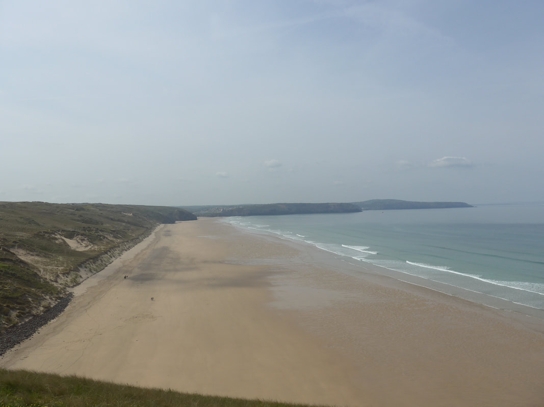 Perran Beach from Ligger Point
 It was just after the church that we came up against the fence of the Penhale Military Training camp. Once we had located ourselves on the map and taking advice from a local dog walker, we reversed our direction of travel for a few hundred yards and were able to start to walk towards the coast, soon finding the gateway on to the military estate.
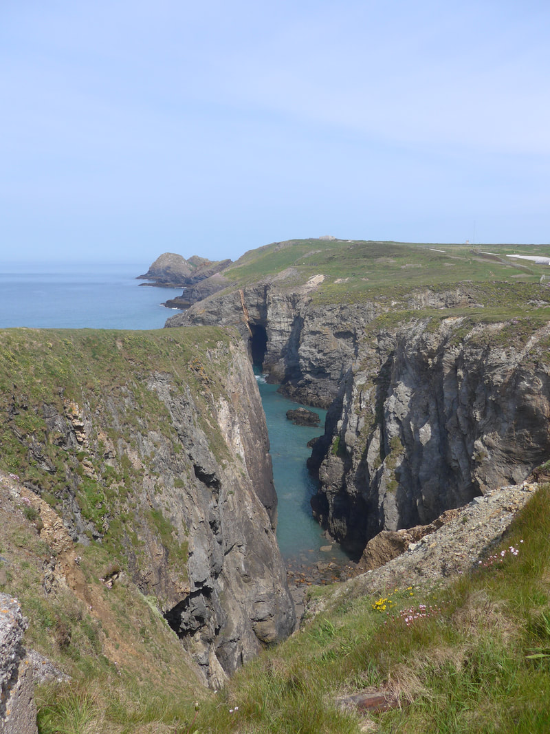
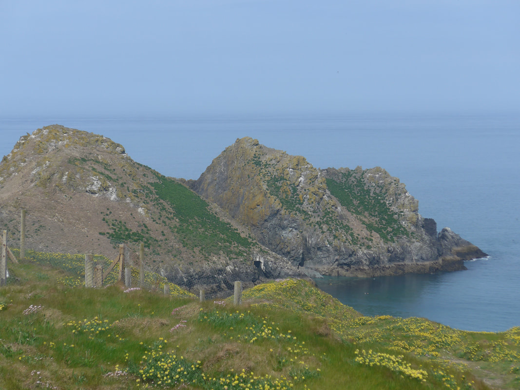
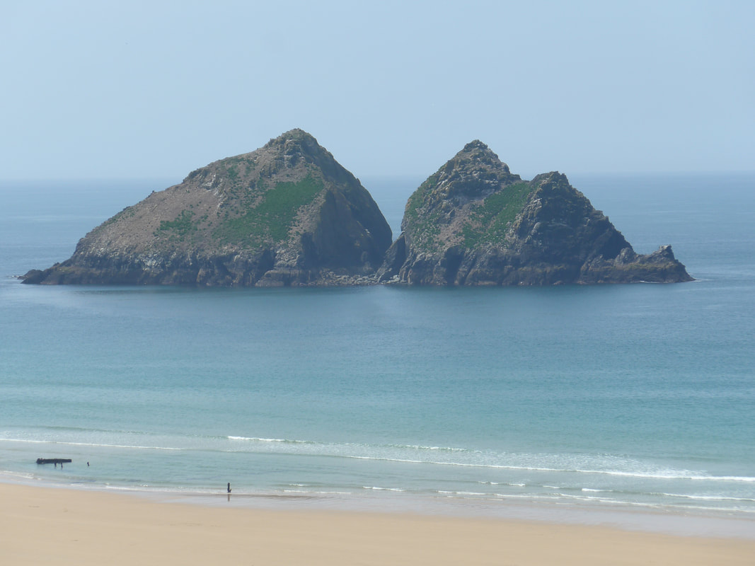
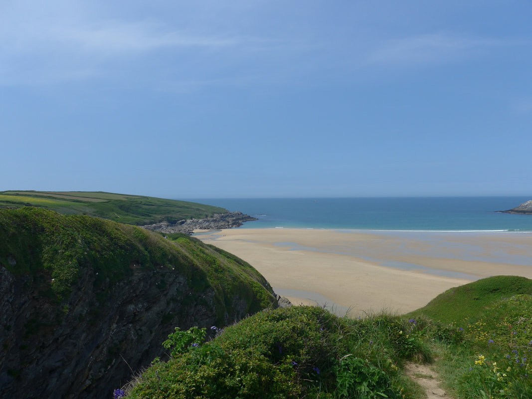
Walking in front of the military camp, the ground was rising slightly as we approached Ligger Point, later continuing to rise until we were at the highest point of the day above Penhale Point. From Ligger Point, where there is still evidence of a linear bowl barrow group (3), we enjoyed a lovely view back along Perran Sands and as far round as St Agnes Point where we had walked yesterday. On the other side the view only went as far as Penhale Point and Gull Rock, the slightly higher land cutting off the view to Holywell Bay beyond. There was an Iron Age Fort located on Penhale Point, with only some of the ground archaeology now remaining. Moving on from Ligger Point, we passed the lovely Hoblyn's Cove which offers tantalising glimpses of the emerald sea through its narrow break in the rockcliff formation and, in to the dark recesses of the mine entrance or cave on the opposite side of the cove.
Walking in front of the military camp, the ground was rising slightly as we approached Ligger Point, later continuing to rise until we were at the highest point of the day above Penhale Point. From Ligger Point, where there is still evidence of a linear bowl barrow group (3), we enjoyed a lovely view back along Perran Sands and as far round as St Agnes Point where we had walked yesterday. On the other side the view only went as far as Penhale Point and Gull Rock, the slightly higher land cutting off the view to Holywell Bay beyond. There was an Iron Age Fort located on Penhale Point, with only some of the ground archaeology now remaining. Moving on from Ligger Point, we passed the lovely Hoblyn's Cove which offers tantalising glimpses of the emerald sea through its narrow break in the rockcliff formation and, in to the dark recesses of the mine entrance or cave on the opposite side of the cove.
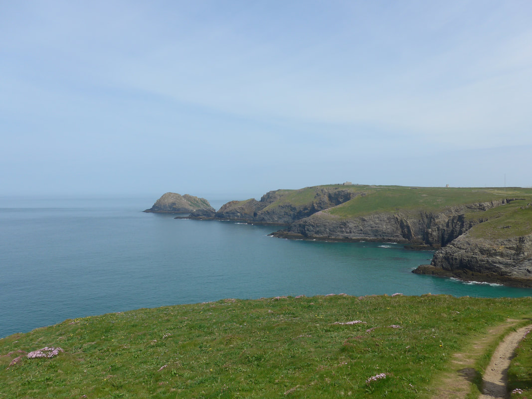
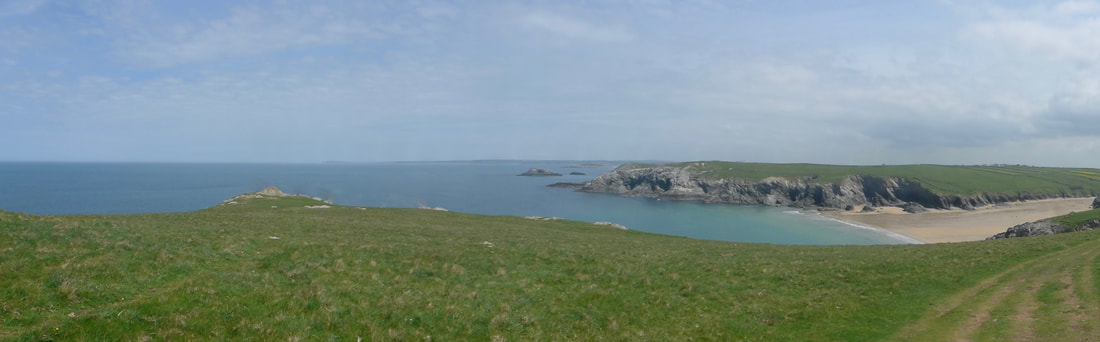
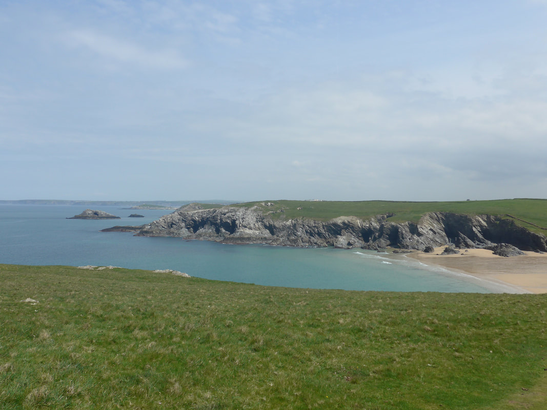
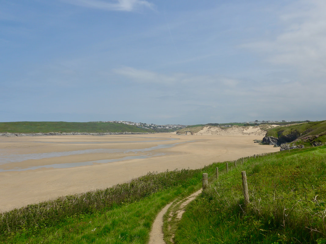
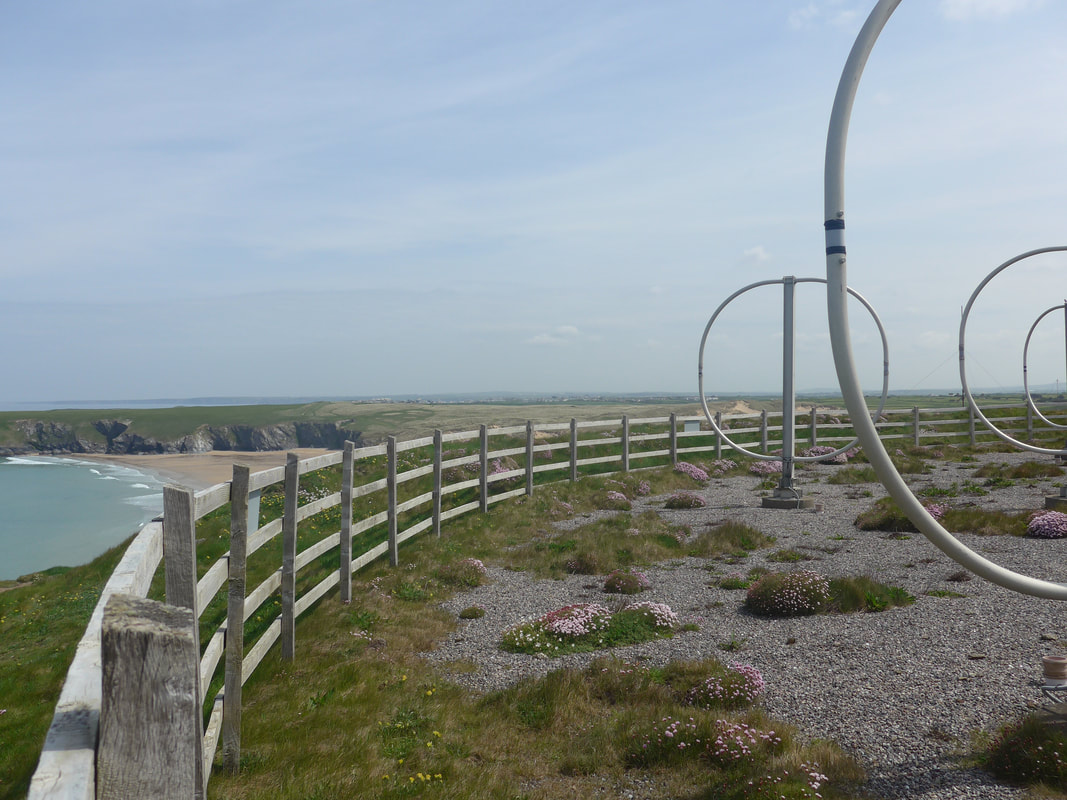 Aerials over Holywell Beach
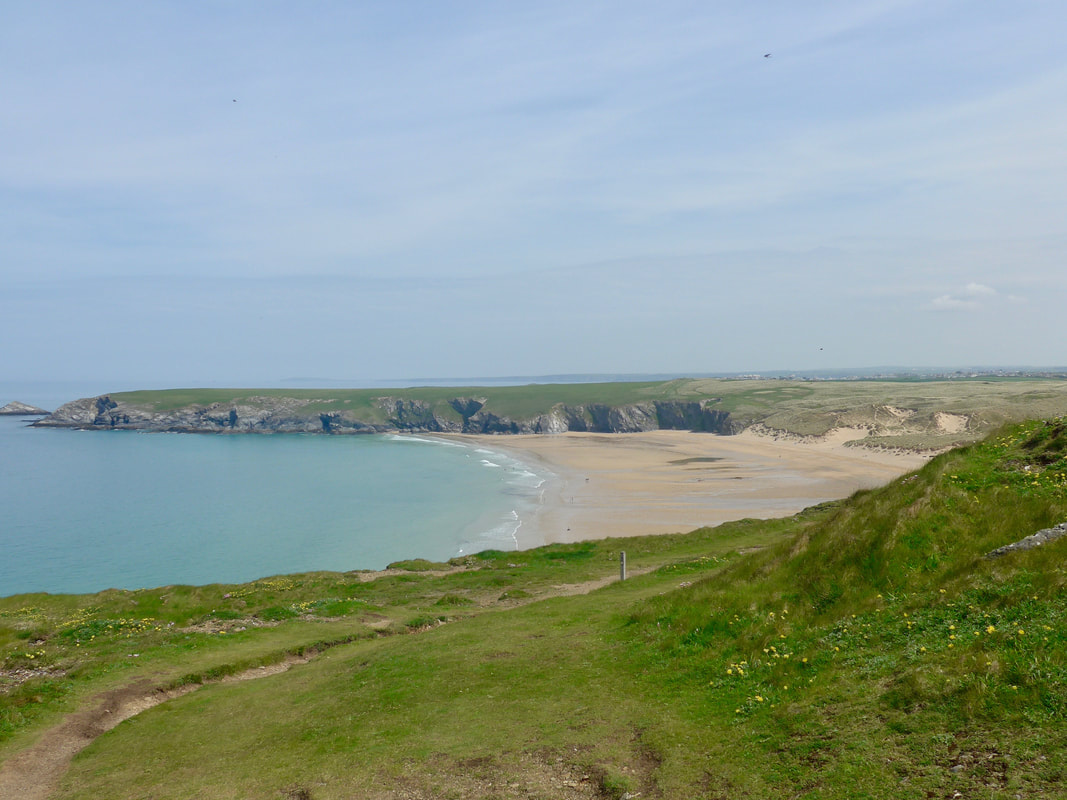
 On the top of Penhale Point, as well as the fort, there is an army radar station, with an array of curiously-shaped, almost circular ariels contained within a wooden fence. From this vantage point you can see over the military establishment and there are also good views over Holywell Beach. The route cuts inland here and drops down to the village of Holywell, located at the back of the dunes. Coming off the hill, there is a pub (St Piran's Inn) just off the sand and, although it was still relatively early, we decided to stop for an early lunch and then set a pace to reach the River Gannel in time to use the submerged crossing at low tide. As much as anything, we wanted a break from the heat of the day which was now very hot. The quality of the food in the pub was good with healthy portions.
We had been delayed this morning waiting for the office to open to retrieve my Garmin GPS, which was being re-charged. The re-charge lasted as far as Holywell where the device gave up the ghost. Whatever else was put in it, it was not electrical charge.
We had been delayed this morning waiting for the office to open to retrieve my Garmin GPS, which was being re-charged. The re-charge lasted as far as Holywell where the device gave up the ghost. Whatever else was put in it, it was not electrical charge.
Kelsey Head, Porth Joke & Pentire West to The Goose
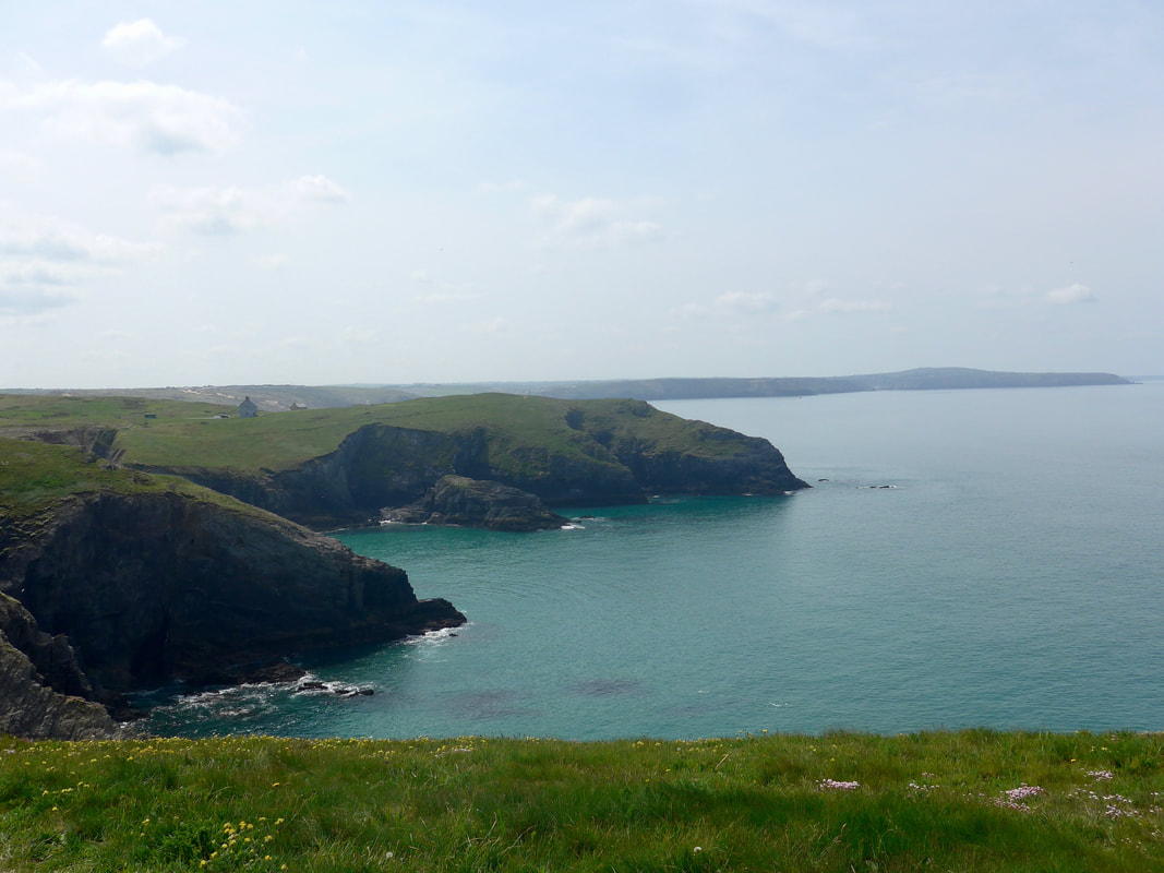
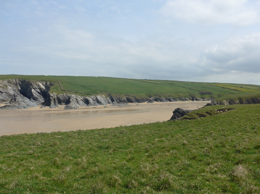
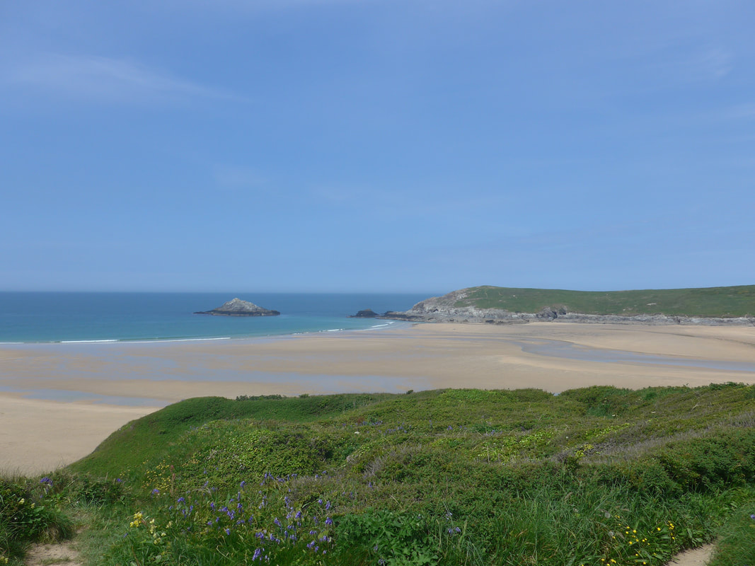
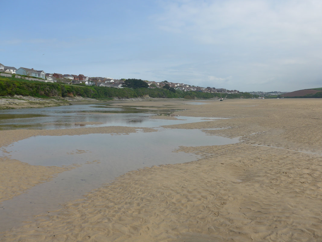
After lunch we followed the SWCP through the dunes and back on to the heathland for a gently rising walk to above Kelsey Point from where we could see across Porth Joke to Pentire Point West and beyond to The Goose, the rock feature that lies off Pentire Point East. The two Pentire Points guard the approaches to the mouth of the River Gannel, with Crantock Beach lying on the western side. Lining Porth Joke there are slightly raised edges to the beach that mean you need to take a short walk inland to the head of the beach and then back down the other side to head on to Pentire West. If you are young and agile enough you might want to try climbing up the edges, but for me with a full rucksack it was not an option I wanted to take. There was a nice mixture of wild flower and flowering shrubs on Pentire West with broom and Blue Bell in abundance. Looking across Crantock Beach, the sands exposed by low tide, there was a lovely feeling of quietide and solitude. We were walking now in extreme heat and at times, particularly when what little breeze there was dropped away, it became a bit of a struggle to keep going.
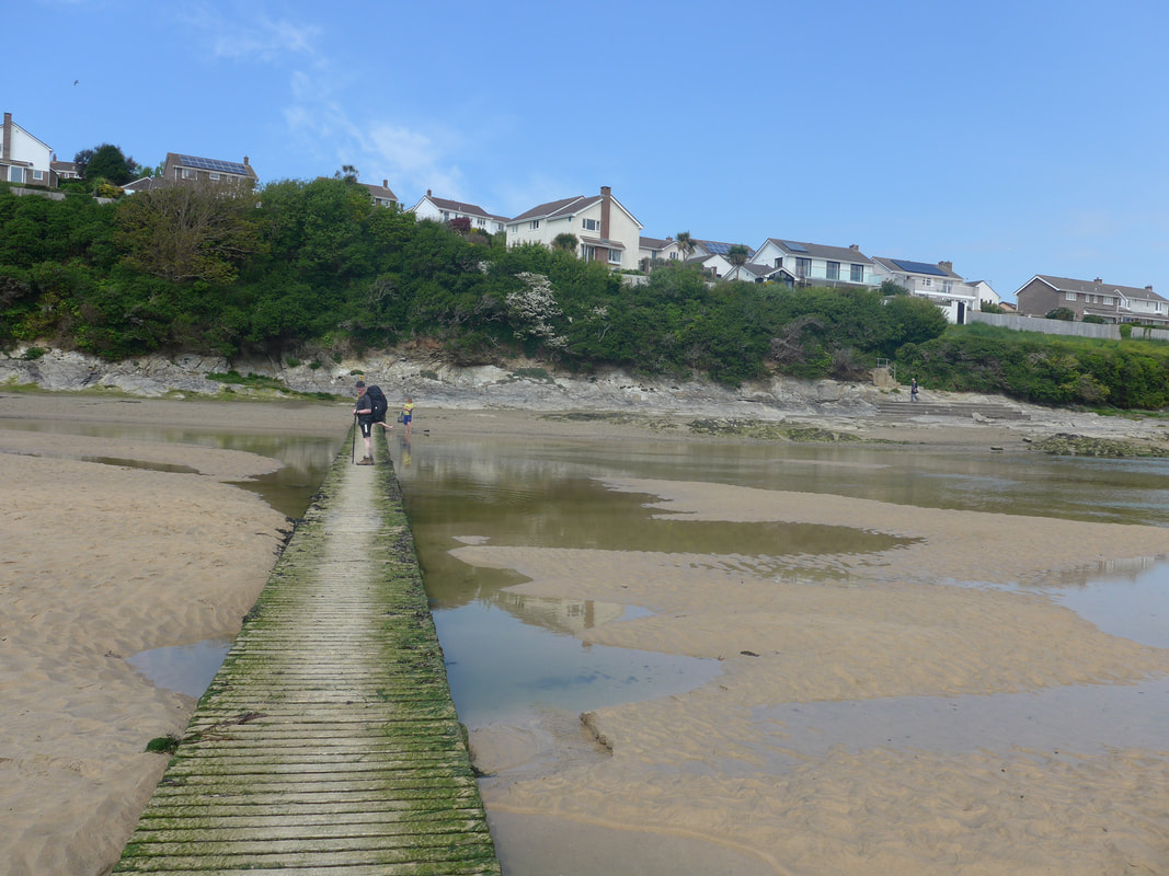
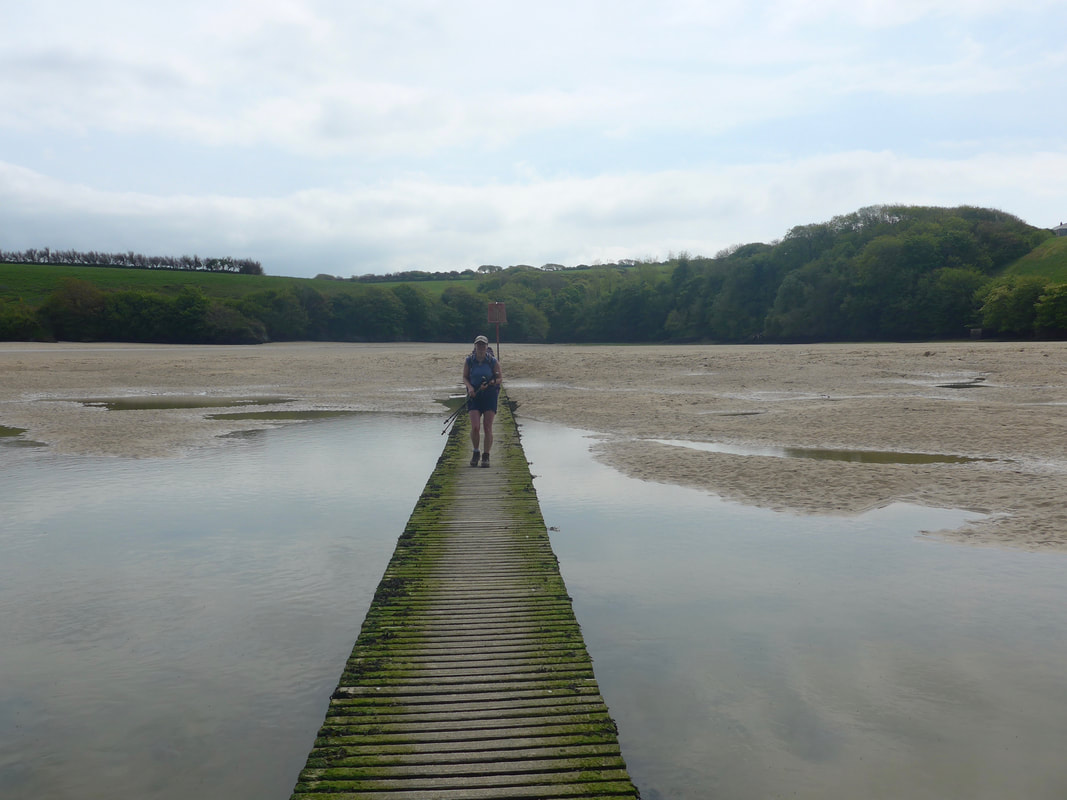
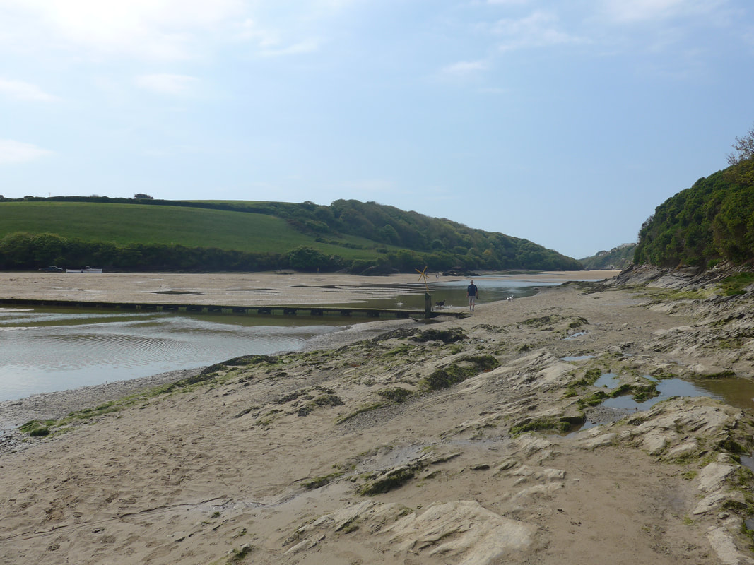
There are three options that I know of for crossing the River Gannel. A ferry service running in the summer months three hours either side of high tide, a submerged footbridge up the river by Trenance, accessible at low tide, or go further up the river to the first road crossing at Trevemper. As it was still low tide, albeit close to changing, there was no ferry service so we set off on what seemed like a long walk up the side of the Gannel, in reality a distance of about three kilometres, from Pentire West to the bridge. At the footbridge we were pleased to find it still well clear of the water. After crossing, we stopped on the steps just beside the bridge and enjoyed the view for half an hour. Although we were just below the outskirts of Newquay and could probably have found somewhere more comfortable to sit further on, it was just nice to sit on the steps beside the river and watch the waters gently start to rise as the tide turned and the sea came in. As we sat on the steps, a lady warned us about the dangers of UVA levels and we promptly lavered on more sunscreen to make her feel better. On the sands on the other side of the river, we could see the four young fellas making their way towards us, no doubt refreshed from a vist to the nearest pub.
Crantock Beach & The Gannel
 Fistral Beach to Towan Head
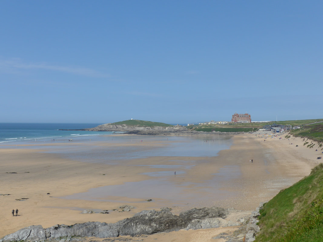
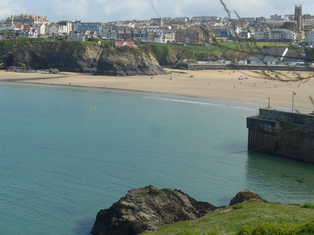
 After resting, we continued on up a narrow flight of stair, sitting to the back of the broad steps on the beach. This took us up on to Pentire East and the start of the last leg in to Newquay. As we progressed along Pentire East we had fine views over Fistral Bay & Beach as far as the Headland Hotel & Spa on Towan Head. After walking all day in the sun, we decided to pass along in front of the hotel and forego the pleasures of walking out to the head, only to come back in again, but we did treat ourselves to an ice-cream.
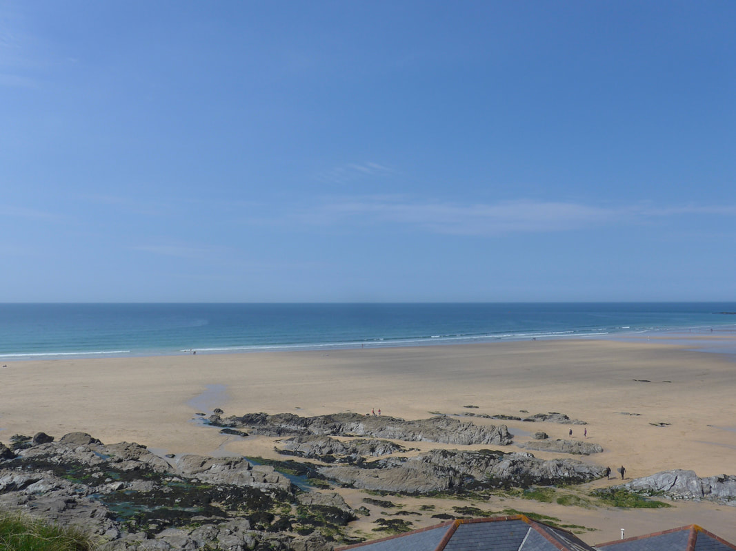
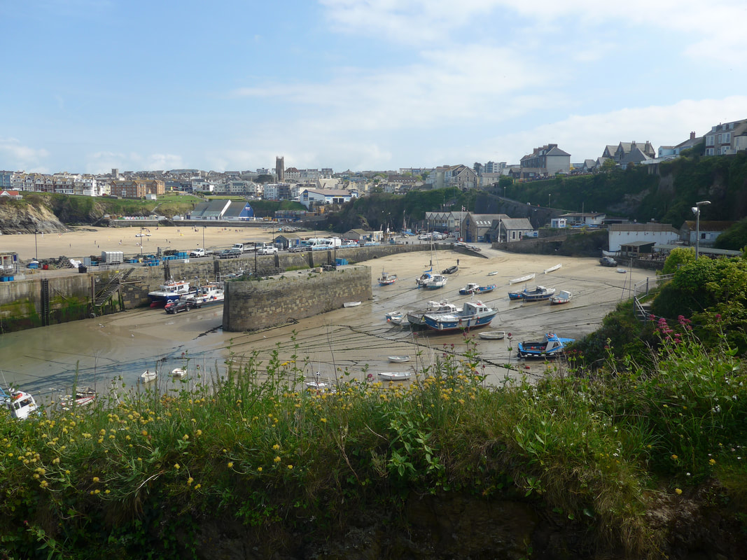
Coming off the head, which marks the western end of Newquay Bay, there were lovely views across the sands which, given the beautiful day it was, were surprisingly sparely populated with only a few hardies surfing off shore and a sprinkling of people on the beach. The sky and sea were a most wonderful shade of blue and with the tide out there was a great expanse of sand. The foot path we walked on was lined on the edges by wild flowers and, when you looked from the edge of the path to the beach beyond and out over the harbour; busy and colourful with boats and sails, the marriage of wild flowers, cliff face and busy harbour was picture perfect.
Coming off the head, which marks the western end of Newquay Bay, there were lovely views across the sands which, given the beautiful day it was, were surprisingly sparely populated with only a few hardies surfing off shore and a sprinkling of people on the beach. The sky and sea were a most wonderful shade of blue and with the tide out there was a great expanse of sand. The foot path we walked on was lined on the edges by wild flowers and, when you looked from the edge of the path to the beach beyond and out over the harbour; busy and colourful with boats and sails, the marriage of wild flowers, cliff face and busy harbour was picture perfect.
Towan Beach & Harbour
 The Island
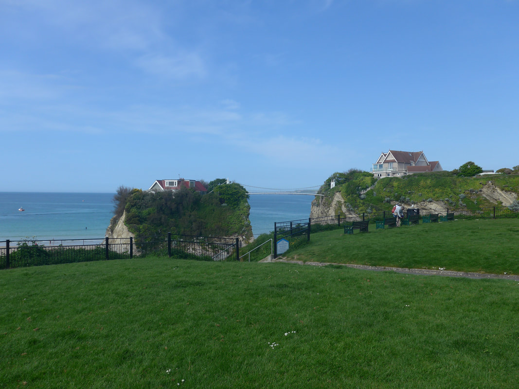
 As we walked round Newquay, we could see down in to all the little coves and bays that make up the beach, seperated by little rock promontories, all offering a nice degree of privacy and protection from the elements. Our accommodation for the night was in Airbnb, located on the far side of the town. As we did not want to miss out on our turn off, we stayed up on the road, rather than walk round on the beach, not at all like us to spurn an opportunity to walk by the water.
On the way round, we passed the private property known as 'The Island', atop of which sits a 3-bedroom house, accessed by the only private suspension bridge in Great Britain. The house actually sits on top of Towan Island. When the tide is in the house is totally cut off from the mainland and can only be accessed by the ninety foot high, one hundred metre long, suspension bridge. When it was last on the market in 2012, the asking price was in the region of one million pounds.
On the way round, we passed the private property known as 'The Island', atop of which sits a 3-bedroom house, accessed by the only private suspension bridge in Great Britain. The house actually sits on top of Towan Island. When the tide is in the house is totally cut off from the mainland and can only be accessed by the ninety foot high, one hundred metre long, suspension bridge. When it was last on the market in 2012, the asking price was in the region of one million pounds.
We turned off of the beachfront road just before Lusty Glaze beach,to walk a short distance up the A3058 to our accommodation. Schedules to be camping the other side of Trevelgue Head, we had booked Airbnb only the night before, deciding we should take advantage of being in a large town to have a little bit of luxury for the old bones. As a consequence, we had had got it at a good price and were delighted at the quality of the accommodation. We were the first Airbnb guest for the owners and to mark the occassion Sally, our hostess, had prepared a fresh cream tea for us. Sally could not have been more welcoming and over the next few hours we spent some time chatting with her about her work as an aircraft controller.
I can testify, that after a hard day's walking in extreme heat, a hot shower and a Cornish cream tea taken in the shade of a sunny day, has wonderful restorative capacities.
I can testify, that after a hard day's walking in extreme heat, a hot shower and a Cornish cream tea taken in the shade of a sunny day, has wonderful restorative capacities.
 RSS Feed
