Route Map
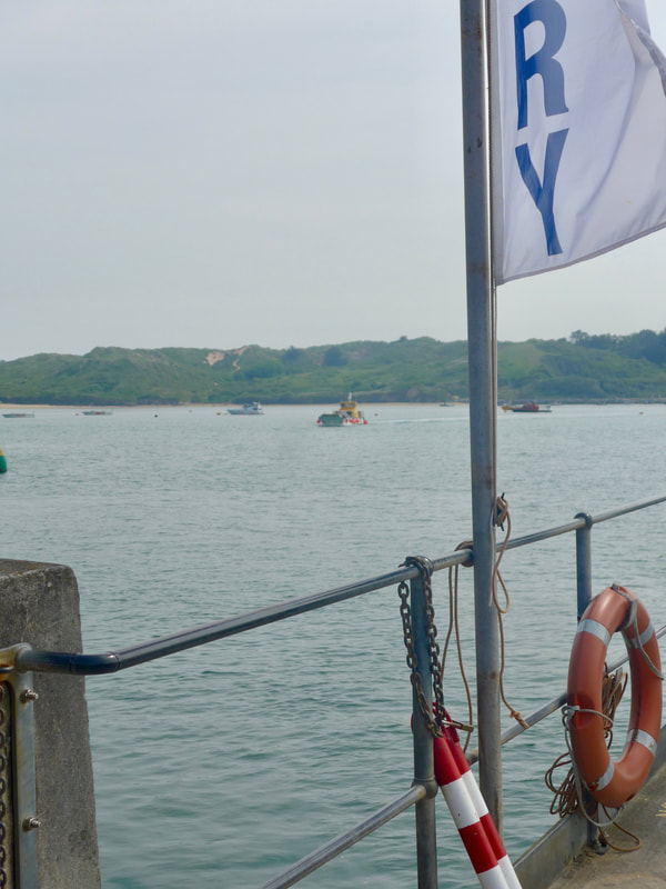
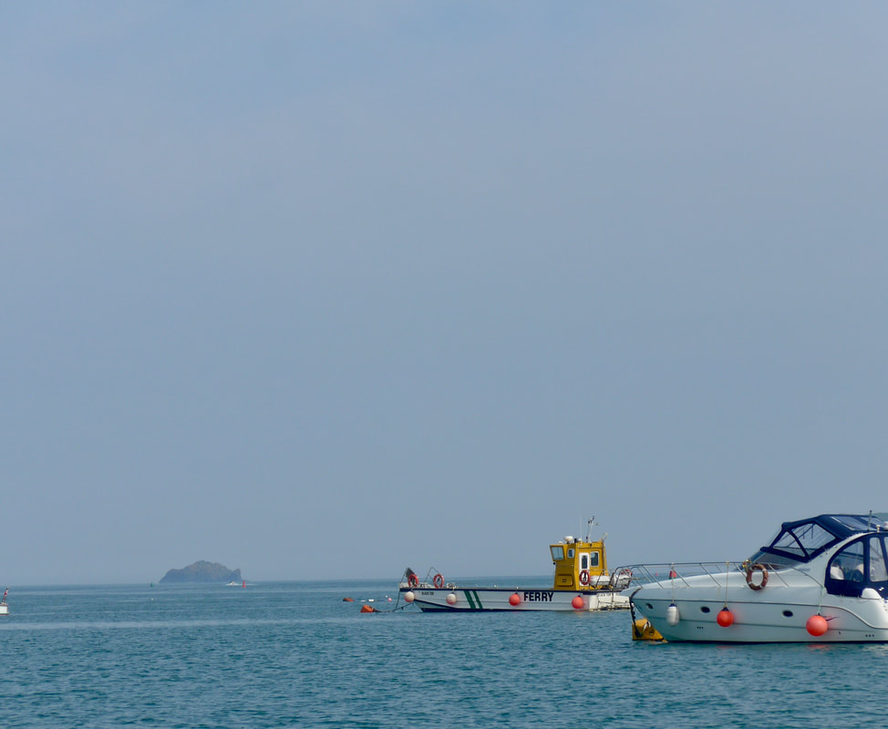
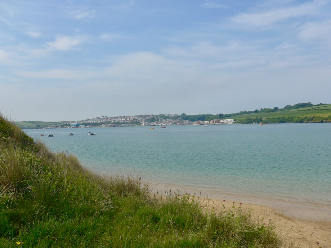
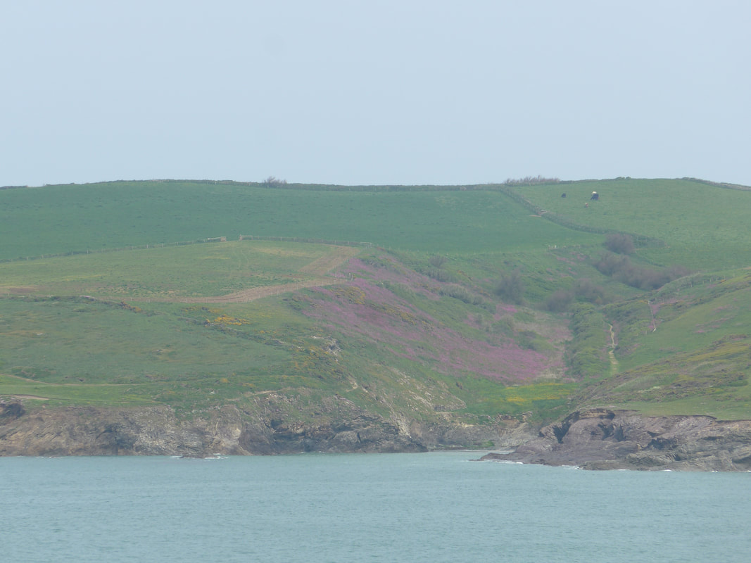
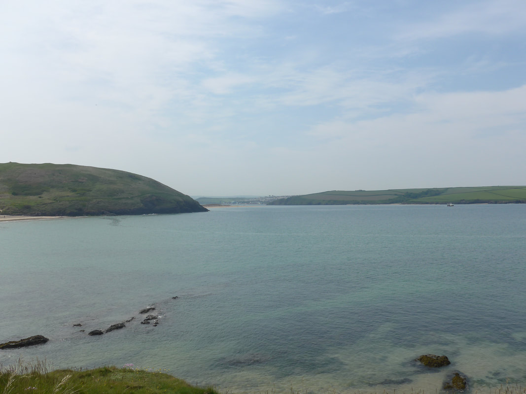
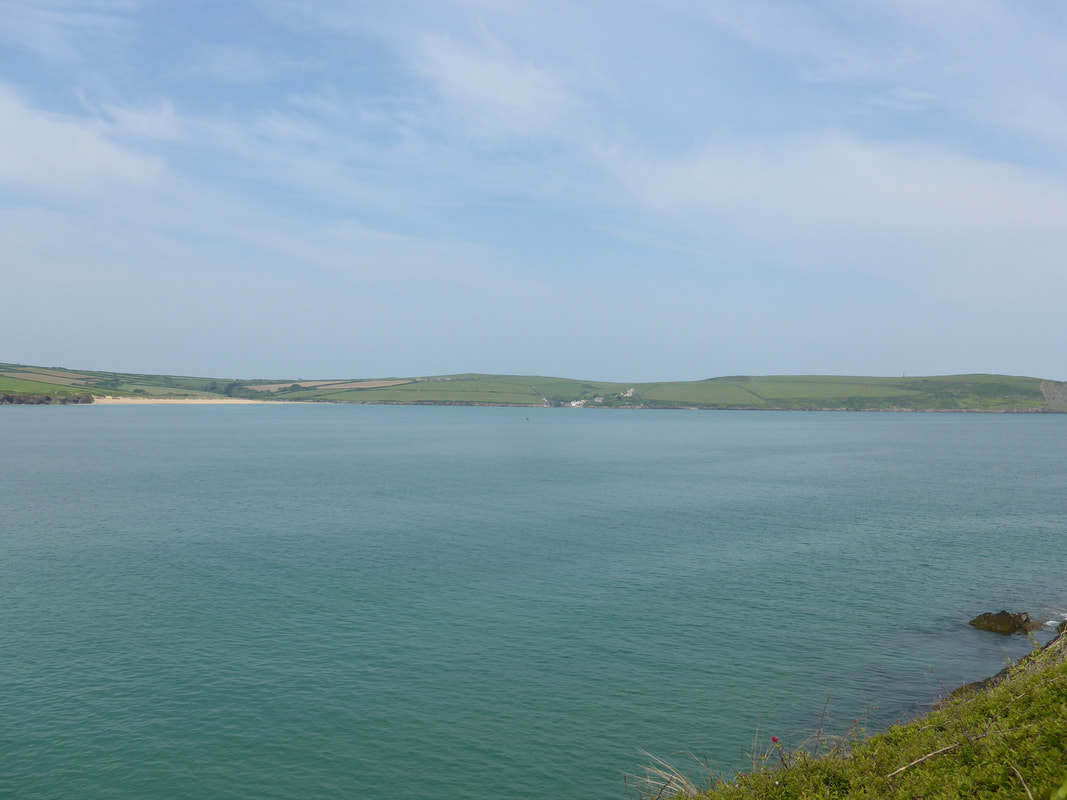
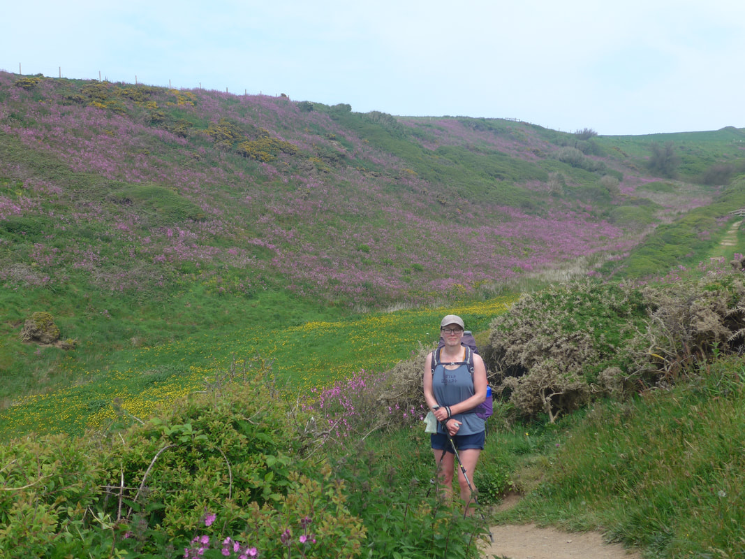
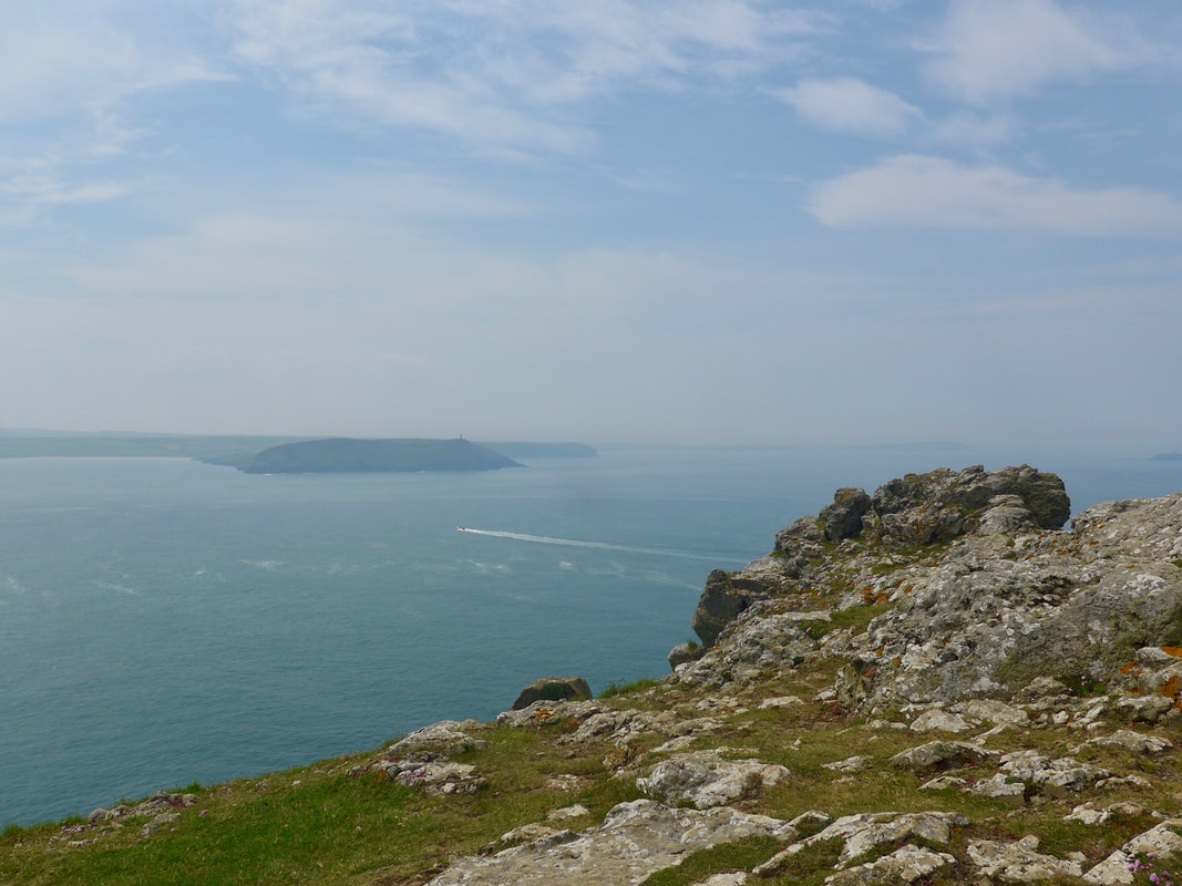
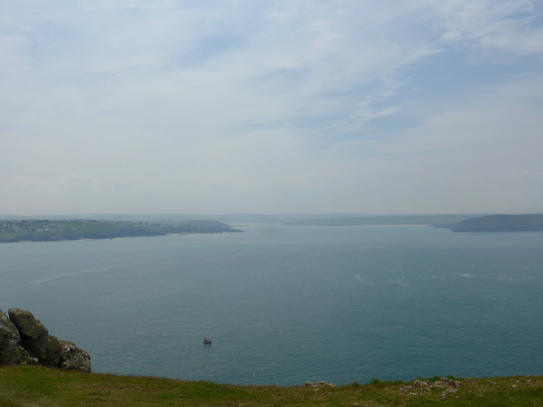
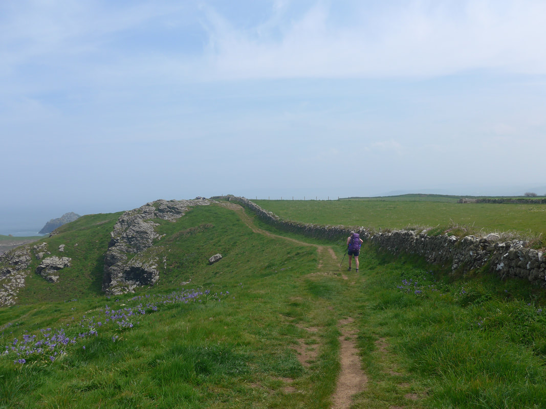
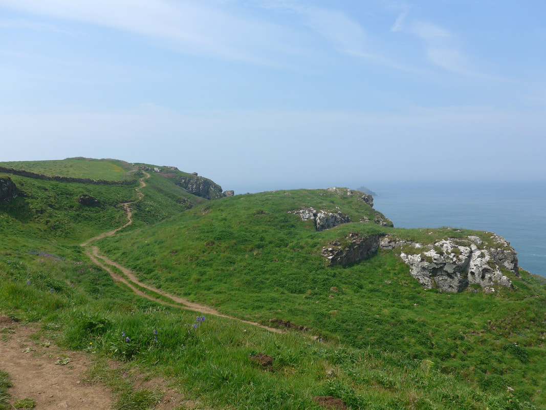
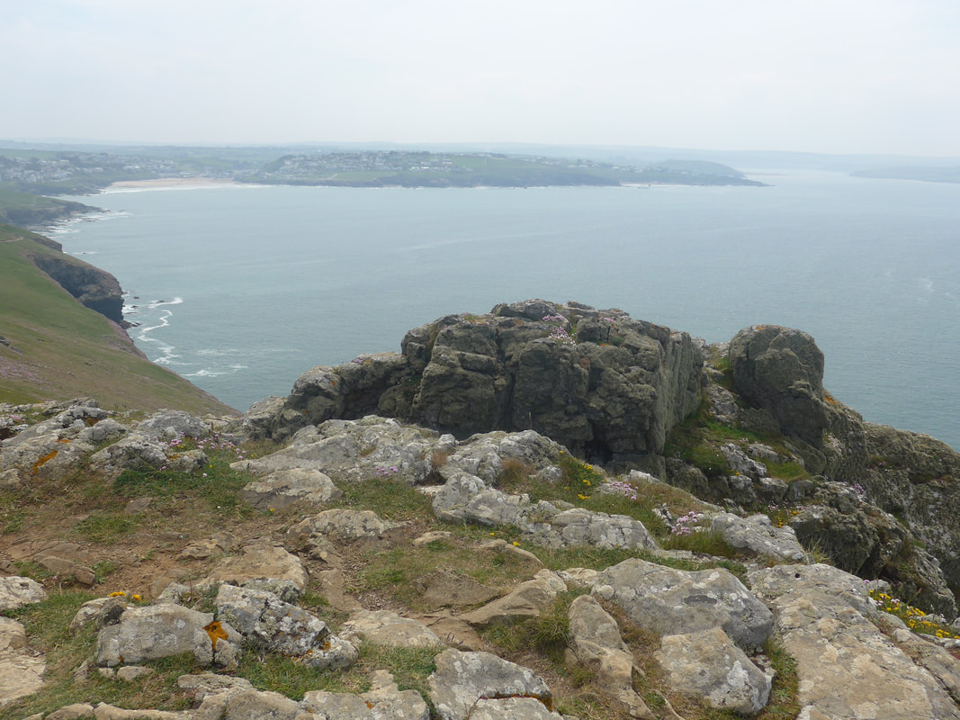
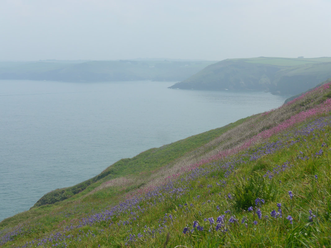
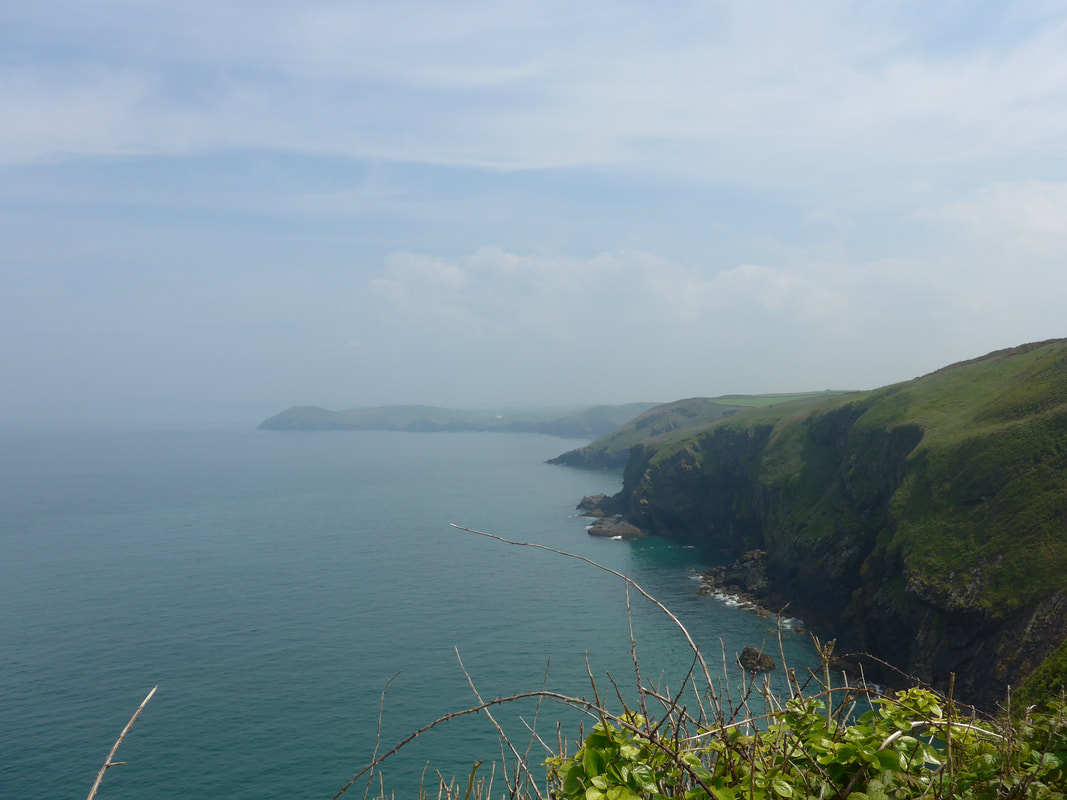
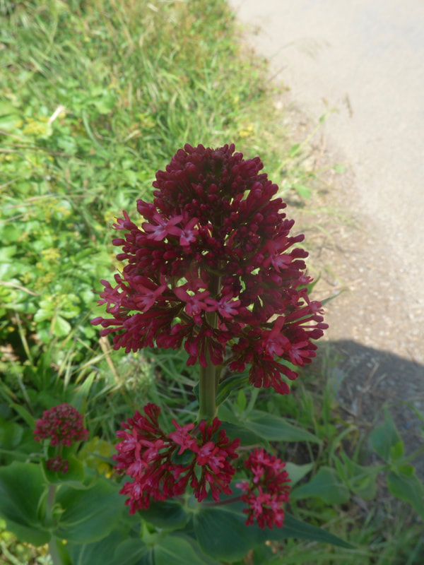
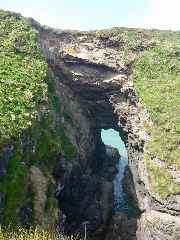
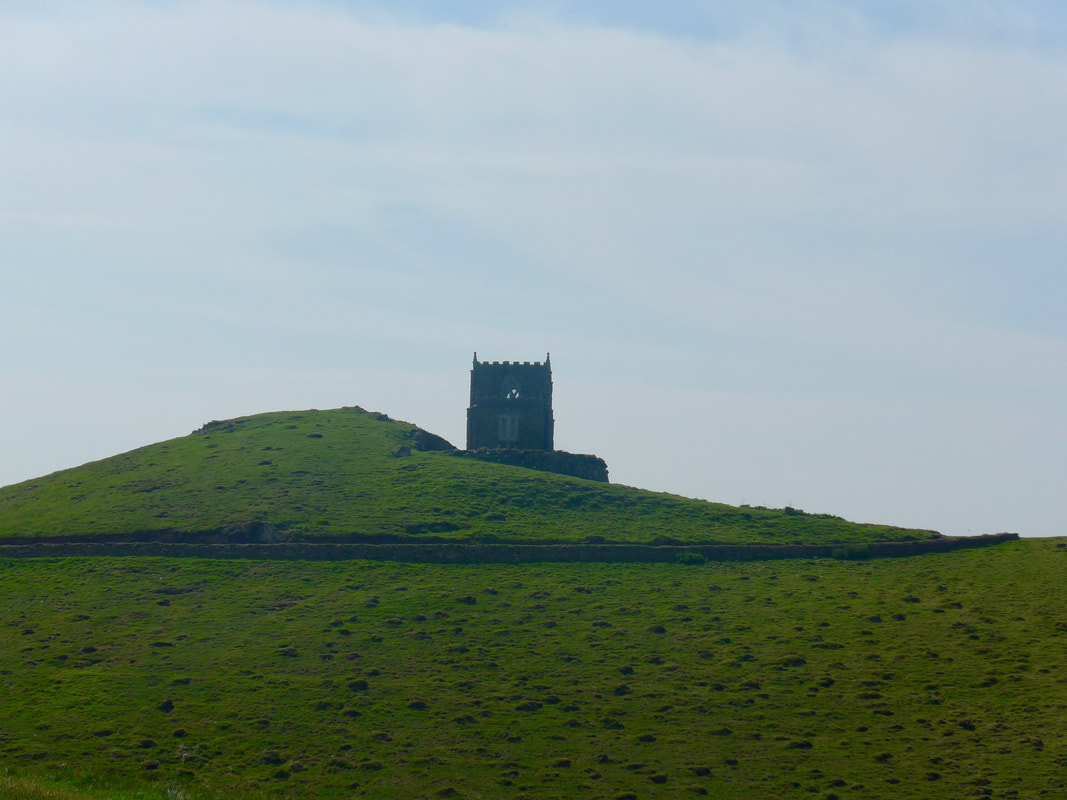
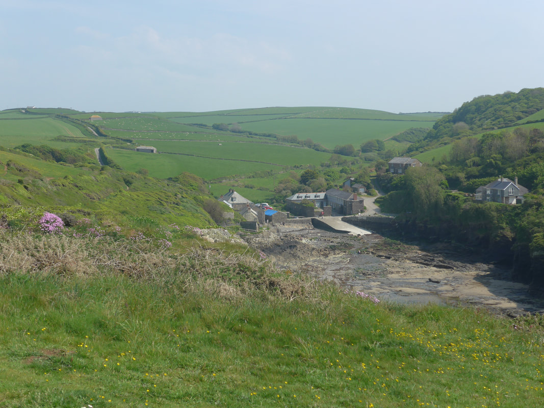
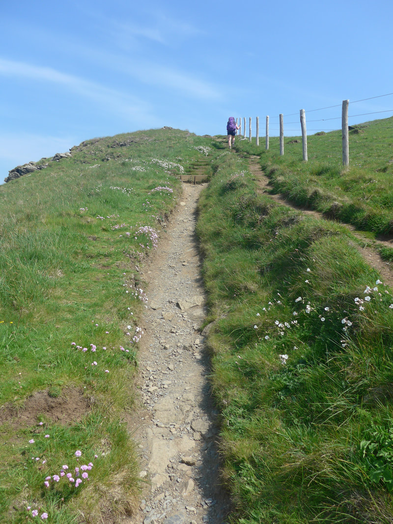
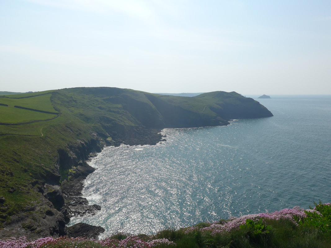
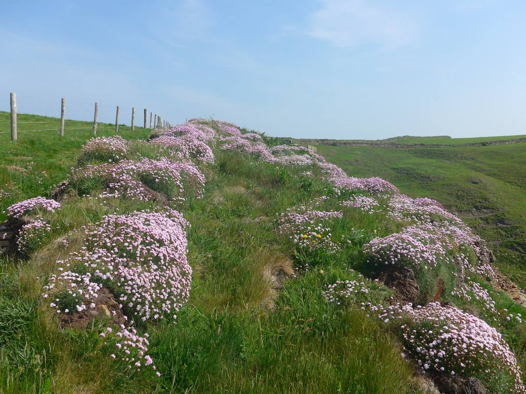
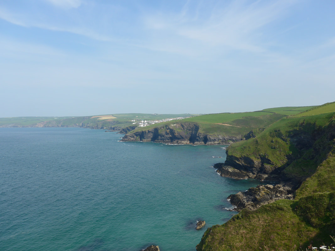
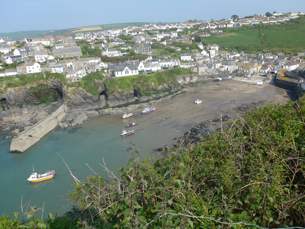
| | 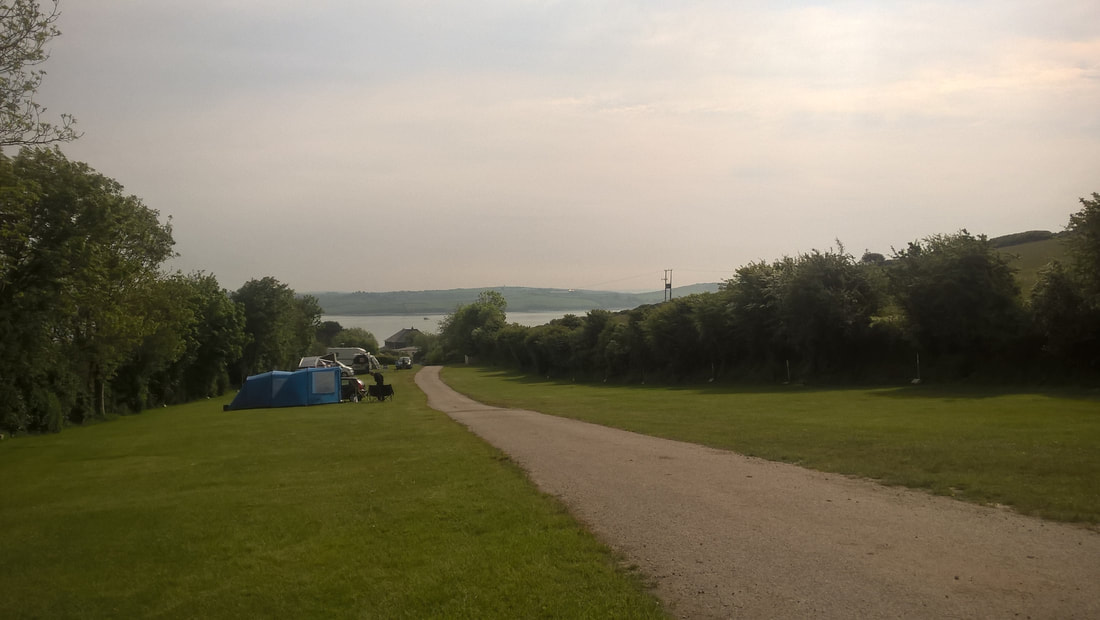 Dennis Farm Campsite Dennis Farm Campsite The day started reasonably fair but with white cloud overhead that blocked the sun. We had hopes that the sun would eventually burn it off before we started walking. While I had enjoyed a good night's sleep, Joanna apparently had not and had set about the young man across the way for making too much noise when him and his girlfriend came back from the pub. Me? I slept through it all. After coffee and hot Ready Brek to get us on the road, we packed up the tent and equipment and headed off down the steep hill for the mile or so back to Padstow where we would catch the ferry across the River Camel to the village of Rock.  The early part of our route this morning is fairly straightforward with a couple of gentle rises to stretch the limbs. As the day goes on, however, the tasks becomes harder with an almost constant series of rise and fall for the last two-thirds of the journey, including a couple of stepped sections right at the end that I have heard described as 'challenging'. The weather is set to be hot again, but you would not have believed it as we broke camp in slightly chilly conditions. 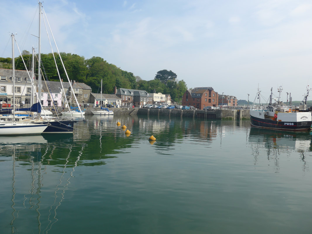 Padstow Harbour Padstow Harbour We reached as far as the harbour where, while I went to the camping shop for more dubbin for my boots, Joanna ordered up the coffee and bacon baps for the second breakfast which we ate sitting on a bench overlooking the harbour. When we arrived last night the harbour area was teeming and now, even in the early morning, there were throngs of people on the pavements. Our intention had been to go in to a cafe for breakfast but as we waited in the queue for a seat, we noticed the wee carry-out place right next door did baps for a third of the price. Canny Scots that we are, carry-out won the day. The young lady serving at the counter was from New Zealand and we spent some time discussing the Milford Track, said to be the most beautiful walk in the world and which we completed a couple of years ago. It was a nice leisurely start to the day; not too hurried, not too laid back, just going with the flow, sitting on a bench in the sunshine that was coming through a break in the clouds, watching the gentle lap of the water against the harbour wall. Across Padstow Harbour 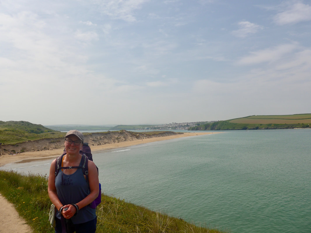 Back to Padstow Back to Padstow We caught the ferry from Padstow to the Rock and, as the tide was in and keeping us off the beach, started to walk the sand dunes to Trebetherick, our first port of call. As we had waited at Padstow the white cloud covering had started to break up and the day had brightened. As yesterday, the views of the Camel Estuary were beautiful, lovely multi-coloured, chrystal clear waters, big sky and a flowering hillside on the opposite shore. The path we were on in the sand dunes was packed sand which made walking easy enough. Once clear of Rock, we lost the crowds of people for a while and were free to enjoy the wide open spaces. Coming away from Rock, the path passes to the front of a large, round mound known as Brea Hill. On the top of the hill there two Bronze Age burial sites and to the rear in the middle of a golf course, the little, enigmatic church of St Enodoc is located and in its grounds is to be found the burial place of Sir John Betjeman. The chapel was built some time in the 12thC and was renovated in the 19thC. 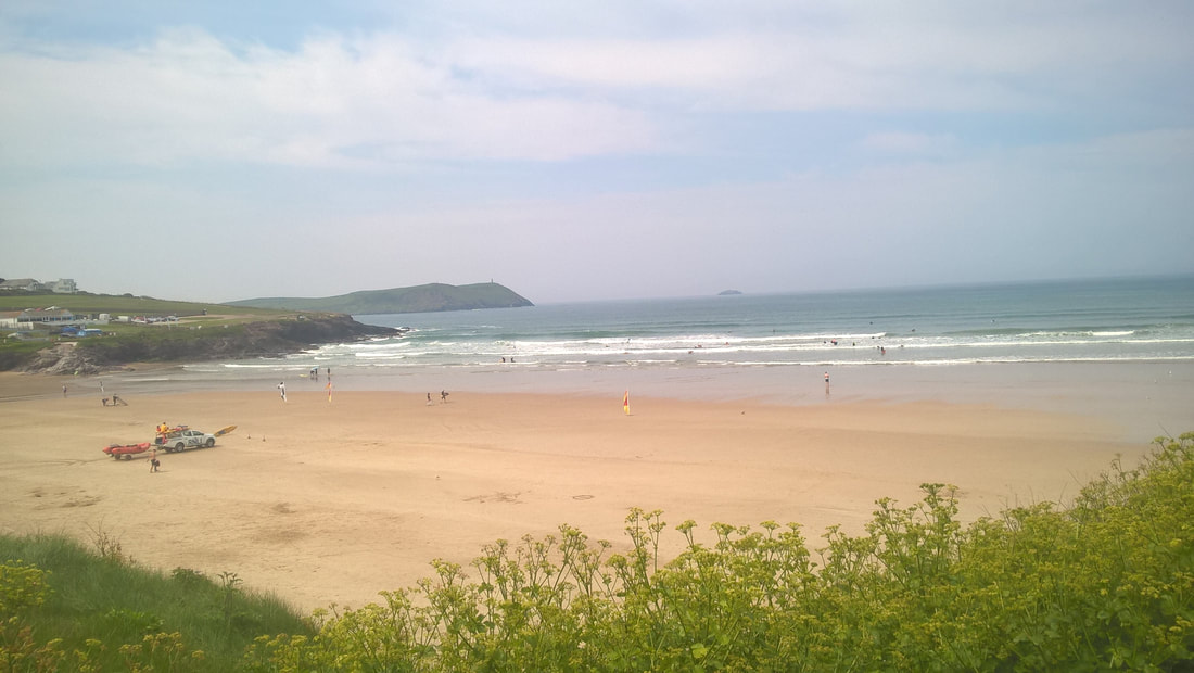 Hayle Bay Hayle Bay Rounding the hill, Daymer Bay lies in front of you and the settlements of Trebetherick, Polzeath and New Polzeath are warmly cuddled by the hills that run round Padstow Bay. Along the beach and sand dunes to Polzeath, with lovely coves and beaches, sand and sea were busy with surfers and sun-worshippers. The walking remained fairly easy. From New Polzeath the land starts to rise and the walking becomes a little more challenging as you go up above the headland at Pentire Point. As we progressed up the hill the quality of the views continued to impress offering different kinds of spectacles including swooping paths and rocky crags, a view across the River Camel to the chimney tower on Stepper Point where we had cavorted yesterday, to a hillside completely covered in the magenta Ragged Robin and the yellow of Broom and Common Splurge. The pathways were narrower, rockier, steeper, the whole thing just absolutely glorious. On top of Pentire Point we stopped to take a photograph for two young ladies and they returned the compliment giving us a very rare photo of both of us on the trail.  Rumps Point Rumps Point From Pentire Point it is a short distance to Rumps Point which juts out further over the sea. Rumps Point is the location of yet another Iron Age Fort where evidence has been found of at least three ramparts built across the neck of the headland. Remains found between the ramparts of round houses have dated the period of occupation as between 2ndC BC and 1stC AD. Looking out from the point, The Mouls Rock lies to the west. 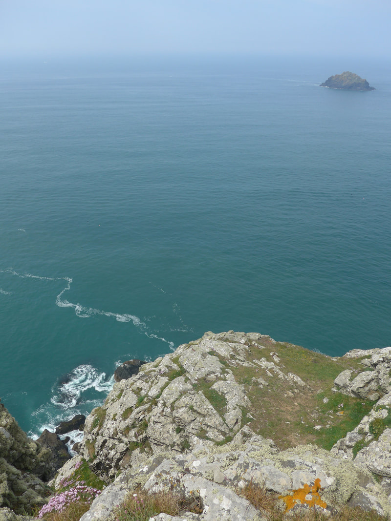 Newland Rock, Pentire Point Newland Rock, Pentire Point The path was busy with day walkers on this stretch, with access directly to the path from a car park at Pentireglaze. As you progress along the coast you appreciate why it is so popular. The scenery is stunning but it is the actual walking, stony path aside, that for me was the highlight. Once you are beyond the Rumps, forget the day trippers and there is a lovely feeling of wilderness about the walk. For most of the time there is no sign of civilisation, no cars, houses, no loud, unexpected noises just the swooping path, the rocky crags, bays and headlands and sweet, sweet solitude. We stayed high, stopping at Carnweather Point, overlooking Port Quin Bay, for lunch of ham hock sandwiches with Apple chutney and honey flap jacks which we had purchased at the wee stall in Padstow. With freshly made sweet coffee using the Jetboil it was a king's feast. As we ate, a herd of stirks that had been grazing nearby came to join us and gazed enviously at our fare. Moving on after lunch the scenery continued to entertain us with more lovely cliff top scenarios and flowered hillsides. In the distance, we could see the mass of Kellan Head, indicating the position of the village of Port Quinn. Dropping down from our high lunch position, we passed Lundy Hole, which is a lovely little arch right down on the beach. The archway was created when the roof of a seacave collapsed, leaving only the archway. With tide still quite high the sea sparkled on the other side of the arch as you looked through and the sound of the waves beating the rocks was magnified through the archway. From Lundy Hole we went back uphill to cross over Trevan Point and then a short rolling section as we approached Port Quinn. Just before we reached the port, we passed below Doyden Castle which we could just see peeking round the side of the hilltop. Built in 1830 by Samuel Symons to entertain friends, the Gothic tower, described by the NT as ' truncated Gothic folly', has one room on each of the two floors and is available through the National Trust for private rents. From the castle it was a short drop in to the inlet of Port Quinn which is a popular location for coasteering. The only buildings in the village now are the four properties owned by the National Trust. In the mid-19th C, however, the village was known to have a larger population living in over twenty houses. The village plied its trade on the sea, shipping the likes of lead and granite and, of course by fishing. It is reported that in the late 19th C, the whole fishing fleet of the village was lost in a major storm with no survivors. Deprived of their men folk, the women of the village tried to keep it going but were eventually overcome by circumstances and the village was abandoned On the clim up out of Port Quin, both sides of the path were clothed in Sea Pink which was lovely to behold. The sun heat of the day was now quite oppressive and we were struggling a bit as neared the end of this section. On the sections of the hill where it is very steep, or where the earth has been subject to too much wear, wooden steps have been put in to assist the walker. I didn't count the steps but on the three mile stretch from Port Quin to Port Isaac there must have been hundreds of them, both going up and coming down. For all it was a tough section, it was canny and beautiful with stunning views and swathes of wild flowers. My notes told me the section was three miles, but in the heat of the day it seemed to go on and on and up and down with great regularity. Coming off Varley Head we had our first glimpe of Port Isaac but we could see that we still had some walking to do, including a couple of headlands. Some time in the past week we had passed the two hundred mile mark of this trip and as we approached the last, long, stair-case descent to Port Isaac, I felt everyone of those miles. Oh, how I longed to take the monkey off my back and lie down in a cool place. No matter how hard it becomes there is always good news somewhere in the mix and our good news was that we were heading for a B&B and a day off. The first views of Port Isaac confirmed for us that we had made the right decision to stop here. It was just charming and beautiful. Many people, of course, will know it as Port Wenn from the television series 'Doc Martin' and as we came off the hillside we passed his house. We passed the harbour where a film crew were at work filming a movie about the Fisherman's Friends, a Cornish choir, starring among others the Scots actor David Hayman. Our accommodation for the night was a mile or so outside town and when we phoned for directions the owner offered to come in and pick us up. As the distance would not detract from 'coast' miles, we were more than happy to accept his offer. 'Joy of Joys' The accommodation when we arrived was a lovely, rose-covered cottage full of charm and history and peopled by a delightful couple who could not do enough for us. What a joy it was to get and settled, shower, enjoy tea and cake and, for a short time at least, to be out of the sun. Journey's End |

 RSS Feed
