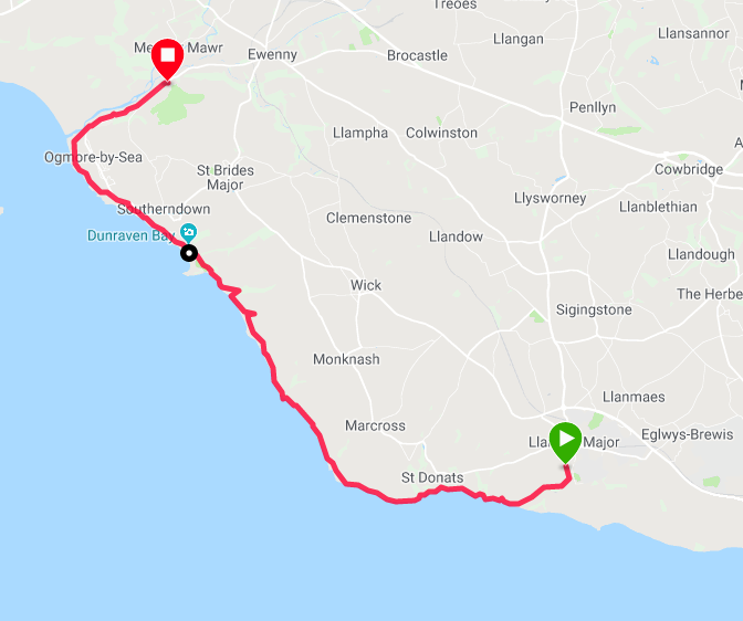
Route Map
We enjoyed a nice pub meal last night in a good, old fashioned pub in the centre of the village that was recommended to us by our Airbnb hostess, Cheryl. As well as enjoying the pub, we enjoyed our lovely Airbnb accommodation and Cheryl's company, one of life's 'ever young' characters, possessed of a Joy for life that shines on her face.
Today's route is estimated at about thirteen miles, mainly on the coast, but cutting inland at the end of the day from Ogmore-by-Sea to the village of Ogmore where we are being picked up by a friend with whom we are stayng for a couple of nights at Bridgend.
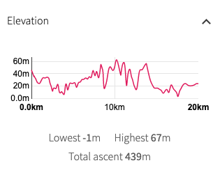
There is a fair bit of variation in the elevation of the walk today as we return to a more rolling countryside. That said, there is nothing above sixty metres so it should not be too exhausting. The general forecast for Britain is for storms but with the micro-climates in South Wales the weather can be quite different from what is forecast. Our best bet is to wait and see. We always carry waterproofs if the worst materialises. We expect nice walking, often on cliff top and if the light is with us there should be good views across the Bristol Channel to be had. Between Llanwit and Ogmore, there is little habitation once you are past St Donat's, so we will carry lunch and snacks although always with the hope that a wee cafe might turn up out of no-where.
There is a fair bit of variation in the elevation of the walk today as we return to a more rolling countryside. That said, there is nothing above sixty metres so it should not be too exhausting. The general forecast for Britain is for storms but with the micro-climates in South Wales the weather can be quite different from what is forecast. Our best bet is to wait and see. We always carry waterproofs if the worst materialises. We expect nice walking, often on cliff top and if the light is with us there should be good views across the Bristol Channel to be had. Between Llanwit and Ogmore, there is little habitation once you are past St Donat's, so we will carry lunch and snacks although always with the hope that a wee cafe might turn up out of no-where.
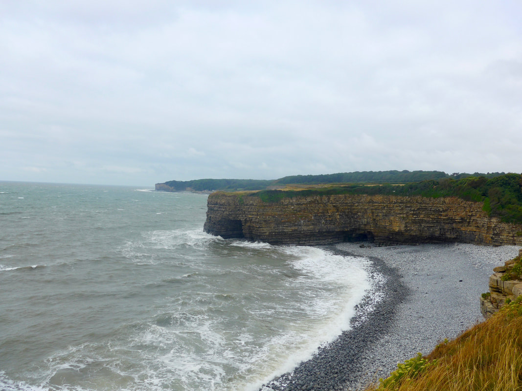
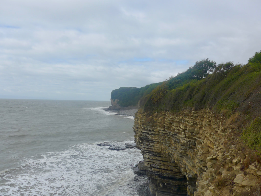
 Coastal Gap
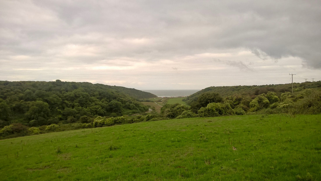
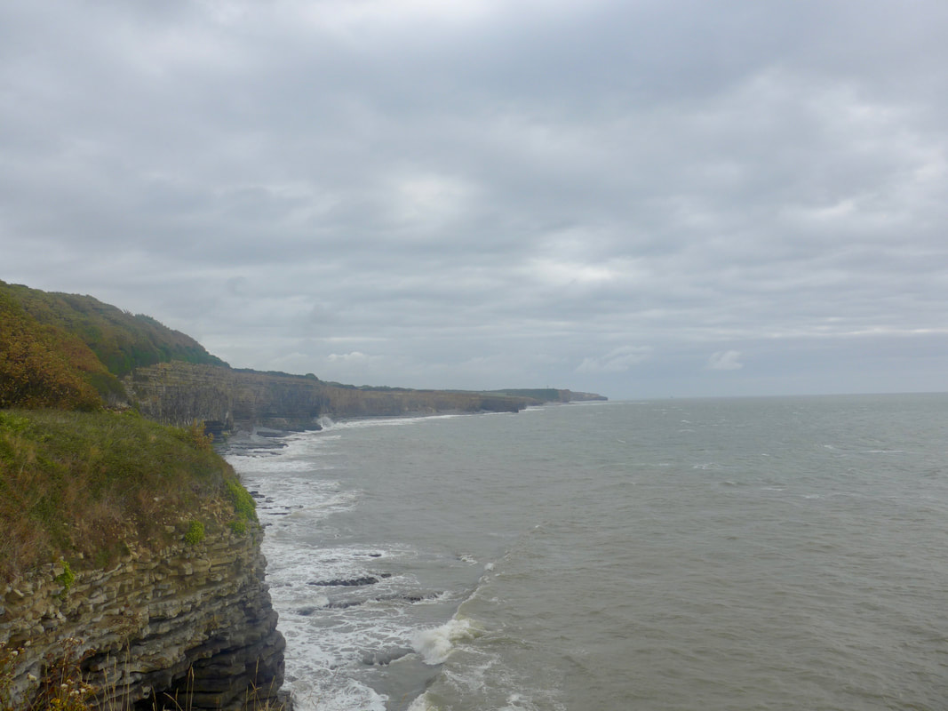
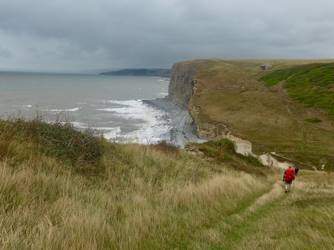
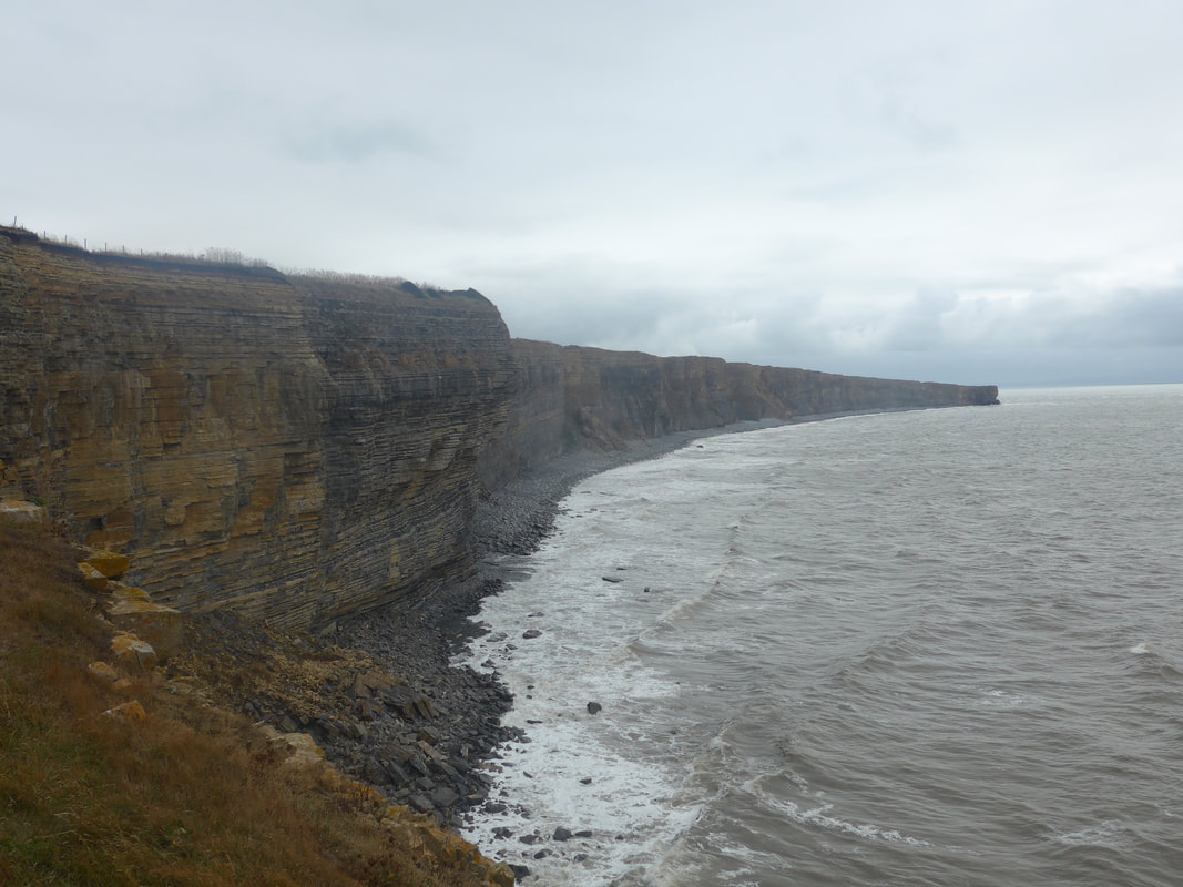
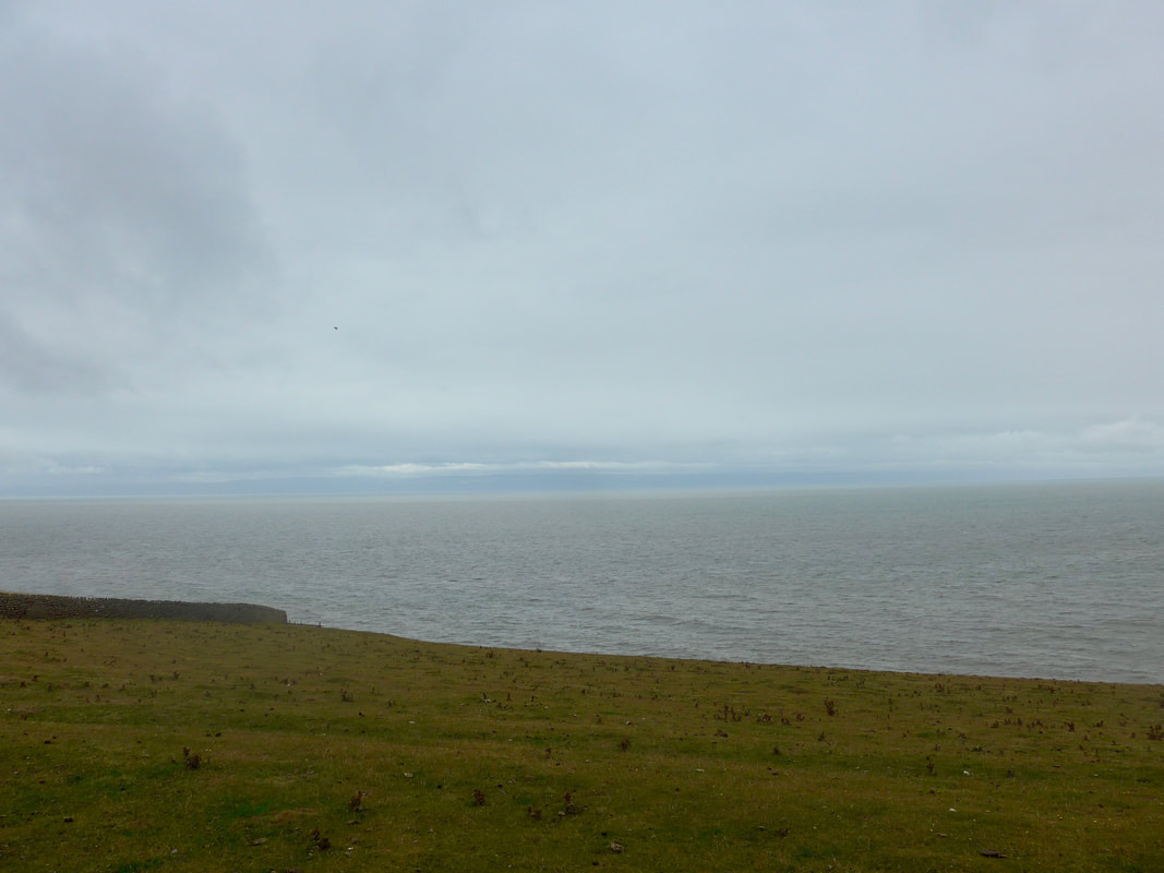
 As we made our way across country on the stretch of a mile or so from Llanwit village back to the coastal path, heading for the break in the hills that gives access to the sea, there was heavy cloud overhead. Despite that, we had decided to walk in light clothing of shorts and t-shirts as it was also quite warm and muggy. It was slight downhill walk until we hit the shore where we turned right to start a gentle uphill section, rising in small elements until we reached a height of forty metres approaching Cym Nash. Despite the poor weather there were good views across the Bristol Channel and of the many-tiered cliffs abutting the shore.
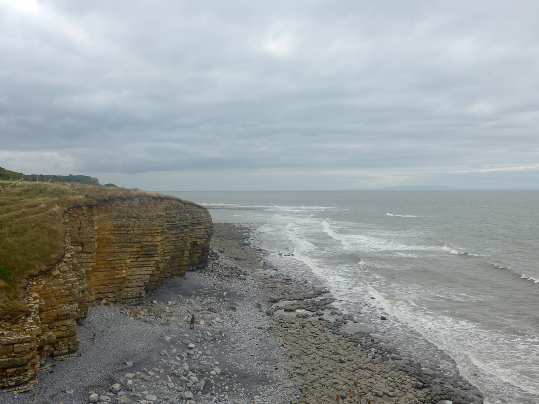
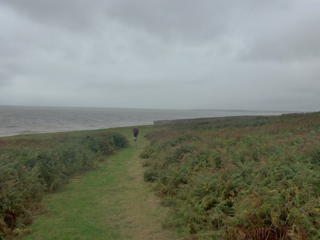
On this stretch of coast, particularly slightly further east, at low tide there are lovely examples of 'tessellated pavements' on the low water line. On the beach below us a gentleman looked both insignifant in the shadow of the rocks and, in imminent danger from the tidal waters. The walking surface on the cliff top was initially good on a hard-packed earth path, eventually giving way to slightly rougher ground as we crossed fields. However, it remained reasonable and it was a pleasant stretch of cliff walking.
On this stretch of coast, particularly slightly further east, at low tide there are lovely examples of 'tessellated pavements' on the low water line. On the beach below us a gentleman looked both insignifant in the shadow of the rocks and, in imminent danger from the tidal waters. The walking surface on the cliff top was initially good on a hard-packed earth path, eventually giving way to slightly rougher ground as we crossed fields. However, it remained reasonable and it was a pleasant stretch of cliff walking.

 St Donat Castle & College
 Walking along from Tresilian to St Donat's Bay and Point, the castle and college of the same name is dominant in the valley. St Donat's Castle is of medieval origin, dating from sometime in the 12thC AD. During the 18th and 19th C, the castle fell in to disrepair and over subsequent years went through various 'restorations'. The last owner before the current one was William Randolph Hearst the newspaper baron. Following the failure of his estate the castle was purchased in the 1960's by an educational philanthropist who gifted it to United World Colleges (UWC), an international educational trust with the aim of fostering international understanding. Still within UWC, the college is an independent, private residential Sixth Form educational establishment.
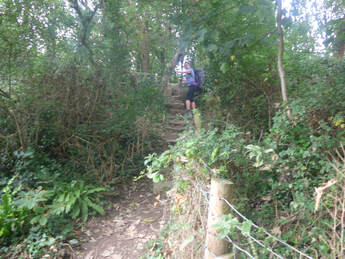
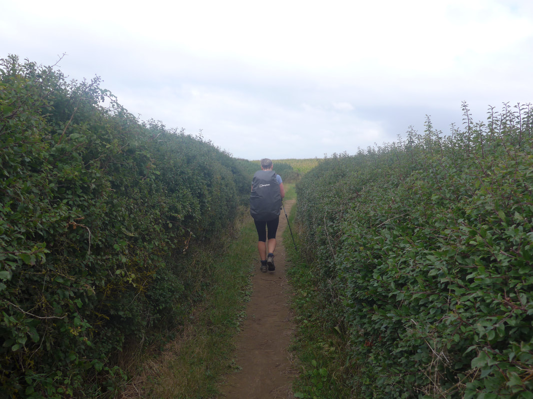
From St Donat's we continued to climb gently as the land rose to go up to Nash Point. In the course of the day we were to walk on all different kinds of surfaces including man-made gravel paths, stony bedrock, field margin, woodland walks and extensive grasslands. Leaving St Donat's there was a set of stairs rising up through a bit of woodland. Despite the change in the profile of the walk today, it was never strenuous, helped by the fact that we had remembered to bring the walking poles. While there are different schools of thought about using poles, we find them particularly useful when walking with a full pack and have used them to great effect on walks in the UK, as well as on expeditions in the Grand Canyon, the Milford Track (New Zealand) and various places in Europe. Thay have great utility on both the upward and the downward slope, particularly on the latter as they take the pressure off the knees.
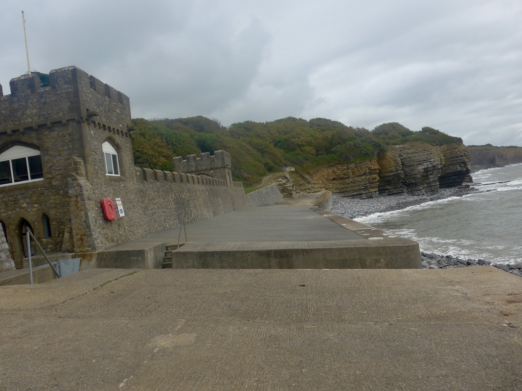
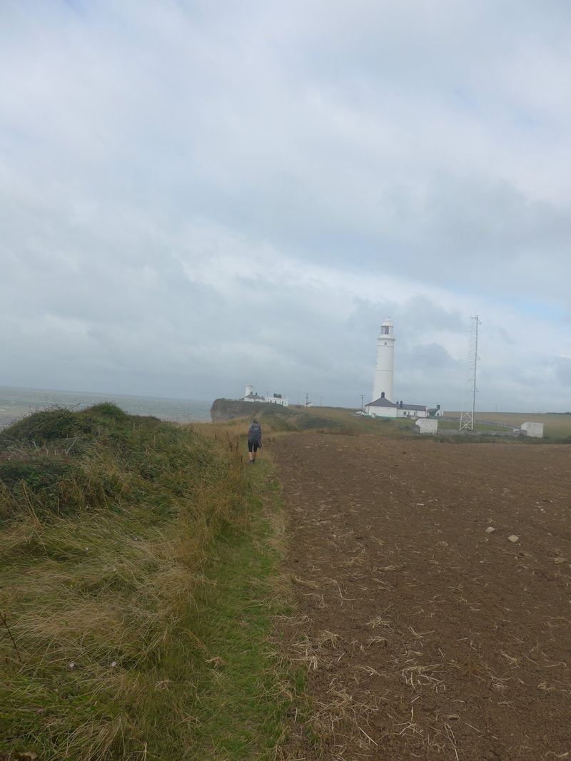
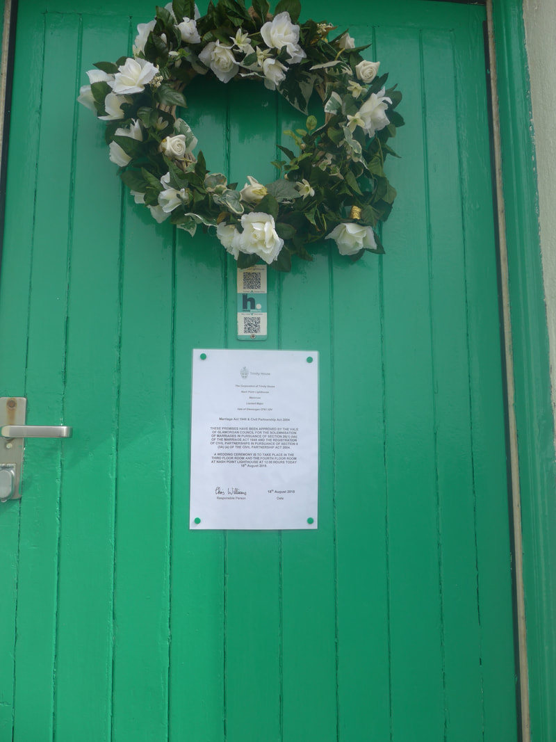
On clearing the wood and hedgerow section, we could see the lighthouse on Nash Point very clearly. It was built in the early 1830's following a tragedy when the passenger ship PS Frolic sank with the loss of eighty lives. Originally two towers, one was decommissioned in 1920's, the second was automated in 1998, the last manned lighthouse in Wales. People will be aware of recent changes to civil marriage ceremonies which mean that the civil service can be held in a number of different and, sometimes, unusual places. We were tickled to find pinned to one of the lighthouse keeper's cottages a notice that a marriage was to be held that day in the lighthouse on the third and fourth floors! We were also very pleased to find a nice cafe here where I enjoyed the Welsh teatime treat of bara brith (a fruit teabread traditionally flavoured with tea). In the cafe we met two English walkers and in conversation found out we knew his brother quite well who lived in Ullapool in the far north of Scotland! Many degrees of separation indeed.
On clearing the wood and hedgerow section, we could see the lighthouse on Nash Point very clearly. It was built in the early 1830's following a tragedy when the passenger ship PS Frolic sank with the loss of eighty lives. Originally two towers, one was decommissioned in 1920's, the second was automated in 1998, the last manned lighthouse in Wales. People will be aware of recent changes to civil marriage ceremonies which mean that the civil service can be held in a number of different and, sometimes, unusual places. We were tickled to find pinned to one of the lighthouse keeper's cottages a notice that a marriage was to be held that day in the lighthouse on the third and fourth floors! We were also very pleased to find a nice cafe here where I enjoyed the Welsh teatime treat of bara brith (a fruit teabread traditionally flavoured with tea). In the cafe we met two English walkers and in conversation found out we knew his brother quite well who lived in Ullapool in the far north of Scotland! Many degrees of separation indeed.
 Descending to Cwm Nash
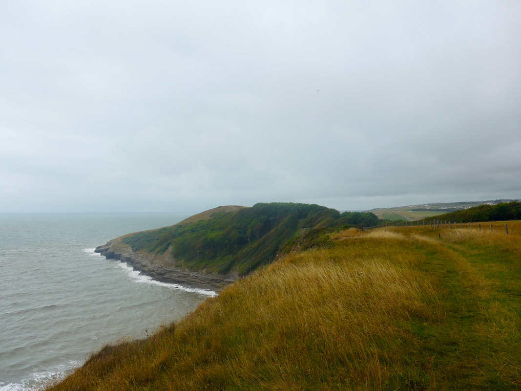
 From the college the land continues to rise up until it reaches almost sixty metres, before going back down again at Cwm Nash which is known as a great place to see Peregrine Falcons which nest on the cliff there. They must have been on their holidays when we visited because we saw nothing of them.
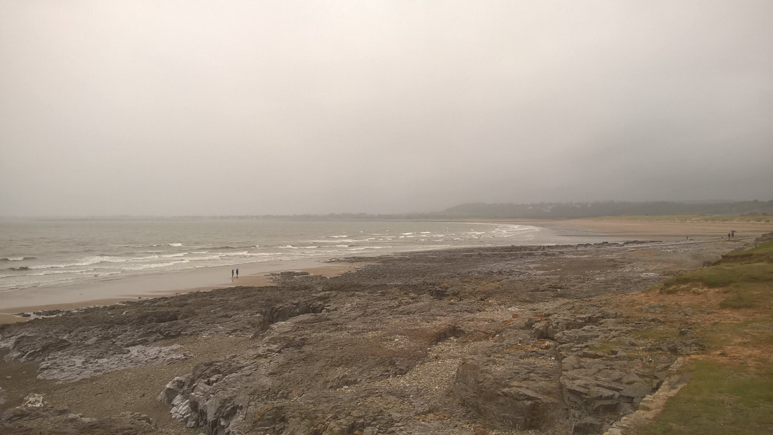
There are two or three gullies on this stretch as you head towards Dunraven Bay, as well as some nice little beaches at Traeth Mawr, Traeth Bach and Dunraven itself. From the top of the vale of Cwm Nash, the route drops down to the beach (known as Monknash) from where you can see waterfalls as a small brook tumbles to the sea. The route goes immediately back up hill again to the highest point of the day at Whitmore Stairs, a large (seventy metre) cliff with a rock outcrop below, hence the stair. Just before Dunraven there is a nice view out across Witches Point, the site of the Pillow Mounds, or rabbit warrens, probably associated with Dunraven Castle. By the time we reached Dunraven Bay, we were ready for another stop and despite the strong wind coming off the sea and the threat of rain, from our picnic table we enjoyed our views across the Bristol Channel. It was only when we moved on we realised that there was a beautiful walled garden at our back in the grounds of the ruined Dunraven Castle which would have been a lovely alternative spot for a picnic without the wind.
There are two or three gullies on this stretch as you head towards Dunraven Bay, as well as some nice little beaches at Traeth Mawr, Traeth Bach and Dunraven itself. From the top of the vale of Cwm Nash, the route drops down to the beach (known as Monknash) from where you can see waterfalls as a small brook tumbles to the sea. The route goes immediately back up hill again to the highest point of the day at Whitmore Stairs, a large (seventy metre) cliff with a rock outcrop below, hence the stair. Just before Dunraven there is a nice view out across Witches Point, the site of the Pillow Mounds, or rabbit warrens, probably associated with Dunraven Castle. By the time we reached Dunraven Bay, we were ready for another stop and despite the strong wind coming off the sea and the threat of rain, from our picnic table we enjoyed our views across the Bristol Channel. It was only when we moved on we realised that there was a beautiful walled garden at our back in the grounds of the ruined Dunraven Castle which would have been a lovely alternative spot for a picnic without the wind.
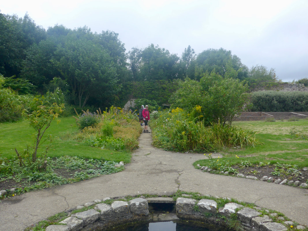
 Back to the Castle
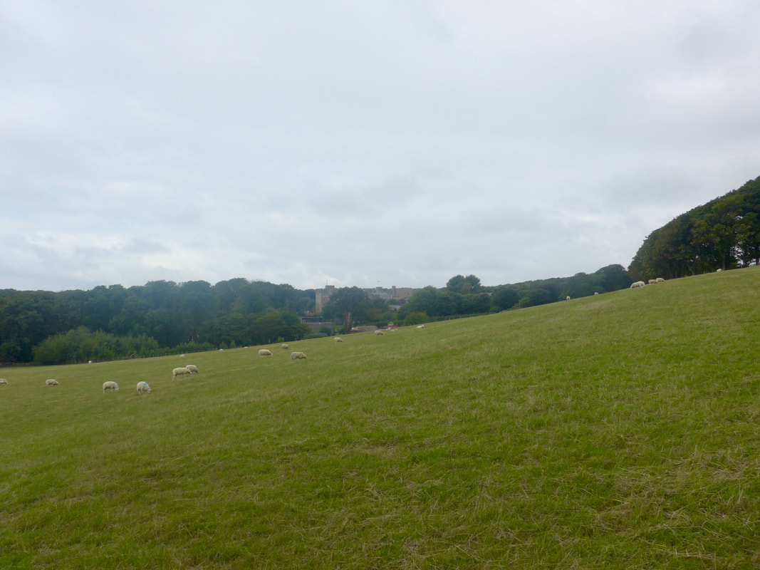
 We had a short climb back up out of the vale from where we had nice views of the walled garden in its local environment. The sky was seriously clouding over, growing dark above us and angry out at sea where we could see the shadows of falling rain on the horizon. The wind had whipped up again, the temperatire had fallen and there was moisture in the air that was almost as bad as rain. Fortunately, the clifftop section between Dunraven and Ogmore-by sea was not too long and we managed to finish it before the rain came. The walking was good, in open countrside with good footing and, despite the cold and the wind, it was a good stretch with which to finish on the coastal section. The day was not done at Ogmore-by-sea, however, as we still had to make our way inland to our pick-up point.
We had a walk inland for a mile or so along the flood plain of the Ogmore River. The path weaved in and out a bit as it sought a route, running parallel to the road, but below it for the main part. The final part was on the road itself but as the road was reasonably quiet it felt safe enough. Our final destination before pick up was the wonderfully named pub 'The Pelican in her Piety'. The name is a reference to the bird's practice of opening her breast to feed her young with her blood. This was later taken to symbolise Christ feeding his flock with his blood; later still to symbolise charity. We enjoyed cold drinks and then coffee, chatting with fellow walkers, while waiting for our friend to pick us up.
It had been a pleasant day, with good walking, new friends made and old acquaintances renewed. Now, you cannot ask for better than that.
It had been a pleasant day, with good walking, new friends made and old acquaintances renewed. Now, you cannot ask for better than that.
 RSS Feed
