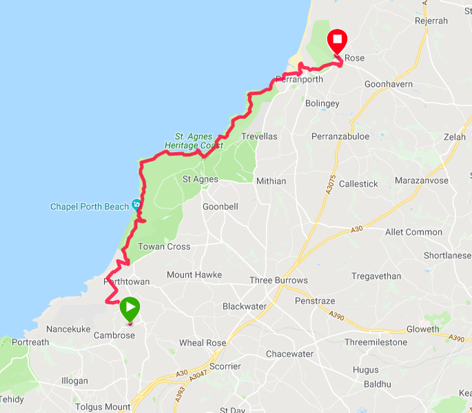
Route Map
We enjoyed a wonderfully quiet night in our little arbor under the trees at Elm Farm campsite, with only one other person on the campsite and he was in a campervan at the other side of a large field. Although there was a cafe up the hill at the campsite office, we stuck to practice and made our own breakfast before packing up and setting off. We called in to say our goodbyes and were almost tempted by the smell of cooking bacon but resisted. We left by the back of the bicycle shop, which cut off a little bit of road walking for us. It was then back to the zig-zag lanes for a couple of miles to make our way back to the coast.
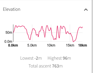 Walk Profile
 Once back on the coast this morning, we stay there until we reach the village of Perranporth where we are again camping slightly inland at Tollgate Farm. It is a rollercoaster of a day with a number of ascents and descents, the highest over ninety metres and there are a few of them. We have a climb on the road coming out from the campsite but once the initial height has been gained we are fairly level until we hit the coast. Once on the coast and almost from the 'get-go', we are on rolling hillsides. The weather forecast for the day is okay, slightly overcast which may result in a hot and humid day. With that in mind, we set off in t-shirt and shorts in an effort to stay cool.
 To St Agnes Head
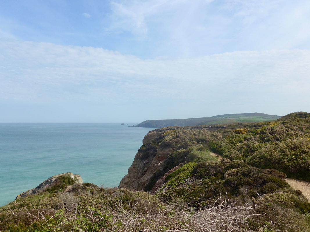
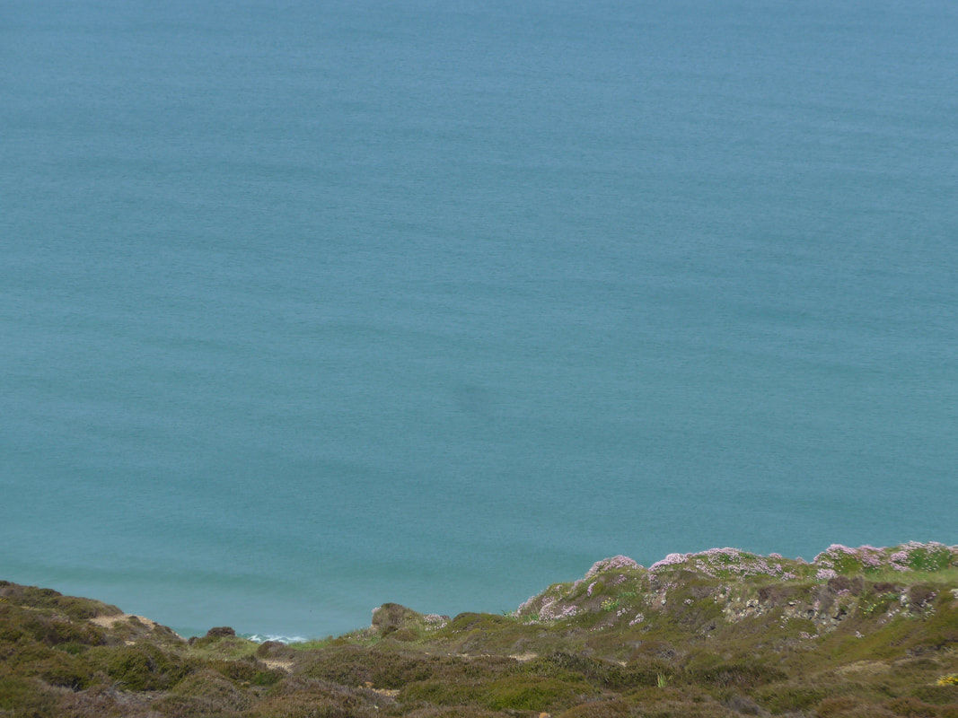
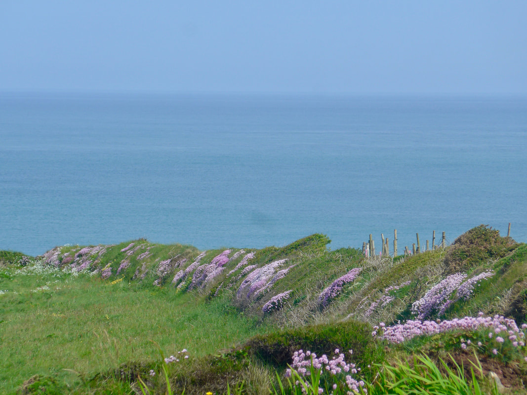
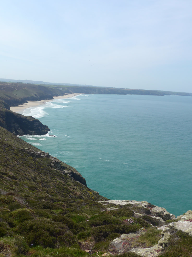
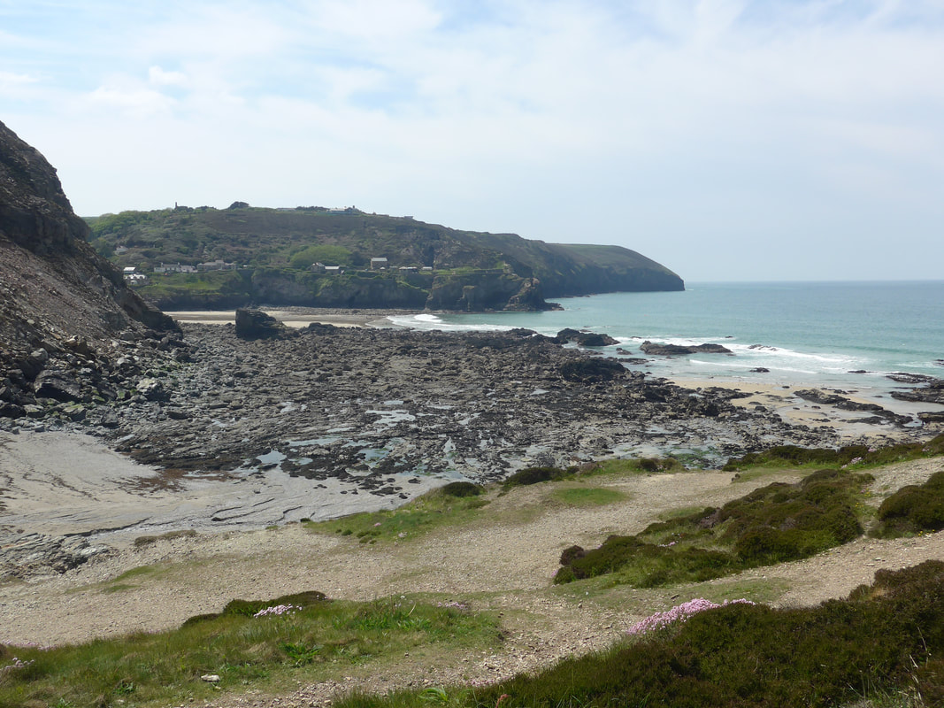
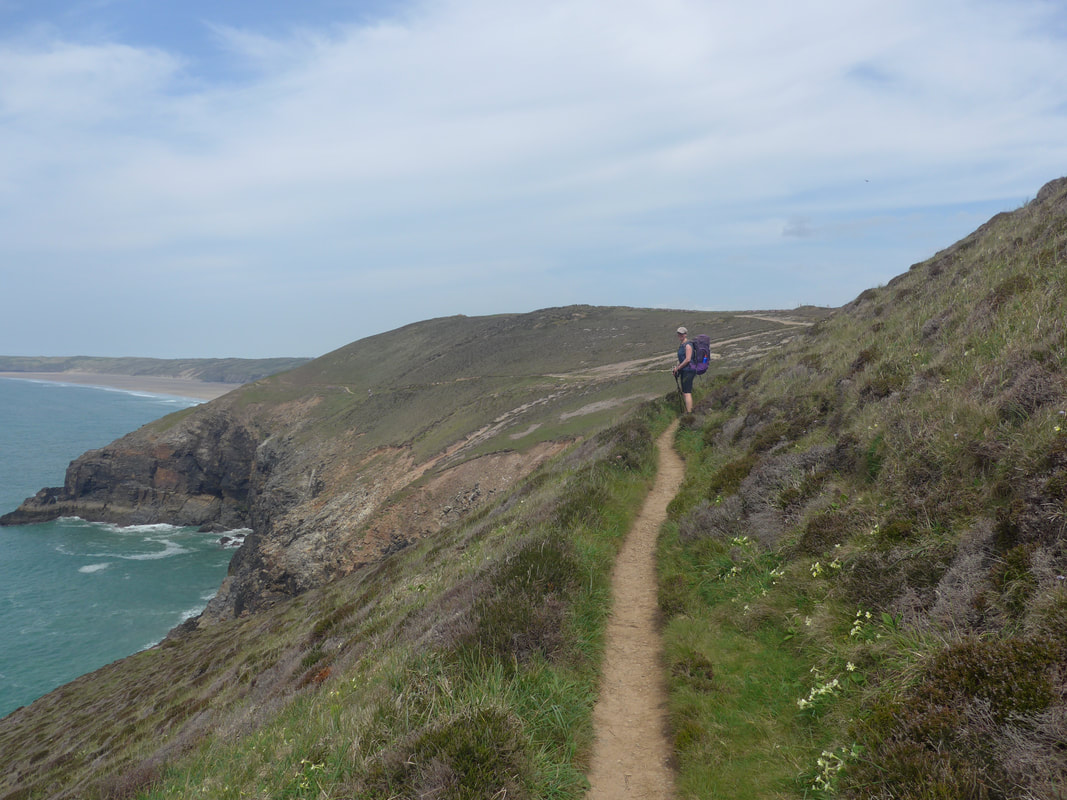
 It was an uneventful return to the coast and by the time we reached the path just above Tobban Horse, the skies had cleared a bit and we had good views outover the Celtic Sea. To the west we could see as far as St Agnes Head and beyond to Bawden Rock or "Man and his man', as it is sometimes known. The sea was a beautiful aquamarine colour and seemed endless as it stretched out towards the southern coast of Ireland. We were excited when we saw a huge shadow beneath the waves, expecting a basking shark to appear, but nothing came of it and we moved on nursing disappointment, constantly looking back 'just in case'. The lines of old stone dykes, long since covered by soil and grass, glowed in the morning sun, festooned with the flowers Sea Pink and with crowds of buttercup and white and yellow daisies at their feet. As we walked along the clifftop to Porthtowan, we were caught by surprise how busy the path was with lots of walkers, runners and people exercising their dogs.
From Tobban Horse it is a gradual but steady descent down to the village of Porthtowan. As we had only just started walking, we did not stop at the village but carried on to go up above Towan Sands, rising to over seventy-five metres before dropping back down again to the gully at Chapel Porth. Before we descend, lookin back Wheal Tye chimney was still standing station on its hilltop, as it has done for some years and will continue to do long after I am gone. To the right of the chimney, the roof of the radio 'golf-ball' was peeking over the rise of the hill. invisible signals searching out who knows what, Russians or aliens? There was a smattering of people on the sands, including the lifeguards just setting up for the day. All along the bottom of the cliffs, the rock was studded with caves where the sea had started to make inroads in to the face of the cliff. To the front of us the heathland stretched out towards St Agnes head, the path a khaki scar through the brush.

 Mine Workings
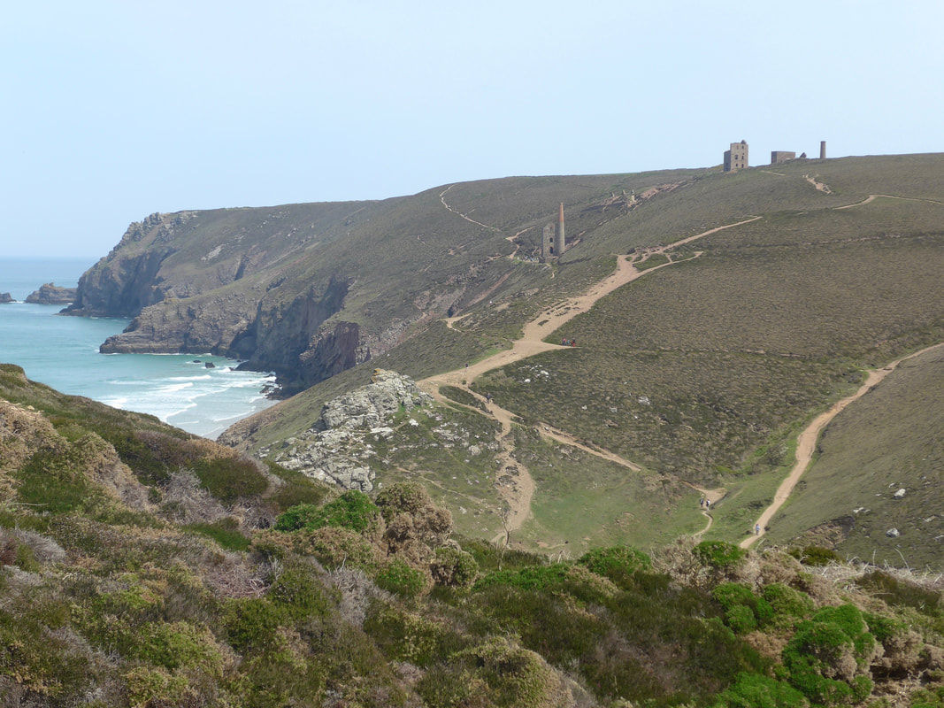
 The landscape above Porthtowan is littered with industrial past, the mine buildings and the mines themselves, with little metal 'hats' or caps over the tops of the shafts. Dropping down between two hills after Porthtowan the remnants of old copper mines march up the hill in front of you, the hillside here and round about threaded by the sandy, dusty paths that gave access to mainly copper mines, with a smaller amount of tin may also mined here. There are a lot of people around, including small groups on what was obviously a guided tour. Within walking distance you can visit Wheal Charlotte, Wheal Coates or Trevellas mines.
There were too many people around the mine workings, or maybe it was that we had been on our own too long, but it was too noisy and busy to want to linger long. Continuing on up Mulgram Hill we were happy to be back on our own again with views over endless sea, sky and coastline. Off course, once at the top of Mulgram Hill, we were immediately dropping back down again to Chapel Porth where there is a wee beach, a car park, toilets and 'lots of people'. We took the opportunity to use the toilets and I spent some tyime chatting a family group from Germany who were doing day walks along the coast. There is a long, slow rise out of Chapel Porth back up to the clifftop, rising to over ninety metres above Tubby's Head. There are archaeological remains on this headland that have been interpreted as an Iron Age cliff castle. The feature was protected on three sides by natural rock formations and on the neck of the headland by a bank and eart-cut ditch. A possible shell midden and two hut circles have also been tentatively identified.
 Trevaunance Beach
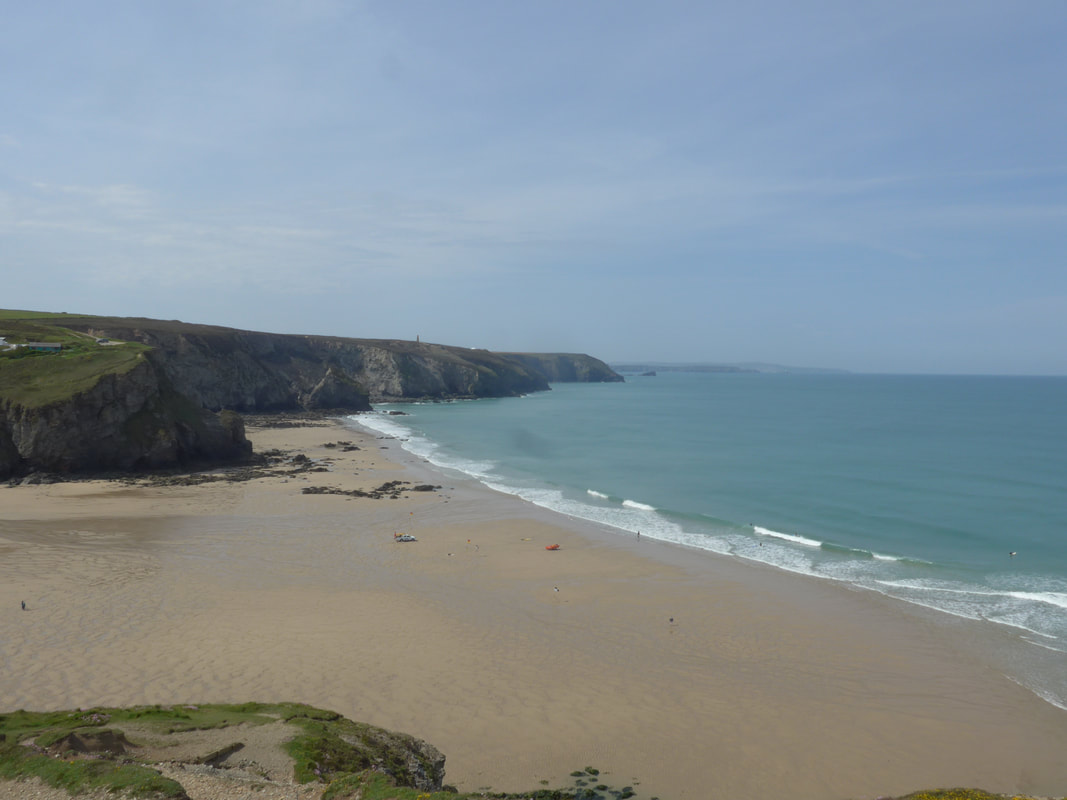
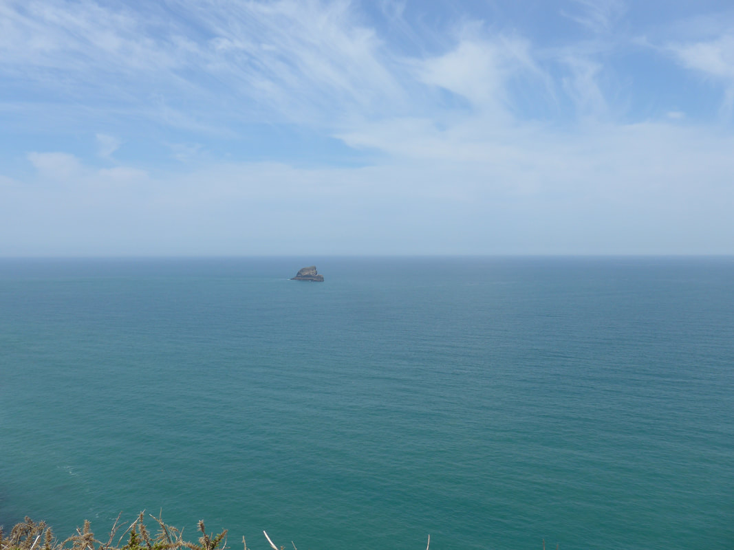
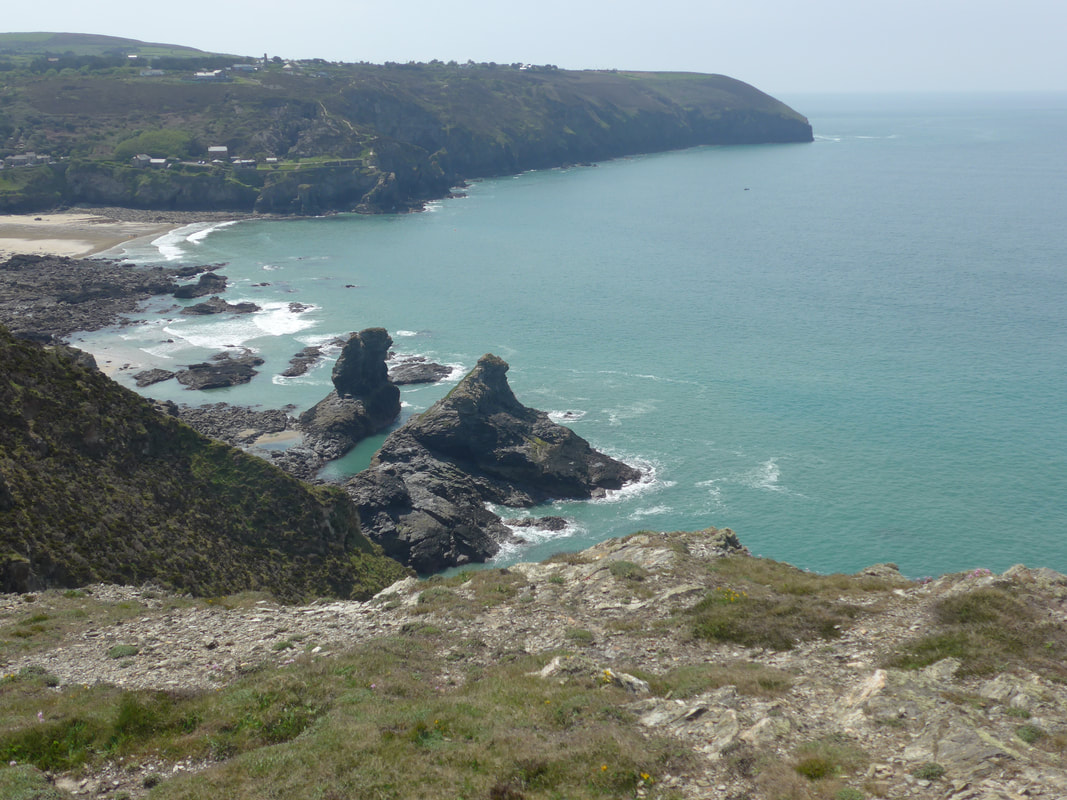
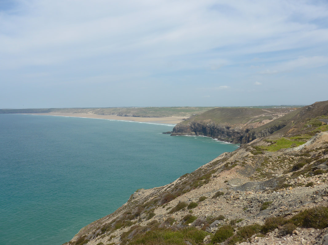
 From Tubby's the land continues to rise to stand over ninety three metres at St Agnes Point. Off the point there are good views of the Bawden Rocks which, unfortunately, my photograph does not separate out in to the two features. The sea here was a beautiful aquamarine colour and we could see for miles in all directions. From our standpoint above St Agnes we could just make out two deer at the very top of the rock but they were too faraway for our small camera to catch them. Continuing on we went round Newdown's Head to complete a steep descent to Trevaunance Cove where we stopped for lunch. The main restaurant at the cove was full and we had to make do with a cafe next door where we had what was the worst meal of our whole South West Coast Path adventure, a nasty and penny-pinching haloumi burger.
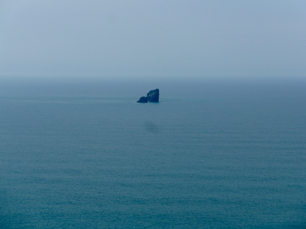 Bawden Rocks (Man and his man)
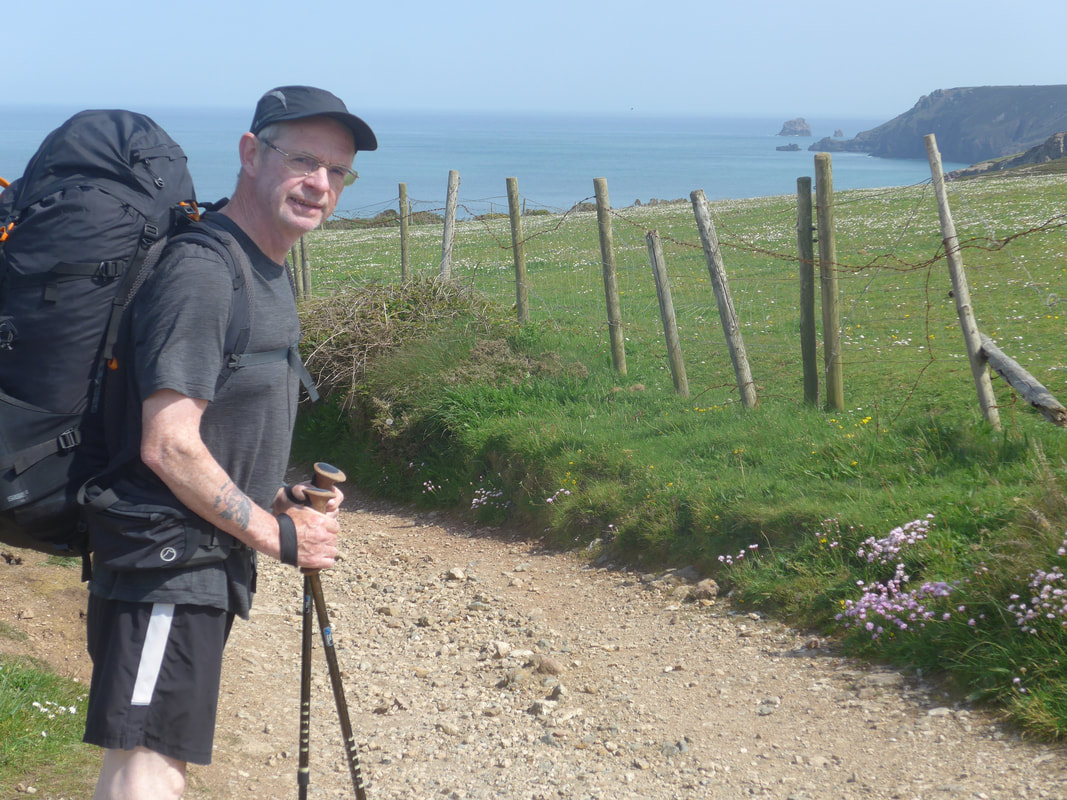
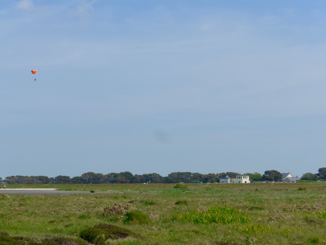
 When it was time to move off, the tide had receded enough that we avoided our next up and over headland by walking along a sand and rock beach. It was the kind of place where you could take the kids and spend hours in the pool. Sadly, we didn't have the hours to spare. We had a bit of a clamber to get off the beach and back on to the path but it was nice enough to have made it a worthwhile detour. Rejoining the path at the end of Trevella Porth, we had a steep climb up to Cross Coombe where we were walking along the boundary of Perranporth Airfield. It wouldn't be Cornwall if you stayed up and before long we were dropping down to a point just above a sea stack known as Green island, then back up again to above the rock headland of Pen a Gader.
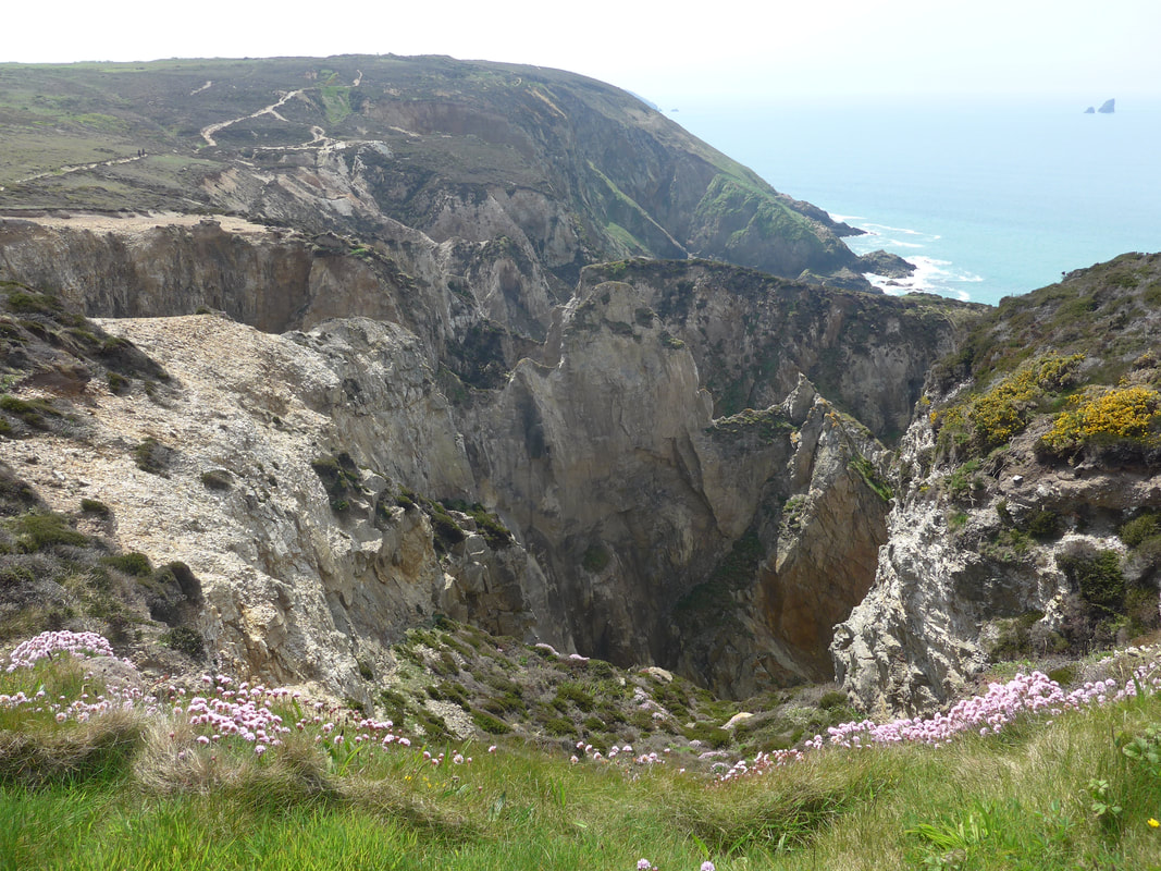
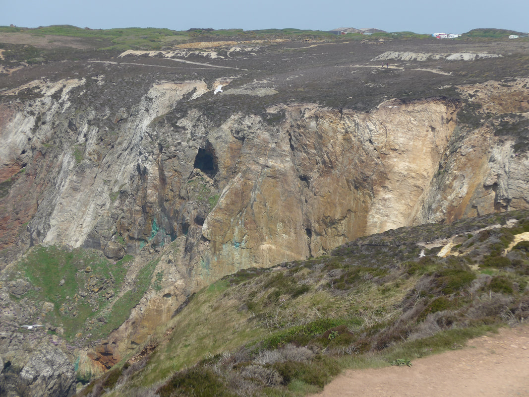
 'Thar be copper here'
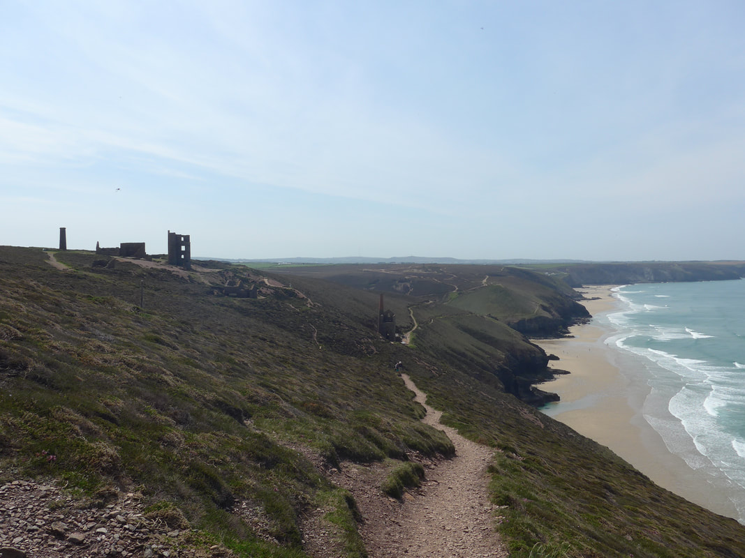
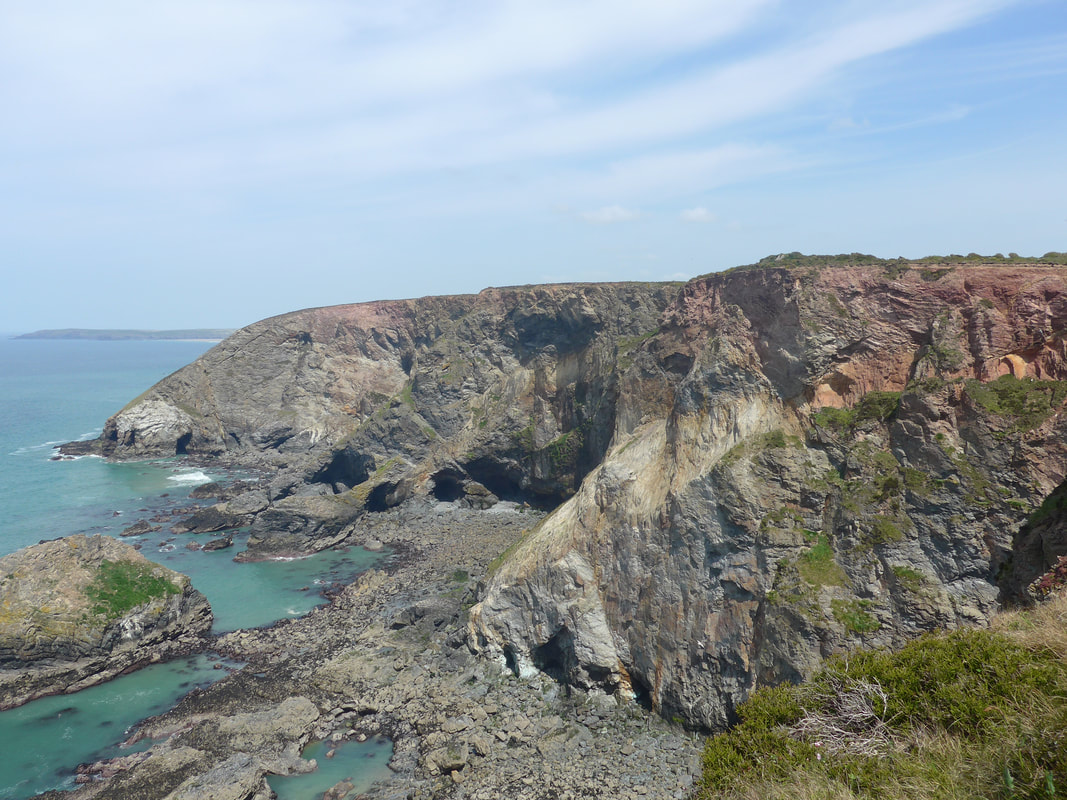
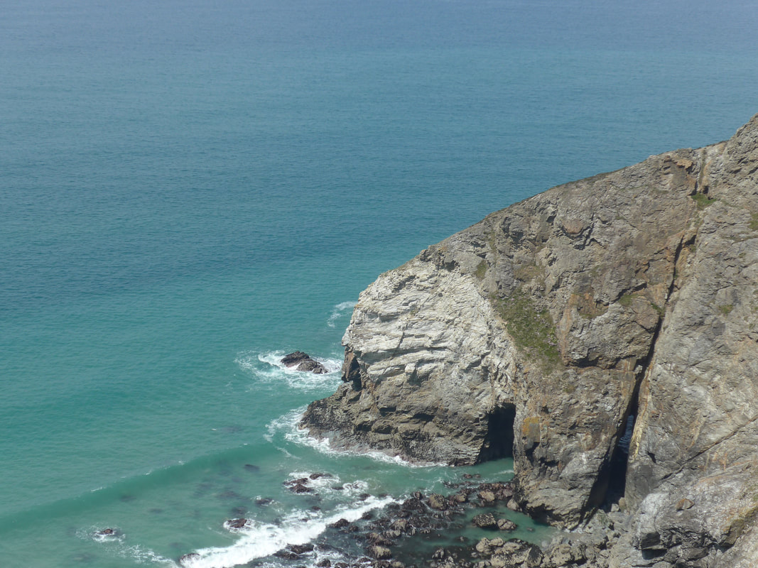
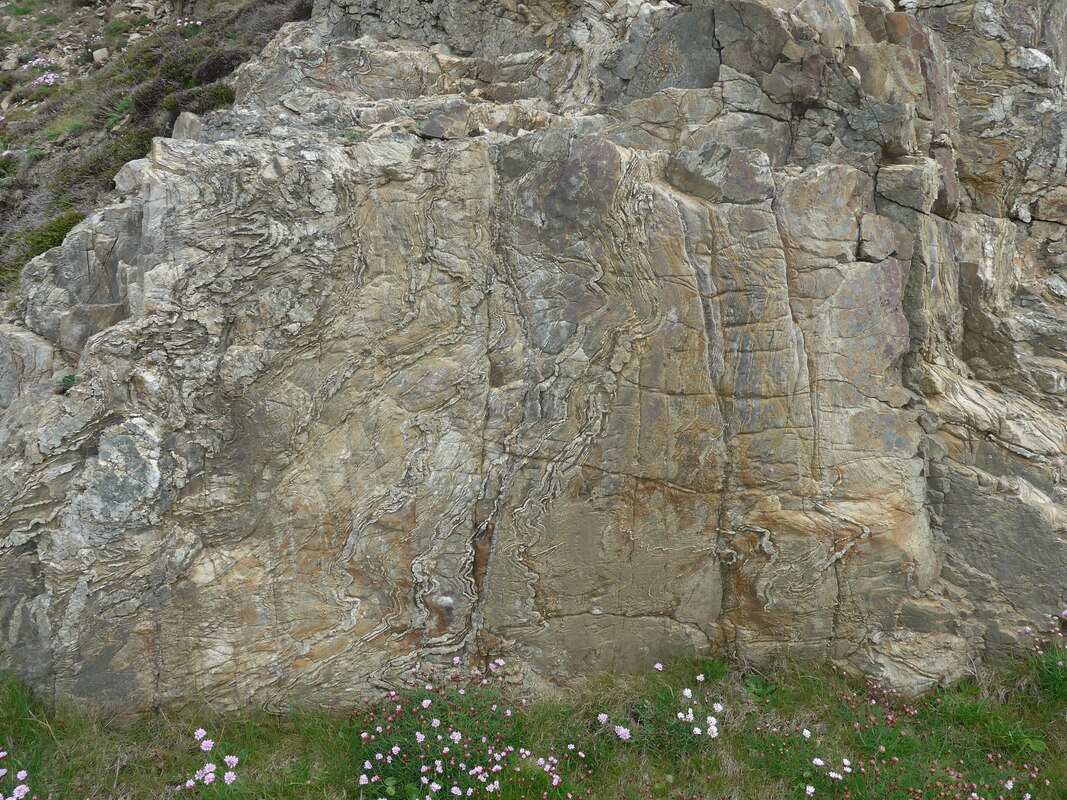
 -The walk out from Pen a Gader started with a drop to Cigga Head and ofter a relatively short level section, we descended back to sea level at Perranporth Beach. The walk from Pena Gader might best be described as 'walking on the moon', because at times it resembled a lunar landscape, the consequences of mining and natural erosion both leaving their marks. The cliff face and the clifftop had been mined extensively. What you think at first glance to be natural caves, on second inspection can be seen to be man-made mine entrances. These are visible both right at the foot of the cliff- face on the beach and, high up near to the top. The consequences of the various chemicals used in the mining process can be seen in the spoil heaps on the cliff top. In places, on the face of the cliff, traces of the valuable copper can be seen in the green streaks that mark the cliff face.
 Perranporth Cove & Museum
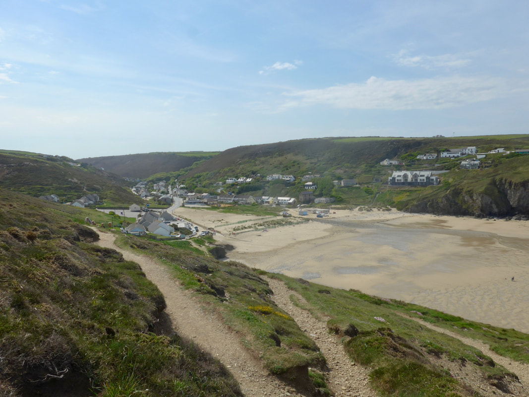
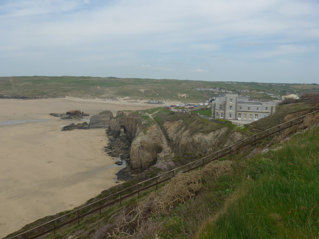
 It was with relief that we looked from Droskyne Point over Perranporth Cove and the museum at the head of the beach. However, the day was not finished with us yet. There is nearly always a sting in the tail for us. It had been an arduous and strenuous day, walked in heat and with little respite from the constantly rolling hillsides and we are blaming the tiredness and dehydration for the fact that we could not follow a fairly straight line. I do not know what it is about them but Jo and I never seem to have any luck navigating in sand dunes. Either we cannot find the path coming off the beach or, we go off the path once in the dunes. This time we needed directions from a lifeguard to get on the right path to access our campsite at the back of the town. Once through the sand dunes, we needed to cross the local golf course and perform a wee wiggle round a couple of roads and there in front of us was Tollgate Farm.
I would like to tell you all about Tollgate campsite but I cannot remember much about it. The only things I can recall are: arriving, that the owner agreed to recharge my Garmin GPS and, there were good shower and toilet facilities. Oh! And I slept, and slept, and slept and then I must have left the next morning.
 RSS Feed
