
Route Map
Last night we had a nice room at the Hartland Quay Hotel where we were able to rest up and shower before dinner. The dining experience was not so good as first they brought the wrong meal for Joanna (should have been a vegetable curry) and secondly, replaced it with a very quickly thrown together, de-constructed lasagne in which it appeared the ingredients were all strangers to each other prior to the minutes before serving. While it can be difficult when restaurants are busy, you do expect hotels that know they will be busy to have learned to adapt.
 Walk Profile
 Today's route is another roller coaster without being cruel, gradually climbing to over one hundred and fifty metres above Beckland Bay, before dropping down to sea level at Blackchurch Rock. The highest point of the day at over two hundred metres is reached at the end of the walk, thankfully, on a road climb up to Higher Clovelly where we have taken Airbnb.
Weatherwise, it is set to be a mixed bag. As we set off the clouds were thick, but it was still warm so we stuck to t-shirts and shorts. However, we expect rain at some point, so the waterproofs are near the top of the bag.
Weatherwise, it is set to be a mixed bag. As we set off the clouds were thick, but it was still warm so we stuck to t-shirts and shorts. However, we expect rain at some point, so the waterproofs are near the top of the bag.
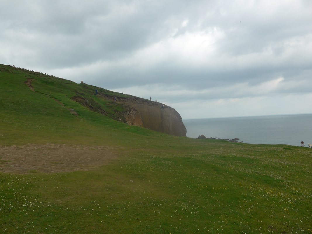
 To Gull Rock
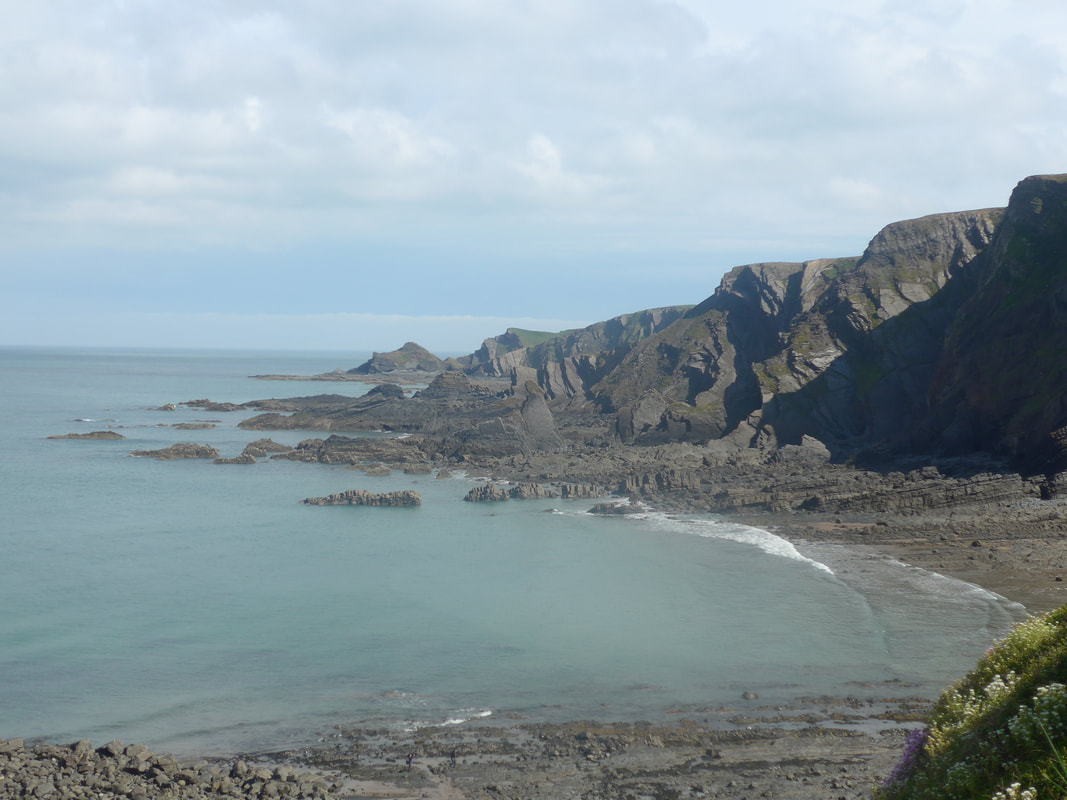
 From just outside Hartland Quay Hotel there are wonderful rock formations on the shore with insightful roiling folds and faults visible on the rock faces that tell the tale of their creation amid the tumultous conditions of the Variscan Orogeny that created them. This was a period of mountain making, tectonic plate and earthquake activity, hence the complexity of the geology.
Making our way up the hill, we took a path to the left on to the long, green sward that leads you back on to the high ground and on to Warren Cliff with its ruined tower. This area, as the name implies, is suggested in a local archaeological field survey to have been a commercial rabbit warren in the Medieval period and the 'tower' possibly the home of the Warrener, who oversaw the commercial activity. Further inland from Warren Cliff at Stoke is the Church of St Nectan, known as the 'Cathedral of North Devon'. St Nectan is one of numerous Celtic Saints who populated the South West of England and his holy well, which is thought to be the site of his hermitage, is close to the church.
Making our way up the hill, we took a path to the left on to the long, green sward that leads you back on to the high ground and on to Warren Cliff with its ruined tower. This area, as the name implies, is suggested in a local archaeological field survey to have been a commercial rabbit warren in the Medieval period and the 'tower' possibly the home of the Warrener, who oversaw the commercial activity. Further inland from Warren Cliff at Stoke is the Church of St Nectan, known as the 'Cathedral of North Devon'. St Nectan is one of numerous Celtic Saints who populated the South West of England and his holy well, which is thought to be the site of his hermitage, is close to the church.


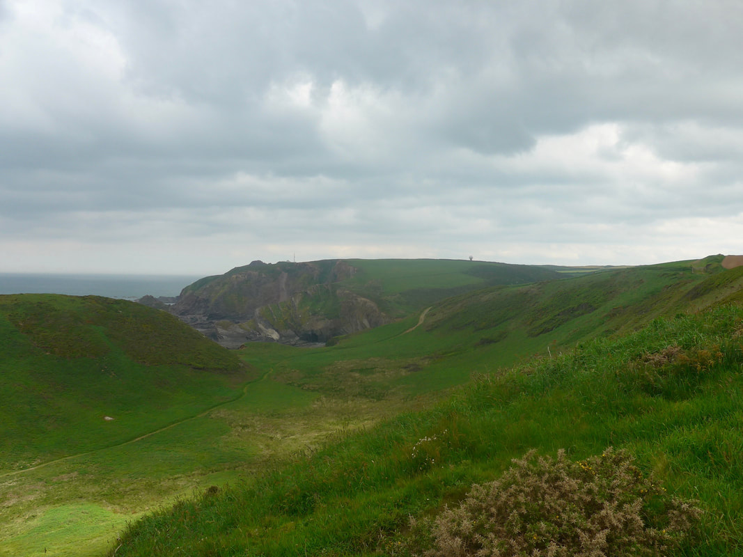
 Below Dyer's Lookout
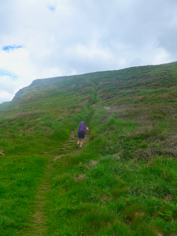
 It is a fairly easy start along the Warren, up on to Broad Bench, a short drop down from Dyer's lookout before the steep climb up and on to Berry Cliff. Fortunately, a fair bit of the climb on Berry Hill is stepped, which made it slightly easier with the rucksack. Once up on Berry, there are clear views over to Gull Rock and the descent down towards Blegberry Beach, with the rambling path up to Blegberry Cliff standing out on the opposite hillside. We could see a small group of people sitting on the green sward by Blackpool Mill, obviously watching something on the cliff which we could not see. As we progressed over Berry Cliff, we eventually had eyes on a group of young people who were abseiling on the face of Berry Cliff which, we later found out, is a popular spot and activity for charity fund raisers.
 Blegbury Cliff to Upright Cliff
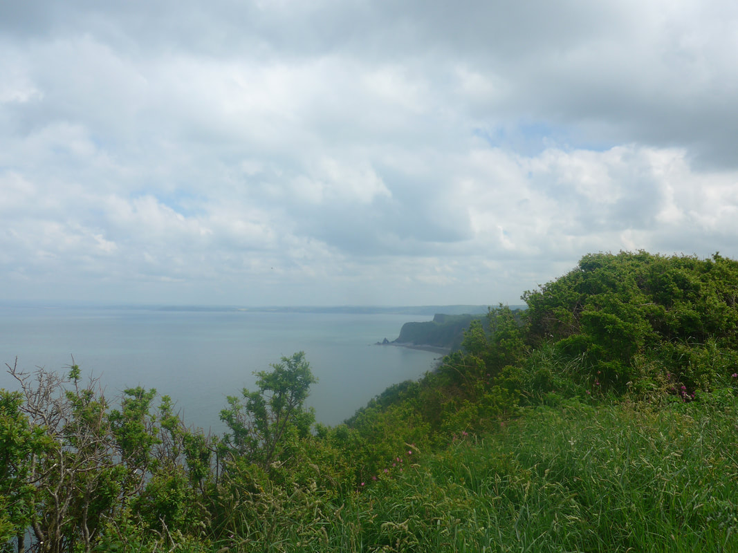
 This was familiar up and down countryside, walking on rough pasture land. On the foreshore and at the bottom of the cliffs, jagged rocks, their many fingers pointing skywards, was like a seascape scene from 'Game of Thrones'. Looking back we could just see the Warreners Tower on the hilltop and at a lower level Hartland Quay Hotel squatting on the rocks below.
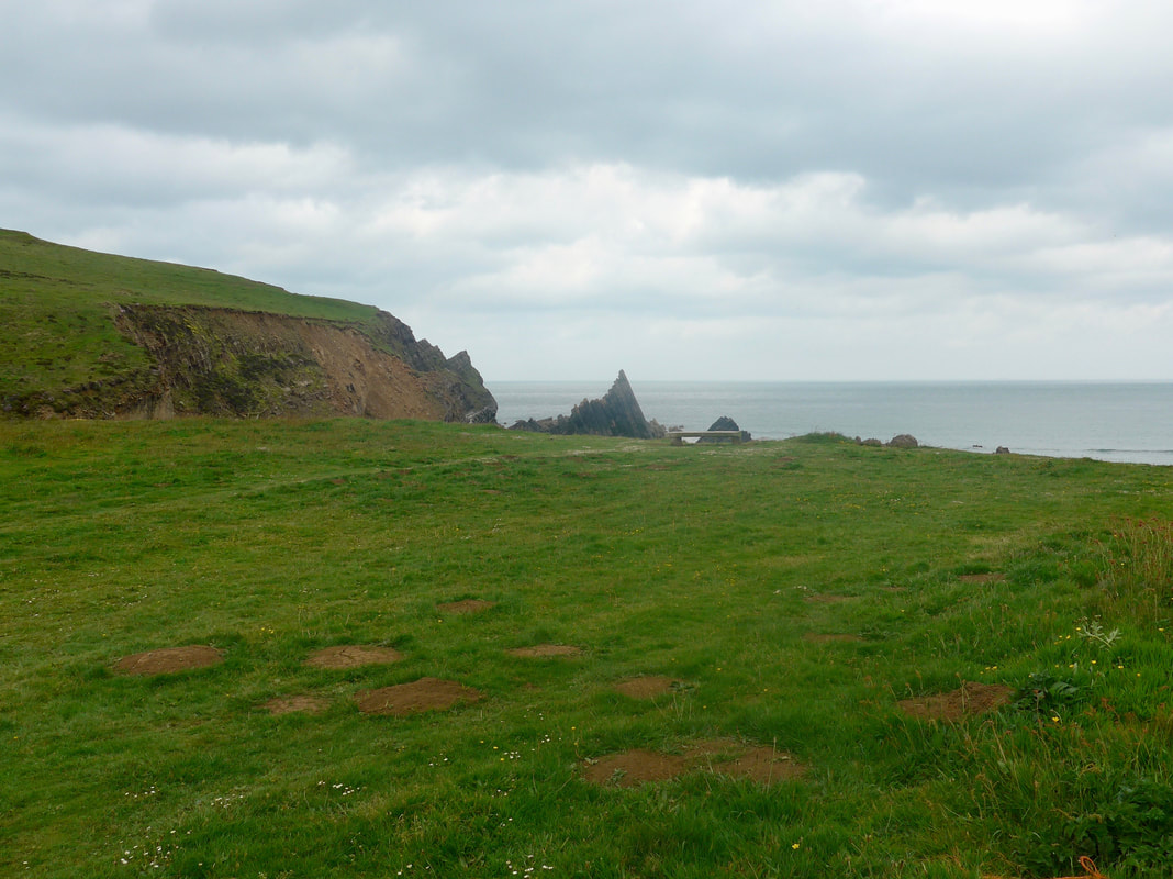
There was a very fine grey mist that lent an aura of mystery to the views. To the front of us, the horizon was dominated by Gull Rock at Damehole Point and beyond Upright and Blagdon Cliffs. The descent down to Dame Hole is stepped and at the bottom there is nice little 'green' where you can sit and enjoy the closeness of the sea. Coming off Blegberry Cliff there is a choice of a high or a low path and we chose to take the lower one, to be closer to Gull Rock and the shore.
There was a very fine grey mist that lent an aura of mystery to the views. To the front of us, the horizon was dominated by Gull Rock at Damehole Point and beyond Upright and Blagdon Cliffs. The descent down to Dame Hole is stepped and at the bottom there is nice little 'green' where you can sit and enjoy the closeness of the sea. Coming off Blegberry Cliff there is a choice of a high or a low path and we chose to take the lower one, to be closer to Gull Rock and the shore.

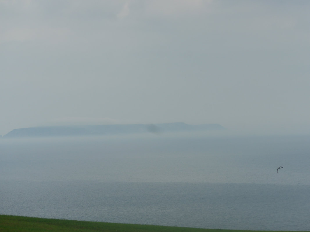
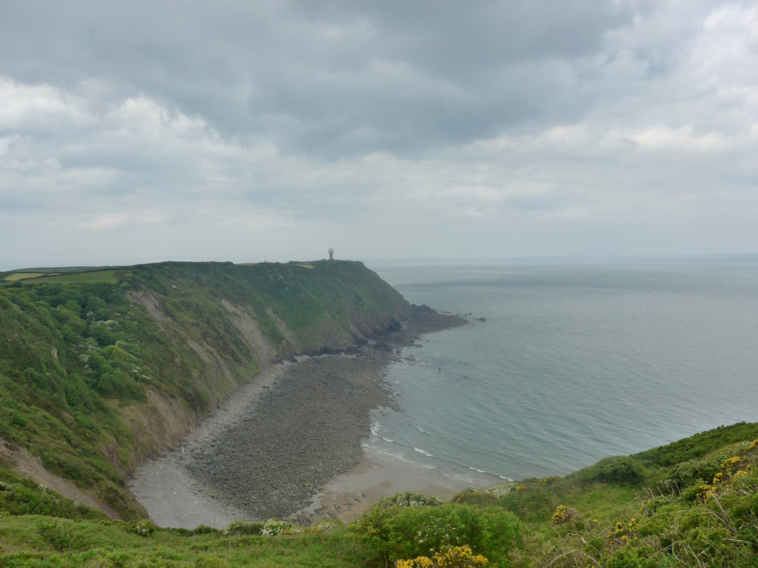 Radar Station, Hartland Point
 From Smoothlands, just after Gull Rock, the path goes back uphill to re-connect with the top path from where it goes on in to a gully for a very short distance before dropping down the hillside to cross the valley and then tackle the long climb up to the Upright Cliff. As we progressed along here and Blagdon Cliff, poor weather started to set in to the front of us. By the time we reached Hartland Point, to the seaward we could see nothing of the lighthouse and Lundy Island disappeared from view literally as we tried to photograph it. It was so quick; one minute we could see, the next we couldn't. Curiously, by the time we reached East Titchberry Cliff a mile or so later, the weather had cleared as quickly as it had fallen and you wondered if you had imagined it all.
Given the circumstances with the change in weather, we were pleased to find the wee cafe kiosk just below Blagdon Farm where, despite the early hour, we stopped for coffee and cake. While here we chatted to a couple (Graham & Linda) who were keen walkers and interested on our UK coastal adventure. By the time we started back the worst of the weather had passed and once back on the hill, looking back across Shipload Bay from East Titchberry Cliff to the radar station, the colour palette was all shades of silver and grey.
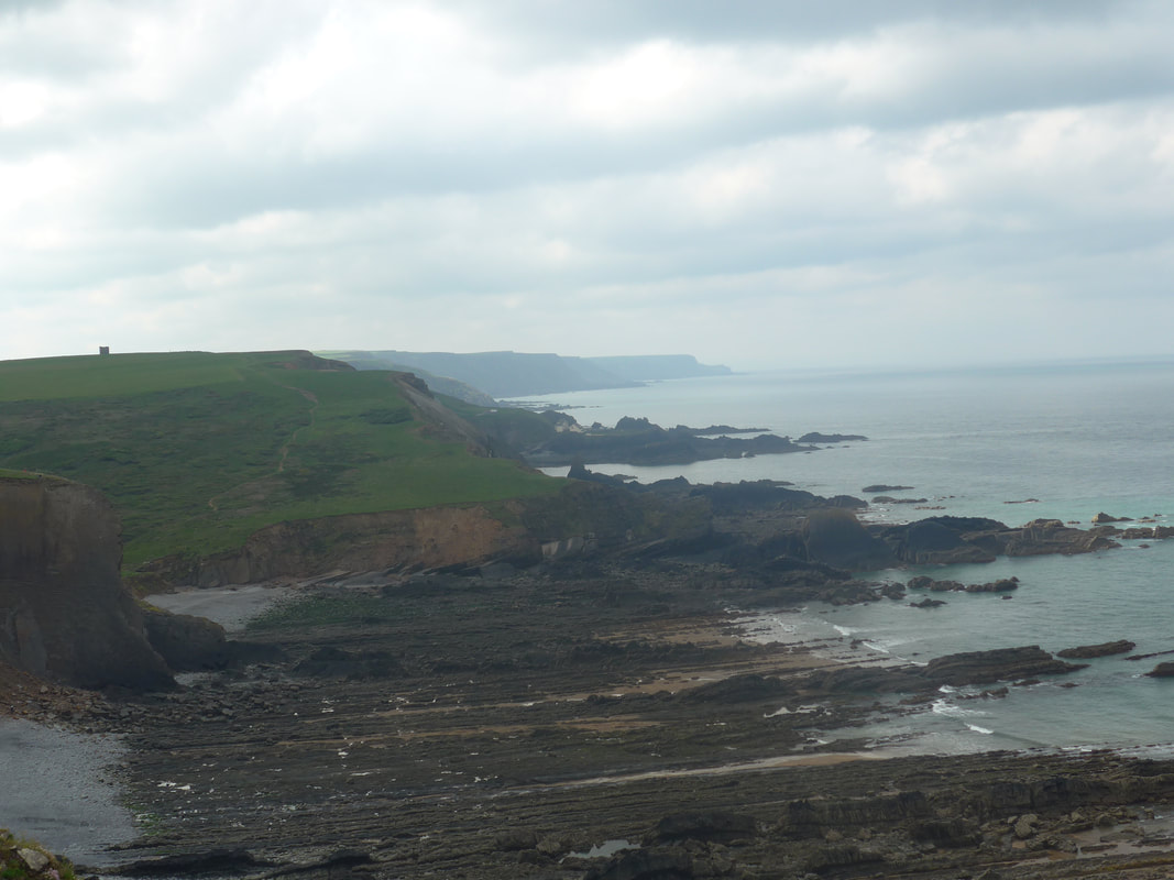
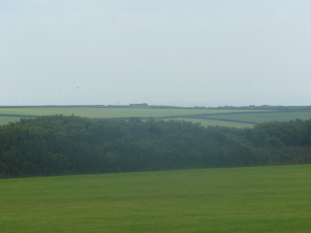
From just after Hartland Point the nature of the land changes quite dramatically. While the cliffs and the rock features remain to give rough texture to the scene, on the cliff top moving inland it starts to soften with swathes of arable land, as well as grasslands and heathland. The latter can be thick with undergrowth, nettles, thistles and brambles in abundance. On the clifftop, flowering shrubs grow tall, with the occasional break giving sight to otherwise hidden jewels
From just after Hartland Point the nature of the land changes quite dramatically. While the cliffs and the rock features remain to give rough texture to the scene, on the cliff top moving inland it starts to soften with swathes of arable land, as well as grasslands and heathland. The latter can be thick with undergrowth, nettles, thistles and brambles in abundance. On the clifftop, flowering shrubs grow tall, with the occasional break giving sight to otherwise hidden jewels
 Bideford Bay
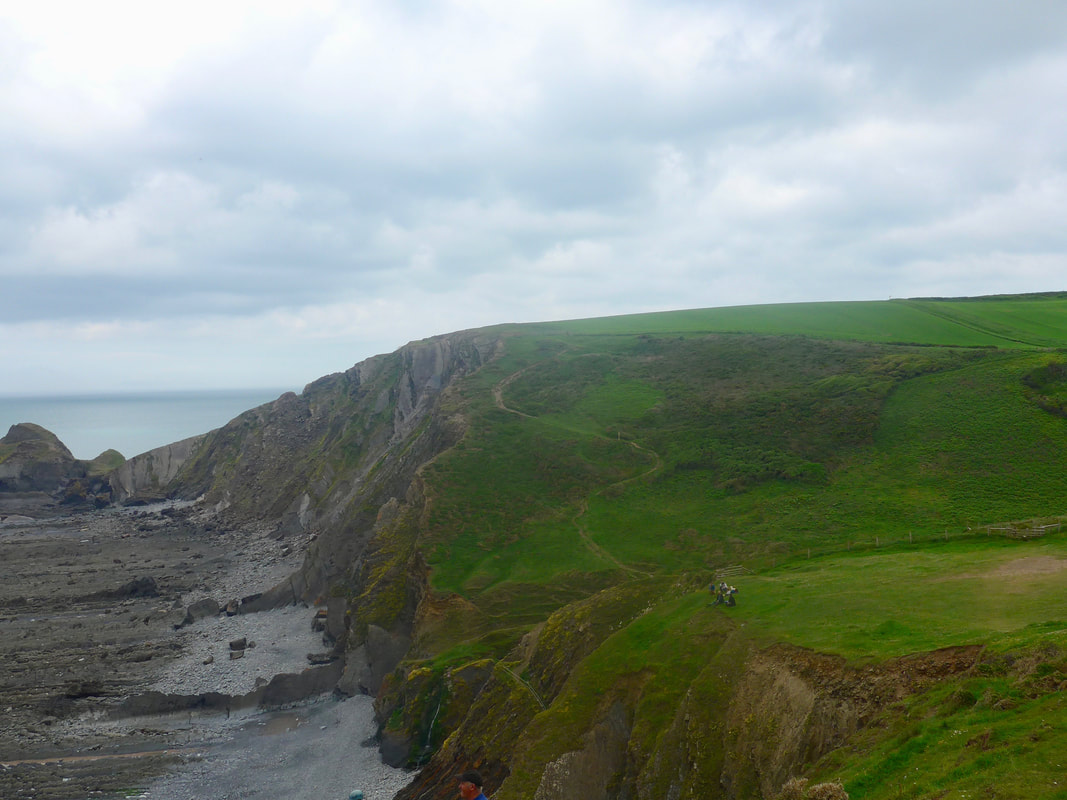
 We moved quickly along Gawlish and Fatacott Cliffs, enjoying the walking despite the clouds and, at times and in places, difficult undergrowth with the nettles, brambles and thistles slowing us down as we walked carefully to avoid being stung. With overcast skies and poor light there was little on the move in the hedgerow and where we might expect to find butterflies, moths and birdsong there was not a sight or sound to be seen or heard. At the end of Fatacott Cliff we passed the trig point above Chapman Rock.
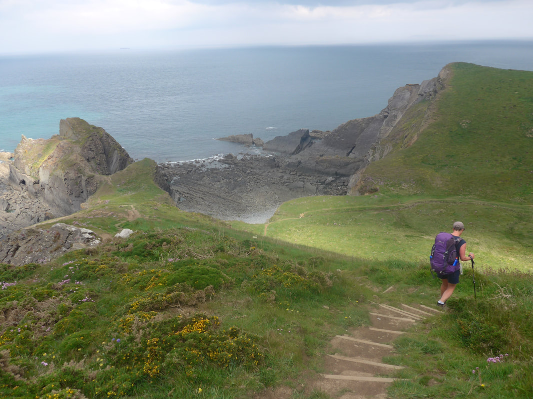
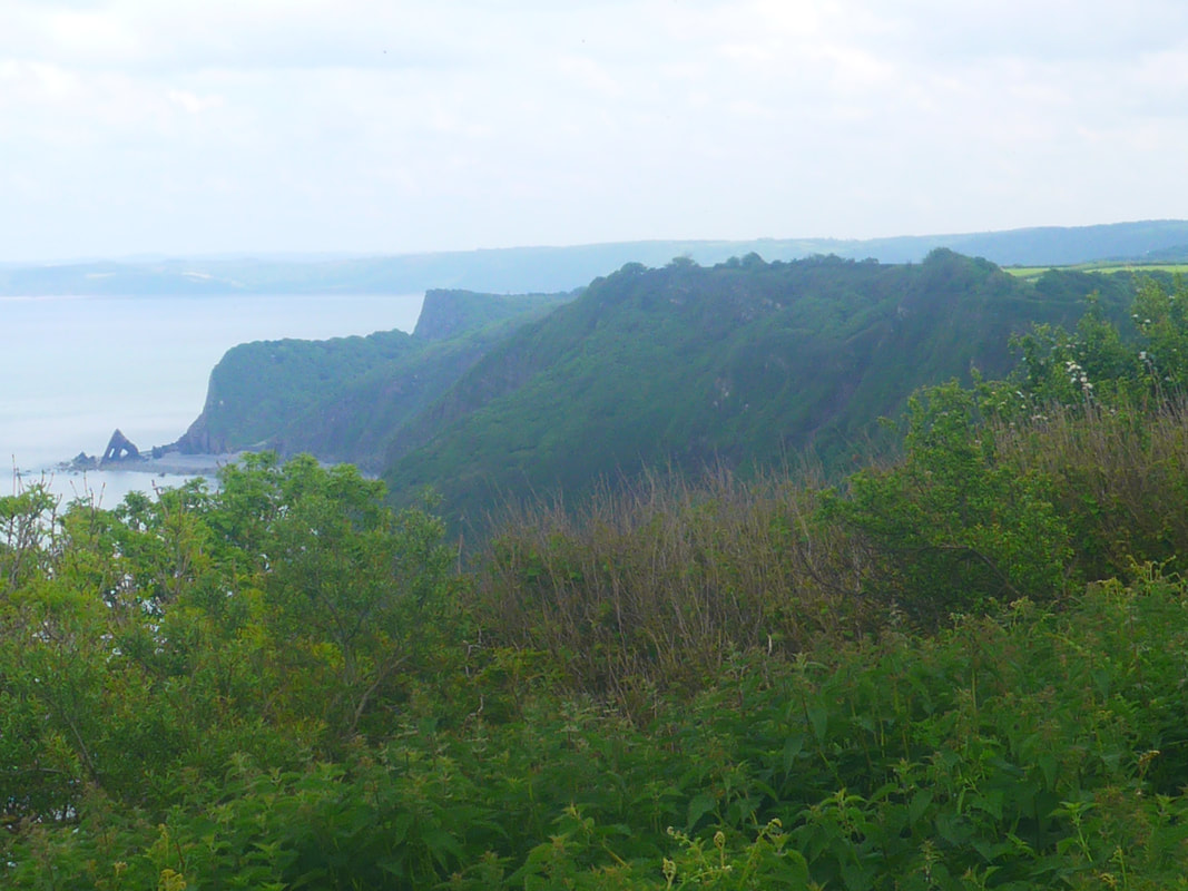
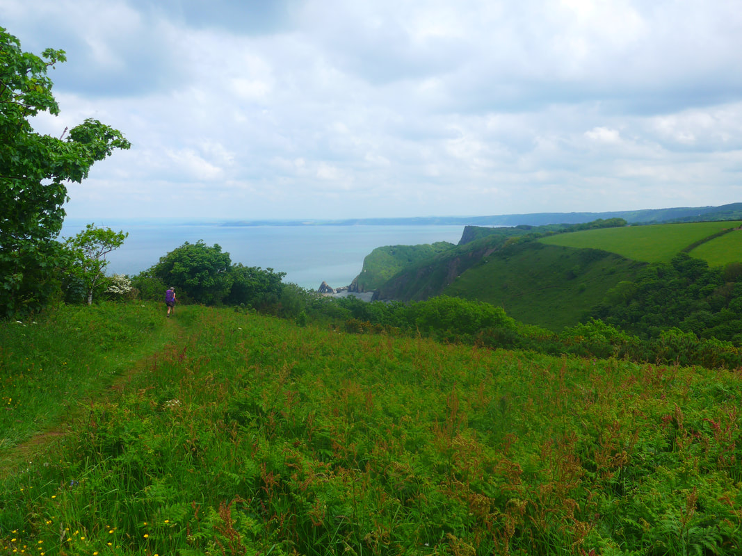
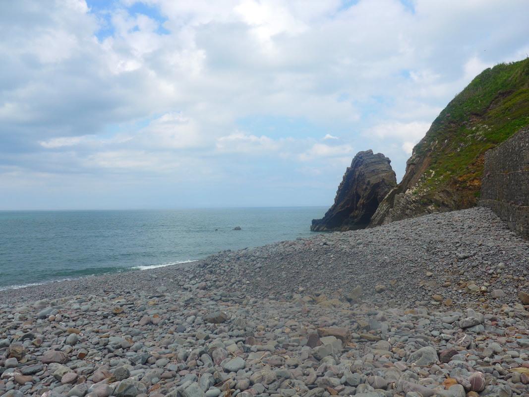
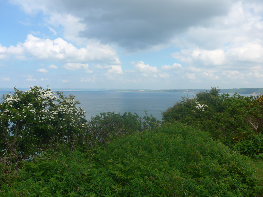
In places, our view was obscured by vegetation but when it cleared we could see right across Bideford Bay to distant Westward Ho and beyond. Before too long, we had our first views of the magnificent Blackchurch Rock. The weather brightened as we approached Mouth Mill, at least enough to let us enjoy the swathes of green grass, trees and shrubbery against the backdrop of Bideford Bay. At the end of Beckland Bay, you enter the National Trust's Bideford Bay and Hartland Reserve where the route turns slightly inland before dropping down the hill via a set of steps to Mouth Mill where, if the tide is right, you can become closely acquainted with Blackchurch Rock where we stopped to brew up. If you have five minutes to spare David Linnett's short video of a climb on the rock is worth watching.
In places, our view was obscured by vegetation but when it cleared we could see right across Bideford Bay to distant Westward Ho and beyond. Before too long, we had our first views of the magnificent Blackchurch Rock. The weather brightened as we approached Mouth Mill, at least enough to let us enjoy the swathes of green grass, trees and shrubbery against the backdrop of Bideford Bay. At the end of Beckland Bay, you enter the National Trust's Bideford Bay and Hartland Reserve where the route turns slightly inland before dropping down the hill via a set of steps to Mouth Mill where, if the tide is right, you can become closely acquainted with Blackchurch Rock where we stopped to brew up. If you have five minutes to spare David Linnett's short video of a climb on the rock is worth watching.
 Bideford Bay
 From Mouthmill Beach the route goes from sea level rising gently uphill on to the last cliff of the day, albeit somewhat hidden behind the glory of Snaxland Wood. This heavily wooded area is part of the Clovelly Estate and there was evidence where attempts had been made to clear some of the woodland to open up the views. The views across the bay were lovely and where it was framed by flowering shrubs particularly beguiling.
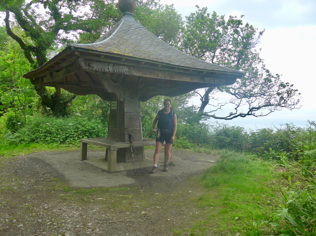
In the midst of the woods we came across the Angel's Wings shelter. A Grade II listed structure, it was built in 1826 and renovated in the 1930's. Time and again we come across these lovely little locations for a stop just after we have had coffee somewhere else and had no excuse to stop for a decent length of time.
From the shelter it took us no time at all to reach the lower level of Clovelly and from there to complete the long climb up Wrinkleberry Lane to our accommodation in Higher Clovelly. The lane itself is an old, old sunken lane and walking up, hemmed in on either side by a dense stand of woods, it feels like being in another age. Where it exits on to the main village road, just by the school and village hall, it is to a lovely quaint row of traditional houses, with some lovely cottage country gardens.

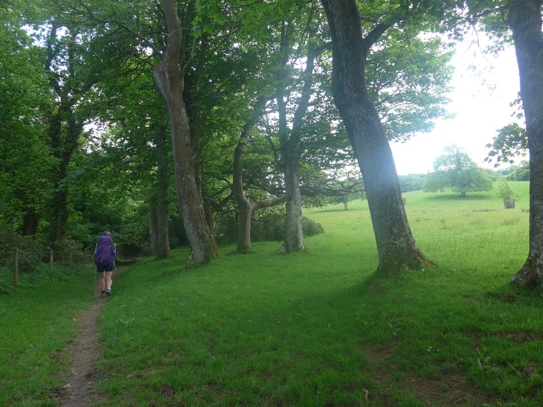
 Wrinkleberry Lane
 We were very pleased with our Airbnb accommodation, hosted by the delightful Debbie, who could not have made us feel more at home. We were in a section of the house that had a bedroom and its own separate, spacious bathroom where we could luxuriate in privacy and with no need to rush. It was a very pleasant and welcome end to another lovely day's walking.
 RSS Feed
