 Sunrise over the Estuary
 Early start this morning and on the road before another soul in the camp had stirred. By the time I was on the promenade the sun had barely risen above the horizon. The early part of my journey would continue along the seafront on the concrete promenade, before striking out in to the countryside on the sea wall or dike. The route I take later on today will depend on the alert status on the Donna Nook missile firing range. I understand that if the red flag is flying there will be no entry to the sea wall and I will have no option but to find another inland route and walk parallel to the coast.
 Promenade
 Of course the notion of walking ‘the coast’ in this part of the country (Lincolnshire), is a bit of a misnomer. Even when you are walking on the outermost dike; there can be two or three of them parallel to each other and only separated by a few hundred yards, the sea can be as much as a couple of miles away. The environment left behind can be extremely dangerous. At low tide the water leaves behind enormous areas of mud and saltflats and marshes that can be dangerous to walk on unless you know what you are doing. Likewise, when the tide is in and you are close to the water’s edge there are dangers here as well with numerous inshore ‘creeks’ that when the tide is in cannot be easily seen. They can be deep and very fast running and if you were to try swimming near them you would be at risk of being swept away, particularly on a retreating tide.
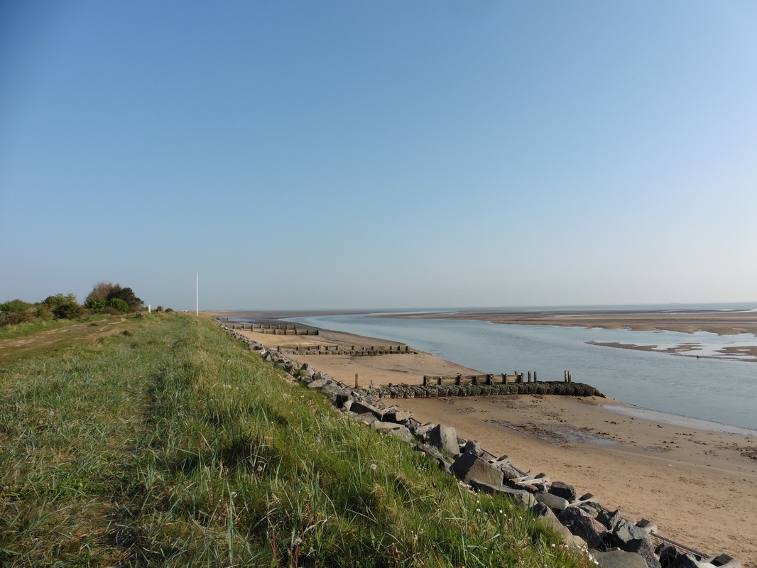 By Hunberston Fitties
 The creeks can cause difficulties of a different sort if like us you like to walk close to the water’s edge when the tide is on its way out. Sand attrition here can result in high berms ( big steps of sand) that hide the creeks from you when you are on the lower side and they are running parallel to you. Sometimes you only become aware of them when they run in front of you on their way to the sea. As well as being fast flowing they can also be deep and you must find a way to cross them. Occasionally, if the tide is on the wain, this can be done right down at the sea’s edge where it can flatten out and become shallower. However, dependent on where the tide is at the channel can be deep and you either need to backtrack along the creek until you can find a place where it is shallow enough to cross, or its off with the boots and socks and up with the trouser legs! It would not be the first time we have been caught out by one and had to walk back a considerable distance to get to a reasonable crossing point.
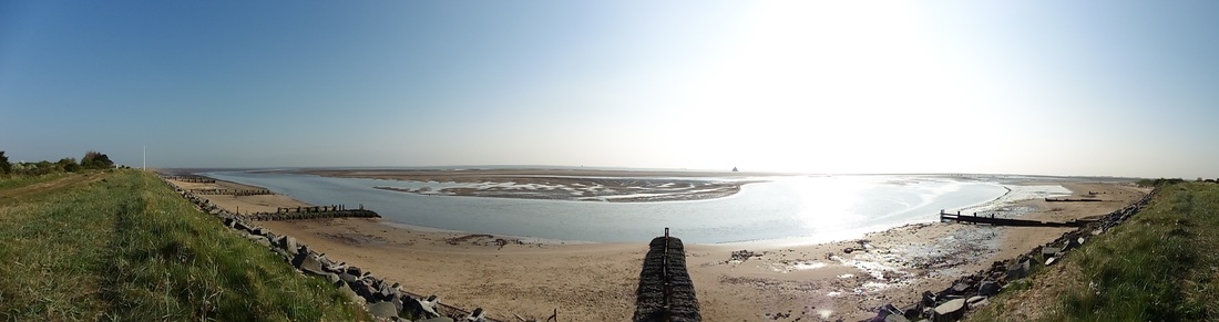
My route this morning passed such a creek early on as I passed the ‘Humberston Fitties’. The creek is in part created by the run off of the Louth Canal / Tetney Haven which discharges here. The ‘fitties’ were a collection of old chalets and hand-built huts erected on a ‘fittie’ or saltmarsh from early 1900’s onwards. People used the huts like holiday homes. During WW1 the site was used as a billet for soldiers who manned the sea-bound Haile Sands Fort, which stands just off the shore, guarding the approaches to the strategically important Humber Estuary. The fort is seen here in the middle distance of the panorama shot. When the soldiers moved out of the fitties, the local people moved back in, one or two at first until by the late 1920’s over 150 families were using the site as holiday accommodation. Over the years the tradition has continued and grown with caravans sometimes taking the place of huts or chalets. Latterly, the local council operated the site with 300 permits available for occupation.
Creek at Humberston Fitties
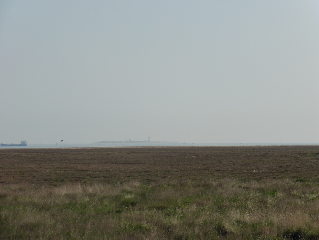
Just off the coast, Haile Sands Fort still stands in the sea, up to its belly in the salty brine. Built in 1915 as part of the sea defences for the Humber, the fort and its companion on the other side of the estuary Bull Sand Fort (best viewed from Spurn Point) were decommissioned in 1956. A four-storey building, when first operationally commissioned in 1917 it had two 12-pounder guns. Haille Sands has been on the market in the last couple of years with an asking price of about £350K. However, it has no modern facilities and you would need to have maybe another £1M to kit the place out. A detailed transport plan would also be required to get you to the office on time!
From Humberston Fitties I made my way along the dike to pass by the Tetney Marshes bird reserve and to cross the bridge over Tetney Haven. Managed by the RSPB since 1975, Tetney Marshes covers a large area of coastal mudflats, salt marsh, dunes and saline lagoons. The area is known for its populations of passage and winter waders including Knot, Whimbrel, Grey and Golden Plover. Harriers pass through the site and in the season Little Terns breed here. Tetney Haven is on the saltwater side of Tetney Lock with the the fresh water Louth Canal on the other side. Tetney Lock is the final lock on the canal before it reaches the sea. Louth Canal is wider than most other canals in Britain and as a consequence sea-going vessels could at one time sail up the canal to Louth which at that time was a thriving port. Over time the approaches silted up and trade fell away. I understand that the presence of an oil pipeline at the mouth of the canal also prevents larger boats going up the canal now.

Across the Marshes
 Tetney to Spurn Point
 Crossing over the Haven just below Stonebridge Farm my route continued along the dike, passing Tetney High Sands. It is an interesting land and seascape with the wetlands, lagoons and standing water ponds. The sparse hedgerow was just starting to come in to bloom and the path and field edges were starting to show early summer flowers. There was an interesting contrast between the musicality of the songbirds in the hedgerow and the slightly harsher cries of the sea birds out over the sands and marshes. I spent some time here watching a large grey heron stalk one of the ponds. It was so relaxing just watching this large bird move so slowly and carefully and then suddenly burst in to motion when it took a frog or fish.
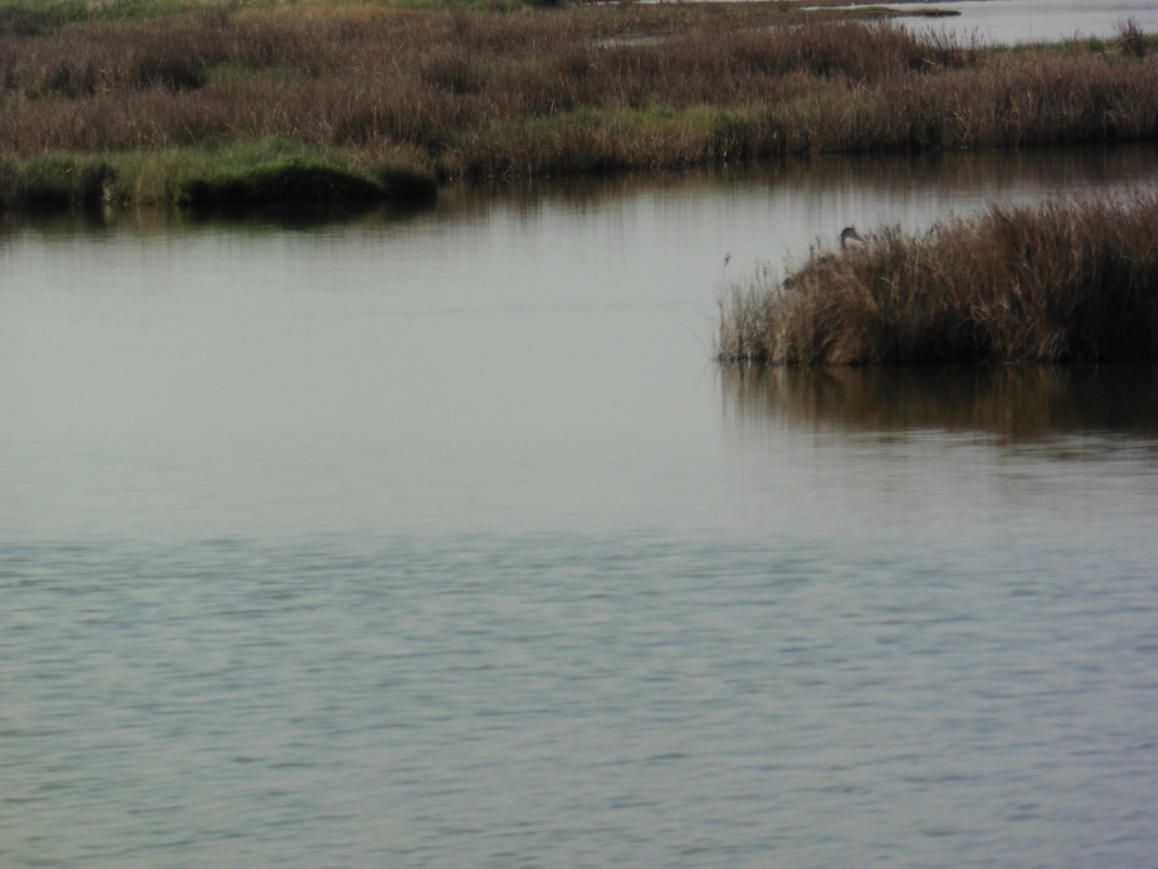 Heron Fishing
 I was able to stay on the dike out past Northcoates Point and on up to the car park at Horseshoe Point on the edges of the Donna Nook Nature Reserve. Managed by the Lincolnshire Wildlife Trust and the Ministry of Defence, the reserve is six miles in length and contains a number of important habitats for birds, vertebrates and plants. The name comes from a Spanish vessel ‘The Donna’ which sank of the ‘Nook’ in 1588.
In its military capacity the RAF Donna Nook is a bombing range used by UK and NATO forces for bombing practice. Part of its function as a nature reserve is that it holds one of the largest breeding colonies of grey seals in the Britain. It is also a hauling out site for common seals. The seals are said to be unperturbed by the bombing activities but easily distrubed by humans therefore wardens on site control access to see the seal colony when the range is not in use.
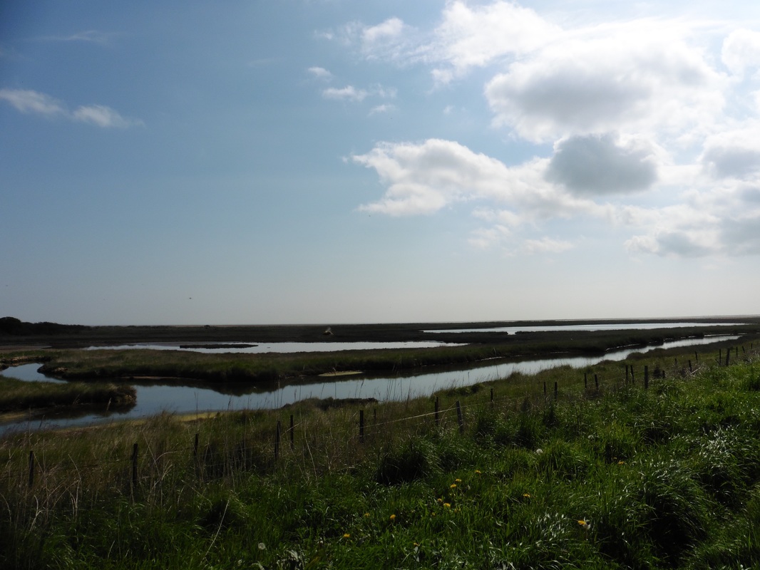


Different water habitats
 Locksley Hall
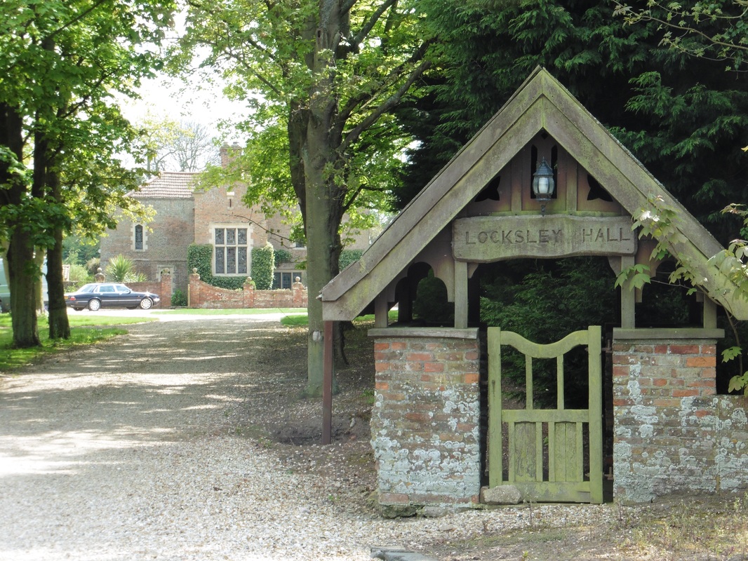
 At the Horseshoe Point car park I had to leave the dike and take the path that runs along the back of it to the Stonebridge car park which is the main reception point for the reserve. I tried to access the dike again at this point but was turned back by people working on the ground who advised me there was work being undertaken and the route was closed off. I tried walking a bit further down across some fields to dodge in to the range but could not find a way back through the hedgerow on to the dike. Reluctantly I returned to the Stonebridge area and began the long, boring walk out to North Somercoates. I took the road that goes through Laramie and then followed a public footpath in to the village of North Somercoates. On the way I passed the lovely Locksley Hall. After a short walk on the A1031 I took another footpath to access the dike below Saltbox Farm and get back on what passes for the coast..
 By Howdens Pullover
 This was still technically the bombing range but although the red flag was flying I had heard no planes flying overhead in the hours I had been walking to and round the reserve and was happy to take my chances. I’m glad I did because I enjoyed an hour of solitary walking in bright sunshine and across some beautiful grasslands and with the sand dunes away to my left. The end of this section of the walk is just on the edges of the location of the Saltfleetby-Theddlethorpe Dunes National Nature Reserve, where the now rare natterjack toad can be found.
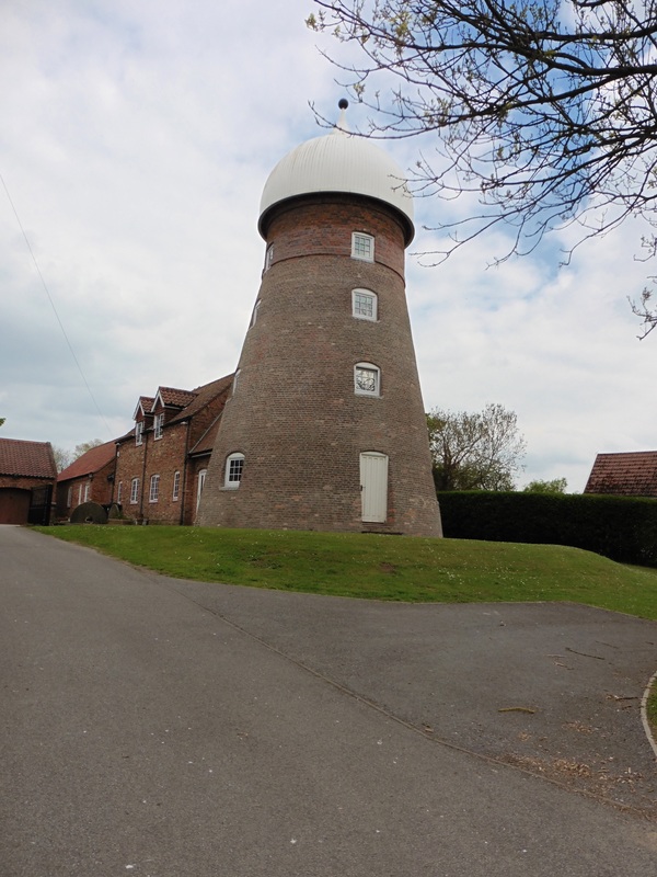 Saltfleet MIll
 After about an hour I took some advice from two local ladies out walking their dogs as to best place to leave the range to access Saltfleet-by-All Saints where I would be camping that night. Eventually I had to move inland to cross over the Saltfleet Haven which with the Great Eau river discharge at Saltfleet. I ended up walking again for a short distance on the busy A1031 (it was rush hour, at least four cars an hour). Passing through the main village of Saltfleet I was impressed by Grade II listed, 19thC Saltfleet Mill. As I walked along the road the Great Eau river was running parallel to me on the left on its final mile to the sea and the fenlands lay out to my right as far as the horizon. At the first junction going out of town I went on to the B1200 to Saltfleet-by-St. Clement where I took time to admire the St Clement's Church. Leaving the village I took a left to Saltfleet- All Saints to finally reach my camping site for the night.
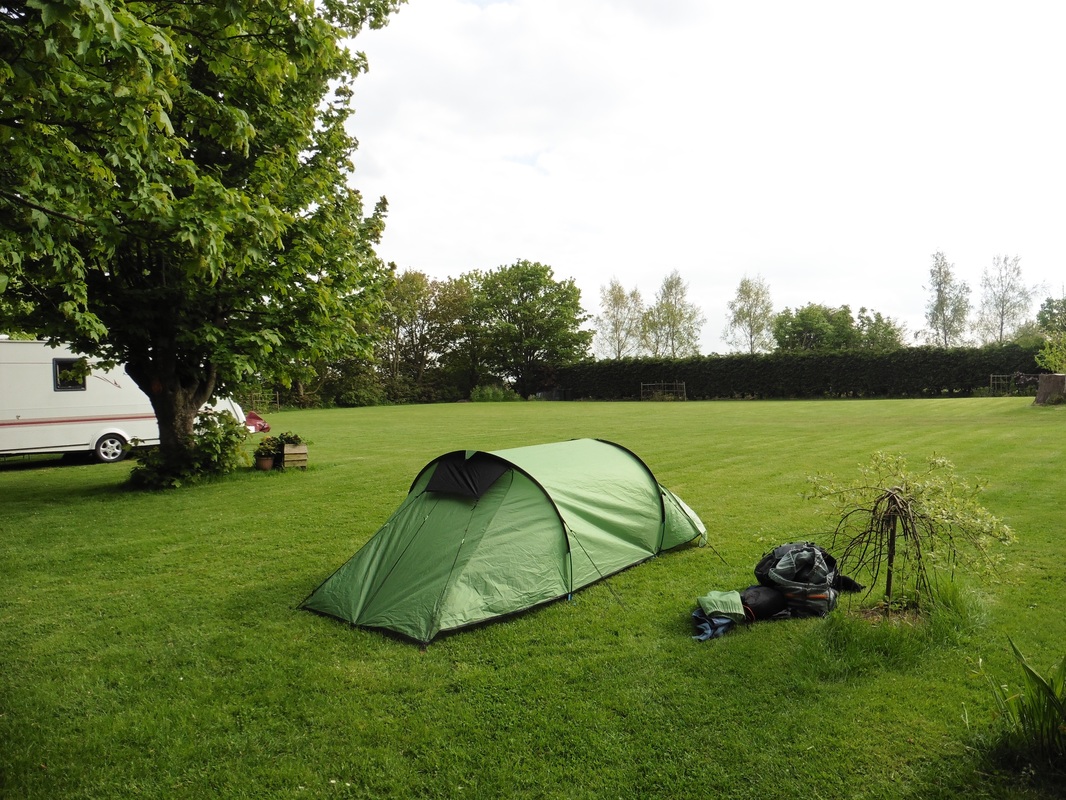 Bed for the night
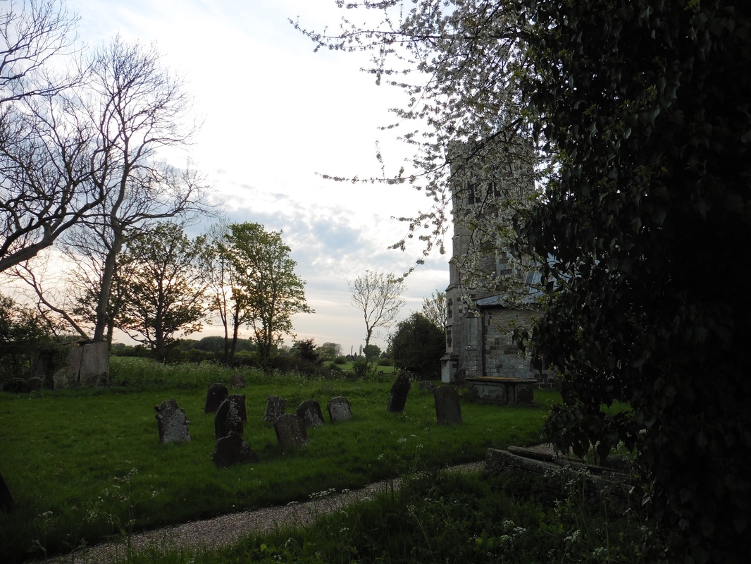
 It didn’t take me long to pitch up and after brewing up a cup of tea and dinner off I went for a wee walk around the policies. Main item of interest, as it is in many of the small fenland villages, was the church, in this case All Saints Church. Sometimes known as the leaning tower of Lincolshire, you can see in the photograph that it leans considerable to one side. It is a wonderfully simple church but in the dramatic setting of the woods in the fenlands with the sun setting in the background it was very striking. In total there are three churches in the local area all called 'Saltfleet-by' and then denoted by the name of the local church dedication. the other church which I did not see is Saltfleet-by St. Peters.


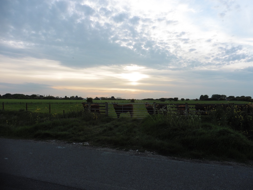
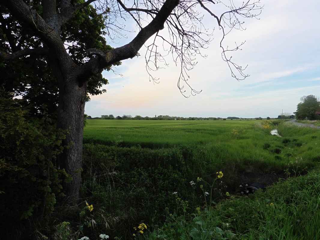
The sun was setting as I made my way back to the campsite. There was a wonderful peace and stillness in the air. In the quiet of the countryside, the swan sitting on its nest by the side of the road; the cattle in the field and the yellow, red and pink colour show slowly spreading across the evening sky belonged in a Constable painting. As I stood and watched the sun slip below the horizon across the endless fens of Lincolnshire I felt at peace and only reluctantly let the day draw to a close.

 RSS Feed
